Items Similar to Curious Map of the Laptev Sea 'Arctic Ocean' and the Mediterranean, ca.1700
Want more images or videos?
Request additional images or videos from the seller
1 of 5
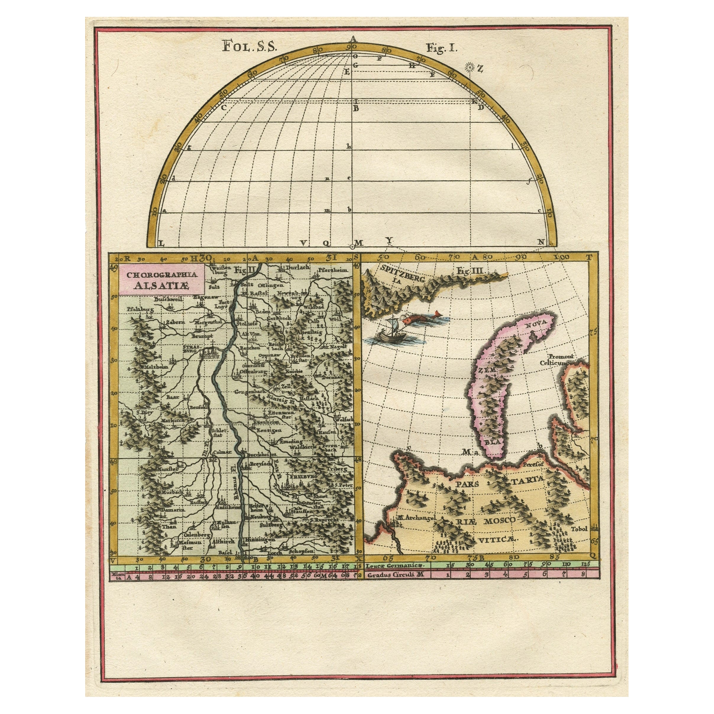
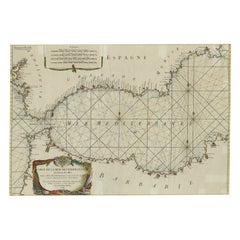
Curious Map of the Laptev Sea 'Arctic Ocean' and the Mediterranean, ca.1700
About the Item
Antique map, untitled.
Map of the Laptev Sea (Arctic Ocean) and the Mediterranean, printed for Scherer's 'Atlas Novus' (1702-1710). Scherer's 'Atlas Novus' forms an important milestone in the development of scientific and thematic cartography, providing a remarkable and revolutionary alternative vision of the World in showing only its major physical and topographical features. From: 'Atlas Novus'.
Artists and Engravers: Made by 'Heinrich Scherer' after an anonymous artist. Heinrich Scherer (1628-1704) was a Professor of Hebrew, Mathematics and Ethics at the University of Dillingen until about 1680. Thereafter he obtained important positions as Official Tutor to the Royal Princes of Mantua and Bavaria. It was during his time in Munich as Tutor to the Princely house of Bavaria that his lifetime’s work as a cartographer received acclaim and recognition. Scherer’s world atlas, the Atlas Novus, first published in Munich between 1702 and 1710 and reissued in a second edition between 1730 and 1737, forms a singularly unusual, almost revolutionary work in terms of the development of European mapmaking at the beginning of the 18th Century.
Condition: Good, given age. Light damp stain top left, extending 1 cm into image. Irregular edges with an occasional tiny tear. General age-related toning and/or occasional minor defects from handling. Please study scan carefully.
- Dimensions:Height: 10.63 in (27 cm)Width: 8.31 in (21.1 cm)Depth: 0 in (0.02 mm)
- Materials and Techniques:
- Period:1700-1709
- Date of Manufacture:circa 1700
- Condition:Condition: Good, given age. Light damp stain top left, extending 1 cm into image. Irregular edges with an occasional tiny tear. General age-related toning and/or occasional minor defects from handling. Please study scan carefully.
- Seller Location:Langweer, NL
- Reference Number:
About the Seller
5.0
Platinum Seller
These expertly vetted sellers are 1stDibs' most experienced sellers and are rated highest by our customers.
Established in 2009
1stDibs seller since 2017
1,929 sales on 1stDibs
Typical response time: <1 hour
- ShippingRetrieving quote...Ships From: Langweer, Netherlands
- Return PolicyA return for this item may be initiated within 14 days of delivery.
More From This SellerView All
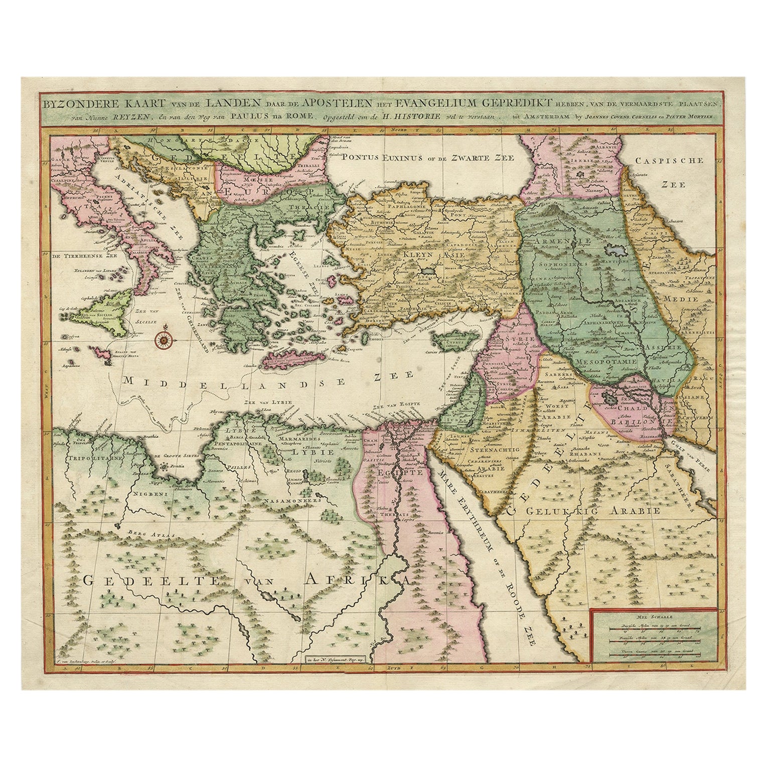
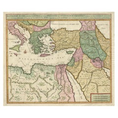
- Highly Decorative Map of The Eastern Mediterranean and The Middle East, ca.1700Located in Langweer, NLAntique map titled 'Byzondere Kaart van de Landen Daar de Apostelen Het Evangelium Gepredikt Hebben (..).' Highly decorative map of the eastern Mediterranean...Category
Antique Early 1700s Maps
MaterialsPaper
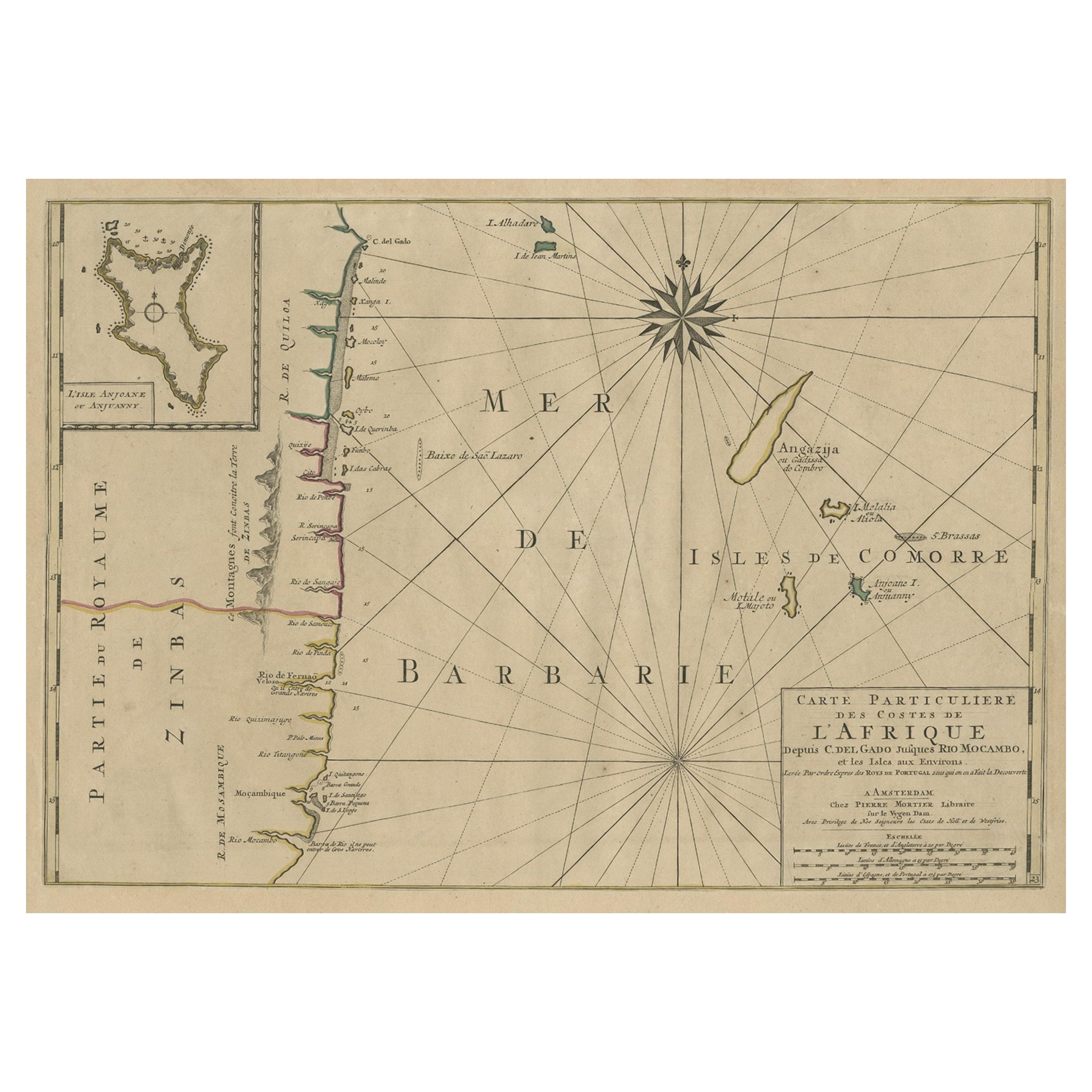
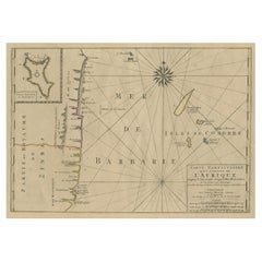
- Map of the Mozambique and Tanzania Coast & Inset Map of Anjouan Island, ca.1700Located in Langweer, NLAntique map titled 'Carte particuliere des Costes de l'Afrique'. Depicts the coasts of Mozambique and Tanzania. With an inset map of Anjouan Island. Artists and engravers: Pub...Category
Antique Early 1700s Maps
MaterialsPaper
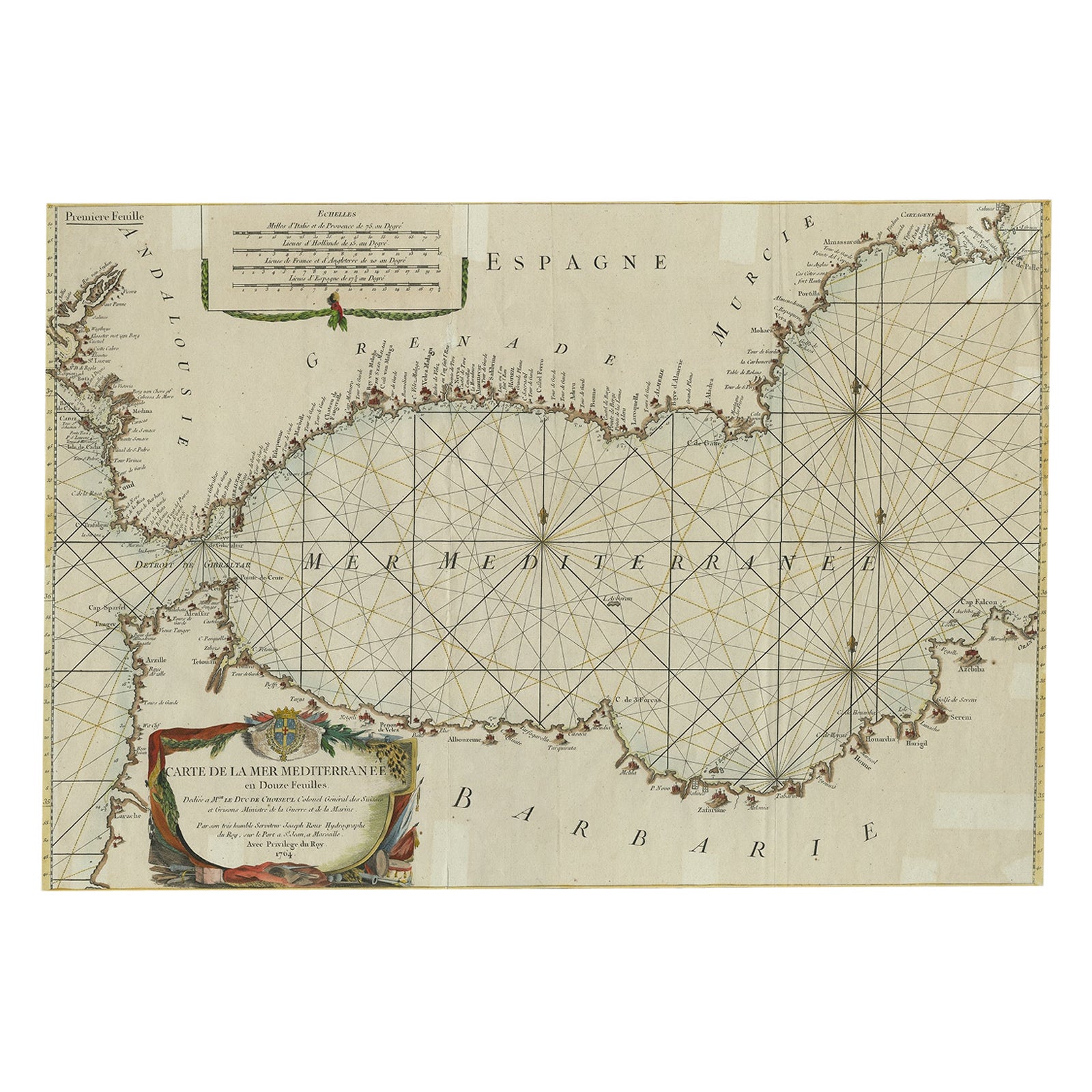
- Large Decorative Antique Map of the Mediterranean, ca.1770Located in Langweer, NLAntique map titled 'Carte de la Mer Mediterranee en Douze Feuilles'. First map out of twelve fine engraved double-page and folding maps that join to create a large wall map...Category
Antique 1770s Maps
MaterialsPaper
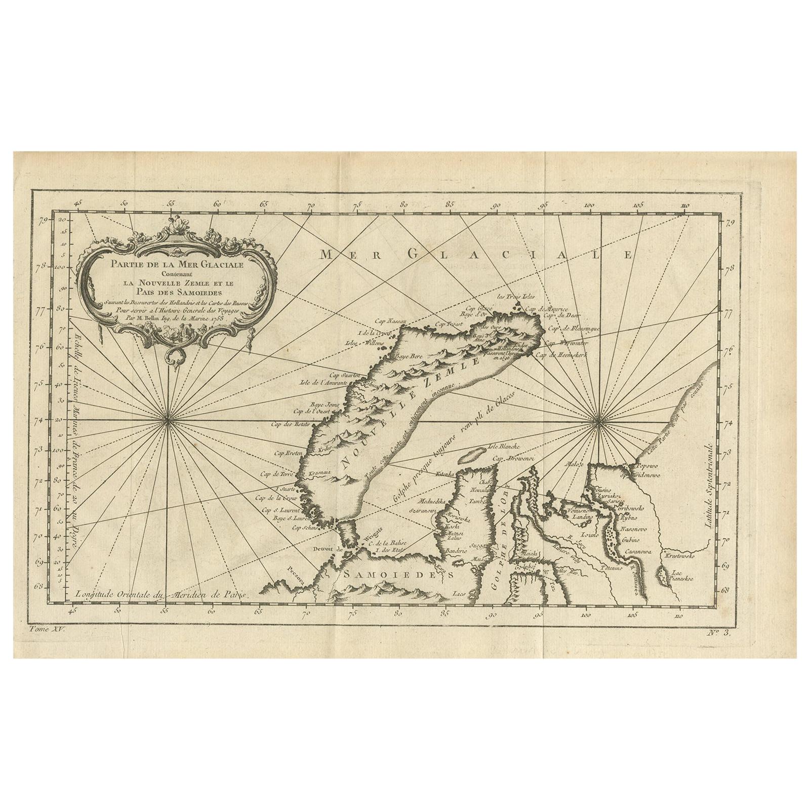
- Antique Map of the Arctic Ocean and Novaya Zemlya by Bellin '1759'Located in Langweer, NLAntique map titled 'Partie de la Mer Glaciale contenant la Nouvelle Zemle et le Pais des Samoiedes (..)'. Original antique map of the Arctic Ocean containing Novaya Zemlya and the co...Category
Antique Mid-18th Century Maps
MaterialsPaper
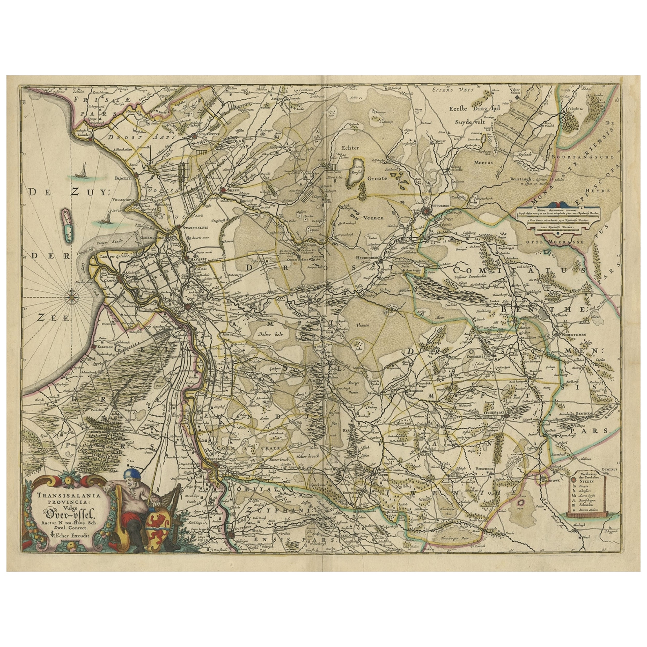
- Attractive Original Map of the Province of Overijssel, the Netherlands, Ca.1700Located in Langweer, NLAntique print, titled: 'Transisalania Provincia vulgo Over-yssel.' Attractive original handcoloured map of the province of Overijssel, The Netherlands. With beautiful title carto...Category
Antique Early 1700s Maps
MaterialsPaper
- Old Dutch Map of the Region Around the Mediterranean Sea, 1773Located in Langweer, NLAntique map titled 'Kaart van een Deel der Middelandsche Zee (..)'. Old map of the region around the Mediterranean Sea. Originates from the first Dutch editon of an interesting t...Category
Antique 1770s Maps
MaterialsPaper

You May Also Like
- Hand-Colored 18th Century Homann Map of the Black Sea, Turkey and Asia MinorBy Johann Baptist HomannLocated in Alamo, CAAn attractive original early 18th century hand-colored map of the Black Sea and Turkey entitled "Carte de L'Asie Minevre ou de la Natolie et du Pont Evxin Tiree des Voyages et des Ob...Category
Antique Early 18th Century German Maps
MaterialsPaper
- Hand-Colored 18th Century Homann Map of Denmark and Islands in the Baltic SeaBy Johann Baptist HomannLocated in Alamo, CAAn 18th century copper plate hand-colored map entitled "Insulae Danicae in Mari Balthico Sitae utpote Zeelandia, Fionia, Langelandia, Lalandia, Falstria, Fembria Mona" created by Joh...Category
Antique Early 18th Century German Maps
MaterialsPaper
- Map of the Republic of GenoaLocated in New York, NYFramed antique hand-coloured map of the Republic of Genoa including the duchies of Mantua, Modena, and Parma. Europe, late 18th century. Dimension: 25...Category
Antique Late 18th Century European Maps
- Map "Estuary- Mouth of the Thames"Located in Alessandria, PiemonteST/426 - Antique French Map of the estuary of the Thames, map dated 1769 - "Mape of the entrance of the Thames. Designed by filing of Navy cards fo...Category
Antique Mid-18th Century French Other Prints
MaterialsPaper
- Vintage "View of the Center of Paris Taken from the Air" Lithograph MapLocated in San Diego, CAA very stylish "View of the Center of Paris Taken from the Air" lithograph map published by the Paris Ministry of Tourism, circa early 1950s. The piece measures 27" x 43" and shows...Category
20th Century French Mid-Century Modern Prints
MaterialsPaper
- New Map of North America from the Latest Discoveries, 1763Located in Philadelphia, PAA fine antique 18th century map of the North American seaboard. Entitled "A New Map of North America from the Latest Discoveries 1763". By the Cartographer/Engraver - John Spil...Category
Antique Mid-18th Century English Georgian Maps
MaterialsPaper


Recently Viewed
View AllMore Ways To Browse
Mediterranean Antique
Antique Mediterranean Furniture
Topographical Map
Antique Topographic Maps
Antique Ocean Prints
Antique Ocean Map
Maps Of Mediterranean
Antique Map Mediterranean
Hebrew Antique
Map Mediterranean
Heinrich Bavaria
Antique Mediterranean Map
Map Bavaria
Map Of Bavaria
Mediterranean Sea Map
Heir Antiques
Route Map
Marine 18th Century