Mediterranean Sea Map

7
85
to
9
75
10
85
85
85
5
2
39
22
24
10
11
3
9
1
7
2
2
2
1
80
4
3
2
1
29
8
7
6
3
2
1
1
1
1
Sort By
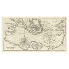
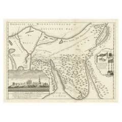
Old Dutch Map of the Region Around the Mediterranean Sea, 1773
Located in Langweer, NL
around the Mediterranean Sea. Originates from the first Dutch editon of an interesting travel account of
Category

Antique 1770s Maps

Materials

Paper

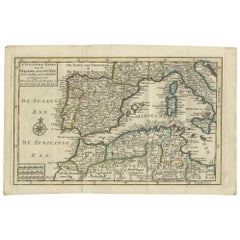
Antique Map of the Mediterranean Sea and Surroundings by Keizer & de Lat, 1788
Located in Langweer, NL
the Mediterranean Sea and surroundings. This map originates from 'Nieuwe Natuur- Geschied- en
Category

Antique Late 18th Century Maps

Materials

Paper

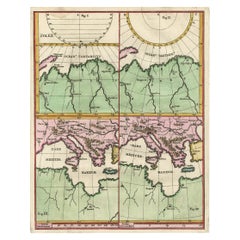
Curious Map of the Laptev Sea 'Arctic Ocean' and the Mediterranean, ca.1700
Located in Langweer, NL
Antique map, untitled. Map of the Laptev Sea (Arctic Ocean) and the Mediterranean, printed for
Category

Antique Early 1700s Maps

Materials

Paper

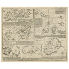
Antique Map of 'African' Islands in the Mediterranean Sea and The Atlantic, 1747
Located in Langweer, NL
Antique map titled 'Particular draughts of some of the chief African Islands in the Mediterranean
Category

Antique 18th Century Maps

Materials

Paper

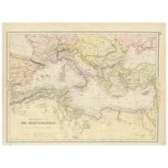
Mediterranean Tapestry: A 19th Century Map of the Mediterranean Shores, 1882
Located in Langweer, NL
This map, titled "The Shores of the Mediterranean," is part of the 1882 atlas by Blackie & Son, and
Category

Antique 1880s Maps

Materials

Paper

Old Map of the Sinai Peninsula Showing the Mediterranean and the Red Sea, 1773
Located in Langweer, NL
Antique map of the Sinai Peninsula showing the Mediterranean Sea to the north and the Red Sea to
Category

Antique 1770s Maps

Materials

Paper

Large Decorative Antique Map of the Mediterranean, ca.1770
Located in Langweer, NL
fine engraved double-page and folding maps that join to create a large wall map of the Mediterranean
Category

Antique 1770s Maps

Materials

Paper

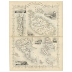
Old Map of British Mediterranean Territories with Images of Historic Sites, 1851
Located in Langweer, NL
influence over the Mediterranean Sea, protecting trade routes and maintaining military strength. The Tallis
Category

Antique 1850s Maps

Materials

Paper

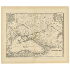
Black Sea in Antiquity: Pontus Euxinus Map, Published in 1880
Located in Langweer, NL
This map, titled "PONTUS EUXINUS," depicts the Black Sea region, historically known as the Pontus
Category

Antique 1880s Maps

Materials

Paper

Black Sea in Antiquity: Pontus Euxinus Map, Published in 1880
Free Shipping
H 15.56 in W 18.51 in D 0 in
Old Map of Mediterranean Powers: Pompey to Actium (66-31 BC), Published in 1880
Located in Langweer, NL
This is a historical map that depicts the Mediterranean region during a specific timeframe in Roman
Category

Antique 1880s Maps

Materials

Paper

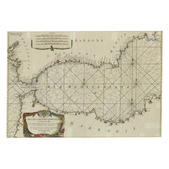
Original Antique Engraving of a Sea Chart of the Western Mediterranean, ca.1650
Located in Langweer, NL
Antique map titled 'Pascaerte van 't westlyckste deel vande Middelandsche-Zee (..)'. Sea chart of
Category

Antique 1650s Maps

Materials

Paper

Algarve: A Tapestry of Sea and Sunlight in an Antique Map, 1903
Located in Langweer, NL
sea caves. 2. **Climate**: The region is renowned for its Mediterranean climate, characterized by hot
Category

Antique Early 1900s Maps

Materials

Paper

Hand-Colored 18th Century Homann Map of the Black Sea, Turkey and Asia Minor
By Johann Baptist Homann
Located in Alamo, CA
An attractive original early 18th century hand-colored map of the Black Sea and Turkey entitled
Category

Antique Early 18th Century German Maps

Materials

Paper

Original Antique Map of the Region Between the Gulf of Lybia and the Red Sea
Located in Langweer, NL
Gulf of Lybia and the Red Sea, with marvelous detail along the Mediterranean Coastline and the Nile
Category

Antique Early 18th Century Maps

Materials

Paper

Cádiz 1901: Nautical Crossroads of the Atlantic and Mediterranean
Located in Langweer, NL
Atlantic Ocean and the Mediterranean Sea, including the Strait of Gibraltar. Blue lines mark the rivers
Category

Antique Early 1900s Maps

Materials

Paper

Colored wall map of the WORLD
By Chambon
Located in ZWIJNDRECHT, NL
map is most notable for its depiction of the Sea of Japan labeled "Mer de Corée" and of "Mer de
Category

Antique Mid-18th Century French French Provincial Maps

Materials

Wood, Paper

Colored wall map of the WORLD
Free Shipping
H 45 in W 57 in D 0.8 in
Mediterranean Encounters: From the Punic Wars to the Hannibalic War, 1880
Located in Langweer, NL
Vespasiani M. princip," depicts the Mediterranean Sea and its surrounding territories, extending from the
Category

Antique 1880s Maps

Materials

Paper

Antique Map of the Sinai Peninsula, '1895'
Located in Langweer, NL
Egypt, and the only part of the country located in Asia. It is situated between the Mediterranean Sea to
Category

Antique Late 19th Century Maps

Materials

Paper

Antique Map of the Sinai Peninsula, '1895'
H 9.85 in W 6.3 in D 0.02 in
Small Detailed Antique Map of France, c.1780
Located in Langweer, NL
Channel, Bay of Biscay, Part of Spain, the Mediterranean Sea, Part of Italy, Switzerland and Part of
Category

Antique 18th Century Maps

Materials

Paper

Antique Decorative Coloured Map Marocco, Algeria and Tunis, 1882
Located in Langweer, NL
. 5. **Navigational Aid**: For ships navigating the Mediterranean Sea, the map would have been an
Category

Antique 1880s Maps

Materials

Paper

Antique Map of Asia by A. Blondeau, circa 1800
Located in Langweer, NL
Africa and the Mediterranean east to the Bering Sea and south as far as Java and New Guinea. This map is
Category

Antique Early 19th Century Maps

Materials

Paper

Antique Map of Spain and Portugal, with Frame Style Border
Located in Langweer, NL
of Spain and Portugal from France to the Mediterranean Sea and includes the Balearic Islands of Ibiza
Category

Antique Mid-19th Century Maps

Materials

Paper

Cartographic Tapestry: Antique Map of Asia Minor, circa 1640
Located in Langweer, NL
Euphrates River to the Aegean Islands and from the Black Sea to the Mediterranean. Notably, it includes key
Category

Antique Mid-17th Century Maps

Materials

Paper

Antique Map of the Turkish Empire by Tirion 'c.1760'
Located in Langweer, NL
antique map of the Turkish Empire. The map is centered on the Mediterranean Sea but covers most of
Category

Antique Mid-18th Century Maps

Materials

Paper

Antique Map of the Arabian Peninsula by Bellin 'c.1740'
Located in Langweer, NL
the Gulf of Oman and from the Mediterranean Sea and Iraq to the Horn of Africa. Published by J.N
Category

Antique Mid-18th Century Maps

Materials

Paper

Topographical and Infrastructure Map of the Province of Valencia, 1901
Located in Langweer, NL
governmental source for the map. The province of Valencia is located along the Mediterranean coast, which is
Category

Antique Early 1900s Maps

Materials

Paper

Antique Map of Persia, Also Showing the Indus River, circa 1673
By Joan (Johannes) Blaeu
Located in Langweer, NL
Antique map titled 'Persia sive Sophorum Regnum'. Original old map of Persia. The map extends from
Category

Antique Late 17th Century Maps

Materials

Paper

Antique Map of Spain and Portugal by Tardieu, circa 1795
Located in Langweer, NL
elements like rivers and mountain ranges. The coastline is intricately detailed, with the Mediterranean Sea
Category

Antique Late 18th Century Maps

Materials

Paper

Original Antique Map of Canaan, Armenia, Syria, Mesopotamia and Arabia, 1709
Located in Langweer, NL
, Armenia, Syria, Mesopotamia and Arabia. It displays the Middle East from the eastern Mediterranean Sea to
Category

Antique Early 1700s Maps

Materials

Paper

Antique Map of Western and Eastern Barbary in Africa, c.1744
Located in Langweer, NL
of the Eastern Parts of Barbary'. Decorative maps of North Africa and the Southern Mediterranean
Category

Antique 18th Century Maps

Materials

Paper

Antique Map of the Middle East by Brion de la Tour '1772'
Located in Langweer, NL
, extending to the Red Sea, Egypt, the Eastern Mediterranean, Black Sea, Caspian Sea and the Indian Ocean
Category

Antique Late 18th Century Maps

Materials

Paper

Territories of Antiquity: The Northern Division of Syria, A Detailed 1882 Map
Located in Langweer, NL
during the late Ottoman period. The map's scope extends from the Mediterranean Sea in the west
Category

Antique 1880s Maps

Materials

Paper

Imperial Splendor: Antique Map of the Ottoman Empire by Blaeu, circa 1640
Located in Langweer, NL
Arabian Sea and the Mediterranean. This likely reflects the importance of maritime trade and naval
Category

Antique Mid-17th Century Maps

Materials

Paper

Historical Map of Canaan with Insets of Jerusalem and Surrounding Regions, 1880
Located in Langweer, NL
Mediterranean coastline, the Jordan River, the Dead Sea, and other significant topographical features like
Category

Antique 1880s Maps

Materials

Paper

Empire's Crossroads: An 1882 Map of Turkey in Asia by Blackie & Son
Located in Langweer, NL
Mediterranean Sea to the borders of Persia and from the Black Sea down to the Arabian Peninsula. The map is a
Category

Antique 1880s Maps

Materials

Paper

"Nova Barbariae Descriptio", a 17th Century Hand-Colored Map of North Africa
By Johannes Janssonius
Located in Alamo, CA
Descriptio" by Johannes Janssonius was published in Paris in 1635. It includes the Mediterranean Sea and
Category

Antique Mid-17th Century Dutch Maps

Materials

Paper

Almería 1901: Coastal Contours and Landscapes in a Map of Southeastern Spain
Located in Langweer, NL
An original antique map of the province of Almería, Spain, from the year 1901. The Mediterranean
Category

Antique Early 1900s Maps

Materials

Paper

Imperium Romanum: A Detailed Map of the Roman Empire in its Zenith, 1880
Located in Langweer, NL
topographical detail, with mountain ranges, rivers, and bodies of water such as the Mediterranean Sea
Category

Antique 1880s Maps

Materials

Paper

Balkan Convergence: A Map of Turkey and Greece with the Balkan States, 1882
Located in Langweer, NL
Southeastern Europe and the Eastern Mediterranean during the late 19th century. The map spans the region from
Category

Antique 1880s Maps

Materials

Paper

The World in the Assyrian Empire's Era: A Historical Map, Published in 1880
Located in Langweer, NL
Caspian Seas, and the mountain ranges of the region. 3. **Inset Maps**: The inclusion of inset maps, such
Category

Antique 1880s Maps

Materials

Paper

Antique Map of the City of Algiers and Surroundings in Northern Africa, 1773
Located in Langweer, NL
to be around 5,000,000. Algiers is located on the Mediterranean Sea and in the north-central portion
Category

Antique 18th Century Maps

Materials

Paper

"Africae Accurata", a Hand-Colored 17th Century Map of Africa by Visscher
By Nicolaes Visscher II
Located in Alamo, CA
Mediterranean Sea and adjacent portions of Portugal, Spain, Italy, Greece and Asia Minor. The map perpetuates
Category

Antique Late 17th Century Dutch Maps

Materials

Paper

Antique Map of Eastern Turkey, Caucasus, Israel through Iraq and part of Arabia
Located in Langweer, NL
Arabia. From the Black to the Caspian Seas and from the Mediterranean to the Persian Gulf, the area
Category

Antique Mid-18th Century Maps

Materials

Paper

Southern & Eastern Europe: A Large 17th C. Hand-colored Map by Sanson & Jaillot
By Nicolas Sanson
Located in Alamo, CA
Empire in Europe, predominantly Eastern Europe. Highlights include, the Mediterranean Sea, the Adriatic
Category

Antique 1690s French Maps

Materials

Paper

17th Century Hand-Colored Map of Valencia and Murcia, Spain by Mercator/Hondius
By Gerard Mercator
Located in Alamo, CA
lower part of the map. It is embellished with a sea monster and a sailing ship in the Mediterranean and
Category

Antique Mid-17th Century Dutch Maps

Materials

Paper

Original Old Composite of Several Maps of the Ancient World on One Sheet, 1880
Located in Langweer, NL
This original antique map is from Karl Spruner von Merz's "Atlas Antiquus", later edited by
Category

Antique 1880s Maps

Materials

Paper

The Holy Land at the Time of Jesus: A 17th Century Dutch Map by Visscher
By Nicolaes Visscher II
Located in Alamo, CA
depicts the Holy Land from the Mediterranean Sea to just beyond the Jordan River as it appeared at the
Category

Antique Mid-17th Century Dutch Maps

Materials

Paper

Map of the Holy Land "Carte de la Syrie et de l'Egypte" by Pierre M. Lapie
By Pierre M. Lapie
Located in Alamo, CA
coastline of the Eastern Mediterranean in the north and the northern coast of the Red Sea in the south
Category

Antique Early 19th Century French Maps

Materials

Paper

Isles of Enchantment: The Balearic Archipelago in 1902
Located in Langweer, NL
." This map illustrates the Balearic archipelago in the Mediterranean Sea, highlighting the islands of
Category

Antique Early 1900s Maps

Materials

Paper

Isles of Enchantment: The Balearic Archipelago in 1902
Free Shipping
H 14.77 in W 20.08 in D 0 in
Barcelona 1901: A Cartographic Portrait of Catalonia's Capital Province
Located in Langweer, NL
and the Pyrenees to the north. The map includes the coastline along the Mediterranean Sea, indicating
Category

Antique Early 1900s Maps

Materials

Paper

Castellón de la Plana 1901: A Cartographic Perspective of the Valencian Coast
Located in Langweer, NL
coastal line along the Mediterranean Sea, indicative of Castellón's location on the eastern coast of Spain
Category

Antique Early 1900s Maps

Materials

Paper

A Catalonian Cartographic Depiction of Tarragona Province, 1901
Located in Langweer, NL
boundary with the Mediterranean Sea. Known for its rich history dating back to the Roman Empire, Tarragona
Category

Antique Early 1900s Maps

Materials

Paper

1902 Murcia: A Cartographic Snapshot of Spain's Southeastern Province
Located in Langweer, NL
The map represents the province of Murcia, Spain, as it was in 1902. Here's an overview of its
Category

Antique Early 1900s Maps

Materials

Paper

Vintage Geographic Splendor: 1859 Spain and Portugal
Located in Langweer, NL
Atlantic Ocean and the Mediterranean Sea. 2. **Political Boundaries**: Reflecting the political divisions
Category

Antique Mid-19th Century Maps

Materials

Paper

Vintage Geographic Splendor: 1859 Spain and Portugal
No Reserve
H 14.57 in W 21.26 in D 0.02 in
The Valley of Inspruck: An 18th-Century Engraved Perspective, 1792
Located in Langweer, NL
antique maps and prints, as well as for those who cherish the enduring allure of the Alpine regions. The
Category

Antique Late 18th Century Maps

Materials

Paper

Vintage Mural Map Mediterranean Sea Near East Countries Rollable Wall Chart
Located in Berghuelen, DE
A large countrycore pull-down map showing the countries surrounding the Mediterranean Sea
Category

Vintage 1970s German Country Prints

Materials

Canvas, Wood, Paper

Vintage Rollable Map Mediterranean Countries Wall Chart Mural Poster
Located in Berghuelen, DE
A decorative countrycore pull-down map depiciting countries surrounding the Mediterranean sea
Category

Vintage 1970s German Country Prints

Materials

Canvas, Wood, Paper

Original Vintage Travel Poster Sloman Line Mediterranean Map Spain Italy Africa
Located in London, GB
and islands on the Mediterranean Sea. Good condition, creasing, staining.
Category

Vintage 1930s German Posters

Materials

Paper

Original Vintage Rail Travel Map Poster France Map SNCF National French Railway
Located in London, GB
Mediterranean Sea / Mer Mediterranee and Atlantic Ocean Atlantique with the English Channel / Manche next to the
Category

Vintage 1950s French Posters

Materials

Paper

Original Vintage Map Poster Marruecos Espanol Spanish Morocco Illustrated Design
Located in London, GB
stylised compass point in the centre of the Mediterranean Sea. Issued by the Cartografia Hispanica under
Category

Vintage 1940s Spanish Art Deco Posters

Materials

Paper

  • 1
Get Updated with New Arrivals
Save "Mediterranean Sea Map", and we’ll notify you when there are new listings in this category.

Mediterranean Sea Map For Sale on 1stDibs

Choose from an assortment of styles, material and more with respect to the mediterranean sea map you’re looking for at 1stDibs. A mediterranean sea map — often made from paper, carrara marble and marble — can elevate any home. Your living room may not be complete without a mediterranean sea map — find older editions for sale from the 18th Century and newer versions made as recently as the 20th Century. A mediterranean sea map, designed in the Art Deco style, is generally a popular piece of furniture. Many designers have produced at least one well-made mediterranean sea map over the years, but those crafted by Nicolaes Visscher II, Ottomar Anton and Gerard Mercator are often thought to be among the most beautiful.

How Much is a Mediterranean Sea Map?

A mediterranean sea map can differ in price owing to various characteristics — the average selling price 1stDibs is $851, while the lowest priced sells for $108 and the highest can go for as much as $13,004.

Read More

Pamela Shamshiri Shares the Secrets behind Her First-Ever Book and Its Effortlessly Cool Interiors

The sought-after designer worked with the team at Hoffman Creative to produce a monograph that beautifully showcases some of Studio Shamshiri's most inspiring projects.

Moroccan Artworks and Objects Take Center Stage in an Extraordinary Villa in Tangier

Italian writer and collector Umberto Pasti opens the doors to his remarkable cave of wonders in North Africa.

Montecito Has Drawn Royalty and Celebrities, and These Homes Are Proof of Its Allure

Hollywood A-listers, ex-pat aristocrats and art collectors and style setters of all stripes appreciate the allure of the coastal California hamlet — much on our minds after recent winter floods.

Whaam! Blam! Pow! — a New Book on Pop Art Packs a Punch

Publishing house Assouline and writer Julie Belcove have teamed up to trace the history of the genre, from Roy Lichtenstein, Andy Warhol and Yayoi Kusama to Mickalene Thomas and Jeff Koons.

The Sparkling Legacy of Tiffany & Co. Explained, One Jewel at a Time

A gorgeous new book celebrates — and memorializes — the iconic jeweler’s rich heritage.

What Makes a Gem-Encrusted Chess Set Worth $4 Million?

The world’s most opulent chess set, weighing in at 513 carats, is literally fit for a king and queen.

Tauba Auerbach’s Geometric Pop-Up Book Is Mighty Rare, Thanks to a Hurricane

This sculptural art book has an epic backstory of its own.

Step inside the Storied Mansions of Palm Beach’s Most Effervescent Architect

From Spanish-style courtyards to fanciful fountains, these acclaimed structures abound in surprising and elegant details.