Map New Amsterdam
3
75
29
to
10
59
45
104
103
103
10
6
1
67
5
3
29
2
1
71
18
8
6
4
54
41
11
6
5
29
4
3
2
1
Sort By
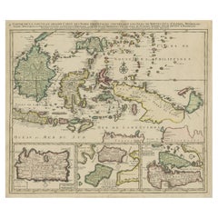
Old Map of Indonesian Islands Borneo, Celebes, New Guinea & New Britain, 1792
Located in Langweer, NL
Borneo, Iava, Celebes, Mindanao (..)'.
Detailed map of the Indonesian islands Borneo, Celebes, New
Category
Antique 1790s Maps
Materials
Paper
No Reserve
H 21.78 in W 25.99 in D 0 in
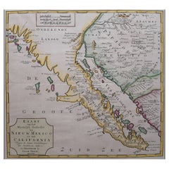
Original Antique Map of the Western Part of NEW MEXICO & CALIFORNIA
Located in Langweer, NL
Title: "Map of the Western Part of NEW MEXICO and CALIFORNIA According to the Latest Discoveries by
Category
Antique 1760s Maps
Materials
Paper
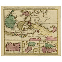
Old Map of the East Indonesian Islands Borneo, Celebes, New Guinea, Bali, 1792
Located in Langweer, NL
Borneo, Iava, Celebes, Mindanao (..)'.
Detailed map of the Indonesian islands Borneo, Celebes, New
Category
Antique 1790s Maps
Materials
Paper
H 21.66 in W 25.4 in D 0 in
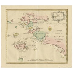
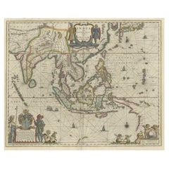
Antique Map extending from the Spice Islands to the west of Papua New Guinea
Located in Langweer, NL
Antique map titled 'Kaart van de Papoasche Eilanden'. Beautiful original old map extending from the
Category
Antique Late 18th Century Maps
Materials
Paper
H 17.33 in W 21.66 in D 0.02 in
Original Blaeu Map of Southeast Asia from India to Tibet and Japan to New Guinea
Located in Langweer, NL
Southeast Asia, extending from India to Tibet to Japan to New Guinea. It was the first popular map to depict
Category
Antique 1640s Maps
Materials
Paper
H 19.49 in W 23.63 in D 0 in
Antique Map of Buru Island, Indonesia, c.1725
Located in Langweer, NL
Joannes van Braam and Gerard onder de Linden (Dordrecht and Amsterdam).
We sell original antique maps to
Category
Antique 18th Century Maps
Materials
Paper
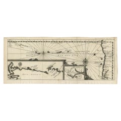
Antique Map of the Pacific Ocean by Renneville, 1702
Located in Langweer, NL
Willem Cornelisz. Schouten, who found a new passage south of Argentina. An inset map shows a detail of
Category
Antique 18th Century Maps
Materials
Paper
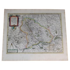
1633 Map Entitled "Beauvaisis Comitatus Belova Cium, Ric.0002
Located in Norton, MA
Amsterdam.
In all, from 1606 onwards, nearly 50 editions with increasing numbers of maps with texts in
Category
Antique 17th Century Dutch Maps
Materials
Paper
Road Map, John Ogilby, No 54, London, Yarmouth, Britannia
By John Ogilby
Located in BUNGAY, SUFFOLK
-sixth year, as a publisher of maps and geographical accounts.
Ogilby was born outside Dundee, in
Category
Antique 1670s English Baroque Maps
Materials
Paper
Antique Map of the East Indies by Janssonius, c.1644
By Johannes Janssonius
Located in Langweer, NL
New Guinea/Australia in the East. This map is dedicated to D. Christophorus Thisius by Henricus
Category
Antique 17th Century Maps
Materials
Paper
Antique Map of Westfalia, Germany by Mercator/Hondius, circa '1620'
Located in Langweer, NL
known for his early maps of the New World and Europe, for re-establishing the reputation of the work of
Category
Antique 16th Century Maps
Materials
Paper
Antique Map of Northern Ireland by Mercator/Hondius, Early 1600's
Located in Langweer, NL
Antique map titled 'Ultoniae Orientalis Pars'. Original antique map of Northern Ireland. Published
Category
Antique 16th Century Maps
Materials
Paper
Beautiful Antique Map of the Northern Hemisphere with California as an Island
By Isaak Tirion
Located in Langweer, NL
tot Amsterdam door Isaak Tirion'. Beautiful map of the Northern Hemisphere and North Pole, which shows
Category
Antique Mid-18th Century Maps
Materials
Paper
H 13.98 in W 18.9 in D 0.02 in
Antique Map of the World in Hemispheres by Keizer & de Lat, 1788
Located in Langweer, NL
Antique map titled 'Schuine Ronde Aard-Bolle waar van 't Middelpunt is Amsterdam (..)'. Interesting
Category
Antique Late 18th Century Maps
Materials
Paper
Old Antique Map of the East Indies and Southeast Asia, ca.1644
Located in Langweer, NL
New Guinea/Australia in the East. This map is dedicated to D. Christophorus Thisius by Henricus
Category
Antique 1640s Maps
Materials
Paper
Antique Map of Southeast Asia 'India, Indonesia' by N. Visscher, circa 1670
Located in Langweer, NL
Antique map titled 'Indiae Orientalis, nec non Insularum Adiacentium Nova Descriptio.' The map
Category
Antique Mid-17th Century Maps
Materials
Paper
H 20.75 in W 25.04 in D 0.02 in
Original Antique Map of the East Indies (Indonesia) by Janssonius, c.1644
By Johannes Janssonius
Located in Langweer, NL
New Guinea/Australia in the East. This map is dedicated to D. Christophorus Thisius by Henricus
Category
Antique 17th Century Maps
Materials
Paper
H 18.51 in W 23.43 in D 0 in
17th Century Hand-Colored Map of Southeastern England by Mercator and Hondius
By Gerard Mercator
Located in Alamo, CA
A 17th century copperplate hand-colored map entitled "The Sixt Table of England" by Gerard Mercator
Category
Antique Mid-17th Century Dutch Maps
Materials
Paper
H 12 in W 14 in D 0.13 in
Large Antique Map of Asia including All of Southeast Asia, c.1792
Located in Langweer, NL
Antique map titled 'L' Asie Divisee en ses Empires, Royaumes, et Etats'. Attractive, large map of
Category
Antique 18th Century Maps
Materials
Paper
No Reserve
H 20.67 in W 25.4 in D 0 in
North & South America: A 17th Century Hand-colored Map by Jansson & Goos
By Johannes Janssonius
Located in Alamo, CA
the new world depicted on this fascination map. Among them is the bulging shape of the Northwest coast
Category
Antique 1620s Dutch Maps
Materials
Paper
Southeastern Ireland: A 17th Century Hand Colored Map by Mercator and Hondius
By Gerard Mercator
Located in Alamo, CA
A 17th century copperplate hand-colored map entitled "The Second Table of Ireland, Udrone" by
Category
Antique Mid-17th Century Dutch Maps
Materials
Paper
H 12 in W 14 in D 0.13 in
A Tallis Map of British Guiana with Colonial Vignettes and Other Landmarks, 1851
Located in Langweer, NL
Amsterdam**: Here, a view of the town of New Amsterdam is depicted, which is another key settlement in
Category
Antique 1850s Maps
Materials
Paper
H 14.26 in W 10.71 in D 0 in
Antique Map of the Strait of Malacca, Malay Peninsula & Dutch Indies, c.1670
Located in Langweer, NL
: The Visscher family were art and map dealers in Amsterdam during the 17th century. Funded by C. J
Category
Antique 1670s Maps
Materials
Paper
H 20.6 in W 24.93 in D 0 in
Road Map John Ogilby No 75 Kings Lyn Harwich, Britannia Framed Wallhanging
By John Ogilby
Located in BUNGAY, SUFFOLK
, as a publisher of maps and geographical accounts.
Ogilby was born outside Dundee, in 1600, the
Category
Antique 1670s European Baroque Maps
Materials
Paper
H 15.75 in W 19.69 in D 0.6 in
Map Road John Ogilby Britannia No 74 Ipswich to Norwich Cromer Framed
By John Ogilby
Located in BUNGAY, SUFFOLK
his sixty-sixth year, as a publisher of maps and geographical accounts.
Ogilby was born outside
Category
Antique 1670s English Baroque Maps
Materials
Paper
Map Road Strip Britannia Sheet 2 John Ogilby London Aberistwith Islip Bramyard
By John Ogilby
Located in BUNGAY, SUFFOLK
of England and Wales.
Strip map Islip to Bramyard, on a scale of approximately one inch to the mile
Category
Antique 17th Century English Baroque Maps
Materials
Paper
H 14.38 in W 19.3 in D 0.79 in
17th Century Hand-Colored Map of Valencia and Murcia, Spain by Mercator/Hondius
By Gerard Mercator
Located in Alamo, CA
A 17th century hand-colored map entitled "Regni Valentiae Typus, Valentia and Murcia" by Gerard
Category
Antique Mid-17th Century Dutch Maps
Materials
Paper
H 12 in W 16 in D 0.13 in
Antique Map of British Guayana with Insets of Georgetown, Devil's Rock Etc, 1851
Located in Langweer, NL
Cataract River Berbice, New Amsterdam and Ataraipu or the Devil’s Rock. Originates from 'The Illustrated
Category
Antique 19th Century Maps
Materials
Paper
Free Shipping
H 14.18 in W 10.83 in D 0 in
Original Antique Hand-Colored Map of The East Indies and Southeast Asia, c.1644
Located in Langweer, NL
New Guinea/Australia in the East. This map is considered a must for all collectors of authentic and
Category
Antique 1640s Maps
Materials
Paper
H 19.69 in W 23.23 in D 0 in
Road Map No43 London to Kings Lynn, Royston to Downham, John Ogilby, Britannia
By John Ogilby
Located in BUNGAY, SUFFOLK
John Ogilby (British 1600-1676) Cosmographer and Geographick Printer to Charles II.
A road map
Category
Antique Late 17th Century British Charles II Maps
Materials
Paper
H 20.48 in W 24.41 in D 0.4 in
Road Map John Ogilby London St David's Britannia No 15 Abingdon Monmouth Framed
By John Ogilby
Located in BUNGAY, SUFFOLK
John Ogilby (British 1600-1676) Cosmographer and Geographick Printer to Charles II. A road map from
Category
Antique 1670s English Baroque Maps
Materials
Paper
H 20.48 in W 24.41 in D 0.6 in
Small Map of Bantam with Dutch Ships and an Engraving of Portugese, 1614
Located in Langweer, NL
discovered a new sea route from Europe to Indonesia and managed to begin the Dutch spice trade.
From the
Category
Antique Early 17th Century Maps
Materials
Paper
Antique Map of Asia and the East Indies and Korea as a Peninsula, ca.1660
Located in Langweer, NL
.
Artists and Engravers: The Visscher family were art and map dealers in Amsterdam during the 17th century
Category
Antique 17th Century Maps
Materials
Paper
Free Shipping
H 19.69 in W 24.02 in D 0 in
Road Map Britannia No 32 the Road from London to Barnstable John Ogilby Framed
By John Ogilby
Located in BUNGAY, SUFFOLK
A road map from Britannia, by John Ogilby Esq., Cosmographer and Geographick Printer to Charles II
Category
Antique Late 17th Century English Charles II Maps
Materials
Paper
H 20.48 in W 24.41 in D 0.6 in
Road Map Britannia No 15 London to St Davids John Ogilby Brown Gilt Frame
By John Ogilby
Located in BUNGAY, SUFFOLK
Lechlade, to Fairford, to Barnsley to Gloucester showing Monmouth as the destination. A road map from
Category
Antique Late 17th Century British Charles II Maps
Materials
Paper
H 22.05 in W 26.19 in D 0.6 in
The Holy Land at the Time of Jesus: A 17th Century Dutch Map by Visscher
By Nicolaes Visscher II
Located in Alamo, CA
Iesu Christo, nessens syne Apostelen" by Nicolaes Visscher was published in Amsterdam in 1663. The map
Category
Antique Mid-17th Century Dutch Maps
Materials
Paper
H 22.75 in W 28.5 in D 1.13 in
Road Map Britannia No 25 London to the Lands End, John Ogilby Brown Gilded Frame
By John Ogilby
Located in BUNGAY, SUFFOLK
Senan in Cornwall. By John Ogilby His Majesties Cosmographer. A road map from Britannia, 1675/6. No 25
Category
Antique Late 17th Century British Charles II Maps
Materials
Paper
H 22.05 in W 26.19 in D 0.6 in
Road Map Britannia 1675/6 No 5 Road London to Barwick, London Stilton Grey Frame
By John Ogilby
Located in BUNGAY, SUFFOLK
John Ogilby (British 1600-1676) cosmographer and geographick printer to Charles II.
A road map from
Category
Antique Late 17th Century British Charles II Maps
Materials
Paper
H 22.84 in W 25.99 in D 0.4 in
Lyonnais, Beaujolais, Forez, Mâconnais: A 1644 Depiction of France's Provinces
Located in Langweer, NL
An original antique map from 1644, depicting the French provinces of Lyonnais, Beaujolais, Forez
Category
Antique 1640s Maps
Materials
Paper
Free Shipping
H 20.08 in W 23.82 in D 0 in
Loudun and Mirebeau: A Cartographic Masterpiece of 17th Century France by Blaeu
Located in Langweer, NL
uploaded is an original antique map titled "Loudonois - Mirebalais," created by Willem Janszoon Blaeu, a
Category
Antique 1650s Maps
Materials
Paper
Free Shipping
H 20.08 in W 23.82 in D 0 in
Old Engraving of A Panoramic Bird's Eye View of Miaco 'Kyoto', Japan, 1669
Located in Langweer, NL
aan de Kaisaren van Japan […]. Amsterdam: Jacob Meurs, 1669.
Artists and Engravers: Made by an
Category
Antique 1660s Maps
Materials
Paper
H 12.68 in W 30.71 in D 0 in
Flanders, Holland & Norfolk: Hand-Colored 17th Century Sea Chart by Collins
By Captain Greenvile Collins
Located in Alamo, CA
Britain's Coasting Pilot. Being a New and Exact Survey of the Sea-Coast of England" by Captain Greenville
Category
Antique Late 17th Century English Maps
Materials
Paper
H 23 in W 27.75 in D 0.5 in
Rare Engraving of Dutch and Danish Forts on the West African Gold Coast, 1744
Located in Langweer, NL
Amsterdam, 1653; d London, 1722). Dutch draughtsman, engraver and dealer, active in England. He was a pupil
Category
Antique 1740s Maps
Materials
Paper
H 15.36 in W 13.67 in D 0 in
c.1900 Handwoven French Tapestry Map New Netherlands, Amsterdam, 1626 New York
Located in Jensen Beach, FL
Striking depiction of a map of the New Netherlands after the Dutch purchase in 1626, including New
Category
Early 20th Century Tapestries
Materials
Wool
H 44 in W 55 in D 0.01 in
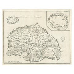
Antique Print of Amsterdam and St. Paul Island, 1753
Located in Langweer, NL
ship on 17 June 1633 in turn named after the Dutch settlement of New Amsterdam that later became New
Category
Antique 18th Century Prints
Materials
Paper
Antique Print of Amsterdam and St. Paul Island by Bellin '1753'
By Jacques-Nicolas Bellin
Located in Langweer, NL
ship on 17 June 1633 in turn named after the Dutch settlement of New Amsterdam that later became New
Category
Antique Mid-18th Century Prints
Materials
Paper
Cemetery on Amsterdam Island, French Territory in the Indian Ocean, ca.1785
Located in Langweer, NL
Antique print titled 'Begraafplaats op het eiland Amsterdam'.
Engraved view of a local cemetery
Category
Antique 1780s Prints
Materials
Paper
H 9.85 in W 15.36 in D 0 in
Engraving of a Meeting of the Dutch Synode in Amsterdam, The Netherlands, 1732
Located in Langweer, NL
in 'De Nieuwe Kerk' in Amsterdam, The Netherlands in 1730. Also depicted the acceptance of a new
Category
Antique 18th Century Prints
Materials
Paper
H 15.36 in W 9.65 in D 0 in
Seminal guide to the East and West Indies, with 42 coloured maps and plates
By Jan Huygen van Linschoten
Located in ZWIJNDRECHT, NL
Seminal guide to the East and West Indies, with 42 double-page and folding plates, including 6 maps
Category
Antique Early 17th Century Dutch Dutch Colonial Books
Materials
Paper
Free Shipping
H 12.6 in W 8.27 in D 1.58 in
Dutch Luther Bible with fine hand-coloured and highlighted in gold illustrations
By Claes Jansz. Visscher (II)
Located in ZWIJNDRECHT, NL
dese Nederlanden.
Printed on the presses of Lodewijk III Elsevier in Amsterdam.
Icluding:
(2) De
Category
Antique 1640s Dutch Dutch Colonial Books
Materials
Gold
Free Shipping
H 15 in W 11 in D 4.5 in
A beautiful Celestial Table Globe produced by Gerard & Leonard Valk
By Gerard and Leonard Valk
Located in ZWIJNDRECHT, NL
, the firm became the only publisher of globes in the Netherlands in the 18th century. In Amsterdam
Category
Antique Early 18th Century Dutch Dutch Colonial Globes
Materials
Other
Wonderful and extremely rare Dutch pocketglobe
By Dementz Family DEUR Art Company
Located in ZWIJNDRECHT, NL
Johannes Deur.
Amsterdam, 1720.
Diameter of 2,5 inches / 6 cm. 2 legends are inscribed and seen. One is in
Category
Antique Early 18th Century Dutch Dutch Colonial Globes
Materials
Hardwood, Paper
Rare Engraving of NY Celebrations by the Moors Muslims in Bengal, India, 1708
Located in Langweer, NL
several celebrations by the Moors/ Muslims like the New Year celebration., January 1664. Bengal, part of
Category
Antique 18th Century Prints
Materials
Paper
H 8.47 in W 6.5 in D 0 in
Rare Antique Engraving of Life Near The Sestro River, Liberia in Africa, 1744
Located in Langweer, NL
Description: Antique print, titled: 'A map of Sestro River (…).' - This plate shows Fish, birds
Category
Antique 1740s Prints
Materials
Paper
No Reserve
H 13.67 in W 16.03 in D 0 in
Antique Print with Various Creatures from A Travel Account, 1744
Located in Langweer, NL
creatures (parakeet, sea cow, monkeys), a small map of Papo’s Bay at Tary (Cayenne?), birds eating fish at
Category
Antique 1740s Prints
Materials
Paper
Maarten Vrolijk, Blooming Terra Textile MVT19001, NL
By Maarten Vrolijk
Located in New York, NY
international museums including the Stedelijk Museum Amsterdam, the Museum of Modern Art, New York and the
Category
2010s Dutch Modern More Carpets
Materials
Wool, Linen
Maarten Vrolijk, Salon et Jardin, NL
By Maarten Vrolijk
Located in New York, NY
international museums including the Stedelijk Museum Amsterdam, the Museum of Modern Art, New York and the
Category
2010s Dutch Contemporary Art
Materials
Canvas
Maarten Vrolijk Helleborus, NL
By Maarten Vrolijk
Located in New York, NY
international museums including the Stedelijk Museum Amsterdam, the Museum of Modern Art, New York and the
Category
2010s Dutch Contemporary Art
Materials
Paint
Maarten Vrolijk, Purple Thistle, NL
By Maarten Vrolijk
Located in New York, NY
international museums including the Stedelijk Museum Amsterdam, the Museum of Modern Art, New York and the
Category
2010s Dutch Contemporary Art
Materials
Paint
Sakura TRP 22006, nl
By Maarten Vrolijk
Located in New York, NY
Amsterdam-based artist and designer Maarten Vrolijk believes that art should make people’s everyday
Category
2010s Dutch Modern Vases
Materials
Blown Glass
- 1
Get Updated with New Arrivals
Save "Map New Amsterdam", and we’ll notify you when there are new listings in this category.
Map New Amsterdam For Sale on 1stDibs
Find many varieties of an authentic map new amsterdam available at 1stDibs. Each map new amsterdam for sale was constructed with extraordinary care, often using paper, ceramic and glass. There are 48 variations of the antique or vintage map new amsterdam you’re looking for, while we also have 13 modern editions of this piece to choose from as well. You’ve searched high and low for the perfect map new amsterdam — we have versions that date back to the 18th Century alongside those produced as recently as the 21st Century are available. Each map new amsterdam bearing Baroque, modern or folk art hallmarks is very popular. Maarten Vrolijk, Gerard Mercator and Johannes Janssonius each produced at least one beautiful map new amsterdam that is worth considering.
How Much is a Map New Amsterdam?
A map new amsterdam can differ in price owing to various characteristics — the average selling price 1stDibs is $1,138, while the lowest priced sells for $103 and the highest can go for as much as $2,872.
More Ways To Browse
Van Diemen
Royal Worcestershire
1600 Still Life
Victorian Hand Signed Lithographs
Charles Morgan
Antique English Settle
Antique Florida Maps
Antique Maps Florida
Antique Map Florida
Antique Florida Map
16th C Door
Chinese Antique Seller
Antique Furniture Camden
Northwest Passage
Antique Maps Cambridge
Antique Map Of Florida
Set Four Maps
Antique Maps Of Florida
