Items Similar to Old Map of the East Indonesian Islands Borneo, Celebes, New Guinea, Bali, 1792


Want more images or videos?
Request additional images or videos from the seller
1 of 5
Old Map of the East Indonesian Islands Borneo, Celebes, New Guinea, Bali, 1792
About the Item
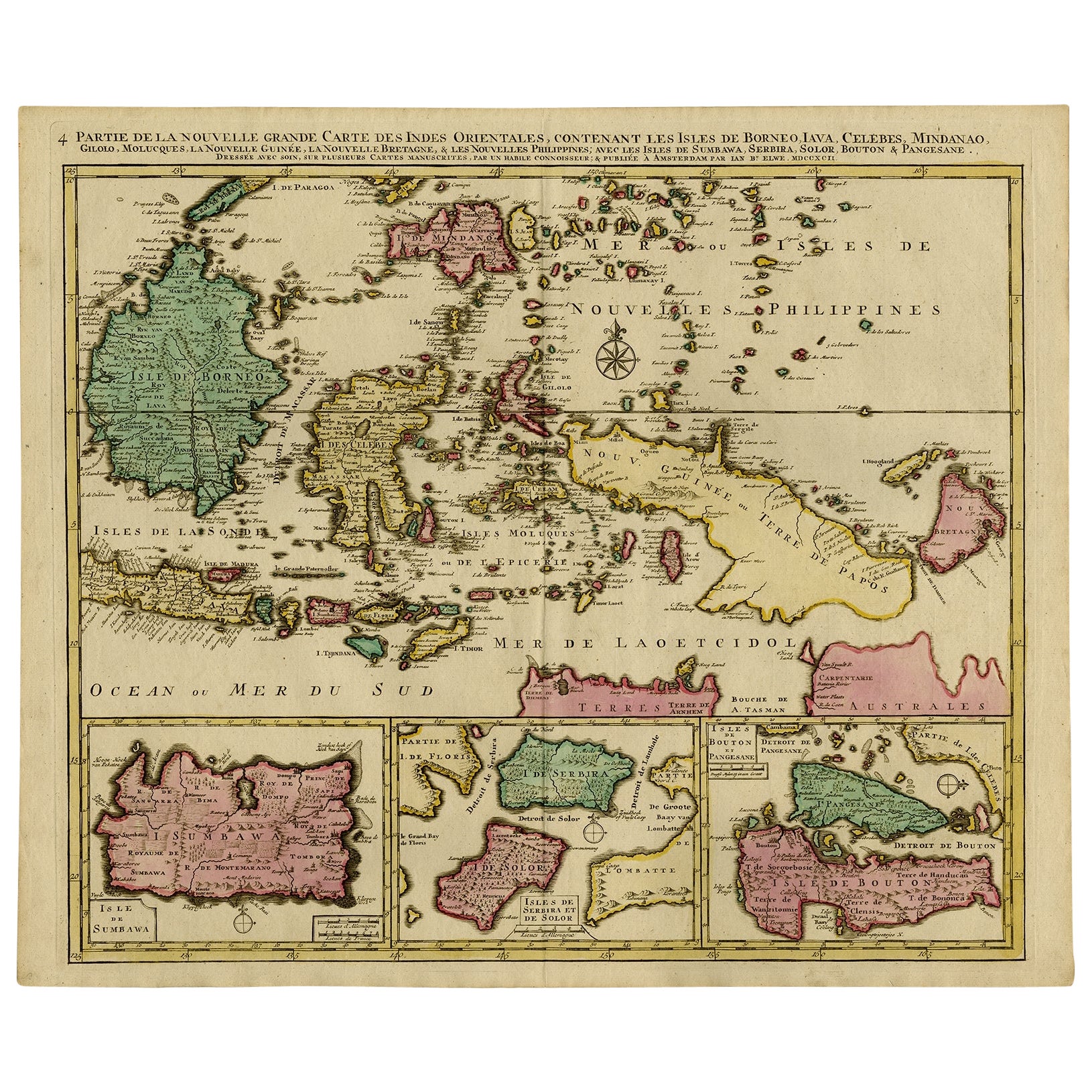
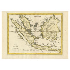
Antique map titled 'Partie de la Nouvelle Grande Carte des Indes Orientales, contenant les Isles de Borneo, Iava, Celebes, Mindanao (..)'.
Detailed map of the Indonesian islands Borneo, Celebes, New Guinea and New Britain, as well as part of Java (Indonesia). Some of the smaller islands include Bali, Lombok, Timor and Madura. Three inset maps in the lower edge depict Pulau Sumbawa, the Solor Islands Adonara (here Serbira) and Solor, and Pulau Muna (here Pangesane) and Bouton. One of the four sheets of Elwe's map of South East Asia, based on Jaillot's work, ca. 100 years ealier. Published in Amsterdam.
Artists and Engravers: Cartographer: Jan Barend Elwe. Jan Barend Elwe (1774-1815), an Amsterdam bookseller.
Condition: Good, original/contemporary hand coloring. Repair on folding line. Shows some creasing. General age-related toning, minor wear. Blank verso, please study image carefully.
- Dimensions:Height: 21.66 in (55 cm)Width: 25.4 in (64.5 cm)Depth: 0 in (0.02 mm)
- Materials and Techniques:
- Period:1790-1799
- Date of Manufacture:1792
- Condition:
- Seller Location:Langweer, NL
- Reference Number:
About the Seller
5.0
Platinum Seller
These expertly vetted sellers are 1stDibs' most experienced sellers and are rated highest by our customers.
Established in 2009
1stDibs seller since 2017
1,928 sales on 1stDibs
Typical response time: <1 hour
- ShippingRetrieving quote...Ships From: Langweer, Netherlands
- Return PolicyA return for this item may be initiated within 14 days of delivery.
More From This SellerView All
- Old Map of Indonesian Islands Borneo, Celebes, New Guinea & New Britain, 1792Located in Langweer, NLAntique map titled 'Partie de la Nouvelle Grande Carte des Indes Orientales, contenant les Isles de Borneo, Iava, Celebes, Mindanao (..)'. Detailed map of the Indonesian islands Bo...Category
Antique 1790s Maps
MaterialsPaper
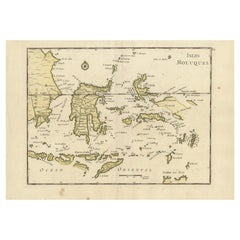
- Old Original Antique Map of the Islands of East Indonesia, 1756Located in Langweer, NLTitle: Isles Moluques. Old and rare, this decorative map of the Maluku Islands in the period it was still controlled by the Dutch colonial power. It also shows the island of Bali, Lombok, part of Borneo (Kalimantan), Celebes (Sulawesi), Timor, The Lesser Sunda Islands, West Papua...Category
Antique 1750s Maps
MaterialsPaper
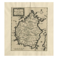
- Antique Map of the Island of Borneo in Asia (Indonesia), 1726Located in Langweer, NLAntique map titled 'Kaart van het Eyland Borneo'. Early map of the island of Borneo. This map originates from 'Oud en Nieuw Oost-Indiën' by F. Valentijn. Artists and Engravers: Fran...Category
Antique 18th Century Maps
MaterialsPaper
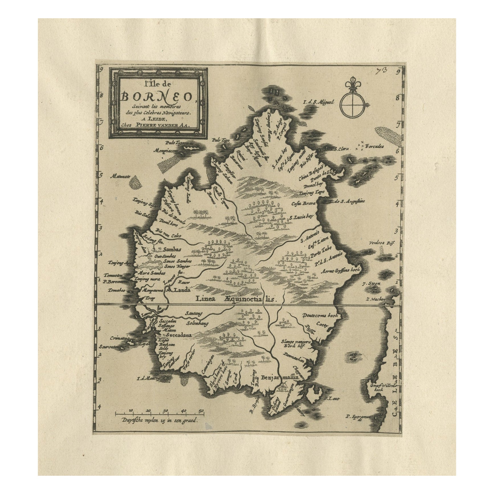
- Extremely Scarce Antique Map of The Island of Borneo, Indonesia, c. 1725Located in Langweer, NLAntique map titled 'L'Ile de Borneo Suivant les memoires des plus Celebres Navigateurs.' A detailed map of the island Borneo, with a small part of Celebes visible. This plate origi...Category
Antique 18th Century Maps
MaterialsPaper
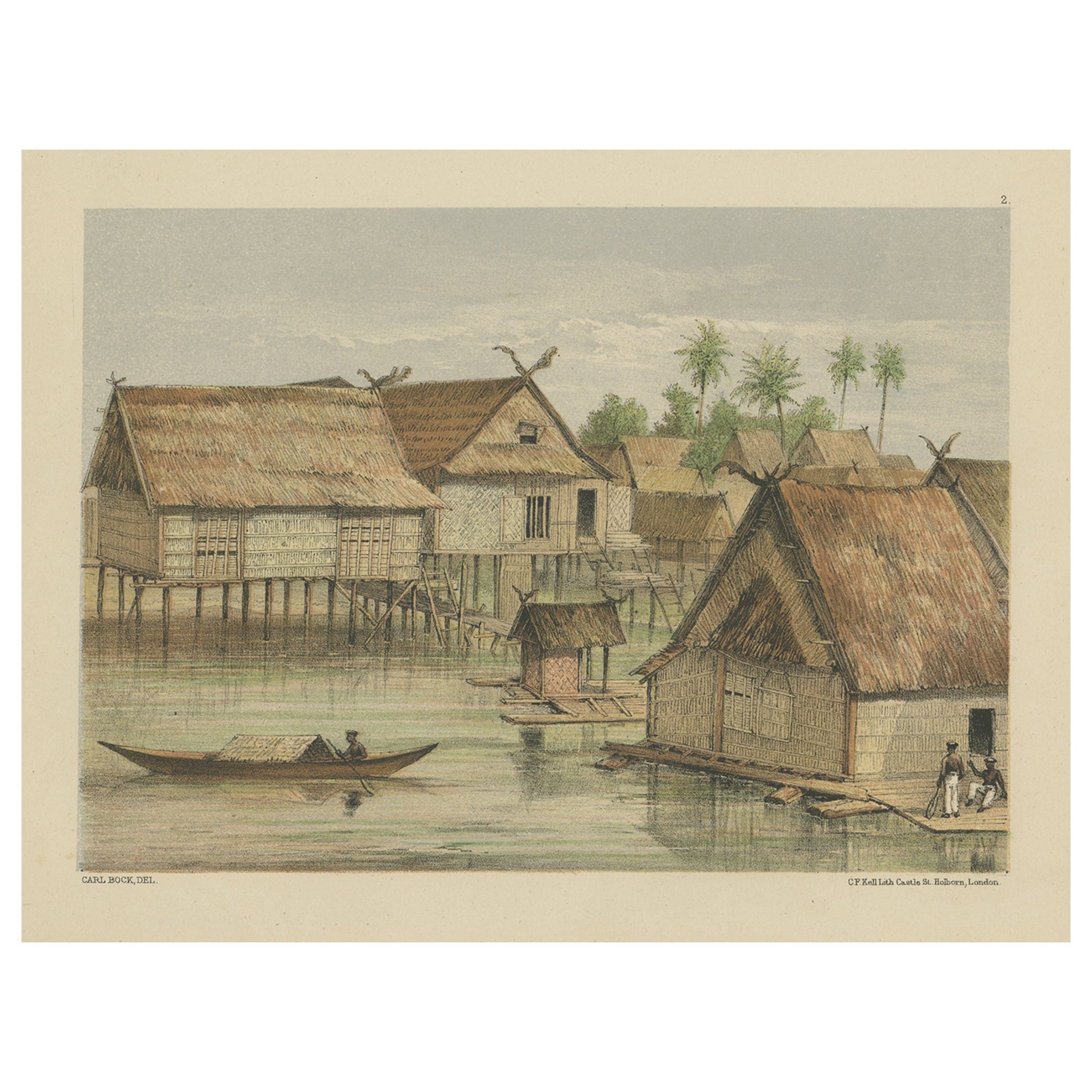
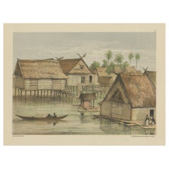
- Print of Tenggarong in East-Kalimantan on The Island of Borneo, Indonesia, 1881Located in Langweer, NLAntique print with a view of Tenggarong, Indonesia. This print originates from 'Reis in Oost- en Zuid-Borneo van Koetei naar Banjermassin (..)' by Carl Bock....Category
Antique 19th Century Prints
MaterialsPaper
- Old Original Antique Map of the Sunda Islands of Indonesia, 1756Located in Langweer, NLTitle: Isles De La Sonde. Attractive old decorative map of the Isles de la Sonde, Borneo, Sumatra, Java and Malacca ( Malaysia) with the Straits of Malacca. Penang is spelled as P...Category
Antique 1750s Maps
MaterialsPaper

You May Also Like
- Old Nautical Map of CorsicaLocated in Alessandria, PiemonteST/556/1 - Old map of Corsica isle, surveyed by Captain Hell, of the French Royal Navy in 1824, engraved and published on 1874, with additions and corre...Category
Antique Early 19th Century English Other Prints
MaterialsPaper
- Old Horizontal Map of EnglandBy TassoLocated in Alessandria, PiemonteST/520 - Old rare Italian map of England, dated 1826-1827 - by Girolamo Tasso, editor in Venise, for the atlas of M.r Le-Sage.Category
Antique Early 19th Century Italian Other Prints
MaterialsPaper
- New Map of North America from the Latest Discoveries, 1763Located in Philadelphia, PAA fine antique 18th century map of the North American seaboard. Entitled "A New Map of North America from the Latest Discoveries 1763". By the Cartographer/Engraver - John Spil...Category
Antique Mid-18th Century English Georgian Maps
MaterialsPaper
- Original Antique Map of South East Asia, Arrowsmith, 1820Located in St Annes, LancashireGreat map of South East Asia Drawn under the direction of Arrowsmith Copper-plate engraving Published by Longman, Hurst, Rees, Orme and Brown, 1820 Unframed.Category
Antique 1820s English Maps
MaterialsPaper
- Map of the Republic of GenoaLocated in New York, NYFramed antique hand-coloured map of the Republic of Genoa including the duchies of Mantua, Modena, and Parma. Europe, late 18th century. Dimension: 25...Category
Antique Late 18th Century European Maps
- Hand-Colored 18th Century Homann Map of Denmark and Islands in the Baltic SeaBy Johann Baptist HomannLocated in Alamo, CAAn 18th century copper plate hand-colored map entitled "Insulae Danicae in Mari Balthico Sitae utpote Zeelandia, Fionia, Langelandia, Lalandia, Falstria, Fembria Mona" created by Joh...Category
Antique Early 18th Century German Maps
MaterialsPaper


Recently Viewed
View AllMore Ways To Browse
Oriental Antiques Collectables
Antique Bookseller
Antique Booksellers
Indonesia Map
Antique Map Indonesia
Antique Maps Indonesia
East Java
Bali Antique
Borneo Antique
Antique Bali Furniture
Old Asia Map
Old Java
Java Map
Bali Map
Map New Amsterdam
British Isles Antique Map
Maps South East Asia
Antique South East Asia Map