Items Similar to A Tallis Map of British Guiana with Colonial Vignettes and Other Landmarks, 1851

Want more images or videos?
Request additional images or videos from the seller
1 of 6
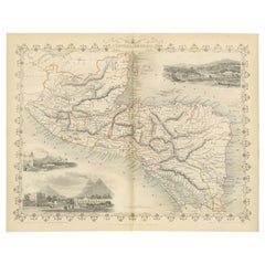
A Tallis Map of British Guiana with Colonial Vignettes and Other Landmarks, 1851
About the Item
This Tallis map of British Guiana (now known as Guyana) is a richly decorated document, much like other maps from the esteemed cartographic publisher John Tallis & Company. The firm, particularly known during the Victorian era, produced maps that were as much informative as they were ornamental.
**The Maker - John Tallis & Company:**
John Tallis, along with his partner John Frederick Tallis, focused on creating maps that were visually appealing, featuring elaborate borders and illustrative vignettes that captured the imagination of their audience. These maps are highly collectible today for their artistic value and historical significance.
**The Map - British Guiana:**
The map itself would have provided a comprehensive view of British Guiana, detailing its physical geography, including river systems, elevation changes, settlements, and other key geographic features. British Guiana was an important colony in South America due to its production of sugar and other resources, and it was the only English-speaking country on the continent.
**The Countries:**
Guyana is bordered by the Atlantic Ocean, Brazil, Suriname, and Venezuela. It has a rich history, from the native Amerindian cultures to Dutch and British colonization. It's known for its diverse ethnic makeup and as the location of the infamous Jonestown massacre.
**The Tallis Series:**
The series produced by Robert Montgomery Martin provided an extensive survey of the British Empire's colonies, catering to the British middle and upper classes' growing interest in the empire's global reach. The maps served not only as tools for education and reference but also as symbols of British pride and achievement.
Today, these maps are prized for their detail, beauty, and as snapshots of history, giving insight into the geographical understanding and imperial mindset of the period.
The insets in more detail:
The insets on this map of British Guiana (now Guyana) provide a detailed look into specific geographical and cultural aspects of the region during the mid-19th century:
1. **Seal of the Colony**: This inset is a detailed illustration of the official seal of British Guiana. It usually features a depiction that has symbolic meaning, often related to the colony’s economic activities or its relationship with the British Crown.
2. **Ataraipu, or the Devil's Rock**: This vignette depicts a notable landmark known as the Devil’s Rock (Ataraipu). The scene is set in a dramatic landscape, possibly illustrating a natural rock formation that stands out in the region.
3. **Georgetown**: This is an illustration of Georgetown, the capital city of British Guiana. It shows a waterside view with ships, indicating the importance of Georgetown as a hub for trade and transportation.
4. **New Amsterdam**: Here, a view of the town of New Amsterdam is depicted, which is another key settlement in British Guiana. Like Georgetown, it is shown as a coastal town with ships, highlighting its role in maritime commerce.
5. **Christmas Cataract, River Berbice**: This vignette likely shows one of the natural waterfalls on the Berbice River, capturing the natural beauty and possibly the challenges of navigating the river.
These insets serve to provide not just visual context but also to emphasize the strategic economic and cultural importance of British Guiana to the British Empire. Maps with such detailed vignettes were not only useful for navigation but also served an educational purpose and were often used to showcase the empire’s reach to audiences back in Britain. These illustrations can be a critical selling point for the map today, offering historical insights into the British colonial perspective of the time.
- Dimensions:Height: 14.26 in (36.2 cm)Width: 10.71 in (27.2 cm)Depth: 0 in (0.02 mm)
- Materials and Techniques:
- Period:
- Date of Manufacture:1851
- Condition:Good given age. Original fold in middle as published. General age-related toning, please study scan carefully.
- Seller Location:Langweer, NL
- Reference Number:
About the Seller
5.0
Platinum Seller
These expertly vetted sellers are 1stDibs' most experienced sellers and are rated highest by our customers.
Established in 2009
1stDibs seller since 2017
1,928 sales on 1stDibs
Typical response time: <1 hour
- ShippingRetrieving quote...Ships From: Langweer, Netherlands
- Return PolicyA return for this item may be initiated within 14 days of delivery.
More From This SellerView All
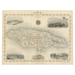
- An Ornate and Historical Tallis Map of Jamaica with Decorative Vignettes, 1851Located in Langweer, NLThis original antique map of Jamaica is part of the renowned series created by the Tallis Company, known for their detailed and decorative maps of the 19th century. The company was f...Category
Antique 1850s Maps
MaterialsPaper
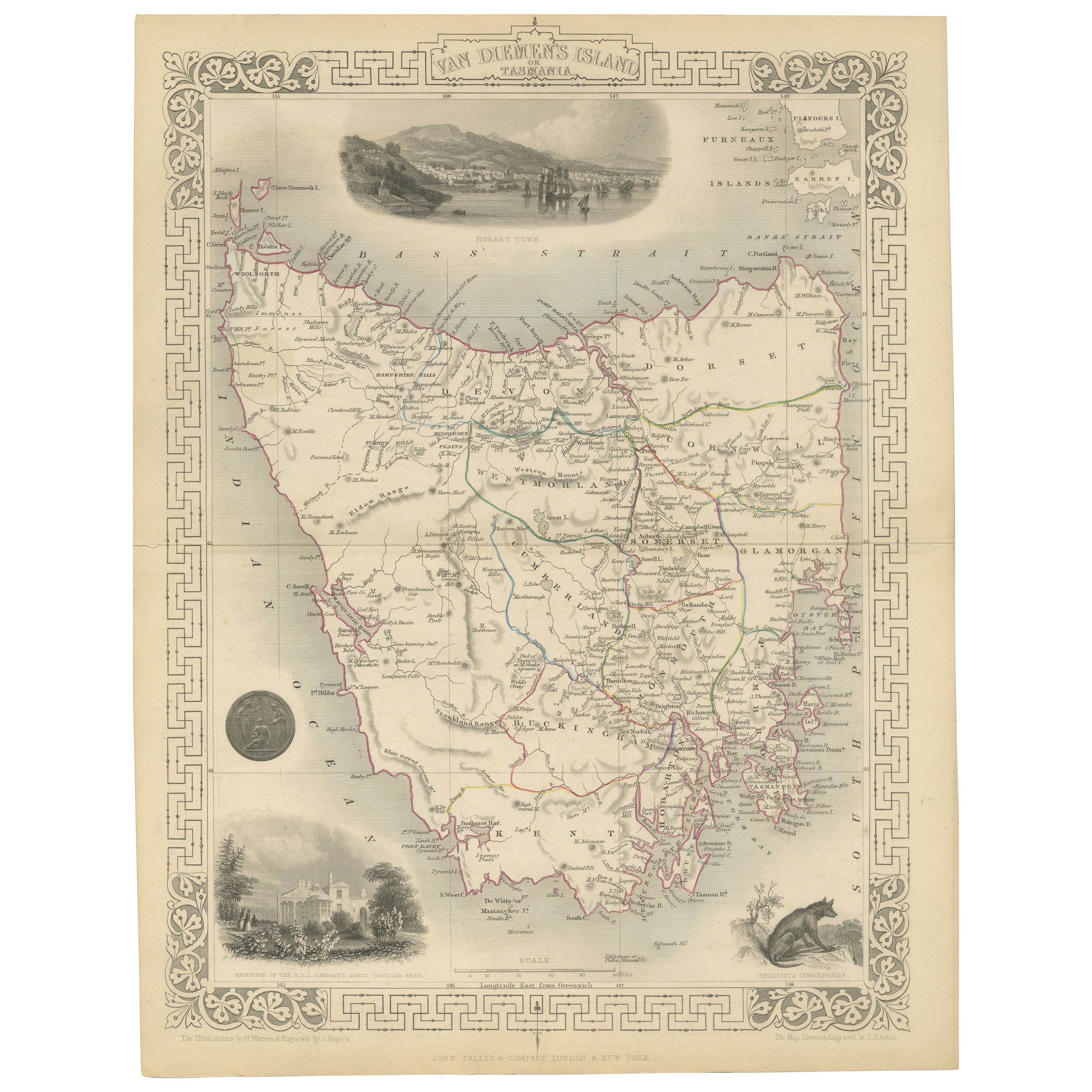
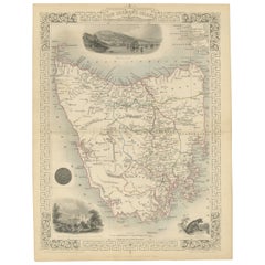
- Map of Tasmania with Illustrations of Local Fauna and Colonial Landmarks, 1851Located in Langweer, NLJohn Tallis & Company was renowned for their detailed and ornate maps during the 19th century. Their maps are distinguished by the intricate borders and vignettes that are as informa...Category
Antique 1850s Maps
MaterialsPaper
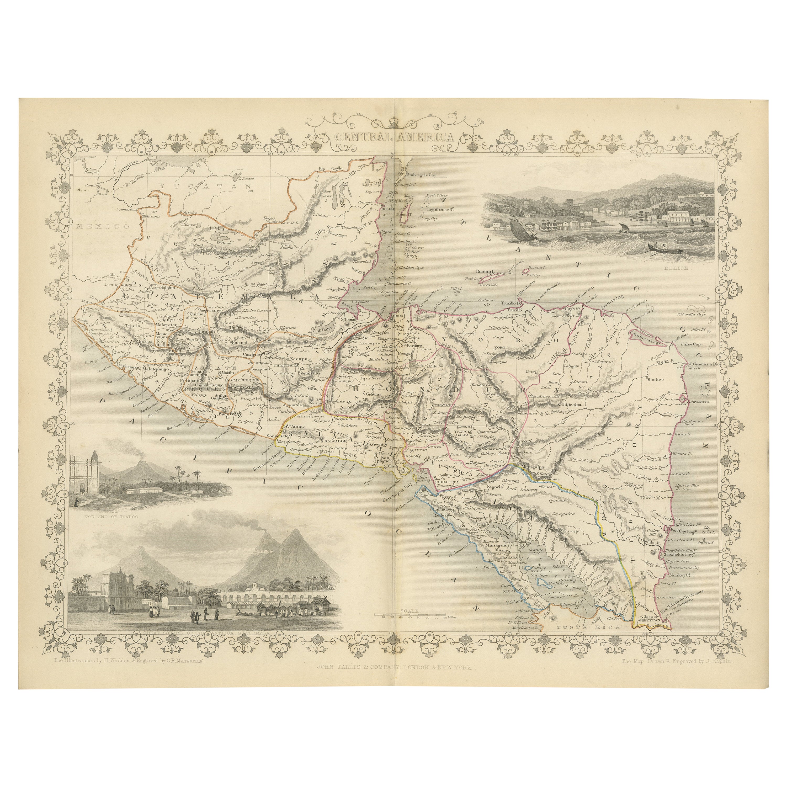
- An Old Illustrated Tallis Map of Central America with Volcanic Vignettes, 1851Located in Langweer, NLThis map of Central America, part of John Tallis & Company's series from "The British Colonies" by Robert Montgomery Martin, is a fine example of mid-19th century cartography and wou...Category
Antique 1850s Maps
MaterialsPaper
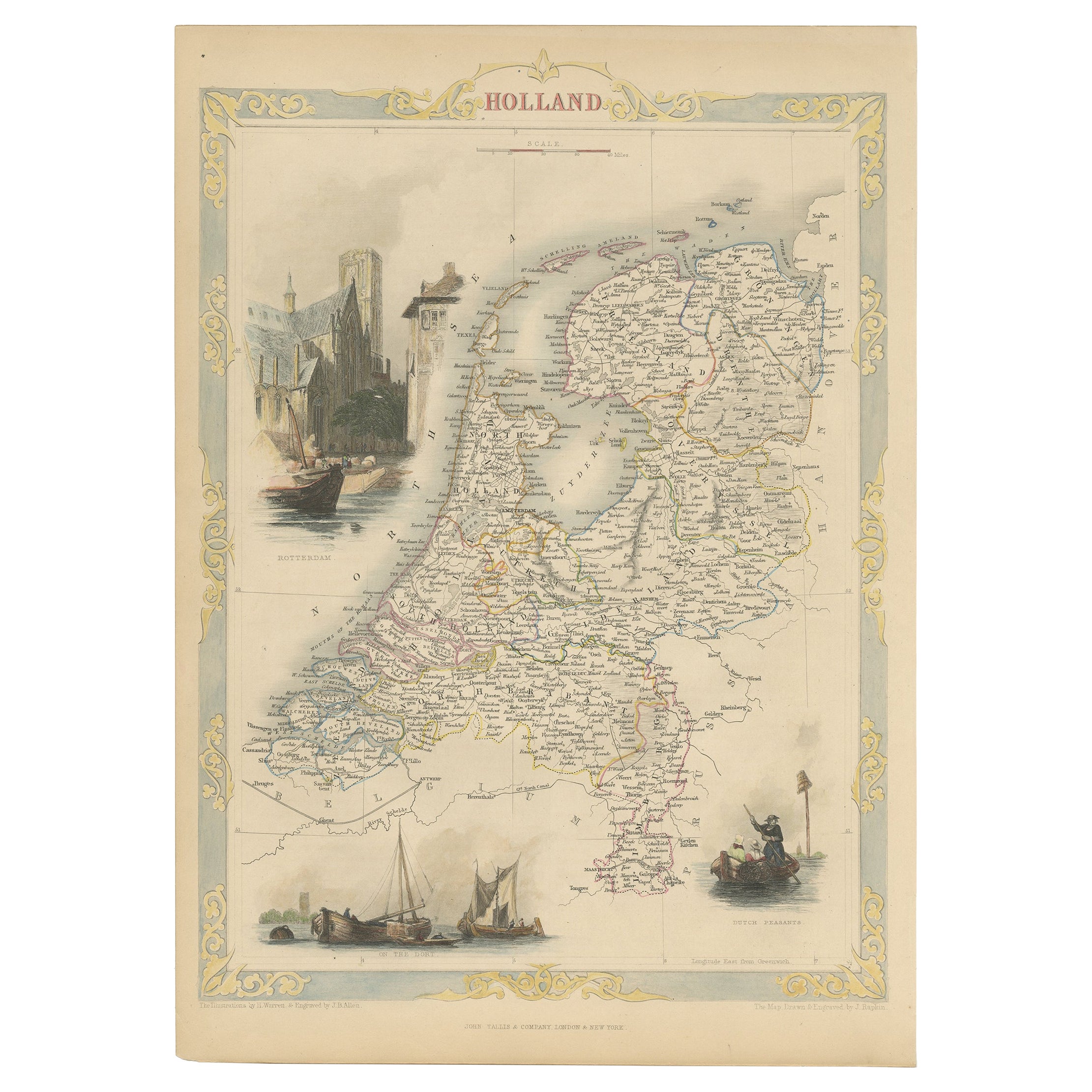
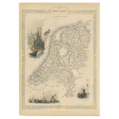
- Antique Map of Holland with Colorful Vignettes, 1851Located in Langweer, NLAntique map titled 'Holland'. Decorative map of Holland. Includes vignettes of Rotterdam, Dutch Peasants and a boating scene on the Dort, the Netherlands. Originates from 'Th...Category
Antique 19th Century Maps
MaterialsPaper
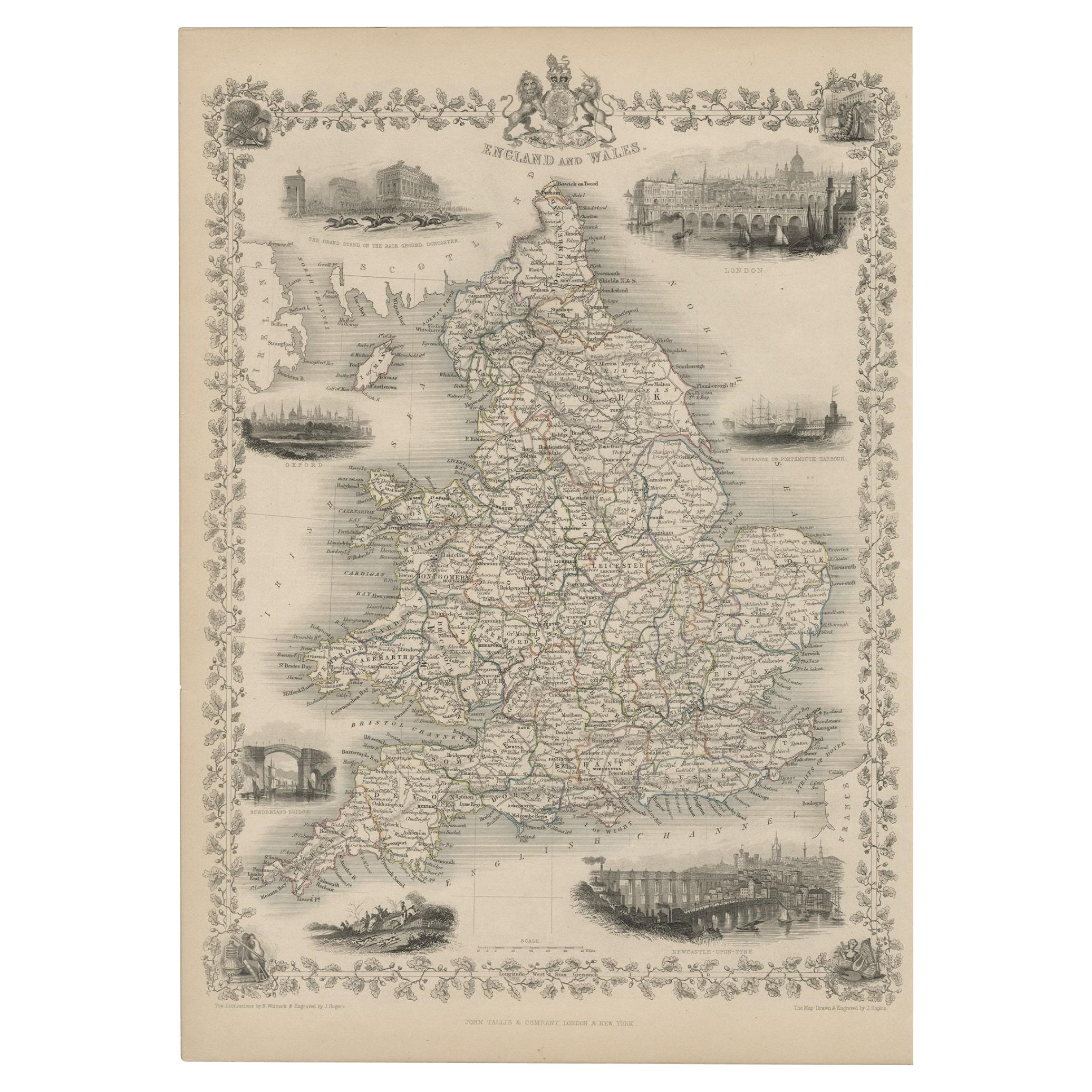
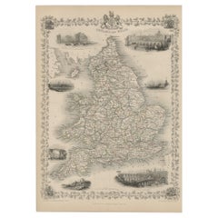
- Antique Map of England and Wales with Decorative Vignettes, 1851Located in Langweer, NLAntique map titled ‘England and Wales’. Includes decorative vignettes titled The grand stand on the race ground Doncaster, London, Oxford, Entrance to Portsmouth Harbour, Sunderland ...Category
Antique 19th Century Maps
MaterialsPaper
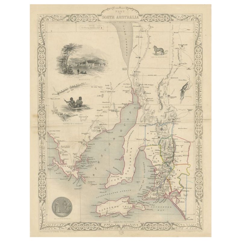
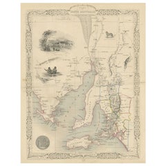
- Antique Map of South Australia by Tallis, 1851By Thomas KitchinLocated in Langweer, NLAntique map Australia titled 'Part of South Australia'. Decorative map of part of South Australia, surrounded by illustrations of Adelaide, natives on a catamaran, an Australian dog and a nymphicus bird illustrated. Originates from 'The Illustrated Atlas, And Modern History Of The World Geographical, Political, Commercial & Statistical, Edited By R. Montgomery Martin'. Published; John Tallis London, New York, Edinburgh & Dublin. 1851. Drawn and Engraved by J. Rapkin. Artists and Engravers: John Tallis (1817-1876) was a British map...Category
Antique 19th Century Maps
MaterialsPaper
You May Also Like
- Original Antique Map of Belgium by Tallis, Circa 1850Located in St Annes, LancashireGreat map of Belgium Steel engraving Many lovely vignettes Published by London Printing & Publishing Co. ( Formerly Tallis ), C.1850 Origin...Category
Antique 1850s English Maps
MaterialsPaper
- Large Original Vintage Map of S.E Asia, with a Vignette of SingaporeLocated in St Annes, LancashireGreat map of South East Asia Original color. Good condition Published by Alexander Gross Unframed.Category
Vintage 1920s English Maps
MaterialsPaper
- 1851 Map of "Independent Tartary", Ric. R018Located in Norton, MA1851 Map of Independent Tartary "Russia" Ric.r018 A highly decorative 1851 map of Independent Tartary by John Tallis and John Rapkin. Covers the regions between the Caspian Sea and Lake Bakquash and between Russia and Afghanistan. These include the ancient Silk Route kingdoms of Khiva, Tartaria, Kokand, and Bokhara. Today this region roughly includes Kazakhstan, Uzbekistan, Turkmenistan, Kyrgyzstan, and Tajikistan. This wonderful map offers a wealth of detail for anyone with an interest in the Central Asian portion of the ancient Silk Road. Identifies various caravan routes, deserts, wells, and stopping points, including the cities of Bokhara and Samarkand. Three vignettes by W. Bragg decorate the map, these including an image of Tartars on a Journey, a horseback Bride Chase, and a tartar camp site. Surrounded by a vine motif border. Engraved by J. Rapkin for John Tallis's 1851 Illustrated Atlas . Tartary Antique Map...Category
Antique 19th Century Unknown Maps
MaterialsPaper
- Original Antique Map / City Plan of Brussels by Tallis, circa 1850Located in St Annes, LancashireGreat map of Brussels. Steel engraving. Published by London Printing & Publishing Co. (Formerly Tallis), C.1850 Free shipping.Category
Antique 1850s English Maps
MaterialsPaper
- "San Francisco, Upper California” 1851 Antique Map of San FranciscoLocated in Colorado Springs, COThis is a pictorial lettersheet view of the city and harbor of San Francisco. This lithograph was printed on grey wove paper, across a double sheet, by famed lithographers Britton & ...Category
Antique 1850s American Prints
MaterialsPaper
- Original Antique English County Map, Herefordshire, J & C Walker, 1851Located in St Annes, LancashireGreat map of Herefordshire Original colour By J & C Walker Published by Longman, Rees, Orme, Brown & Co. 1851 Unframed.Category
Antique 1850s English Other Maps
MaterialsPaper