Items Similar to Small Map of Bantam with Dutch Ships and an Engraving of Portugese, 1614
Want more images or videos?
Request additional images or videos from the seller
1 of 8
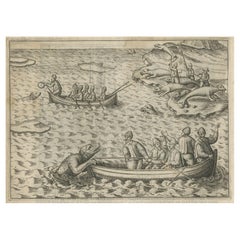
Small Map of Bantam with Dutch Ships and an Engraving of Portugese, 1614
About the Item
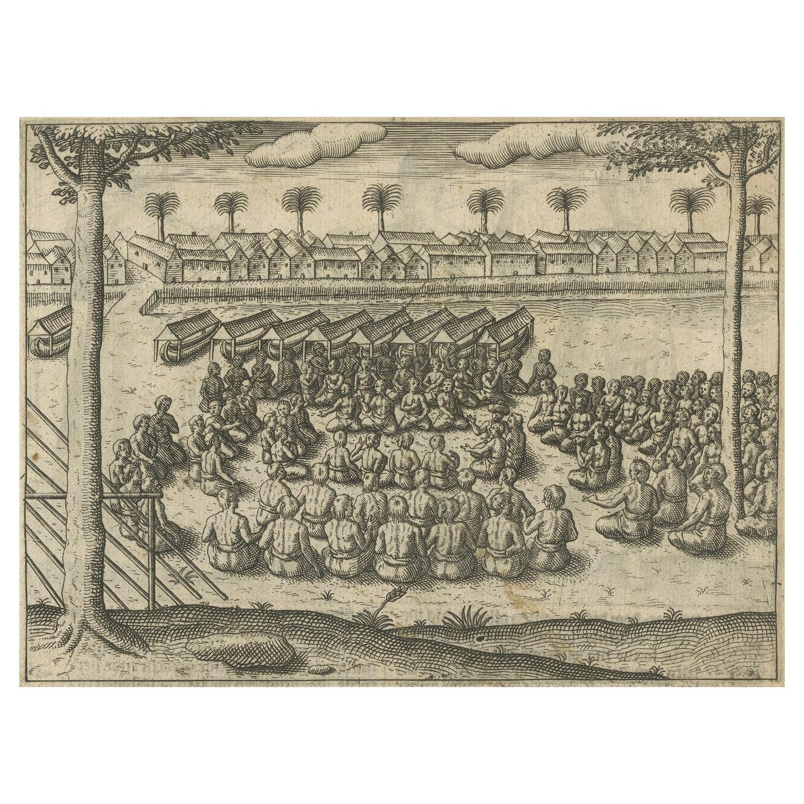
Two rare old miniature copper-engravings one one leaf. One showing the first arrival of the first Dutch in Indonesia, the so-called 'Houtman expedition' and on the reverse Portugese welcoming them with gifts.
The First Dutch Expedition to Indonesia was an expedition that took place from 1595 to 1597. It was instrumental in the opening up of the Indonesian spice trade to the merchants that eventually formed the Dutch East India Company, and marked the end of the Portuguese Empire’s dominance in the region. Although the expedition did not bring back as much as expected – 245 bags of pepper, 45 tons of nutmeg, and 30 bales of mace – spice prices had become so inflated that the expedition was still profitable. All in all, the voyage suffered from bad leadership, but was still instrumental in opening up the East Indies to the Dutch
Artists and Engravers: During this voyage Cornelis de Houtman (1565-1599) emerged as the leader of the expedition. He was the brother of Frederick de Houtman, a Dutch explorer who discovered a new sea route from Europe to Indonesia and managed to begin the Dutch spice trade.
From the Johan Isaac Pontanus & J. Hondius edition of 1614 - 'Historische beschrijvinghe der seer wijt beroemde coop-stadt Amsterdam'.
creator: Anoniem / Anonymous(engraver / etcher), Lodewijcksz, Willem(copied after)
period: 1614
material: paper
technique: engraving
measurements sheet: 9.5 x 7 inch ( 24 x 18 cm)
measurement map: 5.3 x 3.3 inch ( 13,5 x 8.5 cm ) - the engraving of the Portugese is almost an inch bigger
The condition of the engravings itself is very good, Dutch text accompanying the engravings. The area around the engravings has (water) damage, brown spots and borders of the leaf are scuffy. Study the image of the larger leaf carefully.
- Dimensions:Height: 7.09 in (18 cm)Width: 9.45 in (24 cm)Depth: 0 in (0.02 mm)
- Materials and Techniques:
- Period:Early 17th Century
- Date of Manufacture:1614
- Condition:
- Seller Location:Langweer, NL
- Reference Number:
About the Seller
5.0
Platinum Seller
These expertly vetted sellers are 1stDibs' most experienced sellers and are rated highest by our customers.
Established in 2009
1stDibs seller since 2017
1,919 sales on 1stDibs
Typical response time: <1 hour
- ShippingRetrieving quote...Ships From: Langweer, Netherlands
- Return PolicyA return for this item may be initiated within 14 days of delivery.
More From This SellerView All
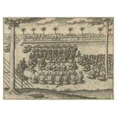
- Rare Engravings of Council of War in Bantam and Javanese Local Traders, 1614Located in Langweer, NLOne leaf with an engraving on each site and text in old Dutch. One side shows the War Council of the locals in Bantam and the other side show some vegetables traders of Bantam. B...Category
Antique Early 17th Century Maps
MaterialsPaper
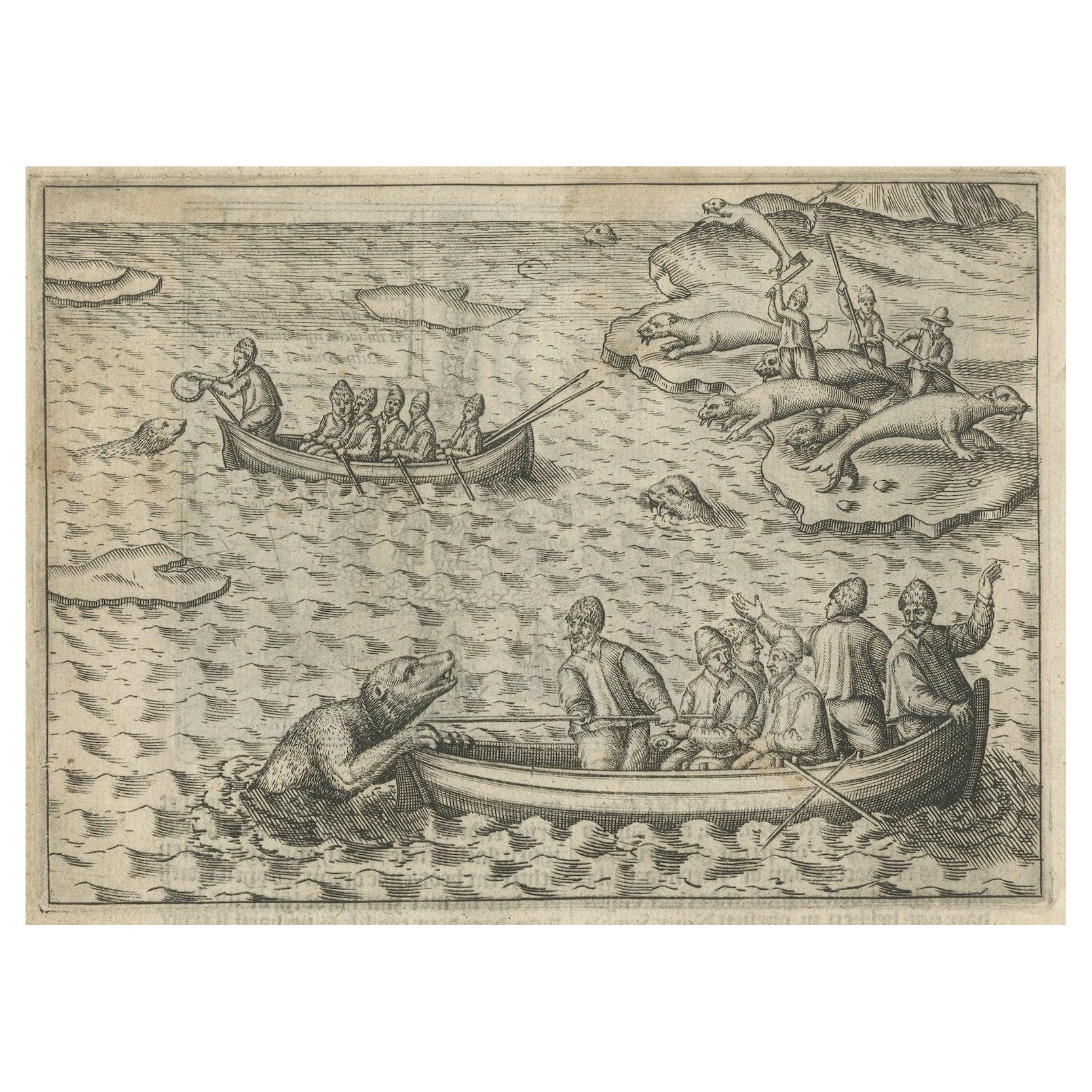
- Rare Map of Kildin Island in Russia Plus Engraving of Seal Hunting, 1614Located in Langweer, NLInsula Kilduyn. Orig. copper-engraving after details from J. H. van Linschoten's map taken from his account of the three expeditions undertaken by Willem Barents in 1594, in an attem...Category
Antique Early 17th Century Maps
MaterialsPaper
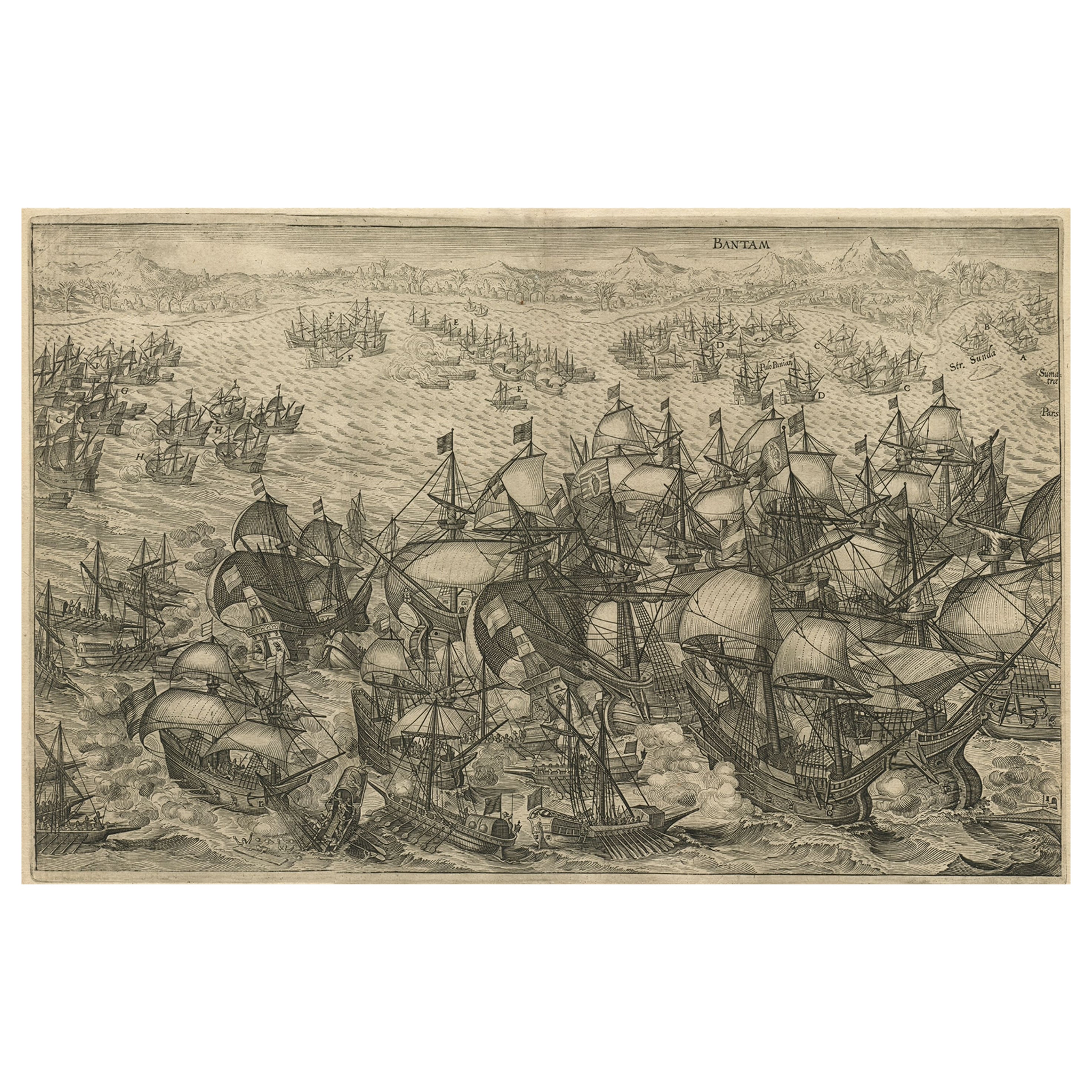
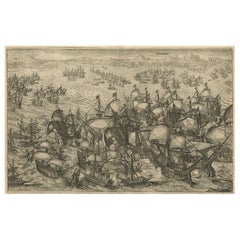
- Engraving of Dutch Attacking the Portuguese Fleet off Bantam, Indonesia, 1644Located in Langweer, NLAntique print titled 'Bantam'. Copper engraving of the Dutch attack on the Portuguese fleet off Bantam in 1601 depicted as the victory of Admiral Wolfert Harmensz and his 5 ships over 30 Portuguese ships. The ships in the battle include the Sultan of Bantam’s war galleys (ghali); ocean-going craft with sails, oars and a prow battering ram built according to Mediterranean standards learnt from Portuguese renegades and Turkish shipwrights. They were built to allow them to shoot the large cannon...Category
Antique 1640s Arms, Armor and Weapons
MaterialsPaper
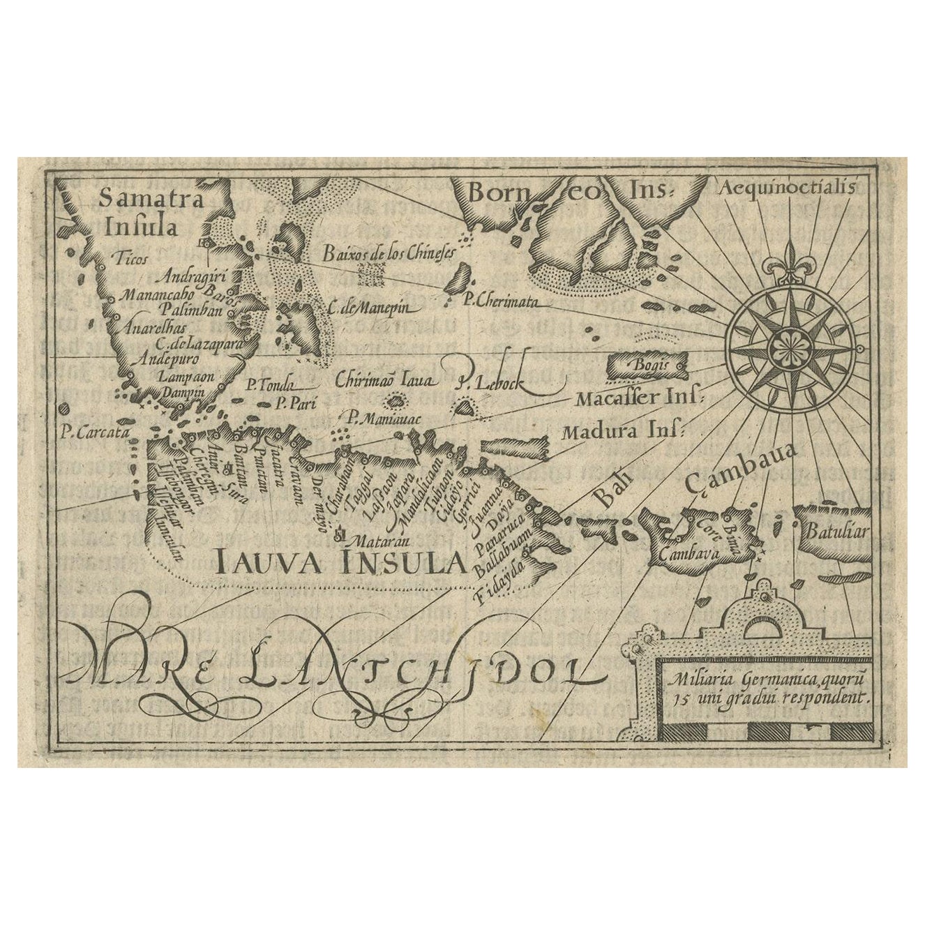
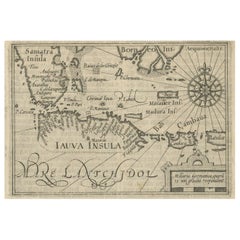
- Rare Small Map of Sumatra, Java, Borneo, Macassar, Madura, Bali, 1614Located in Langweer, NLOne of the first maps of the Indonesia islands of Java, Bali, Sumbawa etc. in early days of the Dutch Indies. Also showing Banten, Jakarta (Jacatra), Indr...Category
Antique Early 17th Century Maps
MaterialsPaper
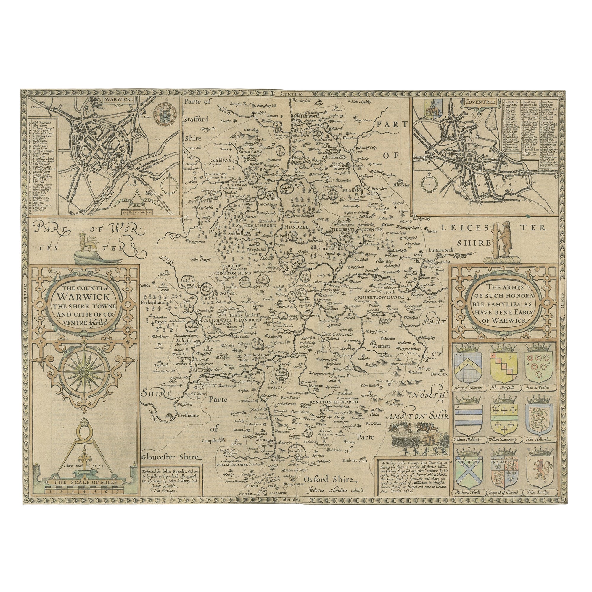
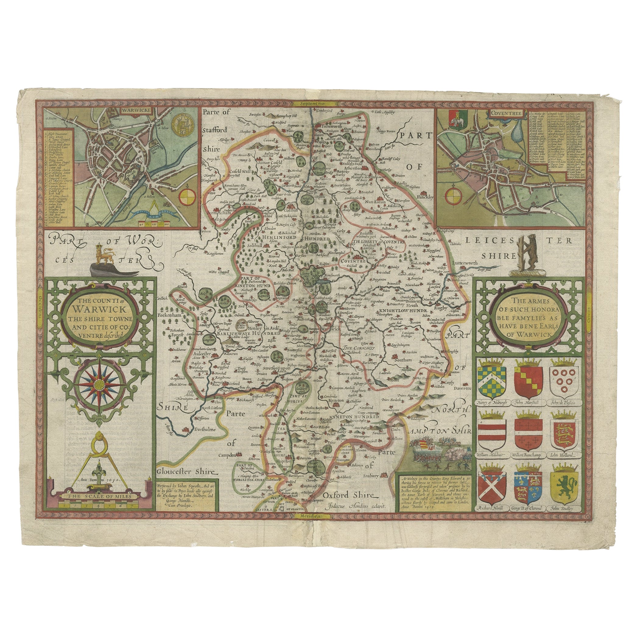
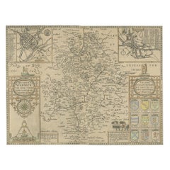
- Antique Map of Warwickshire by Speed, c.1614Located in Langweer, NLAntique map titled 'The Counti of Warwick (..)'. Map of Warwickshire, England. Includes inset town plans of Warwick and Coventry. This map originates from 'Theatre of Great Britaine'...Category
Antique 17th Century Maps
MaterialsPaper
- Map of Warwickshire, England, Incl insets of Warwick and Coventry, c.1614Located in Langweer, NLAntique map titled 'The Counti of Warwick the Shire Towne and Citie of Coventre described'. Map of Warwickshire, England. Includes inset town plans of Warwick and Coventry. This map ...Category
Antique 1610s Maps
MaterialsPaper
You May Also Like
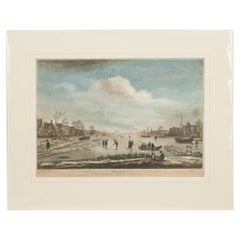
- Dutch Kolf Print, Winter, Golf EngravingLocated in Oxfordshire, GBDutch golf engraving by J. Boydell, Winter. Rare 18th century Dutch golf engraving by J. Boydell depicting Dutchman playing the early form of golf on the ice, titled 'Winter'. The s...Category
Antique 18th Century Dutch Prints
MaterialsPaper
- Italy, Sicily, Sardinia, Corsica and Dalmatian Coast: A 17th Century Dutch MapBy Theodorus DanckertsLocated in Alamo, CAThis hand colored 17th century Dutch map entitled "Novissima et Accuratissima totius Italiae Corsicae et Sardiniae Descriptio" by Theodore Danckerts depicts the Italian Peninsula in ...Category
Antique Late 17th Century Dutch Maps
MaterialsPaper
- Dutch Map and City Plan of La Roche-sur-Foron, France, 17th Century Hand ColoredBy Coenraet DeckerLocated in Alamo, CA"Rupes Allobrogum vulgo La Roche" by Dutch engraver Coenraet Decker (1650-1685) is from the atlas Theatrum Statuum Regiae Celestudinis Sabaudiae Ducis, published in 1682. This richly...Category
Antique Late 17th Century Dutch Maps
MaterialsPaper
- West Coast of Africa, Guinea & Sierra Leone: An 18th Century Map by BellinBy Jacques-Nicolas BellinLocated in Alamo, CAJacques Bellin's copper-plate map entitled "Partie de la Coste de Guinee Dupuis la Riviere de Sierra Leona Jusquau Cap das Palmas", depicting the coast of Guinea and Sierra Leone in ...Category
Antique Mid-18th Century French Maps
MaterialsPaper
- Hand Colored 17th Century Visscher Map "Hollandiae" Southern HollandBy Nicolaes Visscher IILocated in Alamo, CAA hand colored 17th century map of the southern portions of Holland by Nicolaus (Nicolas) Visscher II entitled "Hollandiae pars Meridionalis, vulgo Zuyd-Holland", published in Amsterdam in 1678. The map shows the region between Breda, Heusden, Gornichem, Gouda, Dordrecht, and Willemstad. It includes a decorative cartouche in the lower left corner. The map is presented in an attractive maple colored wood frame with gold trim and a fabric mat. The Visscher family were one of the great cartographic families of the 17th century. Begun by Claes Jansz Visscher...Category
Antique Early 18th Century Dutch Maps
MaterialsPaper
- City View of Nuremberg, Germany: An 18th Century Hand-Colored Map by M. SeutterBy Matthew SeutterLocated in Alamo, CAAn 18th century hand-colored city view of Nuremburg, Germany entitled "Geometrischer Grundris der des Heiligen Römischen Reichs Freyen Stadt Nürnberg" by Matthaus Seutter from his "A...Category
Antique Mid-18th Century German Maps
MaterialsPaper