Ship Map
6
to
93
598
307
362
315
269
202
136
134
88
88
87
61
60
59
54
44
43
36
36
36
36
25
24
22
21
21
16
16
15
12
11
11
10
10
8
7
6
6
5
5
5
4
4
4
4
4
4
4
3
3
3
3
3
2
2
2
1
1
1
1
1
1
63
35
16
14
13
Sort By
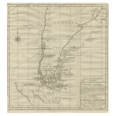
Antique Map of Tracks of Anson's Ships around South America & Cape Horn, 1749
Located in Langweer, NL
Description: Antique map titled 'Kaart van het Zuidelykste Gedeelte van Zuider Amerika (..) - Carte
Category
Antique 1740s Maps
Materials
Paper
No Reserve
H 21.66 in W 19.69 in D 0 in
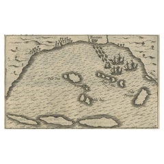
Small Map of Bantam with Dutch Ships and an Engraving of Portugese, 1614
Located in Langweer, NL
18 cm)
measurement map: 5.3 x 3.3 inch ( 13,5 x 8.5 cm ) - the engraving of the Portugese is almost
Category
Antique Early 17th Century Maps
Materials
Paper
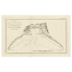
Antique Map of Bonthain Bay, Sulawesi, Celebes
Located in Langweer, NL
Antique map titled 'Vue de la Baye de Bonthain (..)'. Map of the island Sulawesi (Celebes
Category
Antique Late 18th Century Maps
Materials
Paper
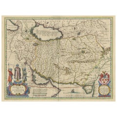
Antique Map of Persia with Dedication Cartouche
Located in Langweer, NL
Antique map titled 'Persia sive Sophorum Regnum'. Original old map of Persia. The map extends from
Category
Antique Mid-17th Century Maps
Materials
Paper
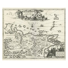
Antique Map of Venezuela by Montanus, 1671
By Arnoldus Montanus
Located in Langweer, NL
Antique map titled 'Venezuela cum parte Australi Novae Andalusiae'. The map extends from Coquibocoa
Category
Antique Mid-17th Century English Maps
Materials
Paper
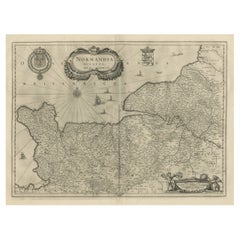
Antique Map of Normandy by Janssonius, 1657
Located in Langweer, NL
decorative cartouche, sailing ships and compass rose. This map originates from 'Atlas Novus, Sive Theatrum
Category
Antique 17th Century Maps
Materials
Paper
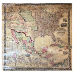
Large Antique 1859 Map of North America
Located in Sag Harbor, NY
This Map was made by Augustus Mitchell in 1859 It is in amazing condition for being 163 years old
Category
Antique Mid-19th Century American Maps
Materials
Canvas, Paper
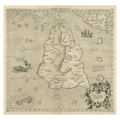
Mercator's Ptolemaic map of Taprobana, (Ceylon) Sri Lanka
Located in Langweer, NL
Antique map titled 'Asiae XII Tab'. Mercator's Ptolemaic map of Taprobana. The map shows Ptolemy's
Category
Antique 16th Century Maps
Materials
Paper
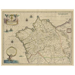
Antique Map of the Northwestern Coast of Spain
Located in Langweer, NL
Antique map titled 'Gallaecia Regnum'. Original old map of the northwestern coast of Spain
Category
Antique Mid-17th Century Maps
Materials
Paper
Antique Map of Eastern Siberia by Bellin '1768'
Located in Langweer, NL
Antique map titled 'Suite de la Carte de la Siberie et le Pays de Kamtchatka'. Original antique map
Category
Antique Mid-18th Century Maps
Materials
Paper
Antique Map of Prussia by Blaeu, circa 1635
By Willem Blaeu
Located in Langweer, NL
Antique map titled 'Prussiae Nova Tabula'. Rare early edition of Blaeu's map of Prussia
Category
Antique Mid-17th Century Maps
Materials
Paper
1646 Jansson Map Entitled "Procinvia Connactiae, " Ric.a006
Located in Norton, MA
1646 Jansson map entitled
"Procinvia connactiae,"
Ric.a006
Description: The PROVINCE of
Category
Antique 17th Century Unknown Maps
Materials
Paper
Antique Lithography Map, Black Sea, English, Framed, Cartography, Victorian
Located in Hele, Devon, GB
This is an antique lithography map of the Black Sea region. An English, framed atlas engraving of
Category
Antique Mid-19th Century British Early Victorian Maps
Materials
Wood
H 17.72 in W 20.48 in D 0.79 in
Antique Lithography Map, Cumbria, English, Framed Cartography Interest, Georgian
Located in Hele, Devon, GB
This is an antique lithography map of Cumbria. An English, framed engraving of cartographic
Category
Antique Early 18th Century British Georgian Maps
Materials
Wood
H 21.86 in W 25.2 in D 0.79 in
Original Antique Map of Turkey, Asia Minor and Cyprus
By Gerard Mercator
Located in Langweer, NL
Antique map titled 'Natoliae sive Asia Minor'. Original old map of Turkey, Asia Minor and Cyprus
Category
Antique Early 17th Century Maps
Materials
Paper
Antique Decorative Coloured Map Marocco, Algeria and Tunis, 1882
Located in Langweer, NL
.
5. **Navigational Aid**: For ships navigating the Mediterranean Sea, the map would have been an
Category
Antique 1880s Maps
Materials
Paper
Free Shipping
H 14.97 in W 22.45 in D 0 in
Antique Ptolemaic Map of Ceylon or nowadays Sri Lanka
Located in Langweer, NL
stipple engraved sea is filled with an oriental ship and two great sea monsters. The handsome map is
Category
Antique Mid-18th Century Maps
Materials
Paper
Antique Map of the Empire of the Great Mogul
Located in Langweer, NL
Antique map titled 'Magni Mogolis Imperium'. This map depicts the Empire of the Great Mogul in
Category
Antique Late 17th Century Maps
Materials
Paper
Genuine Antique Engraved Map of Helvetia or Switzerland, 1729
Located in Langweer, NL
request.
We ship our antique maps and prints carefully packed across the world with Express Service
Category
Antique 1720s Maps
Materials
Paper
Antique Map of British America by Tallis 'c.1850'
Located in Langweer, NL
Whale Fishing, Montreal, Fury and Hecla ships asail. This map originates from 'The History and
Category
Antique Mid-19th Century Maps
Materials
Paper
Antique Map of the Queen Charlotte Islands, Haida Gwaii
Located in Langweer, NL
Antique map titled 'Isles de la Reine Charlotte (..)'. Original old map of the Queen Charlotte
Category
Antique Late 18th Century Maps
Materials
Paper
Antique Map of the Low Countries by Cary, 1813
Located in Langweer, NL
Antique map of the Netherlands titled 'A New Map of the United Provinces comprehending Holland
Category
Antique 19th Century Maps
Materials
Paper
Antique Map of the Holy Land by Schut, 1710
Located in Langweer, NL
Antique map of the Holy Land titled 'Het Beloofde Landt Canaan.' Very detailed and decorative map
Category
Antique 18th Century Maps
Materials
Paper
Antique Map of South America by G. Anson, 1749
Located in Langweer, NL
Antique map titled 'Kaart van het Zuidelykste Gedeelte van Zuider Amerika (..) - Carte de la Partie
Category
Antique Mid-18th Century Dutch Maps
Materials
Paper
Cartographic Tapestry: Antique Map of Asia Minor, circa 1640
Located in Langweer, NL
Title: "Historical Tapestry: Antique Map of Asia Minor, circa 1640"
Description:
This authentic
Category
Antique Mid-17th Century Maps
Materials
Paper
Antique Map of Puerto San Julian in Patagonia, 1749
Located in Langweer, NL
Antique map titled 'Plan van de Haven van St. Juliaan op de Kust van Patagonia (..) - Plan du Port
Category
Antique 18th Century Maps
Materials
Paper
Antique Map of Southern Norway by Janssonius, c.1650
Located in Langweer, NL
"Antique map titled 'Nova et Accurata Tabula Episcopatuum Stavangriensis et Asloiensis'. Old map of
Category
Antique 17th Century Maps
Materials
Paper
Antique Map of Juan Fernandez Island, Chile, c.1750
Located in Langweer, NL
Antique map titled 'Plan de la Côte du N.E. de l 'Ile de Juan Fernandes'.
Map of the northeast
Category
Antique 18th Century Maps
Materials
Paper
Antique Map of New South Wales in Australia, ca. 1850
Located in Langweer, NL
Antique map of Victoria, or Port Phillip (12.7 x 10.0") in Australia. Superb map of Victoria
Category
Antique Mid-19th Century European Maps
Materials
Paper
Northern Scotland: A 16th Century Hand-colored Map by Mercator
By Gerard Mercator
Located in Alamo, CA
search field. A discount is available for purchase of the pair. Since the two maps would ship in one box
Category
Antique 16th Century Dutch Maps
Materials
Paper
Northern Scotland: A 17th Century Hand-colored Map by Mercator
By Gerard Mercator
Located in Alamo, CA
This is a framed hand-colored 17th century map of Northern Scotland by Gerard Mercator entitled
Category
Antique 1630s Dutch Maps
Materials
Paper
Decorative Original Antique Map of Greece by Ortelius, c.1609
Located in Langweer, NL
ship and a large ornate strapwork cartouche. This map originates from 'Theatrum Orbis Terrarum' by A
Category
Antique 17th Century Maps
Materials
Paper
1636 Jansson Map of Ireland Entitled "Comitatus Lageniae, " Ric.a007
Located in Norton, MA
1646 Jansson map entitled
"Procinvia connactiae,"
Ric.a006
Description: The PROVINCE of
Category
Antique 17th Century Unknown Maps
Materials
Paper
Antique Map of the City of Enkhuizen by Tirion, 1743
Located in Langweer, NL
Antique map titled ?Grondtekening der Stad Enkhuisen?. Beautiful map of the City of Enkhuizen. With
Category
Antique 18th Century Maps
Materials
Paper
1880s Map of The Italian Alps from Milan to Lake Garda
Located in Roma, IT
Geographical Map of the Profile and Elevation of the Italian Alps from Milano to Lake Garda. The
Category
Antique 1880s Italian Maps
Materials
Parchment Paper
Original Antique Map of Juan Fernandez by Van Schley, 1757
Located in Langweer, NL
Antique map titled 'Carte Particuliere de l'Isle de Juan Fernandez - Byzondere Kaart van 't Eiland
Category
Antique 18th Century Maps
Materials
Paper
Decorative Original Antique Map of Valencia in Southern Spain, circa 1601
Located in Langweer, NL
This is an original antique map titled 'Valentiae Regni olim Contestanorum Si Ptolemaeo
Category
Antique Early 17th Century Maps
Materials
Paper
Free Shipping
H 17.52 in W 22.45 in D 0.02 in
19th Century Illustrated Map of Ceylon (Sri Lanka) with Notable Landmarks
Located in Langweer, NL
John Tallis & Company is known for producing maps and atlases that were highly regarded for their
Category
Antique 1850s Maps
Materials
Paper
H 14.26 in W 10.71 in D 0 in
Antique Map of Romania and Bulgaria Centered on the Danube River
Located in Langweer, NL
Antique map titled 'Vetus descriptio Daciarum nec non Moesiarum'. Impressive map of the area of
Category
Antique Mid-17th Century Maps
Materials
Paper
Antique Map of Sri Lanka with an unusual five-sided shape
Located in Langweer, NL
Antique map titled 'Ins. Ceilan quae incolis Tenarisin dicitur'. This exquisite, early map of Sri
Category
Antique Early 17th Century Maps
Materials
Paper
Antique Map of Juan Fernandez Island by Anson, c.1740
Located in Langweer, NL
Antique map titled 'Plan de la Côte du N.E. de l 'Ile de Juan Fernandes'.
Map of the northeast
Category
Antique 18th Century Maps
Materials
Paper
Original Antique Map of the Northern Part of Scotland, circa 1640
Located in Langweer, NL
The antique map, titled 'Scotiae pars septentrionalis,' depicts the northern part of Scotland
Category
Antique Mid-17th Century Maps
Materials
Paper
Antique Map of Peru in South America by Blaeu, circa 1645
Located in Langweer, NL
Antique map titled 'Peru'. Original antique map of Peru. With cartouche, compass rose, ships and
Category
Antique Mid-17th Century Maps
Materials
Paper
Rare Original Antique Ptolemy Map of Ceylon, Present Day Sri Lanka
Located in Langweer, NL
Original antique map titled 'Tab XII Asiae Taprobanam (..)'. For this map of Toprobana (Sri Lanka
Category
Antique Late 17th Century Maps
Materials
Paper
South America: Hand-colored 18th Century Framed Map by Thomas Jefferys
By Thomas Jefferys
Located in Alamo, CA
(perhaps the leader of the exploration or ship captain) to join him in exploring further inland.
This map
Category
Antique Mid-18th Century English Maps
Materials
Paper
Antique Map of Victoria, or Port Phillip in Australia, ca. 1850
Located in Langweer, NL
This antique map, measuring approximately 12.7 x 10.0 inches, showcases Victoria, specifically
Category
Antique Mid-19th Century European Maps
Materials
Paper
Detailed Copper Engraved City Map of Enkuizen, the Netherlands, c.1620
By L. Guicciardini
Located in Langweer, NL
Antique map titled 'Die stadt Enchuijsen.' Detailed copper engraved city map of Enkuizen, the
Category
Antique 17th Century Maps
Materials
Paper
Antique Map of Guinea in West Africa by Blaeu, c.1638
Located in Langweer, NL
interior, sailing ships and several elegant cartouches. Both the map and the sea are shown with Rhumb lines
Category
Antique 17th Century Maps
Materials
Paper
Hampshire County, Britain/England: A Map from Camden's" Britannia" in 1607
By John Norden
Located in Alamo, CA
An early hand-colored map of Britain's Hampshire county, published in the 1607 edition of William
Category
Antique Early 17th Century English Maps
Materials
Paper
H 17.13 in W 18.75 in D 0.88 in
Greece 1660 Jan Jansson Watercolour Map Peloponesus Sive Morea I Laurenbergio
Located in GB
We are delighted to offer for sale this Jan Jansson Date: 1660 (published) Amsterdam map of Greece
Category
Antique 1660s Danish Dutch Colonial Maps
Materials
Copper
H 20.08 in W 23.43 in D 0.79 in
Orignal Hand-Colored Antique Map of Chili by W. Blaeu, 1658
By Willem Blaeu
Located in Langweer, NL
Copiapo southward to the island of Chiloé with ships and sea monsters adorning the sea. The map is
Category
Antique Mid-17th Century Maps
Materials
Paper
Free Shipping
H 21.86 in W 25.99 in D 0.02 in
An Ornate and Historical Tallis Map of Jamaica with Decorative Vignettes, 1851
Located in Langweer, NL
This original antique map of Jamaica is part of the renowned series created by the Tallis Company
Category
Antique 1850s Maps
Materials
Paper
H 10.71 in W 14.26 in D 0 in
Interesting Map of the Atlantic Showing Nelson's and Trade Routes, 1817
By John Thomson
Located in Langweer, NL
, North America, &cc'. Large map of the Atlantic, showing the tracks of the ships trading in North America
Category
Antique 19th Century Maps
Materials
Paper
Free Shipping
H 21.26 in W 27.76 in D 0 in
Antique Map of Macedonia by the Famous Mapmaker Blaeu, c.1650
Located in Langweer, NL
ship and a milage scale. Macedonia is shown in the centre of the map. With many details of placenames
Category
Antique 17th Century Maps
Materials
Paper
Greece, "Graeciae Antiquae"" A 17th Century Hand-colored Map by Sanson
By Nicolas Sanson
Located in Alamo, CA
Tavernier (1594–1665) in 1636 in Paris. The map is embellished by seven sailing ships and seven sea monsters
Category
Antique Mid-17th Century French Maps
Materials
Paper
H 24.75 in W 29.75 in D 0.13 in
Map of New Zealand Showing Maori Culture and Early Colonial Settlements, 1851
Located in Langweer, NL
John Tallis & Company were renowned for their ornate and detailed maps in the mid-19th century
Category
Antique 1850s Maps
Materials
Paper
H 14.26 in W 10.71 in D 0 in
Maritime and Terrestrial Survey of Spanish Santander in 1901, An Original Map
Located in Langweer, NL
This antique map is a historical map of the province of Santander (currently known as Cantabria
Category
Antique Early 1900s Maps
Materials
Paper
Free Shipping
H 14.77 in W 20.08 in D 0 in
Map of Tasmania with Illustrations of Local Fauna and Colonial Landmarks, 1851
Located in Langweer, NL
John Tallis & Company was renowned for their detailed and ornate maps during the 19th century
Category
Antique 1850s Maps
Materials
Paper
H 14.26 in W 10.71 in D 0 in
Original Hand-Colored Antique Map of Gelderland and Utrecht in the Netherlands
Located in Langweer, NL
Antique map titled 'Ducatus Geldriae novissima descriptio'. Detailed map of Gelderland, a province
Category
Antique Mid-17th Century Maps
Materials
Paper
H 17.92 in W 21.86 in D 0.02 in
Three Antique Maps on One Folio: Turkey, Northern Egypt, and Ancient Carthage
Located in Langweer, NL
The map consists of three distinct sections on a single folio sheet:
1. **Map of Turkey
Category
Antique 16th Century Maps
Materials
Paper
H 12.72 in W 19.49 in D 0 in
- 1
- ...
Get Updated with New Arrivals
Save "Ship Map", and we’ll notify you when there are new listings in this category.
Ship Map For Sale on 1stDibs
At 1stDibs, there are many versions of the ideal ship map for your home. Each ship map for sale was constructed with extraordinary care, often using paper, chrome and marble. There are many kinds of the ship map you’re looking for, from those produced as long ago as the 18th Century to those made as recently as the 20th Century. A ship map made by Art Deco designers — as well as those associated with Mid-Century Modern — is very popular. You’ll likely find more than one ship map that is appealing in its simplicity, but Ottomar Anton produced versions that are worth a look.
How Much is a Ship Map?
The average selling price for a ship map at 1stDibs is $872, while they’re typically $326 on the low end and $9,284 for the highest priced.
