Items Similar to Antique Map of Sri Lanka with an unusual five-sided shape
Want more images or videos?
Request additional images or videos from the seller
1 of 6
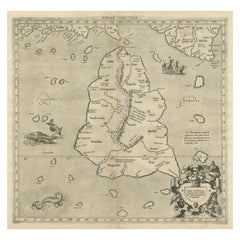
Antique Map of Sri Lanka with an unusual five-sided shape
About the Item
Antique map titled 'Ins. Ceilan quae incolis Tenarisin dicitur'. This exquisite, early map of Sri Lanka is shown with an unusual five-sided shape. North is oriented to the left by an elaborate compass rose. The map was beautifully engraved by Petrus Plancius with pictorial detail of mountains, roads, forests, villages, kingdoms, mines, stupas and spice plantations. It is embellished with three strapwork cartouches and further adorned with a finely rendered sailing ship and animals roaming the interior (including a large elephant with his manhout). Latin text on verso. Published circa 1606.
- Dimensions:Height: 16.93 in (43 cm)Width: 22.05 in (56 cm)Depth: 0.02 in (0.5 mm)
- Materials and Techniques:
- Period:Early 17th Century
- Date of Manufacture:c.1606
- Condition:Repaired. General age-related toning. Original folding line, with split. Few closed tears, also sl. affecting image. Latin text on verso. Please study image carefully.
- Seller Location:Langweer, NL
- Reference Number:
About the Seller
5.0
Platinum Seller
These expertly vetted sellers are 1stDibs' most experienced sellers and are rated highest by our customers.
Established in 2009
1stDibs seller since 2017
1,932 sales on 1stDibs
Typical response time: <1 hour
- ShippingRetrieving quote...Ships From: Langweer, Netherlands
- Return PolicyA return for this item may be initiated within 14 days of delivery.
More From This SellerView All
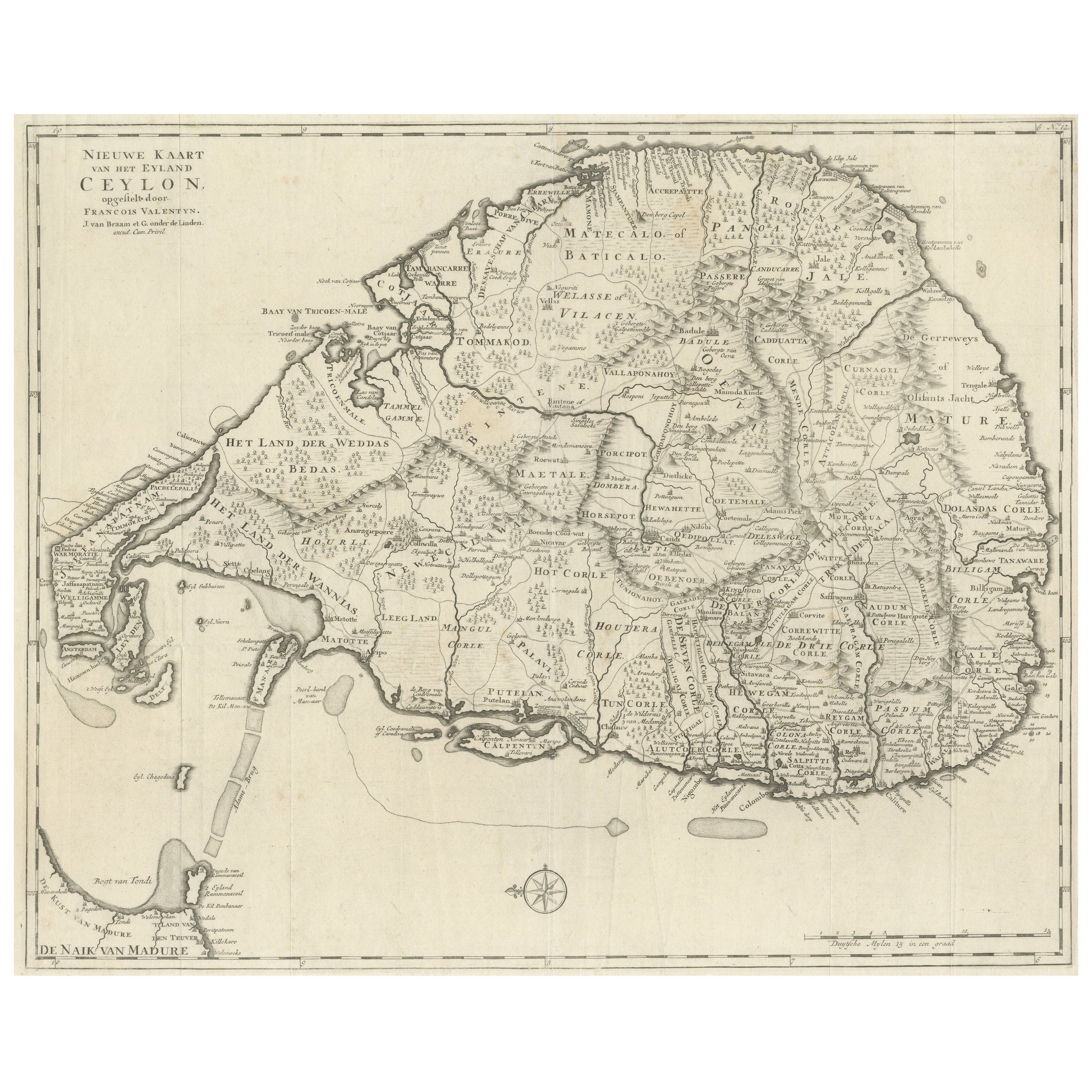
- Large Antique Map of Ceylon, Sri LankaLocated in Langweer, NLAntique map titled 'Nieuwe Kaart van het Eyland Ceylon opgestelt door Francois Valentyn'. Beautiful map of Sri Lanka. Originates from 'Oud en Nieuw Oost Indien (..)' by F. Valentijn,...Category
Antique Mid-18th Century Maps
MaterialsPaper
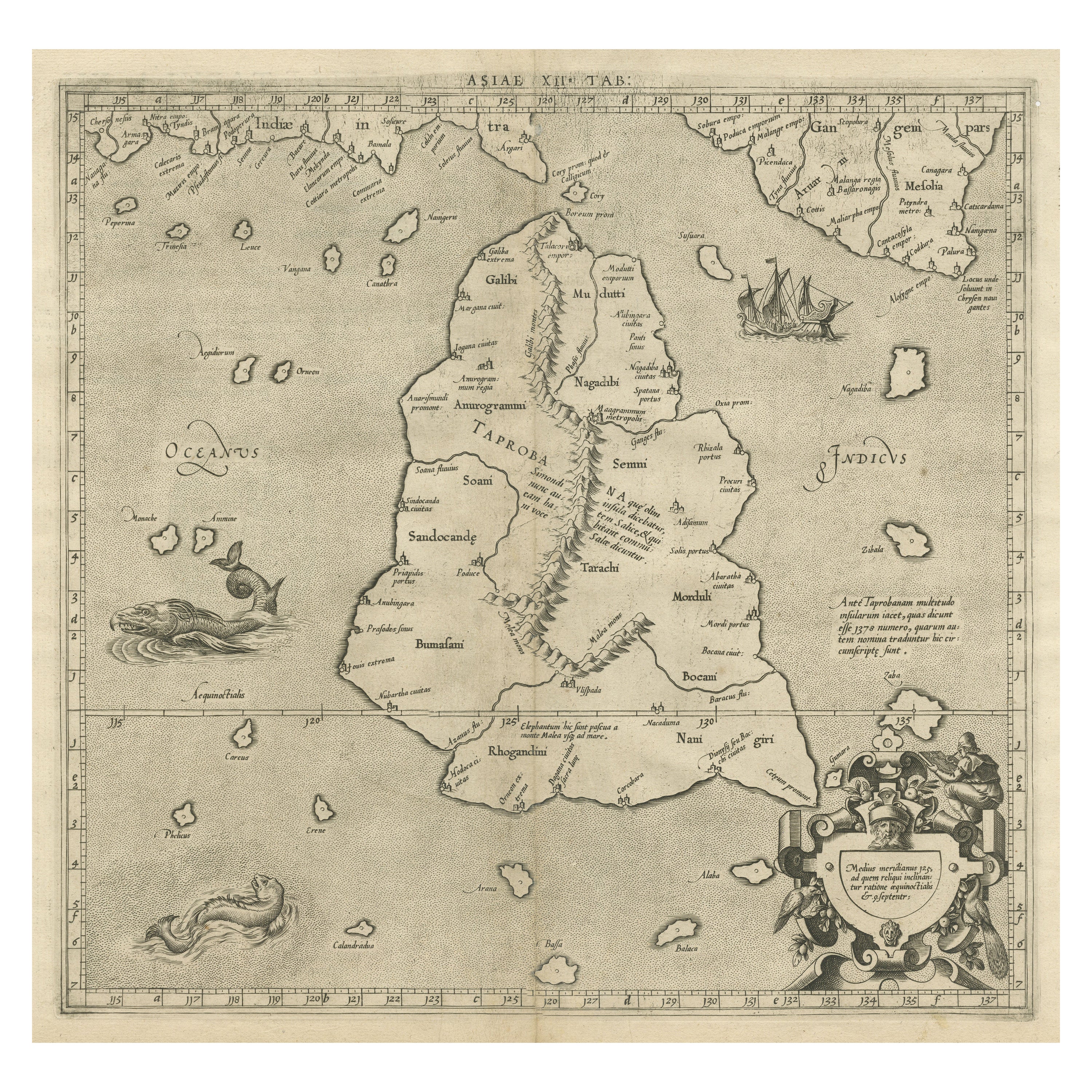
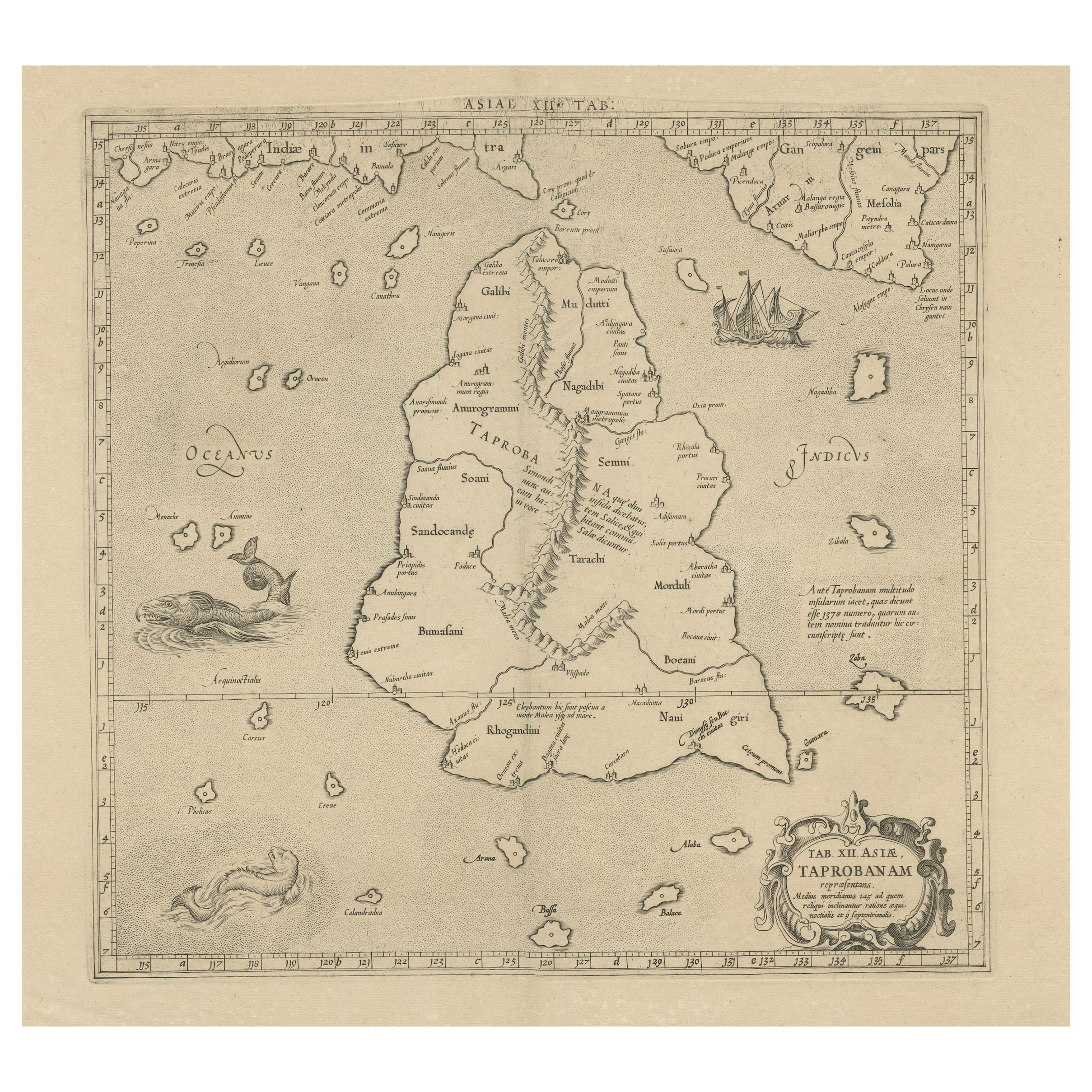
- Antique Ptolemaic Map of Ceylon or nowadays Sri LankaLocated in Langweer, NLAntique map titled 'Tab XII. Asiae Taprobanam'. Ptolemaic map of Sri Lanka. Ptolemy drew on the accounts of travelers and sailors and though the information was secondhand and often ...Category
Antique Mid-18th Century Maps
MaterialsPaper
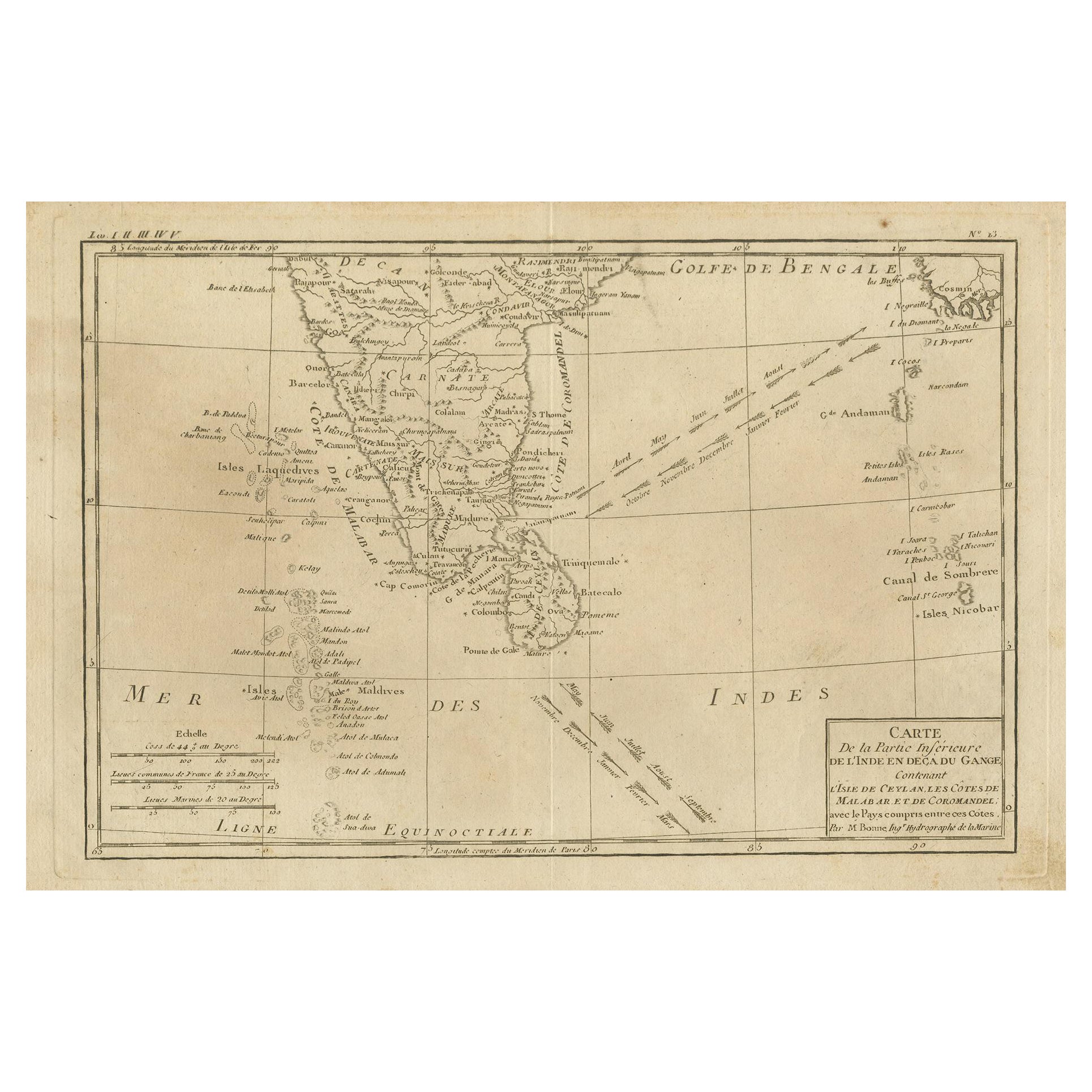
- Antique Map of Southern India, the Maldives and Sri Lanka with CurrentsLocated in Langweer, NLAntique map titled 'Carte de la Partie Inferieure De L'Inde En Deca Du Gange (..)'. Interesting map of Southern India, the Maldives and Sri Lanka. Includes a month by month charting ...Category
Antique Late 18th Century Maps
MaterialsPaper
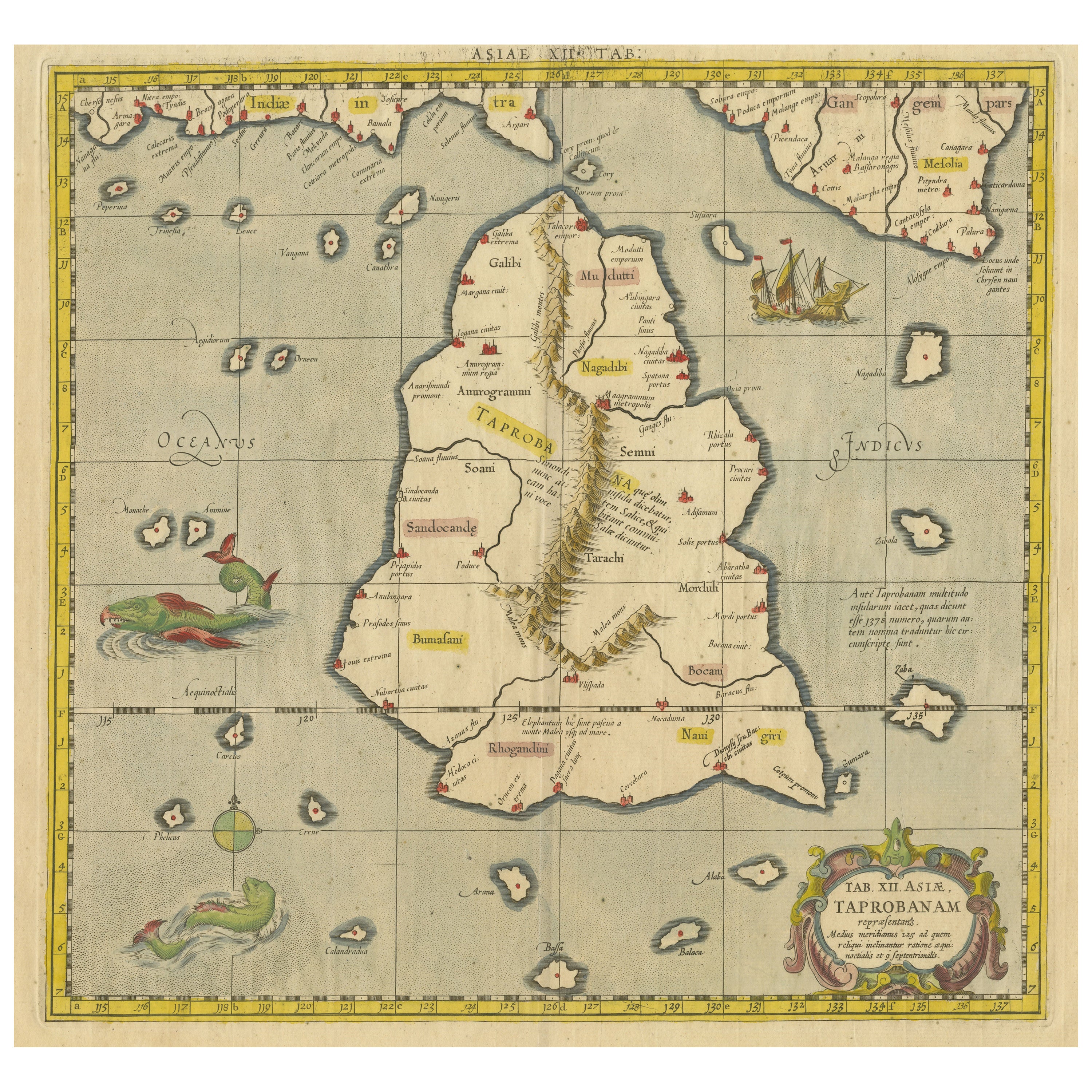
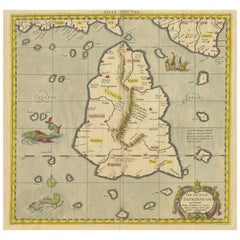
- Mercator's Ptolemaic map of Taprobana, (Ceylon) Sri LankaLocated in Langweer, NLAntique map titled 'Asiae XII Tab'. Mercator's Ptolemaic map of Taprobana. The map shows Ptolemy's erroneous location of the island of Sri Lanka near the equator, with a bit of India...Category
Antique 16th Century Maps
MaterialsPaper
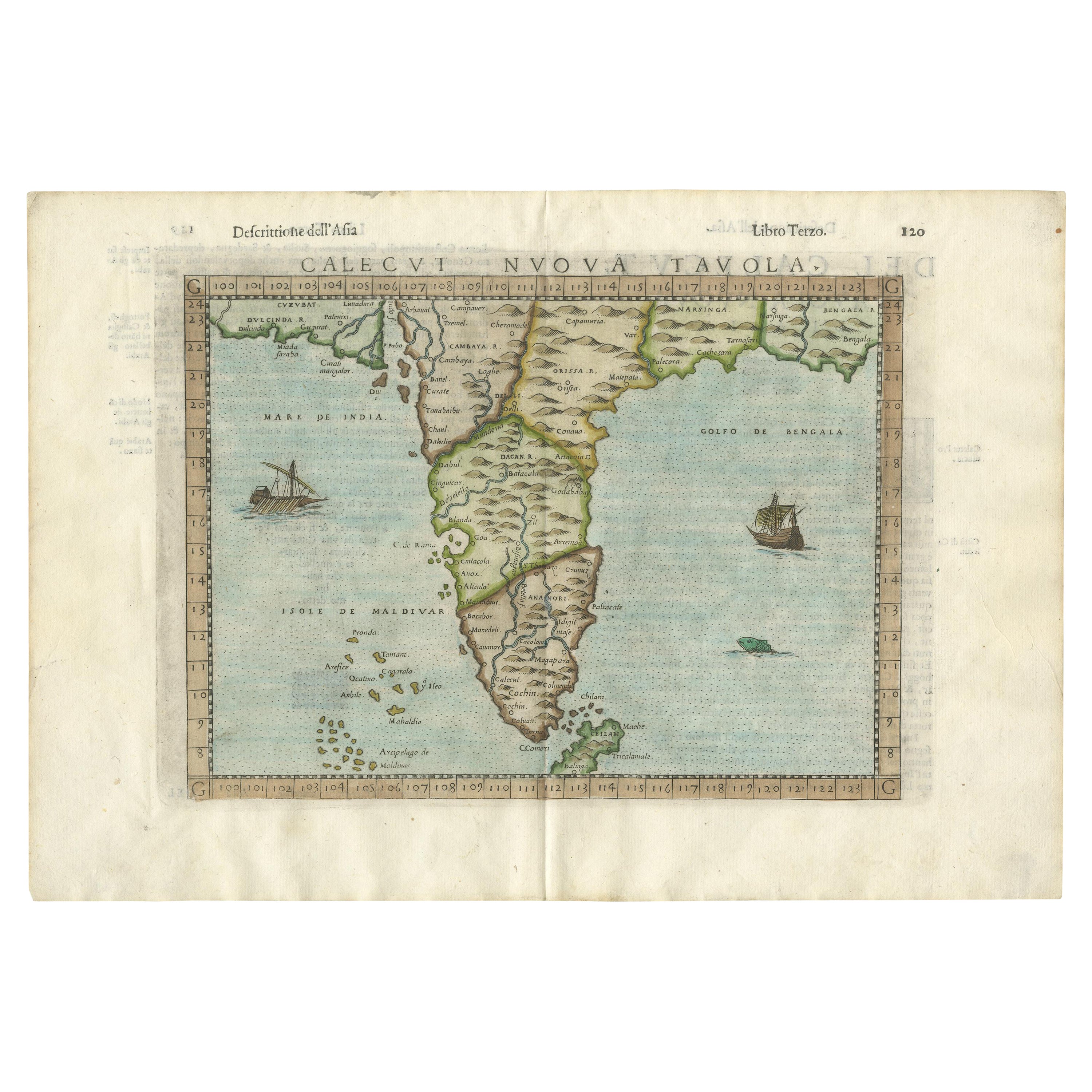
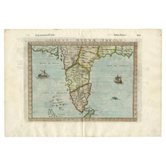
- Rare Attractive Antique Map of Asia, India, Sri Lanka, Maldives, 1599Located in Langweer, NLOriginal Antique map of Asia, India, Ceylon (Sri Lanka), Maldives by Rosaccio / Ruscelli in attractive coloring. Title: Calecut Nuova Tavola Year: 1599 Relief shown pictorially. ...Category
Antique 16th Century European Maps
MaterialsPaper
- Rare Original Antique Ptolemy Map of Ceylon, Present Day Sri LankaLocated in Langweer, NLOriginal antique map titled 'Tab XII Asiae Taprobanam (..)'. For this map of Toprobana (Sri Lanka), Ptolemy drew on the accounts of travelers and sailors and though the information was secondhand and often inaccurate, it represented the most advanced account of the world's geography at that time. This map depicts the island with the typical misconceptions of the period with the enlarged island straddling the Equator and nearly divided by a ridge of mountains. A small part of India is incorrectly shown in the northeast corner of the map and a spurious coastline labeled Gangem fills the upper right corner. The stipple engraved sea contains an oriental ship...Category
Antique Late 17th Century Maps
MaterialsPaper

You May Also Like
- An Unusual Carved Boxwood ‘Sphere’Located in London, GBAn Unusual Carved Boxwood ‘Sphere’ The circumference carved in low relief with the provinces of the Netherlands to one side and the National Arms to the opposite side Boxwood The Net...Category
Antique 17th Century Dutch Models and Miniatures
MaterialsBoxwood
- Antique Map of Principality of MonacoBy Antonio Vallardi EditoreLocated in Alessandria, PiemonteST/619 - "Old Geographical Atlas of Italy - Topographic map of ex-Principality of Monaco" - ediz Vallardi - Milano - A somewhat special edition ---Category
Antique Late 19th Century Italian Other Prints
MaterialsPaper
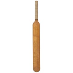
- 1770s Style Cricket Bat, Unusual ShapeLocated in Oxfordshire, GBCurved early oak cricket bat. An unusual shaped, heavy weight, one piece cricket bat of the style used in the 1770s. The blade has an inward bow, convex surface, instead of being fl...Category
Antique Early 1900s British Sports Equipment and Memorabilia
MaterialsOak
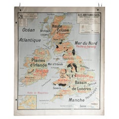
- French School Map of Uk, Double-SidedLocated in Alton, GBMap of the UK in french made for schools from the 20th century.Category
20th Century Maps
MaterialsPaper
- Geographical Antique Map of Principality of MonacoBy Bruno SantiniLocated in Alessandria, PiemonteST/609 - Interesting antique color map of Monaco Principality in French language : "Carte qui contient le Principauté de Piémont, le Monferrat et la comté de...Category
Antique Late 18th Century Italian Other Maps
MaterialsPaper
- 1907 Map of Colorado, Antique Topographical Map, by Louis NellLocated in Colorado Springs, COThis highly detailed pocket map is a topographical map of the state of Colorado by Louis Nell from 1907. The map "has been complied from all availabl...Category
Antique Early 1900s American Maps
MaterialsPaper


Recently Viewed
View AllMore Ways To Browse
Bolivian Antique
St Thomas Cross
Map Of Liverpool
Georgetown Antique
Map Of Gulf Of Mexico
Authentic Pirate
Historic Map Virginia
Map Of Indonesia
United States Antique Map
Antique Map Coats Of Arms
Antique Book Map France
Old Maps England
Map Sumatra
Scotland Coat Of Arms
Malaysia Antique
Map Of Siam
Antique Map Of Sri Lanka
Globes Antique Terrestre