Items Similar to Cartographic Tapestry: Antique Map of Asia Minor, circa 1640


Want more images or videos?
Request additional images or videos from the seller
1 of 8
Cartographic Tapestry: Antique Map of Asia Minor, circa 1640
About the Item
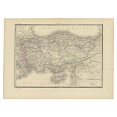
Title: "Historical Tapestry: Antique Map of Asia Minor, circa 1640"
Description:
This authentic antique map, created by Willem Blaeu and published in Amsterdam circa 1640, is a captivating depiction of Asia Minor, including Cyprus and the Aegean Islands. It provides a window into the geographical and historical landscape of the region during the 17th century. Here's a detailed description:
- **Title**: The map features a decorative title cartouche at the top, adorned with two cherubs, adding an artistic touch to the map.
- **Geographical Coverage**: Asia Minor, as depicted on this map, extends from the Euphrates River to the Aegean Islands and from the Black Sea to the Mediterranean. Notably, it includes key geographical features such as the islands of Cyprus, Crete, and Rhodes, as well as prominent cities like Antioch, Troy, and Constantinople.
- **Historical Significance**: The region portrayed on this map holds immense historical significance, with a rich history spanning from the Paleolithic Era to various empires, including the Roman, Byzantine, Ottoman, and Armenian Empires. It serves as a testament to the complex tapestry of cultures and events that have shaped present-day Turkey.
- **Decorative Elements**: The map is adorned with decorative elements, making it visually appealing. Vignettes of sailing ships, a sea battle, and sea monsters provide a glimpse into the maritime history of the region. Additionally, a figure holding a distance scale, indicating German miles, graces the lower right corner, adding both practical and artistic elements to the map.
This antique map not only serves as a geographical reference but also as a historical artifact that allows viewers to explore the past and appreciate the artistry of cartography during the 17th century. It captures the allure of Asia Minor and its enduring significance in the annals of history.
- Dimensions:Height: 20.79 in (52.8 cm)Width: 25.28 in (64.2 cm)Depth: 0.02 in (0.5 mm)
- Materials and Techniques:
- Period:Mid-17th Century
- Date of Manufacture:circa 1640
- Condition:Minor fading. Please study image carefully.
- Seller Location:Langweer, NL
- Reference Number:
About the Seller
5.0
Platinum Seller
These expertly vetted sellers are 1stDibs' most experienced sellers and are rated highest by our customers.
Established in 2009
1stDibs seller since 2017
1,919 sales on 1stDibs
Typical response time: <1 hour
- ShippingRetrieving quote...Ships From: Langweer, Netherlands
- Return PolicyA return for this item may be initiated within 14 days of delivery.
More From This SellerView All
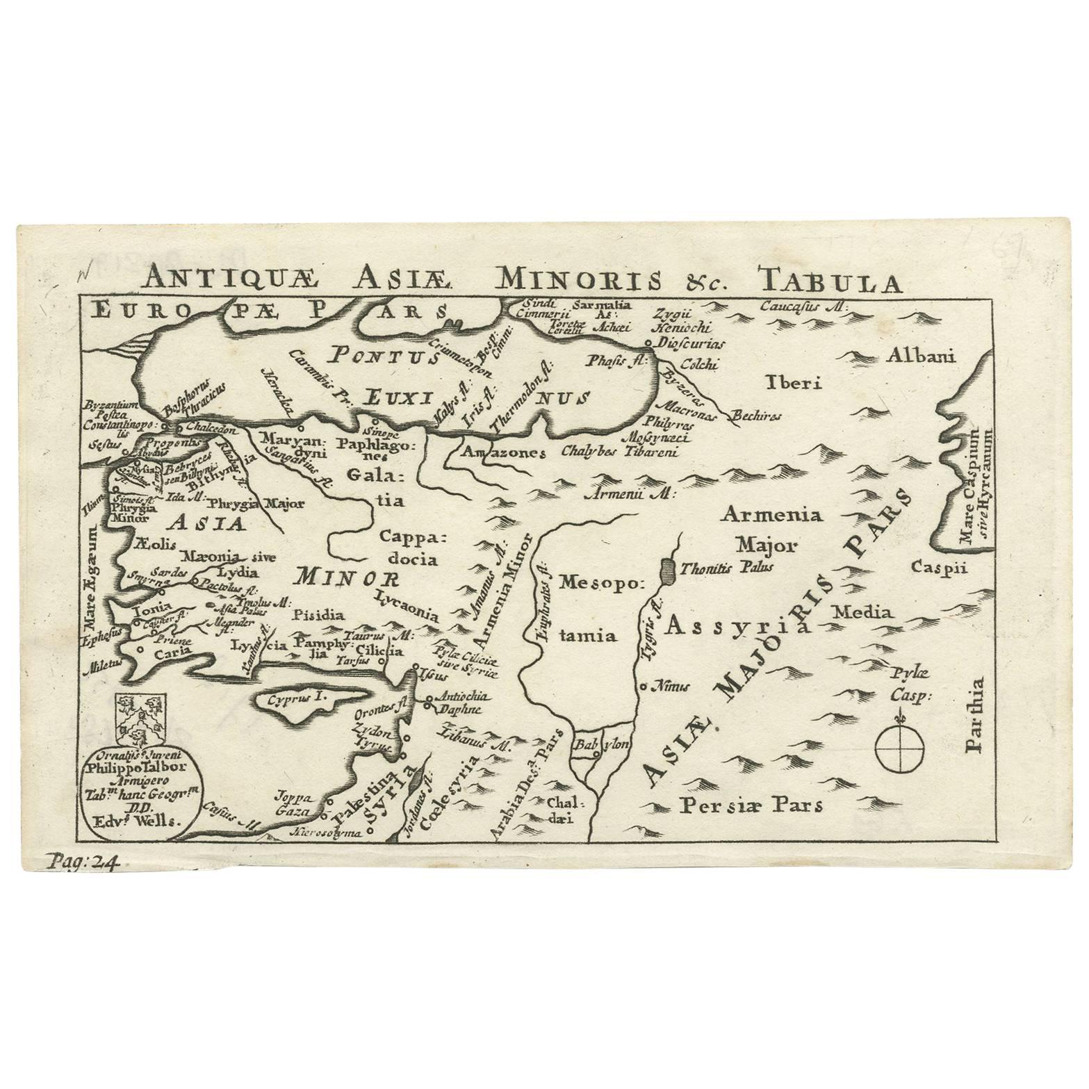
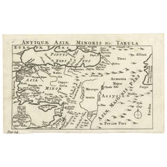
- Nice Antique Map of Asia Minor, Turkey, circa 1718Located in Langweer, NLAntique map titled 'Antiquae Asiae Minoris & C. Tabula' by Philippo Talbor. This rare antique map is published by Edward Wells, circa 1718.Category
Antique Early 18th Century Maps
MaterialsPaper
- Antique Map of Asia Minor by J. Tallis, circa 1851Located in Langweer, NLA highly decorative mid-19th century map of 'Asia Minor' (modern day Turkey) which was drawn and engraved by J. Rapkin and published in John Tallis's Illust...Category
Antique Mid-19th Century Maps
MaterialsPaper
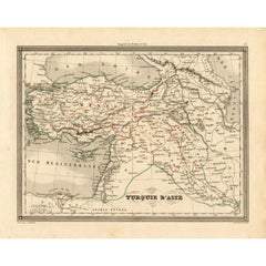
- Antique Map of Turkey in Asia 'Asia Minor', 1841Located in Langweer, NLAntique map titled 'Turkey in Asia'. Original antique map of Asia Minor (Turkey). Source unknown, to be determined. Artists and Engravers: Published by O...Category
Antique 19th Century Maps
MaterialsPaper
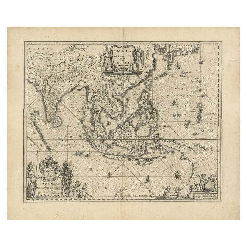
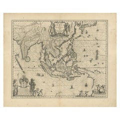
- Antique Map of Southeast Asia by Blaeu, c.1640Located in Langweer, NL"Antique map titled 'India quae Orientalis dicitur et Insulae adiacentes'. Map of Southeast Asia, extending from India to Tibet to Japan to New Guinea. This map is one of the first t...Category
Antique 17th Century Maps
MaterialsPaper
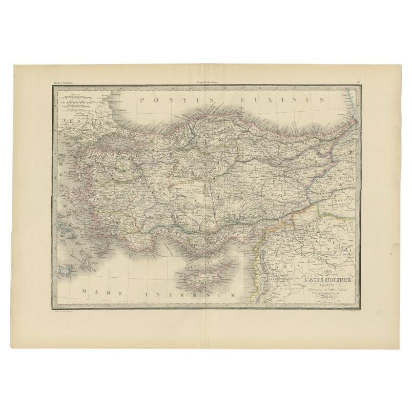
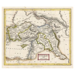
- Antique Map of Asia Minor by Lapie, 1842Located in Langweer, NLAntique map titled 'Carte de l'Asie Mineure Ancienne (..)'. Map of Asia Minor, also called Anatolia or Turkish Anadolu. This map originates from 'Atlas univ...Category
Antique 19th Century Maps
MaterialsPaper
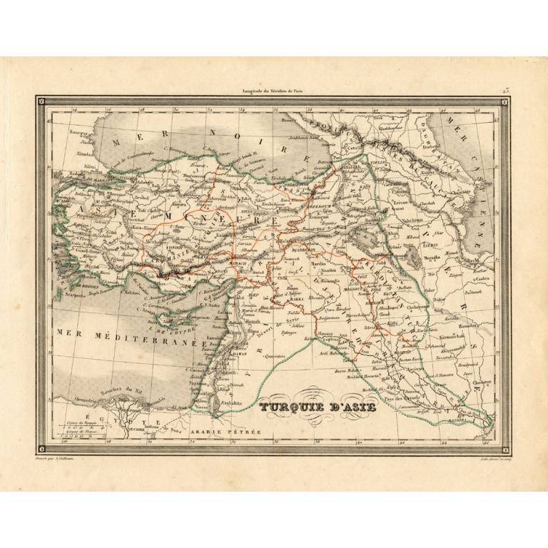
- Antique Map of Turkey in Asia 'Asia Minor' by Vuillemin, 1846Located in Langweer, NLAntique map titled 'Turqui D'Asie'. Map of Turkey in Asia / Asia Minor. This attractive original old antique print / plate / map originates from: 'Atlas Uni...Category
Antique 19th Century Maps
MaterialsPaper

You May Also Like
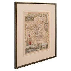
- Antique Lithography Map of Cheshire, English, Framed, Cartography, VictorianLocated in Hele, Devon, GBThis is an antique lithography map of Cheshire. An English, framed atlas engraving of cartographic interest, dating to the mid 19th century and lat...Category
Antique Mid-19th Century British Victorian Maps
MaterialsWood
- Antique Lithography Map, Isle of Wight, English, Framed, Engraving, CartographyLocated in Hele, Devon, GBThis is an antique lithography map of the Isle of Wight. An English, framed atlas engraving of cartographic interest, dating to the early 19th century and later. Superb lithography ...Category
Antique Early 19th Century British Regency Maps
MaterialsWood
- Antique Lithography Map, Isle of Thanet, Kent, English, Cartography, VictorianLocated in Hele, Devon, GBThis is an antique lithography map of The Isle of Thanet in Kent. An English, framed atlas engraving of cartographic interest, dating to the mid 19th century and later. Superb litho...Category
Antique Mid-19th Century British Victorian Maps
MaterialsWood
- Antique Lithography Map, Lincolnshire, English, Framed, Engraving, CartographyLocated in Hele, Devon, GBThis is an antique lithography map of Lincolnshire. An English, framed atlas engraving of cartographic interest, dating to the mid 19th century and...Category
Antique Mid-19th Century British Victorian Maps
MaterialsWood
- Antique Lithography Map, Northumberland, English, Framed, Engraving, CartographyLocated in Hele, Devon, GBThis is an antique lithography map of Northumberland. An English, framed atlas engraving of cartographic interest, dating to the mid 19th century a...Category
Antique Mid-19th Century British Victorian Maps
MaterialsWood
- Antique Lithography Map, Worcestershire, English, Framed Engraving, CartographyLocated in Hele, Devon, GBThis is an antique lithography map of Worcestershire. An English, framed atlas engraving of cartographic interest, dating to the early 19th centur...Category
Antique Early 19th Century British Regency Maps
MaterialsWood