Macedonia Map
2
to
10
26
17
22
12
11
10
7
6
6
4
4
4
4
3
3
3
3
2
1
1
1
1
1
1
1
1
3
3
2
1
1
Sort By
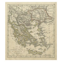
Antique Map of Greece and Macedonia, 1825
Located in Langweer, NL
Antique map titled 'Graecia, Macedonia Thracia et Jllyricum'. Old map of Greece and Macedonia
Category
Antique 19th Century Maps
Materials
Paper
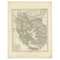
Antique Map of Greece and Macedonia, 1848
Located in Langweer, NL
Antique map titled 'Graecia Epirus Macedonia Moesia Thracia'. Old map of Greece originating from
Category
Antique 19th Century Maps
Materials
Paper
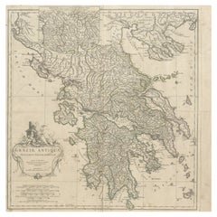
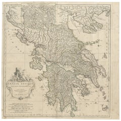
Large Scale Map of Greece with Inset Map of Macedonia, c.1786
Located in Langweer, NL
Cythera. Inset map shows details of Macedonia. Published circa 1786. Artists and Engravers: Jean-Baptiste
Category
Antique 18th Century Maps
Materials
Paper
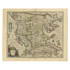
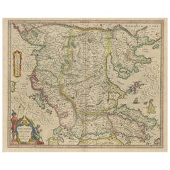
Antique Map of Macedonia by the Famous Mapmaker Blaeu, c.1650
Located in Langweer, NL
Antique map titled 'Macedonia, Epirus et Achaia'.
Ornated with a nice allegoric cartouche, one
Category
Antique 17th Century Maps
Materials
Paper
Antique Map of Macedonia, Northern Greece and part of Turkey in Europe
Located in Langweer, NL
Antique map titled 'Macedonia Epirus et Achaia'. Original old map of Macedonia, northern Greece
Category
Antique Mid-17th Century Maps
Materials
Paper
H 18.59 in W 23.04 in D 0.02 in
Large Scale Map of Greece, Extending to Cythera with Inset of Macedonia, ca.1786
Located in Langweer, NL
of Cythera. Inset map shows details of Macedonia. Published circa 1786.
Artists and Engravers
Category
Antique 1780s Maps
Materials
Paper
H 21.26 in W 21.26 in D 0 in
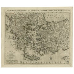
Antique Map of Greece, Albania, Macedonia and Parts of Turkey and Cyprus, c.1745
Located in Langweer, NL
Antique map titled 'Accurata Totius Archipelagi Et Graeciae Universae Tabula'.
Detailed map of
Category
Antique 18th Century Maps
Materials
Paper
H 21.86 in W 25.79 in D 0 in
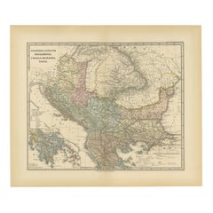
Roman Balkans: Pannonia, Illyricum, Dacia, Moesia, Thracia, Macedonia and Thyris
Located in Langweer, NL
This original antique map showcases the Roman provinces in the Balkan region and parts of Central
Category
Antique 1880s Maps
Materials
Paper
Free Shipping
H 15.56 in W 18.51 in D 0 in
Antique Map of the Ancient Greek Colonization
Located in Langweer, NL
Antique map titled 'Map I containing the Western Division of the Grecian Colonies & Conquests
Category
Antique Late 18th Century Maps
Materials
Paper
Antique Map of Greece from Ortelius's Theatrum Orbis Terrarum, 1595
Located in Langweer, NL
Original antique map titled "Graecia Sophiani." This is a very detailed and decorative engraved map
Category
Antique 16th Century Maps
Materials
Paper
Free Shipping
H 17.92 in W 21.86 in D 0 in
Antique Map of Greece and Its Colonies, with Frame Style Border
Located in Langweer, NL
Antique map titled 'La Grèce'. Attractive map of Greece and its Colonies. The map covers from the
Category
Antique Mid-19th Century Maps
Materials
Paper
18th Century Map of the Southern Balkans by Giovanni Maria Cassini
By Giovanni Maria Cassini
Located in Hamilton, Ontario
18th century map by Italian engraver Giovanni Maria Cassini (Italy 1745-1824).
Map of the Southern
Category
Antique 18th Century Italian Maps
Materials
Paper
Charming Miniature Map of Thrace or Thrake in Southeast Europe, 1685
Located in Langweer, NL
Antique map titled 'Thraciae Descriptio.'
Charming miniature map of Thrace, from the pocket
Category
Antique 1680s Maps
Materials
Paper
Antique Map of The Kingdom of Alexander the Great, Published in 1880
Located in Langweer, NL
The map is titled "ALEXANDRI MAGNI REGNUM," which translates to "The Kingdom of Alexander the Great
Category
Antique 1880s Maps
Materials
Paper
Free Shipping
H 15.56 in W 18.51 in D 0 in
Southern & Eastern Europe: A Large 17th C. Hand-colored Map by Sanson & Jaillot
By Nicolas Sanson
Located in Alamo, CA
This large hand-colored map entitled "Estats de L'Empire des Turqs en Europe, ou sont les
Category
Antique 1690s French Maps
Materials
Paper
H 24.88 in W 38 in D 0.13 in
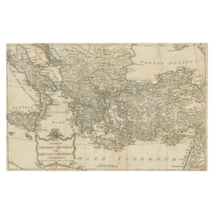
Antique Map of Eastern Mediterranean and Asia Minor by a Benedictine, c.1725
Located in Langweer, NL
Antique map titled 'Byzondere Afbeelding der Landschappen, van de Apostelen bevaren en doorwandelt
Category
Antique 18th Century Maps
Materials
Paper
H 19.1 in W 22.05 in D 0 in
Antique Plan of Turkey in Europe with Inset Map of the Bosporus, ca.1850
Located in Langweer, NL
. With an inset map of the Bosporus. This includes Macedonia, Bulgaria, Croatia, Bosnia, Herzegovina
Category
Antique 1850s Maps
Materials
Paper
H 11.82 in W 17.33 in D 0 in
Antique Map of Moldova to Thessaly and from the Adriatic to the Black Sea, 1880
Located in Langweer, NL
Antique map titled 'Turquie d'Europe'.
Map of the european parts of Turkey. The map covers from
Category
Antique 1880s Maps
Materials
Paper
H 18.71 in W 13.59 in D 0 in
Hand-Colored 18th Century Homann Map of the Black Sea, Turkey and Asia Minor
By Johann Baptist Homann
Located in Alamo, CA
An attractive original early 18th century hand-colored map of the Black Sea and Turkey entitled
Category
Antique Early 18th Century German Maps
Materials
Paper
H 20 in W 23.63 in D 0.07 in
Ancient Map - Macedonia - Etching by Johannes Janssonius - 1650s
By Johannes Janssonius
Located in Roma, IT
Macedonia is an ancient map realized in 1650 by Johannes Janssonius (1588-1664).
The Map is Hand
Category
1650s Modern Figurative Prints
Materials
Etching
H 19.3 in W 23.23 in D 0.04 in
Map of Ancient Greece of Macedonia and... - Lithograph by Auguste Wahlen - 1844
Located in Roma, IT
Map of Ancient Greece of Macedonia and Thrace is a lithograph made by Auguste Wahlen in 1844.
Hand
Category
1840s Modern Figurative Prints
Materials
Lithograph
No Reserve
H 9.85 in W 6.7 in D 0.04 in
Geobond - Colorful Authentic Urban Map Currency Painting
By Fabio Coruzzi
Located in Los Angeles, CA
– Museum of Tetovo Area – Republic of Macedonia
Dontpanic Design Exhibition – 93 Feet East
Category
21st Century and Contemporary Pop Art Figurative Paintings
Materials
Canvas, Oil Pastel, Mixed Media, Acrylic, Ink, Graphite
Broke - Mixed Media Credit Card Map Original Artwork
By Fabio Coruzzi
Located in Los Angeles, CA
– Museum of Tetovo Area – Republic of Macedonia
Dontpanic Design Exhibition – 93 Feet East
Category
21st Century and Contemporary Pop Art Mixed Media
Materials
Mixed Media, Spray Paint, Panel
Broke 2 - Mixed Media Credit Card Map Original Artwork
By Fabio Coruzzi
Located in Los Angeles, CA
– Museum of Tetovo Area – Republic of Macedonia
Dontpanic Design Exhibition – 93 Feet East
Category
21st Century and Contemporary Pop Art Mixed Media
Materials
Mixed Media, Spray Paint, Panel
Mediterranean and Adriatic Seas: Original 18th Century Hand-colored Map by Bowen
Located in Alamo, CA
This is an original 18th century hand-colored map entitled "An Accurate Chart of The Mediterranean
Category
Mid-18th Century Old Masters Landscape Prints
Materials
Engraving
Persia, Armenia & Adjacent Regions: A Hand-colored 17th Century Map by De Wit
By Frederick de Wit
Located in Alamo, CA
This colorful and detailed 17th century copperplate map by Frederick De Wit was published in
Category
Late 17th Century Old Masters More Prints
Materials
Engraving
Frederick de WitPersia, Armenia & Adjacent Regions: A Hand-colored 17th Century Map by De Wit , 1680
H 23.5 in W 27 in D 1.325 in
Southern & Eastern Europe: A Large 17th C. Hand-colored Map by Sanson & Jaillot
By Nicholas Sanson d'Abbeville
Located in Alamo, CA
This large hand-colored map entitled "Estats de L'Empire des Turqs en Europe, ou sont les
Category
1690s Landscape Prints
Materials
Engraving
Hungary & Eastern Europe: A Large 17th C. Hand-colored Map by Sanson & Jaillot
By Nicholas Sanson d'Abbeville
Located in Alamo, CA
This large hand-colored map entitled "Le Royaume De Hongrie et les Estats qui en ont este sujets et
Category
1690s Landscape Prints
Materials
Engraving
"4 Fishermen" Oil On Canvas by Blago
Located in Carmel, CA
Australia. His exploratory spirit leads in establishing Macedonian artists upon a contemporary map of our
Category
21st Century and Contemporary Contemporary Landscape Paintings
Materials
Oil, Canvas
"Man on Hiking Trails" Oil On Canvas by Blago
Located in Carmel, CA
Australia. His exploratory spirit leads in establishing Macedonian artists upon a contemporary map of our
Category
21st Century and Contemporary Contemporary Landscape Paintings
Materials
Oil, Canvas
"Fishermen at the Pier" Oil On Canvas by Blago
Located in Carmel, CA
Australia. His exploratory spirit leads in establishing Macedonian artists upon a contemporary map of our
Category
21st Century and Contemporary Contemporary Landscape Paintings
Materials
Oil, Canvas
'Seated Woman With White Dress' contemporary Painting By Blago
Located in Carmel, CA
Australia. His exploratory spirit leads in establishing Macedonian artists upon a contemporary map of our
Category
21st Century and Contemporary Contemporary Figurative Paintings
Materials
Board, Oil
Ptolemaic map of Balkan coast extending north by Mercator - Engraving - 17th c.
By Gerard Mercator
Located in Zeeland, Noord-Brabant
, Dalmatia, cum Italiae parte. (…).' - A beautiful Ptolemaic map of the Balkan coast and northern Italy along
Category
1690s Old Masters More Prints
Materials
Engraving
Antique Map of Turkey in Europe by J. Tallis, circa 1851
Located in Langweer, NL
A highly decorative and detailed mid-19th century map of 'Turkey in Europe' (The Balkans: northern
Category
Antique Mid-19th Century Maps
Materials
Paper
Map of River Danube, from Regensburg, Passau and Vienna to the Black Sea, c.1660
Located in Langweer, NL
, Passau and Vienna to the Black Sea. The map extends south to the Adriatic, Serbia, Macedonia, Bulgaria
Category
Antique 1660s Maps
Materials
Paper
H 20.87 in W 33.47 in D 0 in
Nassos Daphnis Hard Edged Geometric Abstract Minimalist Silkscreen Op Art Print
By Nassos Daphnis
Located in Surfside, FL
military relief maps. It is speculated by some art critics that it was while painting camouflage that
Category
1970s Abstract Geometric Abstract Prints
Materials
Screen
Antique Map of Macedonia by J. Janssonius, circa 1650
Located in Langweer, NL
Copper engraved map of the ancient country of Macedonia after Laurenberg by Janssonius. The map
Category
Antique Mid-17th Century Maps
Materials
Paper
Antique Map of the Macedonian Empire of Alexander the Great 'c.1860'
Located in Langweer, NL
Antique map titled 'Empire d'Alexandre'. Large, original antique map of the Macedonian Empire of
Category
Antique Mid-19th Century Maps
Materials
Paper
Map of Greece, Macedonia, Thrace from the time of the Peloponnesian War, 1880
Located in Langweer, NL
The map titled "GRAECIA, MACEDONIA, THRACIA et inde a bello Peloponnesiaco tempore," translates to
Category
Antique 1880s Maps
Materials
Paper
No Reserve
H 15.56 in W 18.51 in D 0 in
Large Map of Alexander the Great's Conquests from Macedonia to Persia and Africa
By Covens & Mortier
Located in Langweer, NL
Antique map titled 'Alexandri Magni Imperium et Expeditio (..)'. Detailed map of the Empire of
Category
Antique Mid-18th Century Maps
Materials
Paper
H 22.05 in W 34.65 in D 0.02 in
Antique Map of the Empire of Alexander the Great, with Frame Style Border
Located in Langweer, NL
map covers from Alexander's homeland in Macedonia eastwards past Asia Minor and Persia as far as India
Category
Antique Mid-19th Century Maps
Materials
Paper
H 10.16 in W 13.31 in D 0.02 in
Mainland Greece & Islands: An Original 18th Century Hand-colored Map by Bowen
Located in Alamo, CA
This is an original 18th century hand-colored map entitled "An Accurate Map of the Morea Together
Category
Mid-18th Century Old Masters Landscape Prints
Materials
Engraving
Nassos Daphnis Hard Edged Geometric Abstract Minimalist Silkscreen Op Art Print
By Nassos Daphnis
Located in Surfside, FL
military relief maps. It is speculated by some art critics that it was while painting camouflage that
Category
1970s Abstract Geometric Abstract Prints
Materials
Screen
Nassos Daphnis Hard Edged Geometric Abstract Minimalist Silkscreen Op Art Print
By Nassos Daphnis
Located in Surfside, FL
use and created camouflage for use on enormous military relief maps. It is speculated by some art
Category
1970s Abstract Geometric Abstract Prints
Materials
Screen
Get Updated with New Arrivals
Save "Macedonia Map", and we’ll notify you when there are new listings in this category.
Macedonia Map For Sale on 1stDibs
Choose from an assortment of styles, material and more with respect to the macedonia map you’re looking for at 1stDibs. Each macedonia map for sale was constructed with extraordinary care, often using paper. Whether you’re looking for an older or newer macedonia map, there are earlier versions available from the 18th Century and newer variations made as recently as the 19th Century. You’ll likely find more than one macedonia map that is appealing in its simplicity, but Covens & Mortier, Giovanni Maria Cassini and Johann Baptist Homann produced versions that are worth a look.
How Much is a Macedonia Map?
Prices for a macedonia map can differ depending upon size, time period and other attributes — at 1stDibs, they begin at $137 and can go as high as $7,500, while the average can fetch as much as $969.
