Items Similar to Antique Decorative Coloured Map Marocco, Algeria and Tunis, 1882


Want more images or videos?
Request additional images or videos from the seller
1 of 6
Antique Decorative Coloured Map Marocco, Algeria and Tunis, 1882
About the Item
The maps is from the 1882 atlas by Blackie & Son and offers a detailed view of the North African regions as understood in the late 19th century.
**Map of Morocco, Algeria, and Tunis:**
This map details the North African coast from Morocco to Tunisia, showing major cities, towns, and geographical features such as the Sahara Desert, the Atlas Mountains, and the Mediterranean coast. The map is colored to distinguish between the three regions, which were of strategic interest to colonial powers.
The maps would have been used for educational purposes, as well as by explorers, merchants, and colonial administrators of the era. They reflect the Victorian era's cartographic capabilities, as well as the geopolitical interests of the time. The maps are a fascinating historical record, showing how these regions were perceived and understood by Western cartographers in the 19th century.
The map of Morocco, Algeria, and Tunis from the 1882 atlas by Blackie & Son is interesting for several reasons:
1. **Historical Context**: During the 1880s, European powers were heavily involved in the colonization of Africa. This map offers a snapshot of the geopolitical landscape of the time, just before the 'Scramble for Africa' intensified. The region it covers was of significant interest to colonial powers, particularly France, which had a strong presence in Algeria and would soon establish protectorates in Tunisia and Morocco.
2. **Cartographic Detail**: The map provides detailed geographic information of the region. It features the intricate details of the coastal lines, the rugged terrain of the Atlas Mountains, and the vast expanse of the Sahara Desert. Such detail would have been critical for navigation, trade, and military expeditions.
3. **Cultural Significance**: Maps like this one represent the knowledge and perspective of the European cartographers who created them. Place names are often anglicized or written in French, reflecting the influence of European languages and cultures in the region.
4. **Artistic Representation**: The use of color, shading, and detailed geographic representations are not just practical but also artistic. The aesthetic quality of such maps makes them valuable for historical and visual studies.
5. **Navigational Aid**: For ships navigating the Mediterranean Sea, the map would have been an essential tool. It shows important ports and cities along the coast, which would have been stops for trade and refueling.
6. **Comparative Analysis**: When viewed alongside modern maps, it allows us to see how borders, place names, and political realities have changed over time, providing a comparative historical perspective.
In summary, the map of Morocco, Algeria, and Tunis is a rich historical document, offering insights into the colonial mindset, the state of geographical knowledge at the time, and the natural and political landscape of North Africa as it stood in the late 19th century.
- Dimensions:Height: 14.97 in (38 cm)Width: 22.45 in (57 cm)Depth: 0 in (0.02 mm)
- Materials and Techniques:
- Period:
- Date of Manufacture:1882
- Condition:Good condition, folding line in the middle. The outer borders are slightly discolored due to age, but not the image. This map is ideal for framing. Study the image carefully.
- Seller Location:Langweer, NL
- Reference Number:
About the Seller
5.0
Platinum Seller
These expertly vetted sellers are 1stDibs' most experienced sellers and are rated highest by our customers.
Established in 2009
1stDibs seller since 2017
1,933 sales on 1stDibs
Typical response time: <1 hour
- ShippingRetrieving quote...Ships From: Langweer, Netherlands
- Return PolicyA return for this item may be initiated within 14 days of delivery.
More From This SellerView All
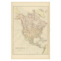
- Antique Decorative Coloured Map of North America, 1882Located in Langweer, NLThis original antique map of North America is from the Blackie & Son Atlas published in 1882. Here are several points of interest about this map: 1. **Political Borders**: The map l...Category
Antique 1880s Maps
MaterialsPaper
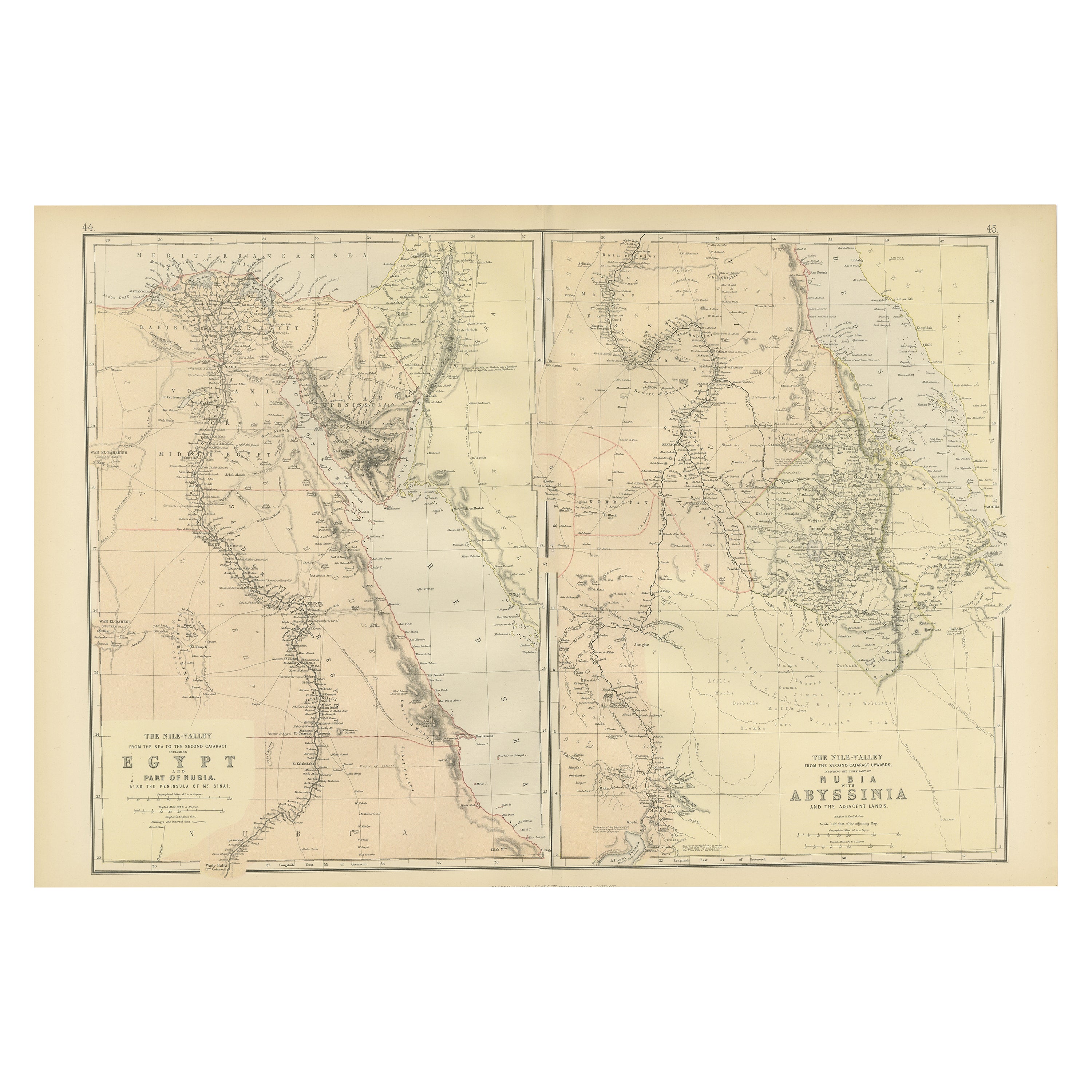
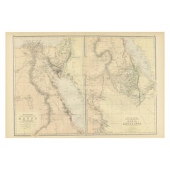
- Antique Decorative Coloured Map Egypt, Nubia, Abyssinia and more, 1882Located in Langweer, NLThis image contains two maps, with the left one being labeled "Egypt" and the right one "Nubia, Abyssinia and the Adjacent Lands." These maps highlight the Nile Valley and surroundin...Category
Antique 1880s Maps
MaterialsPaper
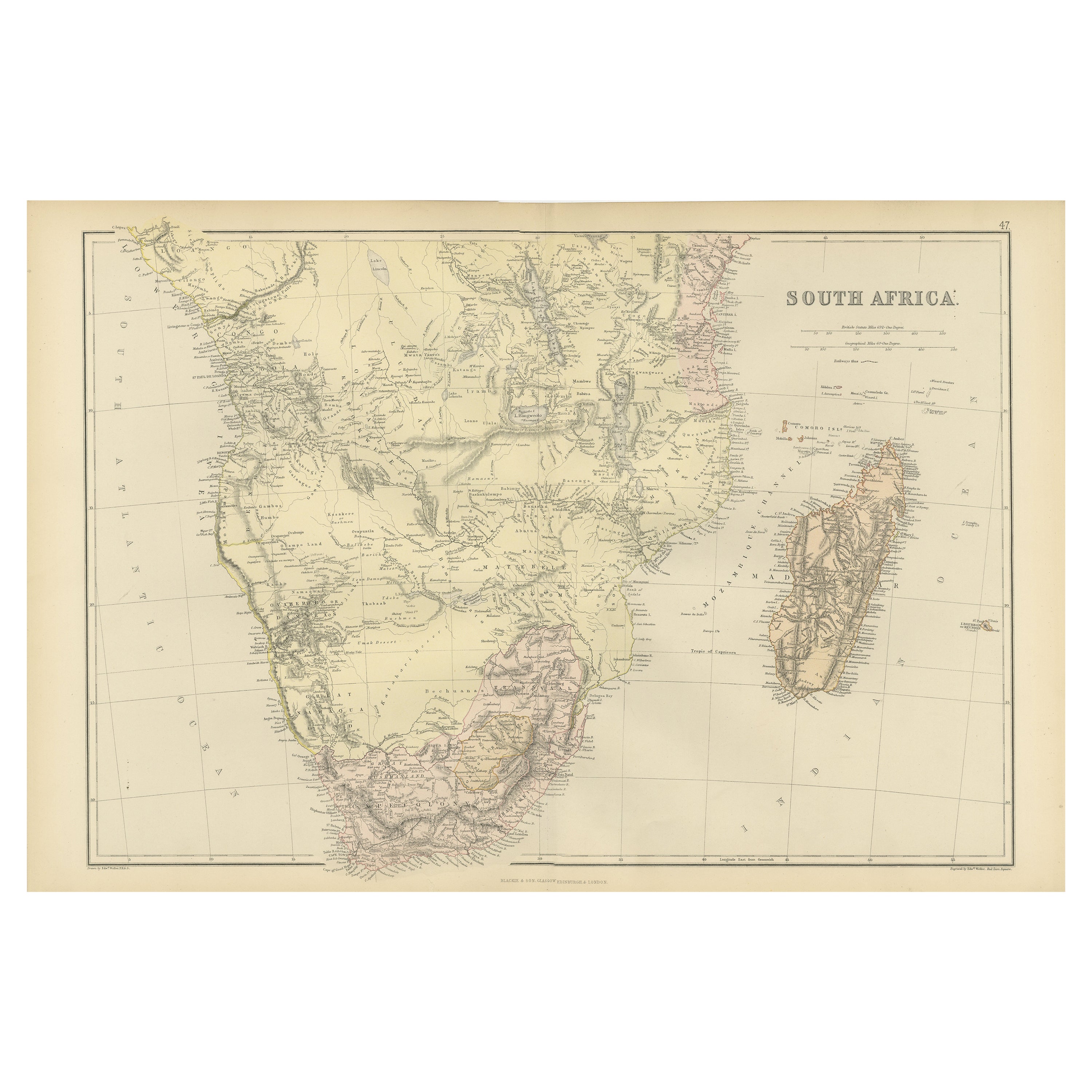
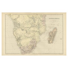
- Antique Decorative Coloured Map of South Africa and Madagascar, 1882Located in Langweer, NLThe map of South Africa is from the Blackie & Son Atlas, published in 1882. This historical map is quite interesting for several reasons: 1. **Historical Period**: This map was crea...Category
Antique 1880s Maps
MaterialsPaper
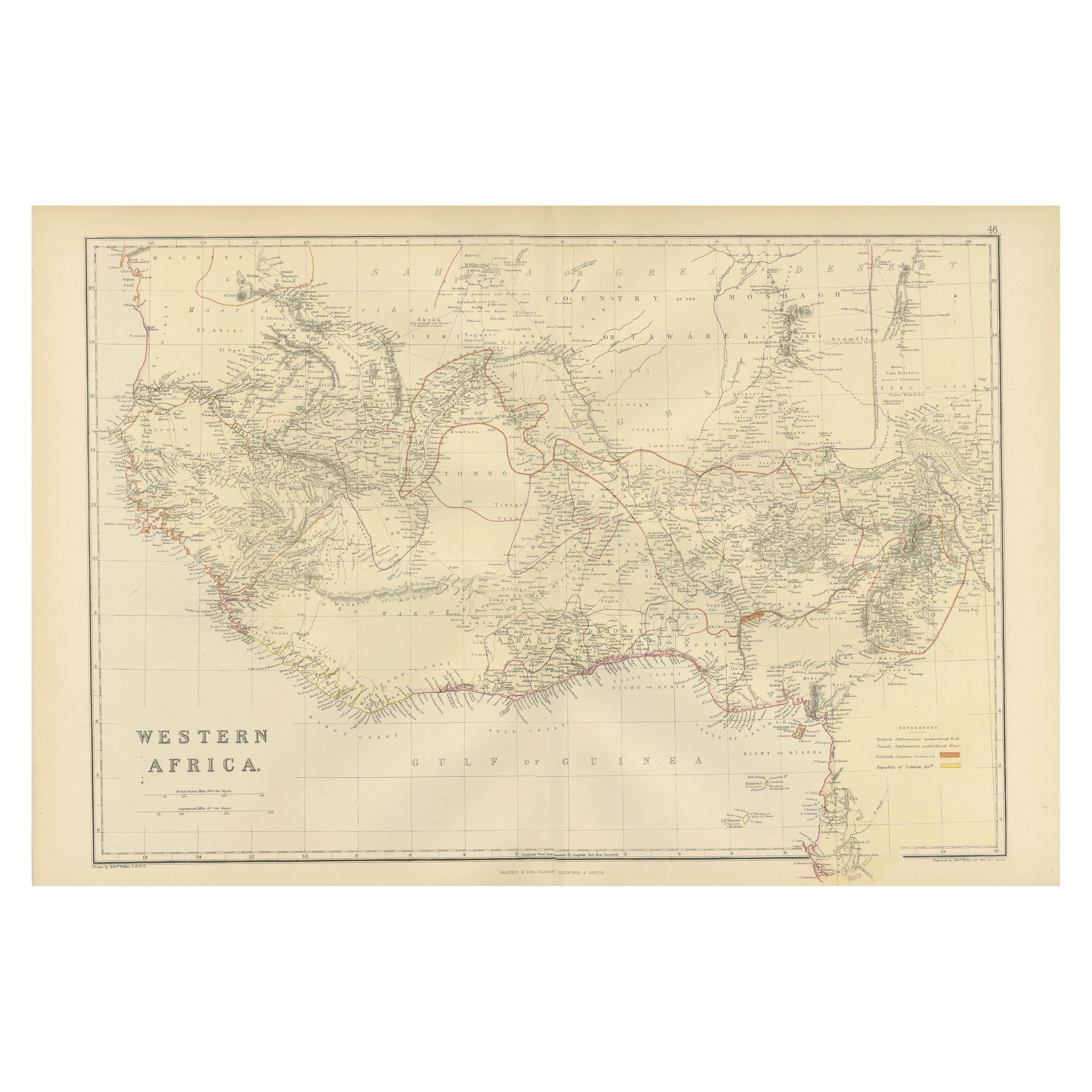
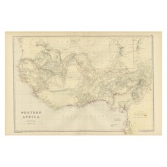
- Original Antique Coloured Map of Western Africa, Published in 1882Located in Langweer, NLThis is a map of Western Africa from the 1882 Blackie & Son atlas. The map details the West African coast from the Sahara Desert in the north down to the Gulf of Guinea, including a ...Category
Antique 1880s Maps
MaterialsPaper
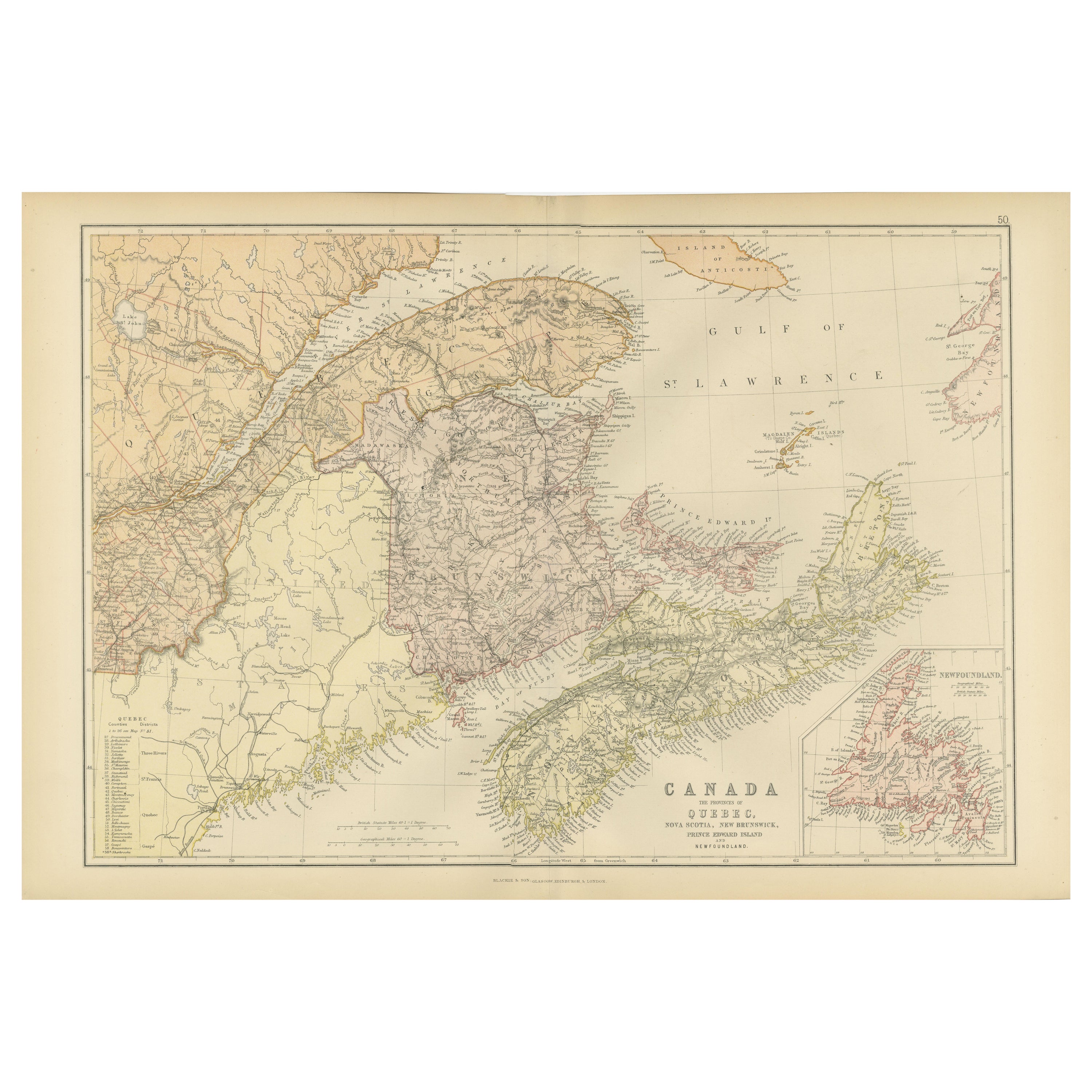
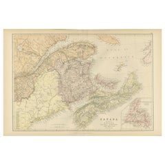
- Decorative Antique Map of Eastern Canada, Published in 1882Located in Langweer, NLThis is a historical map from the 1882 Blackie Atlas, focused on eastern Canada and the maritime provinces. The map is titled "Canada. No. 2. Provinces of Nova Scotia, New Brunswick,...Category
Antique 1880s Maps
MaterialsPaper
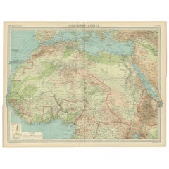
- Old Map of North Africa Depicting Libya, Morocco, Algeria, Tunis Etc, 1922Located in Langweer, NLAntique map of Africa titled 'Northern Africa'. Old map of North Africa depicting Libya, Morocco, Algeria, Tunis and surroundings. This map originates from 'The Times' atlas. ...Category
Vintage 1920s Maps
MaterialsPaper
You May Also Like
- Original Antique Decorative Map of Japan, Fullarton, C.1870Located in St Annes, LancashireGreat map of Japan Wonderful figural border From the celebrated Royal Illustrated Atlas Lithograph. Original color. Published by Fullarton, Edinburgh, C.1870 Unframed...Category
Antique 1870s Scottish Maps
MaterialsPaper
- Original Antique Decorative Map of Iceland & Faroe, Fullarton, C.1870Located in St Annes, LancashireGreat map of Iceland and The Faroe Islands Wonderful figural border From the celebrated Royal Illustrated Atlas Lithograph. Original color. Published by Fullarton, Edinb...Category
Antique 1870s Scottish Maps
MaterialsPaper
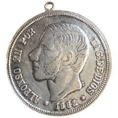
- Antique Spanish Coin Dated 1882Located in Miami, FLFine Spanish coin that was previously on a silver bracelet (sold separately). Spain, Alphonse XII (1874-1885), 5 Peseta, 1882, Year: 1882 Metal: Silver.Category
Antique 19th Century Spanish Collectible Jewelry
MaterialsSilver
- Antique Hand-Coloured Map of Venice with Vintage Frame, Italy, Late 18th CenturyLocated in Copenhagen K, DKItaly, late 18th Century Antique hand-coloured map of Venice. Measures: H 52 x W 59 cm.Category
Antique Late 18th Century Italian Decorative Art
MaterialsOther
- Seminal guide to the East and West Indies, with 42 coloured maps and platesBy Jan Huygen van LinschotenLocated in ZWIJNDRECHT, NLSeminal guide to the East and West Indies, with 42 double-page and folding plates, including 6 maps, all engravings beautifully coloured by a contemporary hand LINSCHOTEN, Jan Huygh...Category
Antique Early 17th Century Dutch Dutch Colonial Books
MaterialsPaper
- Maroc by Albert Watson Marocco Photography BookBy Albert WatsonLocated in Seguin, TXMaroc by Albert Watson. Published by Rizzoli International Publications, New York, 1998. White hardcover binding with illustrated dust jacket. Photographs by renowned photographer ...Category
1990s North American Moorish Books
MaterialsPaper