Items Similar to Three Antique Maps on One Folio: Turkey, Northern Egypt, and Ancient Carthage

Want more images or videos?
Request additional images or videos from the seller
1 of 6
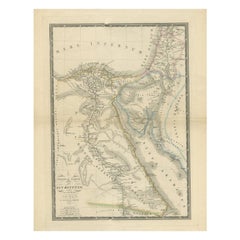
Three Antique Maps on One Folio: Turkey, Northern Egypt, and Ancient Carthage
About the Item
The map consists of three distinct sections on a single folio sheet:
1. **Map of Turkey**:
- Orientation: The map is oriented with the east at the top, which is a common practice in historical maps.
- Geographic Coverage: It provides a detailed depiction of Turkey, extending to include the regions of Candia (now known as Crete) and Cyprus.
- Cartographic Source: The map is based on the cartography of Gastaldi/Forlani, indicating the influence of renowned cartographers of the time.
- Details: The map likely includes geographical features, cities, rivers, and other landmarks of Turkey, Candia, and Cyprus.
2. **Map of Northern Egypt**:
- Geographic Coverage: This section of the map focuses on northern Egypt, particularly the Nile River delta region.
- Nile River: The map showcases the course of the Nile River and its delta, highlighting its significance in the region.
- Details: It likely includes geographical features, settlements, and the network of waterways in the delta.
3. **Map of Ancient Carthage (Tunis)**:
- Geographic Coverage: This section features the vicinity of ancient Carthage, which is located in present-day Tunis.
- Maritime Scene: The map stands out for its depiction of numerous oared ships in the sea, suggesting a vibrant maritime activity in the area.
- Historical Context: Carthage was a prominent ancient city known for its naval prowess, and this map may reflect its historical significance.
4. **German Text on Verso**:
- The reverse side of the folio sheet contains German text, providing additional information, context, or descriptions related to the maps on the front.
Overall, this multi-sectioned map offers a glimpse into the geography and historical significance of the depicted regions during the time of its creation. It serves as a valuable historical document, providing insights into the cartography and knowledge of these areas in the past.
- Dimensions:Height: 12.72 in (32.3 cm)Width: 19.49 in (49.5 cm)Depth: 0 in (0.02 mm)
- Materials and Techniques:Paper,Engraved
- Period:
- Date of Manufacture:1572
- Condition:Repaired: Archival repairs to centerfold separations at top and bottom and a few short edge tears. A nice impression with full contemporary color on a sturdy, watermarked sheet with light soiling, dampstains in the top corners of the sheet.
- Seller Location:Langweer, NL
- Reference Number:
About the Seller
5.0
Platinum Seller
These expertly vetted sellers are 1stDibs' most experienced sellers and are rated highest by our customers.
Established in 2009
1stDibs seller since 2017
1,916 sales on 1stDibs
Typical response time: <1 hour
- ShippingRetrieving quote...Ships From: Langweer, Netherlands
- Return PolicyA return for this item may be initiated within 14 days of delivery.
More From This SellerView All
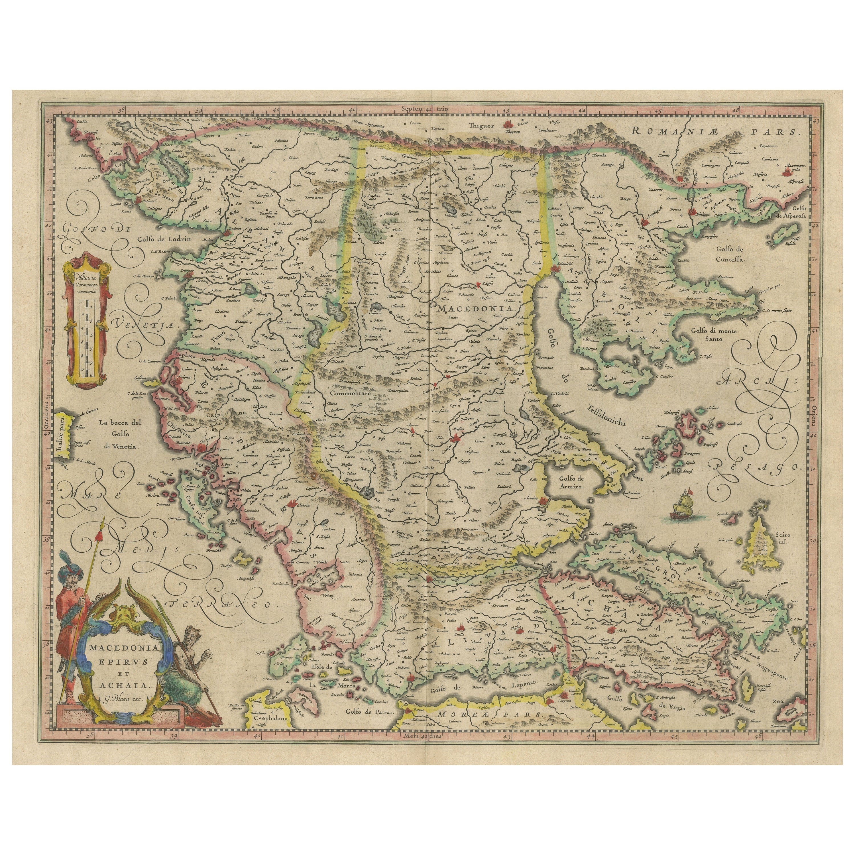
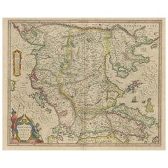
- Antique Map of Macedonia, Northern Greece and part of Turkey in EuropeLocated in Langweer, NLAntique map titled 'Macedonia Epirus et Achaia'. Original old map of Macedonia, northern Greece, and part of Turkey in Europe. Published by W.J. Blaeu, circa 1640. Willem Janszoon ...Category
Antique Mid-17th Century Maps
MaterialsPaper
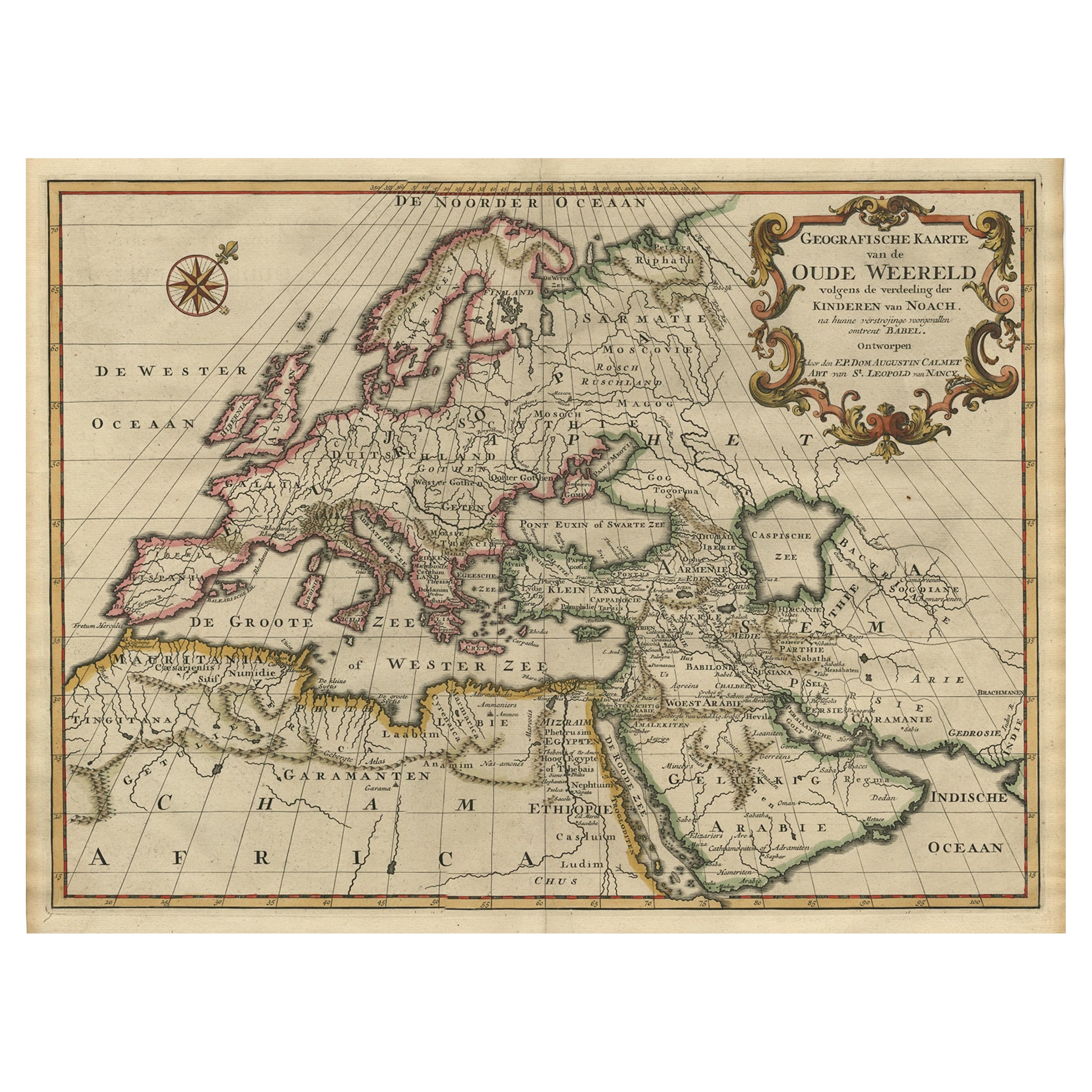
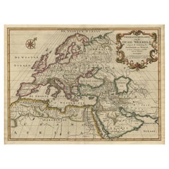
- Ancient World Map of Europe, Asia & Northern Africa with Ancient Names, 1725Located in Langweer, NLAntique map titled 'Geografische Kaarte van de Oude Weereld (..).' Original antique map of the ancient world depicting Europe, Asia, and northern Africa with ancient place names....Category
Antique 1720s Maps
MaterialsPaper
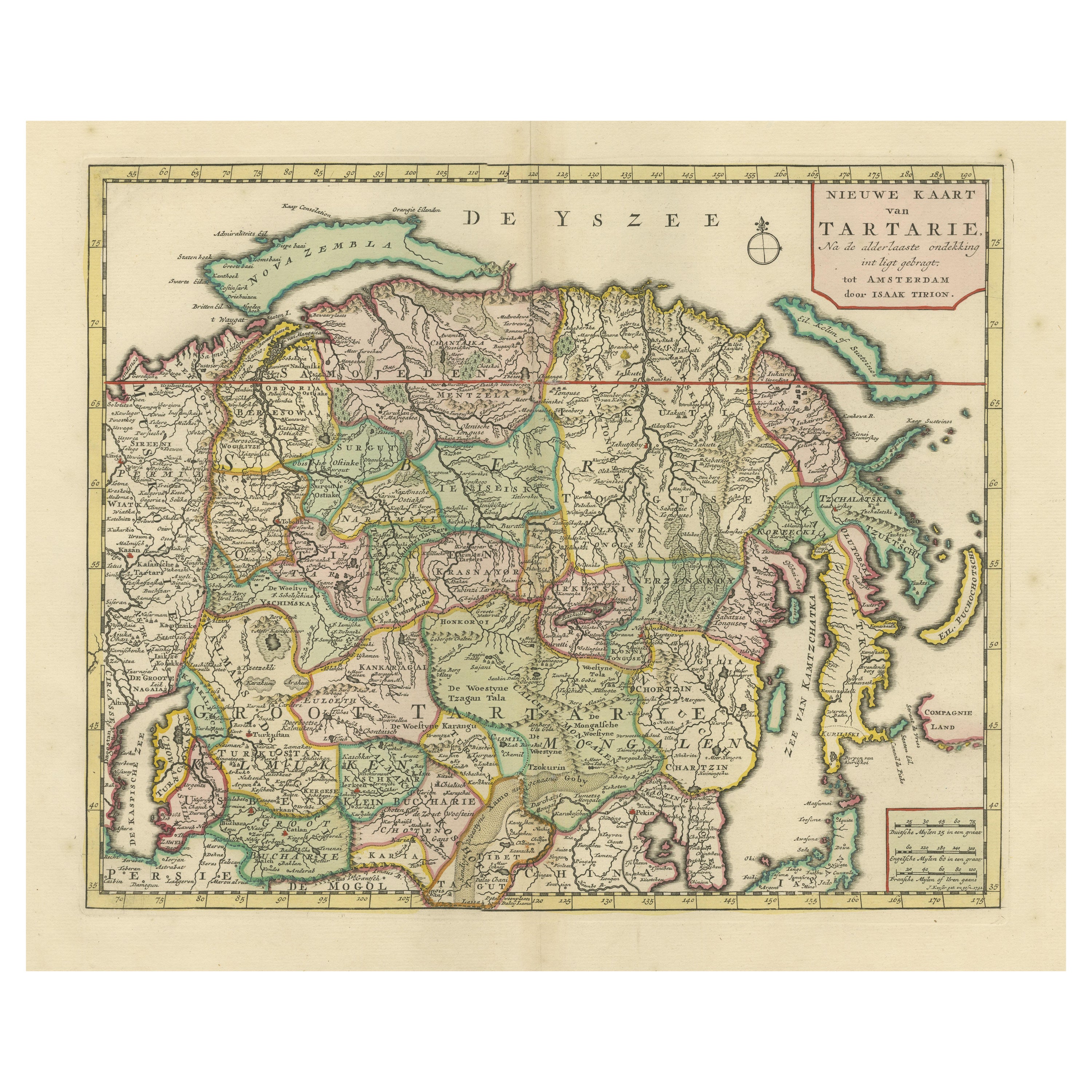
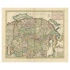
- Antique Map of Northern Asia, with Russia, Korea and Northern JapanLocated in Langweer, NLAntique map titled 'Nieuwe Kaart van Tartarie'. Map op Siberia and Chinese tartary. In the north Novaya Zemlya curls back to attach itself to the mainland by a narrow isthmus. In the...Category
Antique Mid-18th Century Maps
MaterialsPaper
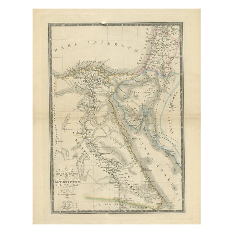
- Antique Map of Ancient Egypt Also Depicting the Nile River and Red Sea, 1845Located in Langweer, NLAntique map Egypt titled 'General Karte von Alt Aegypten von A.H. Brué'. Large map of Egypt also depicting the Nile river and Red Sea. Source unknown...Category
Antique 19th Century Maps
MaterialsPaper
- Antique Map of Egypt, '1875'Located in Langweer, NLAntique map titled 'Carte des l'Égypte'. Large map of Egypt. This map originates from 'Atlas de Géographie Moderne Physique et Politique' by A. Levasseur....Category
Antique Late 19th Century Maps
MaterialsPaper
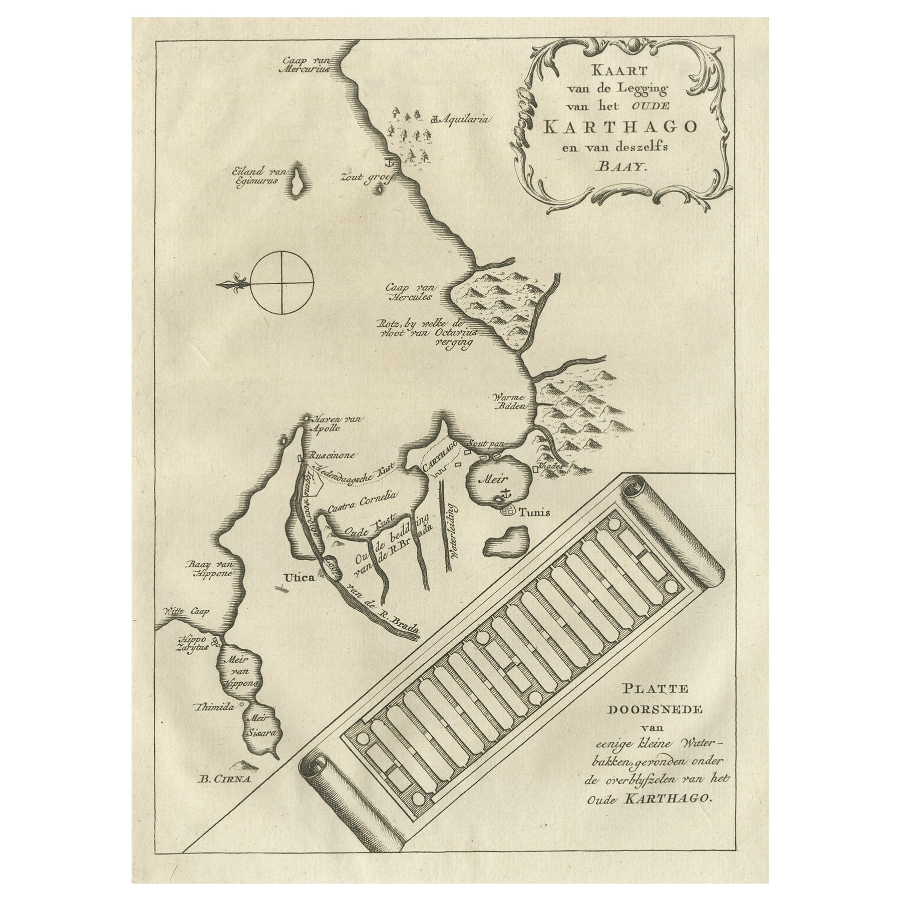
- Old Dutch Map of the City of Carthage and the Bay of Carthage, 1773Located in Langweer, NLAntique print titled 'Kaart van de Legging van het Oude Karthago'. Old map of the city of Carthage and the Bay of Carthage. It was the center or capital city of the ancient Carthagin...Category
Antique 1770s Maps
MaterialsPaper


You May Also Like
- Original Antique Map of Ancient Greece, Achaia, Corinth, 1786Located in St Annes, LancashireGreat map of Ancient Greece. Showing the region of Thessaly, including Mount Olympus Drawn by J.D. Barbie Du Bocage Copper plate engraving by P.F Tardieu Original hand color...Category
Antique 1780s French Other Maps
MaterialsPaper
- Original Antique Map of Ancient Greece- Boeotia, Thebes, 1787Located in St Annes, LancashireGreat map of Ancient Greece. Showing the region of Boeotia, including Thebes Drawn by J.D. Barbie Du Bocage Copper plate engraving by P.F T...Category
Antique 1780s French Other Maps
MaterialsPaper
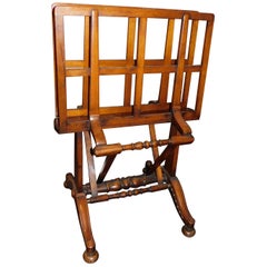
- English Mahogany Wooden Folio Stand, Map and Document Holder, circa 1820Located in Hamilton, OntarioRegency era mahogany wood folio stand rack, map, poster, document holder used in a library, office or den, circa 1820. Folds out to six positions ...Category
Antique Early 19th Century English Regency Magazine Racks and Stands
MaterialsWood
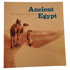
- The American Discovery of Ancient Egypt 1995Located in North Hollywood, CAThe American Discovery of Ancient Egypt 1995. Essays, edited by Nancy Thomas. A survey of the achievements of American Egyptology featuring such enterpris...Category
Late 20th Century Egyptian Moorish Books
MaterialsPaper
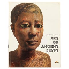
- Art of Ancient Egypt by Kazimierz MichalowskiLocated in Bradenton, FLArt of Ancient Egypt by Kazimierz Michalowski. Hardcover book with dustjacket. Published by Harry N. Abrams Inc., of New York. Printed in France, bound in the Netherlands. 904 illust...Category
Late 20th Century French Egyptian Books
MaterialsPaper
- Large Original Vintage Map of Egypt, circa 1920Located in St Annes, LancashireGreat map of Egypt Unframed Original color By John Bartholomew and Co. Edinburgh Geographical Institute Published, circa 1920 Free shipping.Category
Vintage 1920s British Maps
MaterialsPaper


Recently Viewed
View AllMore Ways To Browse
Bolivian Antique
St Thomas Cross
Map Of Liverpool
Georgetown Antique
Map Of Gulf Of Mexico
Authentic Pirate
Historic Map Virginia
Map Of Indonesia
United States Antique Map
Antique Map Coats Of Arms
Antique Book Map France
Old Maps England
Map Sumatra
Scotland Coat Of Arms
Malaysia Antique
Map Of Siam
Antique Map Of Sri Lanka
Globes Antique Terrestre