Items Similar to Antique Lithography Map, Black Sea, English, Framed, Cartography, Victorian


Want more images or videos?
Request additional images or videos from the seller
1 of 13
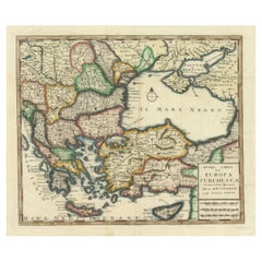
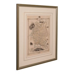
Antique Lithography Map, Black Sea, English, Framed, Cartography, Victorian
About the Item
This is an antique lithography map of the Black Sea region. An English, framed atlas engraving of cartographic interest by John Rapkin, dating to the early Victorian period and later, circa 1850.
John Rapkin was considered as one of the best map makers of the mid 19th century, working in conjunction with John Tallis to engrave maps for the Illustrated Atlas and Modern History of the World (1845-51).
Quality lithography of the Black Sea and the surrounding region - ideal for display
Displaying a desirable aged patina and in very good order
Fascinating cartography, presented tastefully within quality, later frames
Major locations, regional borders and tributaries annotate the map
Superb illustrations showcase six ports with ship interest
Dressed to the rear with hanging cord for ease of mounting
This is a quality antique lithography map of the Black Sea region, with fine cartographic interest. Delivered ready to display.
Dimensions:
Max Width: 52cm (20.5'')
Max Depth: 2cm (.75'')
Max Height: 45cm (17.75'')
Map Width: 33.5cm (13.25'')
Map Height: 26cm (10.25'')
- Dimensions:Height: 17.72 in (45 cm)Width: 20.48 in (52 cm)Depth: 0.79 in (2 cm)
- Style:Early Victorian (Of the Period)
- Materials and Techniques:
- Place of Origin:
- Period:
- Date of Manufacture:circa 1850
- Condition:Wear consistent with age and use.
- Seller Location:Hele, Devon, GB
- Reference Number:
About the Seller
5.0
Platinum Seller
These expertly vetted sellers are 1stDibs' most experienced sellers and are rated highest by our customers.
Established in 2005
1stDibs seller since 2017
833 sales on 1stDibs
Typical response time: 1 hour
- ShippingRetrieving quote...Ships From: Hele, Devon, United Kingdom
- Return PolicyA return for this item may be initiated within 14 days of delivery.
More From This SellerView All
- Antique Lithography Map, West Africa, English, Framed, Cartography, VictorianLocated in Hele, Devon, GBThis is an antique lithography map of Western Africa. An English, framed atlas engraving of cartographic interest by John Rapkin, dating to the early Victorian period and later, circ...Category
Antique Mid-19th Century British Early Victorian Maps
MaterialsWood
- Antique Lithography Map, Western Russia, English, Framed, Cartography, VictorianLocated in Hele, Devon, GBThis is an antique lithography map of Western Russia. An English, framed atlas engraving of cartographic interest by John Rapkin, dating to the early Victorian period and later, circ...Category
Antique Mid-19th Century British Early Victorian Maps
MaterialsWood
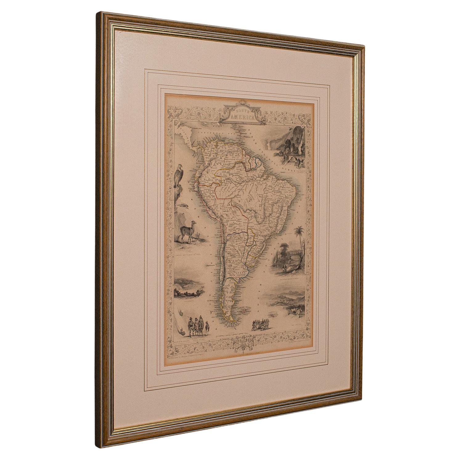
- Antique Lithography Map, South America, English, Framed, Cartography, VictorianLocated in Hele, Devon, GBThis is an antique lithography map of South America. An English, framed atlas engraving of cartographic interest by John Rapkin , dating to the early Victorian period and later, circ...Category
Antique Mid-19th Century British Early Victorian Maps
MaterialsWood
- Antique Lithography Map, Buckinghamshire, English, Framed Cartography, VictorianLocated in Hele, Devon, GBThis is an antique lithography map of Buckinghamshire. An English, framed atlas engraving of cartographic interest, dating to the mid 19th century and later. Superb lithography of B...Category
Antique Mid-19th Century British Victorian Maps
MaterialsWood, Paper
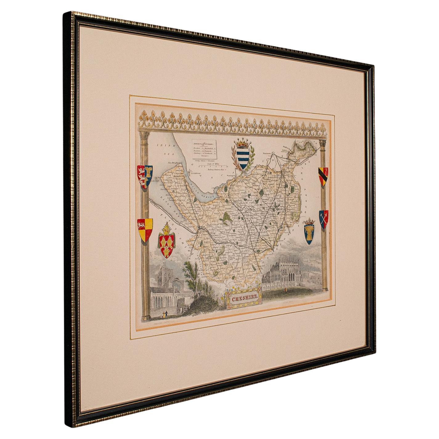
- Antique Lithography Map of Cheshire, English, Framed, Cartography, VictorianLocated in Hele, Devon, GBThis is an antique lithography map of Cheshire. An English, framed atlas engraving of cartographic interest, dating to the mid 19th century and lat...Category
Antique Mid-19th Century British Victorian Maps
MaterialsWood
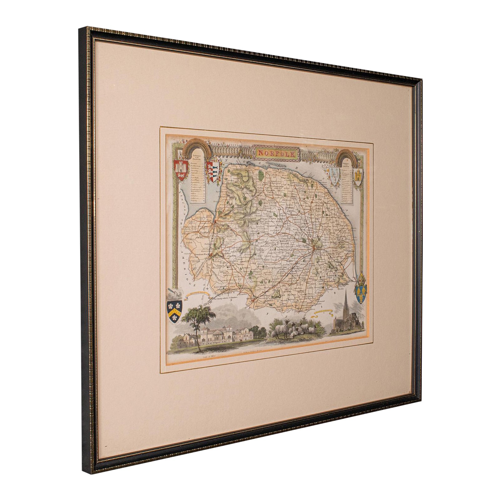
- Antique County Map, Norfolk, English, Framed Lithography, Cartography, VictorianLocated in Hele, Devon, GBThis is an antique lithography map of Norfolk. An English, framed atlas engraving of cartographic interest, dating to the mid 19th century and later. Superb lithography of Norfolk a...Category
Antique Mid-19th Century British Victorian Maps
MaterialsGlass, Wood


You May Also Like
- Cartographic Tapestry: Antique Map of Asia Minor, circa 1640Located in Langweer, NLTitle: "Historical Tapestry: Antique Map of Asia Minor, circa 1640" Description: This authentic antique map, created by Willem Blaeu and published in Amsterdam circa 1640, is a capt...Category
Antique Mid-17th Century Maps
MaterialsPaper
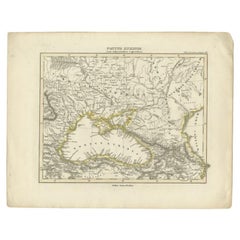
- Antique Map of the Black Sea by Perthes, 1848Located in Langweer, NLAntique map titled 'Pontus Euxinus'. Old map of the Black Sea and surroundings originating from 'Orbis Terrarum Antiquus in usum Scholarum'. Artists and Engravers: Published by Justu...Category
Antique 19th Century Maps
MaterialsPaper
- Cartographic Elegance of the Mughal Dominion in a Hand-Colored Antique Map, 1705Located in Langweer, NLThis original antique map titled “'T Ryk van den Grooten Mogol” by Nicolas Sanson from 1705 is an interesting historical artifact. It depicts the extent of the Mughal Empire in North...Category
Antique Early 1700s Maps
MaterialsPaper
- 19th Century Framed English Antique Embroidered Chasuble Center PieceBy InteriLocated in Dublin, Dalkey19th century English embroidered centerpiece from an antique chasuble with a Sabina Fay Braxton gaufrage mat. It is her signature printed velvet, se...Category
Antique Mid-18th Century English Early Victorian Decorative Art
MaterialsGold Leaf, Metallic Thread
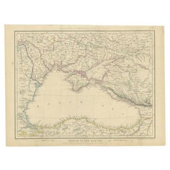
- Antique Map of the Black Sea and Surroundings by Sharpe, 1849Located in Langweer, NLAntique map titled 'Russia on the Euxine'. Old map of the Black Sea and the surrounding (Russia). This map originates from 'Sharpe's Corresponding Atlas (..)' by J. Sharpe. Artists and Engravers: Published by Chapman and Hall...Category
Antique 19th Century Maps
MaterialsPaper
- Detailed Antique Map of the Black Sea, Balkans and Asia MinorLocated in Langweer, NLAntique map titled 'Nuova Carta del Europa Turchesca (..)'. This is an Italian version of Tirion's detailed map of the Black Sea, Balkans, and Asia Minor. It is embellished with a si...Category
Antique Mid-18th Century Maps
MaterialsPaper