Items Similar to Antique Map of the Black Sea by Perthes, 1848

Want more images or videos?
Request additional images or videos from the seller
1 of 5
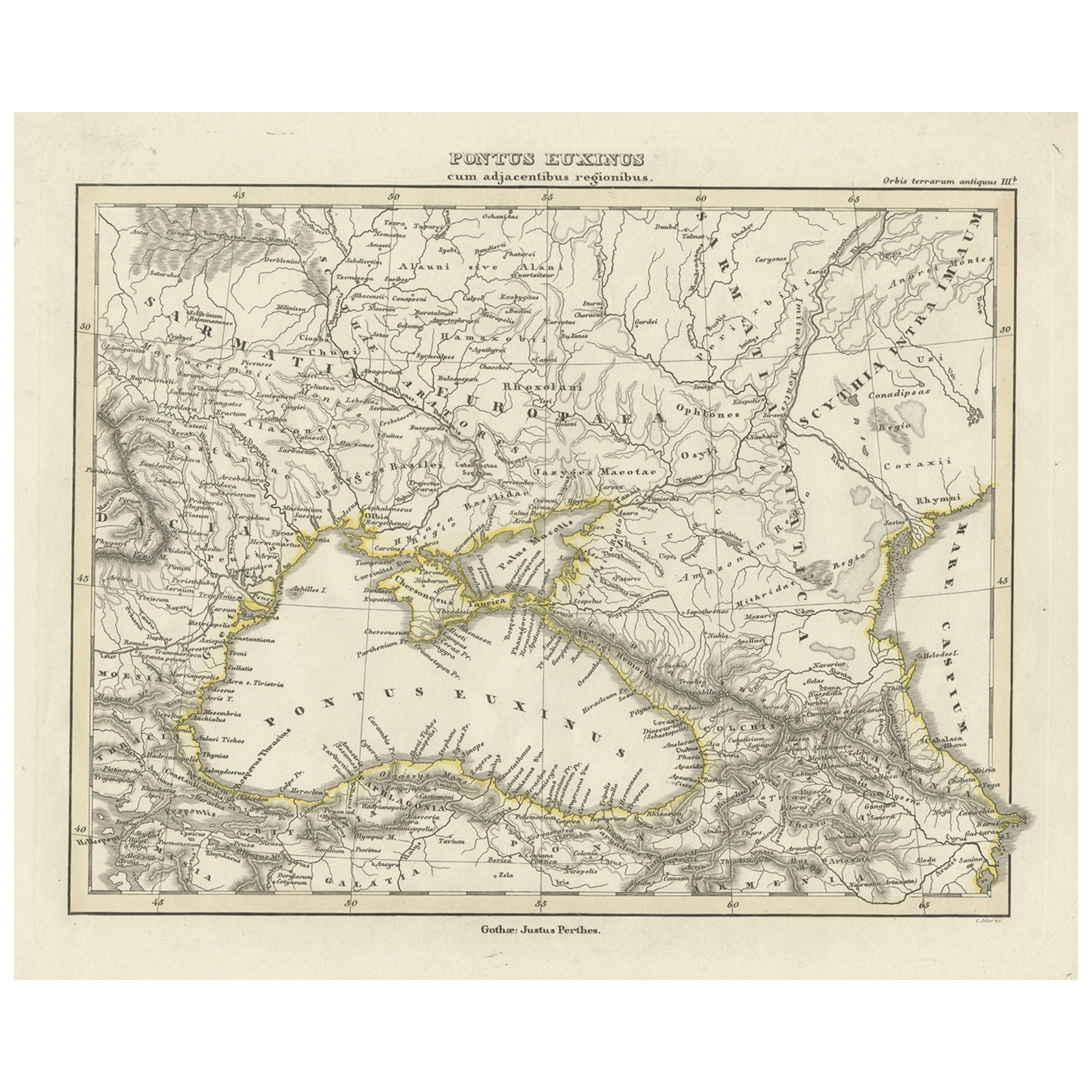
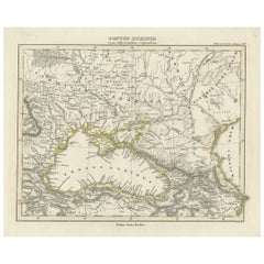
Antique Map of the Black Sea by Perthes, 1848
About the Item
Antique map titled 'Pontus Euxinus'. Old map of the Black Sea and surroundings originating from 'Orbis Terrarum Antiquus in usum Scholarum'. Artists and Engravers: Published by Justus Perthes, 1848.
Artist: Published by Justus Perthes, 1848.
Condition: Good, general age-related toning. Minor defects, please study image carefully.
Date: 1848
Overall size: 31.8 x 24.8 cm.
Image size: 0.001 x 23.6 x 18.3 cm.
Antique prints have long been appreciated for both their aesthetic and investment value. They were the product of engraved, etched or lithographed plates. These plates were handmade out of wood or metal, which required an incredible level of skill, patience and craftsmanship. Whether you have a house with Victorian furniture or more contemporary decor an old engraving can enhance your living space. We offer a wide range of authentic antique prints for any budget.
- Dimensions:Height: 9.77 in (24.8 cm)Width: 12.52 in (31.8 cm)Depth: 0 in (0.01 mm)
- Materials and Techniques:
- Period:
- Date of Manufacture:1848
- Condition:
- Seller Location:Langweer, NL
- Reference Number:
About the Seller
5.0
Platinum Seller
These expertly vetted sellers are 1stDibs' most experienced sellers and are rated highest by our customers.
Established in 2009
1stDibs seller since 2017
1,947 sales on 1stDibs
Typical response time: <1 hour
- ShippingRetrieving quote...Ships From: Langweer, Netherlands
- Return PolicyA return for this item may be initiated within 14 days of delivery.
More From This SellerView All
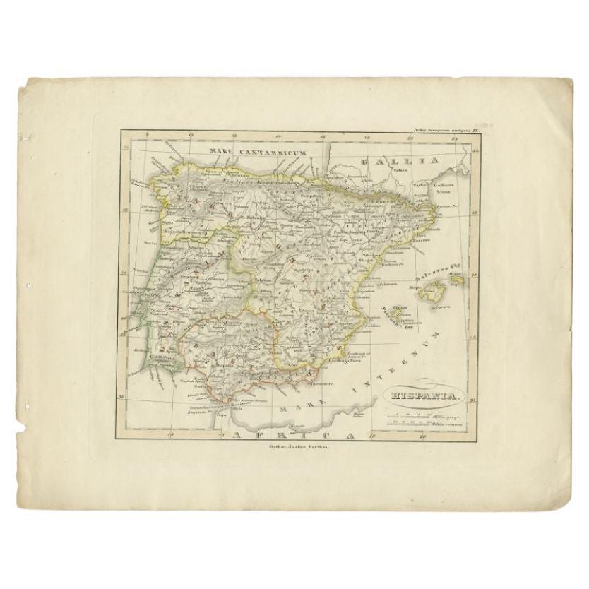
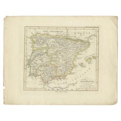
- Antique Map of Spain by Perthes, 1848Located in Langweer, NLAntique map titled 'Hispania'. Old map of Spain originating from 'Orbis Terrarum Antiquus in usum Scholarum'. Artists and Engravers: Published by Justus P...Category
Antique 19th Century Maps
MaterialsPaper
- Antique Map of the Middle East by Perthes, 1848Located in Langweer, NLAntique map titled 'Terra inter Euphratem et Indum Antiqua'. Old map of the Middle East originating from 'Orbis Terrarum Antiquus in usum Schola...Category
Antique 19th Century Maps
MaterialsPaper
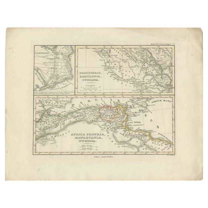
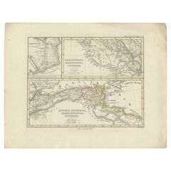
- Antique Map of Northern Africa by Perthes, 1848Located in Langweer, NLAntique map titled 'Africa Propria (..)'. Old map of North Africa and the region of Babylon originating from 'Orbis Terrarum Antiquus in usum Scholarum'. Artists and Engravers: Publi...Category
Antique 19th Century Maps
MaterialsPaper
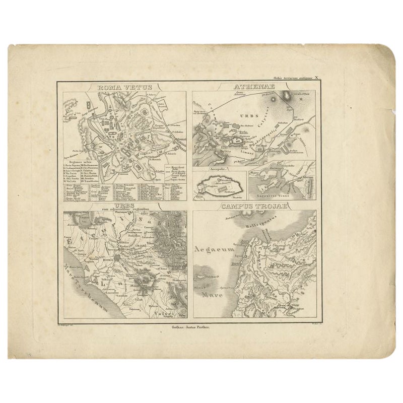
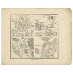
- Antique Map of Rome and Athens by Perthes, 1848Located in Langweer, NLAntique map titled 'Roma Vetus, Athenae, Urbs, Campus Trojae'. Old map of Rome, Athens and surroundings originating from 'Orbis Terrarum Antiquus in usum S...Category
Antique 19th Century Maps
MaterialsPaper
- Old Map of the Black Sea, The Krim, Ukraine, Russia, etc in Historic Times, 1848Located in Langweer, NLAntique map titled 'Pontus Euxinus'. Old map of the black Sea and surroundings originating from 'Orbis Terrarum Antiquus in usum Scholarum'. Artists and Engravers: Published by J...Category
Antique 1840s Maps
MaterialsPaper
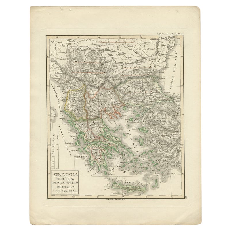
- Antique Map of Greece and Macedonia, 1848Located in Langweer, NLAntique map titled 'Graecia Epirus Macedonia Moesia Thracia'. Old map of Greece originating from 'Orbis Terrarum Antiquus in usum Scholarum'. Artists and Engravers: Published by Just...Category
Antique 19th Century Maps
MaterialsPaper


You May Also Like
- 1861 Topographical Map of the District of Columbia, by Boschke, Antique MapLocated in Colorado Springs, COPresented is an original map of Albert Boschke's extremely sought-after "Topographical Map of the District of Columbia Surveyed in the Years 1856 ...Category
Antique 1860s American Historical Memorabilia
MaterialsPaper
- Antique Lithography Map, Black Sea, English, Framed, Cartography, VictorianLocated in Hele, Devon, GBThis is an antique lithography map of the Black Sea region. An English, framed atlas engraving of cartographic interest by John Rapkin, dating to the early Victorian period and later...Category
Antique Mid-19th Century British Early Victorian Maps
MaterialsWood
- Original Antique Map of The World by Thomas Clerk, 1817Located in St Annes, LancashireGreat map of The Eastern and Western Hemispheres On 2 sheets Copper-plate engraving Drawn and engraved by Thomas Clerk, Edinburgh. Published by Mackenzie And Dent, 1817 ...Category
Antique 1810s English Maps
MaterialsPaper
- Hand-Colored 18th Century Homann Map of the Black Sea, Turkey and Asia MinorBy Johann Baptist HomannLocated in Alamo, CAAn attractive original early 18th century hand-colored map of the Black Sea and Turkey entitled "Carte de L'Asie Minevre ou de la Natolie et du Pont Evxin Tiree des Voyages et des Ob...Category
Antique Early 18th Century German Maps
MaterialsPaper
- 1907 Map of Colorado, Antique Topographical Map, by Louis NellLocated in Colorado Springs, COThis highly detailed pocket map is a topographical map of the state of Colorado by Louis Nell from 1907. The map "has been complied from all availabl...Category
Antique Early 1900s American Maps
MaterialsPaper
- Antique Ships Model "Sovereign of the Seas"Located in Norwell, MAAntique ship model of the Donald Mc Kay Clipper Ship "Sovereign of the Seas". Awesome scale model by noted early twentieth century model maker Th...Category
Vintage 1930s American Models and Miniatures
MaterialsWood


Recently Viewed
View AllMore Ways To Browse
Sea Antique
Victorian Sea Prints
Rare Compass
Map Of United Kingdom
Antique Presentation Plates
Antique Mallet
Antique 16th Century Plates
Antique Caribbean Furniture
Antique Bookseller
17th Century Plate Set
Antique Booksellers
Antique Rose Compass
Compass Rose Antique
Antique Map North America
Antique North America Map
Israeli Antique
Antique Map Paint
North America Antique Map