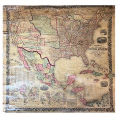
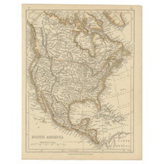
Antique North America Map
16
to
52
194
189
175
157
119
74
56
56
46
45
37
25
24
16
13
13
12
12
10
10
9
9
8
8
7
7
7
7
6
6
5
5
5
5
5
4
3
3
3
3
2
2
1
1
1
1
8
3
3
2
2
Sort By
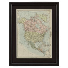
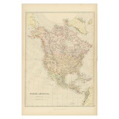
1875 "North America" Map by J. Bartholomew
Located in Colorado Springs, CO
Presented is an original 1875 map of “North America.” The map was issued in Volume 1 of the Ninth
Category
1870s Scottish Antique North America Map
Materials
Paper
New Revised North America Map with Mythical Figures and Animals
Located in Houston, TX
.
Geographical Description: Map of North and Central America showing the northernmost part of South America. The
Category
Early 1700s Naturalistic Antique North America Map
Materials
Engraving
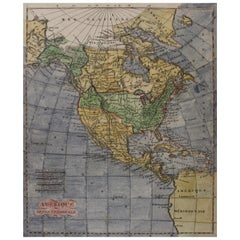
Early 19th Century Hand Coloured Map of North America by Aaron Arrowsmith
By Aaron Arrowsmith
Located in Hamilton, Ontario
Septentionale" (North America).
Map size: 9.5" x 8"
Mat size: 20.5" x 14.25".
Category
Early 19th Century English Antique North America Map
Materials
Paper
H 20.5 in W 14.25 in D 0.1 in
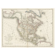
Antique Map of North America, 1821
Located in Langweer, NL
Antique map of America titled 'Carte de l'Amerique septentrionale'. Scarce map of North America
Category
19th Century Antique North America Map
Materials
Paper
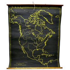
University Chart “Black Map of North America
Located in Chillerton, Isle of Wight
University Chart “Black Map of North America
W&A K Johnston’s Charts of Physical Maps By G W
Category
Early 20th Century Industrial Antique North America Map
Materials
Linen
Large Antique 1859 Map of North America
Located in Sag Harbor, NY
population of 1850 North America is included as well as details of all of North and Central America. The size
Category
Mid-19th Century American Antique North America Map
Materials
Canvas, Paper
Antique Decorative Coloured Map of North America, 1882
Located in Langweer, NL
This original antique map of North America is from the Blackie & Son Atlas published in 1882. Here
Category
1880s Antique North America Map
Materials
Paper
Antique Map of North America by Lowry '1852'
Located in Langweer, NL
Antique map titled 'North America'. Original map of North America. This map originates from
Category
Mid-19th Century Antique North America Map
Materials
Paper
Antique Map of North America by Wyld '1845'
Located in Langweer, NL
Antique map titled 'North America'. Original antique map of North America. This map originates from
Category
Mid-19th Century Antique North America Map
Materials
Paper
Antique Map of North America by Johnson, '1872'
Located in Langweer, NL
Antique map titled 'Johnson's North America'. Original map of North America, with an inset map of
Category
Late 19th Century Antique North America Map
Materials
Paper
Antique Map of North America by Levasseur '1875'
Located in Langweer, NL
Antique map titled 'Carte générale de l'Amérique Septentrionale'. Large map of North America. This
Category
Late 19th Century Antique North America Map
Materials
Paper
Antique Map of North America by Johnston, 1882
By Alexander Keith Johnston
Located in Langweer, NL
Antique map titled 'North America'.
Old map of North America. This map originates from 'The Royal
Category
19th Century Antique North America Map
Materials
Paper
Antique Map of North America by Lapie '1842'
Located in Langweer, NL
Antique map titled 'Carte de l'Amérique septentrionale'. Map of North America, with an inset map of
Category
Mid-19th Century Antique North America Map
Materials
Paper
Antique Map of British North America by Lowry, '1852'
Located in Langweer, NL
Antique map titled 'British North America'. Original map of British North America. This map
Category
Mid-19th Century Antique North America Map
Materials
Paper
Large Original Vintage Map of North America, circa 1920
Located in St Annes, Lancashire
Great map of North America
Original color. Good condition
Published by Alexander Gross
Category
1920s English Edwardian Antique North America Map
Materials
Paper
Antique Map of North America by Dufour 'circa 1834'
Located in Langweer, NL
Antique map titled 'Amérique Septentrionale'. Uncommon map of North America. Published by or after
Category
Mid-19th Century Antique North America Map
Materials
Paper
Antique Map of North America by Laarman, c.1860
Located in Langweer, NL
Antique map titled 'Noord Amerika'. Original antique map of North America. Published circa 1860
Category
19th Century Antique North America Map
Materials
Paper
Antique Map of North America Including the West Indies
Located in Langweer, NL
Original antique map titled 'Nord-America'. Old map of North America and the West Indies. Also
Category
Mid-19th Century Antique North America Map
Materials
Paper
1864 Map of North America, Antique Hand-Colored Map, by Adolphe Hippolyte Dufour
Located in Colorado Springs, CO
Offered is a map of North America entitled Amerique du Nord from 1864. This rare, separately
Category
1860s French Antique North America Map
Materials
Paper
H 44.5 in W 33 in D 1.5 in
Antique Map of North America by A & C. Black, 1870
Located in Langweer, NL
Antique map titled 'North America'. Original antique map of North America. This map originates from
Category
Late 19th Century Antique North America Map
Materials
Paper
Old Original Antique German Map of North America, ca.1870
Located in Langweer, NL
Antique map titled 'Nord-America'.
Old map of North America. This map originates from 'H
Category
1870s Antique North America Map
Materials
Paper
Antique Map of North and Central America by Migeon '1880'
By J. Migeon
Located in Langweer, NL
Antique map titled 'Amérique Septentrionale'. Old map of North and Central America. With a
Category
Late 19th Century French Antique North America Map
Materials
Paper
Antique Map of North and South America by Walker, 1828
Located in Langweer, NL
Antique map titled 'Geographical, Historical and Statistical Map of America'. Two maps on one sheet
Category
19th Century Antique North America Map
Materials
Paper
Antique Map of The United States of North America, 1882
Located in Langweer, NL
This is a historical map titled "The United States of North America, Central Part" from the 1882
Category
1880s Antique North America Map
Materials
Paper
Decorative Dutch Antique Map of North and South America, 1841
Located in Langweer, NL
Description: Antique map titled 'Amerika'. Small map of North and South America.
This map
Category
1840s Antique North America Map
Materials
Paper
New Map of North America from the Latest Discoveries, 1763
Located in Philadelphia, PA
A fine antique 18th century map of the North American seaboard.
Entitled "A New Map of North
Category
Mid-18th Century English Georgian Antique North America Map
Materials
Paper
Antique Map of the West Coast of North America & North East Coast of Asia '1772'
Located in Langweer, NL
'. Map of the West Coast of North America and North-East Coast of Asia, based upon Buache's report of the
Category
Late 18th Century Antique North America Map
Materials
Paper
H 13.78 in W 18.78 in D 0.02 in
Antique Map of British North America by W. G. Blackie, 1859
Located in Langweer, NL
Antique map titled 'British North America'. Original antique map of British North America. This map
Category
Mid-19th Century Antique North America Map
Materials
Paper
Antique Map of the United States of North America, c.1882
Located in Langweer, NL
Antique map titled 'United States of North America'. Old map of the United States of North America
Category
1880s Antique North America Map
Materials
Paper
Antique Hand-Coloured Map of North and South America, ca.1765
Located in Langweer, NL
Description: Antique map titled 'Nieuwe Kaart van Amerika.' Attractive map of North and South
Category
1760s Antique North America Map
Materials
Paper
Antique Map of South America ‘North’ by A.K. Johnston, 1865
Located in Langweer, NL
Antique map titled 'South America, Northern Sheet'. Depicting Guiana, Ecuador, Brazil, Bolivia the
Category
Mid-19th Century Antique North America Map
Materials
Paper
Antique Map of the United States of North America by Johnston '1909'
Located in Langweer, NL
Antique map titled 'United States of North America'. Original antique map of United States of North
Category
Early 20th Century Antique North America Map
Materials
Paper
Antique Map of the British Possessions in North America by Wyld '1845'
Located in Langweer, NL
Antique map titled 'Map of The British Possessions in North America'. Original antique map of the
Category
Mid-19th Century Antique North America Map
Materials
Paper
H 10.24 in W 14.18 in D 0.02 in
Antique Map of the United States of North America by Wyld '1845'
Located in Langweer, NL
Antique map titled 'Map of The United States of North America'. Original antique map of the United
Category
Mid-19th Century Antique North America Map
Materials
Paper
Original Antique Map of North and South America in Attractive Old Coloring
By Isaak Tirion
Located in Langweer, NL
Antique map titled 'Nieuwe Kaart van America'. Beautiful map of America. The fabled Quivira is used
Category
Mid-18th Century Antique North America Map
Materials
Paper
H 16.15 in W 19.69 in D 0.02 in
Antique Map of British North America, The Dominion of of Canada, 1882
Located in Langweer, NL
This map is titled "British North America, Dominion of Canada," from the 1882 Blackie Atlas. It
Category
1880s Antique North America Map
Materials
Paper
No Reserve
H 14.97 in W 22.45 in D 0 in
Antique Map of North and South America by Schneider and Weigel, 1818
Located in Langweer, NL
Antique map titled 'America nach Arrowsmiths Weltcharte und dessen Globular Projection (..)'. Map
Category
Early 19th Century Antique North America Map
Materials
Paper
Antique Map Dedicated to British Merchants Trading to North America, ca.1746
Located in Langweer, NL
’s appearance. Jefferys dedicated this map to the British merchants trading to North America. Originates from
Category
1740s Antique North America Map
Materials
Paper
H 13.98 in W 19.69 in D 0 in
Antique Map of North America from an Old Dutch School Atlas, 1852
Located in Langweer, NL
Antique map titled 'Noord-Amerika'. Map of North America. This map originates from 'School-Atlas
Category
19th Century Antique North America Map
Materials
Paper
Antique Map with Hand Coloring of North America and the West Indies
Located in Langweer, NL
Original antique map titled 'Nord-America'. Old map of North America and the West Indies.
This
Category
Late 19th Century Antique North America Map
Materials
Paper
Free Shipping
H 15.08 in W 18.78 in D 0.02 in
North & South America: A 17th Century Hand-colored Map by Jansson & Goos
By Johannes Janssonius
Located in Alamo, CA
A 17th century hand-colored map of North & South America entitled "Americae Descriptio" by the
Category
1620s Dutch Antique North America Map
Materials
Paper
Antique Map of The United States of North America, Pacific States, 1882
Located in Langweer, NL
The map is from the same 1882 Blackie Atlas and focuses on the Pacific States of the United States
Category
1880s Antique North America Map
Materials
Paper
No Reserve
H 14.97 in W 11.03 in D 0 in
Exploring South America's North: Antique Map from the Royal Atlas of 1909
Located in Langweer, NL
The antique map titled 'South America, Northern Sheet' is a historical cartographic representation
Category
Early 20th Century Antique North America Map
Materials
Paper
H 19.49 in W 24.41 in D 0.02 in
Antique Map of North America and the West Indies by Stieler, circa 1865
Located in Langweer, NL
Antique map titled 'Nord-America und West-Indien'. Old map of North America and the West Indies
Category
Mid-19th Century Antique North America Map
Materials
Paper
H 9.45 in W 12.21 in D 0.02 in
Victorian Visions of the New World: A Detailed Tallis Map of North America, 1851
Located in Langweer, NL
illustrates North America, detailing the political boundaries, cities, and topography with hand-colored
Category
1850s Antique North America Map
Materials
Paper
H 14.26 in W 10.71 in D 0 in
Antique Map of North America with Vignette of the Statue of Liberty, New York
Located in Langweer, NL
Antique map titled 'Amérique du Nord'. Original antique map of North America. Meticulous
Category
Late 19th Century Antique North America Map
Materials
Paper
Free Shipping
H 15.44 in W 20.4 in D 0.02 in
Very Attractive Map of North and South America and Western Part of Africa, 1744
Located in Langweer, NL
Antique map titled 'Nieuwe Kaart van America.' Very attractive map of North and South America, the
Category
18th Century Antique North America Map
Materials
Paper
H 16.34 in W 21.26 in D 0 in
Old Map Showing the Tracks of Cook Between North America and Asia's Coast, 1803
Located in Langweer, NL
Description: Antique map titled 'Kaart van de Noord-West kust van Amerika en de Noord-Oost kust van
Category
Early 1800s Antique North America Map
Materials
Paper
H 20.87 in W 29.14 in D 0 in
Antique Map of the United States ' North East ' by Johnston '1909'
Located in Langweer, NL
Antique map titled 'United States of North America'. Original antique map of United States of North
Category
Early 20th Century Antique North America Map
Materials
Paper
Antique Map of the United States 'North West' by Johnston, '1909'
Located in Langweer, NL
Antique map titled 'United States of North America'. Original antique map of the United States of
Category
Early 20th Century Antique North America Map
Materials
Paper
Antique Chicago Illinois National Map Commercial Rollup Classroom Census Map 47"
Located in Dayton, OH
Antique early to mid 20th century double sided hanging map titled the New Commercial and Census Map
Category
Early 20th Century North American Antique North America Map
Materials
Paper
H 47 in W 41 in D 0.05 in
Interesting Original Antique Map of South America, 1822
Located in Langweer, NL
Antique map titled 'South America'.
Map of South America with attractive topography, surrounded
Category
19th Century Antique North America Map
Materials
Paper
Antique Map of South America by Finlayson, 1822
Located in Langweer, NL
America'. This map depicts part of South America (including part of Brazil and Chili) and provides a lot
Category
19th Century Antique North America Map
Materials
Paper
Antique Map of South America by Buchon, 1825
Located in Langweer, NL
Antique map titled 'Carte de l'Amérique méridionale'. Map of South America with attractive
Category
19th Century Antique North America Map
Materials
Paper
Antique Map of the North Pole & Sangihe Archipelago by Keizer & de Lat, 1788
Located in Langweer, NL
coastline labeled, Onbekend Land, nearly connecting Asia and North America. A second map that takes up
Category
Late 18th Century Antique North America Map
Materials
Paper
H 8.08 in W 11.82 in D 0.02 in
Antique Map of the Northern Hemisphere and North Pole by Tirion, circa 1754
Located in Langweer, NL
'. Map of the Northern Hemisphere and North Pole, which shows the NE Passage, but no definite NW Passage
Category
Mid-18th Century Antique North America Map
Materials
Paper
H 12.8 in W 14.77 in D 0.02 in
Excellent Antique Map of America with Unusual Northwest Coast of America, c.1754
Located in Langweer, NL
aanwyzing an de Scheepstogten der Nederlanderne Naar West Indie.' Excellent map of America, featuring an
Category
1750s Antique North America Map
Materials
Paper
No Reserve
H 13.98 in W 15.75 in D 0 in
Antique Map of South America Depicting Guayana, c.1780
Located in Langweer, NL
Operations et les Cartes recentes des Ingenieurs-Geographes Francois'. Antique map of South America depicting
Category
18th Century Antique North America Map
Materials
Paper
1891 Map of Plymouth County Mass
Located in Norwell, MA
Original 1891 map showing Sandwich, Bourne, Plymouth Carver, Middleborough, Plympton and Kingston
Category
1890s North American Antique North America Map
Materials
Paper
Antique Sea Chart of North America by Ottens, circa 1745
Located in Langweer, NL
waters of North America, including the coast of Labrador and part of New Foundland, the west coast of
Category
Mid-18th Century Antique North America Map
Materials
Paper
Free Shipping
H 21.46 in W 25.99 in D 0.02 in
- 1
Get Updated with New Arrivals
Save "Antique North America Map", and we’ll notify you when there are new listings in this category.
Antique North America Map For Sale on 1stDibs
With a vast inventory of beautiful furniture at 1stDibs, we’ve got just the antique North america map you’re looking for. An antique North america map — often made from paper, fabric and linen — can elevate any home. Whether you’re looking for an older or newer antique North america map, there are earlier versions available from the 18th Century and newer variations made as recently as the 20th Century. When you’re browsing for the right antique North america map, those designed in Folk Art, Victorian and Industrial styles are of considerable interest. Aaron Arrowsmith, Emanuel Bowen and George Willdey each produced at least one beautiful antique North america map that is worth considering.
How Much is a Antique North America Map?
Prices for an antique North america map start at $25 and top out at $150,000 with the average selling for $871.
More Ways To Browse
Isle Royale
Arkansas Map
Original Map Of Connecticut
Antique Map Of Detroit
Map Of Madagascar
Venezuela Antique Map
Map Of North Carolina
Scan Globe
Antique Detroit Map
Map Of Arkansas
North Carolina Map
Antique Easter Collectibles
Antique Furniture Salt Lake City
Greenland Map
Verso Nord
Map Made Of Silver Gold
Antique Maps Of Kentucky
Antique Fishing Tools
