Items Similar to Old Map Showing the Tracks of Cook Between North America and Asia's Coast, 1803


Want more images or videos?
Request additional images or videos from the seller
1 of 5
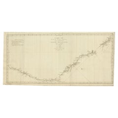
Old Map Showing the Tracks of Cook Between North America and Asia's Coast, 1803
About the Item
Description: Antique map titled 'Kaart van de Noord-West kust van Amerika en de Noord-Oost kust van Asia'.
Antique chart depicting America's northwest coast and Asia's northeast coast. The tracks of the 1778 and 1779 exploration are shown, Cook having done the former and Clerke the latter after Cook's death in Hawaii in Feb. 1779. Originates from 'Reizen Rondom de Waereld door James Cook (..)'.
Artists and Engravers: Translated by J.D. Pasteur. Published by Honkoop, Allart en Van Cleef.
Condition: Good, general age-related toning. Tiny hole outside image border and few vertical folds as issued, please study image carefully.
- Dimensions:Height: 20.87 in (53 cm)Width: 29.14 in (74 cm)Depth: 0 in (0.02 mm)
- Materials and Techniques:
- Period:
- Date of Manufacture:1803
- Condition:
- Seller Location:Langweer, NL
- Reference Number:
About the Seller
5.0
Platinum Seller
These expertly vetted sellers are 1stDibs' most experienced sellers and are rated highest by our customers.
Established in 2009
1stDibs seller since 2017
1,932 sales on 1stDibs
Typical response time: <1 hour
- ShippingRetrieving quote...Ships From: Langweer, Netherlands
- Return PolicyA return for this item may be initiated within 14 days of delivery.
More From This SellerView All
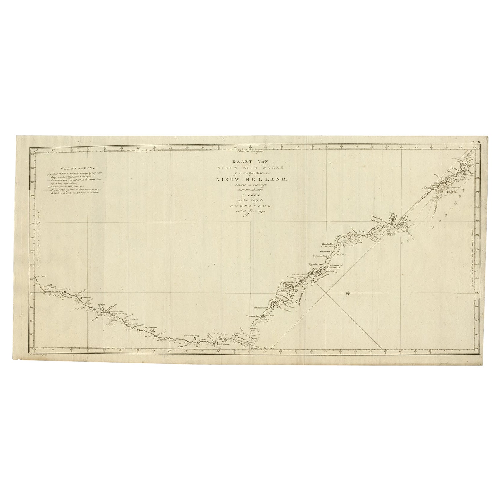
- Old Map of Cook's Discovery and Charting of the East Coast of Australia, 1803Located in Langweer, NLAntique map titled 'Kaart van Nieuw Zuid Wales of de Oostlyke Kust van Nieuw Holland ontdekt en onderzogt door den Luitenant J. Cook met het Schip de Endeavour in het Jaar 1770'. ...Category
Antique Early 1800s Maps
MaterialsPaper
- Antique Map of the West Coast of North America & North East Coast of Asia '1772'Located in Langweer, NLAntique map titled 'Carte des nouvelles decouvertes/ Extrait d'une Carte Japonoise de l'Universe'. Map of the West Coast of North America and North-East Coast of Asia, based upon Buache's report of the various Russian Discoveries between 1731 and 1742 including the various explorers routes and notes. The lower map is based upon a Japanese map...Category
Antique Late 18th Century Maps
MaterialsPaper
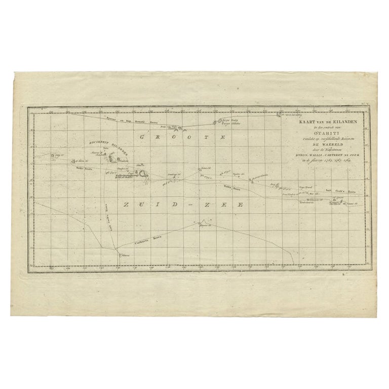
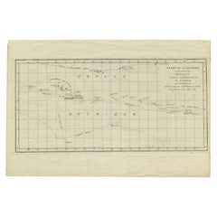
- Antique Map of French Polynesia by Cook Showing His Route, 1803Located in Langweer, NLAntique map Tahiti titled 'Kaart van de Eilanden in den omtrek van Otahiti (..)'. Antique map of French Polynesia with the tracks around the island of Tahiti by Captain Byron, Wallis...Category
Antique 19th Century Maps
MaterialsPaper
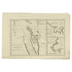
- Detailed Map of New Zealand Showing the Route of Capt. Cook's First Voyage, 1803Located in Langweer, NLAntique map New Zealand titled 'De Rivier de Theems en Mercurius Baai in Nieuw Zeeland'. Detailed map of New Zealand showing the route of Capta...Category
Antique 19th Century Maps
MaterialsPaper
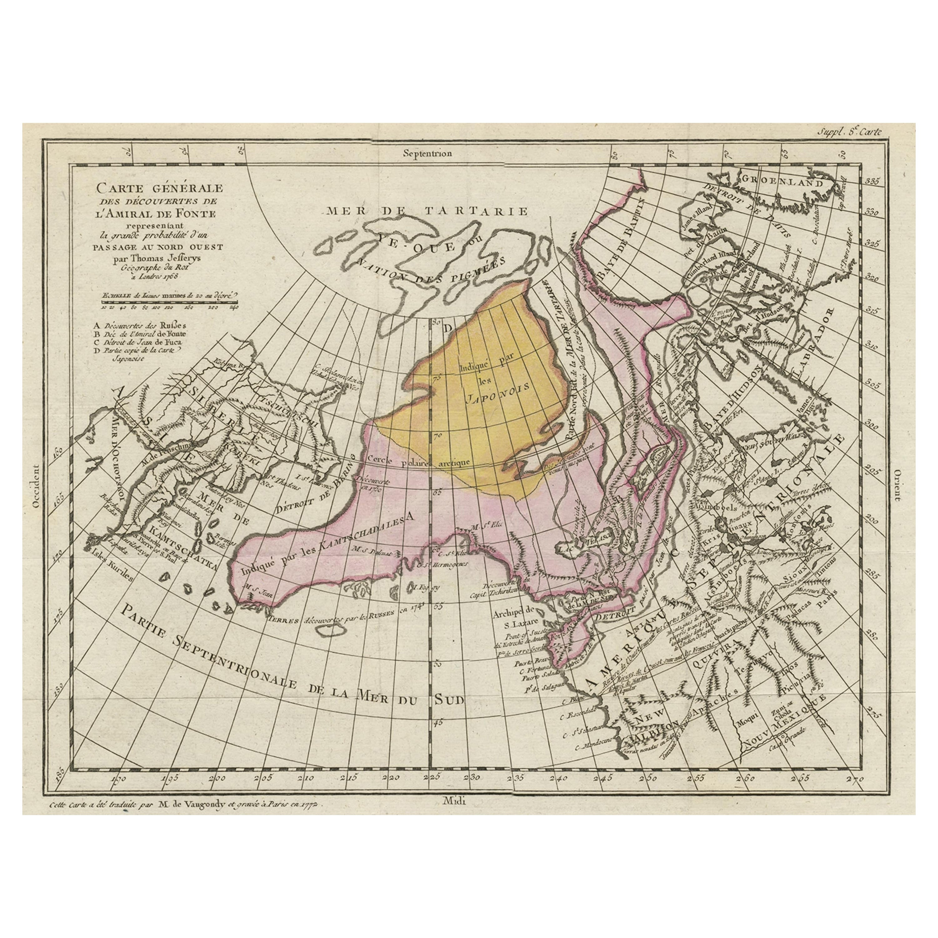
- Interesting Old Map of the Nw Coast of America and the Ne Coast of Asia, ca.1772Located in Langweer, NLAntique map titled 'Carte Generale des Decouvertes de l'Amiral de Fonte (..)'. Original antique map of the discoveries of Admiral de Fonte, showing the possibility of a north-west passage. Interesting map of the NW Coast...Category
Antique 1770s Maps
MaterialsPaper
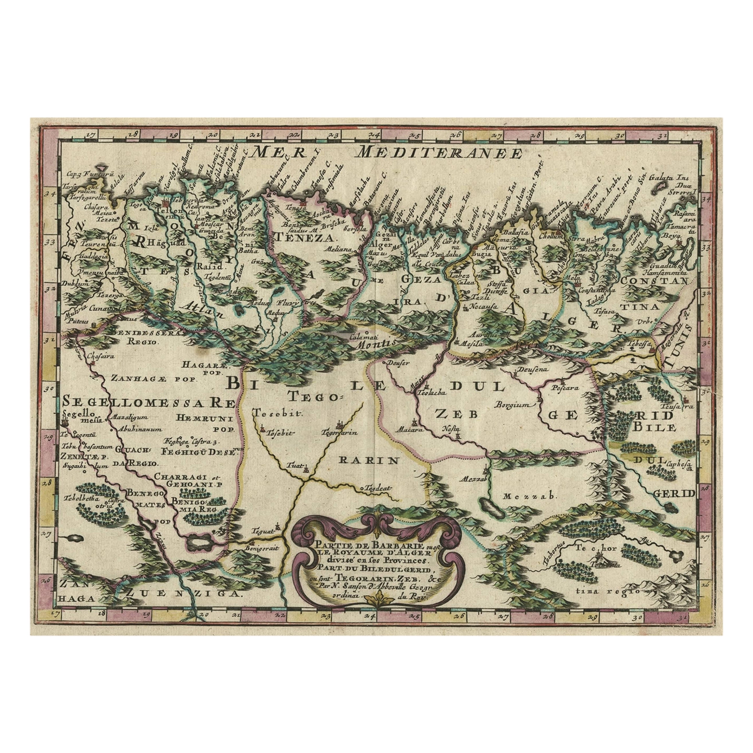
- Copper-Engraved Map Showing the Algerian Coast of North Africa, Published 1683Located in Langweer, NLAntique map titled 'Partie de Barbarie, ou est le Royaume d'Alger (..)'. Copper-engraved map showing the Algerian coast of North Africa. Published 1683. Artists and Engravers:...Category
Antique 1680s Maps
MaterialsPaper


You May Also Like
- New Map of North America from the Latest Discoveries, 1763Located in Philadelphia, PAA fine antique 18th century map of the North American seaboard. Entitled "A New Map of North America from the Latest Discoveries 1763". By the Cartographer/Engraver - John Spil...Category
Antique Mid-18th Century English Georgian Maps
MaterialsPaper
- Large Antique 1859 Map of North AmericaLocated in Sag Harbor, NYThis Map was made by Augustus Mitchell in 1859 It is in amazing condition for being 163 years old. This price is for the rolled up easy to ship version of this piece. I will be Frami...Category
Antique Mid-19th Century American Maps
MaterialsCanvas, Paper

- Original Antique Map of Asia. C.1780Located in St Annes, LancashireGreat map of Asia Copper-plate engraving Published C.1780 Two small worm holes to right side of map Unframed.Category
Antique Early 1800s English Georgian Maps
MaterialsPaper

- Old Nautical Map of CorsicaLocated in Alessandria, PiemonteST/556/1 - Old map of Corsica isle, surveyed by Captain Hell, of the French Royal Navy in 1824, engraved and published on 1874, with additions and corre...Category
Antique Early 19th Century English Other Prints
MaterialsPaper
- Old Horizontal Map of EnglandBy TassoLocated in Alessandria, PiemonteST/520 - Old rare Italian map of England, dated 1826-1827 - by Girolamo Tasso, editor in Venise, for the atlas of M.r Le-Sage.Category
Antique Early 19th Century Italian Other Prints
MaterialsPaper
- Hand-Colored 18th Century Homann Map of the Black Sea, Turkey and Asia MinorBy Johann Baptist HomannLocated in Alamo, CAAn attractive original early 18th century hand-colored map of the Black Sea and Turkey entitled "Carte de L'Asie Minevre ou de la Natolie et du Pont Evxin Tiree des Voyages et des Ob...Category
Antique Early 18th Century German Maps
MaterialsPaper


Recently Viewed
View AllMore Ways To Browse
Toner Chart
Antique Furniture North West
Map North America
Map Of North America
Antique Folding Door
Old American Maps
Map Of American West
Antique North America Map
Antique Maps North America
Antique Map North America
Antique Maps Of North America
North America Antique Map
Hawaiian Collectibles
Antique Map Of North America
Van Cleef Between
Antique Van Cleef
North By Northwest
Antique Hawaiian