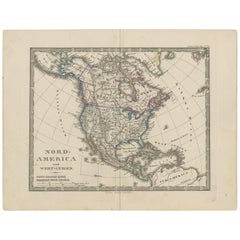
Map Of American West
8
to
34
291
113
120
102
93
86
66
62
48
37
29
28
25
21
21
17
13
12
12
11
11
11
11
9
9
9
7
6
6
6
5
5
5
4
4
4
4
3
3
2
2
2
2
2
2
2
1
1
1
29
19
18
10
7
Sort By
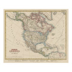
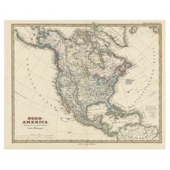
Antique Map of North America Including the West Indies
Located in Langweer, NL
Original antique map titled 'Nord-America'. Old map of North America and the West Indies. Also
Category
Antique Mid-19th Century Maps
Materials
Paper
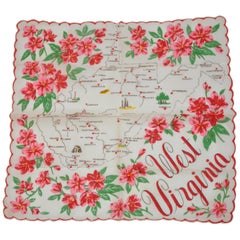
"West Virginia" Cream with Red Florals Area Map Scalloped Cotton Handkerchief
Located in New York, NY
, Bluefield, Berwind, Kenova, and Salt Sulphur Springs is featured within the area map of America's West
Category
1970s American Handkerchiefs
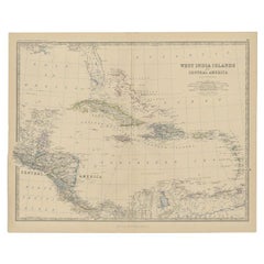
Antique Map of Central America and the West Indies, 1882
Located in Langweer, NL
Antique map titled 'West India Islands and Central America'. Old map of Central America and the
Category
Antique 19th Century Maps
Materials
Paper
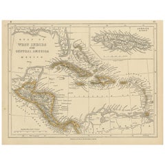
Antique Map of the West Indies and Central America by Lowry '1852'
Located in Langweer, NL
Antique map titled 'West Indies and Central America'. Original map of the West Indies and Central
Category
Antique Mid-19th Century Maps
Materials
Paper
Antique Map with Hand Coloring of North America and the West Indies
Located in Langweer, NL
Original antique map titled 'Nord-America'. Old map of North America and the West Indies.
This
Category
Antique Late 19th Century Maps
Materials
Paper
Free Shipping
H 15.08 in W 18.78 in D 0.02 in
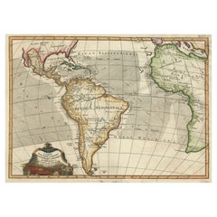
Antique Map of South American, The West Indies & Most of Africa, Ca.1775
Located in Langweer, NL
du Commerce des Europeens dans les deux Indes'.
This map is roughly centered on South America
Category
Antique 1770s Maps
Materials
Paper
H 15.04 in W 19.77 in D 0 in
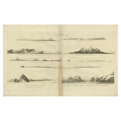
Antique Map of the West Coast of America with Island Views, ca.1784
Located in Langweer, NL
Antique print titled 'Views on the West Coast of America (..)'.
Coastal views of various
Category
Antique 1780s Maps
Materials
Paper
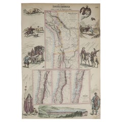
Original Antique Decorative Map of South America-West Coast, Fullarton, C.1870
Located in St Annes, Lancashire
Great map of Chili, Peru and part of Bolivia
Wonderful figural border
From the celebrated
Category
Antique 1870s Scottish Maps
Materials
Paper
No Reserve
H 18.5 in W 12.5 in D 0.07 in
Antique Map of North America and the West Indies by Stieler, circa 1865
Located in Langweer, NL
Antique map titled 'Nord-America und West-Indien'. Old map of North America and the West Indies
Category
Antique Mid-19th Century Maps
Materials
Paper
H 9.45 in W 12.21 in D 0.02 in
Antique Map of the West Coast of North America & North East Coast of Asia '1772'
Located in Langweer, NL
'. Map of the West Coast of North America and North-East Coast of Asia, based upon Buache's report of the
Category
Antique Late 18th Century Maps
Materials
Paper
H 13.78 in W 18.78 in D 0.02 in
Antique Map of Mexico, Central America and West Indies by A & C. Black, 1870
Located in Langweer, NL
Antique map titled 'Mexico, Central America and West Indies'. Original antique map of Mexico
Category
Antique Late 19th Century Maps
Materials
Paper
H 13 in W 17.52 in D 0.02 in
Antique Map of the West Indies and Central America by W. G. Blackie, 1859
Located in Langweer, NL
Antique map titled 'The West India Island & Central America'. Original antique map of the West
Category
Antique Mid-19th Century Maps
Materials
Paper
H 14.57 in W 21.26 in D 0.02 in
Old German Map of the United States, Central America and the West Indies, c.1870
Located in Langweer, NL
, Central America and the West Indies. This map originates from 'H. Kiepert's Kleiner Atlas der Neueren
Category
Antique 19th Century Maps
Materials
Paper
H 13.78 in W 17.68 in D 0 in
Antique Map of West Canada by Tallis 'c.1850'
Located in Langweer, NL
Antique map titled 'West Canada'. Original antique map of West Canada, with decorative vignettes
Category
Antique Mid-19th Century Maps
Materials
Paper
Antique Map Colton's United States of America
Located in Langweer, NL
Antique map titled 'Colton's United States of America'. Show railroads, canals, state capitals
Category
Antique Mid-19th Century Maps
Materials
Paper
Antique Map of America by Vaugondy, 1778
Located in Langweer, NL
Antique map titled 'Amerique ou Indes Occidentales (..)'. Vaugondy's map of America, pre-dating
Category
Antique Late 18th Century Maps
Materials
Paper
Antique Map of the United States 'North West' by Johnston, '1909'
Located in Langweer, NL
North America ( North West ). This map originates from the ‘Royal Atlas of Modern Geography’. Published
Category
Early 20th Century Maps
Materials
Paper
Original Antique Map of the West Indies by J. Arrowsmith, 1842
Located in Langweer, NL
Title: "J. Arrowsmith's 19th Century Map of the West Indies"
This original antique map, crafted by
Category
Antique Early 19th Century Maps
Materials
Paper
No Reserve
H 20.87 in W 27.17 in D 0 in
Interesting Original Antique Map of South America, 1822
Located in Langweer, NL
Antique map titled 'South America'.
Map of South America with attractive topography, surrounded
Category
Antique 19th Century Maps
Materials
Paper
Antique Map of South America by Finlayson, 1822
Located in Langweer, NL
America'. This map depicts part of South America (including part of Brazil and Chili) and provides a lot
Category
Antique 19th Century Maps
Materials
Paper
Excellent Antique Map of America with Unusual Northwest Coast of America, c.1754
Located in Langweer, NL
aanwyzing an de Scheepstogten der Nederlanderne Naar West Indie.' Excellent map of America, featuring an
Category
Antique 1750s Maps
Materials
Paper
No Reserve
H 13.98 in W 15.75 in D 0 in
Antique Map of The United States of North America, 1882
Located in Langweer, NL
This is a historical map titled "The United States of North America, Central Part" from the 1882
Category
Antique 1880s Maps
Materials
Paper
1864 Map of North America, Antique Hand-Colored Map, by Adolphe Hippolyte Dufour
Located in Colorado Springs, CO
edge of South America. The map includes an unusual view of the Transmississippi West, with a misshaped
Category
Antique 1860s French Maps
Materials
Paper
H 44.5 in W 33 in D 1.5 in
Antique Map of South America by Wyld, circa 1850
By J. Wyld
Located in Langweer, NL
Beautiful folding map of South America titled 'Colombia Prima or South America Drawn from the Large
Category
Antique Mid-19th Century British Maps
Materials
Paper
Antique Map of the Gulf of Mexico and all the islands of the West Indies
Located in Langweer, NL
Antique map titled 'Carte du Golfe du Mexique'. This uncommon map depicts the Gulf of Mexico and
Category
Antique Early 19th Century Maps
Materials
Paper
H 17.41 in W 23.63 in D 0.02 in
Authentique Map by Pilon of The French Colonies in The West Indies, 1876
Located in Langweer, NL
This map is a significant representation of the French colonies in the West Indies during the late 19th
Category
Antique Late 19th Century Maps
Materials
Paper
H 14.38 in W 16.54 in D 0 in
Original Steel Engraved Map of French Colonies in America, 1854
Located in Langweer, NL
local animals, produce and activities of the various French Colonies in America. This map originates
Category
Antique Mid-19th Century Maps
Materials
Paper
Free Shipping
H 13.12 in W 18.71 in D 0.02 in
West Coast of Africa, Guinea & Sierra Leone: An 18th Century Map by Bellin
By Jacques-Nicolas Bellin
Located in Alamo, CA
expansive work that mapped China, the East Indies, Asia, the Americas, early voyages to Australia, New
Category
Antique Mid-18th Century French Maps
Materials
Paper
H 10 in W 14.25 in D 0.07 in
Engraving by Tallis and Rapkin of Map of the West Indies in The Caribbean, 1851
Located in Langweer, NL
John Tallis' 1851 map of the West Indies stands as a striking example of his renowned cartographic
Category
Antique Mid-19th Century Maps
Materials
Paper
H 10.44 in W 14.57 in D 0 in
Antique Map of the United States of North America by Johnston '1909'
Located in Langweer, NL
America ( South West Sheet ). With inset maps of Chicago, San Francisco, Philadelphia and Boston. This map
Category
Early 20th Century Maps
Materials
Paper
Early Coastal Views of Various Islands of the American West Coast, 1803
Located in Langweer, NL
Antique print America titled 'Gezigten der West-Kust van Amerika'.
Coastal views of various
Category
Antique Early 1800s Maps
Materials
Paper
Antique Map of The United States of North America, Pacific States, 1882
Located in Langweer, NL
The map is from the same 1882 Blackie Atlas and focuses on the Pacific States of the United States
Category
Antique 1880s Maps
Materials
Paper
No Reserve
H 14.97 in W 11.03 in D 0 in
1875 "North America" Map by J. Bartholomew
Located in Colorado Springs, CO
Presented is an original 1875 map of “North America.” The map was issued in Volume 1 of the Ninth
Category
Antique 1870s Scottish Maps
Materials
Paper
1859 "Map of the United States of America..." by J. H. Colton
By J.H. Colton
Located in Colorado Springs, CO
Presented is an 1859 “Map of the United States of America, the British Provinces, Mexico, the West
Category
Antique 1850s American Maps
Materials
Paper
British Possessions on the North West Coast of South America, 1860
Located in Langweer, NL
British possessions on the northwest coast of South America during that time. It features a detailed map
Category
Antique 1860s Maps
Materials
Paper
Free Shipping
H 18.51 in W 12.41 in D 0 in
Antique Hand-Coloured Map of North and South America, ca.1765
Located in Langweer, NL
America, the western part of Africa and south west Europe. Source unknown, to be determined.
Artists
Category
Antique 1760s Maps
Materials
Paper
Original Hand-Colored Antique Map of America by Danckerts, circa 1680
Located in Langweer, NL
'. Striking map of America. California is shown as an island, Based Upon Sanson's model. The Great Lakes are
Category
Antique Late 17th Century Maps
Materials
Paper
H 20.48 in W 24.22 in D 0.02 in
West Africa Entitled "Guinea Propria": An 18th Century Hand Colored Homann Map
By Johann Baptist Homann
Located in Alamo, CA
This is a scarce richly hand colored copper plate engraved map of Africa entitled "Guinea Propria
Category
Antique Mid-18th Century German Maps
Materials
Paper
H 20.5 in W 23.5 in D 0.13 in
Antique Map of Cayenne and Cassepouri, French Guinea, South America, c.1730
Located in Langweer, NL
Cayenne and Cassepouri, French Guinea, South America, and Martinique in the West Indies. The map of
Category
Antique 18th Century Maps
Materials
Paper
H 16.54 in W 13.59 in D 0 in
Very Attractive Map of North and South America and Western Part of Africa, 1744
Located in Langweer, NL
Antique map titled 'Nieuwe Kaart van America.' Very attractive map of North and South America, the
Category
Antique 18th Century Maps
Materials
Paper
H 16.34 in W 21.26 in D 0 in
Antique Map of the Eastern United States with Inset Map of Texas
Located in Langweer, NL
Antique map titled 'Verein-Staaten von Nord-America mit Ausnahme Florida's und der Westlichen
Category
Antique Mid-19th Century Maps
Materials
Paper
Interesting Old Map of the Nw Coast of America and the Ne Coast of Asia, ca.1772
Located in Langweer, NL
map of the discoveries of Admiral de Fonte, showing the possibility of a north-west passage
Category
Antique 1770s Maps
Materials
Paper
H 13.78 in W 17.13 in D 0 in
America "Amérique Septentrionale": A 19th Century French Map by Delamarche
By Maison Delamarche 1
Located in Alamo, CA
This framed mid 19th century map of North America entitled "Amérique Septentrionale" by Felix
Category
Antique Mid-19th Century American Other Maps
Materials
Paper
H 20 in W 22.63 in D 0.88 in
Old Map Showing the Tracks of Cook Between North America and Asia's Coast, 1803
Located in Langweer, NL
Description: Antique map titled 'Kaart van de Noord-West kust van Amerika en de Noord-Oost kust van
Category
Antique Early 1800s Maps
Materials
Paper
H 20.87 in W 29.14 in D 0 in
1854 Map of Massachusetts, Connecticut and Rhode Island, Antique Wall Map
Located in Colorado Springs, CO
This striking wall map was published in 1854 by Ensign, Bridgman & Fanning and has both full
Category
Antique 19th Century American Maps
Materials
Paper
H 38.13 in W 45 in D 3.5 in
Pictorial Map of Chicago, circa 1926
Located in Colorado Springs, CO
publisher: "This pictorial map, the first of its kind to be made of any American city, gives a comprehensive
Category
Vintage 1920s American Maps
Materials
Paper
Antique 18th Century Map of the Province of Pensilvania 'Pennsylvania State'
Located in Philadelphia, PA
A fine antique of the colony of Pennsylvania.
Noted at the top of the sheet as a 'Map of the
Category
Antique 18th Century British American Colonial Maps
Materials
Paper
H 10.25 in W 13.25 in D 0.5 in
Antique Map of Peru by Carey, 1822
Located in Langweer, NL
text. This map originates from 'A Complete Historical, Chronological, And Geographical American Atlas
Category
Antique 19th Century Maps
Materials
Paper
Original Engraving of the West Indies, Gulf of Mexico, Antilles, Caribbean, 1780
Located in Langweer, NL
Rigobert Bonne and G. Raynal's 1780 map of the West Indies, Gulf of Mexico, Antilles, and the
Category
Antique Late 18th Century Maps
Materials
Paper
H 9.85 in W 15.16 in D 0 in
Original Antique Map of the Western Part of NEW MEXICO & CALIFORNIA
Located in Langweer, NL
Title: "Map of the Western Part of NEW MEXICO and CALIFORNIA According to the Latest Discoveries by
Category
Antique 1760s Maps
Materials
Paper
Antique Map of the Eastside of Coiba Island 'Quibo', Panama, 1749
Located in Langweer, NL
Antique map titled 'Plan de la partie orientale de l'Isle de Quibo'. Map of the eastside of Coiba
Category
Antique 18th Century Maps
Materials
Paper
Antique Map of Juan Fernandez Island, Chile, c.1750
Located in Langweer, NL
Antique map titled 'Plan de la Côte du N.E. de l 'Ile de Juan Fernandes'.
Map of the northeast
Category
Antique 18th Century Maps
Materials
Paper
Ornate Cartography of Colonial Grandeur: The West India Islands around 1851
Located in Langweer, NL
illustrations.
The map itself is a mid-19th-century depiction of the West Indies, which is a region of the
Category
Antique 1850s Maps
Materials
Paper
No Reserve
H 10.71 in W 14.26 in D 0 in
1866 Ensign & Bridgman's Rail Road Map of the United States
Located in Colorado Springs, CO
ornamental border.
The map captures the burgeoning American railway infrastructure and documents the
Category
Antique 1860s American Late Victorian Maps
Materials
Paper
Antique Map of Sweden, Norway and Denmark by Johnson, 1872
Located in Langweer, NL
The image is an antique map, a two-page spread from "Johnson's New Illustrated Family Atlas of the
Category
Antique Late 19th Century Maps
Materials
Paper
Original Antique Map of Juan Fernandez by Van Schley, 1757
Located in Langweer, NL
launching several attacks on the west coast of South America and recuperating on the island, he collected
Category
Antique 18th Century Maps
Materials
Paper
Antique Map of Juan Fernandez Island by Anson, c.1740
Located in Langweer, NL
Antique map titled 'Plan de la Côte du N.E. de l 'Ile de Juan Fernandes'.
Map of the northeast
Category
Antique 18th Century Maps
Materials
Paper
Antique Map of the Harbour of Praia, Santiago Island, Cape Verde, c.1750
Located in Langweer, NL
Antique map titled 'A Draught of ye Harbour of Praya in the Island St. Jago (..)'. Uncommon map
Category
Antique 18th Century Maps
Materials
Paper
Interesting Map of the Atlantic Showing Nelson's and Trade Routes, 1817
By John Thomson
Located in Langweer, NL
Antique map titled 'Chart of the North Atlantic Ocean with Tracks of the Shipping to West Indies
Category
Antique 19th Century Maps
Materials
Paper
Free Shipping
H 21.26 in W 27.76 in D 0 in
1847 Ornamental Map of the United States & Mexico by H. Phelps
Located in Colorado Springs, CO
map of the United States expressing U.S. dominance of the North American continent. The hand-colored
Category
Antique 1840s American Maps
Materials
Paper
- 1
Get Updated with New Arrivals
Save "Map Of American West", and we’ll notify you when there are new listings in this category.
More Ways To Browse
Antique Maps Philippines
Louisiana Antique Map
Antique Maps Caribbean Islands
Map Of Hungary
Antique Maps Of Venice Italy
Vintage Medical Trolley
Robins Antiques
Vintage Wood Pull Toys
Colonies Map
Haitian Cotton
Native American Indian Territory
Wheres Waldo
Constellation Map
Antique Constellation Map
World Map British Empire
Antique Furniture Kingston
Antique Newfoundland Canada
Antique Great Lakes Map
