Antique Louisiana Map
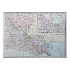
Large Original Antique Map of Louisiana, USA, C.1900
Located in St Annes, Lancashire
Fabulous map of Louisiana.
Original color.
Engraved and printed by the George F. Cram Company
Category
1890s American Antique Louisiana Map
Materials
Paper
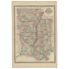
Antique Map of Arkansas, Mississippi and Louisiana by Johnson, 1872
Located in Langweer, NL
Antique map titled 'Johnson's Arkansas (..)'. Original map of Arkansas, Mississippi and Louisiana
Category
Late 19th Century Antique Louisiana Map
Materials
Paper
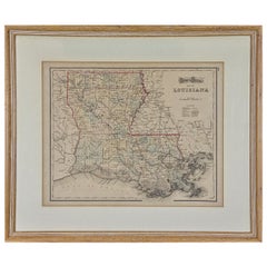
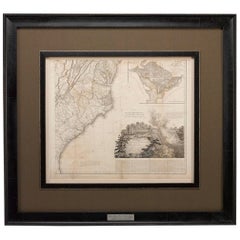
Louisiana: A Framed 19th Century Map by O. W. Gray
By Gray and Co
Located in Alamo, CA
This framed 19th century map of the Louisiana territory was published in "Gray's Atlas of the
Category
Mid-19th Century American Other Antique Louisiana Map
Materials
Paper
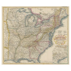
Antique Map of the Eastern United States with Inset Map of Texas
Located in Langweer, NL
Territorien'. This map extends as far west as Louisiana and only includes the northern portion of Florida
Category
Mid-19th Century Antique Louisiana Map
Materials
Paper
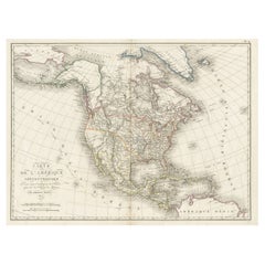
Antique Map of North America, 1821
Located in Langweer, NL
Antique map of America titled 'Carte de l'Amerique septentrionale'. Scarce map of North America
Category
19th Century Antique Louisiana Map
Materials
Paper
1812 United States Map, by Pierre Tardieu, Antique French Map Depicting the U.S.
By Pierre François Tardieu
Located in Colorado Springs, CO
fine works including maps of Louisiana, Mexico, Russia, and Asia in addition to his illustrations of
Category
1810s French Antique Louisiana Map
Materials
Paper
H 43.5 in W 48 in D 2.25 in
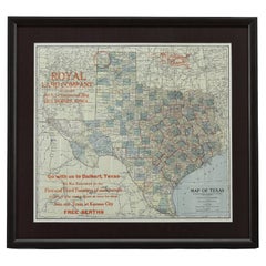
1908 "Map of Texas" by The Kenyon Company
Located in Colorado Springs, CO
Presented is an antique map of the state of Texas, printed as a pocket map in 1908 by The Kenyon
Category
Early 1900s American Antique Louisiana Map
Materials
Paper
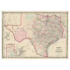
Large Antique Map of the State of Texas, 1861
Located in Langweer, NL
surveyed. The map also includes an inset of Sabine Lake on the border of Texas and Louisiana and another
Category
Mid-19th Century Antique Louisiana Map
Materials
Paper
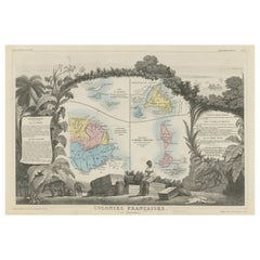
Original Steel Engraved Map of French Colonies in America, 1854
Located in Langweer, NL
Antique map titled 'Colonies Francaises (en Amerique)'. Detailed map bordered by vignettes showing
Category
Mid-19th Century Antique Louisiana Map
Materials
Paper
Free Shipping
H 13.12 in W 18.71 in D 0.02 in
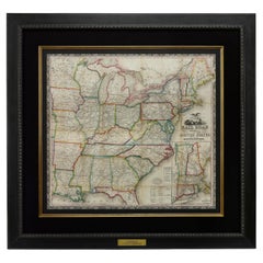
1866 Ensign & Bridgman's Rail Road Map of the United States
Located in Colorado Springs, CO
borders of Minnesota, Iowa, Missouri, Arkansas, and Louisiana. As alluded to in its title, the map
Category
1860s American Late Victorian Antique Louisiana Map
Materials
Paper
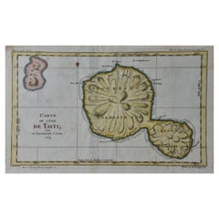
Captain Cook's Exploration of Tahiti 18th C. Hand-Colored Map by Bellin
By Jacques-Nicolas Bellin
Located in Alamo, CA
America (New France, Acadia, Louisiana) are particularly valuable. He died at Versailles. The map was
Category
Mid-18th Century French Antique Louisiana Map
Materials
Paper
H 11.38 in W 17.5 in D 0.13 in
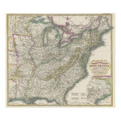
Antique Map of the Eastern United States with Only the Northern Part of Florida
Located in Langweer, NL
Territorien'. This map extends as far west as Louisiana and only includes the northern portion of Florida
Category
Mid-19th Century Antique Louisiana Map
Materials
Paper
H 14.45 in W 17.92 in D 0.02 in
Louisiana. USA Century Atlas state antique vintage map
Located in Melbourne, Victoria
'The Century Atlas. Louisiana'
Inset map of 'New Orleans and Vicinity'.
Original antique map, 1903
Category
Early 20th Century Victorian Antique Louisiana Map
Materials
Lithograph
Louisiana: A Framed 19th Century Map by O.W. Gray
Located in Alamo, CA
This framed 19th century map of the Louisiana territory was published in "Gray's Atlas of the
Category
1870s Antique Louisiana Map
Materials
Engraving
H 20 in W 22.63 in D 0.88 in
Captain Cook's Exploration of Tahiti: 18th C. Hand-colored Map by Bellin
By Jacques-Nicolas Bellin
Located in Alamo, CA
America (New France, Acadia, Louisiana) are particularly valuable. He died at Versailles. The map was
Category
Late 18th Century Antique Louisiana Map
Materials
Engraving
French Empire Style Porcelain Cartographic Cabinet Plate
Located in Fort Lauderdale, FL
map of North America highlighted with an apple-green and gilt border with neoclassical motifs.
This
Category
Early 19th Century French Empire Antique Louisiana Map
Materials
Porcelain
Personal Memoirs of P. H. Sheridan, First Edition, Two-Volume Set, 1888
Located in Colorado Springs, CO
is highly illustrated, with 27 maps and 17 plates. The book is presented beautifully rebound in
Category
1880s American Antique Louisiana Map
Materials
Leather, Paper
Memoirs of General William T. Sherman, First Edition, Two-Volume Set, 1875
Located in Colorado Springs, CO
Florida, California, New York, Kansas, and Louisiana. Yet the bulk of the writing is focused on the Civil
Category
1870s American Antique Louisiana Map
Materials
Leather, Paper
H 9.38 in W 6.38 in D 3.88 in
Plan de la Nouvelle Orléans - Original Lithograph - 1880
Located in Roma, IT
toponomastic map of the city of New Orleans, theatre of the Battle of Liberty Place, or Battle of Canal Street
Category
1880s Modern Antique Louisiana Map
Materials
Lithograph
People Also Browsed
A truly delightful miniature terrestrial pocket globe
By Nathaniel Mills
Located in ZWIJNDRECHT, NL
A truly delightful miniature terrestrial pocket globe in a celestial case, 3 inches / 6.8 cm. The globe consists of 12 wonderful varnished, engraved hand-coloured gores that stretch ...
Category
Mid-18th Century British Dutch Colonial Antique Louisiana Map
Materials
Other
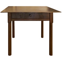
Jim Rose Legacy Collection - One-Drawer Plank Top Side Table, Steel Furniture
By Jim Rose
Located in Chicago, IL
Jim Rose - Legacy Collection
One-drawer plank top table
found steel with natural rust patina
Measures: 27.50 H x 31.50 W x 27.50 D in
69.85 H x 80.01 W x 69.85 D cm
JR0229
Jim Rose
...
Category
2010s American Mid-Century Modern Antique Louisiana Map
Materials
Steel
H 27.5 in W 31.5 in D 27.5 in
English Pocket Globe, London, Circa 1775-1798
By Herman Moll
Located in Milano, IT
Pocket globe
London, between 1775 and 1798
Re-edition of the globe of Hermann Moll (1678-1732) dated 1719
The globe is contained in its original case, which itself is covered in sh...
Category
Late 18th Century English George III Antique Louisiana Map
Materials
Shagreen, Paper
Antique Map of The United States of North America, 1882
Located in Langweer, NL
This is a historical map titled "The United States of North America, Central Part" from the 1882 Blackie Atlas. It depicts the continental United States with a high level of detail, ...
Category
1880s Antique Louisiana Map
Materials
Paper
19th Century Embroidered Silk Panel Map Of The World
Located in Forney, TX
A rare and visually striking framed antique European embroidered silk panel.
Exquisitely hand-crafted in Continental Europe in the 19th century, depicting map of the world, double ...
Category
19th Century European Victorian Antique Louisiana Map
Materials
Silk, Thread
Miniature Terrestrial Globe Newton & Son London, Post 1833, Ante 1858
By Newton and Son
Located in Milano, IT
Miniature Terrestrial Globe
Newton & Son
London, post 1833, ante 1858
Paper, papier-mâché, bronze and wood
It measures: sphere diameter 2.95 in (7.6 cm); diameter of the wooden b...
Category
1840s English Early Victorian Antique Louisiana Map
Materials
Bronze
1859 "Colton's New Map of the State of Texas..." by Johnson & Browning
Located in Colorado Springs, CO
Presented is "Colton's New Map of the State of Texas Compiled from De Cordova's Large Map", published in Alivin J. Johnson’s “New Illustrated Family Atlas.” The map was published in ...
Category
1850s American Antique Louisiana Map
Materials
Paper
H 27.75 in W 38.5 in D 1.38 in
Prof. Antonio Frilli Italian Carved Alabaster Bust of a Young Women circa 1895
By Antonio Frilli
Located in Atlanta, GA
Antonio Frilli Italian Carved Alabaster Bust of a Young Women Circa 1895.
A carved alabaster bust of young girl wearing a frilled lace bonnet and finely carved decoration to bust....
Category
Late 19th Century Italian Antique Louisiana Map
Materials
Alabaster, Marble
H 22 in W 13.5 in D 12 in
Antique Map of North and East Asia, 1751
Located in Langweer, NL
Map 2: 'Carte des parties nord et est de L'Asie'. (Map of the Northern parts and East Asia.) Five maps on one sheet, showing California, Alaska and Siberia, Korea and Japan. South to...
Category
18th Century Antique Louisiana Map
Materials
Paper
1705 Golfe de Mexico and Florida Framed Map
Located in Stamford, CT
Framed map of Mexico & Florida circa 1705, Paris. Small map with Mexico and the Gulf Coast. Inset text indicating Panama, Acapulco, Mexico City and the Mississippi. Extends North to ...
Category
Early 1700s French Spanish Colonial Antique Louisiana Map
Materials
Glass, Wood, Paper
Encounter at Lituya Bay: French Explorers Among the Tlingit, 1786
Located in Langweer, NL
The uploaded authentic engraving for sale portrays a scene of interaction between European explorers and indigenous peoples, identified by the caption as occurring at "Port des Franç...
Category
Late 18th Century Antique Louisiana Map
Materials
Paper
Free Shipping
H 8.08 in W 10.44 in D 0 in
George E. Ohr Signed Biloxi Mississippi Art Pottery Glazed Ceramic Baluster Vase
By George Ohr
Located in Studio City, CA
A wonderfully designed and beautifully glazed vase by renowned American / Mississippian master potter George E. Ohr. ( or as he famously referred to himself as the "Mad Potter of Bil...
Category
19th Century American Antique Louisiana Map
Materials
Ceramic, Pottery
H 2.5 in W 2.5 in D 4.75 in
1859 "Map of the United States of America..." by J. H. Colton
By J.H. Colton
Located in Colorado Springs, CO
Presented is an 1859 “Map of the United States of America, the British Provinces, Mexico, the West Indies and Central America with Part of New Granada and Venezuela” by John Hutchins...
Category
1850s American Antique Louisiana Map
Materials
Paper
17th Century Portuguese Tile Panel
By Europa Antiques
Located in Madrid, ES
17th century Portuguese Tile Panel
Restored
Measures: 56cm x 56cm
14cm x 14cm tiles
With certificate of authenticity and export issued by the Directorate General of Portuguese Cultu...
Category
17th Century Portuguese Baroque Antique Louisiana Map
Materials
Porcelain
50 Million Y/O Fossil Leaves from Arkansas Mounted on a Custom Acrylic Stand
By Pietra Gallery
Located in Polanco, CDMX
Beautiful and detailed two full fossil leaves from Arkansas, USA dating 50-55 million years old from the Eocene period.
Mounted on a custom acrylic stand.
Category
2010s Mexican Organic Modern Antique Louisiana Map
Materials
Acrylic
"The United States from the Latest Authorities" Antique Wall Map, 1835
Located in Colorado Springs, CO
This is a 1835 map of “The United States from the Latest Authorities” by Ezra Strong. A hand-colored engraved wall map of the eastern half of the United States, this map has a large ...
Category
1830s American Antique Louisiana Map
Materials
Paper
Recent Sales
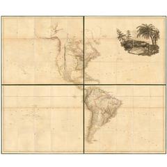
Large 1804 Hand-Colored Map of America After the Louisiana Purchase
By Aaron Arrowsmith
Located in La Jolla, CA
Fine example of Arrowsmith's map of America, in four sheets.
An excellent map of America on the
Category
Early 1800s English Federal Antique Louisiana Map
Materials
Paper
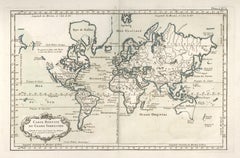
1764 Map "Carte Reduite Du Globe Terrestre"
By Jacques-Nicolas Bellin
Located in New York, NY
Original 1764 hand-colored copperplate engraved map by Jacques Nicholas Bellin, titled "Carte
Category
1760s Antique Louisiana Map
Materials
Engraving
1772 Map of Part of "West Florida"
Located in New York, NY
Original 1772 hand-colored copper plate engraving full title "A Map of Part of West Florida, from
Category
1770s Realist Antique Louisiana Map
Materials
Engraving
1774 Map of Lower Hudson Bay by Nicolas Bellin
By Jacques-Nicolas Bellin
Located in New York, NY
Copper engraved map showing the lower part of the Hudson's Bay over Ontario and Quebec (Karte von
Category
1740s Realist Antique Louisiana Map
Materials
Engraving
Moll's Famous "Beaver Map"
Located in San Francisco, CA
Harbour of Charles-Town", and a map of Louisiana and East Florida.
Moll's famous "Beaver Map
Category
18th Century and Earlier English Antique Louisiana Map
1860 Map of South Central United States by Swanston, Antique Hand-Colored Map
Located in Colorado Springs, CO
"United States. North America. The South Central Section. Comprising Texas, Louisiana, Mississippi
Category
1860s British Antique Louisiana Map
Materials
Paper
H 28.5 in W 24 in D 1 in
1828 "Map of the United States" by T. Ensign
Located in Colorado Springs, CO
peak at the time of this map’s publication. In 1803, President Thomas Jefferson’s Louisiana Purchase
Category
1820s American Antique Louisiana Map
Materials
Paper
1842 Map of Lewis and Clark's Expedition of North America
Located in Colorado Springs, CO
territory of Louisiana and in the Oregon country, Clark’s map became a factor in the Westward Movement
Category
1840s American Antique Louisiana Map
Materials
Paper
Grant's Siege of Vicksburg, Civil War Era Military Map, circa 1863
Located in Colorado Springs, CO
states of Arkansas, Louisiana, and Texas from the rest of the Confederacy.
This map is incredibly
Category
1860s American Antique Louisiana Map
Materials
Paper
1856 a New Map of the Union with the Adjacent Islands and Countries
Located in Colorado Springs, CO
This is a very rare hanging wall map of the North, Central, and part of South America. The map is
Category
1850s American Antique Louisiana Map
Louisiana Purchase Map, 1804
Located in Houston, TX
Louisiana Purchase.
Original antique map on paper displayed on a white mat with a gold border. Mat fits a
Category
Early 1800s Antique Louisiana Map
Materials
Ink, Watercolor, Handmade Paper
Giltwood Framed and Matted Map
Located in Tarry Town, NY
Giltwood framed and matted library / study room map of Arkansas, Mississippi, Louisiana. Each map
Category
Early 20th Century Antique Louisiana Map
Materials
Giltwood, Paper
Crayon or Pastel on Muslin Naive Map of America
Located in York County, PA
NAÏVE MAP OF AMERICA, CRAYON OR PASTEL ON MUSLIN, CA 1920-30, WITH A MYRIAD OF INTERESTING
Category
Early 20th Century Antique Louisiana Map
Materials
Cotton
Gulf of Mexico, Florida, C. America, Cuba: 18th C. Hand-colored Map by Bellin
By Jacques-Nicolas Bellin
Located in Alamo, CA
This beautiful 18th century hand-colored map entitled "Carte du Golphe du Mexique et des Isles de
Category
1750s Antique Louisiana Map
Materials
Engraving
History of the Expedition of Captains Lewis and Clark, 1804-1806, circa 1902
Located in Colorado Springs, CO
discovery into the newly purchased Louisiana Territory in 1804-1806.
This two volume set is the 1902
Category
Early 1900s Antique Louisiana Map
"History of the Expedition of Captains Lewis and Clark" Limited Edition, 1904
Located in Colorado Springs, CO
of Discovery, with William Clark. Their Mission was to explore the territory of the Louisiana
Category
Early 20th Century American Antique Louisiana Map
Materials
Leather, Paper
H 10 in W 2.75 in D 7 in
"Personal Memoirs of P. H. Sheridan" First Edition Set, 2-Volumes, circa 1888
Located in Colorado Springs, CO
leather and cloth boards with gilt stamped spines. Published with 27 maps and 17 plates, the autobiography
Category
1880s American Antique Louisiana Map
Materials
Paper
H 9.75 in W 4.25 in D 6.5 in
Philip Sheridan Personal Memoirs, First Edition, Two Volumes, circa 1888
Located in Colorado Springs, CO
published by Charles L. Webster & Company in 1888. Published with 27 maps and 17 plates, the autobiography
Category
1880s American Antique Louisiana Map
Materials
Paper
32 STARS, COMMEMORATING MINNESOTA STATEHOOD
Located in York County, PA
Louisiana Purchase Exposition), or to celebrate the 50th anniversary of the addition of Minnesota in 1908
Category
19th Century American Antique Louisiana Map
"Southern Gentleman" Unusal White Subject. Known for his African American
By William Aiken Walker
Located in San Antonio, TX
correct that as I own a frame shop as well as the gallery. It was exhibited in 1972 at the Louisiana
Category
1870s Realist Antique Louisiana Map
Materials
Oil
32 Stars, Commemorating Minnesota Statehood American Flag
Located in York County, PA
the 1904 World’s Fair in St. Louis (The Louisiana Purchase Exposition), or to celebrate the 50th
Category
Late 19th Century American Antique Louisiana Map
Original Antique Map of Louisiana, circa 1890
Located in St Annes, Lancashire
Great map of Louisiana
Original color.
Published, circa 1890
Unframed.
Minor edge tears.
Category
1890s English Other Antique Louisiana Map
Materials
Paper
Large Original Antique Map of Louisiana, Usa, 1894
By Rand McNally & Co.
Located in St Annes, Lancashire
Fabulous map of Louisiana.
Original color.
By Rand, McNally & Co.
Published, 1894
Category
1890s American Antique Louisiana Map
Materials
Paper
Original Antique Map of The American State of Louisiana, 1889
Located in St Annes, Lancashire
Great map of Louisiana
Drawn and Engraved by W. & A.K. Johnston
Published By A & C Black
Category
1880s Scottish Victorian Antique Louisiana Map
Materials
Paper
1 bid
No Reserve
H 11 in W 8 in D 0.07 in
1882 Railroad Map of Southern Texas, Antique Map by George Cram
Located in Colorado Springs, CO
Presented is the railroad and county map of the southern part of the state of Texas by George Cram
Category
1880s American Antique Louisiana Map
Materials
Paper
Large Original Antique Map of Texas, United States &c. Fullarton, C.1870
Located in St Annes, Lancashire
Great map of Texas. Also showing Indian Territory, Arkansas, Louisiana etc
From the celebrated
Category
1870s Scottish Antique Louisiana Map
Materials
Paper
Free Shipping
H 18.5 in W 22.5 in D 0.07 in
Framed 19th Century Colton Map of Mexico, Texas, California and US Territories
By J.H. Colton
Located in Alamo, CA
This framed 19th century map of the southern portions of North America by J. H. Colton, published
Category
Mid-19th Century American Other Antique Louisiana Map
Materials
Paper
H 20 in W 22.63 in D 0.88 in
Gulf of Mexico, Florida, C. America, Cuba, etc.: 18th C. Hand-colored Bellin Map
By Jacques-Nicolas Bellin
Located in Alamo, CA
This beautiful 18th century hand-colored map entitled "Carte du Golphe du Mexique et des Isles de
Category
Mid-18th Century French Antique Louisiana Map
Materials
Paper
H 12.63 in W 18 in D 0.13 in
Louisiana Purchase Exposition World's Fair Enamel Cup St Louis, 1904
Located in Bishop's Stortford, Hertfordshire
other a historical map showing the earlier divisions of the USA titled LOUISIANA PURCHASE 1803. The mug
Category
Early 1900s Austrian Art Nouveau Antique Louisiana Map
Materials
Metal, Enamel
Free Shipping
H 2.76 in Dm 2.96 in
Antique Map of Argentina and Uruguay, La Plata, Buenos Aires, Montevideo
By Jacques-Nicolas Bellin
Located in New York, NY
Jacque-Nicolas Bellin (French, 1703 - 1772)
Carte de la Riviere de la Plata (Map of La Plata River
Category
1750s Antique Louisiana Map
Materials
Paper, Ink
Personal Memoirs of Phillip Sheridan, First Edition, Two-Volumes, circa 1888
Located in Colorado Springs, CO
First edition in two volumes of Sheridan’s military autobiography, with 27 maps (many folding) and
Category
1880s Antique Louisiana Map
Expedition of Captains Lewis and Clark, Limited Number 1 of 75, circa 1904
Located in Colorado Springs, CO
purchased Louisiana Territory in 1804-1806. This is the 1904 reprinted edition of the 1814 originals, and
Category
Early 1900s American Antique Louisiana Map
Materials
Paper
H 10.25 in W 8 in D 5.63 in
Roosevelt's "The Winning of the West, " "American Ideals" and "Wilderness Hunter"
Located in Colorado Springs, CO
; Louisiana and the Northwest 1791-1807. pp. vi, [ii], 364. All folding maps are included.
Additionally
Category
Early 1900s Antique Louisiana Map
Memoirs of General William T. Sherman, First Edition, Two-Volume Set, 1875
Located in Colorado Springs, CO
Florida, California, New York, Kansas, and Louisiana. Yet the bulk of the writing is focused on the Civil
Category
1870s American Antique Louisiana Map
Materials
Leather, Paper
H 9.25 in W 6.5 in D 3.75 in
Books, The History of North America, Edited by Guy Carleton Lee
Located in New York, NY
South', 'The Revolution', 'Louisiana Purchase'. Bound in full red Morocco doublunes of blue Morocco
Category
Early 1900s American American Classical Antique Louisiana Map
Materials
Animal Skin, Leather, Satin
Antique Map of the Southern United States with Inset Map of New Orleans
Located in Langweer, NL
Antique map titled 'Die Staaten von Arkansas Mississippi, Louisiana & Alabama'. Detailed map of the
Category
Mid-19th Century Antique Louisiana Map
Materials
Paper
H 9.06 in W 12.21 in D 0.02 in
Monumental Pair of Cary's Library Globes
Located in New York, NY
, ending in spade feet on brass casters.
The terrestrial globe is mapped with detailed
Category
19th Century English Antique Louisiana Map
Materials
Mahogany
La Louisiane et Pays Voisins (Louisiana and surrounding areas) by Bellin
By Jacques-Nicolas Bellin
Located in New York, NY
Original 1764 map of French Louisiana by the French cartographer Jacques-Nicholas Bellin. Centered
Category
1760s Realist Antique Louisiana Map
Materials
Engraving
Get Updated with New Arrivals
Save "Antique Louisiana Map", and we’ll notify you when there are new listings in this category.
Antique Louisiana Map For Sale on 1stDibs
With a vast inventory of beautiful furniture at 1stDibs, we’ve got just the antique louisiana map you’re looking for. Frequently made of paper, ceramic and porcelain, every antique louisiana map was constructed with great care. Your living room may not be complete without an antique louisiana map — find older editions for sale from the 18th Century and newer versions made as recently as the 19th Century. An antique louisiana map is a generally popular piece of furniture, but those created in Empire styles are sought with frequency. A well-made antique louisiana map has long been a part of the offerings for many furniture designers and manufacturers, but those produced by Jacques-Nicolas Bellin, Gray and Co and Pierre François Tardieu are consistently popular.
How Much is a Antique Louisiana Map?
An antique louisiana map can differ in price owing to various characteristics — the average selling price 1stDibs is $743, while the lowest priced sells for $75 and the highest can go for as much as $5,760.
More Ways To Browse
Amish Painting
Antique Map Of Colorado
Antique Map Fabric
Arden B
Antique Map North Carolina
Shenandoah Valley
Storm Shade
Cuban Link Chain Mens
Missouri Antique Map
Monumental Floor Globe
Map Iowa
Antique Maps Of New Mexico
Antique Maps North Carolina
Antique Postcard Collection
Map Of Wyoming
Charles Morin Fine Art
Antique Mission Settle
Antique Maps Of North Carolina
