Missouri Antique Map

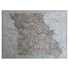
Original Antique Map of Missouri, 1889
Located in St Annes, Lancashire
Great map of Missouri Drawn and Engraved by W. & A.K. Johnston Published By A & C Black
Category

1880s Scottish Victorian Missouri Antique Map

Materials

Paper

Original Antique Map of Missouri, 1889
No Reserve
H 8 in W 11 in D 0.07 in
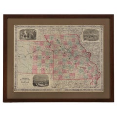
1865 "Johnson's Missouri and Kansas" Map by Johnson and Ward
Located in Colorado Springs, CO
Presented is an original 1865 "Johnson's Missouri and Kansas” map. This map was issued as pages 59
Category

Mid-19th Century Missouri Antique Map

Materials

Paper

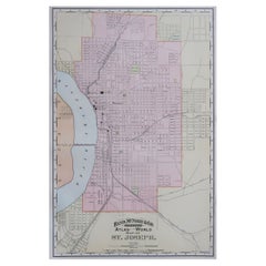
Original Antique City Plan of St Joseph, Missouri, USA, 1894
By Rand McNally & Co.
Located in St Annes, Lancashire
Fabulous colorful map of St Joseph Original color By Rand, McNally & Co. Published, 1894
Category

1890s American Missouri Antique Map

Materials

Paper

Original Antique City Plan of St Joseph, Missouri, USA, 1894
No Reserve
H 20.5 in W 13.25 in D 0.07 in
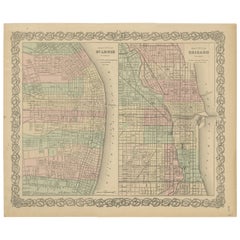
Antique Map of St. Louis and Chicago
Located in Langweer, NL
Antique map titled 'The City of St. Louis Missouri - The City of Chicago Illinois'. Dual map on
Category

Mid-19th Century Missouri Antique Map

Materials

Paper

Antique Map of St. Louis and Chicago
H 14.18 in W 17.21 in D 0.02 in
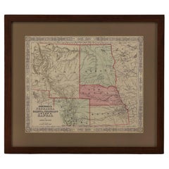
1865 "Johnson's Nebraska, Dakota, Colorado, Idaho & Kansas" Map, Johnson & Ward
Located in Colorado Springs, CO
county. Depicted but not colored are the neighboring states of Minnesota and Missouri. The map is
Category

Mid-19th Century Missouri Antique Map

Materials

Paper

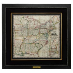
1866 Ensign & Bridgman's Rail Road Map of the United States
Located in Colorado Springs, CO
borders of Minnesota, Iowa, Missouri, Arkansas, and Louisiana. As alluded to in its title, the map
Category

1860s American Late Victorian Missouri Antique Map

Materials

Paper

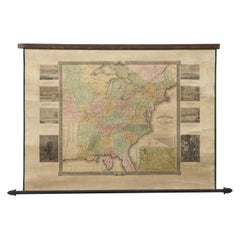
"The United States from the Latest Authorities" Antique Wall Map, 1835
Located in Colorado Springs, CO
This is a 1835 map of “The United States from the Latest Authorities” by Ezra Strong. A hand
Category

1830s American Missouri Antique Map

Materials

Paper

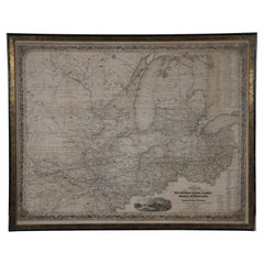
Antique 1844 J Calvin Smith JH Colton Midwest United States Survey Map 27"
By J.H. Colton
Located in Dayton, OH
Antique framed black and white map of seven Midwestern American states. Guide Through Ohio
Category

1840s Missouri Antique Map

Materials

Paper

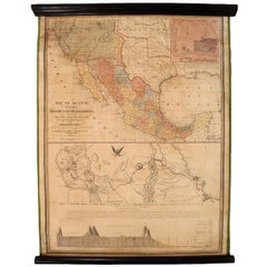
1847 Antique Map of Mexico, Texas and California by Samuel Augustus Mitchell
By Samuel Augustus Mitchell 1
Located in Colorado Springs, CO
Trader's Route to Independence, Missouri. Published in the middle of the Mexican-American War, the map
Category

1840s American Missouri Antique Map

Materials

Paper

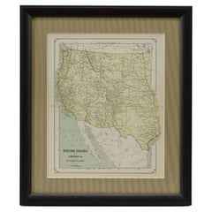
1879 "United States of America, Western Part" by O. J. Stuart
Located in Colorado Springs, CO
This colorful original map, titled “United States of America, Western Part,” was issued in Volume
Category

1870s American Missouri Antique Map

Materials

Paper

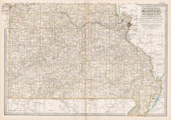
Missouri. Southern Part. USA. Century Atlas state antique vintage map
Located in Melbourne, Victoria
'The Century Atlas. Missouri. Southern Part.' Original antique map, 1903. Central fold as issued
Category

Early 20th Century Victorian Missouri Antique Map

Materials

Lithograph

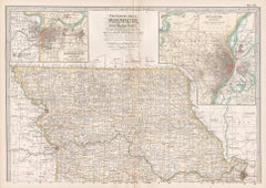
Missouri. Northern Part. USA. Century Atlas state antique vintage map
Located in Melbourne, Victoria
'The Century Atlas. Missouri. Northern Part.' Original antique map, 1903. Central fold as issued
Category

Early 20th Century Victorian Missouri Antique Map

Materials

Lithograph

A huge pair of 21 inches Cruchley Library Globes
By G.F. Cruchley
Located in ZWIJNDRECHT, NL
, published by G.F. Cruchley, map-seller & globe maker, 81 Fleet street. Signed: CRUCHLEY in London England
Category

1850s British Victorian Missouri Antique Map

Materials

Other

"Portrait of an Italian Fencer, " John Frederick Kensett, Hudson River School
By John Frederick Kensett
Located in New York, NY
engraver of labels, banknotes and maps and was employed part of that time by the American Bank Note Company
Category

1840s Hudson River School Missouri Antique Map

Materials

Watercolor, Paper

People Also Browsed

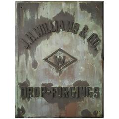
Rare 1880s Handmade Copper/Bronze Sign, Plaque "J.W.Williams Drop Forgings"
By E. N. Little & Sons 1
Located in Buffalo, NY
Rare 1880s handmade copper/bronze sign plaque "J.W.WILLIAMS DROP FORGINGS." Monumental sign/plaque salvaged from the turn of the century J W WILLIAMS factory in Brooklyn New York, ex...
Category

1880s American Industrial Missouri Antique Map

Materials

Bronze, Copper

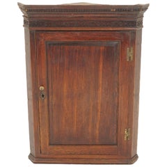
Antique Oak Hanging Corner Cabinet, Scotland 1800, H122
Located in Vancouver, BC
Antique oak hanging corner cabinet, Scotland 1800, H122 Scotland, 1800 Solid oak Original finish Moulded cornice with dentil frieze underneath Canted side panels flank a fielded pan...
Category

Early 1800s Scottish Missouri Antique Map

Materials

Oak

Antique Arts & Crafts Walnut Bookcase, Display, Glass, Scotland 1890, H1010
Located in Vancouver, BC
Antique Arts & Crafts Walnut Bookcase, Display Cabinet, Bevelled Glass, Scotland 1890, H1010 Solid Walnut Original Finish Rectangular moulded top Pair of original bevelled glass doo...
Category

1910s Scottish Missouri Antique Map

Materials

Oak

Antique Scottish Silver And Agate Brooch. Late 19th Century
Located in St Annes, Lancashire
Lovely piece of Scottish silver and agate 8 beautiful agate pieces arranged in a circular design Finely engraved silver mounts Good condition Free shipping
Category

1880s Scottish Victorian Missouri Antique Map

Materials

Agate, Silver

Pair of Antique Koch’s Chicago Porcelain Adjustable Reclining Barber Chairs
Located in New Orleans, LA
Pair Of Antique Kochs, Chicago Porcelain reclining Adjustable Barber Chairs Single pedestal swivel barbers chair on circular chrome and white enamel base with pivoting footrest, whit...
Category

1910s American Machine Age Missouri Antique Map

Materials

Steel

Antique Scottish Silver And Agate Bracelet. Late 19th Century
Located in St Annes, Lancashire
Lovely piece of Scottish silver and agate 5 large pieces of agate Finely engraved silver mounts Good condition Free shipping
Category

1880s Scottish Victorian Missouri Antique Map

Materials

Agate, Silver

Antique Walnut Single Door Display China Cabinet, Scotland 1900, H142
Located in Vancouver, BC
Antique Walnut Single Door Display China Cabinet, Scotland 1900, H142 Scotland 1900 Solid Walnut Original Finish With shaped pediment on top Above single glass door with a geometric...
Category

Early 1900s Scottish Missouri Antique Map

Materials

Walnut

1880s Odd Fellows Lodge Banner from Dakota
Located in Santa Monica, CA
Early 1880s Odd Fellows Lodge all-seeing eye banner from Centerville, Dakota. Excellent hand painting and lettering. Centerville was platted in 1883. Dakota became the states of Nort...
Category

1880s American Folk Art Missouri Antique Map

Materials

Silk

Set of 6 Modern Chicago Dining Chairs, Oak Handmade in Portugal by Greenapple
By Greenapple
Located in Lisboa, PT
Modern set of 6 Chicago Dining Chairs, Contemporary Collection, Handcrafted in Portugal - Europe by Greenapple. Wooden chairs in American Oak upholstered in grey cotton bouclé fabri...
Category

21st Century and Contemporary Portuguese Modern Missouri Antique Map

Materials

Oak, Cotton

Restored Rattan & Wicker Swivel Bar Stool w/ Iron Base, Seng of Chicago
Located in Van Nuys, CA
Rattan and wicker bar stool with swivel iron bases by Seng of Chicago. This chair features a wicker seat and back and rests in a rattan frame mounted to an iron swivel base. This de...
Category

1950s Missouri Antique Map

Materials

Rattan

Mid 19th Century Paisley Shawl in Red, Ivory, Black, Green. Orange
Located in Barrington, IL
Mid 19th Century shawl in red, ivory, black, and green was woven in Paisley, Scotland sometimes also referred to as “Piano” Shawls. The Kashmiri shawls became an extremely fashionab...
Category

Late 19th Century Scottish Missouri Antique Map

Materials

Wool

English Pub Sign, "Free House - The Lord Nelson"
Located in Austin, TX
An authentic English pub sign (one-sided) featuring a portrait painting of Lord Nelson in full regalia, entitled: Free House - The Lord Nelson. A free house in Great Britain is a pu...
Category

20th Century English Missouri Antique Map

Materials

Metal

Original Antique Map of England, Ireland, Scotland and Wales
Located in Langweer, NL
Antique map titled 'Les Isles Britanniques, ou sont les Royaumes d Angleterre (..)'. Detailed map of England, Ireland, Scotland and Wales, with French coast and part of the Netherlan...
Category

Early 18th Century Missouri Antique Map

Materials

Paper

Antique Scottish Sterling Silver Travelling Communion Set
By Hamilton & Inches Ltd.
Located in Jesmond, Newcastle Upon Tyne
An exceptional, fine and impressive antique George V Scottish sterling silver gilt travelling communion set - boxed; an addition to our Christian silverware collection This exceptio...
Category

1910s Scottish Missouri Antique Map

Materials

Sterling Silver

Large 19th Century English Oil Painting -Five Hunting Dogs- signed E. Armfield.
By Edward Armfield
Located in Vero Beach, FL
Large 19th Century English Oil Painting -Five Hunting Dogs- signed E. Armfield. Large, signed painting in oil on canvas. This Armfield features five hunting dogs in a rustic interio...
Category

19th Century English Victorian Missouri Antique Map

Materials

Canvas, Giltwood

Antique Victorian Scottish Sterling Silver Teapot Stand
By James McKay
Located in Jesmond, Newcastle Upon Tyne
An exceptional, fine and impressive antique Victorian Scottish sterling silver teapot stand; an addition to our ornamental silverware collection. This fine antique Victorian Scottis...
Category

1830s Scottish Missouri Antique Map

Materials

Sterling Silver

Recent Sales

1872 County Map of Illinois
Located in New York, NY
. The map covers the state of Illinois as well as portions of Iowa, Missouri, Kentucky and Indiana. An
Category

1870s Realist Missouri Antique Map

Materials

Engraving

Antique 1872 County Map of Illinois
1872 County Map of Illinois
H 17 in W 14 in D 1 in
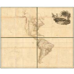
Large 1804 Hand-Colored Map of America After the Louisiana Purchase
By Aaron Arrowsmith
Located in La Jolla, CA
Fine example of Arrowsmith's map of America, in four sheets. An excellent map of America on the
Category

Early 1800s English Federal Missouri Antique Map

Materials

Paper

"History of The Expedition Under the Command of Captains Lewis and Clark" Books
By Paul Allen
Located in Houston, TX
Missouri, thence across the Rocky Mountains and down the River Columbia to the Pacific Ocean. Performed
Category

Early 19th Century American Other Missouri Antique Map

1854 Map of Partial North America, Antique Wall Map by Jacob Monk
Located in Colorado Springs, CO
"New Map of that Portion of North America, exhibiting the United States and Territories, The
Category

1850s American Missouri Antique Map

Materials

Paper

1860 Map of South Central United States by Swanston, Antique Hand-Colored Map
Located in Colorado Springs, CO
, Arkansas, Western Territory, and Part of Missouri" this map was published in The Royal Illustrated Atlas of
Category

1860s British Missouri Antique Map

Materials

Paper

1828 "Map of the United States" by T. Ensign
Located in Colorado Springs, CO
Presented is Timothy Ensign’s “Map of the United States,” published in 1828. The map is one of the
Category

1820s American Missouri Antique Map

Materials

Paper

1842 Map of Lewis and Clark's Expedition of North America
Located in Colorado Springs, CO
map’s principal impact to the cartography of the United States is its delineation of the Missouri and
Category

1840s American Missouri Antique Map

Materials

Paper

The Southern States of North America with Military Positions, Antique Map, 1861
Located in Colorado Springs, CO
1861 hand-colored map of the Southern States of North America with the Forts, Harbours & Military
Category

1860s American Missouri Antique Map

Materials

Paper

1846 Antique Map of Texas, Oregon, California, and Regions Adjoining by Mitchell
By Samuel Augustus Mitchell 1
Located in Colorado Springs, CO
between the Mississippi and the Missouri, and Wilkes map of Oregon. This map features the "Stovepipe
Category

1840s American Missouri Antique Map

Materials

Paper

1855 Pictorial Map of the United States, Pub by Ensign, Bridgman & Fanning
Located in Colorado Springs, CO
This is a large and highly decorative 1855 wall map of the United States. Issued by Ensign
Category

1850s American Missouri Antique Map

Materials

Paper

Antique Map of North America, Depicting the New World's Lakes and Rivers, 1790
Located in Colorado Springs, CO
A particular map of the American Lakes and Rivers Published in London for John Harrison This is a
Category

1790s British Missouri Antique Map

Materials

Paper

1856 a New Map of the Union with the Adjacent Islands and Countries
Located in Colorado Springs, CO
an untitled inset map of portions of Missouri, Kansas, and Nebraska. During the 1840s, the push to
Category

1850s American Missouri Antique Map

1865 Civil War Map, Showing the Marches of General W.T. Sherman 1863-1865
Located in Colorado Springs, CO
Military map showing the marches of the United States forces under command of Maj. Genl. W. T
Category

1860s Missouri Antique Map

"History of the Expedition of Captains Lewis and Clark" Limited Edition, 1904
Located in Colorado Springs, CO
Purchase, establish trade and sovereignty over the natives near the Missouri River, and claim the Pacific
Category

Early 20th Century American Missouri Antique Map

Materials

Leather, Paper

Antique Map of Missouri and Kansas by Johnson, '1872'
Located in Langweer, NL
Antique map titled 'Johnson's Missouri and Kansas'. Original map of Missouri and Kansas. This map
Category

Late 19th Century Missouri Antique Map

Materials

Paper

Original Antique Map of The American State of Missouri, 1889
Located in St Annes, Lancashire
Great map of Missouri Drawn and engraved by W. & A.K. Johnston Published By A & C Black
Category

1880s Scottish Victorian Missouri Antique Map

Materials

Paper

1844 Map of the United States, Antique Map, Featuring the Republic of Texas
Located in Colorado Springs, CO
This is Phelps and Ensign's 1844 travellers guide map of the United States, containing the roads
Category

19th Century American Missouri Antique Map

Materials

Paper

1886 Skeleton Map of the Union Pacific Railway
Located in Colorado Springs, CO
This is a promotional skeleton map of the Union Pacific Railway, touted as “the most popular
Category

1880s American Missouri Antique Map

Materials

Paper

Hand-Drawn School Girl Map of the United States, circa 1831
By Lydia Mudge
Located in Essex, MA
A wonderfully naive, yet accomplished hand-drawn school girl map of the United States, circa 1831
Category

1830s American Missouri Antique Map

Large Original Antique City Plan of St Louis, USA, circa 1900
By Rand McNally & Co.
Located in St Annes, Lancashire
Fabulous colorful map of St Louis, Missouri Original color By Rand, McNally & Co
Category

Early 1900s American Missouri Antique Map

Materials

Paper

Large Original Antique City Plan of St Louis, USA, circa 1900
Free Shipping
H 27.5 in W 20.5 in D 0.07 in
American Commonwealths, Missouri
Located in valatie, NY
Missouri, a bone of contention by Lucien Carr. Boston and New York: Houghton, Mifflin and Company
Category

Late 19th Century American Missouri Antique Map

Materials

Paper, Leather

American Commonwealths, Missouri
H 7.25 in W 5 in D 1 in
The Battle of Little Big Horn River (Custer Massacre, June 25 1876)
By William De La Montagne Cary
Located in Missouri, MO
issue has a map of the battlefield. There are very few, if any holdings of this extremely scarce 19th
Category

19th Century Missouri Antique Map

Materials

Lithograph

Great 1846 Wall Map of the United States
Located in North Beninngton, VT
It's Indian territory west of Missouri. The west half of Iowa is marked with Indian names such as
Category

1840s American Missouri Antique Map

1825 Engraved H/C Map CARTE DE L'AMERIQUE SEPTENTRIONALE Adrien-Hubert Brué
Located in Gallatin, TN
Description Antique Early 19th Century Hand-colored Engraved Map of North America by Andre Hubert
Category

19th Century Missouri Antique Map

Materials

Engraving

Monumental Pair of Cary's Library Globes
Located in New York, NY
, ending in spade feet on brass casters. The terrestrial globe is mapped with detailed
Category

19th Century English Missouri Antique Map

Materials

Mahogany

Get Updated with New Arrivals
Save "Missouri Antique Map", and we’ll notify you when there are new listings in this category.

Missouri Antique Map For Sale on 1stDibs

Choose from an assortment of styles, material and more with respect to the missouri antique map you’re looking for at 1stDibs. Each missouri antique map for sale was constructed with extraordinary care, often using paper, mahogany and wood. You’ve searched high and low for the perfect missouri antique map — we have versions that date back to the 19th Century alongside those produced as recently as the 20th Century are available. A missouri antique map, designed in the Victorian style, is generally a popular piece of furniture. G.F. Cruchley's, Rand McNally & Co. and Samuel Augustus Mitchell each produced at least one beautiful missouri antique map that is worth considering.

How Much is a Missouri Antique Map?

The average selling price for a missouri antique map at 1stDibs is $279, while they’re typically $25 on the low end and $238,935 for the highest priced.

Read More

Pamela Shamshiri Shares the Secrets behind Her First-Ever Book and Its Effortlessly Cool Interiors

The sought-after designer worked with the team at Hoffman Creative to produce a monograph that beautifully showcases some of Studio Shamshiri's most inspiring projects.

Moroccan Artworks and Objects Take Center Stage in an Extraordinary Villa in Tangier

Italian writer and collector Umberto Pasti opens the doors to his remarkable cave of wonders in North Africa.

Montecito Has Drawn Royalty and Celebrities, and These Homes Are Proof of Its Allure

Hollywood A-listers, ex-pat aristocrats and art collectors and style setters of all stripes appreciate the allure of the coastal California hamlet — much on our minds after recent winter floods.

Whaam! Blam! Pow! — a New Book on Pop Art Packs a Punch

Publishing house Assouline and writer Julie Belcove have teamed up to trace the history of the genre, from Roy Lichtenstein, Andy Warhol and Yayoi Kusama to Mickalene Thomas and Jeff Koons.

The Sparkling Legacy of Tiffany & Co. Explained, One Jewel at a Time

A gorgeous new book celebrates — and memorializes — the iconic jeweler’s rich heritage.

What Makes a Gem-Encrusted Chess Set Worth $4 Million?

The world’s most opulent chess set, weighing in at 513 carats, is literally fit for a king and queen.

Tauba Auerbach’s Geometric Pop-Up Book Is Mighty Rare, Thanks to a Hurricane

This sculptural art book has an epic backstory of its own.

Step inside the Storied Mansions of Palm Beach’s Most Effervescent Architect

From Spanish-style courtyards to fanciful fountains, these acclaimed structures abound in surprising and elegant details.