Items Similar to 1865 "Johnson's Missouri and Kansas" Map by Johnson and Ward


Want more images or videos?
Request additional images or videos from the seller
1 of 10
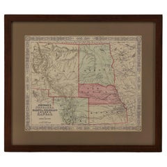
1865 "Johnson's Missouri and Kansas" Map by Johnson and Ward
About the Item
Presented is an original 1865 "Johnson's Missouri and Kansas” map. This map was issued as pages 59 and 60 in the 1865 edition of “Johnson's New Illustrated (Steel Plate) Family Atlas.” The map is engraved, with attractive hand coloring and a decorative strapwork border. The states of Kansas and Missouri are outlined in pink and colored by county. Depicted but not colored are the neighboring states of Iowa, Illinois, and Arkansas. The map is beautifully detailed, with railroads, roads, rivers and creeks, and important cities and towns all marked. The "Osages" tribe is labeled in the lower 1/8 of Kansas. There is very little development in western Kansas. There are three inset vignette illustrations of "Spearing Fish," "Santa Fe from the Great Missouri Trail," and "Fire on the Prairie."
This 1865 Johnson and Ward publication of “Johnson's New Illustrated (Steel Plate) Family Atlas” was written by Richard Swainson Fisher, M.D. Fisher was also the author of "Colton's General Atlas of the World," "The Gazetteer of the United States," and a past editor of the Journal of American Geographical and Statistical Society. The publishing company of Johnson and Ward was a successor to Johnson and Browning, themselves a successor to the famous publishing company, J. H. Colton and Company. A combination of both new plates and older, updated ones, all of the maps in this atlas were compiled, drawn, and engraved under the supervision of J. H. Colton and A. J. Johnson. The new plates, copyrighted by A.J. Johnson, were made exclusively for Johnson's New Illustrated Family Atlas. Others are the same as used in "Colton's General Atlas."
This early 1865 issued atlas offered a really unique and timely snapshot of the United States just after the Civil War. In addition to the maps, the atlas had several pages of American history, recent federal census data, and geographical and statistical notes. The highlight was its “Chronological History of the Civil War in America” with battle records and dates. It also contained updates on the assassination of Abraham Lincoln and subsequent pursuit and death of John Wilkes Booth and included two Civil War-era maps, one of the “Vicinity of Richmond and Peninsular Campaign in Virginia” and the “New Military Map of the United States.”
Condition: Fine condition overall. Hand Colored. Page 59 and 60 from Johnson's New Illustrated (Steel Plate) Family Atlas. Strapwork border. Colored by county in Kansas and Missouri. Uncolored in neighboring states of Iowa, Illinois, Arkansas. Toning, few areas of foxing.
- Dimensions:Height: 23 in (58.42 cm)Width: 29 in (73.66 cm)Depth: 0.75 in (1.91 cm)
- Materials and Techniques:
- Period:
- Date of Manufacture:1865
- Condition:Additions or alterations made to the original: Archivally framed with acid-free mats, UV conservation clear glass, and a custom wooden frame. Framed by Rio Grande Framing Co in Colorado Springs, CO in October of 2023. Wear consistent with age and use. Toning, few areas of foxing.
- Seller Location:Colorado Springs, CO
- Reference Number:
About the Seller
4.9
Platinum Seller
These expertly vetted sellers are 1stDibs' most experienced sellers and are rated highest by our customers.
Established in 2010
1stDibs seller since 2011
400 sales on 1stDibs
Typical response time: <1 hour
- ShippingRetrieving quote...Ships From: Colorado Springs, CO
- Return PolicyA return for this item may be initiated within 10 days of delivery.
More From This SellerView All
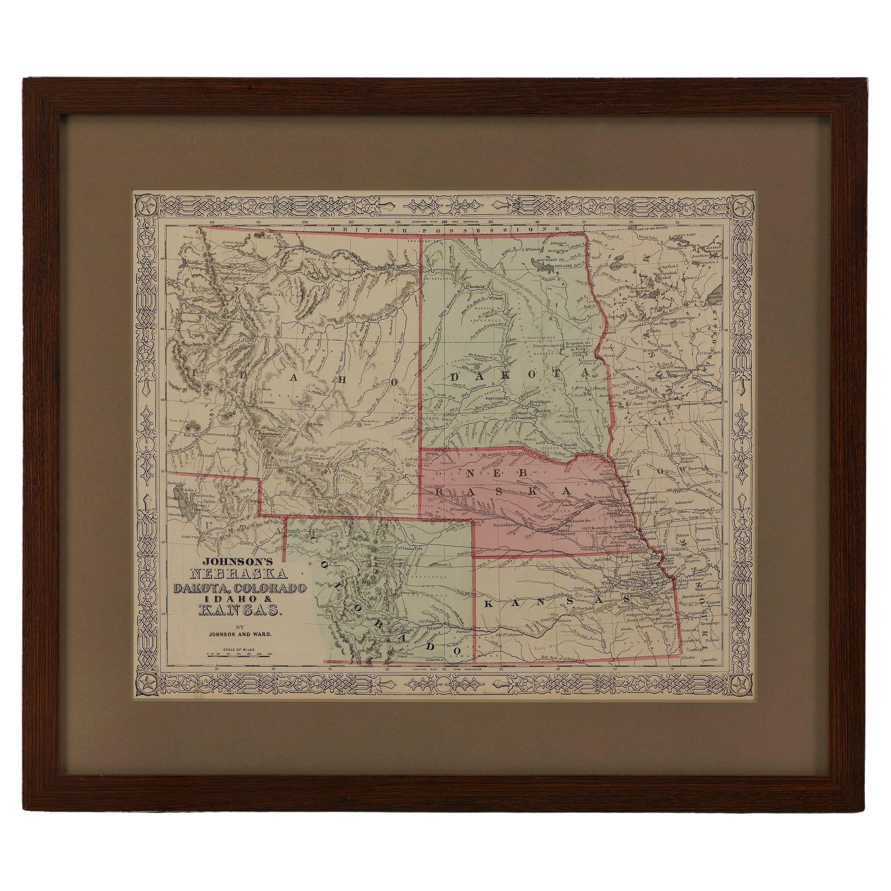
- 1865 "Johnson's Nebraska, Dakota, Colorado, Idaho & Kansas" Map, Johnson & WardLocated in Colorado Springs, COPresented is an original 1865 "Johnson's Nebraska, Dakota, Colorado, Idaho & Kansas” map. This map was issued as page 63 in the 1865 edition of “Johnson's N...Category
Antique Mid-19th Century Maps
MaterialsPaper
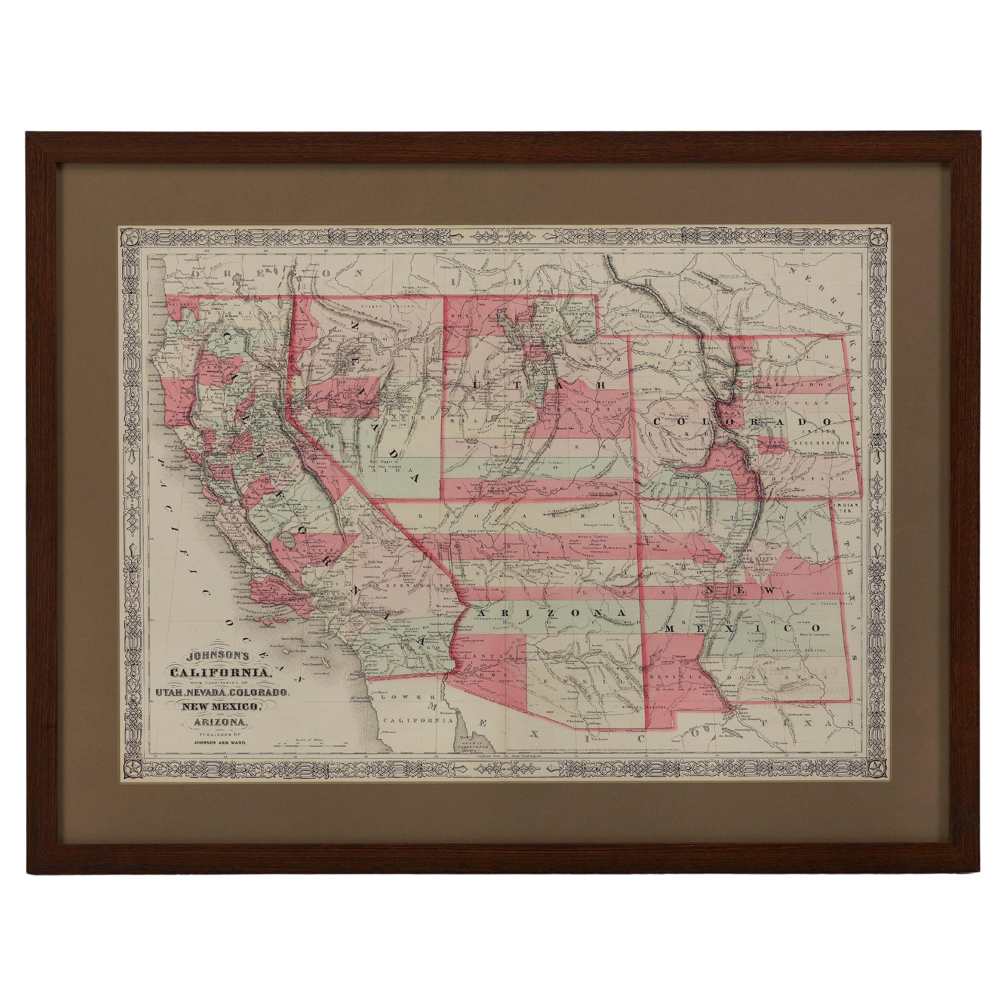
- 1865 "Johnson's California, Utah, Nevada, Colorado, New Mexico, Arizona" MapLocated in Colorado Springs, COPresented is an original 1865 "Johnson's California, with Territories of Utah, Nevada, Colorado, New Mexico, and Arizona” map. First published in 1864, thi...Category
Antique Mid-19th Century Maps
MaterialsPaper
- 1859 "Colton's New Map of the State of Texas..." by Johnson & BrowningLocated in Colorado Springs, COPresented is "Colton's New Map of the State of Texas Compiled from De Cordova's Large Map", published in Alivin J. Johnson’s “New Illustrated Family Atlas.” The map was published in ...Category
Antique 1850s American Maps
MaterialsPaper
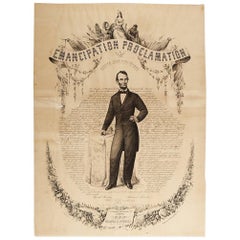
- 1865 Emancipation Proclamation, Antique Lithograph by P.S. Duval and SonLocated in Colorado Springs, COPresented is a lithographic broadside of the text of the Emancipation Proclamation issued on January 1, 1863. This broadside was published in...Category
Antique 1860s American Historical Memorabilia
MaterialsPaper
- "Lady Washington's Reception, " Engraved by A. H. Ritchie, Antique Print, 1865Located in Colorado Springs, COThis 1865, hand-colored engraving by A. H. Ritchie is entitled Lady Washington's Reception and is based on Daniel F. Huntington's original painting "Th...Category
Antique 1860s American Prints
MaterialsPaper
- 1907 Map of Colorado, Antique Topographical Map, by Louis NellLocated in Colorado Springs, COThis highly detailed pocket map is a topographical map of the state of Colorado by Louis Nell from 1907. The map "has been complied from all availabl...Category
Antique Early 1900s American Maps
MaterialsPaper


You May Also Like
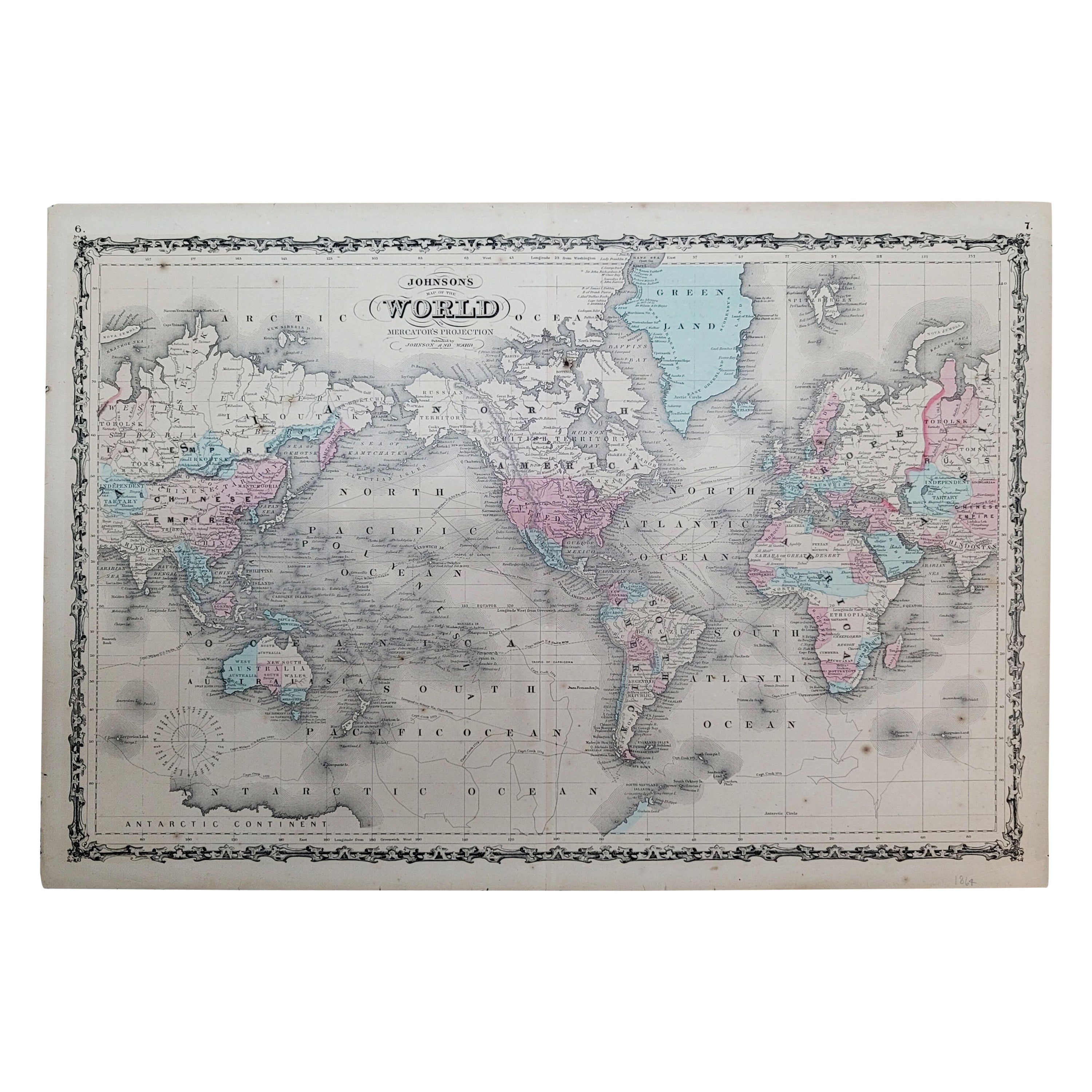
- 1864 Johnson's Map of the World on Mercator's Projection, Ric.B009Located in Norton, MAAn 1864 Johnson's map of the World on Mercator's Projection Ric.b009 About this Item "This antique map came from Johnson's New Illustrated (Steel Plate) Family Atlas, publ...Category
Antique 19th Century Dutch Maps
MaterialsPaper
- Original Antique Map of Missouri, 1889Located in St Annes, LancashireGreat map of Missouri Drawn and Engraved by W. & A.K. Johnston Published By A & C Black, Edinburgh. Original colour Unframed.Category
Antique 1880s Scottish Victorian Maps
MaterialsPaper

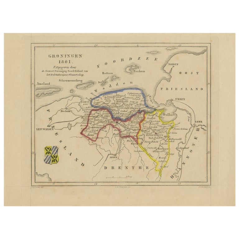
- Antique Map of Groningen by Veelwaard, c.1865Located in Langweer, NLAntique map titled 'Groningen 1861'. Map of Groningen, the Netherlands. Published by 'Gewest. Vereeniging Noord Holland van het Ned. Onderwijzers-Genootschap'. Artists and Engravers:...Category
Antique 19th Century Maps
MaterialsPaper
- Antique Map of England and Wales by A.K. Johnston, 1865Located in Langweer, NLAntique map titled 'England and Wales (Southern Sheet)'. With an inset map of the Scilly Islands. This map originates from the ‘Royal Atlas of Modern Geography’ by Alexander Keith Jo...Category
Antique Mid-19th Century Maps
MaterialsPaper
- Antique Map of China and Japan by A.K. Johnston, 1865Located in Langweer, NLAntique map titled 'China and Japan'. Depicting Eastern China, the Islands of Japan and more. This map originates from the ‘Royal Atlas of Modern Geography’ by Alexander Keith Johnst...Category
Antique Mid-19th Century Maps
MaterialsPaper
- Antique Map of China and Japan by Johnson, 1872Located in Langweer, NLAntique map titled 'Johnson's China and Japan'. Map of China and Japan, with an inset map of the vicinity of Canton and Hong Kong. This map originates from 'Johnson's New Illustrated...Category
Antique Late 19th Century Maps
MaterialsPaper