Antique Maps North Carolina
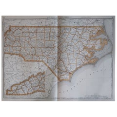
Large Original Antique Map of North Carolina, USA, 1894
By Rand McNally & Co.
Located in St Annes, Lancashire
Fabulous map of North Carolina
Original color
By Rand, McNally & Co.
Published, 1894
Category
1890s American Antique Maps North Carolina
Materials
Paper
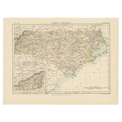
Antique Map of North Carolina, with inset map of the western part
Located in Langweer, NL
Antique map titled 'North Carolina'. Original antique map of North Carolina, United States. With
Category
Late 19th Century Antique Maps North Carolina
Materials
Paper
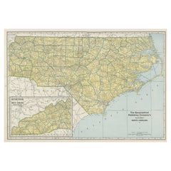
Colourful Old Detailed Map of Northern Carolina, United States of America
Located in Langweer, NL
Vintage map titled 'The Geographical Publishing Company's Premier Map of North Carolina'. Beautiful
Category
Early 20th Century Antique Maps North Carolina
Materials
Paper
H 15.56 in W 21.46 in D 0.02 in
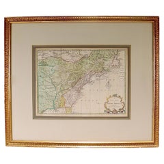
New Map of North America from the Latest Discoveries, 1763
Located in Philadelphia, PA
A fine antique 18th century map of the North American seaboard.
Entitled "A New Map of North
Category
Mid-18th Century English Georgian Antique Maps North Carolina
Materials
Paper
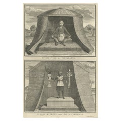
Engraving of Idols of Secotam Village in Virginia 'or now North Carolina', 1721
Located in Langweer, NL
Two religious images on one plate. Upper image 'Kiwasa idole des Virginiens'.
Kiwasa, this Idol is placed in the temple of the town of Secotam, as the keeper of the king's dead c...
Category
1720s Antique Maps North Carolina
Materials
Paper
H 13.98 in W 9.45 in D 0 in
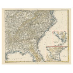
Antique Map of the Region of Georgia with Inset Maps of Florida and Texas
Located in Langweer, NL
Antique map of part of the United States showing Alabama, Georgia, North Carolina, South Carolina
Category
Late 19th Century Antique Maps North Carolina
Materials
Paper
H 15.04 in W 18.63 in D 0.02 in
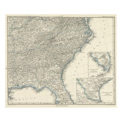
Antique Map of Tennessee, Kentucky, Virginia, Alabama, Georgia and Surroundings
Located in Langweer, NL
Antique map of part of the United States showing Alabama, Georgia, North Carolina, South Carolina
Category
Mid-19th Century Antique Maps North Carolina
Materials
Paper
Free Shipping
H 15.16 in W 18.71 in D 0.02 in
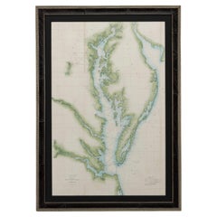
1856 U.S. Coast Survey Map of Chesapeake Bay and Delaware Bay
Located in Colorado Springs, CO
from 1856. The map depicts the region from Susquehanna, Maryland to the northern Outer Banks in North
Category
1850s American Antique Maps North Carolina
Materials
Paper
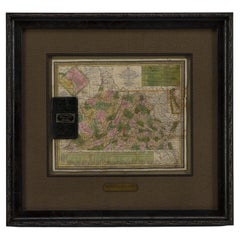
1837 Mitchell's "Tourist's Pocket Map of the State of Virginia" by J.H. Young
Located in Colorado Springs, CO
Ferry, Fredericksburg to Richmond, Petersburg to North Carolina, and Portsmouth to North Carolina.
The
Category
1830s American Antique Maps North Carolina
Materials
Paper
H 24.25 in W 25.75 in D 1.75 in
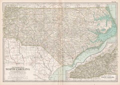
North Carolina. USA. Century Atlas state antique vintage map
Located in Melbourne, Victoria
'The Century Atlas. North Carolina'
Original antique map, 1903.
Central fold as issued. Map name
Category
Early 20th Century Victorian Antique Maps North Carolina
Materials
Lithograph
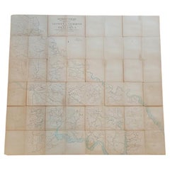
Important Confederate Field Map of Richmond VA 1864 with Provenance
Located in Dallas, TX
.
The Surrender/Parole Paper reads:
“Greensboro, North Carolina
May 1st 1865
In accordance with the
Category
Mid-19th Century American American Classical Antique Maps North Carolina
Materials
Canvas, Paper
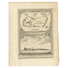
Antique Print of Bunce Island an Island in the Sierra Leone River, 1748
By Jakob van der Schley
Located in Langweer, NL
Island was the departure point for thousands of slaves for the North American colonies of South Carolina
Category
18th Century Antique Maps North Carolina
Materials
Paper
Satyr and Pan, Life Magazine Cover
By B. Cory Kilvert
Located in Fort Washington, PA
several mural-sized pictorial maps, including one for the Pinehurst Country Club in North Carolina
Category
1920s Other Art Style Antique Maps North Carolina
Materials
Oil, Board
Kellogg's Corn Flakes Advertisement
By B. Cory Kilvert
Located in Fort Washington, PA
maps, including one for the Pinehurst Country Club in North Carolina.
Kilvert complemented his
Category
1910s Other Art Style Antique Maps North Carolina
Materials
Board, Gouache, Watercolor
English Pocket Globe, London, Circa 1775-1798
By Herman Moll
Located in Milano, IT
globe is made up of twelve printed paper gores aligned and glued to the sphere.
In the North Pacific
Category
Late 18th Century English George III Antique Maps North Carolina
Materials
Shagreen, Paper
A truly delightful miniature terrestrial pocket globe
By Nathaniel Mills
Located in ZWIJNDRECHT, NL
). There is some slight loss to a portion of North America, and there is a crack to the northern portion of
Category
Mid-18th Century British Dutch Colonial Antique Maps North Carolina
Materials
Other
General William Tecumseh Sherman Autograph
Located in Dallas, TX
surrendered to General Sherman at Greensboro, North Carolina on the 1st May 1865.
We have his surrender
Category
Late 19th Century American American Classical Antique Maps North Carolina
Materials
Paper
Sir Francis Bacon: 18th C. Portrait of Philosopher, Scientist, Author, Statesman
By Jacobus Houbraken
Located in Alamo, CA
rolled manuscript and a compass for measuring distances on a map on the left.
Francis Bacon (1561-1626
Category
1730s Antique Maps North Carolina
Materials
Engraving
Ecce Homo Plate X
By Werner Drewes
Located in Fairlawn, OH
participated in group shows held by Société Anonyme (at Black Mountain College in North Carolina) and the
Category
1920s Bauhaus Antique Maps North Carolina
Materials
Woodcut
Ecce Homo VII
By Werner Drewes
Located in Fairlawn, OH
participated in group shows held by Société Anonyme (at Black Mountain College in North Carolina) and the
Category
1920s Expressionist Antique Maps North Carolina
Materials
Woodcut
People Also Browsed
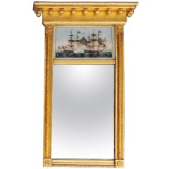
American Classical Eglomise Gilt Mirror with Rope and Medallion Carvings C. 1815
Located in Hollywood, SC
American Classical gilt carved wood eglomise mirror with decorative sphere, medallion, and rope carvings, and painted eglomise of American frigate ships at war. Mirror retains the o...
Category
1810s American American Empire Antique Maps North Carolina
Materials
Glass, Giltwood, Paint
H 29.5 in W 19.25 in D 3.5 in
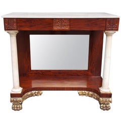
American Mahogany and Gilt Marble Pier Table , Philadelphia Circa 1815
Located in Hollywood, SC
American mahogany marble top pier table with carved acanthus floral edge, marble corner columns, original mirror, and terminating on gilded carved floral lions paw feet. Philadelphi...
Category
1810s American American Empire Antique Maps North Carolina
Materials
Marble
Large Original Antique Map of South Carolina, USA, 1894
By Rand McNally & Co.
Located in St Annes, Lancashire
Fabulous map of South Carolina
Original color
By Rand, McNally & Co.
Published, 1894
Unframed
Free shipping.
Category
1890s American Antique Maps North Carolina
Materials
Paper
Elegant American Mahogany Satinwood Inlaid Corner Cupboard, Va , Circa 1800
Located in Hollywood, SC
American Mahogany elegant corner cupboard with a centered urn scrolled inlaid pediment, original upper flanking glass hinged doors, fitted interior butterfly shelving, single centere...
Category
Early 1800s American American Colonial Antique Maps North Carolina
Materials
Brass
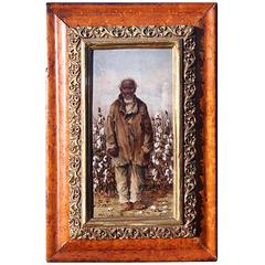
A Cotton Picker - Realist Figurative Oil Painting by William Aiken Walker
By William Aiken Walker
Located in Marlow, Buckinghamshire
Signed figurative oil on board circa 1900 by American Realist painter William Aiken Walker. The work depicts an African American South Carolina gentleman smoking a pipe while she pic...
Category
Early 20th Century American Realist Antique Maps North Carolina
Materials
Board, Oil
American Federal Mahogany Tall Case Clock, Silas Hoadley, CT, Circa 1820
By Silas Hoadley
Located in Hollywood, SC
American Federal mahogany one day tall case clock with the original brass ball finials resting on three carved upper capitals, decorative intertwined fret work, arched hood with bras...
Category
1820s American Federal Antique Maps North Carolina
Materials
Brass
H 91.75 in W 20 in D 10.5 in
American Brilliant Cut Glass Pitcher, circa 1900
Located in New York, NY
American brilliant cut glass pitcher, circa 1900.
Category
Early 20th Century American Antique Maps North Carolina
Materials
Cut Glass
A Cotton Picker - Realist Figurative Oil Painting by William Aiken Walker
By William Aiken Walker
Located in Marlow, Buckinghamshire
Signed figurative oil on board circa 1900 by American Realist painter William Aiken Walker. The work depicts an African American South Carolina lady smoking a pipe while she picks co...
Category
Early 20th Century American Realist Antique Maps North Carolina
Materials
Board, Oil
Primitive Antique 19th C. Oak Carpenters Tool Chest Trunk Dovetailed Steamer 26"
Located in Dayton, OH
A charming late 19th century tool chest from M.J. Gallagher of North Carolina, Dated 1888. The trunk appears to be a carpenter or machinists trunk but could have also been used in mi...
Category
1880s Rustic Antique Maps North Carolina
Materials
Oak
H 10 in W 25.5 in D 14 in
North Carolina Wood Blanket Chest, 19th C.
Located in New York, NY
This charming antique blanket chest, crafted in North Carolina during the 19th century, embodies the rustic charm and functionality of American furniture. Its spacious interior, acce...
Category
19th Century American Antique Maps North Carolina
Materials
Metal
Early American Federal Period Flame Mahogany Antique Wash Stand
Located in Forney, TX
A rare and stunning Federal period (1789-1823) early American flame mahogany wash stand. circa 1810
Exquisitely hand-crafted in the Northeastern United States in the early 19th cent...
Category
Early 19th Century American Federal Antique Maps North Carolina
Materials
Brass
Landing of General Lafayette Staffordshire Plate by James & Ralph Clews
By Ralph & James Clews
Located in valatie, NY
Landing of General Lafayette Staffordshire Plate by James and Ralph Clews, circa 1830. This deep blue Staffordshire plate is made of white earthenware with a blue transfer. It was ma...
Category
Early 19th Century English Antique Maps North Carolina
Materials
Earthenware
Lake George, State of New York Staffordshire Platter by Enoch Wood & Sons
By Enoch Wood & Sons
Located in valatie, NY
Lake George, State of New York Platter by Enoch Wood and Sons, circa 1830. This handsome deep blue Staffordshire platter is made of white earthenware with a blue transfer. It was mad...
Category
Early 19th Century English Antique Maps North Carolina
Materials
Earthenware
H 13 in W 16.75 in D 1.75 in
Yerba Buena by Vanderslice Sterling Silver Flatware Set 41 Pcs California Silver
By W. K. Vanderslice & Company
Located in Big Bend, WI
Rare "Yerba Buena" by Vanderslice circa 1865 California Silver Flatware set of 41 pieces. This set includes:
Six dinner size knives with sterling ferrules and mother-of-pearl Handl...
Category
Mid-19th Century Antique Maps North Carolina
Materials
Sterling Silver
H 1 in W 1 in D 1 in
'The Bell Founders' - A Sculptural Jardiniere By Louis Albert-Lefeuvre
By Albert Lefeuvre
Located in Brighton, West Sussex
A Gilt and Pewter Patinated Bronze Sculptural Jardiniere, Entitled 'The Bell Founders Of The Middle Ages', Cast By The Siot Decauville Foundry, Paris, From The Model By Louis Albert-...
Category
19th Century French Antique Maps North Carolina
Materials
Bronze, Pewter
H 18.9 in W 17.72 in D 12.6 in
Landing of General Lafayette Staffordshire Platter by James & Ralph Clews
By Ralph & James Clews
Located in valatie, NY
Landing of General Lafayette Staffordshire Platter by James and Ralph Clews circa 1830. This deep blue Staffordshire platter is made of white earthenware with a blue transfer. It was...
Category
Early 19th Century English Antique Maps North Carolina
Materials
Earthenware
H 11.75 in W 15.25 in D 1.25 in
Recent Sales
Painting of a Cotton Picker by William Aiken Walker
By William Aiken Walker
Located in Alexandria, VA
the Blue Ridge Mountains of North Carolina, to Florida, to New Orleans, and wherever he traveled, he
Category
1870s American Antique Maps North Carolina
Materials
Composition
Moll's Famous "Beaver Map"
Located in San Francisco, CA
scenes added in lower portion, including "A Map of the Improved Part of Carolina", "A Map of the
Category
18th Century and Earlier English Antique Maps North Carolina
Map of Appomattox Court House, Antique Map from Surveys, 1867
Located in Colorado Springs, CO
. This extensively surveyed and informative map extends south to Evergreen Station and north to the Bent
Category
1860s American Antique Maps North Carolina
Materials
Paper
1865 "Johnson's Kentucky and Tennessee" Map by Johnson and Ward
Located in Colorado Springs, CO
Arkansas, Illinois, Alabama, Georgia, North Carolina, Virginia, Ohio, and Indiana. The map is beautifully
Category
Mid-19th Century Antique Maps North Carolina
Materials
Paper
Florida and Virginia: A 17th Century Hand-colored Map by Hondius after Mercator
By Gerard Mercator
Located in Alamo, CA
most desirable early small maps of the American Southeast, it covers the eastern coast of North America
Category
Early 17th Century Dutch Antique Maps North Carolina
Materials
Paper
H 6.75 in W 8.63 in D 0.13 in
1833 Map of Eastern North & South Carolina, Printed in 1844
Located in Chapel Hill, NC
1833 Map of Eastern North & South Carolina, printed in 1844 by Baldwin & Cradock, London. This
Category
Mid-19th Century English Georgian Antique Maps North Carolina
Materials
Paper
An Early Map of Florida and the Carolinas by Seligmann
Located in Downingtown, PA
An Early Map after Mark Catesby by Johann Michael Seligmann of South Eastern North America
Category
18th Century and Earlier German Antique Maps North Carolina
"The Awakening, " An Extremely Rare & Graphic Women's Suffrage Map, circa 1915
Located in York County, PA
Florey (2013, McFarland & Co., North Carolina), p. A8.
Mounting: The map was mounted on acid-free
Category
1910s American Antique Maps North Carolina
Materials
Paper
H 21 in W 28 in D 2 in
"Southern Gentleman" Unusal White Subject. Known for his African American
By William Aiken Walker
Located in San Antonio, TX
in the winter and the mountains of North Carolina in the summer, where he executed View from Revd
Category
1870s Realist Antique Maps North Carolina
Materials
Oil
American Revenue Cutter Service Ensign Belonging To Capt. W. H. Bagley
Located in York County, PA
1829-1845. The letter dated June 12, 1829 is from Elijah Dickinson in Wilmington, North Carolina. The
Category
1870s American Antique Maps North Carolina
H 53.75 in W 81.25 in D 2.5 in
Antique Map of North Carolina and South Carolina by Johnson, 1872
Located in Langweer, NL
Antique map titled 'Johnson's North Carolina and South Carolina'. Original map of North Carolina
Category
Late 19th Century Antique Maps North Carolina
Materials
Paper
Very Detailed Old Map of North Carolina, United States
Located in Langweer, NL
Antique map titled 'Colton's North Carolina'. Detailed map of North Carolina, colored by counties
Category
Mid-19th Century Antique Maps North Carolina
Materials
Paper
Original Antique Map of The American State of North Carolina, 1889
Located in St Annes, Lancashire
Great map of North Carolina
Drawn and engraved by W. & A.K. Johnston
Published By A & C Black
Category
1880s Scottish Victorian Antique Maps North Carolina
Materials
Paper
No Reserve
H 8 in W 11 in D 0.07 in
Large Original Antique Map of North Carolina by Rand McNally, circa 1900
By Rand McNally & Co.
Located in St Annes, Lancashire
Fabulous monochrome map with red outline color
Original color
By Rand, McNally & Co
Category
Early 1900s American Edwardian Antique Maps North Carolina
Materials
Paper
Free Shipping
H 20.5 in W 27.5 in D 0.07 in
Antique Map of the British Colonies in North America by Homann Heirs, 1756
Located in Langweer, NL
Scarce first edition of this fine early map of the British Colonies in North America at the outset
Category
Mid-18th Century Antique Maps North Carolina
Materials
Paper
H 21.07 in W 24.61 in D 0.02 in
Antique Map of the United States of North America ‘East’ by A.K. Johnston, 1865
Located in Langweer, NL
, Alabama, Florida, Virginia, North Carolina, South Carolina, Tennessee, Kentucky, Ohio and more. This map
Category
Mid-19th Century Antique Maps North Carolina
Materials
Paper
H 24.41 in W 19.1 in D 0.02 in
A Rare French Engraved Map of The Southeastern United States. R.Bonne Circa 1780
By Rigobert Bonne
Located in Hollywood, SC
, North Carolina, South Carolina, and Georgia. Rigobert Bonne, Paris Circa 1780. Plate measures 8.75
Category
1780s French Louis XVI Antique Maps North Carolina
Materials
Paper, Wood
H 16.5 in W 21 in D 1 in
Florida and Virginia: A 17th Century Hand-colored Map by Hondius after Mercator
By Gerard Mercator
Located in Alamo, CA
most desirable early small maps of the American Southeast, it covers the eastern coast of North America
Category
Early 17th Century Antique Maps North Carolina
Materials
Engraving
The Atlantic Ocean, Americas, Africa and Europe: Hand-colored 18th C. Bowen Map
Located in Alamo, CA
Collection of Voyages and Travels". The map depicts the eastern coast of North America from northern Canada
Category
Mid-18th Century Old Masters Antique Maps North Carolina
Materials
Engraving
Pensacola - Original Etching 1769
By Dominic Serres
Located in Roma, IT
Pensacola in the late XVIII century, described the Floridian city in his "Travels Through North and South
Category
1790s Old Masters Antique Maps North Carolina
Materials
Etching
Wall Map of North Carolina
By J.H. Colton
Located in New York, NY
J.H. Colton
"A New Topographical Map of the Eastern Portion of the State of North Carolina
Category
19th Century American Antique Maps North Carolina
Materials
Lithograph
1778 Map of Plans of Cities and Harbours. including Havana, Cuba."
By Thomas Conder
Located in New York, NY
Original 1779 sheet with five maps of harbors in North America. Includes four related leaves of
Category
1770s Realist Antique Maps North Carolina
Materials
Engraving
Get Updated with New Arrivals
Save "Antique Maps North Carolina", and we’ll notify you when there are new listings in this category.
Antique Maps North Carolina For Sale on 1stDibs
Choose from an assortment of styles, material and more with respect to the antique maps north carolina you’re looking for at 1stDibs. Frequently made of paper, animal skin and shagreen, every antique maps north carolina was constructed with great care. There are many kinds of the antique maps north carolina you’re looking for, from those produced as long ago as the 18th Century to those made as recently as the 20th Century. An antique maps north carolina is a generally popular piece of furniture, but those created in Georgian styles are sought with frequency. You’ll likely find more than one antique maps north carolina that is appealing in its simplicity, but Herman Moll and Rand McNally & Co. produced versions that are worth a look.
How Much is a Antique Maps North Carolina?
The average selling price for an antique maps north carolina at 1stDibs is $628, while they’re typically $80 on the low end and $9,853 for the highest priced.
More Ways To Browse
Dior Bowling Bag
Bien U
Confederacy Painting
G C Campbell
Stock Charts
Charles Beale
South Carolina Maps
Map Southampton
Map Of South Carolina
Map Of New Orleans
Traveling Lap Desk Box
Antique Maps Of Kentucky
South Carolina Map
W F Wright Art
New Orleans Maps
Constellation Calendar
Mission Secretary Desk
Addison House
