World Map British Empire
4
to
3
53
12
26
21
18
17
16
12
12
10
7
6
5
5
4
3
3
2
2
2
2
2
1
1
1
1
1
1
1
1
2
2
1
1
1
Sort By
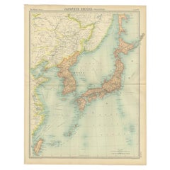
Antique Political Map of the Japanese Empire, 1922
Located in Langweer, NL
Antique map of Japan titled 'Japanese Empire - Political Map'. Old map of Japan depicting Japan
Category
20th Century Maps
Materials
Paper
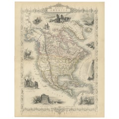
Victorian Visions of the New World: A Detailed Tallis Map of North America, 1851
Located in Langweer, NL
ownership over diverse territories.
The series including maps of various parts of the British Empire and
Category
Antique 1850s Maps
Materials
Paper
H 14.26 in W 10.71 in D 0 in
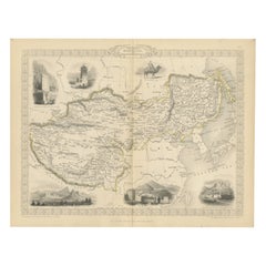
Empires of the East: An Ornate Tallis Map of Tibet, Mongolia, and Manchuri, 1851
Located in Langweer, NL
, areas of great interest during the British Empire's expansion, though not directly controlled by the
Category
Antique 1850s Maps
Materials
Paper
H 10.71 in W 14.26 in D 0 in
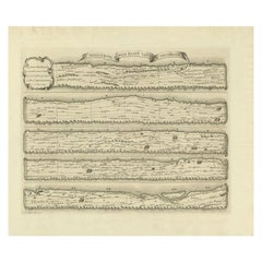
Antique Map Made After a Roman Papyrus Travel Map, Known as Peutinger Map, 1773
Located in Langweer, NL
century that contained a copy of the world map originally prepared by Agrippa during the reign of the
Category
Antique 18th Century Maps
Materials
Paper
H 15.56 in W 18.51 in D 0 in
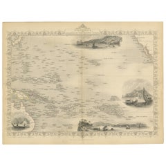
Map of Polynesia Highlighting Cultural Landscapes and Maritime Activities, 1851
Located in Langweer, NL
world in transition, showing how the British saw their empire and its global context. These maps remain
Category
Antique 1850s Maps
Materials
Paper
H 10.71 in W 14.26 in D 0 in
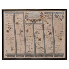
Road Map, John Ogilby, No 54, London, Yarmouth, Britannia
By John Ogilby
Located in BUNGAY, SUFFOLK
Bassett and Richard Chiswell to their edition of John Speed's 'Theatre of the Empire of Great Britain
Category
Antique 1670s English Baroque Maps
Materials
Paper
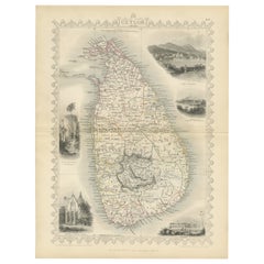
19th Century Illustrated Map of Ceylon (Sri Lanka) with Notable Landmarks
Located in Langweer, NL
fine example of their work. Ceylon was an important British colony at the time, and maps like these
Category
Antique 1850s Maps
Materials
Paper
H 14.26 in W 10.71 in D 0 in
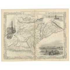
An Illustrated Map of Kabul, Punjab, and Baluchistan by Tallis, 1851
Located in Langweer, NL
British imperialism and the public's curiosity about the empire's territories.
These maps are more than
Category
Antique 1850s Maps
Materials
Paper
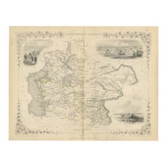
Map of Independent Tartary with Vignettes of the Region's Culture, 1851
Located in Langweer, NL
and political divisions of an area of considerable interest to the British Empire and other European
Category
Antique 1850s Maps
Materials
Paper
No Reserve
H 10.71 in W 14.26 in D 0 in
Mid-19th Century Decorative Map of Asia with Cultural and Natural Vignettes
Located in Langweer, NL
Martin, known for his works on the British Empire, likely provided the textual descriptions accompanying
Category
Antique 1850s Maps
Materials
Paper
H 10.71 in W 14.26 in D 0 in
A Decorative Map of Nova Scotia and Newfoundland by John Tallis, 1851
Located in Langweer, NL
buildings and natural harbor, which was strategically important to the British Empire. The bottom-right
Category
Antique 1850s Maps
Materials
Paper
Mid-19th Century Decorative Map of India with Cultural and Natural Vignettes
Located in Langweer, NL
glimpse into the 19th-century British perspective of the world and its diverse cultures, landscapes, and
Category
Antique 1850s Maps
Materials
Paper
H 14.26 in W 10.71 in D 0 in
An Ornate and Historical Tallis Map of Jamaica with Decorative Vignettes, 1851
Located in Langweer, NL
itself is an intricate representation of Jamaica during the era of the British Empire, detailed with
Category
Antique 1850s Maps
Materials
Paper
H 10.71 in W 14.26 in D 0 in
Original Map of the Kingdom of Bohemia, with Silesia, Moravia and Lusatia, 1804
Located in Langweer, NL
the whole World; being a complete collection of the most approved maps extant; corrected with the
Category
Antique Early 1800s Maps
Materials
Paper
H 21.38 in W 27.37 in D 0 in
Road Map John Ogilby No 75 Kings Lyn Harwich, Britannia Framed Wallhanging
By John Ogilby
Located in BUNGAY, SUFFOLK
Bassett and Richard Chiswell to their edition of John Speed's 'Theatre of the Empire of Great Britain
Category
Antique 1670s European Baroque Maps
Materials
Paper
H 15.75 in W 19.69 in D 0.6 in
Map Road John Ogilby Britannia No 74 Ipswich to Norwich Cromer Framed
By John Ogilby
Located in BUNGAY, SUFFOLK
the Empire of Great Britain', published in 1676. In private correspondence, referring to this piracy
Category
Antique 1670s English Baroque Maps
Materials
Paper
Map Road Strip Britannia Sheet 2 John Ogilby London Aberistwith Islip Bramyard
By John Ogilby
Located in BUNGAY, SUFFOLK
Empire of Great Britain', published in 1676. In private correspondence, referring to this piracy, Ogilby
Category
Antique 17th Century English Baroque Maps
Materials
Paper
H 14.38 in W 19.3 in D 0.79 in
Road Map No43 London to Kings Lynn, Royston to Downham, John Ogilby, Britannia
By John Ogilby
Located in BUNGAY, SUFFOLK
John Ogilby (British 1600-1676) Cosmographer and Geographick Printer to Charles II.
A road map
Category
Antique Late 17th Century British Charles II Maps
Materials
Paper
H 20.48 in W 24.41 in D 0.4 in
Road Map John Ogilby London St David's Britannia No 15 Abingdon Monmouth Framed
By John Ogilby
Located in BUNGAY, SUFFOLK
John Ogilby (British 1600-1676) Cosmographer and Geographick Printer to Charles II. A road map from
Category
Antique 1670s English Baroque Maps
Materials
Paper
H 20.48 in W 24.41 in D 0.6 in
Antique Map of Asia Minor with Cyprus, Syria and Turkey and the Black Sea, 1747
Located in Langweer, NL
such other provinces of the Turkish Empire (..)'. Beautiful map of Turkey between the Black Sea and
Category
Antique 18th Century Maps
Materials
Paper
H 15.16 in W 18.9 in D 0 in
Road Map Britannia No 32 the Road from London to Barnstable John Ogilby Framed
By John Ogilby
Located in BUNGAY, SUFFOLK
Bassett and Richard Chiswell to their edition of John Speed's 'Theatre of the Empire of Great Britain
Category
Antique Late 17th Century English Charles II Maps
Materials
Paper
H 20.48 in W 24.41 in D 0.6 in
Road Map Britannia No 15 London to St Davids John Ogilby Brown Gilt Frame
By John Ogilby
Located in BUNGAY, SUFFOLK
edition of John Speed's 'Theatre of the Empire of Great Britain', published in 1676. In private
Category
Antique Late 17th Century British Charles II Maps
Materials
Paper
H 22.05 in W 26.19 in D 0.6 in
The Roman Empire from the Time of Constantine the Great, Published in 1880
Located in Langweer, NL
Empire, which covered a large portion of the known world at the time, from the British Isles to the Near
Category
Antique 1880s Maps
Materials
Paper
No Reserve
H 15.56 in W 18.51 in D 0 in
Road Map Britannia No 25 London to the Lands End, John Ogilby Brown Gilded Frame
By John Ogilby
Located in BUNGAY, SUFFOLK
edition of John Speed's 'Theatre of the Empire of Great Britain', published in 1676. In private
Category
Antique Late 17th Century British Charles II Maps
Materials
Paper
H 22.05 in W 26.19 in D 0.6 in
Road Map Britannia 1675/6 No 5 Road London to Barwick, London Stilton Grey Frame
By John Ogilby
Located in BUNGAY, SUFFOLK
John Ogilby (British 1600-1676) cosmographer and geographick printer to Charles II.
A road map from
Category
Antique Late 17th Century British Charles II Maps
Materials
Paper
H 22.84 in W 25.99 in D 0.4 in
Ornate Cartography of Colonial Grandeur: The West India Islands around 1851
Located in Langweer, NL
British Empire. His work was often used as the textual accompaniment to the maps produced by John Tallis
Category
Antique 1850s Maps
Materials
Paper
No Reserve
H 10.71 in W 14.26 in D 0 in
British Empire Exhibition 1924 Wembley map by Stanley Kennedy North
Located in London, GB
."
Stanley Kennedy North (1887 - 1942)
British Empire Exhibition Map (1924)
Lithograph
51 x 75 cm
This
Category
1920s Landscape Prints
Materials
Lithograph
[World War Two map] - Dunkirk to Berlin June 1940.
Located in London, GB
[World War Two map]
Dunkirk to Berlin June 1940 - July 1945 - A Map of the Journeys Undertaken by
Category
1940s Other Art Style More Art
Materials
Color
John Speede Map The Countye of Monmouth
By John Speed
Located in London, GB
To see our other views and maps of England - including London, Oxford and Cambridge, scroll down to
Category
17th Century Realist Landscape Prints
Materials
Engraving
The World of ISLAM. Faith, People, Culture Book
Located in North Hollywood, CA
The world of ISLAM. Faith, people, culture.
490 illustrations, 160 in colour, 330 photographs
Category
Late 20th Century British Islamic Books
Materials
Paper
Cambridge map 17th century engraving after John Speed
By John Speed
Located in London, GB
theatre of the empire of Great Britaine,' the first comprehensive atlas depicting the British Isles, and
Category
1620s Landscape Prints
Materials
Engraving
Original Vintage Travel Advertising Poster BOAC Smaller World By Speedbird 1950s
By Beverley Pick
Located in London, GB
a great mid-century design depicting a modern map of the world on a red globe reflected on an old
Category
Vintage 1950s British Posters
Materials
Paper
H 29.93 in W 20.08 in D 0.04 in
Original Vintage Travel Poster BOAC World Air Routes Western Hemisphere Design
By E.O. Seymour
Located in London, GB
the Old World and the New - on a scroll below the compass. Issued by British Overseas Airways
Category
Vintage 1940s British Posters
Materials
Paper
H 30.71 in W 20.48 in D 0.04 in
Original Vintage Travel Poster BOAC Flies To All Six Continents Planisphere Map
Located in London, GB
Six Continents - featuring a planisphere map of the world against a dark blue background with the
Category
Vintage 1960s British Posters
Materials
Paper
H 17.33 in W 26.38 in D 0.04 in
Wonderground Map of London by MacDonald 'Max' Gill c. 1924 original poster
By "Leslie MacDonald ""Max"" Gill"
Located in London, GB
top left-hand corner it reads 'On to Wembley' making reference to the British Empire Exhibition of
Category
1920s Modern Landscape Prints
Materials
Lithograph
John Speede Map The Countye Palatine of Chester with that most ancient citie
By John Speed
Located in London, GB
atlas 'Theatre of the Empire of Great Britaine' that - as the first printed atlas of Great Britain
Category
17th Century Realist Landscape Prints
Materials
Engraving
Original Vintage Travel Poster Imperial Airways Routes Ensign Empire Flying Boat
Located in London, GB
Original vintage travel poster for Imperial Airways showing a world map with the routes operated by
Category
Vintage 1930s British Posters
Materials
Paper
H 25.2 in W 39.77 in D 0.04 in
Original Vintage WWII Poster Anti British State Values Domination Exploitation
Located in London, GB
Original vintage anti-British World War Two propaganda poster issued in Fascist Italy - I principi
Category
Vintage 1940s Italian Posters
Materials
Paper
H 27.56 in W 39.38 in D 0.04 in
Original Vintage Imperial Airways Travel Brochure Poster Flying Boat Land Planes
Located in London, GB
Atalanta (1932-1941) and the flying boat Scipio (1931-1936) with the airline's route map of the world and
Category
Vintage 1930s British Posters
Materials
Paper
H 29.53 in W 19.49 in D 0.04 in
A huge pair of 21 inches Cruchley Library Globes
By G.F. Cruchley
Located in ZWIJNDRECHT, NL
, published by G.F. Cruchley, map-seller & globe maker, 81 Fleet street.
Signed: CRUCHLEY in London England
Category
Antique 1850s British Victorian Globes
Materials
Other
A truly delightful miniature terrestrial pocket globe
By Nathaniel Mills
Located in ZWIJNDRECHT, NL
; to the area concerning the British Isles, and also to parts of Europe and Scandinavia (with some loss
Category
Antique Mid-18th Century British Dutch Colonial Globes
Materials
Other
Marc Newson Works
By Marc Newson, Alison Castle
Located in Los Angeles, CA
appointed Commander of the Order of the British Empire (CBE) by Her Majesty the Queen.
The editor and
Category
21st Century and Contemporary Italian Books
Materials
Other
Original Vintage Travel Advertising Poster BOAC Smaller World By Speedbird 1950s
By Beverley Pick
Located in London, GB
a great mid-century design depicting a modern map of the world on a red globe reflected on an old
Category
1950s More Prints
Materials
Paper
Original Vintage Travel Poster BOAC World Air Routes Western Hemisphere Design
Located in London, GB
the Old World and the New - on a scroll below the compass. Issued by British Overseas Airways
Category
1940s More Prints
Materials
Paper
H 30.71 in W 20.48 in
Original Vintage Travel Poster BOAC Flies To All Six Continents Planisphere Map
Located in London, GB
Six Continents - featuring a planisphere map of the world against a dark blue background with the
Category
1960s More Prints
Materials
Paper
Original Vintage Travel Poster Imperial Airways Routes Ensign Empire Flying Boat
By James Gardner
Located in London, GB
Original vintage travel poster for Imperial Airways showing a world map with the routes operated by
Category
1930s More Prints
Materials
Paper
Original Vintage WWII Poster Anti British State Values Domination Exploitation
Located in London, GB
Original vintage anti-British World War Two propaganda poster issued in Fascist Italy - I principi
Category
1940s More Prints
Materials
Paper
Original Vintage Imperial Airways Travel Brochure Poster Flying Boat Land Planes
Located in London, GB
Atalanta (1932-1941) and the flying boat Scipio (1931-1936) with the airline's route map of the world and
Category
1930s More Prints
Materials
Paper
1701 Western Hemisphere Map with California as an Island
Located in New York, NY
all its empires, kingdoms and states. Illustrated with history and topography, and maps of every
Category
Early 1700s Realist Landscape Prints
Materials
Engraving
Large Original Antique Decorative Map of The World, Fullarton, C.1870
Located in St Annes, Lancashire
Great map of British Empire Throughout the World
Wonderful figurative borders
From the
Category
Antique 1870s Scottish Maps
Materials
Paper
No Reserve
H 18.5 in W 22 in D 0.07 in
Antique Map of the Ottoman Empire by Wyld, c.1840
Located in Langweer, NL
Antique map titled 'Map of the Ottoman Dominions in Asia'. Old map of the Ottoman Empire extending
Category
Antique 19th Century Maps
Materials
Paper
Florida and Virginia: A 17th Century Hand-colored Map by Hondius after Mercator
By Gerard Mercator
Located in Alamo, CA
Low Countries as the commercial map capital of the world during the late 16th and early 17th centuries
Category
Antique Early 17th Century Dutch Maps
Materials
Paper
H 6.75 in W 8.63 in D 0.13 in
Original Vintage Poster Brasil Africa Reise Cruise Travel Hamburg Sud Windrush
By Ottomar Anton
Located in London, GB
mine damage. In 1945 she was acquired by the British Government and renamed HMT Empire Windrush to
Category
Vintage 1930s German Art Deco Posters
Materials
Paper
H 23.63 in W 33.08 in D 0.04 in
"My Early Life" by Winston Churchill, First Edition, Cosway-Style Asprey Binding
By Winston Churchill
Located in Colorado Springs, CO
, accented with his thoughts on British society and the British Empire.
My Early Life was well received in
Category
Vintage 1930s British Books
Materials
Leather, Paper
H 9 in W 6.13 in D 2.13 in
Oil Painting Portrait of Lord Edward Grenfell, 1st Baron St Just (1870-1941)
By Oswald Birley
Located in London, GB
that all British and allied purchases of American war materials should pass through the Morgan firm in
Category
Early 20th Century Victorian Portrait Paintings
Materials
Oil
Antique Map of India and Burma at The Time of the British Empire, 1834
Located in Langweer, NL
at the time of the British Empire. Scale bars and legenda below map. Artists and Engravers: Published
Category
Antique 19th Century Maps
Materials
Paper
Road Map, from London to Kings Lynn, Royston to Downham, John Ogilby, Britannia
By John Ogilby
Located in BUNGAY, SUFFOLK
John Ogilby (British 1600-1676) Cosmographer and Geographick Printer to Charles II
A road map
Category
Antique Late 17th Century British Charles II Maps
Materials
Paper
H 20.48 in W 24.41 in D 0.4 in
Florida and Virginia: A 17th Century Hand-colored Map by Hondius after Mercator
By Gerard Mercator
Located in Alamo, CA
Low Countries as the commercial map capital of the world during the late 16th and early 17th centuries
Category
Early 17th Century Landscape Prints
Materials
Engraving
The Atlantic Ocean, Americas, Africa and Europe: Hand-colored 18th C. Bowen Map
Located in Alamo, CA
World. His course is shown on the map. There is a statement below the title cartouche which states
Category
Mid-18th Century Old Masters Landscape Prints
Materials
Engraving
Annotated Sherlock Holmes, the 4 Novels & 56 Short Stories & a Study in Scarlet
Located in valatie, NY
, in 1874, when he was a university student, to his signal service to the British Empire in the opening
Category
Late 20th Century American Books
Materials
Paper
H 11 in W 8.75 in D 2 in
- 1
Get Updated with New Arrivals
Save "World Map British Empire", and we’ll notify you when there are new listings in this category.
World Map British Empire For Sale on 1stDibs
Choose from an assortment of styles, material and more with respect to the world map British empire you’re looking for at 1stDibs. Each world map British empire for sale was constructed with extraordinary care, often using paper, animal skin and leather. If you’re shopping for a world map British empire, we have 27 options in-stock, while there are 1 modern editions to choose from as well. You’ve searched high and low for the perfect world map British empire — we have versions that date back to the 18th Century alongside those produced as recently as the 21st Century are available. A world map British empire is a generally popular piece of furniture, but those created in Baroque and Art Deco styles are sought with frequency. You’ll likely find more than one world map British empire that is appealing in its simplicity, but Alison Castle, Ottomar Anton and E.O. Seymour produced versions that are worth a look.
How Much is a World Map British Empire?
Prices for a world map British empire start at $119 and top out at $238,943 with the average selling for $2,082.
More Ways To Browse
Sir Walter Raleigh
Antique Furniture Worcester Ma
King Richard Service For 12
Mozart P
Sir John Lavery
Cunard Steamship Line
Frederick Hayes
Goldfish Bowl
Antique Hospital Beds
Stanley Plane
Gilded Stand 1600
George Washington Nicholson
Emily Morgan Brown
Peter Max Dove
Race Car Dress
Azores Map
Stanley Ellis
Abide Table
