Items Similar to John Speede Map The Countye of Monmouth
Want more images or videos?
Request additional images or videos from the seller
1 of 5
John SpeedJohn Speede Map The Countye of Monmouth 1676
1676
About the Item
To see our other views and maps of England - including London, Oxford and Cambridge, scroll down to "More from this Seller" and below it click on "See all from this Seller" - or send us a message if you cannot find the view you want.
John Speed/Speede (1551/2-1629)
The Countye of Monmouthshire
Performed by John Speede assisted by William Smyth. And are to be sold by Henry Overton at the White Horse without Newgate London.
Printed 1710-1743
Probably the most famous early English mapmaker, John Speed's early life is somewhat of an enigma. He is believed to have trained as a rolling-press printer, but he was at heart an historian granted a sinecure in the Customs House by Queen Elizabeth to indulge his passion, later becoming a Fellow of the Society of Antiquaries. His first maps were historical, of the Holy Land 'Canaan as it was Possessed both in Abraham and Israels Dayes' and of England and Ireland recording 'all their Civill Warres since the Conquest'.
In 1611 he published his 'Hostory of Great Britaine' which he regarded as his magnum opus, but it was the companion atlas 'Theatre of the Empire of Great Britaine' that - as the first printed atlas of Great Britain - sealed his reputation. William Rogers engraved the first map, 'the County Palatine of Chester' in about 1600, but following his untimely death the task of engraving was passed to Jodocus Hondius of Amsterdam.
By 1612 the atlas was complete, the maps famed for their decorative elements. Many have town plans - Britain's first series of such plans - and descriptive text was printed to the reverse until the 1676 edition. Later printings (up until 1770) were issued without this text. By 1627 it has become a part of a world atlas 'Prospect of the Most Famous Parts of the World'. During the 17th century the plates passed through the hands of a series of publishers, the 1676 edition of Thomas Bassett and Richard Chiswell being regarded as its high point with the inclusion for the first time of a series of important maps. For the first half of the eighteenth century they were firmly established in the hands of the Overton family.
- Creator:John Speed (1552 - 1629)
- Creation Year:1676
- Dimensions:Height: 15.36 in (39 cm)Width: 20.08 in (51 cm)
- Medium:
- Movement & Style:
- Period:
- Condition:Small losses outside platemark just reaching platemark at top, with some toning to paper as usual. Later but well undertaken hand-colouring. Generally good condition.
- Gallery Location:London, GB
- Reference Number:1stDibs: LU79535889542
About the Seller
4.8
Gold Seller
These expertly vetted sellers are highly rated and consistently exceed customer expectations.
Established in 2014
1stDibs seller since 2017
282 sales on 1stDibs
Typical response time: <1 hour
- ShippingRetrieving quote...Ships From: London, United Kingdom
- Return PolicyA return for this item may be initiated within 14 days of delivery.
More From This SellerView All
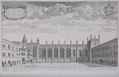
- Botanic Garden, University of Oxford David Loggan 1675 engravingBy David LogganLocated in London, GBTo see our other views of Oxford and Cambridge, scroll down to "More from this Seller" and below it click on "See all from this seller" - or send us a message if you cannot find the view you want. David Loggan (1634 - 1692) The University of Oxford Botanic Garden (1675) Engraving 40 x 50 cm An eighteenth-century view of one of Oxford's dreamiest spaces: the Botanic Garden, engraved by David Loggan, the noted engraver, draughtsman, and painter. The University of Oxford Botanic Garden was founded in 1621 and is the oldest botanical garden in Great Britain. Loggan's engraving focuses on its architectural qualities, with four features of the garden highlighted for their beauty, symmetry, and prowess of design. Of particular interest in this etching are the six trompe l'oeil pieces: four gently curling pieces of paper which frame the gates of the garden, and two heraldic banners borne by cherubs and sporting legends about the garden's foundation. The Danby Gate (bottom left) at the front entrance to the garden is one of the three entrances designed by Nicholas Stone...Category
1670s Realist Landscape Prints
MaterialsEngraving
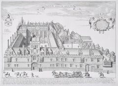
- St Catharine's College, Cambridge David Loggan 1690 engravingBy David LogganLocated in London, GBTo see our other views of Oxford and Cambridge, scroll down to "More from this Seller" and below it click on "See all from this seller" - or send us a message if you cannot find the view you want. David Loggan (1634 - 1692) St Catharine's College, Cambridge (1690) Engraving 35 x 46 cm Loggan's view of St Catharine's College, Cambridge from the 'Cantabrigia Illustrata'. Loggan was born to English and Scottish parents, and was baptised in Danzig in 1634. After studying engraving in Danzig with Willem Hondius (1598-1652 or 1658), he moved to London in the late 1650s, going on to produce the engraved title-page for the folio 1662 Book of Common Prayer. He married in 1663 and moved to Nuffield in Oxfordshire in 1665. Loggan was appointed Public Sculptor to the nearby University of Oxford in the late 1660s, having been commissioned to produce bird’s-eye views of all the Oxford colleges. He lived in Holywell Street as he did this. The 'Oxonia Illustrata' was published in 1675, with the help of Robert White (1645-1704). Following its completion, Loggan began work on his equivalent work for Cambridge; the 'Cantabrigia Illustrata' was finally published in 1690, when he was made engraver to Cambridge University. The 'Oxonia Illustrata' also includes an engraving of Winchester College...Category
1670s Realist Landscape Prints
MaterialsEngraving
- David Loggan: New College, Oxford 1690 engravingBy David LogganLocated in London, GBTo see our other views of Oxford and Cambridge, scroll down to "More from this Seller" and below it click on "See all from this seller" - or send us a message if you cannot find the view you want. David Loggan (1634-1692) New College...Category
1690s Realist Landscape Prints
MaterialsEngraving
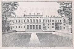
- South Prospect of Somerset House engraving c. 1753 for Stow's Survey of LondonLocated in London, GBTo see our other views and maps of England - including London, Oxford and Cambridge, scroll down to "More from this Seller" and below it click on "See all from this Seller" - or send...Category
1750s Realist Landscape Prints
MaterialsEngraving
- David Loggan: All Souls College, Oxford 1675 engravingBy David LogganLocated in London, GBTo see our other views of Oxford and Cambridge, scroll down to "More from this Seller" and below it click on "See all from this seller" - or send us a message if you cannot find the view you want. David Loggan (1634-1692) All Souls College...Category
1670s Realist Landscape Prints
MaterialsEngraving
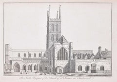
- Southwark Cathedral engraving c. 1753 for Stow's Survey of LondonLocated in London, GBTo see our other views and maps of England - including London, Oxford and Cambridge, scroll down to "More from this Seller" and below it click on "See all from this Seller" - or send...Category
1750s Realist Landscape Prints
MaterialsEngraving
You May Also Like
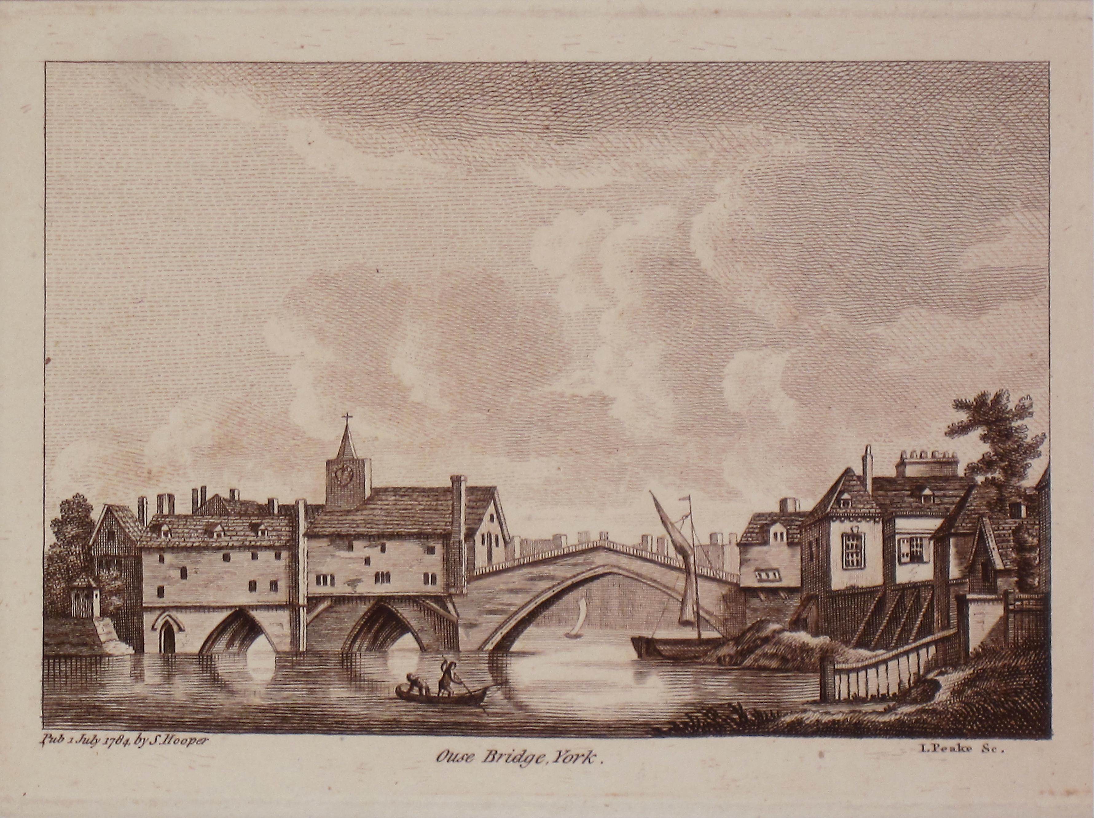
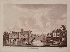
- Ouse Bridge, York. Antique PrintLocated in Sydney, NSWOuse Bridge York Antique Print Matt size 30cm x 33cm Image Size 12cm x 17 cmCategory
1780s Realist Landscape Prints
MaterialsEngraving
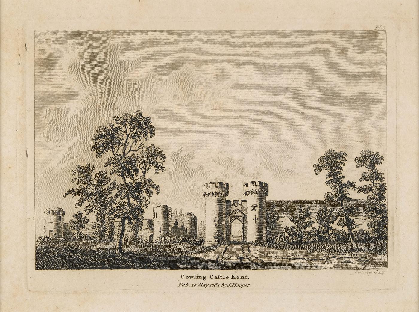
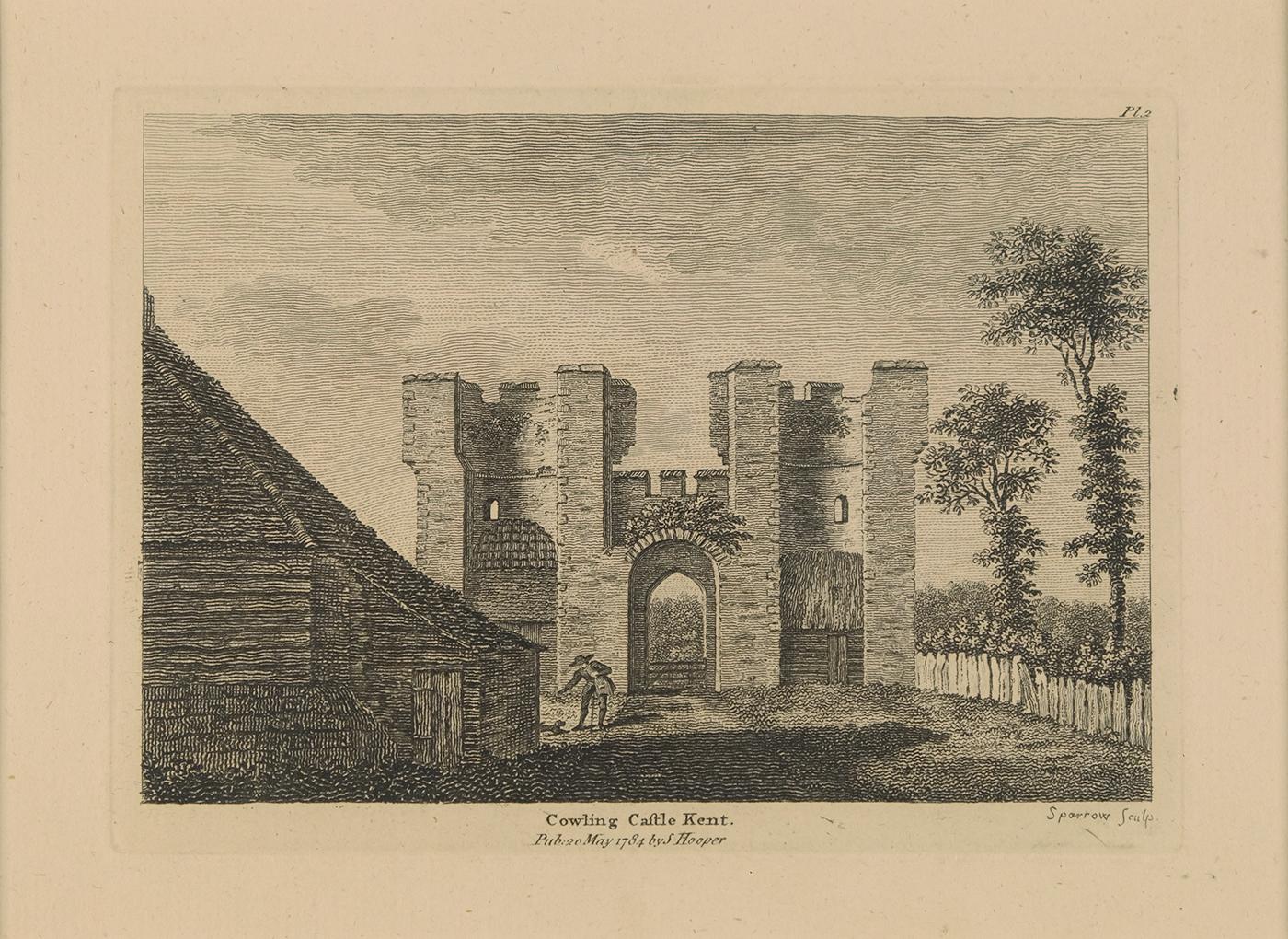
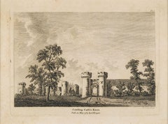
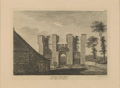
- Cowling Castle Kent Antique PrintLocated in Sydney, NSWView Cowling Castle Kent. Printed in 1784 Matt size 29cm x 33cm Image Size 11 cm x 15 cmCategory
1780s Realist Landscape Prints
MaterialsEngraving
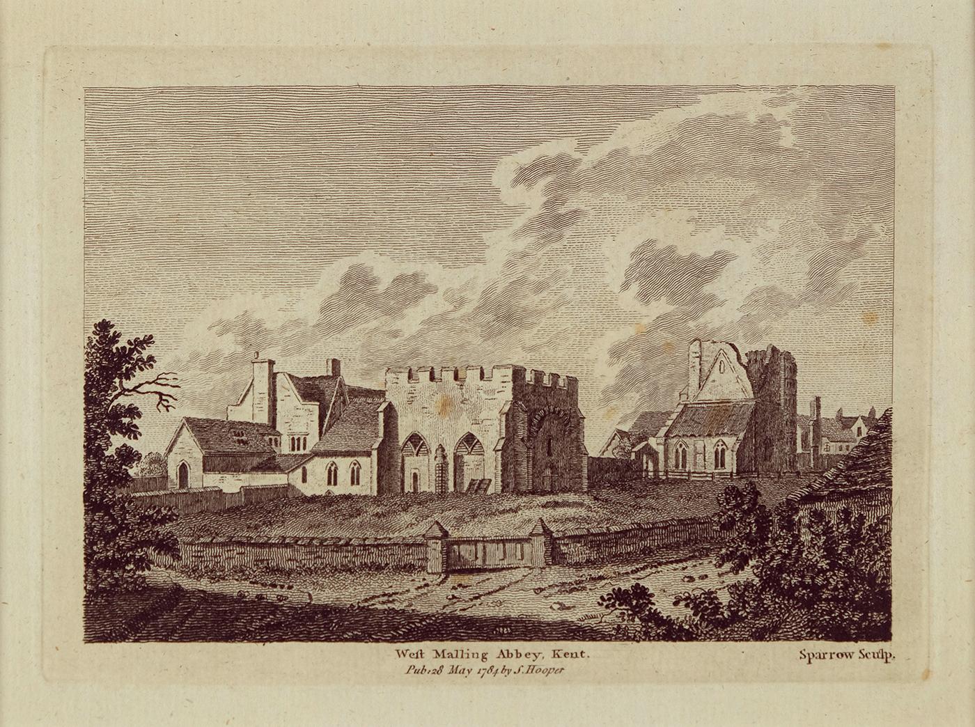
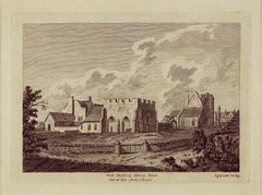
- Weft Malling Abbey, Kent. Antique printLocated in Sydney, NSWWest Malling Abbey,Kent Antique print Matt size 30cm x 33cm Image Size 14 cm x 18 cmCategory
1780s Realist Landscape Prints
MaterialsEngraving
- Cowling Castle Kent May 1784 Antique PrintLocated in Sydney, NSWView Cowling Castlecastle Kent. Printed in 1784 Matt size 29cm x 33cm Image Size 11 cm x 15 cmCategory
1780s Realist Landscape Prints
MaterialsEngraving
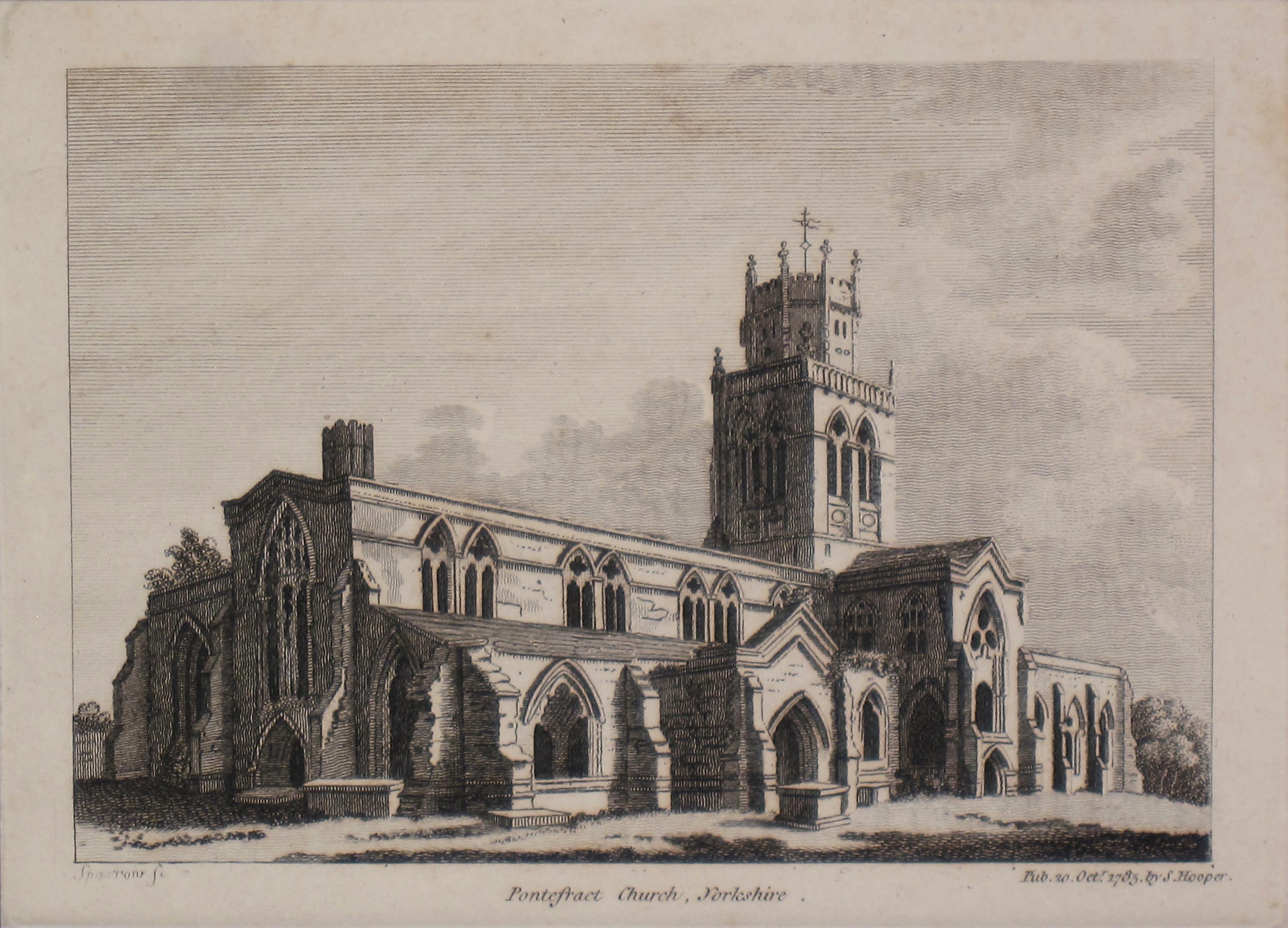
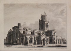
- Pontefract Church, Yorkshir.e. Antique PrintLocated in Sydney, NSWPontefract church, Yorkshire Antique print 1785 Matt size 30cm x 33cm Image Size 12cm x 17 cmCategory
1780s Realist Landscape Prints
MaterialsEngraving
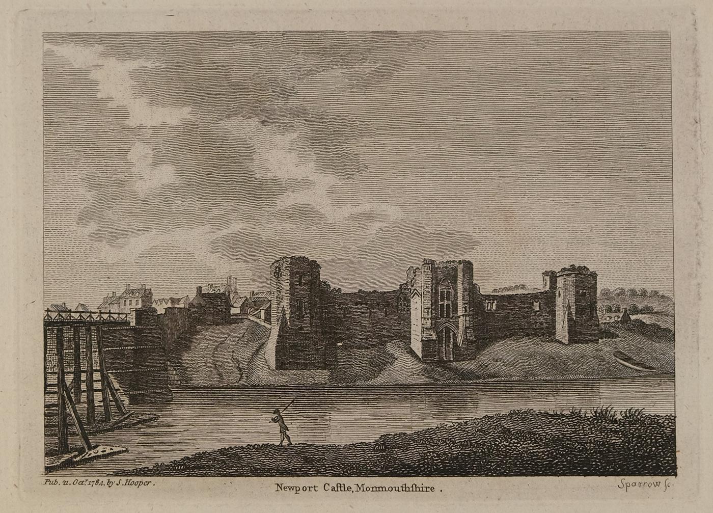
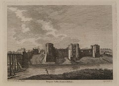
- Newport Caftle, Monmouthshire Antique PrintLocated in Sydney, NSWView Newport Castle from the opposite bank of the River Usk, shows the bridge. Printed in 1784 Matt size 24cm x 26cm Image Size 11 cm x 15 cmCategory
1780s Realist Landscape Prints
MaterialsEngraving
Recently Viewed
View AllMore Ways To Browse
Antique World Atlas
Engravings Train
Engraving Empire
The Holy Land
Antique Rogers
Antique Printing Press
Antique Printing Presses
Printing Press Antique
Antique London Map Print
Irish Heart
Great Britain Maps
John Speed
World Map British
Irish 17th Century
Chester County
Antique Queen Of Hearts
Queen Elizabeth 2
Map Of Ireland