Antique World Atlas

29
to
219
1,451
161
862
724
326
234
201
199
150
58
43
37
35
31
31
28
25
22
22
21
20
16
13
11
11
10
10
7
6
5
5
5
5
5
4
4
4
4
4
4
4
4
4
4
3
2
2
2
2
1
1
1
113
37
30
19
13
Sort By
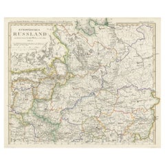
Antique Map of Russia in Europe on Two Sheets from an Old German Atlas, Ca.1825
Located in Langweer, NL
über alle Theile der Erde und über das Weltgebäude (Handy atlas of all parts of the world and of the
Category

1820s Antique World Atlas

Materials

Paper

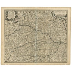
Antique Map of Bavaria ‘Bayern, Germany’ by N. Visscher, circa 1700
Located in Langweer, NL
circa 1700 in N. Visscher's World Atlas. The map "Bavariae pars inferior cum insertis et adjacentibus
Category

Early 18th Century Antique World Atlas

Materials

Paper

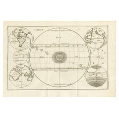
Unique Antique Projection of the World with Twice California as an Island, c1703
Located in Langweer, NL
Description: Antique map of the world. Printed for Scherer's 'Atlas Novus' (1702-1710). On this
Category

Early 1700s Antique World Atlas

Materials

Paper

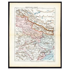
Antique Map of Northern India 'British Indies', C.1880
Located in Langweer, NL
: 'Wereld-atlas voor Kantoor en Huiskamer' (transl: World Atlas for the office and living room), by J
Category

19th Century Antique World Atlas

Materials

Paper

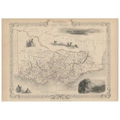
Antique Map of Victoria ‘Australia’ by J. Tallis, circa 1855
Located in Langweer, NL
Atlas, published from 1849, was the last decorative world atlas. The map of Victoria was typical of the
Category

Mid-19th Century Antique World Atlas

Materials

Paper

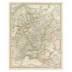
Original Antique German Map of the Russian Empire in Europe, ca.1825
Located in Langweer, NL
alle Theile der Erde und über das Weltgebäude (Handy atlas of all parts of the world and of the
Category

1820s Antique World Atlas

Materials

Paper

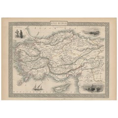
Antique Map of Asia Minor by J. Tallis, circa 1851
Located in Langweer, NL
). The Illustrated Atlas, published from 1849 to 1853, was the last decorative world atlas. The 'Asia
Category

Mid-19th Century Antique World Atlas

Materials

Paper

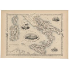
Antique Map of Southern Italy by J. Tallis, circa 1851
Located in Langweer, NL
world atlas. The Northern Italy map was typical of the many fine ones that appeared in this work with
Category

Mid-19th Century Antique World Atlas

Materials

Paper

Antique Map of Northern Italy by J. Tallis, circa 1851
Located in Langweer, NL
world atlas. The Northern Italy map was typical of the many fine ones which appeared in this work with
Category

Mid-19th Century Antique World Atlas

Materials

Paper

Antique Map of Northern Italy by J. Tallis, circa 1851
No Reserve
H 10.44 in W 14.69 in D 0.02 in
1620 Map of Artois Entitled "Artesia Comitatvs Artois, " by Bleau, Ric.a012
Located in Norton, MA
, decorative, title cartouche with two putti and the coat of arms of Artois. From the Blaeu world atlas
Category

17th Century Dutch Antique World Atlas

Materials

Paper

Antique Map of Central and Southern China by Kuyper, 1880
Located in Langweer, NL
from: 'Wereld-atlas voor Kantoor en Huiskamer' (transl: World Atlas for the office and living room), by
Category

19th Century Antique World Atlas

Materials

Paper

Antique Map of Switzerland by J. Tallis, circa 1851
Located in Langweer, NL
last decorative world atlas. The 'Switzerland' map was typical of the many fine ones which appeared in
Category

Mid-19th Century Antique World Atlas

Materials

Paper

Antique Map of Belgium by J. Tallis, circa 1851
Located in Langweer, NL
the last decorative world atlas. The 'Belgium' map was typical of the many fine ones which appeared in
Category

Mid-19th Century Antique World Atlas

Materials

Paper

Antique Map of Turkey in Asia by J. Tallis, circa 1851
Located in Langweer, NL
Atlas, published from 1849-1853, was the last decorative world atlas. The 'Turkey in Asia' map was
Category

Mid-19th Century Antique World Atlas

Materials

Paper

Antique Map of Peru and Bolivia by J. Tallis, circa 1851
Located in Langweer, NL
onwards, was the last decorative world atlas. The 'Peru & Bolivia' map was typical of the many fine ones
Category

Mid-19th Century Antique World Atlas

Materials

Paper

Antique Map of the Northern Part of South America by J. Tallis, circa 1851
Located in Langweer, NL
the last decorative world atlas. The 'Venezuela, New Granada...' map was typical of the many Fine ones
Category

Mid-19th Century Antique World Atlas

Materials

Paper

Antique Map with Hand Coloring of North America and the West Indies
Located in Langweer, NL
of all parts of the world and of the universe), was the leading German world atlas of the last three
Category

Late 19th Century Antique World Atlas

Materials

Paper

Antique Map of South America with Many Details, ca.1859
Located in Langweer, NL
Weltgebäude (Handy atlas of all parts of the world and of the universe), was the leading German world atlas of
Category

Mid-19th Century Antique World Atlas

Materials

Paper

Antique Map of the Islands of the Atlantic by J. Tallis
Located in Langweer, NL
last decorative world atlas. The 'Islands in the Atlantic' map was typical of the many fine ones which
Category

Mid-19th Century Antique World Atlas

Materials

Paper

Set of 4 Antique Maps of part of the United States of America
Located in Langweer, NL
Weltgebäude (Handy atlas of all parts of the world and of the universe), was the leading German world atlas of
Category

Mid-19th Century Antique World Atlas

Materials

Paper

Antique Map of North America Including the West Indies
Located in Langweer, NL
alle Theile der Erde und über das Weltgebäude (Handy atlas of all parts of the world and of the
Category

Mid-19th Century Antique World Atlas

Materials

Paper

Antique Map of the United States with inset map of the region of Mexico City
Located in Langweer, NL
Weltgebäude (Handy atlas of all parts of the world and of the universe), was the leading German world atlas of
Category

Mid-19th Century Antique World Atlas

Materials

Paper

Antique Map with Hand Coloring of the United States and the Caribbean
Located in Langweer, NL
Weltgebäude (Handy atlas of all parts of the world and of the universe), was the leading German world atlas of
Category

Late 19th Century Antique World Atlas

Materials

Paper

Set of Two Antique Maps of South America with Inset Maps of Rio de Janeiro
Located in Langweer, NL
world and of the universe), was the leading German world atlas of the last three decades of the 19th and
Category

Mid-19th Century Antique World Atlas

Materials

Paper

Antique Map of the United States of America, also showing the Caribbean
Located in Langweer, NL
Weltgebäude (Handy atlas of all parts of the world and of the universe), was the leading German world atlas of
Category

Mid-19th Century Antique World Atlas

Materials

Paper

Antique Map of Part of the United States Including Lower California & Arizona
Located in Langweer, NL
(Handy atlas of all parts of the world and of the universe), was the leading German world atlas of the
Category

Late 19th Century Antique World Atlas

Materials

Paper

Set of two Antique Maps of the region of Oregon, Idaho, Wyoming, Nebraska & Iowa
Located in Langweer, NL
Weltgebäude (Handy atlas of all parts of the world and of the universe), was the leading German world atlas of
Category

Late 19th Century Antique World Atlas

Materials

Paper

Antique Bird's-Eye View of the City of Naples in Italy
Located in Langweer, NL
world atlases, containing maps and views of all parts of the world.
Category

Mid-17th Century Antique World Atlas

Materials

Paper

Original Antique Bird's-Eye View of the City of Genoa
Located in Langweer, NL
atlases, containing maps and views of all parts of the world.
Category

Mid-17th Century Antique World Atlas

Materials

Paper

Scarce Antique Map of the Middle East, Surrounded by Latin Text, 1624
Located in Langweer, NL
was copied by Hornius for his World Atlas (1653). Artists and Engravers: Franciscus Haraeus
Category

1620s Antique World Atlas

Materials

Paper

Antique Map of the Region of Georgia with Inset Maps of Florida and Texas
Located in Langweer, NL
das Weltgebäude (Handy atlas of all parts of the world and of the universe), was the leading German
Category

Late 19th Century Antique World Atlas

Materials

Paper

Antique Map of Tennessee, Kentucky, Virginia, Alabama, Georgia and Surroundings
Located in Langweer, NL
das Weltgebäude (Handy atlas of all parts of the world and of the universe), was the leading German
Category

Mid-19th Century Antique World Atlas

Materials

Paper

Antique Map of Gallia and Germania on one Sheet, c.1703
Located in Langweer, NL
recognition. Scherer’s world atlas, the Atlas Novus, first published in Munich between 1702 and 1710 and
Category

18th Century Antique World Atlas

Materials

Paper

Two Charts of The English Channel, Each Adorned with Nice Compass Roses, ca.1700
Located in Langweer, NL
cartographer received acclaim and recognition. Scherer’s world atlas, the Atlas Novus, first published in
Category

Early 1700s Antique World Atlas

Materials

Paper

Map of the Electorate of Bavaria, Incl Lake Constance, by Jesuit Scherer, c.1700
Located in Langweer, NL
Bavaria that his lifetime’s work as a cartographer received acclaim and recognition. Scherer’s world atlas
Category

Early 1700s Antique World Atlas

Materials

Paper

Rare Antique Map of Part of Europe and Africa by Scherer, C.1703
Located in Langweer, NL
cartographer received acclaim and recognition. Scherer's world atlas, the Atlas Novus, first published in
Category

18th Century Antique World Atlas

Materials

Paper

Antique Map of part of Europe by Scherer, c.1703
Located in Langweer, NL
lifetime's work as a cartographer received acclaim and recognition. Scherer's world atlas, the Atlas Novus
Category

18th Century Antique World Atlas

Materials

Paper

Antique Map of Saxony and Westphalia by Scherer, 1699
Located in Langweer, NL
recognition. Scherer?s world atlas, the Atlas Novus, first published in Munich between 1702 and 1710 and
Category

17th Century Antique World Atlas

Materials

Paper

Antique Map of South America by Scherer, c.1700
By Thomas Kitchin
Located in Langweer, NL
that his lifetime?s work as a cartographer received acclaim and recognition. Scherer?s world atlas, the
Category

18th Century Antique World Atlas

Materials

Paper

Antique Map of the Berchtesgaden Region by Scherer, 1699
Located in Langweer, NL
that his lifetime?s work as a cartographer received acclaim and recognition. Scherer?s world atlas, the
Category

17th Century Antique World Atlas

Materials

Paper

Antique Map of the Eastern United States with Only the Northern Part of Florida
Located in Langweer, NL
(Handy atlas of all parts of the world and of the universe), was the leading German world atlas of the
Category

Mid-19th Century Antique World Atlas

Materials

Paper

Antique Map of the Eastern United States with Inset Map of Texas
Located in Langweer, NL
(Handy atlas of all parts of the world and of the universe), was the leading German world atlas of the
Category

Mid-19th Century Antique World Atlas

Materials

Paper

Frederique Constant Worldtimer FC-718WM4H6 Box and Papers 2013
Located in London, GB
-718WM4H6, features a 42mm stainless steel case a domed polished bezel, a mesmerizing world atlas dial with
Category

1910s Swiss Antique World Atlas

Materials

Steel

Antique Map of the Buton Strait by Philippe, 1787
Located in Langweer, NL
Celebes, Indonesia. This map originates from 'World atlas for the study of geography and ancient and
Category

18th Century Antique World Atlas

Materials

Paper

Antique Map of the Alsace region and Nova Zembla by Scherer, c.1700
Located in Langweer, NL
that his lifetime?s work as a cartographer received acclaim and recognition. Scherer?s world atlas, the
Category

18th Century Antique World Atlas

Materials

Paper

Remarkable Map of the Alsace Region and Nova Zembla, Russia, ca.1700
Located in Langweer, NL
Bavaria that his lifetime’s work as a cartographer received acclaim and recognition. Scherer’s world atlas
Category

Early 1700s Antique World Atlas

Materials

Paper

Original Antique Map of the Channel Islands, Incl. Decorative Vignettes, 1851
Located in Langweer, NL
Illustrated Atlas, And Modern History Of The World Geographical, Political, Commercial & Statistical, Edited
Category

1850s Antique World Atlas

Materials

Paper

Antique Map of Russia in Asia by Kuyper, c.1880
Located in Langweer, NL
-atlas voor Kantoor en Huiskamer' (transl: World Atlas for the office and living room), by J. Kuyper
Category

19th Century Antique World Atlas

Materials

Paper

Antique Map of Russia in Asia by Tallis, c.1851
Located in Langweer, NL
collaboration ended in 1849. For the Great Exhibition of 1851, Tallis published the Illustrated World Atlas, one
Category

19th Century Antique World Atlas

Materials

Paper

Curious Map of the Laptev Sea 'Arctic Ocean' and the Mediterranean, ca.1700
Located in Langweer, NL
of the World in showing only its major physical and topographical features. From: 'Atlas Novus
Category

Early 1700s Antique World Atlas

Materials

Paper

Map of Russia with Vignettes of the Neoskoi Prospect, St. Petersburg, ca.1851
Located in Langweer, NL
Atlas, And Modern History Of The World Geographical, Political, Commercial & Statistical, Edited By R
Category

1850s Antique World Atlas

Materials

Paper

Antique Map of Western Africa with Vignettes of Cape Coast Castle etc, ca.1851
Located in Langweer, NL
. For the Great Exhibition of 1851, Tallis published the Illustrated World Atlas, one of the last series
Category

1850s Antique World Atlas

Materials

Paper

Map of Western Australia & Swan River, insets of Perth, Aboriginals, Sheep, 1851
Located in Langweer, NL
. Originates from 'The Illustrated Atlas, And Modern History Of The World Geographical, Political, Commercial
Category

1850s Antique World Atlas

Materials

Paper

Decorative Map of part of South Australia with Illustrations of Adelaide, 1851
Located in Langweer, NL
nymphicus bird illustrated. Originates from 'The Illustrated Atlas, And Modern History Of The World
Category

1850s Antique World Atlas

Materials

Paper

Beautiful Decorative Hand-Colored Antique Map of West Canada, 1851
Located in Langweer, NL
Kingston and Falls of Niagara. Originates from 'The Illustrated Atlas, And Modern History Of The World
Category

1850s Antique World Atlas

Materials

Paper

Decorative Antique Map of the Malay Archipelago or East Indies Island, 1851
Located in Langweer, NL
Illustrated Atlas, And Modern History Of The World Geographical, Political, Commercial & Statistical, Edited
Category

1850s Antique World Atlas

Materials

Paper

Antique Map of Southern Zeeland by Von Reilly, 1790
Located in Langweer, NL
' (Wien: Reilly, 1791-1806), a world atlas in 830 maps by Franz Joseph Johann von Reilly. Artists and
Category

18th Century Antique World Atlas

Materials

Paper

Very Decorative Rare Antique Map of the Northern Part of Africa, 1702
Located in Langweer, NL
cartographer received acclaim and recognition. Scherer’s world atlas, the Atlas Novus, first published in
Category

Early 1700s Antique World Atlas

Materials

Paper

Antique Map of Eastern India by Kuyper, C.1880
Located in Langweer, NL
: 'Wereld-atlas voor Kantoor en Huiskamer' (transl: World Atlas for the office and living room), by J
Category

19th Century Antique World Atlas

Materials

Paper

Antique Map of the Routes of Jean-françois de Galaup to Asia, 1787
Located in Langweer, NL
-François de Galaup to Asia (Jakarta, Indonesia). This map originates from 'World atlas for the study of
Category

18th Century Antique World Atlas

Materials

Paper

  • 1
  • ...
Get Updated with New Arrivals
Save "Antique World Atlas", and we’ll notify you when there are new listings in this category.

Antique World Atlas For Sale on 1stDibs

At 1stDibs, there are many versions of the ideal antique world atlas for your home. Each antique world atlas for sale was constructed with extraordinary care, often using paper, metal and fabric. There are many kinds of the antique world atlas you’re looking for, from those produced as long ago as the 18th Century to those made as recently as the 20th Century. When you’re browsing for the right antique world atlas, those designed in Baroque, Art Deco and Victorian styles are of considerable interest. Johannes Janssonius, Victor Levasseur and Schreiber each produced at least one beautiful antique world atlas that is worth considering.

How Much is a Antique World Atlas?

Prices for an antique world atlas start at $55 and top out at $300,000 with the average selling for $325.

Read More

Pamela Shamshiri Shares the Secrets behind Her First-Ever Book and Its Effortlessly Cool Interiors

The sought-after designer worked with the team at Hoffman Creative to produce a monograph that beautifully showcases some of Studio Shamshiri's most inspiring projects.

Moroccan Artworks and Objects Take Center Stage in an Extraordinary Villa in Tangier

Italian writer and collector Umberto Pasti opens the doors to his remarkable cave of wonders in North Africa.

Montecito Has Drawn Royalty and Celebrities, and These Homes Are Proof of Its Allure

Hollywood A-listers, ex-pat aristocrats and art collectors and style setters of all stripes appreciate the allure of the coastal California hamlet — much on our minds after recent winter floods.

Whaam! Blam! Pow! — a New Book on Pop Art Packs a Punch

Publishing house Assouline and writer Julie Belcove have teamed up to trace the history of the genre, from Roy Lichtenstein, Andy Warhol and Yayoi Kusama to Mickalene Thomas and Jeff Koons.

The Sparkling Legacy of Tiffany & Co. Explained, One Jewel at a Time

A gorgeous new book celebrates — and memorializes — the iconic jeweler’s rich heritage.

What Makes a Gem-Encrusted Chess Set Worth $4 Million?

The world’s most opulent chess set, weighing in at 513 carats, is literally fit for a king and queen.

Tauba Auerbach’s Geometric Pop-Up Book Is Mighty Rare, Thanks to a Hurricane

This sculptural art book has an epic backstory of its own.

Step inside the Storied Mansions of Palm Beach’s Most Effervescent Architect

From Spanish-style courtyards to fanciful fountains, these acclaimed structures abound in surprising and elegant details.