Items Similar to Map of the Electorate of Bavaria, Incl Lake Constance, by Jesuit Scherer, c.1700
Want more images or videos?
Request additional images or videos from the seller
1 of 5
Map of the Electorate of Bavaria, Incl Lake Constance, by Jesuit Scherer, c.1700
About the Item
Antique map titled 'Electorat Bavariae.' Map of the Electorate of Bavaria by the Jesuit Heinrich Scherer. The lower map shows the Lake Constance. Source unknown, to be determined.
Artists and Engravers: Heinrich Scherer (1628-1704) was a Professor of Hebrew, Mathematics and Ethics at the University of Dillingen until about 1680. Thereafter he obtained important positions as Official Tutor to the Royal Princes of Mantua and Bavaria. It was during his time in Munich as Tutor to the Princely house of Bavaria that his lifetime’s work as a cartographer received acclaim and recognition. Scherer’s world atlas, the Atlas Novus, first published in Munich between 1702 and 1710 and reissued in a second edition between 1730 and 1737, forms a singularly unusual, almost revolutionary work in terms of the development of European mapmaking at the beginning of the 18th Century.
Condition: Good, given age. Irregular left edge from binding. General age-related toning and/or occasional minor defects from handling. Please study image carefully.
- Dimensions:Height: 10.63 in (27 cm)Width: 8.47 in (21.5 cm)Depth: 0 in (0.02 mm)
- Materials and Techniques:
- Period:1700-1709
- Date of Manufacture:circa 1700
- Condition:Wear consistent with age and use. Condition: Good, given age. Irregular left edge from binding. General age-related toning and/or occasional minor defects from handling. Please study image carefully.
- Seller Location:Langweer, NL
- Reference Number:
About the Seller
5.0
Platinum Seller
These expertly vetted sellers are 1stDibs' most experienced sellers and are rated highest by our customers.
Established in 2009
1stDibs seller since 2017
1,929 sales on 1stDibs
Typical response time: <1 hour
- ShippingRetrieving quote...Ships From: Langweer, Netherlands
- Return PolicyA return for this item may be initiated within 14 days of delivery.
More From This SellerView All
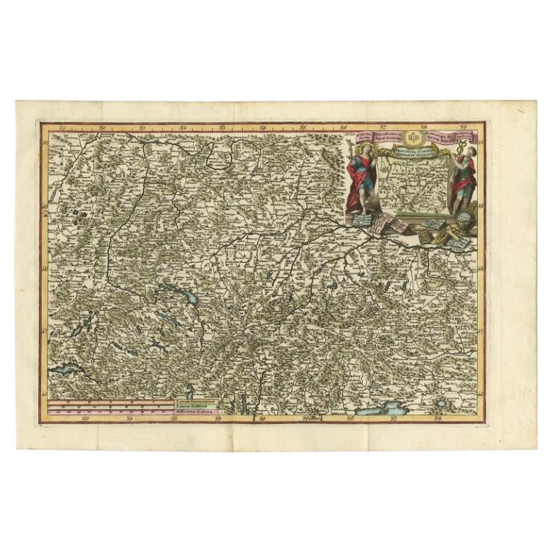
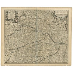
- Very Detailed Antique Map of the Jesuit Province of Bavaria, Germany, c.1700Located in Langweer, NLAntique map titled 'Provinciae Superior Germaniae Societatis.' Very detailed map of the Jesuit province of Bavaria, Germany. Source unknown, to be determined. Artists and Engravers:...Category
Antique 18th Century Maps
MaterialsPaper
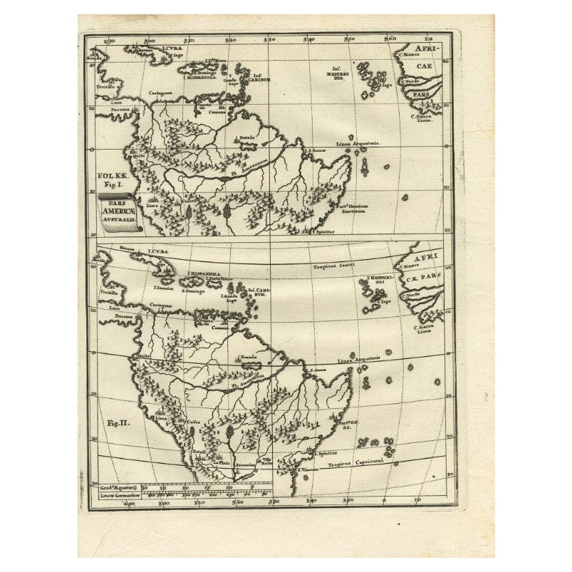
- Antique Map of South America by Scherer, c.1700By Thomas KitchinLocated in Langweer, NLAntique map of part of South America. Two maps on a single sheet, each depicting nearly the same area. On close examination there are slight differences in the rivers, lakes and moun...Category
Antique 18th Century Maps
MaterialsPaper
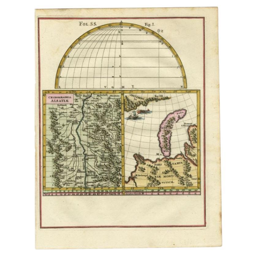
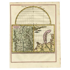
- Antique Map of the Alsace region and Nova Zembla by Scherer, c.1700Located in Langweer, NLAntique map titled 'Chorographia Alsatiae.' Map of the Alsace region and Nova Zembla, printed for Scherer's 'Atlas Novus' (1702-1710). Scherer's 'Atlas Novus' forms an important mile...Category
Antique 18th Century Maps
MaterialsPaper
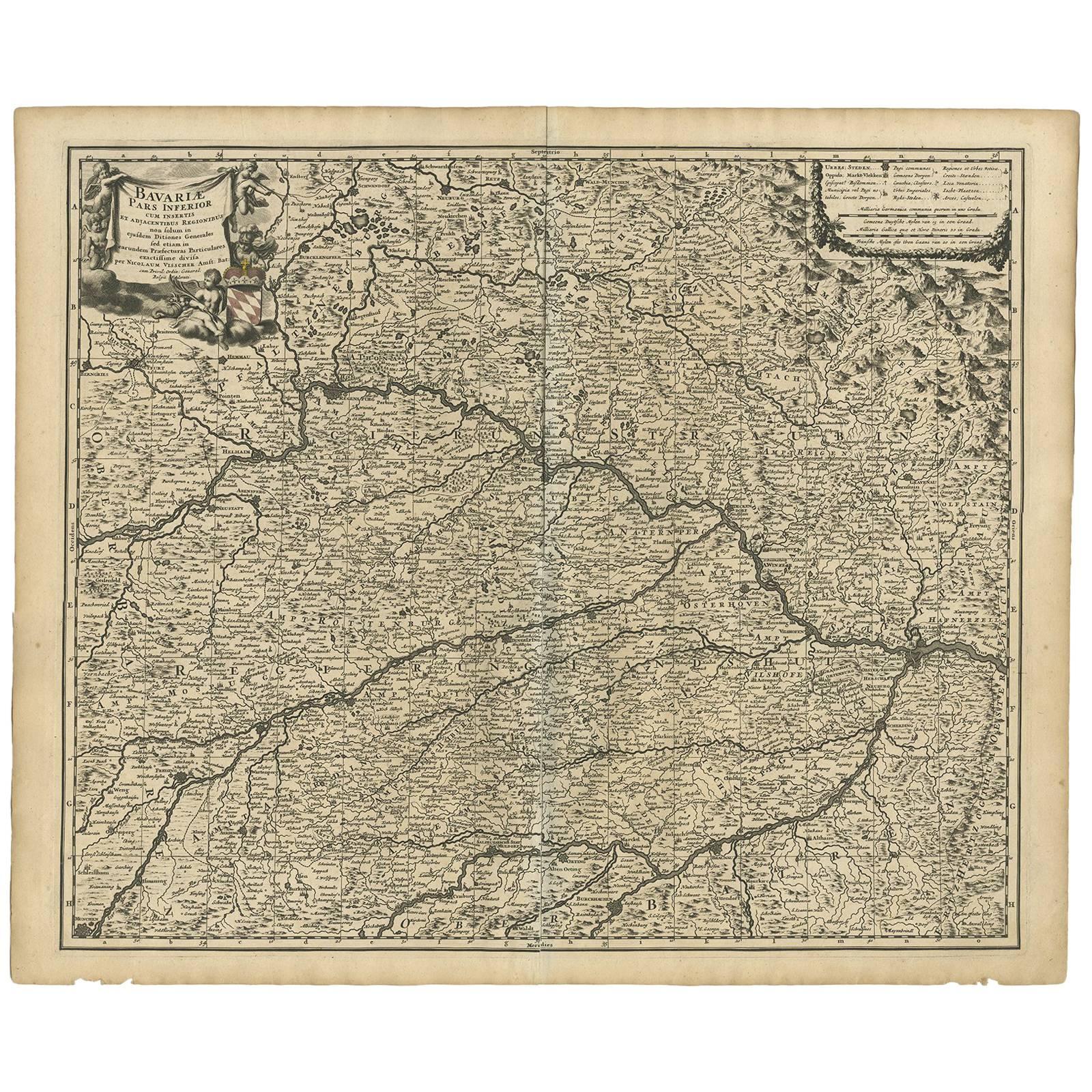
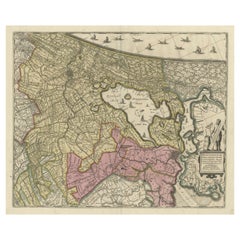
- Antique Map of Bavaria ‘Bayern, Germany’ by N. Visscher, circa 1700Located in Langweer, NLAntique map titled 'Bavariae pars inferior cum insertis et adjacentibus regionibus (..)'. Published circa 1700 in N. Visscher's World Atlas. The map "Bavariae pars inferior cum inse...Category
Antique Early 18th Century Maps
MaterialsPaper
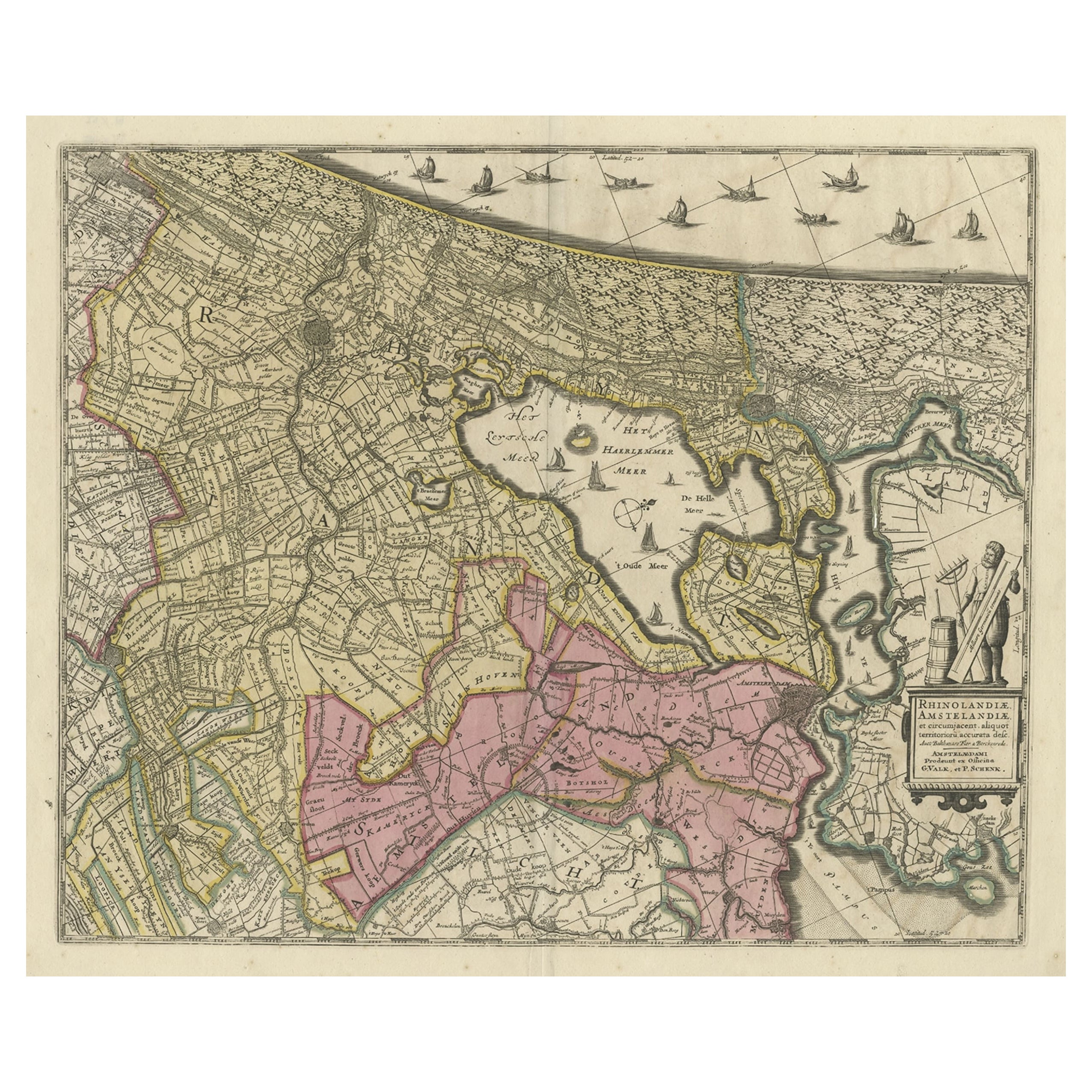
- Original Antique Map of the Netherlands Incl Amsterdam, Leiden and Haarlem, 1700Located in Langweer, NLAntique map titled ‘Rhinolandiae Amsterlandiae et circumjacent (..)’. Map of the regions of Rijnland and Amstelland in the Netherlands, including the cities of Amsterdam, Leiden ...Category
Antique Early 1700s Maps
MaterialsPaper
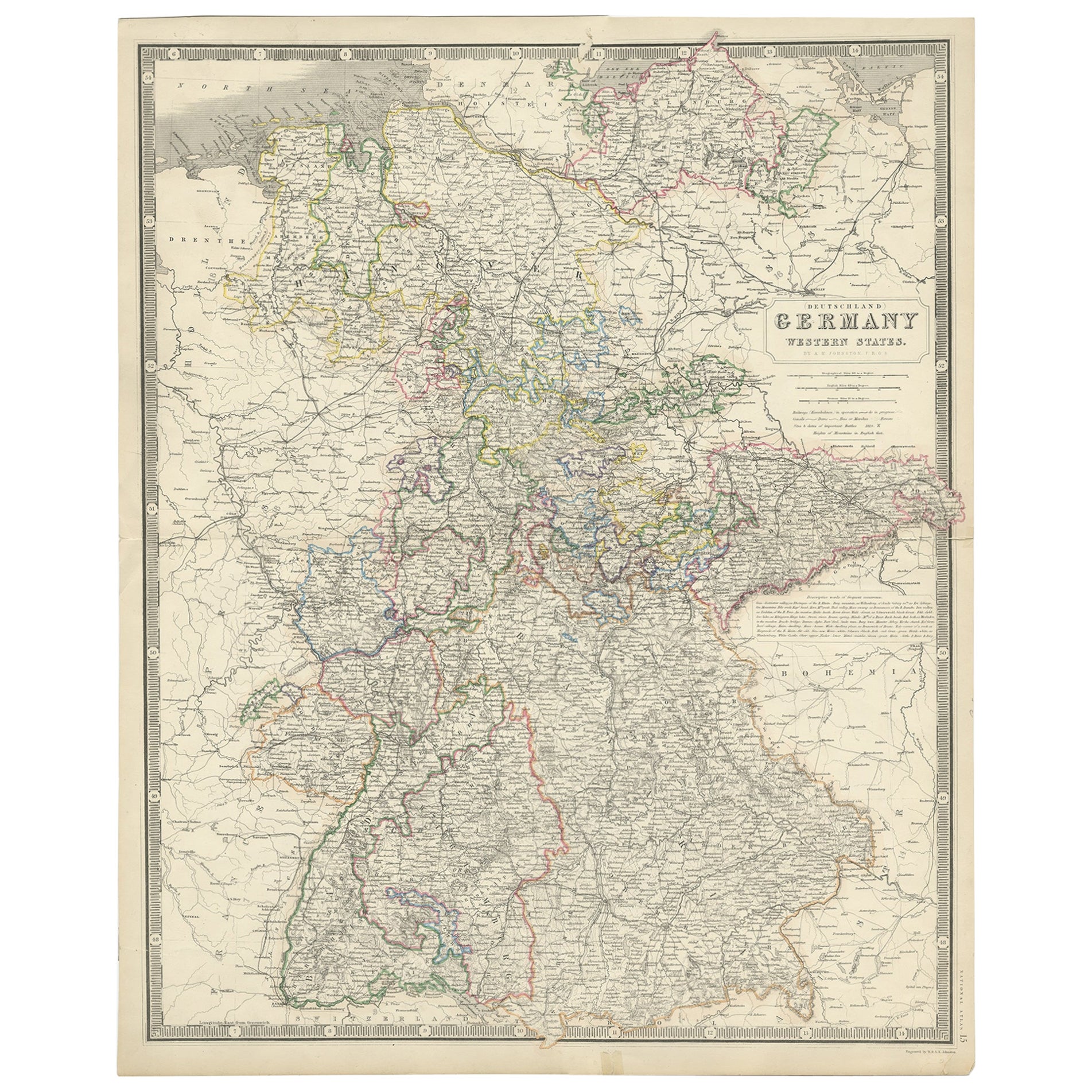
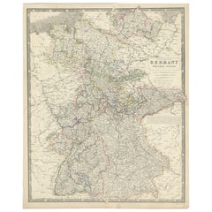
- Map of West Germany Incl Regions Wurtemberg, Bavaria, Hanover, Etc, c.1850Located in Langweer, NLAntique map titled '(Deutschland) Germany, Western States'. Map of West Germany depicting many regions including Wurtemberg, Bavaria, Hanover and others. This map originates from...Category
Antique 1850s Maps
MaterialsPaper
You May Also Like
- 1880s Map of The Italian Alps from Milan to Lake GardaLocated in Roma, ITGeographical Map of the Profile and Elevation of the Italian Alps from Milano to Lake Garda. The map features the name of each peak and key cities including Monza, Brescia and Bergam...Category
Antique 1880s Italian Maps
MaterialsParchment Paper
- 1861 Topographical Map of the District of Columbia, by Boschke, Antique MapLocated in Colorado Springs, COPresented is an original map of Albert Boschke's extremely sought-after "Topographical Map of the District of Columbia Surveyed in the Years 1856 ...Category
Antique 1860s American Historical Memorabilia
MaterialsPaper
- Sean Scherer’s Vignettes Book by Sean SchererLocated in New York, NYSean Scherer’s Vignettes By: Sean Scherer Designer, collector, and proprietor of the contemporary curiosity shop Kabinett & Kammer, Sean Scherer shares h...Category
21st Century and Contemporary Books
MaterialsPaper
- Map of the Republic of GenoaLocated in New York, NYFramed antique hand-coloured map of the Republic of Genoa including the duchies of Mantua, Modena, and Parma. Europe, late 18th century. Dimension: 25...Category
Antique Late 18th Century European Maps
- "Clason's Guide Map of Montana" by The Clason Map Company, Circa 1920sLocated in Colorado Springs, COPresented is “Clason's Guide Map of Montana,” published in the early 1920s by the Clason Map Company. Issued as a folding map, this map identifies county boundaries, county seats, Na...Category
Vintage 1920s American Art Deco Maps
MaterialsPaper
- 1908 "Map of Texas" by The Kenyon CompanyLocated in Colorado Springs, COPresented is an antique map of the state of Texas, printed as a pocket map in 1908 by The Kenyon Company. The state map is brightly colored by county, with principal cities and towns listed. The congressional districts are numbered and boldly outlined in red. Rivers, roads, and railroads all appear prominently on this fantastic map...Category
Antique Early 1900s American Maps
MaterialsPaper