Antique Town Maps

25
to
96
547
184
400
250
221
132
86
86
76
74
57
53
43
38
37
34
33
25
24
21
16
14
14
14
14
13
11
9
8
8
8
7
7
7
7
7
6
5
4
4
4
4
3
3
2
2
2
2
2
1
1
1
16
10
8
6
4
Sort By
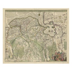
Old Map of the Province of Groningen, the Netherlands & inset of Islands, C.1680
Located in Langweer, NL
town maps. After Frederik’s death in 1706, his wife Maria ran the shop for four years before selling it
Category

1680s Antique Town Maps

Materials

Paper

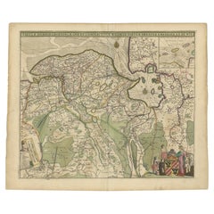
Antique Map of The Dutch Province of Groningen by De Wit, c.1680
Located in Langweer, NL
town maps. After Frederik?s death in 1706, his wife Maria ran the shop for four years before selling it
Category

17th Century Antique Town Maps

Materials

Paper

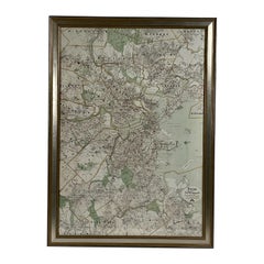
Map of Boston and Surrounding Towns
Located in Norwell, MA
Later copy of a nineteenth century map of Boston and surrounding towns. Showing parts of Quincy
Category

19th Century North American Antique Town Maps

Materials

Paper

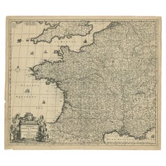
Large Antique Map of France by De Wit, c.1680
By Frederick de Wit
Located in Langweer, NL
; he is best known for these atlases and his Dutch town maps. After Frederik’s death in 1706, his wife
Category

17th Century Antique Town Maps

Materials

Paper

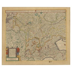
Old Map of the Western Part of Central Europe, c.1680
Located in Langweer, NL
with a variety of maps; he is best known for these atlases and his Dutch town maps. After Frederik’s
Category

17th Century Antique Town Maps

Materials

Paper

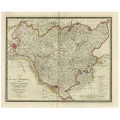
Old Map of Holstein with the Imperial Towns Hamburg & Lubeck, Germany, 1854
Located in Langweer, NL
Antique map titled 'Map of the Duchy of Holstein with the territories of the Imperial Towns Hamburg
Category

1850s Antique Town Maps

Materials

Paper

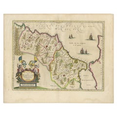
Antique Map of Morocco Showing Towns of Marakesh, Taradant and Fez, 1636
Located in Langweer, NL
Antique map titled 'Fezzae et Marocchi regna Africae Celeberrima'. Map of Morocco, showing large
Category

17th Century Antique Town Maps

Materials

Paper

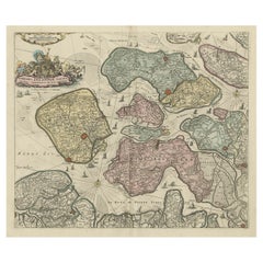
Decorative Antique Sea Chart of Zeeland, a Province of the Netherlands, ca.1730
Located in Langweer, NL
town maps. After Frederik’s death in 1706, his wife Maria ran the shop for four years before selling it
Category

1730s Antique Town Maps

Materials

Paper

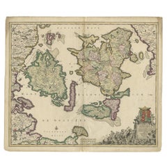
Antique Map of Denmark with Details of Fortresses, Cities, Towns Etc, c.1680
Located in Langweer, NL
terrestrial atlases, wall maps, and town views. Many of his maps were superbly colored by master Dutch
Category

17th Century Antique Town Maps

Materials

Paper

Antique Map of Saldanha Bay 'Near Cape Town, South Africa' by Bellin, 1750
By Jacques-Nicolas Bellin
Located in Langweer, NL
Navigateurs’. Detailed plan of Saldanha Bay, northwest of Cape Town, South Africa. This map originates from
Category

18th Century Antique Town Maps

Materials

Paper

Antique Map Plan of Town and Mole of CAP D'agde & Fort De Brescou, France, 1759
Located in Langweer, NL
Antique Plan titled 'Plan of the Town and Mole of Agde with the Fort de Brescou'. Antique town plan
Category

Mid-18th Century Antique Town Maps

Materials

Paper

1907 Map of Colorado, Antique Topographical Map, by Louis Nell
Located in Colorado Springs, CO
creeks. Towns, villages, settlements, mining areas, railroads and townships are also highlighted. The map
Category

Early 1900s American Antique Town Maps

Materials

Paper

Original 1891 Walker Map
Located in Norwell, MA
Original 1891 map of Massachusetts by Walker. Towns include Cambridge, Boston, Dedham, Ashland
Category

19th Century Antique Town Maps

Original 1891 Walker Map
H 23 in W 32 in D 1 in
"Clason's Guide Map of Montana" by The Clason Map Company, Circa 1920s
Located in Colorado Springs, CO
help viewers find towns on the map. It also provides population data by town, for any town with a
Category

1920s American Art Deco Antique Town Maps

Materials

Paper

1854 Map of Massachusetts, Connecticut and Rhode Island, Antique Wall Map
Located in Colorado Springs, CO
This striking wall map was published in 1854 by Ensign, Bridgman & Fanning and has both full
Category

19th Century American Antique Town Maps

Materials

Paper

1849 Map of "Europaische Russland", 'Meyer Map of European Russia', Ric. R017
Located in Norton, MA
. Throughout, the map identifies various cities, towns, rivers and assortment of additional topographical
Category

19th Century Unknown Antique Town Maps

Materials

Paper

1812 United States Map, by Pierre Tardieu, Antique French Map Depicting the U.S.
By Pierre François Tardieu
Located in Colorado Springs, CO
Map by Tardieu This attractive map, published in Paris in 1812, is one of the most rare large
Category

1810s French Antique Town Maps

Materials

Paper

1891 Map of Norfolk County Massachusetts
Located in Norwell, MA
1891 map of Norfolk county Massachusetts including the towns of Wrentham, Franklin, Medfield
Category

19th Century Antique Town Maps

Antique County Map of Leicestershire, England, 1804
Located in Langweer, NL
Antique county map of Leicestershire first published c.1800. Villages, towns, and cities
Category

Early 1800s Antique Town Maps

Materials

Paper

Antique Map Colton's United States of America
Located in Langweer, NL
Antique map titled 'Colton's United States of America'. Show railroads, canals, state capitals
Category

Mid-19th Century Antique Town Maps

Materials

Paper

Antique Map Colton's United States of America
H 17.45 in W 27.45 in D 0.02 in
Antique County Map of Derbyshire, England, 1804
Located in Langweer, NL
Antique county map of Derbyshire first published, circa 1800. Villages, towns, and cities
Category

Early 1800s Antique Town Maps

Materials

Paper

Antique Map of Northamptonshire by Speed, 1676
Located in Langweer, NL
Antique map titled 'Norhamtonshire'. Map of Norhamptonshire, England. Includes inset town plans of
Category

17th Century Antique Town Maps

Materials

Paper

Antique Map of Corsica and Sardini, 1729
Located in Langweer, NL
Detailed map of the Islands of Corsica and Sardinia, showing towns, rivers, lakes, mountains, bays
Category

Early 18th Century Antique Town Maps

Materials

Paper

Antique Map of Corsica and Sardini,  1729
H 11.46 in W 5.4 in D 0.02 in
Antique Map of Buckinghamshire in England, 1743
Located in Langweer, NL
. With town plans of Buckingham and Redding. This map originates from Overton's atlas 'England Fully
Category

18th Century Antique Town Maps

Materials

Paper

Antique Map of Buckinghamshire in England, 1743
No Reserve
H 15.75 in W 20.48 in D 0 in
Antique Panoramic View of the Town of Malacca, Malaysia, 1726
Located in Langweer, NL
Antique print Malaysia titled 'De Stad Malacka'. Decorative panoramic view of the town of
Category

1720s Antique Town Maps

Materials

Paper

1814 Map of "Russian Empire" Ric.r032
Located in Norton, MA
1814 Map of "Russian Empire" Ric.r032 Russian Empire. Description: This is an 1814 John
Category

19th Century Unknown Antique Town Maps

Materials

Paper

1814 Map of "Russian Empire" Ric.r032
H 20.87 in W 24.81 in D 0.4 in
Antique Map of Sweden by Bowen, 1747
Located in Langweer, NL
Antique map titled 'A New & Accurate Map of Sweden'. This map covers Sweden and Finland (shown as
Category

18th Century Antique Town Maps

Materials

Paper

Antique Map of Sweden by Bowen, 1747
H 14.57 in W 10.24 in D 0 in
Antique Town Plan of Emden ‘Germany’ by Braun & Hogenberg, 1597
Located in Langweer, NL
Antique map titled 'Embdena (..)'. Old, antique bird's-eye view plan of Emden, Germany. This bird's
Category

16th Century Antique Town Maps

Materials

Paper

Antique Map of Nottinghamshire by Speed, 1676
Located in Langweer, NL
inset town plan of Nottingham. This map originates from 'Theatre of Great Britaine' by John Speed
Category

17th Century Antique Town Maps

Materials

Paper

Spectacular Antique Original Engraving of a Town Plan of Jerusalem, 1708
Located in Langweer, NL
Andricom's 1584 map. Inside the fortified walls of the town are numerous buildings, statues, hills, temples
Category

Early 1700s Antique Town Maps

Materials

Paper

Antique Decorative Coloured Map of North America, 1882
Located in Langweer, NL
This original antique map of North America is from the Blackie & Son Atlas published in 1882. Here
Category

1880s Antique Town Maps

Materials

Paper

Antique Decorative Coloured Map of North America, 1882
No Reserve
H 14.97 in W 22.45 in D 0 in
Antique Map of Champagne and surrounding Regions, France
Located in Langweer, NL
Antique map titled 'Carte de la Champagne et des Pays Voisins (..)'. Detailed map of Champagne and
Category

Mid-18th Century Antique Town Maps

Materials

Paper

1908 "Map of Texas" by The Kenyon Company
Located in Colorado Springs, CO
Company. The state map is brightly colored by county, with principal cities and towns listed. The
Category

Early 1900s American Antique Town Maps

Materials

Paper

Antique Map of Gloucestershire by John Speed, '1676'
Located in Langweer, NL
Antique map titled 'Glocestershire'. Original 17th century map of Gloucestershire, South West
Category

Mid-17th Century Antique Town Maps

Materials

Paper

Antique Map of Warwickshire by Speed, c.1614
Located in Langweer, NL
Antique map titled 'The Counti of Warwick (..)'. Map of Warwickshire, England. Includes inset town
Category

17th Century Antique Town Maps

Materials

Paper

Antique Map of Warwickshire by Speed, c.1614
No Reserve
H 14.97 in W 19.69 in D 0 in
Antique Decorative County Map of Lincolnshire, England, 1804
Located in Langweer, NL
Antique county map of Lincolnshire first published circa 1800 Cities illustrated include Grantham
Category

Early 1800s Antique Town Maps

Materials

Paper

Antique Decorative County Map of Huntingdonshire, England, 1804
Located in Langweer, NL
Antique county map of Huntingdonshire first published c.1800. Cities illustrated include Kimbolton
Category

Early 1800s Antique Town Maps

Materials

Paper

Antique County Map of Monmouthshire, England, circa 1804
Located in Langweer, NL
Antique county map of Monmouthshire first published circa 1800. Villages, towns, and cities
Category

Early 1800s Antique Town Maps

Materials

Paper

Antique Map of Essex by Overton, circa 1710
Located in Langweer, NL
(..)'. Map of Essex, England. Includes an inset town plan of Colchester. Published by Henry Overton, circa
Category

Early 18th Century Antique Town Maps

Materials

Paper

Antique Map of Essex by Overton, circa 1710
H 19.49 in W 24.41 in D 0.6 in
Decorative View of the Indonesian Town of Bantam 'Banten', Java, 1726
Located in Langweer, NL
Decorative town-view of the town of Bantam (Banten). In lower margin key a-z to the principal
Category

1720s Antique Town Maps

Materials

Paper

Antique Map of France by Tirion, c.1740
Located in Langweer, NL
Dutch town plans. The maps mainly based on those of Guillaume de l'Isle. He died in 1765. Condition
Category

18th Century Antique Town Maps

Materials

Paper

Antique Map of France by Tirion, c.1740
H 17.21 in W 21.82 in D 0 in
Antique Map of Oostergo, Friesland by Tirion, 1785
Located in Langweer, NL
publisher in Amsterdam. He produced serveral Atlases and Dutch town plans. The maps mainly based on those of
Category

18th Century Antique Town Maps

Materials

Paper

Antique Map of Oostergo, Friesland by Tirion, 1785
Located in Langweer, NL
publisher in Amsterdam. He produced serveral Atlases and Dutch town plans. The maps mainly based on those of
Category

18th Century Antique Town Maps

Materials

Paper

Antique Map of Oostergo, Friesland by Tirion, 1785
Located in Langweer, NL
publisher in Amsterdam. He produced serveral Atlases and Dutch town plans. The maps mainly based on those of
Category

18th Century Antique Town Maps

Materials

Paper

Antique Map of Persia, Afghanistan and Balochistan, 1859
Located in Langweer, NL
The antique map titled "Persia, Afghanistan and Beloochistan" is a remarkable historical document
Category

Mid-19th Century Antique Town Maps

Materials

Paper

Antique Map of Pomerania by Schenk, circa 1750
Located in Langweer, NL
The "Ducatus Pomeraniae" is a historical map depicting the Duchy of Pomerania, a region that
Category

Mid-18th Century Antique Town Maps

Materials

Paper

Antique Map of Pomerania by Schenk, circa 1750
H 20.67 in W 24.02 in D 0.02 in
Antique Map of Bavaria with many details, Germany
Located in Langweer, NL
(..)'. Dutch map of Bavaria, showing the many cities, towns, and other features of this historically
Category

Late 17th Century Antique Town Maps

Materials

Paper

Antique Map of Denmark by Valk 'circa 1690'
Located in Langweer, NL
The map titled "Regnum Daniae, divisum in Dioeceses Arhusiam, Albergum, Viborgum, et Ripam (..)" is
Category

Late 17th Century Antique Town Maps

Materials

Paper

Antique Map of Denmark by Valk 'circa 1690'
H 20.67 in W 24.02 in D 0.02 in
Antique Map of Russia by N. Sanson, 1705
Located in Langweer, NL
A strongly engraved map of European Russia showing its political divisions, major topographical
Category

Early 18th Century Antique Town Maps

Materials

Paper

Antique Map of Russia by N. Sanson, 1705
H 8.82 in W 11.97 in D 0.02 in
Antique Map of Ijlst , Friesland in the Netherlands, 1865
Located in Langweer, NL
Friesland: Gemeente IjJlst. These scarse detailed maps of Dutch Towns originate from the 'Gemeente
Category

19th Century Antique Town Maps

Materials

Paper

Large Antique Map of the State of Texas, 1861
Located in Langweer, NL
Antique map titled 'Johnson's New Map of the State of Texas' Large map of Texas, shows railroads
Category

Mid-19th Century Antique Town Maps

Materials

Paper

Large Antique Map of the State of Texas, 1861
Free Shipping
H 18.04 in W 26.58 in D 0.02 in
Decorative Antique Map of Eastern Canada, Published in 1882
Located in Langweer, NL
This is a historical map from the 1882 Blackie Atlas, focused on eastern Canada and the maritime
Category

1880s Antique Town Maps

Materials

Paper

Decorative Antique Map of Eastern Canada, Published in 1882
Free Shipping
H 14.97 in W 22.45 in D 0 in
Colorful Detailed Antique Map of England and Wales, 1882
Located in Langweer, NL
Explore the Historic Splendor of 'England and Wales' with this Antique Map! Part of a distinguished
Category

1880s Antique Town Maps

Materials

Paper

Antique Decorative Coloured Map Marocco, Algeria and Tunis, 1882
Located in Langweer, NL
The maps is from the 1882 atlas by Blackie & Son and offers a detailed view of the North African
Category

1880s Antique Town Maps

Materials

Paper

Original Antique Map of Malabar, Coromandel 'India' and Ceylon
Located in Langweer, NL
map includes towns, roads, rivers, mountains, lakes, etc. An explanation of the map includes notations
Category

Mid-18th Century Antique Town Maps

Materials

Paper

Antique Map of the Rhine centered on Cologne, Germany
Located in Langweer, NL
topographic information, the map names hundreds of cities, towns, rivers and lakes. Putti display coats of
Category

Early 18th Century Antique Town Maps

Materials

Paper

Antique Map of the Balkans with Coat of Arms
Located in Langweer, NL
Antique map titled 'Tavola Nuova di Schiavonia'. Ruscelli's map of the Balkans, with a coat of arms
Category

16th Century Antique Town Maps

Materials

Paper

Antique Map of the Balkans with Coat of Arms
H 8.27 in W 11.34 in D 0.02 in
Antique Map of Zeeland, The Netherlands, by Jaillot, 1693
Located in Langweer, NL
Antique map titled 'Le Comte de Zeelande (..).' Detailed map of the province of Zeeland, The
Category

17th Century Antique Town Maps

Materials

Paper

Rare Map of Dutch Municipality Noorddijk Near Groningen, 1865
Located in Langweer, NL
Groningen: Gemeente Engelbert, Middelbert, Noorddijk. These scarse detailed maps of Dutch Towns
Category

19th Century Antique Town Maps

Materials

Paper

Antique Hand-Colored County Map of Rutland, England, 1804
Located in Langweer, NL
Antique county map of Rutland first published c.1800. Villages, towns, and cities illustrated
Category

Early 1800s Antique Town Maps

Materials

Paper

  • 1
  • ...
Get Updated with New Arrivals
Save "Antique Town Maps", and we’ll notify you when there are new listings in this category.

Antique Town Maps For Sale on 1stDibs

At 1stDibs, there are several options of antique town maps available for sale. Each of these unique antique town maps was constructed with extraordinary care, often using paper. Antique town maps have been made for many years, and versions that date back to the 18th Century alongside those produced as recently as the 19th Century. There have been many well-made antique town maps over the years, but those made by Jacques-Nicolas Bellin, Bowen and Johannes Nieuhof are often thought to be among the most beautiful.

How Much are Antique Town Maps?

The average selling price for at 1stDibs is $645, while they’re typically $156 on the low end and $3,800 highest priced.

Read More

Pamela Shamshiri Shares the Secrets behind Her First-Ever Book and Its Effortlessly Cool Interiors

The sought-after designer worked with the team at Hoffman Creative to produce a monograph that beautifully showcases some of Studio Shamshiri's most inspiring projects.

Moroccan Artworks and Objects Take Center Stage in an Extraordinary Villa in Tangier

Italian writer and collector Umberto Pasti opens the doors to his remarkable cave of wonders in North Africa.

Montecito Has Drawn Royalty and Celebrities, and These Homes Are Proof of Its Allure

Hollywood A-listers, ex-pat aristocrats and art collectors and style setters of all stripes appreciate the allure of the coastal California hamlet — much on our minds after recent winter floods.

Whaam! Blam! Pow! — a New Book on Pop Art Packs a Punch

Publishing house Assouline and writer Julie Belcove have teamed up to trace the history of the genre, from Roy Lichtenstein, Andy Warhol and Yayoi Kusama to Mickalene Thomas and Jeff Koons.

The Sparkling Legacy of Tiffany & Co. Explained, One Jewel at a Time

A gorgeous new book celebrates — and memorializes — the iconic jeweler’s rich heritage.

What Makes a Gem-Encrusted Chess Set Worth $4 Million?

The world’s most opulent chess set, weighing in at 513 carats, is literally fit for a king and queen.

Tauba Auerbach’s Geometric Pop-Up Book Is Mighty Rare, Thanks to a Hurricane

This sculptural art book has an epic backstory of its own.

Step inside the Storied Mansions of Palm Beach’s Most Effervescent Architect

From Spanish-style courtyards to fanciful fountains, these acclaimed structures abound in surprising and elegant details.