Items Similar to Antique Map of Denmark by Valk 'circa 1690'


Want more images or videos?
Request additional images or videos from the seller
1 of 5
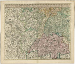
Antique Map of Denmark by Valk 'circa 1690'
About the Item
The map titled "Regnum Daniae, divisum in Dioeceses Arhusiam, Albergum, Viborgum, et Ripam (..)" is a meticulously detailed representation of the Kingdom of Denmark during a historical period, including parts of northern Germany and southern Sweden. Published by G. & L. Valk, this map is an exemplar of cartographic detail and precision, delineating the various dioceses such as Aarhus, Aalborg, Viborg, and Ribe, as indicated by the title.
The map provides a comprehensive view of the region's geographical features, including coastlines, rivers, forests, and the locations of towns and cities. The division into dioceses suggests a focus on the ecclesiastical or church administrative divisions that were significant during the time.
Cartouches, ornamental in design, may adorn the map, containing the title and possibly other details such as the scale of miles, a dedication, or the mapmaker's mark. The map's utility goes beyond mere navigation, serving as a historical record of the political and religious territorial divisions of the time. It would hold significant value for historians, researchers, and enthusiasts of cartographic history, providing insights into the period's landscape as well as the mapmaking artistry of G. & L. Valk.
- Dimensions:Height: 20.67 in (52.5 cm)Width: 24.02 in (61 cm)Depth: 0.02 in (0.5 mm)
- Materials and Techniques:
- Period:Late 17th Century
- Date of Manufacture:circa 1690
- Condition:Original/contemporary hand coloring, blank verso. General age-related toning, minor wear. Please study images carefully.
- Seller Location:Langweer, NL
- Reference Number:
About the Seller
5.0
Platinum Seller
These expertly vetted sellers are 1stDibs' most experienced sellers and are rated highest by our customers.
Established in 2009
1stDibs seller since 2017
1,933 sales on 1stDibs
Typical response time: <1 hour
- ShippingRetrieving quote...Ships From: Langweer, Netherlands
- Return PolicyA return for this item may be initiated within 14 days of delivery.
More From This SellerView All
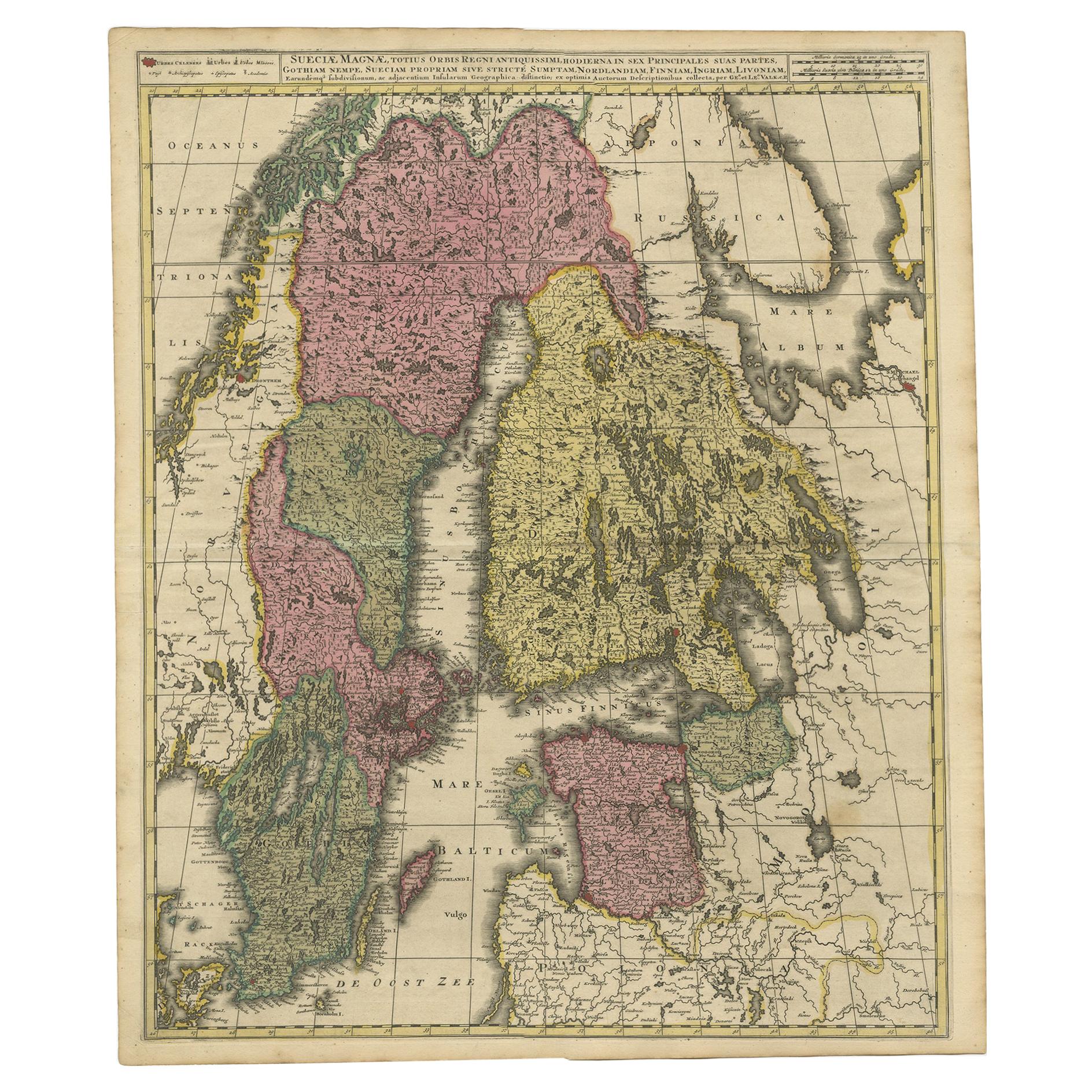
- Antique Map of Scandinavia and the Baltic Region by Valk, circa 1690Located in Langweer, NLAntique map titled 'Sueciae Magnae, totius orbis regni antiquissimi (..)'. Map of Scandinavia and the Baltic region. It shows Norway, Sweden, Finla...Category
Antique Late 17th Century Maps
MaterialsPaper
- Antique Map of Austria by N. Visscher, circa 1690Located in Langweer, NLAntique map titled 'Austriae Archiducatus pars superior in omnes ejusdem'. Spectacular large map of Upper and Lower Austria between Passau and Wien with figurative cartouche and armo...Category
Antique Late 17th Century Maps
MaterialsPaper
- Antique Map of Switzerland by N. Visscher, circa 1690Located in Langweer, NLBeautifully detailed map of Switzerland and surrounding regions in present-day France, Germany, and Italy. This map features two decorative cartouches: the larger is flanked by two p...Category
Antique Late 17th Century Maps
MaterialsPaper
- Antique Map of Switzerland by N. Visscher, circa 1690Located in Langweer, NLAntique map titled 'Tabula Geogaphica qua Pars Meridionalis sive Superior Rheni, Mosae, et Mosellae (..)'. Published by N. Visscher, Amsterdam, circa 1690. Contemporary coloring.Category
Antique Late 17th Century Maps
MaterialsPaper
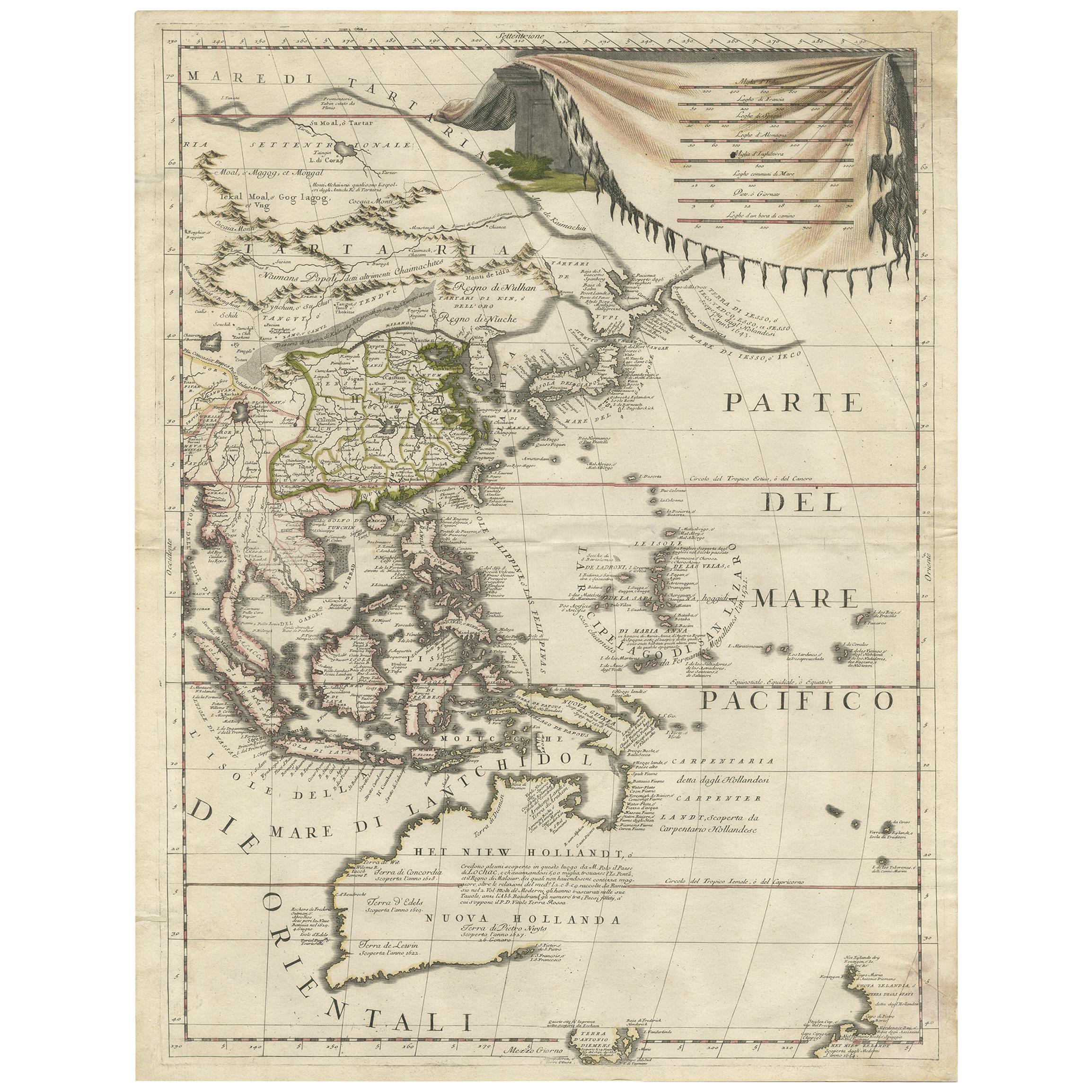
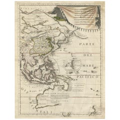
- Antique Map of East Asia by Coronelli, circa 1690Located in Langweer, NLAntique map of East Asia showing New Holland and parts of Van Diemens Land and New Zealand. This map is the right hand part of a two sheet map, but is complete on its own. This map o...Category
Antique Late 17th Century Maps
MaterialsPaper
- Antique Map of Brabant 'The Netherlands' by N. Visscher, circa 1690Located in Langweer, NLAntique map titled 'Brabantiae Batavae pars orientalis, comprehendens Tetrarchiam sive majoratum sylvaeducensem in ejusdem subjacentes ditiones (..)'. Map of the Dutch province 'Brab...Category
Antique Mid-18th Century Maps
MaterialsPaper

You May Also Like
- Original Antique Map of Belgium by Tallis, Circa 1850Located in St Annes, LancashireGreat map of Belgium Steel engraving Many lovely vignettes Published by London Printing & Publishing Co. ( Formerly Tallis ), C.1850 Origin...Category
Antique 1850s English Maps
MaterialsPaper
- Original Antique Map of South America, circa 1830Located in St Annes, LancashireGreat map of South America Copper plate engraving Published by Butterworth, Livesey & Co., circa 1830 Unframed.Category
Antique Early 1800s English Other Maps
MaterialsPaper
- Original Antique Map / City Plan of Brussels by Tallis, circa 1850Located in St Annes, LancashireGreat map of Brussels. Steel engraving. Published by London Printing & Publishing Co. (Formerly Tallis), C.1850 Free shipping.Category
Antique 1850s English Maps
MaterialsPaper
- Original Antique Map of South East Asia by Becker, circa 1840Located in St Annes, LancashireGreat map of South East Asia Steel engraving with original color outline Engraved by Becker Published by Virtue, circa 1840. Unframed.Category
Antique 1840s English Other Maps
MaterialsPaper
- Original Antique Map of Spain and Portugal, circa 1790Located in St Annes, LancashireSuper map of Spain and Portugal Copper plate engraving by A. Bell Published, circa 1790. Unframed.Category
Antique 1790s English Other Maps
MaterialsPaper
- Antique Map of Italy by Andriveau-Goujon, 1843By Andriveau-GoujonLocated in New York, NYAntique Map of Italy by Andriveau-Goujon, 1843. Map of Italy in two parts by Andriveau-Goujon for the Library of Prince Carini at Palazzo Carini i...Category
Antique 1840s French Maps
MaterialsLinen, Paper


Recently Viewed
View AllMore Ways To Browse
Swedish And Danish Antiques
Antique 17th Century Map
17th Swedish
17th Century Swedish
17th Century Danish
Denmark Maps
Denmark Map
Swedish 17th Century Furniture
Map Of Sweden
Map Sweden
Antique Map Denmark
Sweden Antique Map
Map Of The World Antique
Rare Maps
Used World Atlas
Russian Collectable
Office World Map
Sea Collectables