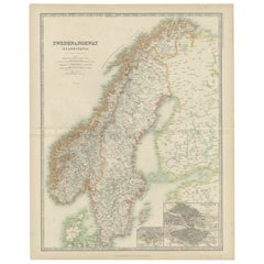
Sweden Antique Map

9
to
19
101
20
62
46
37
22
14
14
13
12
12
10
5
5
5
4
4
3
3
3
2
2
2
2
2
2
1
1
1
1
1
1
1
1
4
3
2
2
1
Sort By
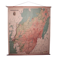
Vintage Swedish School Map of Vastergötland, Made in Sweden 1920
Located in Los Angeles, CA
Vintage Swedish School Map of Vastergötland, Made in Sweden 1920 Västergötland also known as
Category

1920s Swedish Sweden Antique Map

Materials

Linen, Wood, Paper

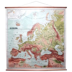
Vintage Swedish School Map of Europe, Large, Made in Sweden, 1905
Located in Los Angeles, CA
Vintage Swedish School Map of Europe - LARGE - Made in Sweden, 1905 This vintage Swedish school
Category

Early 1900s Swedish Sweden Antique Map

Materials

Linen, Wood, Paper

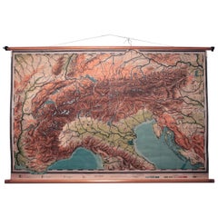
Vintage Swedish Topographic School Map of European Alps, Made in Sweden 1922
Located in Los Angeles, CA
Vintage Swedish Topographic School map of European Alps, Made in Sweden 1922 This vintage
Category

1920s Swedish Sweden Antique Map

Materials

Linen, Wood, Paper

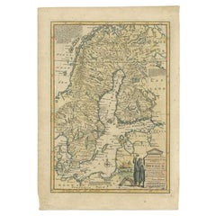
Antique Map of Sweden by Bowen, 1747
Located in Langweer, NL
Antique map titled 'A New & Accurate Map of Sweden'. This map covers Sweden and Finland (shown as
Category

18th Century Sweden Antique Map

Materials

Paper

Antique Map of Sweden by Bowen, 1747
H 14.57 in W 10.24 in D 0 in
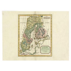
Antique Map of Sweden by Delamarche, 1806
Located in Langweer, NL
Antique map titled 'La Suede.' Decorative map of Sweden and part of Finland by Robert de Vaugondy
Category

19th Century Sweden Antique Map

Materials

Paper

Antique Map of Sweden by Delamarche, 1806
H 11.19 in W 15.08 in D 0 in
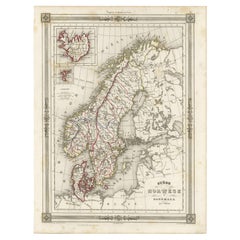
Antique Map of Scandinavia: Norway, Sweden and Denmark
Located in Langweer, NL
Antique map titled 'Suède, Norwège & Danemark'. Attractive map of Scandinavia, with Sweden, Norway
Category

Mid-19th Century Sweden Antique Map

Materials

Paper

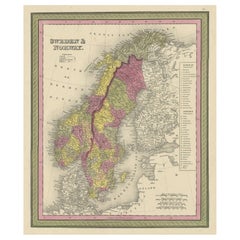
Old Colourful Map of Sweden and Norway, 1846
Located in Langweer, NL
Antique map titled 'Sweden & Norway'. Old map of Sweden and Norway. This map originates from 'A
Category

1840s Sweden Antique Map

Materials

Paper

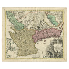
Antique Map of Sweden by Homann, 'circa 1730'
Located in Langweer, NL
Sweden: Schonen with Malmö, Blekinge with Karlskrona and the south part of Halland. With inset map of the
Category

Mid-18th Century Sweden Antique Map

Materials

Paper

Antique Map of Sweden by Homann, 'circa 1730'
H 20.87 in W 24.61 in D 0.02 in
Antique Map of Sweden and Norway by Johnston (1909)
Located in Langweer, NL
Antique map titled 'Sweden and Norway'. Original antique map of Sweden and Norway. With inset maps
Category

Early 20th Century Sweden Antique Map

Materials

Paper

Antique Map of Sweden and Norway by Lowry, '1852'
Located in Langweer, NL
Antique map titled 'Sweden and Norway'. Two individual sheets of Sweden and Norway. This map
Category

Mid-19th Century Sweden Antique Map

Materials

Paper

Original Antique Map of Sweden, Engraved by Barlow, 1806
Located in St Annes, Lancashire
Great map of Sweden Copper-plate engraving by Barlow Published by Brightly & Kinnersly
Category

Early 1800s English Sweden Antique Map

Materials

Paper

Antique Map of Sweden and Norway by Mitchell, 1846
Located in Langweer, NL
Antique map titled 'Sweden & Norway'. Old map of Sweden and Norway. This map originates from 'A New
Category

19th Century Sweden Antique Map

Materials

Paper

Antique Map of Sweden and Norway by Russell, 1814
Located in Langweer, NL
Antique map Scandinavia titled 'Sweden & Norway'. Antique map of Scandinavia with a focus on Sweden
Category

19th Century Sweden Antique Map

Materials

Paper

Antique Map of Sweden and Norway by Johnston, 1882
Located in Langweer, NL
Antique map titled 'Sweden & Norway (Scandinavia)'. Old map of Sweden and Norway, with inset map of
Category

19th Century Sweden Antique Map

Materials

Paper

Antique Map of Sweden and Norway by Petri, 1852
Located in Langweer, NL
Antique map titled 'Zweden en Noorwegen'. Map of Sweden and Norway. This map originates from
Category

19th Century Sweden Antique Map

Materials

Paper

Antique Map of Sweden and Norway by Migeon, 1880
Located in Langweer, NL
Antique map titled 'Suède et Norvége'. Old map of Sweden and Norway. With decorative vignette of
Category

19th Century Sweden Antique Map

Materials

Paper

Antique Map of Denmark and Southern Sweden, c.1658
Located in Langweer, NL
Antique map titled 'Royaume de Danemarq.' Map centered on Sjaelland and covers all of Denmark and
Category

17th Century Sweden Antique Map

Materials

Paper

Antique Map of Central Sweden by J. Blaeu, 1662
Located in Langweer, NL
A striking, rare map with a cartouche dedicated to Gabriel Bengtsson Oxenstierna. Published by J
Category

Mid-17th Century Sweden Antique Map

Materials

Paper

Large Original Vintage Map of Sweden and Norway circa 1920
Located in St Annes, Lancashire
Great map of Sweden and Norway Original color. Good condition Published by Alexander Gross
Category

1920s English Victorian Sweden Antique Map

Materials

Paper

Antique Map of Southern Sweden by Covens & Mortier, 'circa 1720'
Located in Langweer, NL
Antique map titled 'Regni Gothiae (..)'. Detailed map of South Sweden. Embellished with beautiful
Category

Early 18th Century Sweden Antique Map

Materials

Paper

Antique Map of Sweden & Norway by A.K. Johnston '1865'
Located in Langweer, NL
Antique map titled 'Sweden & Norway (Scandinavia)'. With an inset map of Stockholm and environments
Category

Mid-19th Century Sweden Antique Map

Materials

Paper

Antique Map of the Kingdom of Sweden by Güssefeld, 1793
Located in Langweer, NL
Antique map titled 'Charte über das Konigreich Schweden (..)'. Original antique map of the Kingdom
Category

18th Century Sweden Antique Map

Materials

Paper

Decorative Antique Map of Sweden and Part of Finland, 1806
Located in Langweer, NL
Antique map titled 'La Suede.' Decorative map of Sweden and part of Finland by Robert de
Category

Early 1800s Sweden Antique Map

Materials

Paper

Antique Map of Sweden, Norway and Denmark by Johnson, 1872
Located in Langweer, NL
World," by A.J. Johnson, dated 1872. This particular map offers a depiction of Sweden and Norway on one
Category

Late 19th Century Sweden Antique Map

Materials

Paper

Antique Map of Sweden, Norway and Denmark by Johnson, 1872
No Reserve
H 18.12 in W 26.38 in D 0.02 in
Antique Map of Sweden and Norway by Petri, c.1873
Located in Langweer, NL
Antique map titled 'Zweden en Noorwegen'. Old map depicting Sweden and Norway. This map originates
Category

19th Century Sweden Antique Map

Materials

Paper

Antique Map of Sweden and Norway by W. G. Blackie, 1859
Located in Langweer, NL
Antique map titled 'Sweden and Norway'. Original antique map of Sweden and Norway. This map
Category

Mid-19th Century Sweden Antique Map

Materials

Paper

Original Antique Map of Sweden and Norway, Grattan and Gilbert, 1843
Located in St Annes, Lancashire
Great map of Sweden and Norway Drawn and engraved by Archer Published by Grattan and Gilbert
Category

1840s English Other Sweden Antique Map

Materials

Paper

Antique Map of South Sweden 'Scandinavia' by F. de Wit, 1680
Located in Langweer, NL
'. This map shows South Sweden with an inset of Halmstad and vicinity. Contemporary coloring.
Category

Late 17th Century Sweden Antique Map

Materials

Paper

Antique Map of Sweden and Norway by H. Moll, circa 1715
Located in Langweer, NL
Beautiful and rare map of Sweden and Norway including English text. This map most likely originates
Category

Early 18th Century Sweden Antique Map

Materials

Paper

Antique Map of the Kingdoms of Sweden and Norway by Wyld '1845'
Located in Langweer, NL
Antique map titled 'Kingdoms of Sweden and Norway'. Original antique map of the Kingdoms of Sweden
Category

Mid-19th Century Sweden Antique Map

Materials

Paper

Original and Decorative Antique Engraved Map of Finland and Sweden, ca.1720
Located in Langweer, NL
of Finland and Sweden. Originally published by Frederick de Wit in the late 1600's. This map was
Category

1720s Sweden Antique Map

Materials

Paper

Antique Map of the City of Visby 'Sweden' by F. Hogenberg, 1598
Located in Langweer, NL
This is a wonderful bird's-eye plan/view of the oldest city in Sweden. Visby, the largest city
Category

16th Century Sweden Antique Map

Materials

Paper

Attractive Antique Map showing Denmark and part of Sweden and Germany c.1750
By Isaak Tirion
Located in Langweer, NL
Antique map titled 'Nieuwe Kaart van het Koninkryk van Deenemarken (..).' Attractive detailed map
Category

18th Century Sweden Antique Map

Materials

Paper

Sweden & Adjacent Portions of Scandinavia: A Hand-Colored 18th C. Map by Homann
By Johann Baptist Homann
Located in Alamo, CA
This hand-colored map of Sweden and adjacent portions of Scandinavia entitled "Regni Sueciae in
Category

1720s German Sweden Antique Map

Materials

Paper

Original Old Map East of Stockholm, the Island Ljusterö and Värmdö, Sweden, 1720
Located in Langweer, NL
Antique map titled 'Accurate Carte der Upländischen Scheren mit der Situation und Gegend umb die
Category

1720s Sweden Antique Map

Materials

Paper

Antique Map of the Kingdom of Sweden and Norway by Keizer & de Lat, 1788
Located in Langweer, NL
Kingdom of Sweden and Norway. This map originates from 'Nieuwe Natuur- Geschied- en Handelkundige Zak- en
Category

Late 18th Century Sweden Antique Map

Materials

Paper

Antique Map of the North Sea From the English Channel to Norway & Sweden, 1746
Located in Langweer, NL
Antique map titled 'A correct Chart of the German Ocean from the North of Scotland to the Start
Category

1740s Sweden Antique Map

Materials

Paper

Antique Map of Denmark with Schleswig-Holstein and the South of Sweden, c.1750
Located in Langweer, NL
Antique map titled 'General Charte von Konigreich Daenemark nebst dem Herzogthum Holstein.' Denmark
Category

18th Century Sweden Antique Map

Materials

Paper

Antique Map of Lapland Covering all of Sweden around the Gulf of Bothnia, 1714
Located in Langweer, NL
Antique map titled 'Carte de la Laponie Suedoise (..)'. Includes an inset map of Lapland covering
Category

18th Century Sweden Antique Map

Materials

Paper

Antique Map of Scandinavia by Lapie, 1842
Located in Langweer, NL
Danemark'. Map of Scandinavia including Sweden, Norway and Denmark. With inset maps of Iceland and the
Category

Mid-19th Century Sweden Antique Map

Materials

Paper

Antique Map of Scandinavia by Lapie, 1842
H 26.78 in W 19.89 in D 0.02 in
Globe Table Terrestrial Swedish
Located in BUNGAY, SUFFOLK
A Swedish 12 inch terrestrial globe, circa 1900. Measure: height 59cm Just purchased more
Category

1890s Swedish Baroque Revival Sweden Antique Map

Materials

Paper

Globe Table Terrestrial Swedish
H 23.23 in Dm 15.75 in
1814 Map of "Russian Empire" Ric.r032
Located in Norton, MA
Thomson map of the Russian Empire. The map depicts the region from the Baltic Sea, Prussia, and Sweden to
Category

19th Century Unknown Sweden Antique Map

Materials

Paper

1814 Map of "Russian Empire" Ric.r032
H 20.87 in W 24.81 in D 0.4 in
Antique Map of Vänersborg by Merian 'circa 1680'
Located in Langweer, NL
engraved plan of Vänersborg, Sweden. This map orginates from 'Theatrum Europaeum' by Merian, circa 1680.
Category

Late 17th Century Sweden Antique Map

Materials

Paper

Antique Map of Denmark by Hall, circa 1820
Located in Langweer, NL
Antique map titled 'Denmark'. A map of Denmark and the direct surroundings (northern Germany
Category

19th Century Sweden Antique Map

Materials

Paper

Antique Map of Denmark by Hall, circa 1820
H 17.33 in W 12.13 in D 0 in
Antique Map of Denmark by Valk 'circa 1690'
Located in Langweer, NL
, including parts of northern Germany and southern Sweden. Published by G. & L. Valk, this map is an exemplar
Category

Late 17th Century Sweden Antique Map

Materials

Paper

Antique Map of Denmark by Valk 'circa 1690'
H 20.67 in W 24.02 in D 0.02 in
Antique Map of Denmark by F. de Wit, 1680
Located in Langweer, NL
Antique map titled 'Dania Regnum'. Large, attractive map of Denmark, Sleschwig-Holstein and
Category

Late 17th Century Sweden Antique Map

Materials

Paper

Antique Map of Denmark by F. de Wit, 1680
H 20.99 in W 24.22 in D 0.02 in
Antique Map of Scandinavia by T. Jefferys, circa 1750
Located in Langweer, NL
Antique map titled 'Sweden, Denmark, Norway & Finland'. An original mid-18th century copper
Category

Mid-18th Century Sweden Antique Map

Materials

Paper

Antique Map of Russia and Surroundings by Stieler, 1874
Located in Langweer, NL
Antique map titled 'Nord- & Mittal-Asien, Ubersicht des Russischen Reiches.' A map of Russia in
Category

19th Century Sweden Antique Map

Materials

Paper

Antique Map of Northern Europe by Bonne, c.1780
Located in Langweer, NL
Antique map titled 'Le Nord de L'Europe, Contenant Le Danemark, La Norwege; La Suede et La Laponie
Category

18th Century Sweden Antique Map

Materials

Paper

Antique Map of Scandinavia by Van der Aa 'circa 1710'
Located in Langweer, NL
with two maps on one sheet. The upper map depicts Northern Scandinavia with Norway, Sweden and Finland
Category

Early 18th Century Sweden Antique Map

Materials

Paper

Antique Map of Northern Europe and European Russia, ca.1780
Located in Langweer, NL
Antique map titled 'Le Nord de L'Europe, Contenant Le Danemark, La Norwege; La Suede et La Laponie
Category

1780s Sweden Antique Map

Materials

Paper

Antique Map of Denmark with the Danish Royal Crest, c.1730
By Homann Heirs
Located in Langweer, NL
, Scania Blekingia (..).' Map of Denmark and islands, part of Sweden and Germany, drawn by Johann Huber
Category

18th Century Sweden Antique Map

Materials

Paper

Antique Map of Scandinavia and the Baltic Region by Valk, circa 1690
Located in Langweer, NL
Antique map titled 'Sueciae Magnae, totius orbis regni antiquissimi (..)'. Map of Scandinavia and
Category

Late 17th Century Sweden Antique Map

Materials

Paper

Persia, Armenia & Adjacent Regions: A 17th Century Hand-colored Map by De Wit
By Frederick de Wit
Located in Alamo, CA
attractive map of Scandinavia, which includes the Baltic Sea, Norway, Sweden, Finland, Denmark and portions
Category

Late 17th Century Dutch Sweden Antique Map

Materials

Paper

Antique Map of Denmark with Details of Fortresses, Cities, Towns Etc, c.1680
Located in Langweer, NL
Falstriae, Fembriae, Monae (..)'. This map depicts the main Danish Islands and a small part of Sweden. Great
Category

17th Century Sweden Antique Map

Materials

Paper

Antique Map of the Surroundings of the Baltic Sea by A.K. Johnston, 1865
Located in Langweer, NL
Antique map titled 'Basin of the Baltic'. Depicting, Denmark, Sweden, Finland, Estonia, Poland
Category

Mid-19th Century Sweden Antique Map

Materials

Paper

Antique Map of the Gulf of Bothnia, the Northernmost Arm of the Baltic, 1759
Located in Langweer, NL
Antique map titled 'Suite du Golphe de Bothnie'. Original antique map of the Gulf of Bothnia
Category

1750s Sweden Antique Map

Materials

Paper

Attractive Antique Map of Western Africa with Lots of Details on the Coast, 1655
Located in Langweer, NL
veües jusques a present". Handsome map of Western Africa filled with information, much of it
Category

1650s Sweden Antique Map

Materials

Paper

Hand-Colored 18th Century Homann Map of Denmark and Islands in the Baltic Sea
By Johann Baptist Homann
Located in Alamo, CA
An 18th century copper plate hand-colored map entitled "Insulae Danicae in Mari Balthico Sitae
Category

Early 18th Century German Sweden Antique Map

Materials

Paper

Old Map of the Gulf of Bothnia, the Northernmost Arm of the Baltic Sea, 1759
Located in Langweer, NL
Antique map titled 'Carte du Golphe de Bothnie'. Original antique map of the Gulf of Bothnia
Category

1750s Sweden Antique Map

Materials

Paper

  • 1
Get Updated with New Arrivals
Save "Sweden Antique Map", and we’ll notify you when there are new listings in this category.

Sweden Antique Map For Sale on 1stDibs

Choose from an assortment of styles, material and more with respect to the Sweden antique map you’re looking for at 1stDibs. Frequently made of paper, wood and fabric, every Sweden antique map was constructed with great care. Whether you’re looking for an older or newer Sweden antique map, there are earlier versions available from the 18th Century and newer variations made as recently as the 20th Century. Erik Von Dahlberg, Johann Baptist Homann and Isaak Tirion each produced at least one beautiful Sweden antique map that is worth considering.

How Much is a Sweden Antique Map?

A Sweden antique map can differ in price owing to various characteristics — the average selling price 1stDibs is $358, while the lowest priced sells for $50 and the highest can go for as much as $9,000.

Read More

Pamela Shamshiri Shares the Secrets behind Her First-Ever Book and Its Effortlessly Cool Interiors

The sought-after designer worked with the team at Hoffman Creative to produce a monograph that beautifully showcases some of Studio Shamshiri's most inspiring projects.

Moroccan Artworks and Objects Take Center Stage in an Extraordinary Villa in Tangier

Italian writer and collector Umberto Pasti opens the doors to his remarkable cave of wonders in North Africa.

Montecito Has Drawn Royalty and Celebrities, and These Homes Are Proof of Its Allure

Hollywood A-listers, ex-pat aristocrats and art collectors and style setters of all stripes appreciate the allure of the coastal California hamlet — much on our minds after recent winter floods.

Whaam! Blam! Pow! — a New Book on Pop Art Packs a Punch

Publishing house Assouline and writer Julie Belcove have teamed up to trace the history of the genre, from Roy Lichtenstein, Andy Warhol and Yayoi Kusama to Mickalene Thomas and Jeff Koons.

The Sparkling Legacy of Tiffany & Co. Explained, One Jewel at a Time

A gorgeous new book celebrates — and memorializes — the iconic jeweler’s rich heritage.

What Makes a Gem-Encrusted Chess Set Worth $4 Million?

The world’s most opulent chess set, weighing in at 513 carats, is literally fit for a king and queen.

Tauba Auerbach’s Geometric Pop-Up Book Is Mighty Rare, Thanks to a Hurricane

This sculptural art book has an epic backstory of its own.

Step inside the Storied Mansions of Palm Beach’s Most Effervescent Architect

From Spanish-style courtyards to fanciful fountains, these acclaimed structures abound in surprising and elegant details.