Items Similar to Antique Map of Denmark by Hall, circa 1820


Want more images or videos?
Request additional images or videos from the seller
1 of 7
Antique Map of Denmark by Hall, circa 1820
About the Item
Antique map titled 'Denmark'. A map of Denmark and the direct surroundings (northern Germany, Baltic Sea, Kattegatt and North Sea, south east Sweden). Sheet XXV from an unidentified English atlas, published in London, circa 1820.
Artists and Engravers: Made by 'Sidney Hall' after an anonymous artist. Sidney Hall (1788–1831) was a British engraver and cartographer, popular for his early nineteenth century atlases containing maps of the United Kingdom and of the ancient world.
Condition: Very good, given age. Margin edges faintly browned with age. A small crease in the right margin (not affecting image). General age-related toning and/or occasional minor defects from handling. Please study image carefully.
Date: circa 1820
Overall size: 30.8 x 44 cm.
Image size: 0.001 x 25.5 x 38.5 cm.
We sell original antique maps to collectors, historians, educators and interior decorators all over the world. Our collection includes a wide range of authentic antique maps from the 16th to the 20th centuries. Buying and collecting antique maps is a tradition that goes back hundreds of years. Antique maps have proved a richly rewarding investment over the past decade, thanks to a growing appreciation of their unique historical appeal. Today the decorative qualities of antique maps are widely recognized by interior designers who appreciate their beauty and design flexibility. Depending on the individual map, presentation, and context, a rare or antique map can be modern, traditional, abstract, figurative, serious or whimsical. We offer a wide range of authentic antique maps for any budget.
- Dimensions:Height: 17.33 in (44 cm)Width: 12.13 in (30.8 cm)Depth: 0 in (0.01 mm)
- Materials and Techniques:
- Period:
- Date of Manufacture:circa 1820
- Condition:
- Seller Location:Langweer, NL
- Reference Number:
About the Seller
5.0
Platinum Seller
These expertly vetted sellers are 1stDibs' most experienced sellers and are rated highest by our customers.
Established in 2009
1stDibs seller since 2017
1,916 sales on 1stDibs
Typical response time: <1 hour
- ShippingRetrieving quote...Ships From: Langweer, Netherlands
- Return PolicyA return for this item may be initiated within 14 days of delivery.
More From This SellerView All
- Antique Map of Denmark by Valk 'circa 1690'Located in Langweer, NLThe map titled "Regnum Daniae, divisum in Dioeceses Arhusiam, Albergum, Viborgum, et Ripam (..)" is a meticulously detailed representation of the Kingdom of Denmark during a historic...Category
Antique Late 17th Century Maps
MaterialsPaper
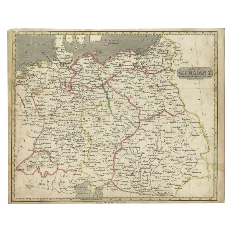
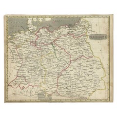
- Antique Map of Germany by Walker, 1820By R. WalkerLocated in Langweer, NLAntique map Germany titled 'Map of Germany as defined by the Peace of Paris'. Detailed antique map of Germany. Artists and Engravers: Engrav...Category
Antique 19th Century Maps
MaterialsPaper
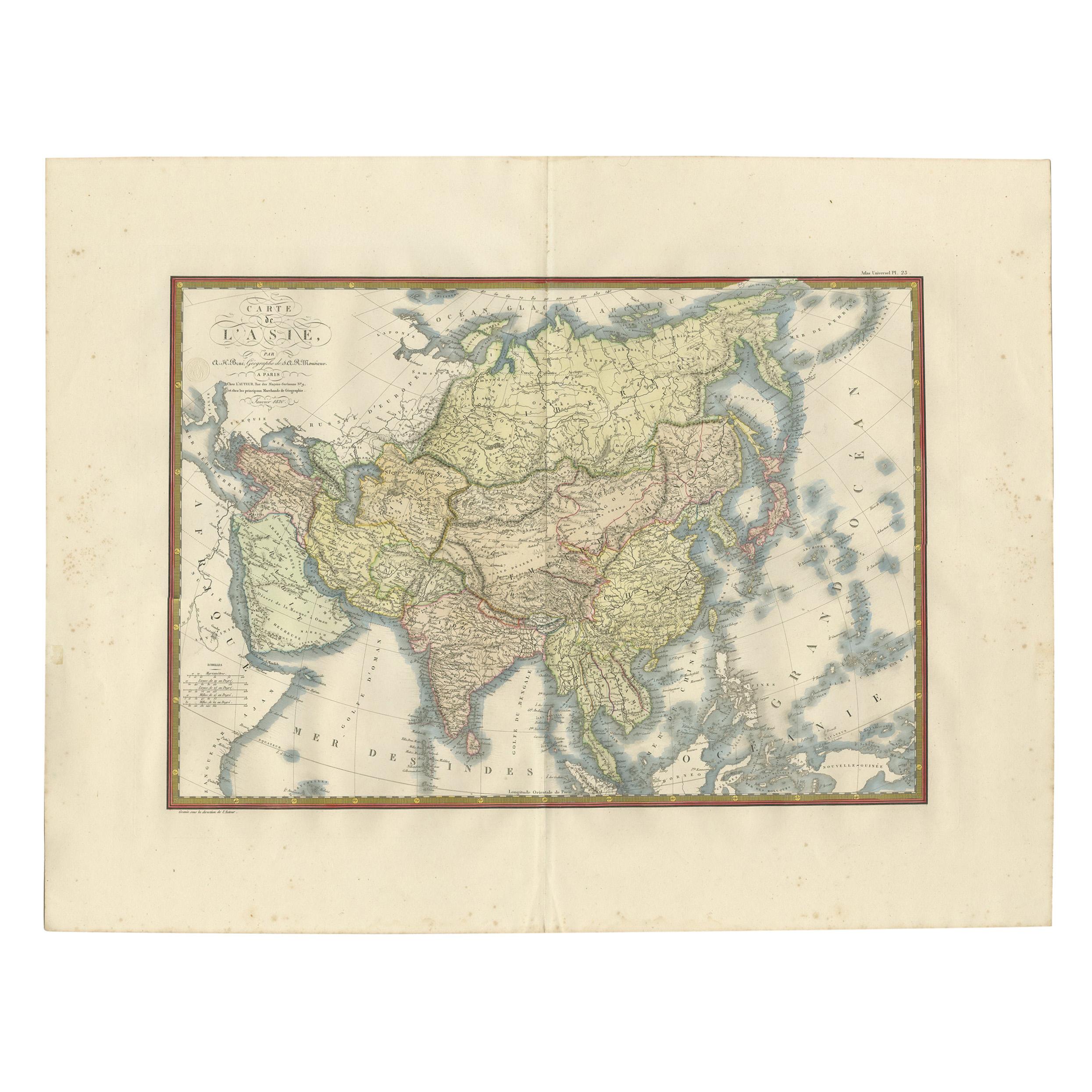
- Antique Map of Asia by Brué '1820'Located in Langweer, NLAntique map titled 'Carte de l'Asie'. Original antique map of Asia. A blind stamp near the title reads 'Carte Encyprotipe'. This map originates fro...Category
Antique Early 19th Century Maps
MaterialsPaper
- Antique Map of Denmark by Moll 'circa 1730'By Herman MollLocated in Langweer, NLAntique map titled 'Denmark, agreeable to Modern History'. Uncommon map of Denmark by Herman Moll, published, circa 1730.Category
Antique Mid-18th Century Maps
MaterialsPaper
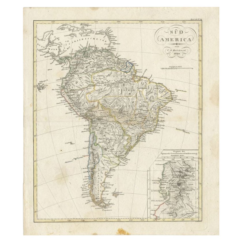
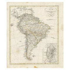
- Antique Map of South America by Reichard, 1820By Thomas KitchinLocated in Langweer, NLAntique map titled 'Süd America'. Decorative antique map of South America with an inset map of Ecuador. Artists and Engravers: Published b...Category
Antique 19th Century Maps
MaterialsPaper
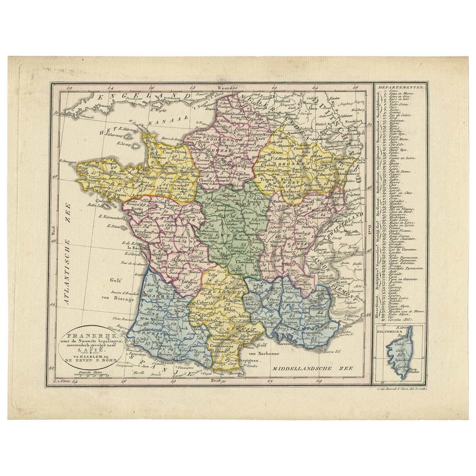
- Antique Map of France by Van Baarsel (c.1820)Located in Langweer, NL'Frankrijk naar de nieuwste bepalingen meerendeels gevolgd naar Lapie'. Beautiful map of France with an inset map of the island of Corsica. Includes a table with reference to the dep...Category
Antique Early 19th Century Maps
MaterialsPaper


You May Also Like
- Original Antique Map of Russia By Arrowsmith. 1820Located in St Annes, LancashireGreat map of Russia Drawn under the direction of Arrowsmith Copper-plate engraving Published by Longman, Hurst, Rees, Orme and Brown, 1820 Unframed.Category
Antique 1820s English Maps
MaterialsPaper
- Original Antique Map of Hungary, Arrowsmith, 1820Located in St Annes, LancashireGreat map of Hungary Drawn under the direction of Arrowsmith. Copper-plate engraving. Published by Longman, Hurst, Rees, Orme and Brown, 1820 Unframed.Category
Antique 1820s English Maps
MaterialsPaper
- Original Antique Map of France, Arrowsmith, 1820Located in St Annes, LancashireGreat map of France Drawn under the direction of Arrowsmith. Copper-plate engraving. Published by Longman, Hurst, Rees, Orme and Brown, 1820 Unframed.Category
Antique 1820s English Maps
MaterialsPaper
- Original Antique Map of Canada, Arrowsmith, 1820Located in St Annes, LancashireGreat map of Canada. Drawn under the direction of Arrowsmith. Copper-plate engraving. Published by Longman, Hurst, Rees, Orme and Brown, 1820 ...Category
Antique 1820s English Maps
MaterialsPaper
- Original Antique Map of Europe, Arrowsmith, 1820Located in St Annes, LancashireGreat map of Europe Drawn under the direction of Arrowsmith. Copper-plate engraving. Published by Longman, Hurst, Rees, Orme and Brown, 1820 ...Category
Antique 1820s English Maps
MaterialsPaper
- Original Antique Map of Italy. Arrowsmith. 1820Located in St Annes, LancashireGreat map of Italy Drawn under the direction of Arrowsmith Copper-plate engraving Published by Longman, Hurst, Rees, Orme and Brown, 1820 Unframed.Category
Antique 1820s English Maps
MaterialsPaper


Recently Viewed
View AllMore Ways To Browse
Danish Range
Size 1820
Maps London
Map London
London Map
Map Of London
Swedish And Danish Antiques
Antique Danish Modern Furniture
Danish Modern Antique Furniture
Danish Antique And Modern
Antique Map London
Antique London Maps
Antique London Map
London Antique Maps
Antique Maps London
London Antique Map
London Map Antique
Map Of Britain