Items Similar to Antique Map of Sweden by Delamarche, 1806


Want more images or videos?
Request additional images or videos from the seller
1 of 5
Antique Map of Sweden by Delamarche, 1806
About the Item
Antique map titled 'La Suede.' Decorative map of Sweden and part of Finland by Robert de Vaugondy, revised and published by Delamarche. Source unknown, to be determined. Artists and Engravers: Made by 'Charles Francois Delamarche' after an anonymous artist. Charles Francois Delamarche (1740-1817) founded the important and prolific Paris based Maison Delamarche map publishing firm in the late 18th century. A lawyer by trade Delamarche entered the map business with the acquisition from Jean-Baptiste Fortin of Robert de Vaugondy's map plates and copyrights and later addes many plates from other sources as well. Charles Delamarche eventually passed control of the firm to his son Felix Delamarche (18th C. - 1st half 19th C.) and geographer Charles Dien (1809-1870). It was later passed on to Alexandre Delamarche, who revised and reissued several Delamarche publications in the mid-19th century. The firm continued to publish maps and globes until the middle part of the 19th century.
Artist: Made by 'Charles Francois Delamarche' after an anonymous artist. Charles Francois Delamarche (1740-1817) founded the important and prolific Paris based Maison Delamarche map publishing firm in the late 18th century. A lawyer by trade Delamarche entered the map business with the acquisition from Jean-Baptiste Fortin of Robert de Vaugondy's map plates and copyrights and later addes many plates from other sources as well. Charles Delamarche eventually passed control of the firm to his son Felix Delamarche (18th C. - 1st half 19th C.) and geographer Charles Dien (1809-1870). It was later passed on to Alexandre Delamarche, who revised and reissued several Delamarche publications in the mid-19th century. The firm continued to publish maps and globes until the middle part of the 19th century.
Condition: Good, given age. Soft crease upper right. Original middle fold as issued. General age-related toning and/or occasional minor defects from handling. Please study image carefully.
Date: 1806
Overall size: 38.3 x 28.4 cm.
Image size: 0.001 x 19.4 x 24.3 cm.
Antique prints have long been appreciated for both their aesthetic and investment value. They were the product of engraved, etched or lithographed plates. These plates were handmade out of wood or metal, which required an incredible level of skill, patience and craftsmanship. Whether you have a house with Victorian furniture or more contemporary decor an old engraving can enhance your living space. We offer a wide range of authentic antique prints for any budget.
- Dimensions:Height: 11.19 in (28.4 cm)Width: 15.08 in (38.3 cm)Depth: 0 in (0.01 mm)
- Materials and Techniques:
- Period:
- Date of Manufacture:1806
- Condition:
- Seller Location:Langweer, NL
- Reference Number:
About the Seller
5.0
Platinum Seller
These expertly vetted sellers are 1stDibs' most experienced sellers and are rated highest by our customers.
Established in 2009
1stDibs seller since 2017
1,919 sales on 1stDibs
Typical response time: <1 hour
- ShippingRetrieving quote...Ships From: Langweer, Netherlands
- Return PolicyA return for this item may be initiated within 14 days of delivery.
More From This SellerView All
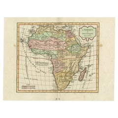
- Antique Map of Africa by Delamarche, 1806Located in Langweer, NLAntique map titled 'L'Afrique'. Decorative map of Africa by Robert de Vaugondy, revised and published by Delamarche. Source unknown, to be determined. Artists and Engravers: Charl...Category
Antique 19th Century Maps
MaterialsPaper
- Antique Map of the British Isles by Delamarche, 1806Located in Langweer, NLAntique map titled 'Les Isles Britanniques.' Decorative map of the British Isles by Robert de Vaugondy, revised and published by Delamarche. Source unkno...Category
Antique 19th Century Maps
MaterialsPaper
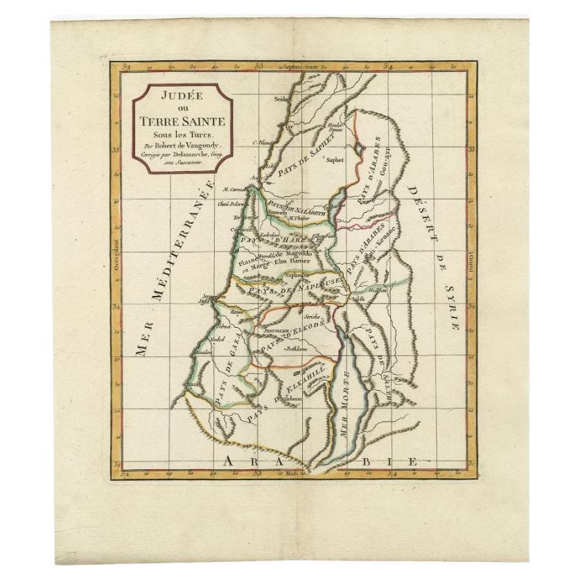
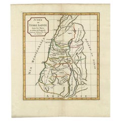
- Antique Map of the Holy Land by Delamarche, 1806By Charles Francois DelamarcheLocated in Langweer, NLAntique map titled 'Judee ou Terre Sainte sous les Turcs.' This map shows the holy land under the Turcs. By Robert de Vaugondy, revised and published by ...Category
Antique 19th Century Maps
MaterialsPaper
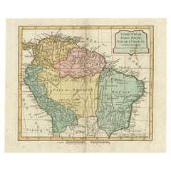
- Antique Map of the Northern Part of South America by Delamarche, 1806Located in Langweer, NLAntique map titled 'Terre-Ferme, Perou, Bresil, Pays de L'Amazone.' This map shows the northern part of South America with Peru, Brazil, Guyana etc. By Robert de Vaugondy, revised an...Category
Antique 19th Century Maps
MaterialsPaper
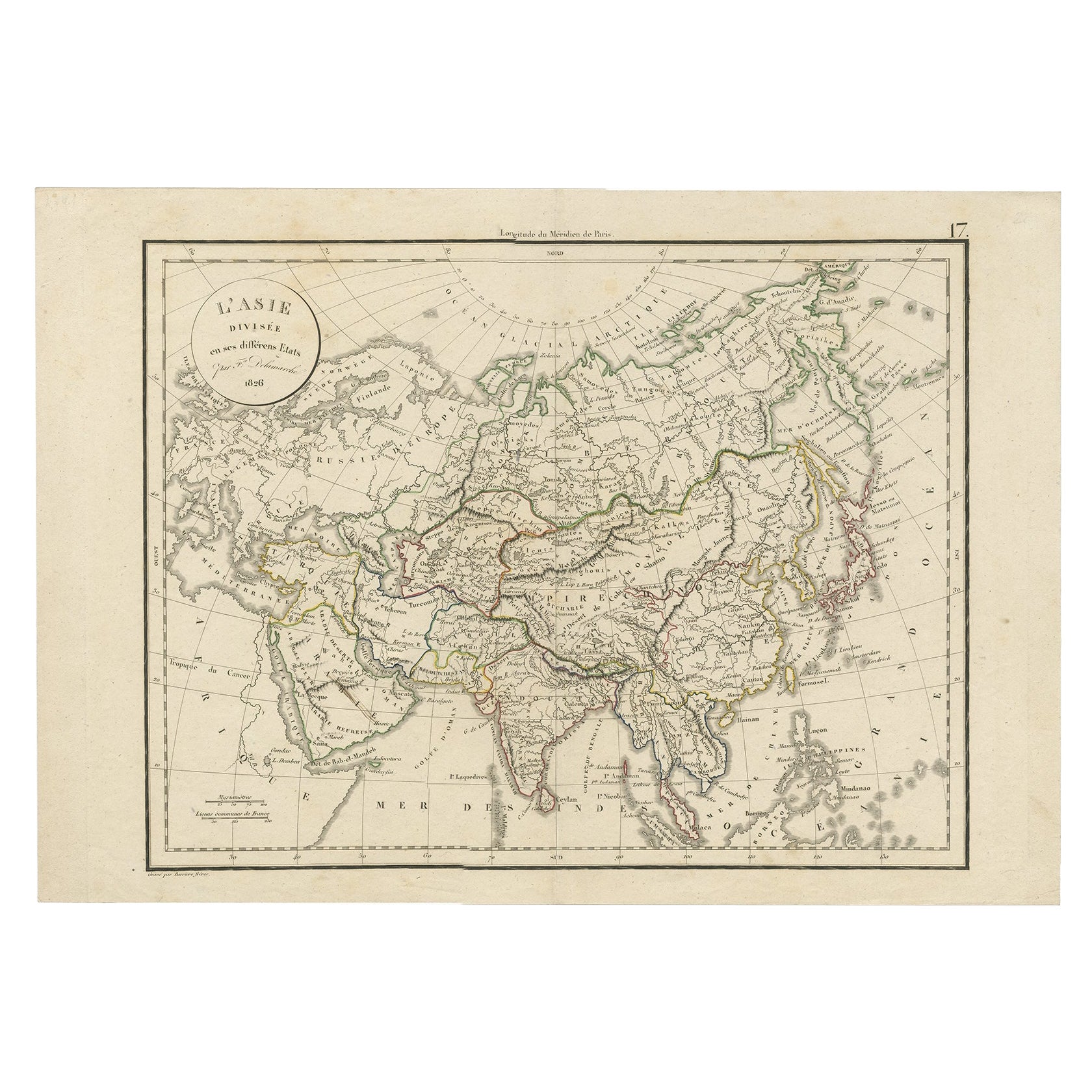
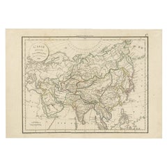
- Antique Map of Asia by Delamarche, 1826Located in Langweer, NLVaugondy's map plates and copyrights and later addes many plates from other sources as well. Charles Delamarche eventually passed control of the firm to his son Felix Delamarche (18t...Category
Antique 19th Century Maps
MaterialsPaper
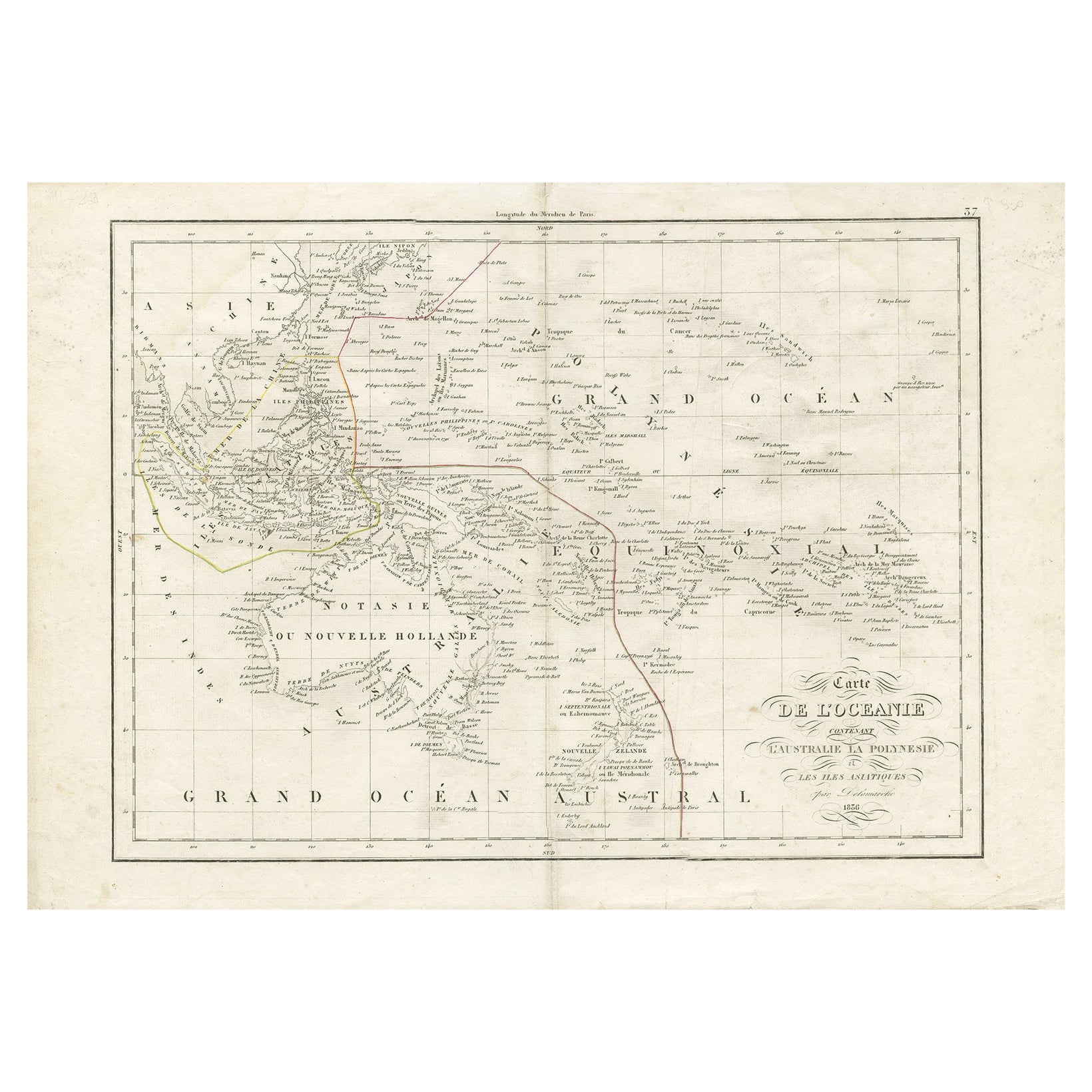
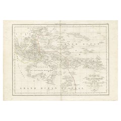
- Antique Map of Oceania by Delamarche, 1836Located in Langweer, NLAntique map titled 'Carte de l'Oceanie contenant l'Australie la Poynesie et les iles Asiatiques.' Antique map of Oceania comprising Australia and Polynesia, New Zealand and Indonesia...Category
Antique 19th Century Maps
MaterialsPaper

You May Also Like
- Original Antique Map of Spain and Portugal, Engraved By Barlow, 1806Located in St Annes, LancashireGreat map of Spain And Portugal Copper-plate engraving by Barlow Published by Brightly & Kinnersly, Bungay, Suffolk. 1806 Unframed.Category
Antique Early 1800s English Maps
MaterialsPaper
- America "Amérique Septentrionale": A 19th Century French Map by DelamarcheBy Maison Delamarche 1Located in Alamo, CAThis framed mid 19th century map of North America entitled "Amérique Septentrionale" by Felix Delamarche was published in Paris in 1854 by Quay de l'Horloge du Palais, avec les Carte...Category
Antique Mid-19th Century American Other Maps
MaterialsPaper
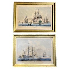
- Antique Pair of English Maritime Colored Etchings 1806.Located in Vero Beach, FLAntique Pair of English Maritime Colored Etchings 1806. English hand-colored etchings of a 90 Gun Ship at Spithead and a Collier with a view of the S...Category
Antique 19th Century English Romantic Nautical Objects
MaterialsGlass, Giltwood, Paper
- 1861 Topographical Map of the District of Columbia, by Boschke, Antique MapLocated in Colorado Springs, COPresented is an original map of Albert Boschke's extremely sought-after "Topographical Map of the District of Columbia Surveyed in the Years 1856 ...Category
Antique 1860s American Historical Memorabilia
MaterialsPaper
- 1907 Map of Colorado, Antique Topographical Map, by Louis NellLocated in Colorado Springs, COThis highly detailed pocket map is a topographical map of the state of Colorado by Louis Nell from 1907. The map "has been complied from all availabl...Category
Antique Early 1900s American Maps
MaterialsPaper
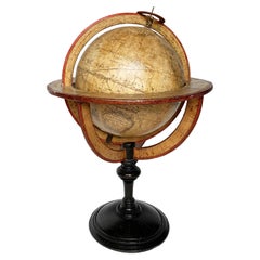
- Terrestrial Table Globe by Félix Delamarche, Paris, 1821By Félix DelamarcheLocated in Milano, ITTerrestrial table globe Félix Delamarche Paris, 1821 It measures 20.47 in height, Ø max 14.17 in; the sphere Ø 9.44 in (h 52 cm x Ø max 36.5 cm; the sphere Ø 24 cm) Wood, printed...Category
Antique 1820s French Restauration Scientific Instruments
MaterialsMetal


Recently Viewed
View AllMore Ways To Browse
Finnish Antiques
Finnish Antique Furniture
De Suede
Antique Plate With Metal Handle
Lawyer Office
Maison Charles Of Paris
Antique Metal Globes
Antique Paris Map Print
Antique Lawyer
Antique Map Globe
Suede La
Antique Swedish Plates
Maison Jean Charles
Authentic Midcentury Decor
Antique Swedish Print
Space Age Francois
Unknown Swedish Artist
Globe Engraving