Antique Paris Map Print
1
to
23
196
115
174
125
104
54
46
44
25
21
20
17
17
16
15
12
9
8
8
8
7
6
5
5
4
4
4
4
4
3
3
3
3
2
2
2
2
1
1
1
1
16
13
12
9
4
Sort By
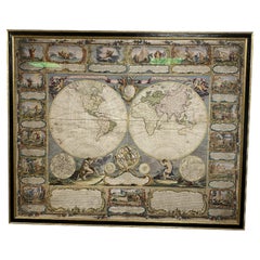
Colored wall map of the WORLD
By Chambon
Located in ZWIJNDRECHT, NL
huge wall map of the world in two hemispheres printed on two sheets, depicting the Eastern and Western
Category
Mid-18th Century French French Provincial Antique Paris Map Print
Materials
Wood, Paper
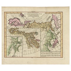
Map of North and East coast of Asia with Japan & inset maps of Kamchatka, c1750
Located in Langweer, NL
east coast of Asia, showing an oddly shaped Japan and inset maps of Kamchatka. This old antique print
Category
1750s Antique Paris Map Print
Materials
Paper
H 14.77 in W 17.45 in D 0 in
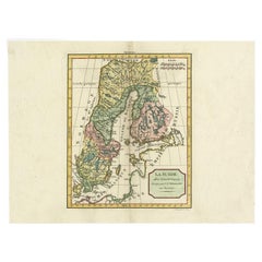
Antique Map of Sweden by Delamarche, 1806
Located in Langweer, NL
the important and prolific Paris based Maison Delamarche map publishing firm in the late 18th century
Category
19th Century Antique Paris Map Print
Materials
Paper
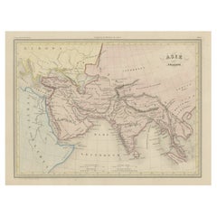
Original Antique Map of Ancient Asia, 1847
Located in Langweer, NL
, revised by J.J. N. Huot, printed in 1847, Paris.
Artists and Engravers: Conrad Malte-Brun (1755 - 1826
Category
1840s Antique Paris Map Print
Materials
Paper
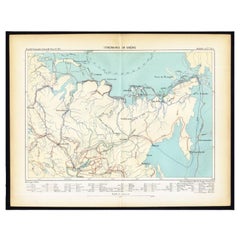
Antique Map of Siberia by Reclus, 1881
Located in Langweer, NL
Antique map titled 'Itineraires en Siberie.' This map shows the itineraries of famous explorers in
Category
19th Century Antique Paris Map Print
Materials
Paper
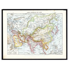
Antique Map of Asia by Larousse, 1897
Located in Langweer, NL
Front: 'Carte Generale de l'Asie.' (General map of Asia). Rear: 'Asie.' (Asia, scenes of Asia
Category
19th Century Antique Paris Map Print
Materials
Paper
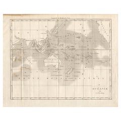
Antique Map of Oceania by Didot, 1836
Located in Langweer, NL
Antique map titled 'Oceanie par G.L.Dy. De Rienzi'. Map of the Oceania region, around Australia
Category
19th Century Antique Paris Map Print
Materials
Paper
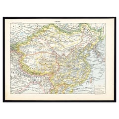
Antique Map of China by Larousse, 1897
By Pierre Larousse
Located in Langweer, NL
Sheet: Front: 'Chine.' (China map). Verso: 'China.' (China views, nature, animals, costume). This
Category
19th Century Antique Paris Map Print
Materials
Paper
Antique Map of Sumatra by Tardieu, 1811
Located in Langweer, NL
Antique map Sumatra titled 'Partie de l'Isle Sumatra'. Part of the Island of Sumatra, where the
Category
19th Century Antique Paris Map Print
Materials
Paper
Antique Map of Oceania by Hérisson, 1816
Located in Langweer, NL
Antique map titled "Océanie ou cinquième partie du monde". This is an original antique map of
Category
19th Century Antique Paris Map Print
Materials
Paper
Antique Map of the Archdiocese of Cologne, Germany
Located in Langweer, NL
mainly have been printed by Pierre Mortier in Amsterdam but also in Paris.
Category
Late 17th Century Antique Paris Map Print
Materials
Paper
Antique Map of Southeast Asia by Dussy, 1778
Located in Langweer, NL
Engravers: E. Dussy, a Paris draughtsman and map engraver, active 1754-1784, best known for his long
Category
18th Century Antique Paris Map Print
Materials
Paper
Antique Map of Southern Italy by Migeon, 1880
Located in Langweer, NL
"Antique map titled 'Italie Méridionale'. Old map of southern Italy including Sicily/Sicilia. This
Category
19th Century Antique Paris Map Print
Materials
Paper
Antique Map of Northern Italy by Migeon, 1880
Located in Langweer, NL
Antique map titled 'Italie Septentrionale'. Old map of the northern part of Italy. This map
Category
19th Century Antique Paris Map Print
Materials
Paper
Antique Map of Siberia and Russia, c.1885
Located in Langweer, NL
. Migeon (fl. c. 1855 - 1899) was a late 19th century map publisher based in Paris, France. His most
Category
19th Century Antique Paris Map Print
Materials
Paper
Antique Map of North and East Asia, 1751
Located in Langweer, NL
as an peninsular. This map originates from the plate section. This old antique print originates from
Category
18th Century Antique Paris Map Print
Materials
Paper
Antique Map of Southeast Asia by Larousse, 1897
Located in Langweer, NL
"Front: 'Carte Generale des Indes.' (General map of India / The Indies / Thailand / Malaysia). Rear
Category
19th Century Antique Paris Map Print
Materials
Paper
French Geographical, Statistical and Historical Map of Pensylvania, 1825
Located in Langweer, NL
. Carez in Paris. (1825)
Hand colored engraved map. Relief shown by hachures. Text and tables at sides
Category
1820s Antique Paris Map Print
Materials
Paper
H 20.08 in W 25.99 in D 0 in
Antique Map of Spain and Portugal by Migeon, 1880
Located in Langweer, NL
Paris, France.
Antique prints have long been appreciated for both their aesthetic and investment value
Category
19th Century Antique Paris Map Print
Materials
Paper
Antique Map of Russia in Europe by Migeon, 1880
Located in Langweer, NL
Antique map titled 'Russie d'Europe'. Old map of Russia in Europe. This map originates from
Category
19th Century Antique Paris Map Print
Materials
Paper
Antique Map of the Austrian Empire by Migeon, 1880
Located in Langweer, NL
Antique map titled 'Empire d'Autriche'. Old map of the Austrian Empire. With decorative vignette
Category
19th Century Antique Paris Map Print
Materials
Paper
Antique Map of Sweden and Norway by Migeon, 1880
Located in Langweer, NL
Antique map titled 'Suède et Norvége'. Old map of Sweden and Norway. With decorative vignette of
Category
19th Century Antique Paris Map Print
Materials
Paper
Antique Map of the Pacific Ocean by Rienzi, 1836
Located in Langweer, NL
Antique map titled 'Mélanésie'. Map of the Pacific ocean around Australia, including Java, Timor
Category
19th Century Antique Paris Map Print
Materials
Paper
Antique Map of Asia Minor by Malte-Brun, 1847
Located in Langweer, NL
Malte Brun's "" Atlas de Géographie Universelle"", revised by J.J. N. Huot, printed in 1847, Paris
Category
19th Century Antique Paris Map Print
Materials
Paper
Antique Map of the British Isles by Delamarche, 1806
Located in Langweer, NL
) founded the important and prolific Paris based Maison Delamarche map publishing firm in the late 18th
Category
19th Century Antique Paris Map Print
Materials
Paper
Antique Map of the Buton Strait by Philippe, 1787
Located in Langweer, NL
Antique map titled 'Carte du Détroit de Bouton'. Map of the Buton Strait between Paula Buton and
Category
18th Century Antique Paris Map Print
Materials
Paper
Antique Map of Northern Germany by Wyld, c.1840
Located in Langweer, NL
, Hamburg and Lubeck Conformably with the Treaty of Paris'. Scarce regional map of Northern Germany filled
Category
19th Century Antique Paris Map Print
Materials
Paper
Antique Map of Russia and Siberia by Migeon, 1880
Located in Langweer, NL
Antique map titled 'Sibérie ou Russie d'Asie'. Migeon's map covers the Russian empire in Asia from
Category
19th Century Antique Paris Map Print
Materials
Paper
Original Antique Map of the Cape Verde Islands, 1746
Located in Langweer, NL
Antique map titled 'Carte Des Isles Du Cap Verd.' Original antique map of the Cape Verde Islands
Category
18th Century Antique Paris Map Print
Materials
Paper
Antique Map of Spain by Covens & Mortier, c.1740
Located in Langweer, NL
Antique map Spain titled 'L?Espagne dressée sur la Description qui en a eté faite par Rodrigo
Category
18th Century Antique Paris Map Print
Materials
Paper
Rare Antique Map of 'Barbarie' or Northern Africa, 1655
Located in Langweer, NL
Antique map titled 'Partie de la Coste de Barbarie en Africque ou sont les Royaumes de Tunis et
Category
17th Century Antique Paris Map Print
Materials
Paper
Antique Map of Southern Brazil by Bonne, c.1780
Located in Langweer, NL
"Antique map titled 'Carte de la Partie Méridionale du Bresil (..)'. This antique map of Brazil
Category
18th Century Antique Paris Map Print
Materials
Paper
Original Antique Map of Peru with Regions Outlined in Color
Located in Langweer, NL
to eke out this meagre wage, he began to trade in prints, books and maps. He is remembered for more
Category
Early 19th Century Antique Paris Map Print
Materials
Paper
Remarkable Antique Map of West Europe by Scherer, circa 1703
Located in Langweer, NL
Antique map of Western Europe. Depicting Bergen, Stockholm, Dublin, Paris, Wien, Madrid, Rome
Category
18th Century Antique Paris Map Print
Materials
Paper
1594 Maurice Bouguereau Map of the Region Limoges, France, Ric0015
Located in Norton, MA
1594 Maurice Bouguereau map of the region Limoges, France, entitled
"Totivs Lemovici et Confinium
Category
16th Century Dutch Antique Paris Map Print
Materials
Paper
French Antique Map of Northern Africa and Libya, c.1840
Located in Langweer, NL
Antique map titled 'Marok, Alger et Tunis - Etat de Tripoli'. Map of Northern Africa and Libya
Category
19th Century Antique Paris Map Print
Materials
Paper
Antique Map of the Bukhari Region by Van Schley, 1758
Located in Langweer, NL
Antique map titled 'Carte de la petite Bukharie et pays voisins.' Original antique map of the
Category
18th Century Antique Paris Map Print
Materials
Paper
"Africa Vetus": a 17th Century Hand-Colored Map by Sanson
By Nicolas Sanson
Located in Alamo, CA
engraved map of Africa is printed on antique hand-made watermarked, laid, chain-linked paper with wide
Category
Late 17th Century French Antique Paris Map Print
Materials
Paper
Antique Map of European Trade in Asia by Pluche, 1742
Located in Langweer, NL
Map pag. 444: 'Le commerce des Europeens en Asie.' (The commerce / trade of the Europeans in Asia
Category
18th Century Antique Paris Map Print
Materials
Paper
Antique Engraved Map with Original Hand Colour of French Guiana, 1876
Located in Langweer, NL
. Fisquet; Published by A. Le Vasseur, Paris [Grand atlas départemental]
**Type:** Antique engraved map
Category
Late 19th Century Antique Paris Map Print
Materials
Paper
1797 Tardieu Map of Southeast Asia: The Malay Archipelago and Beyond
Located in Langweer, NL
An original historical map titled 'Presqu' Île Au Dela Du Gange et Archipel De L'Inde', created by
Category
1790s Antique Paris Map Print
Materials
Paper
Free Shipping
H 25.2 in W 19.1 in D 0 in
Antique Map of Turkey in Asia 'Asia Minor' by Vuillemin, 1846
Located in Langweer, NL
old antique print / plate / map originates from: 'Atlas Universal de Geographie Ancienne et Moderne
Category
19th Century Antique Paris Map Print
Materials
Paper
Antique Map of part of Europe by Scherer, c.1703
Located in Langweer, NL
Untitled map of Europe depicting Calais, Münster, Paris, Lion, Prag, Wien, Berlin, Clermont and
Category
18th Century Antique Paris Map Print
Materials
Paper
Antique Map of Western Europe and Spain by Scherer, circa 1703
Located in Langweer, NL
Untitled map of Western Europe and Spain. Depicting Rome, Edinburgh, Paris, Madrid, Stockholm and
Category
18th Century Antique Paris Map Print
Materials
Paper
Antique Map of the Peter the Great Gulf by Reclus, 1881
Located in Langweer, NL
Antique map titled 'Le Golfe de Pierre-Le-Grand.' This map shows the Peter The Great Gulf in the
Category
19th Century Antique Paris Map Print
Materials
Paper
Antique Map of Persia, Georgia and Kazakhstan by Bonne, c.1780
Located in Langweer, NL
Antique map titled 'Carte de la Perse, de la Georgie, et de la Tartarie Independante'. Map of
Category
18th Century Antique Paris Map Print
Materials
Paper
Original Antique Map of the Philippines, Malaysia, Indonesia, Singapore, c.1690
Located in Langweer, NL
produced several hundred maps, either printed separately or as parts of atlases. By the end of the 17th
Category
1690s Antique Paris Map Print
Materials
Paper
Free Shipping
H 19.49 in W 27.56 in D 0 in
Antique Map Depicting Sydney and Surrounding Areas, Known as Port Jackson, c1889
Located in Langweer, NL
," published in Paris.
The map is a color-printed engraving, a common technique of the time, which allowed for
Category
1880s Antique Paris Map Print
Materials
Paper
Free Shipping
H 10.16 in W 13.39 in D 0 in
Antique Map of Cities of the Province of Shanxi in China, 1749
By Jacques-Nicolas Bellin
Located in Langweer, NL
Antique print titled: 'Lan-Tcheou ou Lan-Chew dan la province Chensi; Can Tcheou ou Kan-Chew dan la
Category
18th Century Antique Paris Map Print
Materials
Paper
Antique Map of Africa with a Decorative Dedication to the Dauphin, 1717
Located in Langweer, NL
(1646-1720) was the youngest son of Parisian print and map seller, Antoine de Fer [d.1673]. He became an
Category
18th Century Antique Paris Map Print
Materials
Paper
Antique Map of the Bay Near Huchou Island by Van Schley, 1758
Located in Langweer, NL
Antique map titled 'Carte de la Baye d' Hocsieu et des entrees de la Riviere de Chang situees dans
Category
18th Century Antique Paris Map Print
Materials
Paper
Antique Map with Details of Berings' Expedition into Russians' Far East, 1737
Located in Langweer, NL
jusqua'a Kamtschatka'.
This is the first printed map to illustrate Vitus Bering's first voyage
Category
1730s Antique Paris Map Print
Materials
Paper
H 12.96 in W 22.64 in D 0 in
California, Alaska and Mexico: 18th Century Hand-Colored Map by de Vaugondy
By Didier Robert de Vaugondy
Located in Alamo, CA
), created by Didier Robert De Vaugondy and published in Paris in 1772 in Diderot's Encyclopedie. The map and
Category
1770s French Antique Paris Map Print
Materials
Paper
H 13.75 in W 16.63 in D 0.13 in
Portugal: A Large 17th Century Hand-colored Map by Sanson and Jaillot
By Nicolas Sanson
Located in Alamo, CA
This large hand-colored map entitled "Le Royaume de Portugal et des Algarves Divisee en see
Category
1690s French Antique Paris Map Print
Materials
Paper
Antique Map of Cities in the Region of Hubei in China, 1758
Located in Langweer, NL
Antique map titled 'Plans de Quelques villes de la province de Hou-Quang.' Three plans of cities in
Category
18th Century Antique Paris Map Print
Materials
Paper
Map of Rhône: Culture and Commerce in Lyon's Silk and Wine Legacy, 1852
Located in Langweer, NL
name, A. Combette from Paris, and the addresses of the various contributors to the map's creation, like
Category
1850s Antique Paris Map Print
Materials
Paper
Africa: A Large 17th Century Hand-Colored Map by Sanson and Jaillot
By Nicolas Sanson
Located in Alamo, CA
This large original hand-colored copperplate engraved map of Africa entitled "L'Afrique divisee
Category
1690s French Antique Paris Map Print
Materials
Paper
Authentique Map by Pilon of The French Colonies in The West Indies, 1876
Located in Langweer, NL
Vasseur, Paris [Grand atlas départemental]
**Type:** Antique engraved map with original hand coloring
Category
Late 19th Century Antique Paris Map Print
Materials
Paper
H 14.38 in W 16.54 in D 0 in
Captain Cook's Exploration of Tahiti 18th C. Hand-Colored Map by Bellin
By Jacques-Nicolas Bellin
Located in Alamo, CA
This beautiful 18th century hand-colored copper plate engraved map is entitled "Carte de l'Isle de
Category
Mid-18th Century French Antique Paris Map Print
Materials
Paper
H 11.38 in W 17.5 in D 0.13 in
Antique Map of the Mouth of the Amu Darya River by Reclus, 1881
Located in Langweer, NL
Antique map titled 'Bouches de L'Amou - Daria'. Original antique map showing the river mouth of the
Category
19th Century Antique Paris Map Print
Materials
Paper
- 1
Get Updated with New Arrivals
Save "Antique Paris Map Print", and we’ll notify you when there are new listings in this category.
Antique Paris Map Print For Sale on 1stDibs
At 1stDibs, there are many versions of the ideal antique paris map print for your home. An antique paris map print — often made from paper, wood and glass — can elevate any home. You’ve searched high and low for the perfect antique paris map print — we have versions that date back to the 18th Century alongside those produced as recently as the 20th Century are available. An antique paris map print, designed in the Neoclassical style, is generally a popular piece of furniture. Andriveau-Goujon, Angelique Marie Martin and Georg Braun and Frans Hogenberg each produced at least one beautiful antique paris map print that is worth considering.
How Much is a Antique Paris Map Print?
An antique paris map print can differ in price owing to various characteristics — the average selling price 1stDibs is $2,400, while the lowest priced sells for $227 and the highest can go for as much as $32,500.
