Alexandre Antique Prints Maps
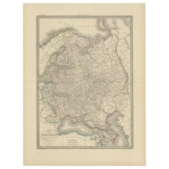
Antique Map of Russia in Europe, 1842
Located in Langweer, NL
Antique map titled 'Carte de la Russie d'Europe'. Map of Russia in Europe. This map originates from
Category
19th Century Alexandre Antique Prints Maps
Materials
Paper
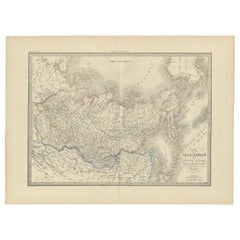
Antique Map of Siberia by Lapie, 1842
Located in Langweer, NL
Antique map titled 'Carte de la Sibérie ou Russie d'Asie'. Map of Siberia. This map originates from
Category
19th Century Alexandre Antique Prints Maps
Materials
Paper
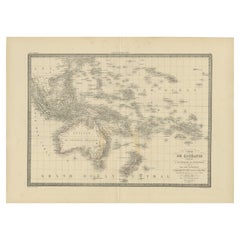
Antique Map of Oceania by Lapie, 1842
Located in Langweer, NL
Antique map titled 'Carte de l'Océanie contenant l'Australie, la Polynesie et les Iles Asiatiques
Category
19th Century Alexandre Antique Prints Maps
Materials
Paper
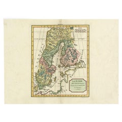
Antique Map of Sweden by Delamarche, 1806
Located in Langweer, NL
Antique map titled 'La Suede.' Decorative map of Sweden and part of Finland by Robert de Vaugondy
Category
19th Century Alexandre Antique Prints Maps
Materials
Paper
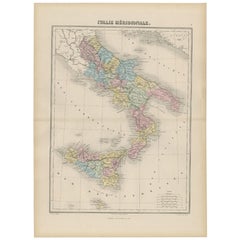
Antique Map of Southern Italy by Migeon, 1880
Located in Langweer, NL
"Antique map titled 'Italie Méridionale'. Old map of southern Italy including Sicily/Sicilia. This
Category
19th Century Alexandre Antique Prints Maps
Materials
Paper
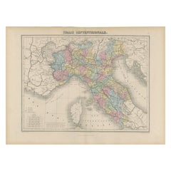
Antique Map of Northern Italy by Migeon, 1880
Located in Langweer, NL
Antique map titled 'Italie Septentrionale'. Old map of the northern part of Italy. This map
Category
19th Century Alexandre Antique Prints Maps
Materials
Paper
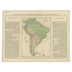
Antique Map of South America by Buchon, 1825
Located in Langweer, NL
Antique map titled 'Carte de l'Amérique méridionale'. Map of South America with attractive
Category
19th Century Alexandre Antique Prints Maps
Materials
Paper
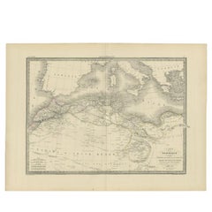
Antique Map of the Barbary Coast by Lapie, 1842
Located in Langweer, NL
Antique map titled 'Carte de la Barbarie contenant l'Empire de Maroc (..)'. Map of the Barbary
Category
19th Century Alexandre Antique Prints Maps
Materials
Paper
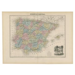
Antique Map of Spain and Portugal by Migeon, 1880
Located in Langweer, NL
Antique map titled 'Espagne et Portugal'. Old map of Spain and Portugal with a decorative vignette
Category
19th Century Alexandre Antique Prints Maps
Materials
Paper
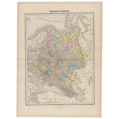
Antique Map of Russia in Europe by Migeon, 1880
Located in Langweer, NL
Antique map titled 'Russie d'Europe'. Old map of Russia in Europe. This map originates from
Category
19th Century Alexandre Antique Prints Maps
Materials
Paper
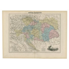
Antique Map of the Austrian Empire by Migeon, 1880
Located in Langweer, NL
Antique map titled 'Empire d'Autriche'. Old map of the Austrian Empire. With decorative vignette
Category
19th Century Alexandre Antique Prints Maps
Materials
Paper
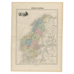
Antique Map of Sweden and Norway by Migeon, 1880
Located in Langweer, NL
Antique map titled 'Suède et Norvége'. Old map of Sweden and Norway. With decorative vignette of
Category
19th Century Alexandre Antique Prints Maps
Materials
Paper
Antique Map of Russia and Siberia by Migeon, 1880
Located in Langweer, NL
Antique map titled 'Sibérie ou Russie d'Asie'. Migeon's map covers the Russian empire in Asia from
Category
19th Century Alexandre Antique Prints Maps
Materials
Paper
Antique Map of the British Isles by Delamarche, 1806
Located in Langweer, NL
Antique map titled 'Les Isles Britanniques.' Decorative map of the British Isles by Robert de
Category
19th Century Alexandre Antique Prints Maps
Materials
Paper
Antique Map of Peru, Ecuador and Bolivia by Lapie, 1842
Located in Langweer, NL
Antique map titled 'Carte du Perou et du Haut Perou'. Map of Peru, Ecuador and Bolivia. This map
Category
19th Century Alexandre Antique Prints Maps
Materials
Paper
Original Antique Map of Peru with Regions Outlined in Color
Located in Langweer, NL
to eke out this meagre wage, he began to trade in prints, books and maps. He is remembered for more
Category
Early 19th Century Alexandre Antique Prints Maps
Materials
Paper
Antique Map of Turkey in Asia 'Asia Minor' by Vuillemin, 1846
Located in Langweer, NL
old antique print / plate / map originates from: 'Atlas Universal de Geographie Ancienne et Moderne
Category
19th Century Alexandre Antique Prints Maps
Materials
Paper
1861 Original vintage map of Paris - Historical cartography
Located in PARIS, FR
witness to the urban evolution of the French capital in the 19th century. Drawn up by Alexandre Vuillemin
Category
1860s Alexandre Antique Prints Maps
Materials
Paper, Lithograph
H 33.86 in W 42.92 in
Carte du Bresil, antique 1860s engraved map of Brazil
Located in Melbourne, Victoria
'Carte du Bresil'
Engraving with original outline colouring, circa 1860, by Alexandre Vuillemin
Category
Late 19th Century Victorian Alexandre Antique Prints Maps
Materials
Lithograph
Antique Portrait of Charles Alexandre De Lorraine, circa 1760
Located in Langweer, NL
Antique print titled 'Charles Alexandre de Lorraine'. Portrait of Charles Alexandre de Lorraine
Category
18th Century Alexandre Antique Prints Maps
Materials
Paper
Map of the Holy Land "Carte de la Syrie et de l'Egypte" by Pierre Lapie
By Pierre M. Lapie
Located in Alamo, CA
This is an early 19th century map of ancient Syria and Egypt entitled "Carte de la Syrie et de
Category
1830s Alexandre Antique Prints Maps
Materials
Engraving
H 27 in W 21.38 in D 0.75 in
Rare Hand Colored "Cabane Des Hold" - 1st Ed "Description de l’Univers" C. 1683
By Alain Manesson Mallet
Located in Soquel, CA
publication which contains maps of all parts of the then-known world (both ancient and modern), star maps
Category
1680s Realist Alexandre Antique Prints Maps
Materials
Paper, Ink, Gouache
H 11.5 in W 9.07 in D 0.07 in
People Also Browsed
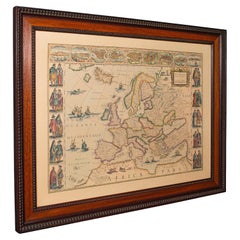
Vintage Reproduction 17th Century Map of Europe, American, Cartography, Blaeuw
Located in Hele, Devon, GB
This is a vintage reproduction map of Europe. An American, paper stock cartography print in frame after the work by Blaeuw, dating to the late 20th century, circa 1970.
Fascinating ...
Category
Late 20th Century Central American Mid-Century Modern Alexandre Antique Prints Maps
Materials
Glass, Wood, Paper
H 30.32 in W 38.39 in D 1.38 in
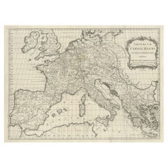
Large Antique Map of Europe, Showing the Empire of Charlemagne
Located in Langweer, NL
Antique map titled 'Imperium Caroli Magni (..)'. Large antique map of Europe, showing the Empire of Charlemagne in the 8th Century. Engraved by T. Kitchin. Published J. Blair, circa ...
Category
Late 18th Century Alexandre Antique Prints Maps
Materials
Paper
Antique Map of Central Europe Showing The Railways and The Political Bounderies
Located in Langweer, NL
Explore the Heart of Europe with the 'Central Europe' Map, Featuring Principal Railways and Political Boundaries! This map offers a captivating view of the dynamic landscapes and pol...
Category
1880s Alexandre Antique Prints Maps
Materials
Paper
H 14.97 in W 22.45 in D 0 in
Antique Map of the Europe Continent, 1880
Located in Langweer, NL
Antique map titled 'Europe'. Old map of the European continent. This map originates from 'Géographie Universelle Atlas-Migeon' by J. Migeon.
Artists and Engravers: Published by J....
Category
19th Century Alexandre Antique Prints Maps
Materials
Paper
Huge Europe and Asia Vintage Wall Map
Located in San Diego, CA
A huge Europe and Asia vintage wall map, circa 1950s. The map is in fair vintage condition and measures 78"W x 73"H". #2863
Category
Mid-20th Century American Alexandre Antique Prints Maps
Materials
Paper
Colorful Detailed Antique Map of Europe, Published in 1882
Located in Langweer, NL
"The Antique Map of Europe from 'The Comprehensive Atlas and Geography of the World,' published in 1882 by Blackie & Son, is a testament to meticulous cartography and scholarly preci...
Category
1880s Alexandre Antique Prints Maps
Materials
Paper
Europe Map Vintage Rollable Mural Countrystyle Wall Chart Decoration
Located in Berghuelen, DE
The vintage pull-down map shows the European continent / Europe. Published by Haack-Painke, Justus Perthes Darmstadt. Colorful print on paper reinforced with canvas.
Measurements:
Wi...
Category
1970s German Country Alexandre Antique Prints Maps
Materials
Canvas, Wood, Paper
Eason's War Map of Europe, circa 1914
Located in Langweer, NL
Antique map titled 'Eason's War Map of Europe'. Printed in Ireland. Source unknown, to be determined.
Artists and Engravers: Anonymous.
Condition: Good, age-related toning. Min...
Category
20th Century Alexandre Antique Prints Maps
Materials
Paper
Original Antique Map of Russia in Europe, 1882
Located in Langweer, NL
Embark on an enthralling journey with an original Antique Map of European Russia from the esteemed 'Comprehensive Atlas and Geography of the World,' meticulously crafted in 1882. Thi...
Category
1880s Alexandre Antique Prints Maps
Materials
Paper
Antique Map of Europe in the Year 800 and 1500, Published in 1842
Located in Langweer, NL
Antique map titled 'Carte de l'Europe'. Two maps of Europe. The upper map depicts Europe in the year 800, the lower map depicts Europe in 1500. This map originates from 'Atlas univer...
Category
19th Century Alexandre Antique Prints Maps
Materials
Paper
Antique Map of Old European Russia, 1846
Located in Langweer, NL
Antique map titled 'Russia in Europe'. Old map of European Russia. This map originates from 'A New Universal Atlas Containing Maps of the various Empires, Kingdoms, States and Republ...
Category
19th Century Alexandre Antique Prints Maps
Materials
Paper
Original Antique Map of Europe, Arrowsmith, 1820
Located in St Annes, Lancashire
Great map of Europe
Drawn under the direction of Arrowsmith.
Copper-plate engraving.
Published by Longman, Hurst, Rees, Orme and Brown, 1820
Unframed.
Category
1820s English Alexandre Antique Prints Maps
Materials
Paper
Antique Map of Turkey in Europe, c.1780
Located in Langweer, NL
Antique map titled 'Bowles's new pocket map of Turky in Europe divided into its Provinces'. Large map of Turkey in Europe. Source unknown, to be determined.
Artists and Engravers:...
Category
18th Century Alexandre Antique Prints Maps
Materials
Paper
Antique Map of Europe by R. Bonne, 1780
Located in Langweer, NL
A fine example of Rigobert Bonne and Guilleme Raynal’s 1780 map of Europe. Drawn by R. Bonne for G. Raynal’s Atlas de Toutes les Parties Connues du Globe Terrestre, Dressé pour l'His...
Category
Late 18th Century Alexandre Antique Prints Maps
Materials
Paper
Original Antique Map of West Europe, circa 1870
Located in Langweer, NL
Antique map titled 'Gallia, Britannia, Germania'. Old map of West Europe including France, Germany and the United Kingdom. This map originates from 'Atlas Antiquus, twaalf kaarten be...
Category
19th Century Alexandre Antique Prints Maps
Materials
Paper
Antique Map of Germany and Central Europe
Located in Langweer, NL
Antique map titled 'S. Imperium Romano-Germanicum oder Teutschland mit seinen angrantzenden Königreichen und Provincien'. Original antique map of Germany covering the central part of...
Category
Late 17th Century Alexandre Antique Prints Maps
Materials
Paper
Recent Sales
Mappe Monde … Division par Religions…
By E. Dussy
Located in Zeeland, Noord-Brabant
after Robert de Vaugondy.
We have found little about E. Dussy. A Paris draughtsman and map engraver
Category
1770s Alexandre Antique Prints Maps
Materials
Engraving
Portrait of the Maire of Piedicavallo by Domenico Del Pino (Genoa, 1793 -1851)
By Domenico Del Pino
Located in London, GB
in the army as a professional player of military maps and fortified buildings. A large number of
Category
19th Century Italian Alexandre Antique Prints Maps
H 18.9 in W 13 in D 2.17 in
Map of Marseilles, France: A 16th Century Hand-colored Map by Braun & Hogenberg
By Franz Hogenberg
Located in Alamo, CA
Hogenberg's The City Maps of Europe, pl. 72.
This striking hand-colored city view is printed on laid, chain
Category
16th Century Old Masters Alexandre Antique Prints Maps
Materials
Engraving
Get Updated with New Arrivals
Save "Alexandre Antique Prints Maps", and we’ll notify you when there are new listings in this category.
Alexandre Antique Prints Maps For Sale on 1stDibs
Find a variety of alexandre antique prints maps available on 1stDibs. These items have been made for many years, with versions that date back to the 19th Century alongside those produced as recently as the 19th Century. Alexandre antique prints maps available on 1stDibs span a range of colors that includes gray and more. There have been many well-done artworks of this subject over the years, but those made by Pierre M. Lapie are often thought to be among the most beautiful. The range of these distinct pieces — often created in engraving and lithograph — can elevate any room of your home.
How Much are Alexandre Antique Prints Maps?
The average selling price for alexandre antique prints maps we offer is $173, while they’re typically $81 on the low end and $775 for the highest priced.
