Items Similar to Antique Map of Russia in Europe, 1842


Want more images or videos?
Request additional images or videos from the seller
1 of 5
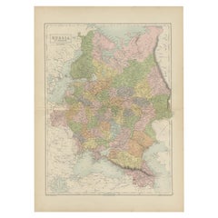
Antique Map of Russia in Europe, 1842
About the Item
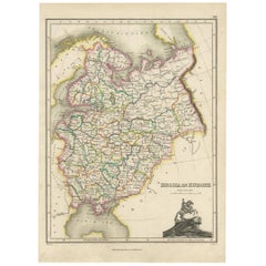
Antique map titled 'Carte de la Russie d'Europe'. Map of Russia in Europe. This map originates from 'Atlas universel de géographie ancienne et moderne (..)' by Pierre M. Lapie and Alexandre E. Lapie. Artists and Engravers: Pierre M. Lapie was a French cartographer and engraver. He was the father of cartographer Alexandre Emile Lapie.
Artist: Pierre M. Lapie was a French cartographer and engraver. He was the father of cartographer Alexandre Emile Lapie.
Condition: Very good, general age-related toning. Original folding line, blank verso. Please study image carefully.
Date: 1842
Overall size: 50.5 x 68 cm.
Image size: 40.5 x 54.5 cm.
Antique prints have long been appreciated for both their aesthetic and investment value. They were the product of engraved, etched or lithographed plates. These plates were handmade out of wood or metal, which required an incredible level of skill, patience and craftsmanship. Whether you have a house with Victorian furniture or more contemporary decor an old engraving can enhance your living space. We offer a wide range of authentic antique prints for any budget.
- Dimensions:Height: 26.78 in (68 cm)Width: 19.89 in (50.5 cm)Depth: 0 in (0.01 mm)
- Materials and Techniques:
- Period:
- Date of Manufacture:1842
- Condition:Condition: Very good, general age-related toning. Original folding line, blank verso. Please study image carefully.
- Seller Location:Langweer, NL
- Reference Number:
About the Seller
5.0
Platinum Seller
These expertly vetted sellers are 1stDibs' most experienced sellers and are rated highest by our customers.
Established in 2009
1stDibs seller since 2017
1,916 sales on 1stDibs
Typical response time: <1 hour
- ShippingRetrieving quote...Ships From: Langweer, Netherlands
- Return PolicyA return for this item may be initiated within 14 days of delivery.
More From This SellerView All
- Antique Map of Europe by Lapie, 1842Located in Langweer, NLAntique map titled 'Carte de l'Europe'. Map of Europe. This map originates from 'Atlas universel de géographie ancienne et moderne (..)' by Pierre M. Lapie and Alexandre E. Lapie. Pi...Category
Antique Mid-19th Century Maps
MaterialsPaper
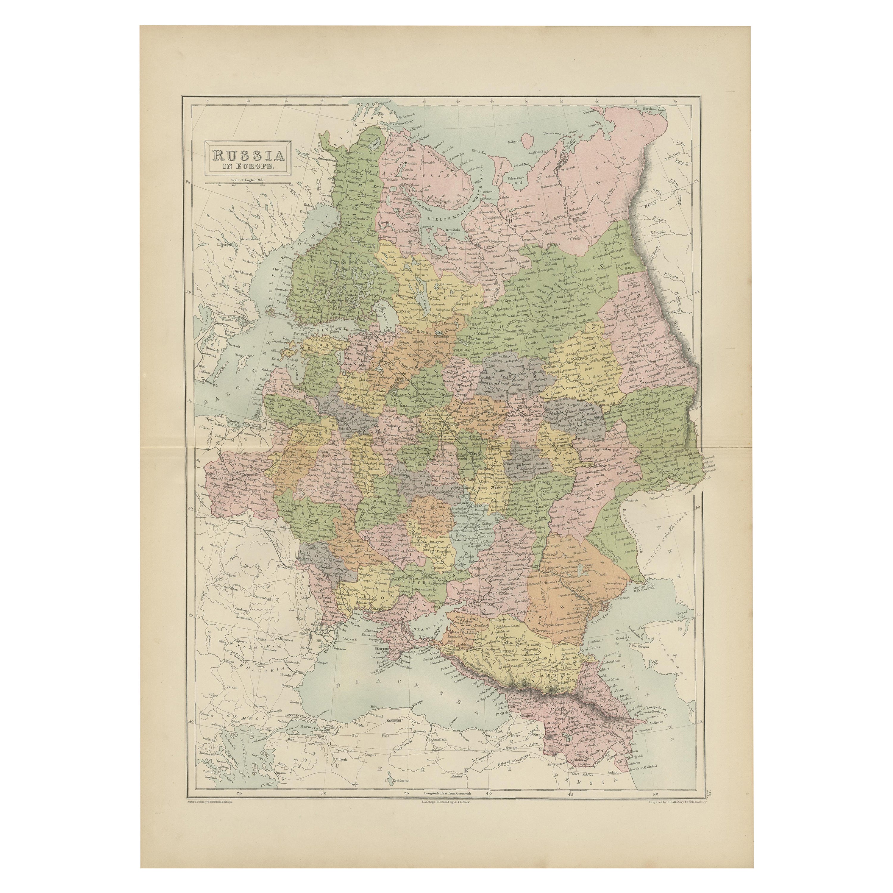
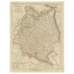
- Antique Map of Old European Russia, 1846Located in Langweer, NLAntique map titled 'Russia in Europe'. Old map of European Russia. This map originates from 'A New Universal Atlas Containing Maps of the various Em...Category
Antique 19th Century Maps
MaterialsPaper
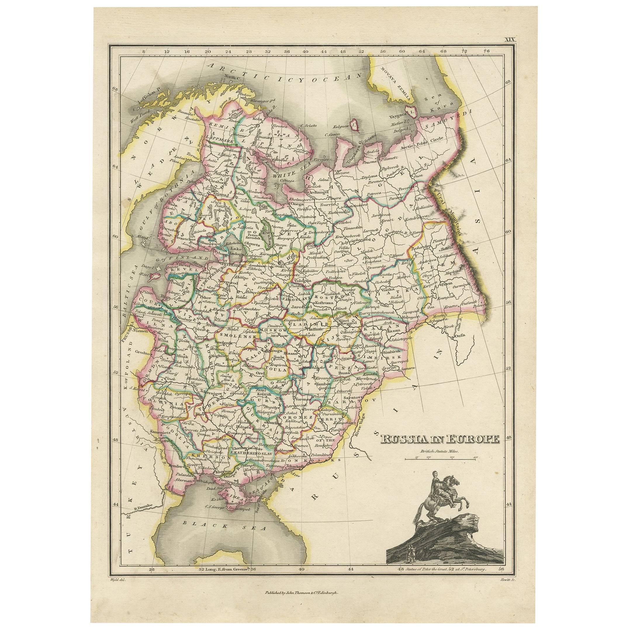
- Antique Map of Russia in Europe by J. Thomson, 1819Located in Langweer, NLFine early-19th century map, precisely engraved with an impressive amount of detail. With inset view of equestrian statue of Peter the Great. Issued Edinburgh, 1819 by J. Thomson. Dr...Category
Antique Early 19th Century Maps
MaterialsPaper
- Antique Map of Russia in Europe by A & C, Black, 1870Located in Langweer, NLAntique map titled 'Russia in Europe'. Original antique map of Russia in Europe. This map originates from ‘Black's General Atlas of The World’. Published by A & C. Black, 1870.Category
Antique Late 19th Century Maps
MaterialsPaper
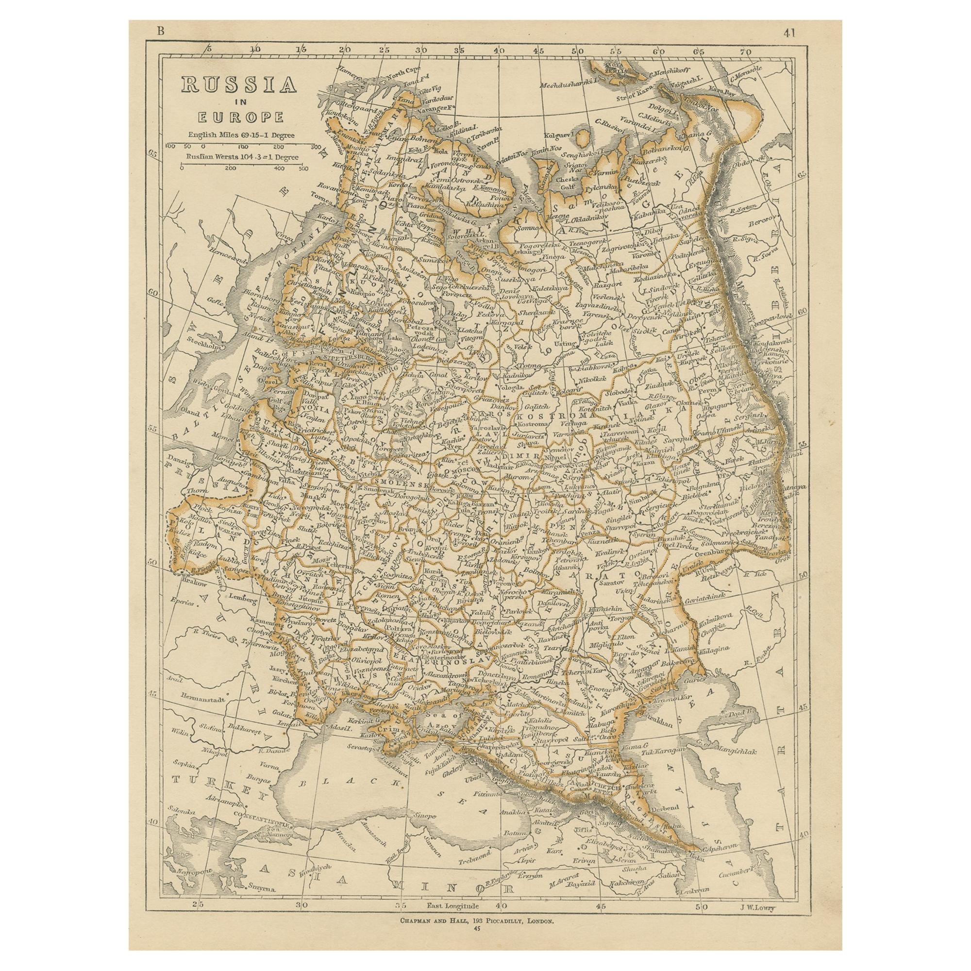
- Antique Map of Russia in Europe by Lowry, 1852Located in Langweer, NLAntique map titled 'Russia in Europe'. Original map of Russia in Europe. This map originates from 'Lowry's Table Atlas constructed and engraved from the most recent Authorities' by J...Category
Antique Mid-19th Century Maps
MaterialsPaper
- Antique Map of Russia in Europe by Levasseur, '1875'Located in Langweer, NLAntique map titled 'Carte générale de la Russie d'Europe (..)'. Large map of Russia in Europe. This map originates from 'Atlas de Géographie Moderne Physique et Politique' by A. Leva...Category
Antique Late 19th Century Maps
MaterialsPaper


You May Also Like
- Original Antique Map of Europe, Arrowsmith, 1820Located in St Annes, LancashireGreat map of Europe Drawn under the direction of Arrowsmith. Copper-plate engraving. Published by Longman, Hurst, Rees, Orme and Brown, 1820 ...Category
Antique 1820s English Maps
MaterialsPaper
- Original Antique Map of Russia By Arrowsmith. 1820Located in St Annes, LancashireGreat map of Russia Drawn under the direction of Arrowsmith Copper-plate engraving Published by Longman, Hurst, Rees, Orme and Brown, 1820 Unframed.Category
Antique 1820s English Maps
MaterialsPaper
- Antique Map of Principality of MonacoBy Antonio Vallardi EditoreLocated in Alessandria, PiemonteST/619 - "Old Geographical Atlas of Italy - Topographic map of ex-Principality of Monaco" - ediz Vallardi - Milano - A somewhat special edition ---Category
Antique Late 19th Century Italian Other Prints
MaterialsPaper
- Original Antique Map of Italy. C.1780Located in St Annes, LancashireGreat map of Italy Copper-plate engraving Published C.1780 Unframed.Category
Antique Early 1800s English Georgian Maps
MaterialsPaper

- Original Antique Map of Asia. C.1780Located in St Annes, LancashireGreat map of Asia Copper-plate engraving Published C.1780 Two small worm holes to right side of map Unframed.Category
Antique Early 1800s English Georgian Maps
MaterialsPaper

- Original Antique Map of India. C.1780Located in St Annes, LancashireGreat map of India Copper-plate engraving Published C.1780 Three small worm holes to right side of map and one bottom left corner Unframed.Category
Antique Early 1800s English Georgian Maps
MaterialsPaper


Recently Viewed
View AllMore Ways To Browse
Antique In Europe
Antique European Plates
Antique Russian Plate
Antique Russian Plates
Engraved 68
Old Maps Of Europe
Old Europe Map
A La Carte
Antique Russian Wood Furniture
Antique Russian Wood
Antique Russian Map
Antique Map Russia
Antique Map Of Russia
Antique Maps Of Russia
Russian Antique Plates
Carte Ancienne
Alexandre Antique Prints Maps
Small Antique Globes