Old Maps Of Europe
to
22
282
175
165
135
134
93
73
69
37
30
29
21
19
19
18
14
13
13
12
12
9
9
8
7
5
4
4
4
3
3
3
3
3
3
2
2
2
2
2
2
2
2
2
2
2
2
1
1
1
1
1
1
1
1
1
42
42
34
19
13
Sort By
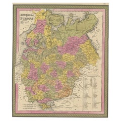
Antique Map of Old European Russia, 1846
Located in Langweer, NL
Antique map titled 'Russia in Europe'. Old map of European Russia. This map originates from 'A New
Category
Antique 19th Century Maps
Materials
Paper
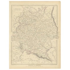
Old Original Map of Russia in Europe, 1849
Located in Langweer, NL
Antique map titled 'Russia in Europe'.
Old map of Russia in Europe. This map originates from
Category
Antique 1840s Maps
Materials
Paper
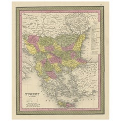
Old Colourful Decorative Map of Turkey in Europe, 1846
Located in Langweer, NL
Antique map titled 'Turkey in Europe'. Old map of Turkey in Europe.
This map originates from 'A
Category
Antique 1840s Maps
Materials
Paper
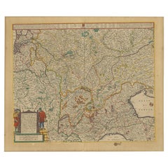
Old Map of the Western Part of Central Europe, c.1680
Located in Langweer, NL
Antique map titled 'Carta nova accurate del Passagio et strada dalli Paesi Bassi'. Old map of the
Category
Antique 17th Century Maps
Materials
Paper
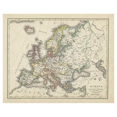
Antique Map of Europe from an Old Dutch School-Atlas, 1852
Located in Langweer, NL
Antique map titled 'Europa'. Map of Europe. This map originates from 'School-Atlas van alle deelen
Category
Antique 19th Century Maps
Materials
Paper
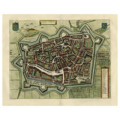
Original Old Map of Leeuwarden, European Cultural Capital 2018, Holland, 1649
Located in Langweer, NL
Antique print, titled: 'Leoverdia.'
This map shows Leoverdia (Leeuwarden). Bird's-eye view plan
Category
Antique 1640s Maps
Materials
Paper
H 20.87 in W 25.79 in D 0 in
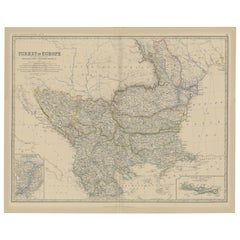
Old Map of Turkey in Europe, incl Romania, Servia, Montenegro & Bulgaria, 1882
Located in Langweer, NL
Antique map titled 'Turkey in Europe'.
Old map of Turkey in Europe, also depicting part of
Category
Antique 1880s Maps
Materials
Paper
H 19.53 in W 24.14 in D 0 in
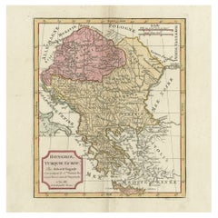
Old Engraved Map of Hungary, European Balkan Countries, Greece and Crete, 1806
Located in Langweer, NL
Antique map titled 'Hongrie, Turquie Europe'.
Decorative map of Hungary, southeast European
Category
Antique 19th Century Maps
Materials
Paper
H 15.08 in W 11.34 in D 0 in
Antique Map of the Europe Continent, 1880
Located in Langweer, NL
Antique map titled 'Europe'. Old map of the European continent. This map originates from
Category
Antique 19th Century Maps
Materials
Paper
Antique Map of the European Continent, 1882
Located in Langweer, NL
Antique map titled 'Europe'. Old map of the European continent. This map originates from 'The Royal
Category
Antique 19th Century Maps
Materials
Paper
Antique Map of Russia in Europe, 1842
Located in Langweer, NL
Antique map titled 'Carte de la Russie d'Europe'. Map of Russia in Europe. This map originates from
Category
Antique 19th Century Maps
Materials
Paper
Original Antique Map of West Europe, circa 1870
Located in Langweer, NL
Antique map titled 'Gallia, Britannia, Germania'. Old map of West Europe including France, Germany
Category
Antique 19th Century Maps
Materials
Paper
Antique Map of Russia in Europe and Poland from an d Old Dutch Atlas, 1852
Located in Langweer, NL
Description: Antique map titled 'Europeesch Rusland en Polen'.
Map of Russia in Europe and
Category
Antique 1850s Maps
Materials
Paper
H 13.59 in W 10.63 in D 0 in
Antique Map of Russia in Europe on Two Sheets from an Old German Atlas, Ca.1825
Located in Langweer, NL
they depict Russia in Europe. These maps originate from 'Stielers Handatlas'. Published circa 1825
Category
Antique 1820s Maps
Materials
Paper
H 13.39 in W 16.54 in D 0 in
Antique Map of Southwest Europe by Kiepert, c.1870
Located in Langweer, NL
"Antique map titled 'Romanisches Südwest-Europa'. Old map of Southwest Europe. This map originates
Category
Antique 19th Century Maps
Materials
Paper
Antique Map of Russia in Europe by Migeon, 1880
Located in Langweer, NL
Antique map titled 'Russie d'Europe'. Old map of Russia in Europe. This map originates from
Category
Antique 19th Century Maps
Materials
Paper
French Antique Map of France and Western Europe, 1765
By G. A. Rizzi-zannoni
Located in Langweer, NL
Antique map titled 'Carte de tous les Lieux, célébres dans l'Histoire (..)'. Beautiful old map of
Category
Antique 18th Century Maps
Materials
Paper
Antique Map of Northwest Europe by Kiepert, c.1870
Located in Langweer, NL
Antique map titled 'Germanisches Nordwest-Europa'. Old map of North-West Europe depicting the
Category
Antique 19th Century Maps
Materials
Paper
Antique Map of part of Europe by Scherer, c.1703
Located in Langweer, NL
Untitled map of Europe depicting Calais, Münster, Paris, Lion, Prag, Wien, Berlin, Clermont and
Category
Antique 18th Century Maps
Materials
Paper
Antique Map of Northern Europe by Bonne, c.1780
Located in Langweer, NL
Antique map titled 'Le Nord de L'Europe, Contenant Le Danemark, La Norwege; La Suede et La Laponie
Category
Antique 18th Century Maps
Materials
Paper
Antique Map of Europe and Part of Asia and Africa, 1848
Located in Langweer, NL
Antique map titled 'Orbis Veteribus Notus'. Old map of the European continent, also depicting a
Category
Antique 19th Century Maps
Materials
Paper
Antique Map of Russia in Europe by Petri, c.1873
Located in Langweer, NL
Antique map titled 'Rusland in Europa'. Old map depicting Russia in Europe. This map originates
Category
Antique 19th Century Maps
Materials
Paper
Antique Map of European Trade in Asia by Pluche, 1742
Located in Langweer, NL
Map pag. 444: 'Le commerce des Europeens en Asie.' (The commerce / trade of the Europeans in Asia
Category
Antique 18th Century Maps
Materials
Paper
Antique Map of Macedonia, Northern Greece and part of Turkey in Europe
Located in Langweer, NL
Antique map titled 'Macedonia Epirus et Achaia'. Original old map of Macedonia, northern Greece
Category
Antique Mid-17th Century Maps
Materials
Paper
H 18.59 in W 23.04 in D 0.02 in
Antique Map of Asia Showing the European Language Areas, c.1873
Located in Langweer, NL
Antique map titled 'Asia'. Old map depicting the Asian continent. This map originates from 'School
Category
Antique 19th Century Maps
Materials
Paper
Antique Detailed Map of the Mountain Chains of Europe and Asia, c.1850
Located in Langweer, NL
Antique map titled 'The Mountain Chains of Europe & Asia'.
Old map depicting the mountain chains
Category
Antique 19th Century Maps
Materials
Paper
Nice Colourful Antique Map of the Rivers and Mountains of Europe c.1870
By Heinrich Kiepert
Located in Langweer, NL
Antique map titled 'Fluss und Gebirgs Karte von Mittel-Europa'. Old map of the European continent
Category
Antique 19th Century Maps
Materials
Paper
Old Antique Map of the Province of Friesland, the Netherlands, c.1580
Located in Langweer, NL
Antique map titled 'Frisia Occidentalis'. Old map of the province of Friesland, the Netherlands
Category
Antique 16th Century Maps
Materials
Paper
Original Old Map of Northeastern Greece & Northwestern Turkey, Published in 1661
Located in Langweer, NL
covers the ancient region of Thrace, present-day European Turkey and part of Greece. The map is graced
Category
Antique 1660s Maps
Materials
Paper
H 6.42 in W 8 in D 0 in
Authentic Old Map of Southeast Asia with Original Border Coloring, 1745
Located in Langweer, NL
Holland) on this map is noteworthy as it reflects the historical European exploration and discovery of the
Category
Antique 1740s Maps
Materials
Paper
Rare Antique Map of Part of Europe and Africa by Scherer, C.1703
Located in Langweer, NL
Antique map with two figures. The upper figures showing part of Europe and Africa. Below a chart
Category
Antique 18th Century Maps
Materials
Paper
Antique Old Map of Africa with Insets of Mauritius, Reunion and Natal, 1882
Located in Langweer, NL
The uploaded image is a historical map of Africa from the 1882 atlas by Blackie & Son. The map
Category
Antique 1880s Maps
Materials
Paper
Free Shipping
H 14.97 in W 22.45 in D 0 in
Antique Map of the River Systems of Europe and Asia by Johnston, c.1850
Located in Langweer, NL
Antique map titled 'The River Systems of Europe & Asia'. Old map depicting the river systems of
Category
Antique 19th Century Maps
Materials
Paper
Antique Map of the British Isles and Part of Europe by Chatelain, c.1720
Located in Langweer, NL
Antique map titled 'Carte pour l'Intelligence de l'Histoire d'Angleterre (..)'. Decorative map
Category
Antique 18th Century Maps
Materials
Paper
H 16.93 in W 19.89 in D 0 in
Original Old Composite of Several Maps of the Ancient World on One Sheet, 1880
Located in Langweer, NL
Europe, North Africa, and parts of Asia, reflecting the Roman Empire at its extent.
The map includes
Category
Antique 1880s Maps
Materials
Paper
Free Shipping
H 15.56 in W 18.51 in D 0 in
Old Ptolemaic Map of the Region Between the Persian Gulf and Caspian Sea, 1598
Located in Langweer, NL
, and maps of the Old World were revised. Ptolemy's Geographia continued to be revised and published by
Category
Antique 16th Century Maps
Materials
Paper
H 7.09 in W 9.81 in D 0 in
Uncommon Old Map of Lapland to Russia and Denmark to Kazan in the South, 1785
Located in Langweer, NL
of Bonne's map of Northern Europe covers the region from Lapland to Russia in the north and Denmark
Category
Antique 1780s Maps
Materials
Paper
H 10.04 in W 14.73 in D 0 in
Map Silk Embroidered Western Eastern Hemisphere New Old World Asia America Afri
Located in BUNGAY, SUFFOLK
A rare, late-18th century, silk, embroidered, double hemisphere, world map, blackwork, sampler
Category
Antique 18th Century British Georgian Maps
Materials
Silk
H 0.4 in W 0.4 in D 0.4 in
Old Bird's Eye View of the European Trading Posts at Sabi, Benin, Africa, 1748
Located in Langweer, NL
Faktooryen, te Xavier of Sabi (..)'.
Bird's eye view of the European trading posts at Sabi. This print
Category
Antique 1740s Maps
Materials
Paper
H 9.85 in W 12.8 in D 0 in
Old Map Showing Info Related to the Ottoman Wars including Conflict Dates, c1690
Located in Langweer, NL
, Vincenzo Maria
Subject: Central Europe, Danube River
Period: 1690 (circa)
Publication:
Color: Black
Category
Antique 1690s Maps
Materials
Paper
H 24.02 in W 17.8 in D 0 in
Antique Map of Switzerland by Homann, 1753
Located in Langweer, NL
a major place in the European map market throughout the eighteenth century. Founded in 1702 by
Category
Antique 18th Century Maps
Materials
Paper
Antique Map of Friesland by Guicciardini, 1613
Located in Langweer, NL
Antique map titled 'Frisia Occidenta.' (Map of the province of Friesland, the Netherlands.) This
Category
Antique 17th Century Maps
Materials
Paper
Antique Map Made After a Roman Papyrus Travel Map, Known as Peutinger Map, 1773
Located in Langweer, NL
Old Dutch engraving with title: 'Romeinsche Reis Kaart van K. Peutinger'.
Rare antique map based
Category
Antique 18th Century Maps
Materials
Paper
H 15.56 in W 18.51 in D 0 in
Antique Map of Siberia and Russia, c.1885
Located in Langweer, NL
in Asia. Migeon's map covers the Russian empire in Asia from european Russia and the Ural Mountains
Category
Antique 19th Century Maps
Materials
Paper
Antique Map of Alentejo: Land of Tradition and Tranquility, 1903
Located in Langweer, NL
The image is a historical original antique map of the Alentejo region in Portugal. This map
Category
Antique Early 1900s Maps
Materials
Paper
Free Shipping
H 20.08 in W 14.77 in D 0 in
Antique Map of the Queen Charlotte Islands, Haida Gwaii
Located in Langweer, NL
Antique map titled 'Isles de la Reine Charlotte (..)'. Original old map of the Queen Charlotte
Category
Antique Late 18th Century Maps
Materials
Paper
Antique Map of the Siege of Groningen by Le Clerc, 1730
Located in Langweer, NL
original old antique print / plate was published in several works by Hugo de Groot ('Nederlandtsche
Category
Antique 18th Century Maps
Materials
Paper
Antique Map of Russia and Poland by Petri, 1852
Located in Langweer, NL
Antique map titled 'Europeesch Rusland en Polen'. Map of Russia in Europe and Poland. This map
Category
Antique 19th Century Maps
Materials
Paper
Antique Map of the Bay of Terney by La Pérouse, 1797
Located in Langweer, NL
Antique map titled 'Plan de la Baie de Ternai'. Old map of the north eastern coast of Russia. This
Category
Antique 18th Century Maps
Materials
Paper
Antique Map of Gelderland and Overijssel by Guicciardini, 1613
Located in Langweer, NL
Antique map titled 'Geldria et Transisulania.' (Map of the provinces of Gelderland and Overijssel
Category
Antique 17th Century Maps
Materials
Paper
Antique Map of Russia and Siberia by Migeon, 1880
Located in Langweer, NL
Antique map titled 'Sibérie ou Russie d'Asie'. Migeon's map covers the Russian empire in Asia from
Category
Antique 19th Century Maps
Materials
Paper
Antique Map of Spain and Portugal by Thomson, 1815
Located in Langweer, NL
Antique map titled 'Spain & Portugal.' Map of Spain and Portugal. From Thomson's 'New General Atlas
Category
Antique 19th Century Maps
Materials
Paper
Antique Map of Cities of the Province of Che-Kiang in China, 1738
Located in Langweer, NL
Antique map titled 'Cities of the Province of Che-Kyang'. Old map depicting four walled cities of
Category
Antique 18th Century Maps
Materials
Paper
Antique Map of Cities of the Province of Che-Kyang in China, 1738
Located in Langweer, NL
Antique print China titled 'Cities of the Province of Che-Kyang'. Old map depicting four walled
Category
Antique 18th Century Maps
Materials
Paper
Antique Map of Saxony and Westphalia by Scherer, 1699
Located in Langweer, NL
Antique map titled 'Saxonia et Westphalia varijs in locis sacris erga dei matre est officiosa
Category
Antique 17th Century Maps
Materials
Paper
Antique Map of South America by Scherer, c.1700
By Thomas Kitchin
Located in Langweer, NL
Antique map of part of South America. Two maps on a single sheet, each depicting nearly the same
Category
Antique 18th Century Maps
Materials
Paper
Antique Map of the Berchtesgaden Region by Scherer, 1699
Located in Langweer, NL
Antique map titled 'Principat et praepositura Berchtesgadensis (..).' Detailed uncommon map of the
Category
Antique 17th Century Maps
Materials
Paper
Antique Map of the Shanxi Province of China by Du Halde, 1738
Located in Langweer, NL
Antique map titled 'Province IX Shan-Si'. Old map depicting the Shanxi province of China
Category
Antique 18th Century Maps
Materials
Paper
Antique Map of the Huguang Province of China by Du Halde, 1738
Located in Langweer, NL
Antique map titled 'Province VI Hu-Quang'. Old map depicting the Huguang province of China
Category
Antique 18th Century Maps
Materials
Paper
Antique Map of the Jiangxi Province of China by Du Halde, 1738
Located in Langweer, NL
Antique map titled 'Province III Kyang-Si'. Old map depicting the Jiangxi province of China
Category
Antique 18th Century Maps
Materials
Paper
- 1
Get Updated with New Arrivals
Save "Old Maps Of Europe", and we’ll notify you when there are new listings in this category.
Old Maps Of Europe For Sale on 1stDibs
With a vast inventory of beautiful furniture at 1stDibs, we’ve got just the old maps of europe you’re looking for. An old maps of europe — often made from paper — can elevate any home. There are many kinds of the old maps of europe you’re looking for, from those produced as long ago as the 18th Century to those made as recently as the 19th Century.
How Much is an Old Maps Of Europe?
Prices for an old maps of europe start at $133 and top out at $1,497 with the average selling for $311.
More Ways To Browse
Antique Puerto Rico Map
Franz West Chain Table
Antique Maps Scandinavia
Antique Map Of Puerto Rico
Antique Maps Of Puerto Rico
Coach Burgundy
Antique Ornamental Map
Wooden Copper Coat Of Arms
Herman Mile
Old Sicily Map
Retro Mexican Movie Posters
Puerto Rico Map
Antique Maps Of Tennessee
Santa Cruz Island
At319 Table
East Coast Australia Charts
Tunisia Antique Map
Antique Maps Of Lithuania
