Items Similar to Original Old Map of Leeuwarden, European Cultural Capital 2018, Holland, 1649


Want more images or videos?
Request additional images or videos from the seller
1 of 5
Original Old Map of Leeuwarden, European Cultural Capital 2018, Holland, 1649
About the Item
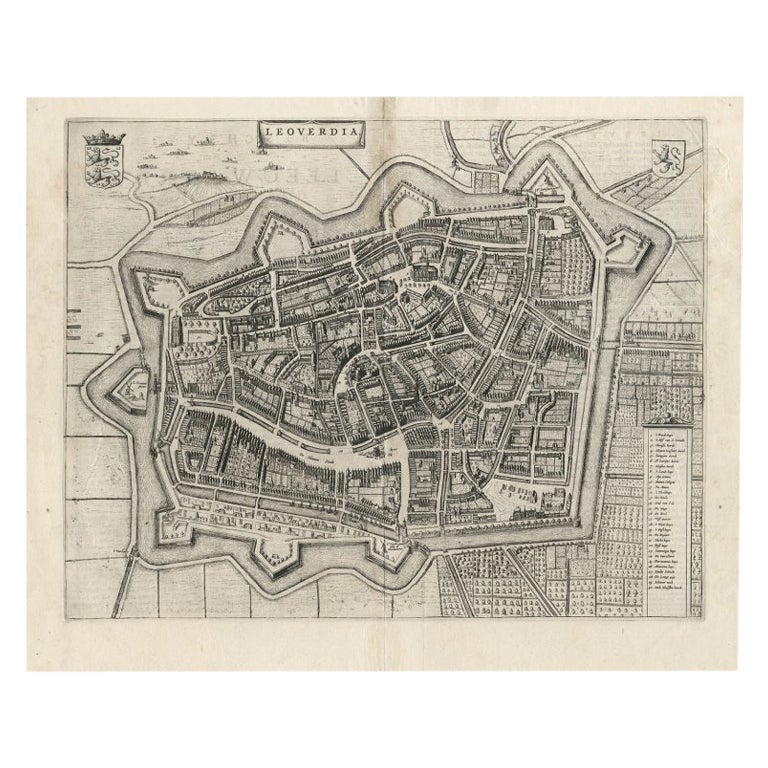
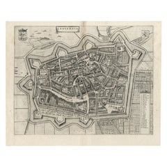
Antique print, titled: 'Leoverdia.'
This map shows Leoverdia (Leeuwarden). Bird's-eye view plan of Leeuwarden in The Netherlands, with key to locations and coats of arms. Text in Dutch on verso. This plan originates from the famous city Atlas: 'Toneel der Steeden' published by Joan Blaeu 1649.
Artists and Engravers: Publisher: Joan Blaeu. Joan Blaeu (23 September 1596 - 28 May 1673) was a Dutch cartographer. He was born in Alkmaar, the son of cartographer Willem Blaeu. In 1620 he became a doctor of law but he joined the work of his father. In 1635 they published the Atlas Novus (full title: Theatrum orbis terrarum, sive, Atlas novus) in two volumes. Joan and his brother Cornelius took over the studio after their father died in 1638. Joan became the official cartographer of the Dutch East India Company. Around 1649 Joan Blaeu published a collection of Dutch city maps named Tooneel der Steeden (Views of Cities). In 1651 he was voted into the Amsterdam council. In 1654 Joan published the first atlas of Scotland, devised by Timothy Pont. In 1662 he reissued the atlas with 11 volumes, and one for oceans. It was also known as Atlas Maior. A cosmology was planned as their next project, but a fire destroyed the studio completely in 1672. Joan Blaeu died in Amsterdam the following year.
Condition: Very good, given age. Original middle fold, as issued. Small tear in top left margin, not affecting image. Recent hand coloring. General age-related toning and/or occasional minor defects from handling. Please study scan carefully.
- Dimensions:Height: 20.87 in (53 cm)Width: 25.79 in (65.5 cm)Depth: 0 in (0.02 mm)
- Materials and Techniques:
- Period:1640-1649
- Date of Manufacture:1649
- Condition:
- Seller Location:Langweer, NL
- Reference Number:
About the Seller
5.0
Platinum Seller
These expertly vetted sellers are 1stDibs' most experienced sellers and are rated highest by our customers.
Established in 2009
1stDibs seller since 2017
1,933 sales on 1stDibs
Typical response time: <1 hour
- ShippingRetrieving quote...Ships From: Langweer, Netherlands
- Return PolicyA return for this item may be initiated within 14 days of delivery.
More From This SellerView All
- Antique Map of Leeuwarden, Capital of Friesland, the Netherlands, by Blaeu, 1649Located in Langweer, NLAntique map titled 'Leoverdia.' Bird's-eye view plan of Leeuwarden, Friesland, the Netherlands. With key to locations and coats of arms. Text in Dutch on verso. This plan origina...Category
Antique 17th Century Maps
MaterialsPaper
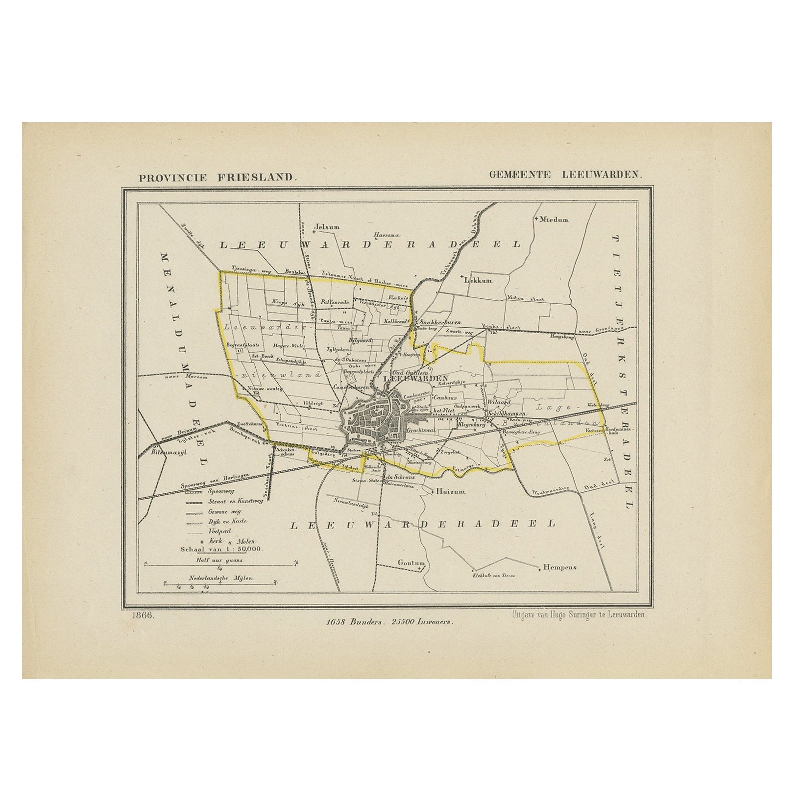
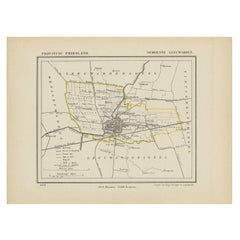
- Antique Map of Leeuwarden, Capital of Friesland, the Netherlands, 1868Located in Langweer, NLAntique map titled 'Provincie Friesland - Gemeente Leeuwarden'. Map of the township of Leeuwarden, Friesland. This map originates from 'Gemeente-Atlas van Nederland' by J. Kuyper. Ar...Category
Antique 19th Century Maps
MaterialsPaper
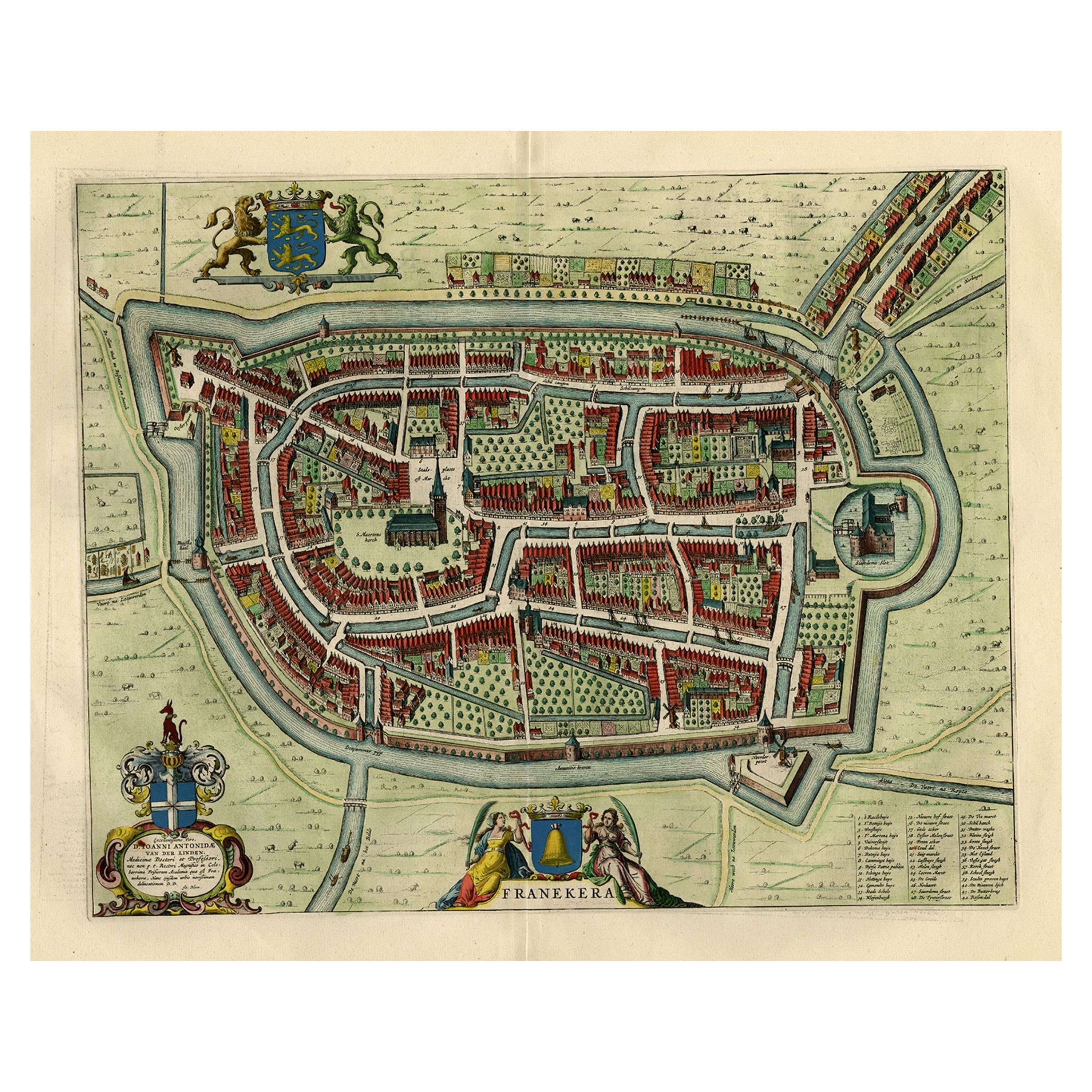
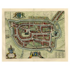
- Old Map by Blaeu of the City of Franeker, Friesland, The Netherlands, 1649Located in Langweer, NLAntique map titled 'Franekera'. Old map of the city of Franeker, Friesland. Also shows two cartouches, coats of arms and legend. This map originates from a Latin edition of the t...Category
Antique 1640s Maps
MaterialsPaper
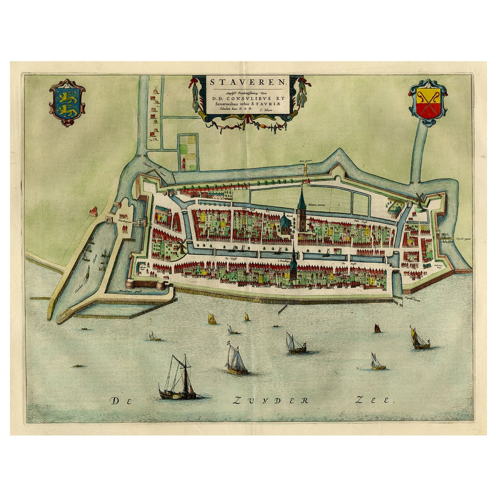
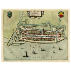
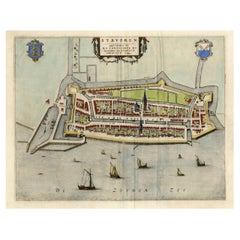
- Original Antique Map of the City of Stavoren, Friesland, The Netherlands, 1649Located in Langweer, NLAntique map titled 'Staveren'. Original antique map of the city of Stavoren, Friesland, The Netherlands. This map originates from 'Toonneel der Steden van de Vereenighde Nederlanden'...Category
Antique 1640s Maps
MaterialsPaper
- Antique Map of Old European Russia, 1846Located in Langweer, NLAntique map titled 'Russia in Europe'. Old map of European Russia. This map originates from 'A New Universal Atlas Containing Maps of the various Em...Category
Antique 19th Century Maps
MaterialsPaper

You May Also Like
- Original Antique Map of Europe, Arrowsmith, 1820Located in St Annes, LancashireGreat map of Europe Drawn under the direction of Arrowsmith. Copper-plate engraving. Published by Longman, Hurst, Rees, Orme and Brown, 1820 ...Category
Antique 1820s English Maps
MaterialsPaper
- Old Nautical Map of CorsicaLocated in Alessandria, PiemonteST/556/1 - Old map of Corsica isle, surveyed by Captain Hell, of the French Royal Navy in 1824, engraved and published on 1874, with additions and corre...Category
Antique Early 19th Century English Other Prints
MaterialsPaper
- Old Horizontal Map of EnglandBy TassoLocated in Alessandria, PiemonteST/520 - Old rare Italian map of England, dated 1826-1827 - by Girolamo Tasso, editor in Venise, for the atlas of M.r Le-Sage.Category
Antique Early 19th Century Italian Other Prints
MaterialsPaper
- Original Antique Map of Italy. C.1780Located in St Annes, LancashireGreat map of Italy Copper-plate engraving Published C.1780 Unframed.Category
Antique Early 1800s English Georgian Maps
MaterialsPaper

- Original Antique Map of Asia. C.1780Located in St Annes, LancashireGreat map of Asia Copper-plate engraving Published C.1780 Two small worm holes to right side of map Unframed.Category
Antique Early 1800s English Georgian Maps
MaterialsPaper

- Original Antique Map of India. C.1780Located in St Annes, LancashireGreat map of India Copper-plate engraving Published C.1780 Three small worm holes to right side of map and one bottom left corner Unframed.Category
Antique Early 1800s English Georgian Maps
MaterialsPaper


Recently Viewed
View AllMore Ways To Browse
Dutch Originals
Old Dutch Antique
Holland And Company
Collecting Antique Keys
Keys Collectible Antique
Antique Capital
Holland And Sons Furniture
Holland And Son
Holland And Sons
Ocean Maps
Ocean Map
Scotland Map
Dutch East India Company
Old Europe Map
Old Maps Of Europe
Dutch East India
Antique Map Scotland
Antique Maps Scotland