Items Similar to French Antique Map of France and Western Europe, 1765
Want more images or videos?
Request additional images or videos from the seller
1 of 5
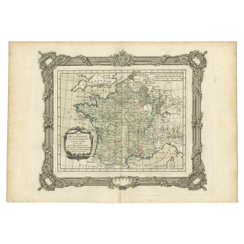
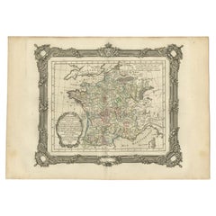
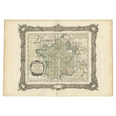
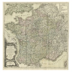
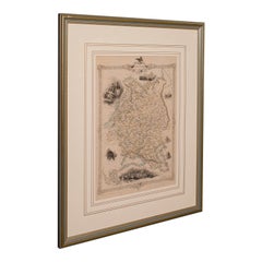
French Antique Map of France and Western Europe, 1765
About the Item
Antique map titled 'Carte de tous les Lieux, célébres dans l'Histoire (..)'. Beautiful old map of France and western Europe. This map originates from 'Atlas Historique de la France Ancienne et Moderne' by M. Rizzi Zannoni.
Artists and Engravers: Published by S. Desons, Paris. Giovanni Rizzi Zannoni (1736-1814 ) was an Italian cartographer and geographer.
Condition: Very good, please study image carefully.
Date: 1765
Overall size: 40 x 28 cm.
Image size: 30 x 24 cm.
We sell original antique maps to collectors, historians, educators and interior decorators all over the world. Our collection includes a wide range of authentic antique maps from the 16th to the 20th centuries. Buying and collecting antique maps is a tradition that goes back hundreds of years. Antique maps have proved a richly rewarding investment over the past decade, thanks to a growing appreciation of their unique historical appeal. Today the decorative qualities of antique maps are widely recognized by interior designers who appreciate their beauty and design flexibility. Depending on the individual map, presentation, and context, a rare or antique map can be modern, traditional, abstract, figurative, serious or whimsical. We offer a wide range of authentic antique maps for any budget.
- Creator:G. A. Rizzi-zannoni (Artist)
- Dimensions:Height: 11.03 in (28 cm)Width: 15.75 in (40 cm)Depth: 0 in (0.01 mm)
- Materials and Techniques:
- Period:
- Date of Manufacture:1765
- Condition:
- Seller Location:Langweer, NL
- Reference Number:
About the Seller
5.0
Platinum Seller
These expertly vetted sellers are 1stDibs' most experienced sellers and are rated highest by our customers.
Established in 2009
1stDibs seller since 2017
1,933 sales on 1stDibs
Typical response time: <1 hour
- ShippingRetrieving quote...Ships From: Langweer, Netherlands
- Return PolicyA return for this item may be initiated within 14 days of delivery.
More From This SellerView All
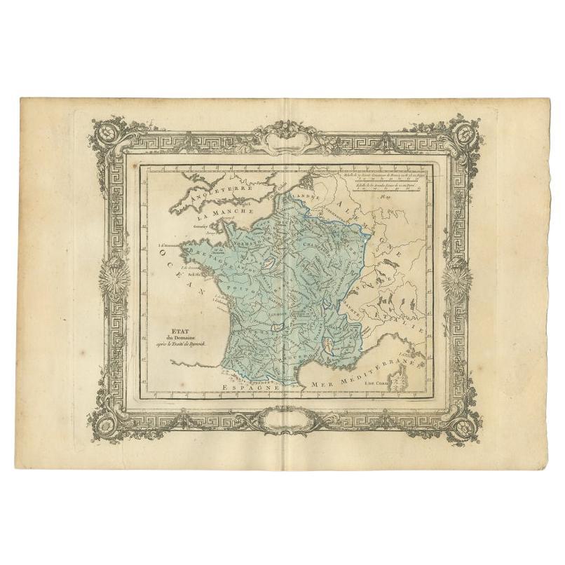
- Antique Map of France After the Peace of Ryswick by Zannoni, 1765By G. A. Rizzi-zannoniLocated in Langweer, NLAntique map France titled 'Etat du Domaine apès le Traité de Ryswick (..)'. Beautiful old map of France. This map originates from 'Atlas Historique de la France Ancienne et Moderne' ...Category
Antique 18th Century Maps
MaterialsPaper
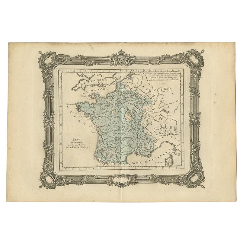
- Antique Map of France at the End of the Ministry of Cardinal Richelieu, 1765By G. A. Rizzi-zannoniLocated in Langweer, NLAntique map France titled 'Etat du Domaine à la fin du Ministère du Cardinal de Richelieu (..)'. Beautiful old map of France. This map originates fr...Category
Antique 18th Century Maps
MaterialsPaper
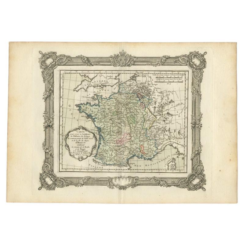
- Antique Map of France at the Beginning of the 17th Century by Zannoni, 1765By G. A. Rizzi-zannoniLocated in Langweer, NLAntique map France titled 'Carte pour servir à intelligence de l'Histoire de France (..)'. Beautiful old map of France. This map originates from 'At...Category
Antique 18th Century Maps
MaterialsPaper
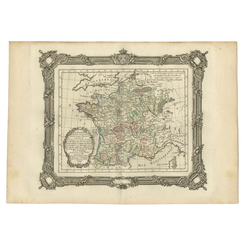
- Antique Map of France at the End of the Reign of Jean II by Zannoni, 1765By G. A. Rizzi-zannoniLocated in Langweer, NLAntique map France titled 'La France sous la fin du Regne de Jean II (..)'. Beautiful old map of France. This map originates from 'Atlas Historique de la France Ancienne et Moderne' ...Category
Antique 18th Century Maps
MaterialsPaper
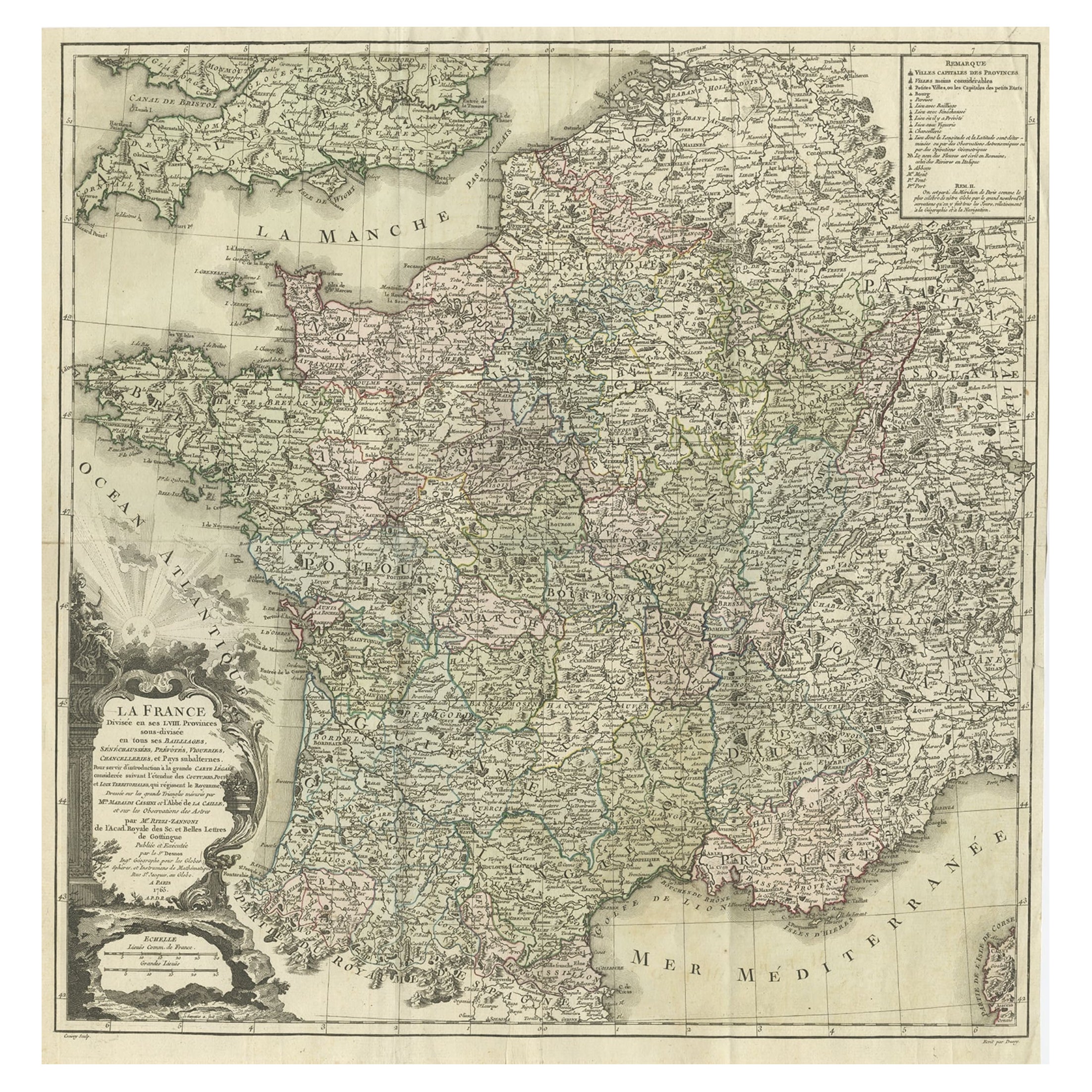
- Antique Map of France at the end of the Reign of Louis the Great by Zannoni 1765By G. A. Rizzi-zannoniLocated in Langweer, NLAntique map France titled 'Etat de la France à la fin du Règne de Louis le Grand (..)'. Beautiful old map of France. This map originates from 'Atlas Historique de la France Ancienne ...Category
Antique 18th Century Maps
MaterialsPaper
- Antique Map of France by Zannoni, 1765Located in Langweer, NLAntique map titled 'La France divisée en ses LVIII Provinces (..)'. Beautiful old map of France. This map originates from 'Atlas Historique de la France Ancienne et Moderne' by M. Ri...Category
Antique 18th Century Maps
MaterialsPaper

You May Also Like
- Antique Puzzle of Colored Cardboard Depicting World Map, Europe and FranceLocated in Milan, ITEducational puzzle of colored cardboard composed of three folders depicting world map, Europe and France. The world map in addition to the territorial map of the continents depicts t...Category
Antique 1850s French Games
MaterialsPaper
- Antique Hand Colored Framed Map of EuropeLocated in West Palm Beach, FLAntique reproduction copied from an edition dated 1595 by Ortelius.Category
Antique Late 19th Century Maps
- Original Antique Map of Europe, Arrowsmith, 1820Located in St Annes, LancashireGreat map of Europe Drawn under the direction of Arrowsmith. Copper-plate engraving. Published by Longman, Hurst, Rees, Orme and Brown, 1820 ...Category
Antique 1820s English Maps
MaterialsPaper
- Cross, Western Europe, 1950sLocated in Chorzów, PLA wooden cross from the 1950s. Dimensions: height 170 cm / width 75 cm / depth 20 cm.Category
Vintage 1950s Belgian Gothic Religious Items
MaterialsWood
- Cross, Western Europe, 1950sLocated in Chorzów, PLA wooden cross from the 1950s. Dimensions: height 85 cm / width 40 cm / depth 15 cm.Category
Vintage 1950s Belgian Gothic Religious Items
MaterialsWood
- Antique Lithography Map, Western Russia, English, Framed, Cartography, VictorianLocated in Hele, Devon, GBThis is an antique lithography map of Western Russia. An English, framed atlas engraving of cartographic interest by John Rapkin, dating to the early Victorian period and later, circ...Category
Antique Mid-19th Century British Early Victorian Maps
MaterialsWood


Recently Viewed
View AllMore Ways To Browse
40s French Furniture
French 40s Furniture
Antique Maps Europe Maps
Antique Western Collectibles
Paris Map Antique
Antique Maps Of Paris
Antique Map Of Paris
Rare Map France
Antique Italian Maps
Antique Italy Maps
Antique Maps Italy
Antique Map Italy
Antique Italian Map
Antique Italy Map
Italy Antique Map
Italy Map Antique
Antique Maps Of Italy
Antique Map Of Italy