Antique Maps Of Paris
7
to
110
593
178
387
354
258
169
80
76
53
49
38
37
37
32
29
25
20
16
13
12
12
11
10
10
9
9
8
7
7
7
7
6
6
6
5
5
5
4
4
4
4
3
2
2
1
67
16
16
14
13
Sort By
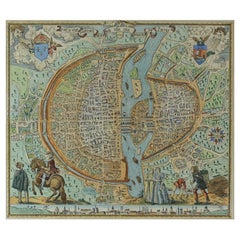
French Map of Paris, Musuem Carnavalet Rossingol University Map, 1576
Located in Gardena, CA
French Map of Paris, Musuem Carnavalet Rossingol University Map, 1576.
Map of Paris, France
Category
16th Century French Antique Maps Of Paris
Materials
Paper
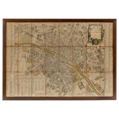
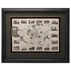
18th Century Map of Paris
Located in Washington, DC
18th century map of Paris.
Category
Late 18th Century French Antique Maps Of Paris
Materials
Glass, Wood, Paper
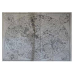
Original Large Antique Map of Paris, France by John Dower, 1861
Located in St Annes, Lancashire
Fabulous monochrome map of Paris.
Vignettes of St Germain En Laye, Saint Cloud, Versailles and
Category
1860s English Victorian Antique Maps Of Paris
Materials
Paper
No Reserve
H 25.5 in W 36 in D 0.07 in
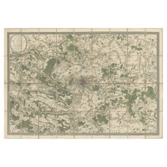
Large Folding Map of Paris, France, on Linen, 36 Segments, Published in 1836
Located in Langweer, NL
Antique map Paris titled 'Carte Topographique des Environs de Paris Nouvelle edition rectifié
Category
1830s Antique Maps Of Paris
Materials
Paper
H 27.96 in W 39.77 in D 0 in
Map of Paris - Original Etching - 19th Century
Located in Roma, IT
This Map of Paris is an original print in etching technique.
The state of preservation of the
Category
19th Century Antique Maps Of Paris
Materials
Etching
Antique Map of Paris, "Carte Routiere des Environs de Paris" 1841
Located in Colorado Springs, CO
This beautiful hand-colored road map of Paris was published in 1841. The map shows Paris and the
Category
1840s French Antique Maps Of Paris
Materials
Paper
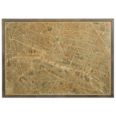
French 1930s Map of Paris à Vol d'Oiseau under Glass in Custom Iron Frame
Located in Atlanta, GA
A French map of Paris from the early 20th century, with custom iron frame. Created in Paris during
Category
Early 20th Century French Antique Maps Of Paris
Materials
Iron
H 28.75 in W 40.25 in D 1 in
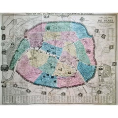
1861 Original vintage map of Paris - Historical cartography
Located in PARIS, FR
The "Nouveau Plan Illustré de la Ville de Paris avec le Système Complet de ses Fortifications et
Category
1860s Antique Maps Of Paris
Materials
Paper, Lithograph
H 33.86 in W 42.92 in
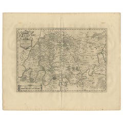
Antique Map of the Region of 'Île de France' by Janssonius, 1657
By Johannes Janssonius
Located in Langweer, NL
Antique map of France titled 'Ager Parisiensis vulgo l'Isle de France'. Old map of Paris and
Category
17th Century Antique Maps Of Paris
Materials
Paper
Antique Map of France in Provinces, with Inset of Paris
Located in Langweer, NL
the east. Also includes Corsica. An inset on the bottom left corner details Paris in 1789. This map
Category
Mid-19th Century Antique Maps Of Paris
Materials
Paper
Antique Map of the City of Paris by Tirion '1763'
Located in Langweer, NL
Paris, France. This map originates from 'Nieuwe en Beknopte Hand-Atlas, bestaande in eene Verzameling
Category
Mid-18th Century Antique Maps Of Paris
Materials
Paper
Antique Map of New Paris and Morning Sun, 1871
Located in Langweer, NL
Antique map titled 'New Paris, Morning Sun'. Original antique map of villages and communities of
Category
Late 19th Century Antique Maps Of Paris
Materials
Paper
Plan of Paris, France, by A. Vuillemin, Antique Map, 1845
Located in Colorado Springs, CO
This large and detailed plan of Paris was published by Alexandre Vuillemin in 1845. The map conveys
Category
1840s American Antique Maps Of Paris
Materials
Paper
Antique Map of the Region of Paris by Homann Heirs, c.1720
By Homann Heirs
Located in Langweer, NL
. Centered on Paris, the map extends to show these cities at the extremities - Ablis, Messe, Herissy, Senlies
Category
18th Century Antique Maps Of Paris
Materials
Paper
Antique Map of the Region of Paris ‘France’ by H. Heirs, circa 1720
Located in Langweer, NL
. Centered on Paris, the map extends to show these cities at the extremities - Ablis, Messe, Herissy, Senlies
Category
Early 18th Century Antique Maps Of Paris
Materials
Paper
Antique Map of France according to the Treaty of Paris '1815', Published in 1854
Located in Langweer, NL
Paris. (1815)'. Large map of France. From James Wyld's 'A New General Atlas of Modern Geography
Category
19th Century Antique Maps Of Paris
Materials
Paper
H 23.04 in W 28.35 in D 0 in
Decorative Antique Map of the Seine River and Paris in France, ca.1854
By Victor Levasseur
Located in Langweer, NL
Antique map titled 'Dépt. de la Seine'. Map of the French department of Seine. Focusing on Paris
Category
Mid-19th Century Antique Maps Of Paris
Materials
Paper
H 13.98 in W 20.67 in D 0.02 in
Antique Map of Algeria, 1880
Located in Langweer, NL
Antique map titled 'Algérie. Old map of Algeria. This map originates from 'Géographie Universelle
Category
19th Century Antique Maps Of Paris
Materials
Paper
Antique Map of Asia, 1846
Located in Langweer, NL
Antique map titled 'Asie'. Original antique map of Asia. Source unknown, to be determined
Category
19th Century Antique Maps Of Paris
Materials
Paper
Map of North and East coast of Asia with Japan & inset maps of Kamchatka, c1750
Located in Langweer, NL
Antique map titled 'Nouvelle representation des Cotes Nord et Est de L'Asie.'
Map the north and
Category
1750s Antique Maps Of Paris
Materials
Paper
H 14.77 in W 17.45 in D 0 in
Antique Political Map of France, 1880
By J. Migeon
Located in Langweer, NL
Antique map titled 'France Féodale'. Old map of France with a decorative vignette of Castle de
Category
19th Century Antique Maps Of Paris
Materials
Paper
Colored wall map of the WORLD
By Chambon
Located in ZWIJNDRECHT, NL
.. - 1781)
Paris, Longchamps et Janvier, 1754
Size H. 115 x W. 145 cm.
Gobert-Denis Chambon made copper
Category
Mid-18th Century French French Provincial Antique Maps Of Paris
Materials
Wood, Paper
Scarce Antique Map of South America
Located in Langweer, NL
Paris in 1821. The map shows the continent in the midst its of several decades of revolution, which
Category
Early 19th Century Antique Maps Of Paris
Materials
Paper
Decorative Antique Map of Central Asia
Located in Langweer, NL
Antique map titled 'Carte de la Tartarie Indépendante (..)'. Decorative map of Central Asia
Category
Late 18th Century Antique Maps Of Paris
Materials
Paper
Antique Map of the Archdiocese of Cologne, Germany
Located in Langweer, NL
Antique map titled 'Archevesche et Eslectorat de Cologne avec ses Enclaves'. Original old map of
Category
Late 17th Century Antique Maps Of Paris
Materials
Paper
Antique Map of of Brazil, Paraguay and Uruguay
Located in Langweer, NL
Antique map titled 'Bresil Paraguay et Uruguay'. Fine steel engraved map of Brazil, Paraguay and
Category
Mid-19th Century Antique Maps Of Paris
Materials
Paper
Antique Map of the Bay of Brusc, France
Located in Langweer, NL
Antique map titled 'Carte de la rade du Brusc'. Original map of the bay of Brusc, France. This map
Category
Mid-18th Century Antique Maps Of Paris
Materials
Paper
Antique Map of the Coast of Roussillon, France
Located in Langweer, NL
Antique map titled 'Coste de Roussillon depuis Port Vendres, jusqu'au golphe de Rozes'. Original
Category
Mid-18th Century Antique Maps Of Paris
Materials
Paper
Antique Map of the Kingdom of Prussia, 1880
Located in Langweer, NL
Antique map titled 'Prusse'. Old map of the Kingdom of Prussia, with a decorative vignette of the
Category
19th Century Antique Maps Of Paris
Materials
Paper
Antique Map of the Region of Martigues, France
Located in Langweer, NL
Title: "Etang de Martigues et Environs: Antique Map of the Martigues Region, France"
Description
Category
Mid-18th Century Antique Maps Of Paris
Materials
Paper
Antique Map of the Region of Fréjus, France
Located in Langweer, NL
Title: "Golf de Fréjus"
Description: This antique map, titled "Golf de Fréjus," is an original
Category
Mid-18th Century Antique Maps Of Paris
Materials
Paper
Antique Map of Grenada, West Indies, 1758
Located in Langweer, NL
originating from Paris, this map serves as both a historical artifact and a visual delight, capturing
Category
1750s Antique Maps Of Paris
Materials
Paper
1864 Map of North America, Antique Hand-Colored Map, by Adolphe Hippolyte Dufour
Located in Colorado Springs, CO
Offered is a map of North America entitled Amerique du Nord from 1864. This rare, separately
Category
1860s French Antique Maps Of Paris
Materials
Paper
H 44.5 in W 33 in D 1.5 in
Antique Map of Arabia by Tardieu '1843'
Located in Langweer, NL
Antique map titled 'Arabie'. Attractive small map of Arabia. This map originates from 'Dictionnaire
Category
Mid-19th Century Antique Maps Of Paris
Materials
Paper
Antique Map of France by Zannoni, 1765
Located in Langweer, NL
Antique map titled 'La France divisée en ses LVIII Provinces (..)'. Beautiful old map of France
Category
18th Century Antique Maps Of Paris
Materials
Paper
Antique Map of Germany by Walker, 1820
By R. Walker
Located in Langweer, NL
Antique map Germany titled 'Map of Germany as defined by the Peace of Paris'. Detailed antique map
Category
19th Century Antique Maps Of Paris
Materials
Paper
Antique Map of the Europe Continent, 1880
Located in Langweer, NL
Antique map titled 'Europe'. Old map of the European continent. This map originates from
Category
19th Century Antique Maps Of Paris
Materials
Paper
Antique Map of France by Migeon, 1880
Located in Langweer, NL
Antique map titled 'France Physique'. Old map of France. This map originates from 'Géographie
Category
19th Century Antique Maps Of Paris
Materials
Paper
Antique Map of Asia by Dussy, 1778
Located in Langweer, NL
Antique map of Asia titled 'Indostan presqu'isles de l'Inde, Chine, Tartarie Independante
Category
Late 18th Century French Antique Maps Of Paris
Materials
Paper
Antique Map of Siberia by Reclus, 1881
Located in Langweer, NL
Antique map titled 'Itineraires en Siberie.' This map shows the itineraries of famous explorers in
Category
19th Century Antique Maps Of Paris
Materials
Paper
Antique Map of Asia by Larousse, 1897
Located in Langweer, NL
Front: 'Carte Generale de l'Asie.' (General map of Asia). Rear: 'Asie.' (Asia, scenes of Asia
Category
19th Century Antique Maps Of Paris
Materials
Paper
Antique Map of Sweden by Delamarche, 1806
Located in Langweer, NL
the important and prolific Paris based Maison Delamarche map publishing firm in the late 18th century
Category
19th Century Antique Maps Of Paris
Materials
Paper
Antique Map of Africa by Delamarche, 1806
Located in Langweer, NL
Delamarche (1740-1817) founded the important and prolific Paris based Maison Delamarche map publishing firm
Category
19th Century Antique Maps Of Paris
Materials
Paper
Antique Map of Cher in France, 1854
By Victor Levasseur
Located in Langweer, NL
map originates from ‘Atlas National de la France Illustré’. Published by A. Combette, Paris, 1854.
Category
Mid-19th Century Antique Maps Of Paris
Materials
Paper
Antique Map of China by Larousse, 1897
By Pierre Larousse
Located in Langweer, NL
Sheet: Front: 'Chine.' (China map). Verso: 'China.' (China views, nature, animals, costume). This
Category
19th Century Antique Maps Of Paris
Materials
Paper
Original Antique Map of Ancient Asia, 1847
Located in Langweer, NL
Description: Antique map Asia titled 'Asie Ancienne'.
This is an original antique map of
Category
1840s Antique Maps Of Paris
Materials
Paper
Antique Map of Oceania by Didot, 1836
Located in Langweer, NL
Antique map titled 'Oceanie par G.L.Dy. De Rienzi'. Map of the Oceania region, around Australia
Category
19th Century Antique Maps Of Paris
Materials
Paper
Antique Map of Oceania by Hérisson, 1816
Located in Langweer, NL
Antique map titled "Océanie ou cinquième partie du monde". This is an original antique map of
Category
19th Century Antique Maps Of Paris
Materials
Paper
Antique Map of Sumatra by Tardieu, 1811
Located in Langweer, NL
Antique map Sumatra titled 'Partie de l'Isle Sumatra'. Part of the Island of Sumatra, where the
Category
19th Century Antique Maps Of Paris
Materials
Paper
Antique Map of Trincomalee and Tambalagam Bay, 1758
Located in Langweer, NL
these maps by Van Schley after Bellin were initially made for 'Histoire Generale des Voyages' (Paris
Category
18th Century Antique Maps Of Paris
Materials
Paper
Antique Map of the United States with Vignette of Washington
Located in Langweer, NL
. Migeon was a late 19th century map publisher based in Paris, France.
Category
Late 19th Century Antique Maps Of Paris
Materials
Paper
Antique Map of Southeast Asia by Dussy, 1778
Located in Langweer, NL
Engravers: E. Dussy, a Paris draughtsman and map engraver, active 1754-1784, best known for his long
Category
18th Century Antique Maps Of Paris
Materials
Paper
Antique Map of the Region of Berre-l'Étang, France
Located in Langweer, NL
Antique map titled 'Carte des etangs de Berre de Martigue et environs'. Original map of the region
Category
Mid-18th Century Antique Maps Of Paris
Materials
Paper
Antique Map of the Netherlands by Zannoni, 1765
Located in Langweer, NL
Antique map titled 'Carte Historique, Geographique et Militaire des Campagnes de Louis XIV dans les
Category
18th Century Antique Maps Of Paris
Materials
Paper
Antique Map of ancient France by Zannoni, 1765
Located in Langweer, NL
Antique map France titled 'Galliae Veteris (..)'. Beautiful old map of France. This map originates
Category
18th Century Antique Maps Of Paris
Materials
Paper
Antique Map of Asia by V. Levasseur, 1854
By Victor Levasseur
Located in Langweer, NL
map originates from ‘Atlas National de la France Illustré’. Published by A. Combette, Paris, 1854.
Category
Mid-19th Century Antique Maps Of Paris
Materials
Paper
Antique Map of the Departments of France by Migeon, 1880
By J. Migeon
Located in Langweer, NL
Antique map titled 'France par Départements'. Old map of France with a decorative vignette of
Category
19th Century Antique Maps Of Paris
Materials
Paper
Antique Map of Northern Italy by Migeon, 1880
Located in Langweer, NL
Antique map titled 'Italie Septentrionale'. Old map of the northern part of Italy. This map
Category
19th Century Antique Maps Of Paris
Materials
Paper
Decorative Antique Map of the Southern Part of Africa, 1806
Located in Langweer, NL
Antique map titled 'Congo, Cafrerie.'
Decorative map of the southern part of Africa by Robert
Category
Early 1800s Antique Maps Of Paris
Materials
Paper
Antique Map of Southern Italy by Migeon, 1880
Located in Langweer, NL
"Antique map titled 'Italie Méridionale'. Old map of southern Italy including Sicily/Sicilia. This
Category
19th Century Antique Maps Of Paris
Materials
Paper
- 1
- ...
Get Updated with New Arrivals
Save "Antique Maps Of Paris", and we’ll notify you when there are new listings in this category.
Antique Maps Of Paris For Sale on 1stDibs
Choose from an assortment of styles, material and more with respect to the antique maps of paris you’re looking for at 1stDibs. Each antique maps of paris for sale was constructed with extraordinary care, often using paper, wood and fabric. There are many kinds of the antique maps of paris you’re looking for, from those produced as long ago as the 18th Century to those made as recently as the 20th Century. An antique maps of paris is a generally popular piece of furniture, but those created in Neoclassical and Victorian styles are sought with frequency. Georg Braun and Frans Hogenberg, Andriveau-Goujon and Angelique Marie Martin each produced at least one beautiful antique maps of paris that is worth considering.
How Much is a Antique Maps Of Paris?
Prices for an antique maps of paris start at $225 and top out at $11,000 with the average selling for $1,575.
More Ways To Browse
Antique Map German Empire
J Denis
Antique Map Of Northern Italy
Pyramid Lake
Map Of Sicily
Sicily Map
California Island Map
Sea Island Georgia
Las Vegas Used Office Furniture
Putti On Paper
Used Office Furniture Las Vegas
Antique Lawyer Prints
Antique Korean Wood Furniture
French Empire Ottoman
Saint Helena
Used Office Furniture In Las Vegas
Vin Antique
Antique Glove Box
