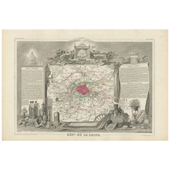
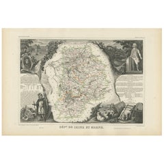
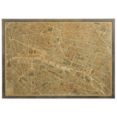
Decorative Antique Map of the Seine River and Paris in France, ca.1854
View Similar Items


Want more images or videos?
Request additional images or videos from the seller
1 of 5
Decorative Antique Map of the Seine River and Paris in France, ca.1854
About the Item
- Creator:Victor Levasseur (Artist)
- Dimensions:Height: 13.98 in (35.5 cm)Width: 20.67 in (52.5 cm)Depth: 0.02 in (0.5 mm)
- Materials and Techniques:
- Period:
- Date of Manufacture:1854
- Condition:General age-related toning. Please study image carefully.
- Seller Location:Langweer, NL
- Reference Number:Seller: BG-05614/251stDibs: LU3054310739603
About the Seller
5.0
Platinum Seller
These expertly vetted sellers are 1stDibs' most experienced sellers and are rated highest by our customers.
Established in 2009
1stDibs seller since 2017
1,947 sales on 1stDibs
More From This SellerView All
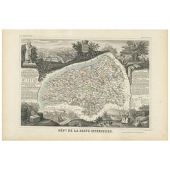
- Antique Map of Seine Inférieure, France by V. Levasseur, 1854By Victor LevasseurLocated in Langweer, NLAntique map titled 'Dépt. de la Seine Inférieure'. Map of the French department of Seine Inferieure, France. Centered around its capital of Rouen, this area is known for its producti...Category
Antique Mid-19th Century Maps
MaterialsPaper
 $175 Sale Price20% Off
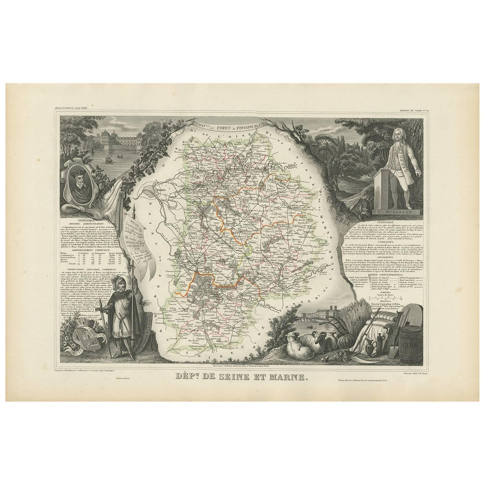
 - Antique Map of Seine et Marne 'France' by V. Levasseur, 1854By Victor LevasseurLocated in Langweer, NLAntique map titled 'Dépt. de Seine et Marne'. Map of the French department of Seine Et Marne, France. This region produces a wide variety of wines and h...Category
Antique Mid-19th Century Maps
MaterialsPaper
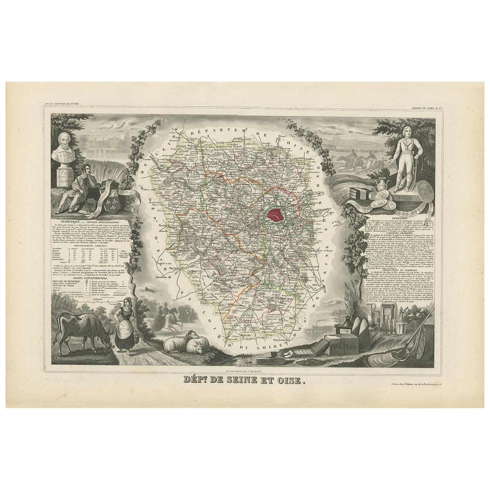
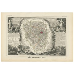
- Antique Map of Seine et Oise 'France' by V. Levasseur, 1854By Victor LevasseurLocated in Langweer, NLAntique map titled 'Dépt. de Seine et Oise'. Map of the French department of Seine-et-Oise. Centred on Versailles, its administrative centre, Seine-et-Oise extends from Espernon to M...Category
Antique Mid-19th Century Maps
MaterialsPaper
 $175 Sale Price20% Off
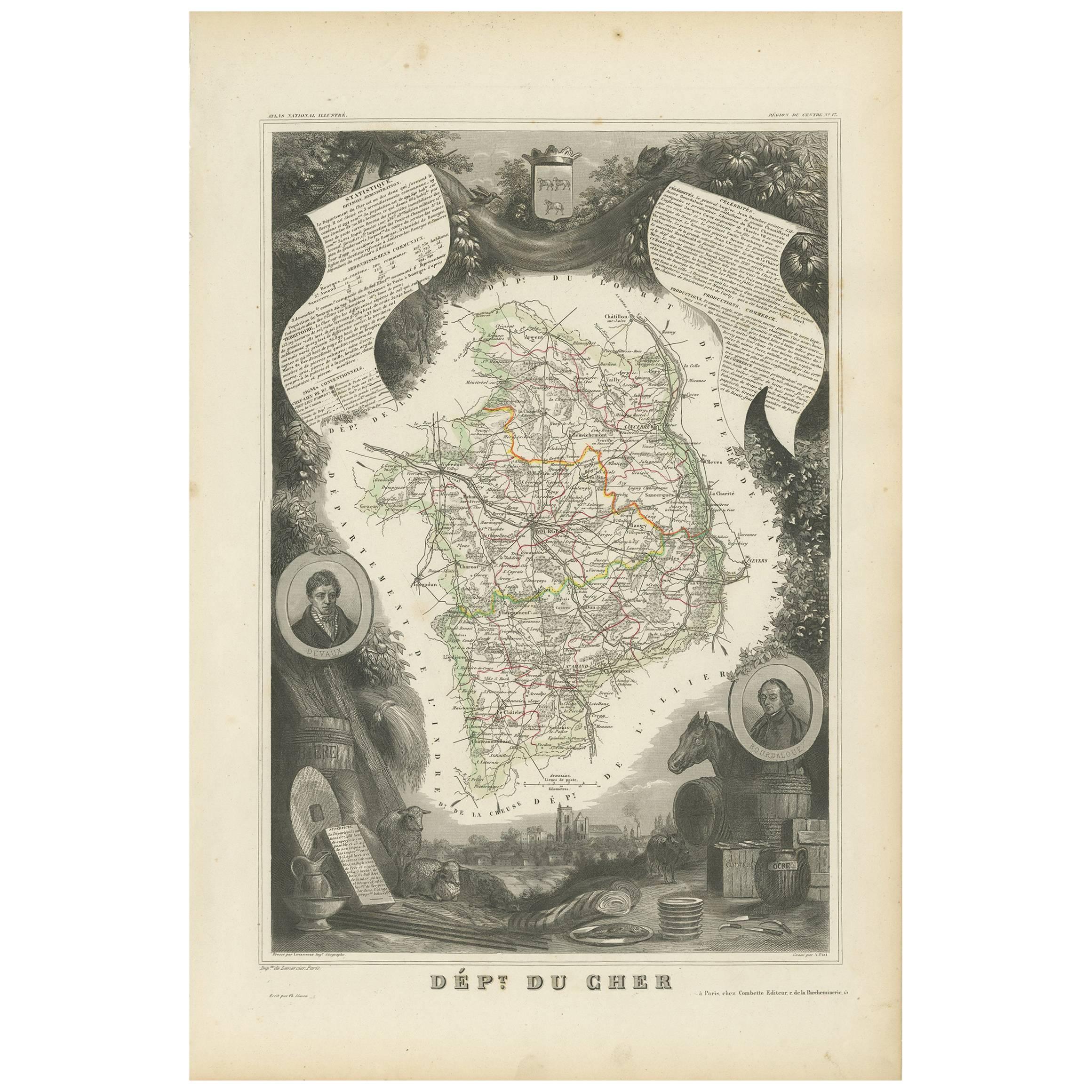
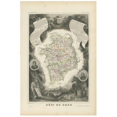
 - Antique Map of Cher in France, 1854By Victor LevasseurLocated in Langweer, NLAntique map titled 'Dépt. des Bses. Pyrénées'. Map of the French department of Basses Pyrenees, France. This department includes the Jurancon wine region, famous for its production d...Category
Antique Mid-19th Century Maps
MaterialsPaper
 $158 Sale Price20% Off
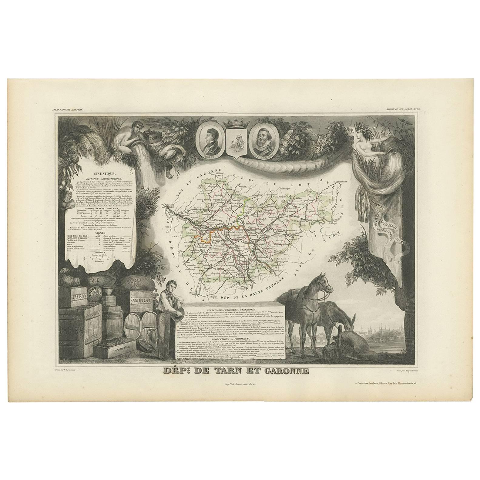
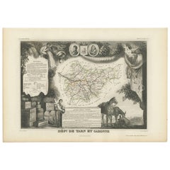
 - Antique Map of Tarn and Garonne in France, 1854By Victor LevasseurLocated in Langweer, NLAntique map titled 'Dépt. de Tarn et Garonne'. Map of the French department of Tarn et Garonne, France. This map is centered around the city of Moissac, which is known for its fine d...Category
Antique Mid-19th Century Maps
MaterialsPaper
 $158 Sale Price20% Off
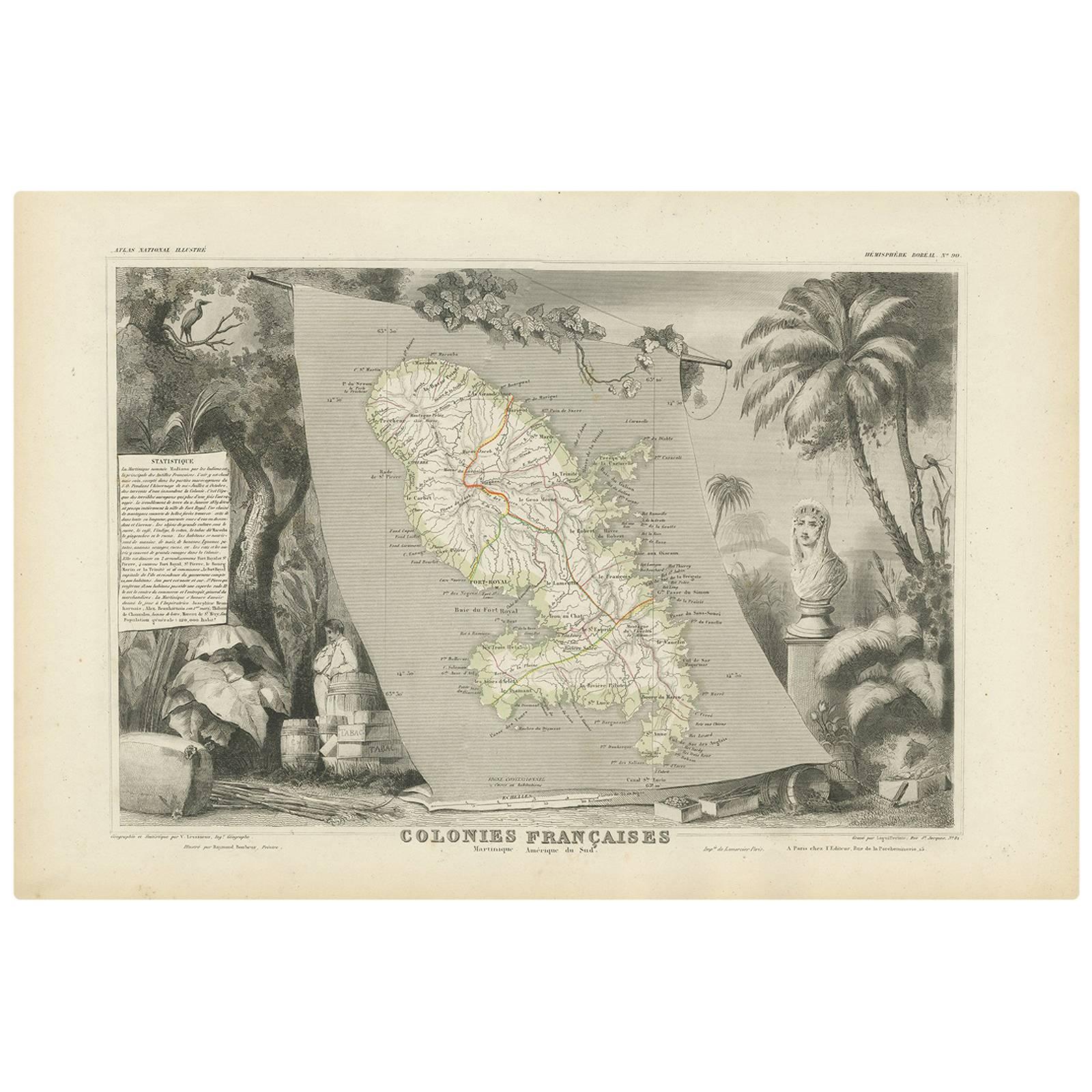
 - Antique Map of the French Colony Martinique by V. Levasseur, 1854By Victor LevasseurLocated in Langweer, NLAntique map titled 'Colonies Françaises. Martinique, Amérique du Sud'. This map originates from ‘Atlas National de la France Illustré’. Published by A. Combette, Paris, 1854.Category
Antique Mid-19th Century Maps
MaterialsPaper
 $164 Sale Price25% Off
You May Also Like
- Antique Map of Paris, "Carte Routiere des Environs de Paris" 1841Located in Colorado Springs, COThis beautiful hand-colored road map of Paris was published in 1841. The map shows Paris and the surrounding area in a folding pocket map. Organized and detailed for travelers, this ...Category
Antique 1840s French Maps
MaterialsPaper
- Vintage "View of the Center of Paris Taken from the Air" Lithograph MapLocated in San Diego, CAA very stylish "View of the Center of Paris Taken from the Air" lithograph map published by the Paris Ministry of Tourism, circa early 1950s. The piece measures 27" x 43" and shows...Category
20th Century French Mid-Century Modern Prints
MaterialsPaper
 $680 Sale Price20% Off
 - Original Antique Map of France, Arrowsmith, 1820Located in St Annes, LancashireGreat map of France Drawn under the direction of Arrowsmith. Copper-plate engraving. Published by Longman, Hurst, Rees, Orme and Brown, 1820 Unframed.Category
Antique 1820s English Maps
MaterialsPaper

- French 1930s Map of Paris à Vol d'Oiseau under Glass in Custom Iron FrameLocated in Atlanta, GAA French map of Paris from the early 20th century, with custom iron frame. Created in Paris during the second quarter of the 20th century, this map of Paris à vol d'oiseau (as the Cr...Category
Early 20th Century French Prints
MaterialsIron
- Map of the Republic of GenoaLocated in New York, NYFramed antique hand-coloured map of the Republic of Genoa including the duchies of Mantua, Modena, and Parma. Europe, late 18th century. Dimension: 25...Category
Antique Late 18th Century European Maps
- Antique Map of Principality of MonacoBy Antonio Vallardi EditoreLocated in Alessandria, PiemonteST/619 - "Old Geographical Atlas of Italy - Topographic map of ex-Principality of Monaco" - ediz Vallardi - Milano - A somewhat special edition ---Category
Antique Late 19th Century Italian Other Prints
MaterialsPaper
 $228 Sale Price74% Off


Recently Viewed
View AllMore Ways To Browse
Antique In Paris
Map Wall
French Antique Decorative Collectibles
Paris Map
Map Paris
Map Of Paris
Antique Wall Map
Antique Wall Maps
River Map
Paris France Map
Antique Paris Engravings
Antique Maps Paris
Antique Map Paris
Paris Map Antique
Antique Paris Maps
Antique Paris Map
Paris Antique Maps
Antique Maps Of Paris