Map Wall

20
to
184
2,083
1,387
1,096
843
828
768
635
528
500
234
226
191
132
122
108
94
83
77
74
59
51
48
45
40
37
33
30
28
27
21
20
18
18
16
15
13
13
13
11
10
9
9
8
8
8
8
7
7
7
7
6
6
5
5
4
4
4
3
3
2
2
1
1
1
81
65
42
42
42
Sort By
Two Impressive and Huge Midcentury World Map Wall Globes, Austria, 1950s
Located in Vienna, AT
We proudly offer this outstanding pair of very large wall-mounted modernist globes / world maps
Category

Mid-20th Century Austrian Mid-Century Modern Maps

Materials

Aluminum, Iron

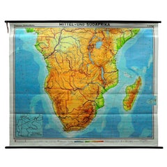
Countrycore Mural Vintage Map Wall Chart Rollable Poster Central South Africa
Located in Berghuelen, DE
The cottagecore pull-down mural map depicts Middle and South Africa. Published by Westermann
Category

Vintage 1970s German Country Posters

Materials

Canvas, Wood, Paper

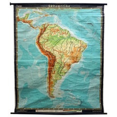
Old Vintage Look Pull Down Map Wall Chart Poster South America
Located in Berghuelen, DE
The wall map shows South America in a combination of physical and political map with the emphasis
Category

Mid-20th Century German Country Prints

Materials

Canvas, Wood, Paper

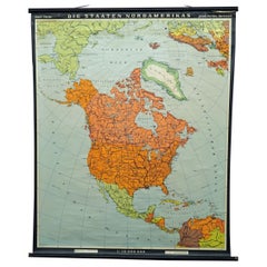
Vintage Map Wall Chart Countries of North America Rollable Mural Poster
Located in Berghuelen, DE
The vintage pull-down school map illustrates the countries / states of North America. Published by
Category

Late 20th Century German Country Prints

Materials

Canvas, Wood, Paper

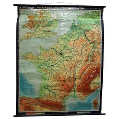
Vintage Mural Rollable Map Wall Chart France Benelux Countries South England
Located in Berghuelen, DE
A cottagecore pull-down wall chart map illustrating France and the Benelux countries (the
Category

Mid-20th Century German Country Prints

Materials

Canvas, Wood, Paper

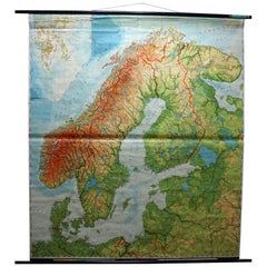
Vintage Rollable Mural Map Wall Chart Print Scandinavia Norway Sweden Finland
Located in Berghuelen, DE
A great impressive cottagecore map illustrating Scandinavia (Norway, Sweden, Finland, Denmark and
Category

Mid-20th Century German Country Prints

Materials

Canvas, Wood, Paper

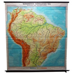
Vintage Rollable Map Wall Chart South America Brasilia and Neighbour States
Located in Berghuelen, DE
A classical pull-down school map showing South America with Brasilia and its neighbor states
Category

Mid-20th Century German Country Prints

Materials

Canvas, Wood, Paper

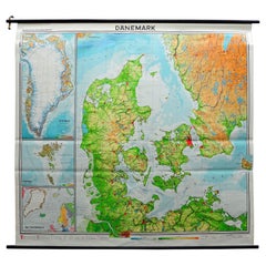
Denmark Greenland Faroe Islands the North Atlantic Vintage Mural Map Wall Chart
Located in Berghuelen, DE
The vintage pull-down mural map illustrates Denmark with Greenland, the Faroe Islands and the North
Category

Vintage 1970s German Country Posters

Materials

Canvas, Wood, Paper

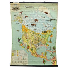
Land Use and Livestock North America Picture Map Wall Chart Poster Mural
Located in Berghuelen, DE
The vintage rollable picture map of North- and Middle America shows land use and livestock
Category

Late 20th Century German Country Prints

Materials

Canvas, Wood, Paper

Religious Bible Mural Journey of Apostle Paul Rollable Vintage Map Wall Chart
Located in Berghuelen, DE
A colorful picturous map showing the journey of the apostle Paul, published by Becker´s Hamburg
Category

Late 20th Century German Country Prints

Materials

Paper, Canvas, Wood

Fun Signed Curtis Jere Globe World Wall Sculpture Mid-Century Modern
By Curtis Jeré
Located in Pemberton, NJ
Fun Curtis Jere designed brass two piece world map wall sculpture. A finely rendered handmade two
Category

Vintage 1980s American Mid-Century Modern Wall-mounted Sculptures

Materials

Brass

Colored wall map of the WORLD
By Chambon
Located in ZWIJNDRECHT, NL
huge wall map of the world in two hemispheres printed on two sheets, depicting the Eastern and Western
Category

Antique Mid-18th Century French French Provincial Maps

Materials

Wood, Paper

Colored wall map of the WORLD
Free Shipping
H 45 in W 57 in D 0.8 in
1854 Map of Massachusetts, Connecticut and Rhode Island, Antique Wall Map
Located in Colorado Springs, CO
This striking wall map was published in 1854 by Ensign, Bridgman & Fanning and has both full
Category

Antique 19th Century American Maps

Materials

Paper

Huge Europe and Asia Vintage Wall Map
Located in San Diego, CA
A huge Europe and Asia vintage wall map, circa 1950s. The map is in fair vintage condition and
Category

Mid-20th Century American Maps

Materials

Paper

World Map Silver Leaf Print Based on Original Willem Blaeu Wall Map 1571-1638
Located in GB
We are delighted to offer for sale this lovely Antique style pictorial plan map of the globe based
Category

20th Century English Campaign Maps

Materials

Silver Leaf

Framed Mid-19th Century Wall Map of Long Island, the Hamptons
Located in Sag Harbor, NY
A Framed museum quality find. This large wall map dates to the mid-1800s. Detailed inset maps of
Category

Antique Mid-19th Century American Maps

Materials

Linen, Paper

Large Antique Wall Map of Friesland by Vegelin van Claerbergen, 1739
Located in Langweer, NL
. Heeren Gedeputeerde Staeten'. Rare and large attractive wall map of Friesland, the so-called 'Vegelin
Category

Antique 18th Century Maps

Materials

Paper

Antique Map of Tartary, Also Showing the Great Wall of China
Located in Langweer, NL
Antique map titled 'Carte de Tartarie'. Detailed map of Tartary, consisting of the Eastern part of
Category

Antique Early 18th Century Maps

Materials

Paper

Large Wall Map of Europe by George Philip & Son, circa 1920
Located in Langweer, NL
Antique map titled 'Philips' New Commercial Map of Europe'. Very large wall map of Europe including
Category

Early 20th Century Maps

Materials

Linen, Paper

Large Wall Map of Europe by George Philip & Son, circa 1920
No Reserve
H 72.05 in W 66.15 in D 0.02 in
"The United States from the Latest Authorities" Antique Wall Map, 1835
Located in Colorado Springs, CO
-colored engraved wall map of the eastern half of the United States, this map has a large inset of the
Category

Antique 1830s American Maps

Materials

Paper

Massive Vintage Wall Map of the Soviet Union 'Sowjetunion' by Karl Wenschow
By Denoyer-Geppert
Located in San Diego, CA
A massive vintage wall map of the Soviet Union (Sowjetunion) published by Karl Wenschow in Munich
Category

Mid-20th Century American Maps

Materials

Wood, Paper

Antique Map of the British Isles with Walls, Settlements and Other Features
Located in Langweer, NL
Antique map titled 'Insulae Britannicae'. Interesting map of Britain, Scotland, and Ireland. It
Category

Antique Late 18th Century Maps

Materials

Paper

1847 “World at One View” Antique Hand-Colored Wall Map of the World
Located in Colorado Springs, CO
This is a highly desirable hanging wall map of the "World at One View", published in 1847 by Ensign
Category

Antique 19th Century American Maps

Materials

Paper

Map Hanging Wall County of Devon C&J Greenwood 1827 Exeter Cathedral Lundy Isle
Located in BUNGAY, SUFFOLK
C & J GREENWOOD MAP OF THE COUNTY OF DEVON, FROM AN ORIGINAL SURVEY, PUBLISHED 1827, WITH ENGRAVING
Category

Antique 1820s English Early Victorian Maps

Materials

Paper

Antique Map of Scotland With an Inset Map of the Shetland Islands, 1854
Located in Langweer, NL
Stunning Map of Scotland that will look beautiful in any setting framed on the wall. Description
Category

Antique 1850s Maps

Materials

Paper

Silver Leaf Foil Wall World Map Engraving Based on the Original Moses Pitt, 1681
Located in GB
We are delighted to offer for sale this lovely antique style pictorial silver leaf foil world map
Category

20th Century English Modern Maps

Materials

Silver Leaf

1864 Map of North America, Antique Hand-Colored Map, by Adolphe Hippolyte Dufour
Located in Colorado Springs, CO
published wall map was produced by Adolphe Hippolyte Dufour. This map includes vibrant and elaborate hand
Category

Antique 1860s French Maps

Materials

Paper

Original Antique Map of Switzerland, 1882
Located in Langweer, NL
era, waiting to grace your home or office walls. Bring home this antique map today and let its
Category

Antique 1880s Maps

Materials

Paper

Original Antique Map of Switzerland, 1882
H 14.97 in W 22.45 in D 0 in
1842 Wall Map of the United States by J. H. Young, Published by S. A. Mitchell
Located in Colorado Springs, CO
earliest counties present. Elaborately detailed, the hanging wall map includes a large inset "Map of
Category

Antique 1840s American Maps

Materials

Paper

Antique Map of Delfland by Cruquius, 1712
Located in Langweer, NL
Map no. 25 of a large wall map of Delfland, The Netherlands. The map covers the region of Polder
Category

Antique 18th Century Maps

Materials

Paper

Original Antique Map of The Austrian Empire, 1882
Located in Langweer, NL
Step into the past with an original Antique Map of The Austrian Empire from the esteemed
Category

Antique 1880s Maps

Materials

Paper

Original Antique Map of Russia in Europe, 1882
Located in Langweer, NL
Embark on an enthralling journey with an original Antique Map of European Russia from the esteemed
Category

Antique 1880s Maps

Materials

Paper

Large Antique Map of Delfland by Cruquius, 1712
Located in Langweer, NL
Map no. 20 of a large wall map of Delfland, The Netherlands. The map covers the region of Pijnacker
Category

Antique 18th Century Maps

Materials

Paper

Original Antique Map of Spain and Portugal, 1882
Located in Langweer, NL
Embark on a historical voyage with an original Antique Map of Spain and Portugal from the esteemed
Category

Antique 1880s Maps

Materials

Paper

Antique Map of Ambon Island by Valentijn, 1726
By F. Valentijn
Located in Langweer, NL
Antique map titled 'Caart van het Eyland Amboina in 't bijsonder'. Map of the Islands Ambon and
Category

Antique Early 18th Century Dutch Maps

Materials

Paper

Antique Map of Ambon Island by Valentijn, 1726
H 13.39 in W 16.93 in D 0.02 in
Antique Map of The German Empire (West Sheet), 1882
Located in Langweer, NL
, Bavaria & c. This isn't just a map; it's a gateway to a captivating past. Its presence on your wall
Category

Antique 1880s Maps

Materials

Paper

Antique Map of The German Empire (East Sheet), 1882
Located in Langweer, NL
Step into history with an authentic Antique Map of The German Empire (East Sheet) from the esteemed
Category

Antique 1880s Maps

Materials

Paper

Colorful Detailed Antique Map of England and Wales, 1882
Located in Langweer, NL
Explore the Historic Splendor of 'England and Wales' with this Antique Map! Part of a distinguished
Category

Antique 1880s Maps

Materials

Paper

Antique Map of Asia Showing Its Political Divisions, 1874
Located in Langweer, NL
company had specialized in the production of school atlases and wall maps of America. They were one of the
Category

Antique 19th Century Maps

Materials

Paper

Antique Map of Friesland by De Wit, c.1690
Located in Langweer, NL
cartographic material including separate terrestrial maps and sea charts, sea and terrestrial atlases, wall
Category

Antique 17th Century Maps

Materials

Paper

Antique Map of Friesland by De Wit, c.1690
H 20.87 in W 24.41 in D 0 in
Antique Map of Asia by Pierre du Val, '1663'
Located in Langweer, NL
Antique map titled 'L'Asie'. Antique map of the Asian continent by Pierre Duval, dated 1663. Most
Category

Antique Mid-17th Century Maps

Materials

Paper

Antique Map of Asia by Pierre du Val, '1663'
H 16.15 in W 20.87 in D 0.02 in
1633 Map Entitled "Beauvaisis Comitatus Belova Cium, Ric.0002
Located in Norton, MA
den Keere * 1595 Europe (wall map): with Pieter van den Keere * 1598 World and the Continents * 1599
Category

Antique 17th Century Dutch Maps

Materials

Paper

Large Decorative Antique Map of the Mediterranean, ca.1770
Located in Langweer, NL
fine engraved double-page and folding maps that join to create a large wall map of the Mediterranean
Category

Antique 1770s Maps

Materials

Paper

Road Map, John Ogilby, No 54, London, Yarmouth, Britannia
By John Ogilby
Located in BUNGAY, SUFFOLK
-sixth year, as a publisher of maps and geographical accounts. Ogilby was born outside Dundee, in
Category

Antique 1670s English Baroque Maps

Materials

Paper

Italian Parchment Map of the City of Lucca Dated 1640
By Matthäus Merian the Elder
Located in Roma, IT
An antique map of the Tuscan city of Lucca engraved for The 'Itinerarium Italiæ Nov-antiquæ' by
Category

Antique 1640s Italian Maps

Materials

Parchment Paper, Paper

Antique Map of Western Tartary, with Information from Kyrkov's Surveys
Located in Langweer, NL
Antique map titled 'Carte de la Tartarie Occidentale'. This map covers western Tartary with a focus
Category

Antique Mid-18th Century Maps

Materials

Paper

Italian Parchment Map of the City of Pisa Dated, 1640
By Matthäus Merian the Elder
Located in Roma, IT
An antique map of the Tuscan city of Pisa engraved for The 'Itinerarium Italiæ Nov-antiquæ' by
Category

Antique 1640s Italian Maps

Materials

Paper

Antique Map of Vlaams-Brabant by Homann Heirs, c.1720
By Homann Heirs
Located in Langweer, NL
Antique map titled 'Ducatus Brabantiae Nova Tabula in qua (..).' Fully engraved copper plate map
Category

Antique 18th Century Maps

Materials

Paper

Very Large Vintage Map of Canada, German, Education, Institution, Cartography
Located in Hele, Devon, GB
between a pair of ebonized spars for ease of wall mounting This is a captivating vintage map of Canada
Category

Mid-20th Century German Maps

Materials

Paper

Antique Map of Alentejo: Land of Tradition and Tranquility, 1903
Located in Langweer, NL
The image is a historical original antique map of the Alentejo region in Portugal. This map
Category

Antique Early 1900s Maps

Materials

Paper

Antique Map of the Region of Pasuruan, Java, Indonesia, 1726
Located in Langweer, NL
"Map of the region around Pasuruan. It shows the location of rice fields, the village Bangil, as
Category

Antique 18th Century Maps

Materials

Paper

Original Antique Map of Italy with an Inset of Sardinia, 1882
Located in Langweer, NL
Embark on a historical odyssey with an original Antique Map of Italy from the esteemed
Category

Antique 1880s Maps

Materials

Paper

Colorful Detailed Antique Map of The World on Mercators Projection, 1882
Located in Langweer, NL
The 'World of Mercator's Projection' is a map with a stunning portrayal of global geography and
Category

Antique 1880s Maps

Materials

Paper

Old Genuine Antique Map of Tartary in the Russian Far East
Located in Langweer, NL
Original antique map titled 'Tartaria sive Magni Chami Imperium'. This great map of Tartary covers
Category

Antique Mid-17th Century Maps

Materials

Paper

Antique Map of Paris, "Carte Routiere des Environs de Paris" 1841
Located in Colorado Springs, CO
surrounds the gray center of Paris, as the map clearly shows, however, that wall was soon replaced by the
Category

Antique 1840s French Maps

Materials

Paper

1864 Johnson's Map of the World on Mercator's Projection, Ric.B009
Located in Norton, MA
An 1864 Johnson's map of the World on Mercator's Projection Ric.b009 About this Item
Category

Antique 19th Century Dutch Maps

Materials

Paper

Detailed Antique Map of Southeast England, incl Warwickshire and Hampshire, 1690
Located in Langweer, NL
terrestrial atlases, wall maps, and town views. Many of his maps were superbly colored by master Dutch
Category

Antique 1690s Maps

Materials

Paper

Antique Hand-Coloured Map of India, Sri Lanka, Maldives, ca.1599
Located in Langweer, NL
. Put this map in a frame on the wall and amaze your visitors. This original engraving was made over 400
Category

Antique 16th Century Maps

Materials

Paper

1915 "San Francisco City and County" Hanging Map by W. Bashford Smith
Located in Colorado Springs, CO
Presented is a rare wall map of San Francisco by W. Bashford Smith. Published in San Francisco in
Category

Vintage 1910s American Art Deco Maps

Materials

Wood, Paper

Map of Friesland with Terschelling, Vlieland, Ameland En Schiermonnikoog, C.1670
Located in Langweer, NL
cartographic material including separate terrestrial maps and sea charts, sea and terrestrial atlases, wall
Category

Antique 1670s Maps

Materials

Paper

  • 1
  • ...
Get Updated with New Arrivals
Save "Map Wall", and we’ll notify you when there are new listings in this category.

Map Wall For Sale on 1stDibs

Choose from an assortment of styles, material and more with respect to the map wall you’re looking for at 1stDibs. Frequently made of paper, wood and fabric, every map wall was constructed with great care. There are 656 variations of the antique or vintage map wall you’re looking for, while we also have 23 modern editions of this piece to choose from as well. There are many kinds of the map wall you’re looking for, from those produced as long ago as the 18th Century to those made as recently as the 21st Century. Each map wall bearing mid-century modern, modern or folk art hallmarks is very popular. Many designers have produced at least one well-made map wall over the years, but those crafted by Curtis Jere, Lucien Boucher and Leslie MacDonald Gill are often thought to be among the most beautiful.

How Much is a Map Wall?

Prices for a map wall start at $125 and top out at $250,000 with the average selling for $1,237.

Read More

In Francks Deceus’s ‘Mumbo Jumbo #5,’ the Black Experience Is . . . Complicated

Despite the obstacles, the piece’s protagonist navigates the chaos without losing his humanity.

12 Floral-Accented Rooms with a Handmade, Folkloric Feel

Who needs a flower garden? Just use your imagination — and some beautifully patterned wallpaper or fabric — to bring the outdoors in.

This Wolf Kahn Pastel Is the Epitome of Beauty at Its Most Essential

A longtime admirer of Kahn’s work, 1stDibs editorial director Anthony Barzilay Freund explores why it’s relevant now more than ever.

Why Jules Chéret Was the King of the Modern Poster

The streets of fin-de-siècle Paris were set aglow with colorful poster ads, thanks to the printing techniques invented by Jules Chéret. Now, the Milwaukee Art Museum is celebrating this undersung talent in America's first solo show dedicated his exuberant works.

Anna Condo’s Multifaceted Career Spans Film, Photography and NFTs

From her historic Manhattan townhouse, the talented creator and curator of 1stDibs' latest NFT exhibition tells us about the art in her home and how she got involved with cryptoart.

How Keith Rivers Went from NFL Linebacker to Blue-Chip Art Aficionado

The former football player is as serious about becoming a great contemporary-art patron as he once was about making tackles. Here, Rivers tells us how he got the collecting bug and how his tastes have evolved over the years.

More Than Ever, the Female Design Council Is Embracing Funked-Up Creativity

The organization's "Womxn’s History Month" collection celebrates female-identified creators pushing the boundaries of technique and material.

This New Orleans Antiques Dealer’s Stylish Home Doubles as Her Art Studio

A former lawyer, Karina Gentinetta has achieved second-act success as a furniture gallerist and painter.