Items Similar to Countrycore Mural Vintage Map Wall Chart Rollable Poster Central South Africa


Want more images or videos?
Request additional images or videos from the seller
1 of 6
Countrycore Mural Vintage Map Wall Chart Rollable Poster Central South Africa
About the Item
The cottagecore pull-down mural map depicts Middle and South Africa. Published by Westermann. Colorful print on paper reinforced with canvas. A great scroll picture with a vintage look for all friends of African decorations.
Measurements:
Width 213 cm (83.86 inch)
Height 174 cm (68.50 inch)
The measurements shown refer just to the canvas and do not include the poles.
Background information on the history of school wall charts:
The idea to upgrade every day school life by using pictures was supported in the late 18th century by Johann Bernhard Basedow. In 1774 he published a four-volume book "Elementarwerk" which combined pictures, text and information with merely hundred copperplates. Modern printing methods enabled the spread from rich private schools to rural grade schools. From 1820-1836 the oldest mentioned series of wall charts were published with the range of six booklets including 63 large sized charts. The rising 20th century was the golden age for publishers printing wall charts. Artists Masterly performed pictures which combined the subject-specific standards of a scientist with the standards given by an educator and finally created a magnificent art work.
artfour is an owner-managed trading company dealing in Black Forest woodcarvings, antler furniture and an impressive variety of unique decorative items. Our antiques are displayed in a 100 years old barn in southern Germany which we have remodeled ourselves. Antique pieces have been our passion since the 1980s. We ship worldwide, perfectly packed and with money back guarantee. This qualifies us as your preferred partner for Black Forest and antique art.
- Dimensions:Height: 68.51 in (174 cm)Width: 83.86 in (213 cm)Depth: 0.79 in (2 cm)
- Style:Country (In the Style Of)
- Materials and Techniques:
- Place of Origin:
- Period:
- Date of Manufacture:1970
- Condition:Wear consistent with age and use. The wall chart / map has been utilised and therefore shows age-related traces of usage. During storage the chart might partly be fissured, stained, sometimes smells and may have some old repairs. Please contact us for a detailed report .
- Seller Location:Berghuelen, DE
- Reference Number:
About the Seller
5.0
Platinum Seller
These expertly vetted sellers are 1stDibs' most experienced sellers and are rated highest by our customers.
Established in 1989
1stDibs seller since 2013
498 sales on 1stDibs
Typical response time: 2 hours
- ShippingRetrieving quote...Ships From: Berghuelen, Germany
- Return PolicyA return for this item may be initiated within 30 days of delivery.
More From This SellerView All
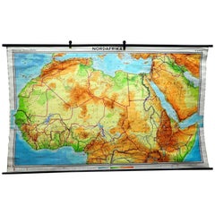
- Vintage Mural Map of North Africa Countrycore African Wall Chart DecorationLocated in Berghuelen, DEThe wall map shows North Africa. It was published by Westermann-Schulwandkarten. Used as teaching material in German schools. Colorful print on paper reinforced with canvas, Measurem...Category
Late 20th Century German Country Prints
MaterialsCanvas, Wood, Paper
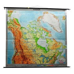
- Canada Greenland North America Map Vintage Mural Rollable Wall Chart CountrycoreLocated in Berghuelen, DEA classical pull-down map of Canada and Greenland (North American Continent). Used as teaching material in German schools. Colorful print on paper reinforced with canvas. Published b...Category
Vintage 1970s German Country Posters
MaterialsCanvas, Wood
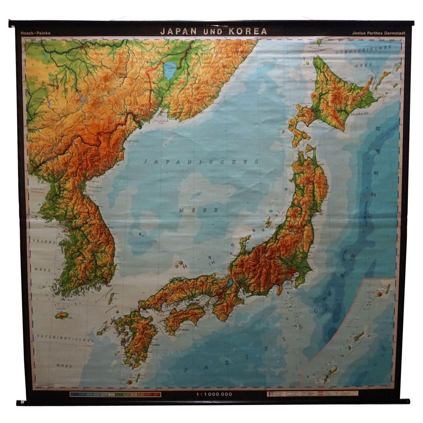
- Vintage Rollable Map Asia Japan Korea Wall Chart Poster Countrycore DecorationLocated in Berghuelen, DEA decorative country core pull-down map depicting Japan and Korea. Published by Haack-Paincke Justus Perthes. Colorful print on paper reinforced with canvas. Measurements: Width 199....Category
Late 20th Century German Country Prints
MaterialsCanvas, Wood, Paper
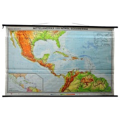
- Large Rollable Map Central America Northern South America Wall Chart PosterLocated in Berghuelen, DEA fantastic pull-down wall chart depicting a map of Central America and Northern South America. Used as teaching material in German schools. Colorful print on paper reinforced with c...Category
Mid-20th Century German Country Prints
MaterialsCanvas, Wood, Paper
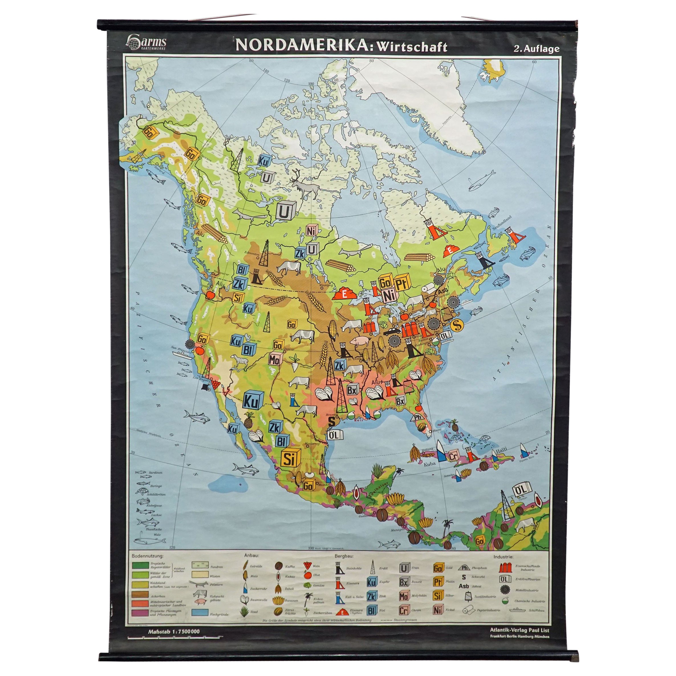
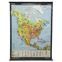
- North America Map Economy Wall Chart Rollable Poster Vintage MuralLocated in Berghuelen, DEA vintage pull-down map showing the economy of North America, published by Harms. Colorful print on paper reinforced with canvas. Measurements: Width 101 cm (39.76 inch) Height 169 c...Category
Late 20th Century German Country Prints
MaterialsCanvas, Wood, Paper
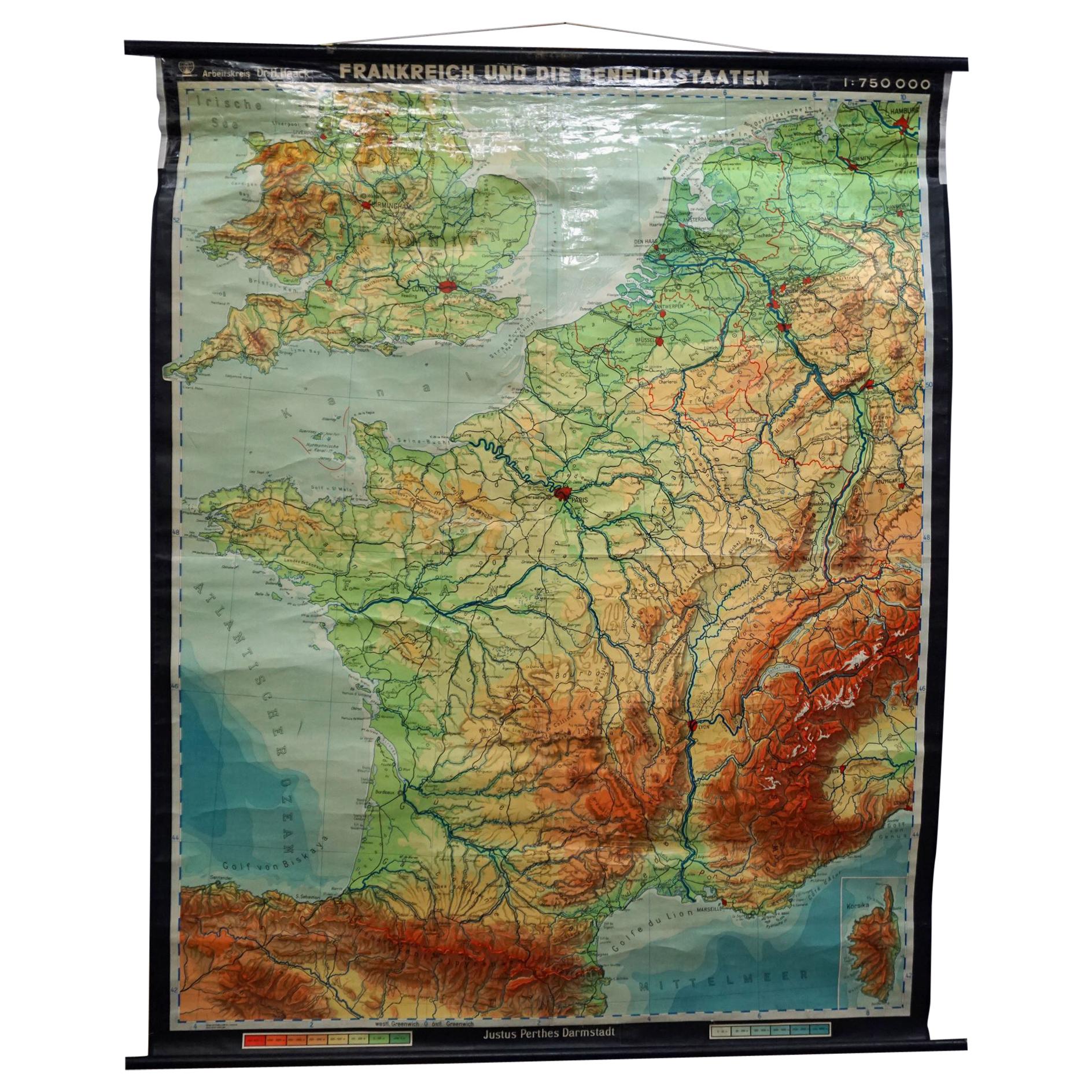
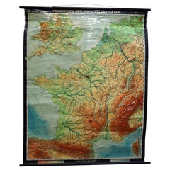
- Vintage Mural Rollable Map Wall Chart France Benelux Countries South EnglandLocated in Berghuelen, DEA cottagecore pull-down wall chart map illustrating France and the Benelux countries (the Netherlands, Belgium and Luxemburg) and main parts of Western Europe. Published by Justus Pe...Category
Mid-20th Century German Country Prints
MaterialsCanvas, Wood, Paper

You May Also Like
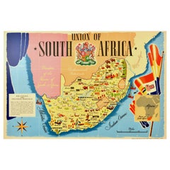
- Original Vintage Poster Union Of South Africa Map Natural & Industrial ResourcesLocated in London, GBOriginal vintage illustrated map poster for the Union of South Africa Her Natural and Industrial Resources featuring colourful images of the main cities including Cape Town, Pretoria...Category
Vintage 1940s British Posters
MaterialsPaper
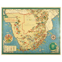
- Original Vintage Illustrated Map Poster Union Of South Africa MacDonald GillBy "Leslie MacDonald ""Max"" Gill"Located in London, GBOriginal vintage illustrated map poster for the Union of South Africa - Philips pictorial map based upon original drawings by notable British ...Category
Vintage 1950s British Posters
MaterialsPaper
- Large University Chart “Physical Map of Africa” by BaconLocated in Chillerton, Isle of WightLarge university chart “Physical Map of Africa” by Bacon W&A K Johnston’s Charts of Physical Maps By G W Bacon, This is colorful Physical map of North America, it is large lithograph set...Category
Early 20th Century Folk Art Posters
MaterialsLinen
- Vintage Wall Chart of a Landscape and Geographic Map, circa 1955Located in Langweer, NLVintage wall chart titled 'Kaart en Landschap'. This wall chart shows a mountain range and geographic map. Published by J.B. Wolters, circa 1955.Category
Mid-20th Century Prints
MaterialsPaper
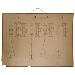
- Vintage Swedish Engineering Chart PosterLocated in Atlanta, GAVintage Swedish engineering instructional diagram chart or poster. Unframed. String hanger. Highly collectible ephemera from 1950's Sweden.Category
Vintage 1950s Swedish Mid-Century Modern Posters
MaterialsPaper
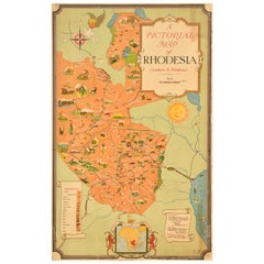
- Original Vintage Travel Poster Rhodesia Pictorial Map Southern Africa ZimbabweLocated in London, GBOriginal vintage travel poster - A Pictorial Map of Rhodesia (Southern & Northern) - featuring a colourful map of the region with the railway and road routes and illustrations of bui...Category
Vintage 1930s British Posters
MaterialsPaper