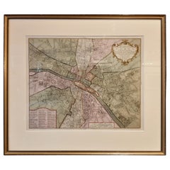
Paris France Map
7
to
108
760
423
443
305
292
281
204
163
157
109
83
73
68
65
62
56
48
46
43
41
37
31
28
25
25
24
20
16
13
12
11
10
10
9
8
8
7
7
7
6
6
6
5
5
4
4
4
4
3
3
3
2
2
2
1
1
79
67
43
42
42
Sort By
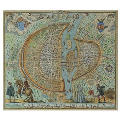
French Map of Paris, Musuem Carnavalet Rossingol University Map, 1576
Located in Gardena, CA
French Map of Paris, Musuem Carnavalet Rossingol University Map, 1576.
Map of Paris, France
Category
Antique 16th Century French Maps
Materials
Paper
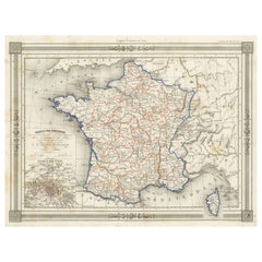
Antique Map of France in Provinces, with Inset of Paris
Located in Langweer, NL
Antique map titled 'France par Provinces'. Original antique map of France in Provinces. It covers
Category
Antique Mid-19th Century Maps
Materials
Paper
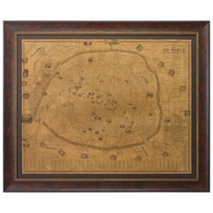
Plan of Paris, France, by A. Vuillemin, Antique Map, 1845
Located in Colorado Springs, CO
This large and detailed plan of Paris was published by Alexandre Vuillemin in 1845. The map conveys
Category
Antique 1840s American Maps
Materials
Paper
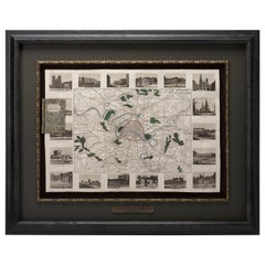
Antique Map of Paris, "Carte Routiere des Environs de Paris" 1841
Located in Colorado Springs, CO
This beautiful hand-colored road map of Paris was published in 1841. The map shows Paris and the
Category
Antique 1840s French Maps
Materials
Paper
Original Large Antique Map of Paris, France by John Dower, 1861
Located in St Annes, Lancashire
Fabulous monochrome map of Paris.
Vignettes of St Germain En Laye, Saint Cloud, Versailles and
Category
Antique 1860s English Victorian Maps
Materials
Paper
No Reserve
H 25.5 in W 36 in D 0.07 in
Large Folding Map of Paris, France, on Linen, 36 Segments, Published in 1836
Located in Langweer, NL
d'apres les travaux de la Nouvelle Carte De France'.
Folding map of Paris on linen, 36 segments
Category
Antique 1830s Maps
Materials
Paper
H 27.96 in W 39.77 in D 0 in
Antique Map of the Region of Paris ‘France’ by H. Heirs, circa 1720
Located in Langweer, NL
. Centered on Paris, the map extends to show these cities at the extremities - Ablis, Messe, Herissy, Senlies
Category
Antique Early 18th Century Maps
Materials
Paper
Antique Map of France according to the Treaty of Paris '1815', Published in 1854
Located in Langweer, NL
Paris. (1815)'. Large map of France. From James Wyld's 'A New General Atlas of Modern Geography
Category
Antique 19th Century Maps
Materials
Paper
H 23.04 in W 28.35 in D 0 in
Antique Map of the City of Paris by Tirion '1763'
Located in Langweer, NL
Paris, France. This map originates from 'Nieuwe en Beknopte Hand-Atlas, bestaande in eene Verzameling
Category
Antique Mid-18th Century Maps
Materials
Paper
Antique Political Map of France, 1880
By J. Migeon
Located in Langweer, NL
Antique map titled 'France Féodale'. Old map of France with a decorative vignette of Castle de
Category
Antique 19th Century Maps
Materials
Paper
1812 United States Map, by Pierre Tardieu, Antique French Map Depicting the U.S.
By Pierre François Tardieu
Located in Colorado Springs, CO
Map by Tardieu
This attractive map, published in Paris in 1812, is one of the most rare large
Category
Antique 1810s French Maps
Materials
Paper
H 43.5 in W 48 in D 2.25 in
French Antique Map of France and Western Europe, 1765
By G. A. Rizzi-zannoni
Located in Langweer, NL
France and western Europe. This map originates from 'Atlas Historique de la France Ancienne et Moderne
Category
Antique 18th Century Maps
Materials
Paper
Antique Map of France by Zannoni, 1765
Located in Langweer, NL
Antique map titled 'La France divisée en ses LVIII Provinces (..)'. Beautiful old map of France
Category
Antique 18th Century Maps
Materials
Paper
Antique Map of France by Migeon, 1880
Located in Langweer, NL
Antique map titled 'France Physique'. Old map of France. This map originates from 'Géographie
Category
Antique 19th Century Maps
Materials
Paper
Antique Map of Cher in France, 1854
By Victor Levasseur
Located in Langweer, NL
map originates from ‘Atlas National de la France Illustré’. Published by A. Combette, Paris, 1854.
Category
Antique Mid-19th Century Maps
Materials
Paper
Antique Map of the Bay of Brusc, France
Located in Langweer, NL
Antique map titled 'Carte de la rade du Brusc'. Original map of the bay of Brusc, France. This map
Category
Antique Mid-18th Century Maps
Materials
Paper
Antique Map of the Coast of Roussillon, France
Located in Langweer, NL
map of the coast of Roussillon, France. This map originates from 'Le Petit Atlas Maritime (..)' by J.N
Category
Antique Mid-18th Century Maps
Materials
Paper
Antique Map of ancient France by Zannoni, 1765
Located in Langweer, NL
Antique map France titled 'Galliae Veteris (..)'. Beautiful old map of France. This map originates
Category
Antique 18th Century Maps
Materials
Paper
Antique Map of the Region of Martigues, France
Located in Langweer, NL
Title: "Etang de Martigues et Environs: Antique Map of the Martigues Region, France"
Description
Category
Antique Mid-18th Century Maps
Materials
Paper
Antique Map of the Region of Fréjus, France
Located in Langweer, NL
of charts for the French Depot de la Marine. He was born in Paris in 1703 and educated as an engineer
Category
Antique Mid-18th Century Maps
Materials
Paper
Antique Map of Morbihan ‘France’ by V. Levasseur, 1854
Located in Langweer, NL
Antique map titled 'Dépt. du Morbihan'. Map of the French department of Morbihan, France. This map
Category
Antique Mid-19th Century Maps
Materials
Paper
Antique Map of the Adour River, Near Bayonne, France
Located in Langweer, NL
of the Adour river, near Bayonne, France. This map originates from 'Le Petit Atlas Maritime (..)' by
Category
Antique Mid-18th Century Maps
Materials
Paper
Antique Map of Vosges ‘France’ by V. Levasseur, 1854
By Victor Levasseur
Located in Langweer, NL
map originates from ‘Atlas National de la France Illustré’. Published by A. Combette, Paris: 1854.
Category
Antique Mid-19th Century Maps
Materials
Paper
Antique Map of Meurthe ‘France’ by V. Levasseur, 1854
Located in Langweer, NL
Antique map titled 'Dépt. de la Meurthe'. Map of the French department of Meurthe, France. Part of
Category
Antique Mid-19th Century Maps
Materials
Paper
Antique Map of Loire ‘France’ by V. Levasseur, 1854
Located in Langweer, NL
Antique map titled 'Dépt. de la Loire'. Map of the French department of Loire, France. This area of
Category
Antique Mid-19th Century Maps
Materials
Paper
Antique Map of Loire ‘France’ by V. Levasseur, 1854
Located in Langweer, NL
Antique map titled 'Dépt. de la Loire'. Map of the French department of Loire, France. This area of
Category
Antique Mid-19th Century Maps
Materials
Paper
Antique Map of France in Ancient Roman Times, 1880
Located in Langweer, NL
Antique map titled 'Gaule indépendante et Romaine'.
Old map of Gaul or France in ancient Roman
Category
Antique 19th Century Maps
Materials
Paper
French Geographical, Statistical and Historical Map of Pensylvania, 1825
Located in Langweer, NL
and bottom. Prime meridians: Washington and Paris.
A very interesting 1825 French hand-colored map
Category
Antique 1820s Maps
Materials
Paper
H 20.08 in W 25.99 in D 0 in
Antique Map of Oise ‘France’ by V. Levasseur, 1854
By Victor Levasseur
Located in Langweer, NL
Antique map titled 'Dépt. de l'Oise'. Map of the French department of Oise, France. The map is
Category
Antique Mid-19th Century Maps
Materials
Paper
Antique Map of Moselle ‘France’ by V. Levasseur, 1854
Located in Langweer, NL
Antique map titled 'Dépt. de la Moselle'. Map of the French department of Moselle, France. This
Category
Antique Mid-19th Century Maps
Materials
Paper
Antique Map of Doubs ‘France’ by V. Levasseur, 1854
By Victor Levasseur
Located in Langweer, NL
Antique map titled 'Dépt. du Doubs'. Map of the French department of Doubs, France. The whole is
Category
Antique Mid-19th Century Maps
Materials
Paper
Antique Map of Mayenne ‘France’ by V. Levasseur, 1854
Located in Langweer, NL
Antique map titled 'Dépt. de la Mayenne'. Map of the French department of Mayenne, France. This
Category
Antique Mid-19th Century Maps
Materials
Paper
Antique Map of Somme ‘France’ by V. Levasseur, 1854
By Victor Levasseur
Located in Langweer, NL
Antique map titled 'Dépt. de la Somme'. Map of the French department of Somme, France. This area is
Category
Antique Mid-19th Century Maps
Materials
Paper
Antique Map of Landes ‘France’ by V. Levasseur, 1854
By Victor Levasseur
Located in Langweer, NL
Antique map titled 'Dépt. des Landes'. Map of the French department Landes, France. This area is
Category
Antique Mid-19th Century Maps
Materials
Paper
Antique Map of Marne ‘France’ by V. Levasseur, 1854
Located in Langweer, NL
Antique map titled 'Dépt. de la Marne'. Map of the French department of Marne, France. This
Category
Antique Mid-19th Century Maps
Materials
Paper
Antique Map of Calais ‘France’ by V. Levasseur, 1854
By Victor Levasseur
Located in Langweer, NL
Antique map titled 'Dépt. du Pas de Calais'. Map of the French department of Calais, France. This
Category
Antique Mid-19th Century Maps
Materials
Paper
Antique Map of Aube ‘France’ by V. Levasseur, 1854
Located in Langweer, NL
Antique map titled 'Dépt. de l'Aube'. Map of the French department of Aube, France. This area of
Category
Antique Mid-19th Century Maps
Materials
Paper
Antique Map of Calvados ‘France’ by V. Levasseur, 1854
By Victor Levasseur
Located in Langweer, NL
Antique map titled 'Dépt. du Calvados'. Map of the French department of Calvados, France. This area
Category
Antique Mid-19th Century Maps
Materials
Paper
Antique Map of Nièvre ‘France’ by V. Levasseur, 1854
Located in Langweer, NL
Antique map titled 'Dépt. de la Nièvre'. Map of the French department of Nievre, France. Part of
Category
Antique Mid-19th Century Maps
Materials
Paper
Antique Map of Lot ‘France’ by V. Levasseur, 1854
Located in Langweer, NL
Antique map titled 'Dépt. du Lot'. Map of the French department of Lot, France. This area of France
Category
Antique Mid-19th Century Maps
Materials
Paper
Antique Map of Vienne 'France' by V. Levasseur, 1854
By Victor Levasseur
Located in Langweer, NL
Antique map titled 'Dépt. de la Vienne'. Decorative antique map of the French Department of Vienne
Category
Antique Mid-19th Century Maps
Materials
Paper
Antique Map of Ariège ‘France’ by V. Levasseur, 1854
Located in Langweer, NL
Antique map titled 'Dépt. de l'Ariège'. Map of the French department of Ariege, France. This area
Category
Antique Mid-19th Century Maps
Materials
Paper
Antique Map of Gard ‘France’ by V. Levasseur, 1854
By Victor Levasseur
Located in Langweer, NL
Antique map titled 'Dépt. du Gard'. Map of the French department of Gard, France. This area of
Category
Antique Mid-19th Century Maps
Materials
Paper
Antique Map of Cantal ‘France’ by V. Levasseur, 1854
By Victor Levasseur
Located in Langweer, NL
Antique map titled 'Dépt. du Cantal'. Map of the French department of Cantal, France. This area of
Category
Antique Mid-19th Century Maps
Materials
Paper
Antique Map of Corrèze ‘France’ by V. Levasseur, 1854
By Victor Levasseur
Located in Langweer, NL
Antique map titled 'Dépt. da la Corrèze'. Map of the French department of Correze, France. This
Category
Antique Mid-19th Century Maps
Materials
Paper
Antique Map of Eure ‘France’ by V. Levasseur, 1854
By Victor Levasseur
Located in Langweer, NL
Antique map titled 'Dépt. de l'Eure'. Map of the French department of Eure, France. This region of
Category
Antique Mid-19th Century Maps
Materials
Paper
Antique Map of Meuse ‘France’ by V. Levasseur, 1854
Located in Langweer, NL
Antique map titled 'Dépt. de la Meuse'. Map of the French department of Meuse, France. This area
Category
Antique Mid-19th Century Maps
Materials
Paper
Antique Map of Drôme ‘France’ by V. Levasseur, 1854
Located in Langweer, NL
map originates from ‘Atlas National de la France Illustré’. Published by A. Combette, Paris, 1854.
Category
Antique Mid-19th Century Maps
Materials
Paper
Antique Map of Orne ‘France’ by V. Levasseur, 1854
By Victor Levasseur
Located in Langweer, NL
map. This map originates from ‘Atlas National de la France Illustré’. Published by A. Combette, Paris
Category
Antique Mid-19th Century Maps
Materials
Paper
Antique Map of Tarn 'France' by V. Levasseur, 1854
By Victor Levasseur
Located in Langweer, NL
Antique map titled 'Dépt. du Tarn'. Map of the French department of Tarn, France. This area
Category
Antique Mid-19th Century Maps
Materials
Paper
Antique Map of Loiret ‘France’ by V. Levasseur, 1854
Located in Langweer, NL
Antique map titled 'Dépt. du Loiret'. Map of the French department of Loiret, France. Surrounding
Category
Antique Mid-19th Century Maps
Materials
Paper
Antique Map of Jura ‘France’ by V. Levasseur, 1854
By Victor Levasseur
Located in Langweer, NL
Antique map titled 'Dépt. du Jura'. Map of the French department Jura, France. The Jura wines are
Category
Antique Mid-19th Century Maps
Materials
Paper
Antique Map of Finistère ‘France’ by V. Levasseur, 1854
By Victor Levasseur
Located in Langweer, NL
map. This map originates from ‘Atlas National de la France Illustré’. Published by A. Combette, Paris
Category
Antique Mid-19th Century Maps
Materials
Paper
Antique Map of Creuse ‘France’ by V. Levasseur, 1854
By Victor Levasseur
Located in Langweer, NL
Antique map titled 'Dépt. de la Creuse'. Map of the French department of Creuse, France. This
Category
Antique Mid-19th Century Maps
Materials
Paper
Antique Map of Ain ‘France’ by V. Levasseur, 1854
By Victor Levasseur
Located in Langweer, NL
Antique map titled 'Dépt. de l'Ain'. Map of the French department of l'Ain, France. This area of
Category
Antique Mid-19th Century Maps
Materials
Paper
Antique Map of Lozère ‘France’ by V. Levasseur, 1854
Located in Langweer, NL
Antique map titled 'Dépt. de la Lozère'. Map of the French department of Lozere, France. This
Category
Antique Mid-19th Century Maps
Materials
Paper
Antique Map of Isère ‘France’ by V. Levasseur, 1854
By Victor Levasseur
Located in Langweer, NL
Antique map titled 'Dépt. de l'Isère'. Map of the French department Isere. It is presented with a
Category
Antique Mid-19th Century Maps
Materials
Paper
Antique Map of Allier ‘France’ by V. Levasseur, 1854
By Victor Levasseur
Located in Langweer, NL
Antique map titled 'Dépt. de l'Allier'. Map of the French department of l'Allier, France. This area
Category
Antique Mid-19th Century Maps
Materials
Paper
Antique Map of Gironde ‘France’ by V. Levasseur, 1854
By Victor Levasseur
Located in Langweer, NL
Antique map titled 'Dépt. de la Gironde'. Map of the French department of Gironde. This coastal
Category
Antique Mid-19th Century Maps
Materials
Paper
1859 Classic Map of France: Blackie's Imperial Geographic Masterpiece
Located in Langweer, NL
The "Antique Map of France" from 'The Imperial Atlas of Modern Geography', published in 1859 by W
Category
Antique Mid-19th Century Maps
Materials
Paper
H 21.26 in W 14.57 in D 0.02 in
- 1
- ...
Get Updated with New Arrivals
Save "Paris France Map", and we’ll notify you when there are new listings in this category.
More Ways To Browse
Hermes H Watches
Hermes H Watch
Collectable Knives
Antique French Glassware
Hermes H Watch Sizes
Louis Phillipe Antiques
Antique Glove Box
Antique French Louis Phillipe
De Gournay
Migeon And Migeon
Migeon Migeon
French Colonial Side Table
4 Antique Bronze Plaques
Antique Marine Compass
Antique Marine Compasses
Leather Map Case
Antique Mormon Furniture
Antique Cheese Domes
