Items Similar to Antique Political Map of France, 1880

Want more images or videos?
Request additional images or videos from the seller
1 of 6
Antique Political Map of France, 1880
About the Item
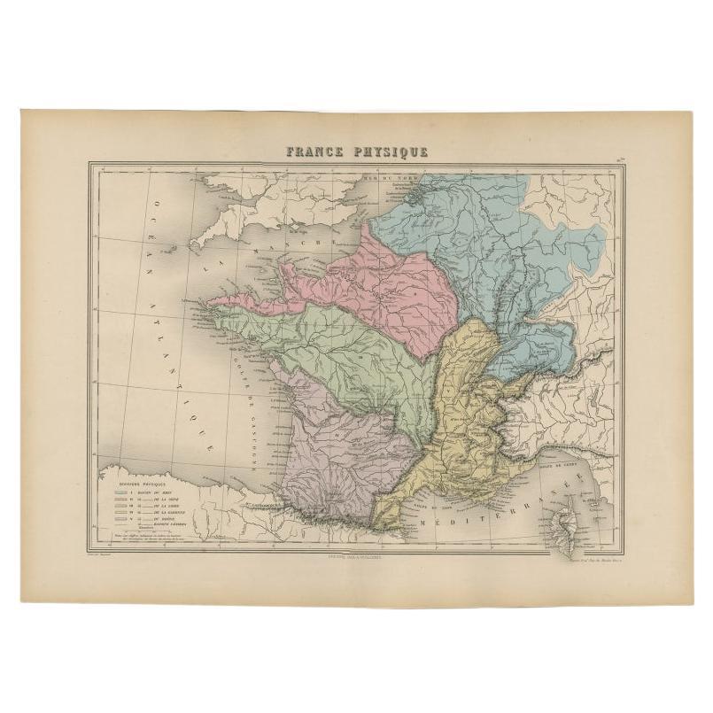
Antique map titled 'France Féodale'. Old map of France with a decorative vignette of Castle de Pierrefonds. This map originates from 'Géographie Universelle Atlas-Migeon' by J. Migeon.
Artists and Engravers: Published by J. Migeon. Reviewed by A. Vuillemin. Alexandre Vuillemin (1812-1880) was a cartographer and an book editor based in Paris, France.
Condition: Good, age-related toning. Please study image carefully.
Date: 1880
Overall size: 47.5 x 34.5 cm.
Image size: 37.5 x 28 cm.
We sell original antique maps to collectors, historians, educators and interior decorators all over the world. Our collection includes a wide range of authentic antique maps from the 16th to the 20th centuries. Buying and collecting antique maps is a tradition that goes back hundreds of years. Antique maps have proved a richly rewarding investment over the past decade, thanks to a growing appreciation of their unique historical appeal. Today the decorative qualities of antique maps are widely recognized by interior designers who appreciate their beauty and design flexibility. Depending on the individual map, presentation, and context, a rare or antique map can be modern, traditional, abstract, figurative, serious or whimsical. We offer a wide range of authentic antique maps for any budget.
- Creator:J. Migeon (Artist)
- Dimensions:Height: 13.59 in (34.5 cm)Width: 18.71 in (47.5 cm)Depth: 0 in (0.01 mm)
- Materials and Techniques:
- Period:
- Date of Manufacture:1880
- Condition:Condition: Good, age-related toning. Please study image carefully.
- Seller Location:Langweer, NL
- Reference Number:
About the Seller
5.0
Platinum Seller
These expertly vetted sellers are 1stDibs' most experienced sellers and are rated highest by our customers.
Established in 2009
1stDibs seller since 2017
1,922 sales on 1stDibs
Typical response time: <1 hour
- ShippingRetrieving quote...Ships From: Langweer, Netherlands
- Return PolicyA return for this item may be initiated within 14 days of delivery.
More From This SellerView All
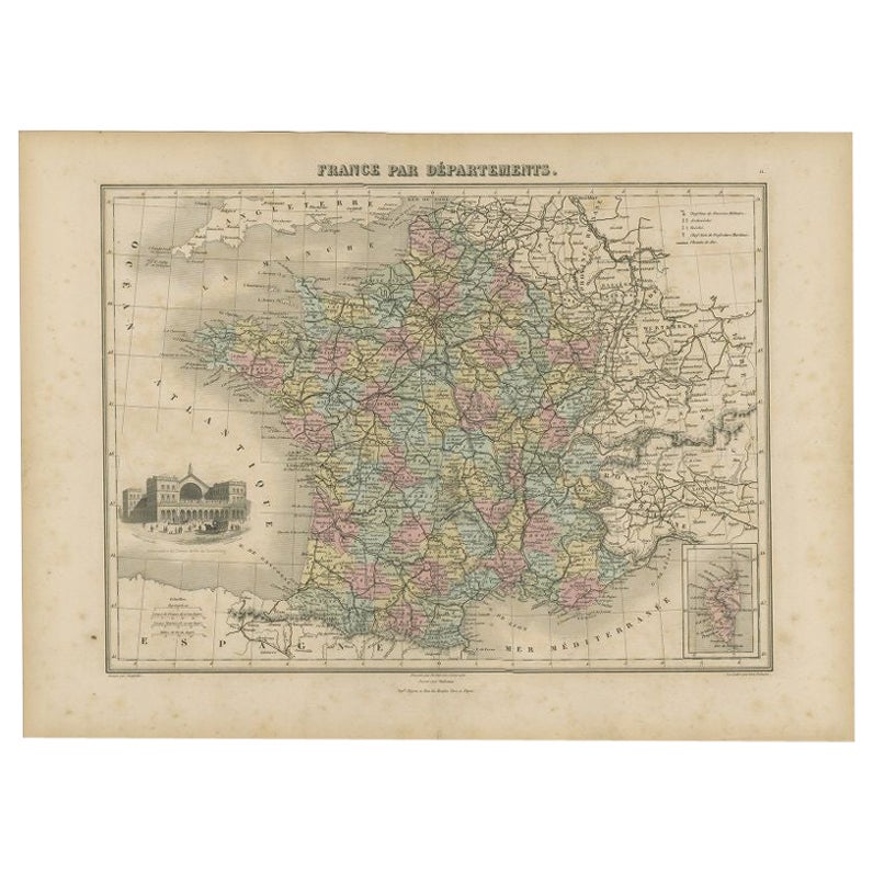
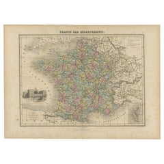
- Antique Map of the Departments of France by Migeon, 1880By J. MigeonLocated in Langweer, NLAntique map titled 'France par Départements'. Old map of France with a decorative vignette of Strasbourg and an inset map of Corsica. This map originate...Category
Antique 19th Century Maps
MaterialsPaper
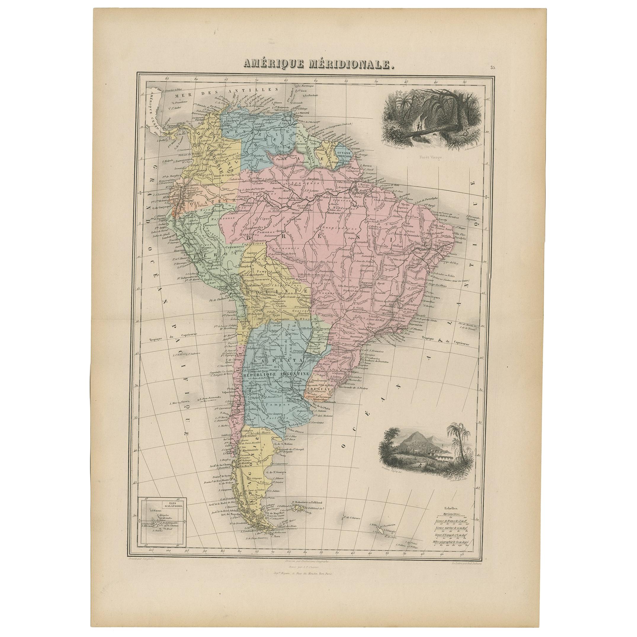
- Antique Map of South America by Migeon '1880'By J. MigeonLocated in Langweer, NLAntique map titled 'Amérique Méridionale'. Old map of South America. With an inset map of the Galapagos Islands and decorative vignettes. This map...Category
Antique Late 19th Century French Maps
MaterialsPaper
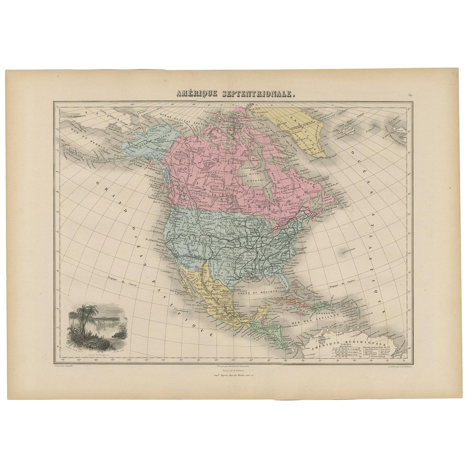
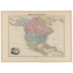
- Antique Map of North and Central America by Migeon '1880'By J. MigeonLocated in Langweer, NLAntique map titled 'Amérique Septentrionale'. Old map of North and Central America. With a decorative vignette of the Niagara Falls. This map originates from 'Géographie Universelle ...Category
Antique Late 19th Century French Maps
MaterialsPaper
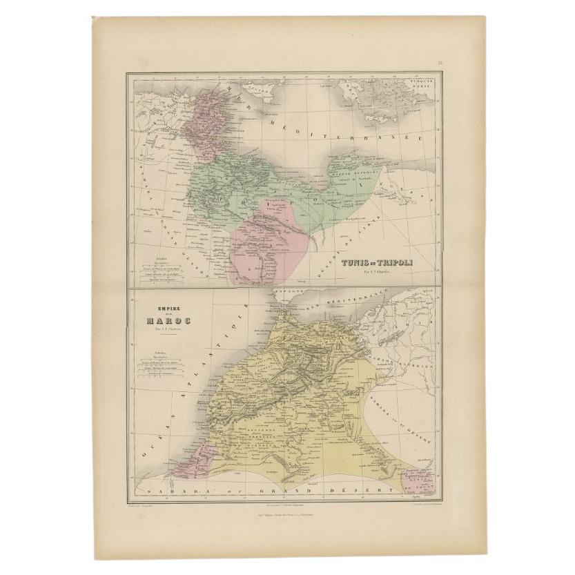
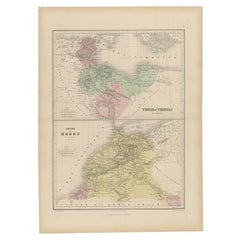
- Antique Map of Tunis and Tripoli in Northern Africa, circa 1880By J. MigeonLocated in Langweer, NLAntique map titled 'Tunis et Tripoli & Empire de Maroc'. Old map of Tunis and Tripoli and the Empire of Morocco. This map originates from 'Géographie Universelle Atlas-Migeon' by J. ...Category
Antique 19th Century Maps
MaterialsPaper
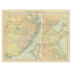
- Antique Political Map of Eastern China, 1922Located in Langweer, NLAntique map of China titled 'Eastern China - Political Map'. Old map of eastern China depicting Kiangsi, Chekiang, Fukien, Kwangtung, Taiwan (Formosa) an...Category
20th Century Maps
MaterialsPaper
- Antique Map of France by Migeon, 1880Located in Langweer, NLAntique map titled 'France Physique'. Old map of France. This map originates from 'Géographie Universelle Atlas-Migeon' by J. Migeon. Artists and Engravers: Published by J. Migeon...Category
Antique 19th Century Maps
MaterialsPaper


You May Also Like
- Original Antique Map of Cyprus. Circa 1880Located in St Annes, LancashireGreat map of Cyprus Drawn and Engraved by R.Walker Published W.Mackenzie, London Original colour Unframed.Category
Antique 1880s English Maps
MaterialsPaper
- Large University Chart “Political Map of North America” by BaconLocated in Chillerton, Isle of WightLarge University Chart “Political Map of North America” by Bacon W&A K Johnston’s Charts of Physical Maps By G W Bacon, This is colourful Physical map ...Category
Early 20th Century American Empire Posters
MaterialsLinen
- Large University Chart “Political Map of North America” by BaconLocated in Chillerton, Isle of WightLarge University chart “Political Map of North America” by Bacon W&A K Johnston’s Charts of Political Maps by G W Bacon, This is colorful Physical ...Category
Early 20th Century American Empire Posters
MaterialsLinen
- Large Original Antique Map of The Environs of Dublin, Ireland, circa 1880Located in St Annes, LancashireGreat map of The Environs of Dublin Published circa 1880 Unframed Free shipping.Category
Antique 1880s Scottish Maps
MaterialsPaper
- Large Original Antique Map of the Environs of Cork, Ireland, circa 1880Located in St Annes, LancashireGreat map of The Environs of Cork Published circa 1880 Unframed Free shipping.Category
Antique 1880s Scottish Maps
MaterialsPaper
- Original Antique Map of France, Arrowsmith, 1820Located in St Annes, LancashireGreat map of France Drawn under the direction of Arrowsmith. Copper-plate engraving. Published by Longman, Hurst, Rees, Orme and Brown, 1820 Unframed.Category
Antique 1820s English Maps
MaterialsPaper


Recently Viewed
View AllMore Ways To Browse
Cambodia Antique Map
Antique Map Singapore
Guyana Antique Map
Antique Map Vietnam
Antique Maps Michigan
Puerto Rico Map
Wisconsin Map
Antique Map Sydney
Antique Maps Sydney
J Beringer
Antique Map Of Michigan
Antique Wisconsin Maps
Bedfordshire Antique Map
Herefordshire Antique Map
Antique Furniture Pondicherry
Antique Indiana Map
Antique Maps Rhode Island
Buckinghamshire Antique Map