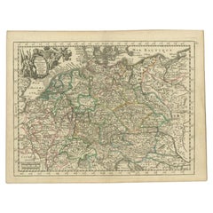
Antique Map German Empire
2
to
10
61
38
63
45
28
25
11
10
10
10
9
6
5
4
4
3
3
3
3
3
3
2
2
2
2
2
2
1
1
1
1
1
1
1
1
1
19
6
3
2
2
Sort By
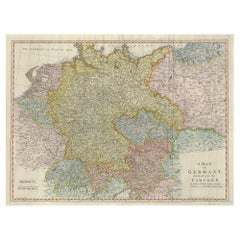
Large Antique Map of the German Empire
Located in Langweer, NL
Antique map titled 'A Map of Germany (..)'. Large antique map of the German Empire, highly detailed
Category
Late 18th Century Antique Map German Empire
Materials
Paper
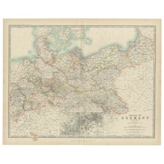
Antique Map of the German Empire by Johnston, '1909'
Located in Langweer, NL
Antique map titled 'Empire of Germany'. Original antique map of the German Empire. With inset maps
Category
Early 20th Century Antique Map German Empire
Materials
Paper
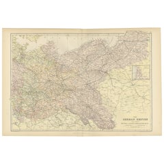
Antique Map of The German Empire (East Sheet), 1882
Located in Langweer, NL
Step into history with an authentic Antique Map of The German Empire (East Sheet) from the esteemed
Category
1880s Antique Map German Empire
Materials
Paper
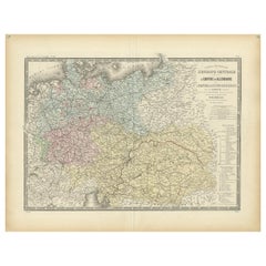
Antique Map of the German Empire by Levasseur, '1875'
Located in Langweer, NL
Antique map titled 'Carte générale de l'Europe Centrale (..)'. Large map of the German Empire. This
Category
Late 19th Century Antique Map German Empire
Materials
Paper
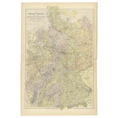
Antique Map of The German Empire (West Sheet), 1882
Located in Langweer, NL
Transport yourself to the heart of history with an original Antique Map of The German Empire (west
Category
1880s Antique Map German Empire
Materials
Paper
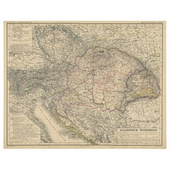
Old German Map of the Austrian Empire, ca.1870
Located in Langweer, NL
Antique map titled 'Kaiserthum Österreich'.
Old map of the Austrian Empire. This map originates
Category
1870s Antique Map German Empire
Materials
Paper
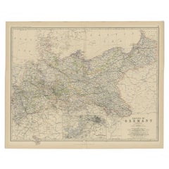
Antique Map of the German Empire by Johnston, 1882
By Alexander Keith Johnston
Located in Langweer, NL
Antique map titled 'Empire of Germany'. Old map of the German Empire with an inset map of Berlin
Category
19th Century Antique Map German Empire
Materials
Paper
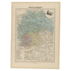
Antique Map of the German Empire by Migeon, 1880
Located in Langweer, NL
Antique map titled 'Empire d'Allemagne'. Old map of Germany. With decorative vignette of Mainz
Category
19th Century Antique Map German Empire
Materials
Paper
Antique Map of the German Empire by Le Rouge, 1743
Located in Langweer, NL
Antique map Germany titled 'L'Empire d'Allemagne dedie a Monseigneur Amelot (..)'. Antique map of
Category
18th Century Antique Map German Empire
Materials
Paper
Antique Map of the German Empire by De Leth, 1749
Located in Langweer, NL
Antique map Germany titled 'L'Empire d'Allemagne divisé en ses dix cercles et Autres Estats
Category
18th Century Antique Map German Empire
Materials
Paper
Antique Map of the German Empire with decorative Title Cartouche
Located in Langweer, NL
antique map of Germany. The map first appeared in 1606, with views in margins and a portrait of the
Category
Early 17th Century Antique Map German Empire
Materials
Paper
Antique Map of the 'Southern' German Empire by Johnston, 1882
Located in Langweer, NL
Antique map titled 'Empire of Germany'. Old map of the southern portion of the German Empire. This
Category
19th Century Antique Map German Empire
Materials
Paper
Antique Map of the German Empire by Keizer & de Lat, 1788
Located in Langweer, NL
Antique map titled 'Het Duitsche Keizer-Ryk (..)'. Uncommon original antique map of the German
Category
Late 18th Century Antique Map German Empire
Materials
Paper
Antique Map of Germany with the Empire of Austria by Wyld '1845'
Located in Langweer, NL
Antique map titled 'The Confederated States of Germany with the Empire of Austria, and The Kingdoms
Category
Mid-19th Century Antique Map German Empire
Materials
Paper
Antique Map of the German Empire, Johannes Janssonius van Waesbergen, circa 1670
Located in Langweer, NL
Antique map titled 'Nova Totius Germaniae Descriptio'. Uncommon map of the German Empire including
Category
Late 17th Century Antique Map German Empire
Materials
Paper
H 20.48 in W 23.43 in D 0.02 in
Original Antique German Map of the Russian Empire in Europe, ca.1825
Located in Langweer, NL
Russian Empire in Europe. This map originates from 'Stielers Handatlas'. Published circa 1825.
Artists
Category
1820s Antique Map German Empire
Materials
Paper
Antique Map of the Western Part of the German Empire by Levasseur, '1875'
Located in Langweer, NL
Antique map titled 'Empire d'Allemagne (..)'. Large map of the western part of the German Empire
Category
Late 19th Century Antique Map German Empire
Materials
Paper
H 24.02 in W 18.71 in D 0.02 in
Original Rare Antique Map of the Ancient German Empire in Northern Europe, c1650
Located in Langweer, NL
Antique map titled 'Germaniae Veteris typus.'
Map of the ancient German Empire in Northern
Category
1650s Antique Map German Empire
Materials
Paper
No Reserve
H 16.46 in W 21.46 in D 0 in
Decorative Antique Map of Germany, 1846
Located in Langweer, NL
Antique map titled 'Germany'. Old map of Germany.
This map originates from 'A New Universal
Category
1840s Antique Map German Empire
Materials
Paper
Antique Map of Germany by Johnston '1909'
Located in Langweer, NL
Antique map titled 'Empire of Germany'. Original antique map of Germany. With inset maps of
Category
Early 20th Century Antique Map German Empire
Materials
Paper
18th Century Hand-Colored Homann Map of Germany, Including Frankfurt and Berlin
By Johann Baptist Homann
Located in Alamo, CA
, becoming the leading map publisher in Germany and an important entity in the European map market. In 1715
Category
Early 18th Century German Antique Map German Empire
Materials
Paper
H 20.25 in W 23.5 in D 0.07 in
Antique Map of Germany from an American 19th Century Atlas, 1846
Located in Langweer, NL
Antique map titled 'Germany'. Old map of Germany. This map originates from 'A New Universal Atlas
Category
19th Century Antique Map German Empire
Materials
Paper
The World in the Assyrian Empire's Era: A Historical Map, Published in 1880
Located in Langweer, NL
map:
1. **Scope of the Assyrian Empire**: The map likely outlines the extent of the Assyrian Empire
Category
1880s Antique Map German Empire
Materials
Paper
Free Shipping
H 15.56 in W 18.51 in D 0 in
Antique Map of the Netherlands in the time of the Domination by the Roman Empire
Located in Langweer, NL
'. Copper engraved map of the Netherlands in the time of the domination by the Roman Empire. The map also
Category
Mid-18th Century Antique Map German Empire
Materials
Paper
H 12.72 in W 16.15 in D 0.02 in
Antique Map Made After a Roman Papyrus Travel Map, Known as Peutinger Map, 1773
Located in Langweer, NL
Old Dutch engraving with title: 'Romeinsche Reis Kaart van K. Peutinger'.
Rare antique map based
Category
18th Century Antique Map German Empire
Materials
Paper
H 15.56 in W 18.51 in D 0 in
Antique Map of Denmark with Inset Maps of Iceland, Copenhagen and the Elbe, 1882
Located in Langweer, NL
Antique map titled 'Denmark with North-West portion of the German Empire comprising Schleswic
Category
19th Century Antique Map German Empire
Materials
Paper
H 24.22 in W 19.53 in D 0 in
Scandinavia & Portions of Eastern Europe: 18th Century Hand-Colored Homann Map
By Johann Baptist Homann
Located in Alamo, CA
in Nuremberg, Germany, initially in 1710 and again in 1730. The map depicts Scandinavia, including
Category
Early 18th Century German Antique Map German Empire
Materials
Paper
H 20.75 in W 23.5 in D 0.07 in
Hand-Colored 18th Century Homann Map of the Danube, Italy, Greece, Croatia
By Johann Baptist Homann
Located in Alamo, CA
the leading map publisher in Germany and an important entity in the European map market. In 1715
Category
Early 18th Century German Antique Map German Empire
Materials
Paper
H 20 in W 23.88 in D 0.07 in
West Africa Entitled "Guinea Propria": An 18th Century Hand Colored Homann Map
By Johann Baptist Homann
Located in Alamo, CA
flourished, becoming the leading map publisher in Germany and an important entity in the European map market
Category
Mid-18th Century German Antique Map German Empire
Materials
Paper
H 20.5 in W 23.5 in D 0.13 in
Sweden & Adjacent Portions of Scandinavia: A Hand-Colored 18th C. Map by Homann
By Johann Baptist Homann
Located in Alamo, CA
in 1710 and published in Nuremberg, Germany in 1730 shortly after his death. The map detail cities
Category
1720s German Antique Map German Empire
Materials
Paper
H 21 in W 23.38 in D 0.07 in
Hand Colored 18th Century Homann Map of Austria Including Vienna and the Danube
By Johann Baptist Homann
Located in Alamo, CA
. The firm flourished, becoming the leading map publisher in Germany and an important entity in the
Category
Early 18th Century German Antique Map German Empire
Materials
Paper
H 20.25 in W 23.63 in D 0.07 in
The Kingdom of Naples and Southern Italy: A Hand-Colored 18th Century Homann Map
By Johann Baptist Homann
Located in Alamo, CA
house that specialized in engravings. The firm flourished, becoming the leading map publisher in Germany
Category
Early 18th Century German Antique Map German Empire
Materials
Paper
H 20 in W 23.88 in D 0.07 in
Hand-Colored 18th Century Homann Map of Denmark and Islands in the Baltic Sea
By Johann Baptist Homann
Located in Alamo, CA
, becoming the leading map publisher in Germany and an important entity in the European map market. In 1715
Category
Early 18th Century German Antique Map German Empire
Materials
Paper
H 20.25 in W 23.25 in D 0.07 in
Cartographic Tapestry: Antique Map of Asia Minor, circa 1640
Located in Langweer, NL
Title: "Historical Tapestry: Antique Map of Asia Minor, circa 1640"
Description:
This authentic
Category
Mid-17th Century Antique Map German Empire
Materials
Paper
Hand-Colored 18th Century Homann Map of the Black Sea, Turkey and Asia Minor
By Johann Baptist Homann
Located in Alamo, CA
Nuremberg, Germany in 1728. This detailed map depicts Turkey and the area surrounding the Black Sea and the
Category
Early 18th Century German Antique Map German Empire
Materials
Paper
H 20 in W 23.63 in D 0.07 in
Antique Map of Russia and Central Asia, showing the Northeast Passage
Located in Langweer, NL
Central Asia, showing the Northeast Passage. The map covers the entirety of the Russian Empire at the time
Category
Mid-18th Century Antique Map German Empire
Materials
Paper
Antique Map of Bohemia in the Present-Day Chech Repubic, 1730
Located in Langweer, NL
Antique map titled 'Nieuwe Kaart van t Koninkryk Bohemen t Hertogdom Silesien markgraafschap
Category
18th Century Antique Map German Empire
Materials
Paper
Antique Map of Central Europe Showing The Railways and The Political Bounderies
Located in Langweer, NL
States of the German Empire are listed seperately.
Crafted for history enthusiasts, railway aficionados
Category
1880s Antique Map German Empire
Materials
Paper
H 14.97 in W 22.45 in D 0 in
Cartographic Elegance of the Mughal Dominion in a Hand-Colored Antique Map, 1705
Located in Langweer, NL
copies of Sanson's maps for his German translation of Die Gantze Erd-Kugel in 1679. Johannes Ribbius and
Category
Early 1700s Antique Map German Empire
Materials
Paper
Free Shipping
H 8.67 in W 11.89 in D 0 in
Southern & Eastern Europe: A Large 17th C. Hand-colored Map by Sanson & Jaillot
By Nicolas Sanson
Located in Alamo, CA
This large hand-colored map entitled "Estats de L'Empire des Turqs en Europe, ou sont les
Category
1690s French Antique Map German Empire
Materials
Paper
H 24.88 in W 38 in D 0.13 in
Map Road Strip Britannia Sheet 2 John Ogilby London Aberistwith Islip Bramyard
By John Ogilby
Located in BUNGAY, SUFFOLK
of England and Wales.
Strip map Islip to Bramyard, on a scale of approximately one inch to the mile
Category
17th Century English Baroque Antique Map German Empire
Materials
Paper
H 14.38 in W 19.3 in D 0.79 in
Old Map of the Moluccas, Known as the Famous Spice Islands, Indonesia, ca.1730
Located in Langweer, NL
Antique map titled 'Insularum Moluccarum Nova Descriptio.'
Old map of the Moluccas. The famous
Category
1730s Antique Map German Empire
Materials
Paper
H 17.33 in W 23 in D 0 in
Levant in Antiquity: Lands of Phoenicia, Judea, and Neighboring Kingdoms, 1880
Located in Langweer, NL
The map is titled "PHOENICE, COELESYRIA, IDUMAEA, JUDAEA MACCABAEORUM TEMPORE," which translates to
Category
1880s Antique Map German Empire
Materials
Paper
Free Shipping
H 15.56 in W 18.51 in D 0 in
Roman Frontiers Engraved: Germania, Raetia, and Noricum, Published in 1880
Located in Langweer, NL
Antiquus." This atlas, often known for its detailed historical maps of ancient civilizations and empires
Category
1880s Antique Map German Empire
Materials
Paper
No Reserve
H 15.56 in W 18.51 in D 0 in
Original Copper Engraving of Koroni 'or Corone', Greece, 1688
Located in Langweer, NL
Turkish Empire and Turkish wars and was filled with copper engravings, portraits, maps, and city views.
Category
1680s Antique Map German Empire
Materials
Paper
The Valley of Inspruck: An 18th-Century Engraved Perspective, 1792
Located in Langweer, NL
antique maps and prints, as well as for those who cherish the enduring allure of the Alpine regions.
The
Category
Late 18th Century Antique Map German Empire
Materials
Paper
German Empire, Northern Part. Century Atlas antique vintage map
Located in Melbourne, Victoria
'The Century Atlas. German Empire, Northern Part.'
Original antique map, 1903.
Central fold as
Category
Early 20th Century Victorian Antique Map German Empire
Materials
Lithograph
German Empire, Southwestern Part. Century Atlas antique vintage map
Located in Melbourne, Victoria
'The Century Atlas. German Empire, Southwestern Part'
Original antique map, 1903.
Central fold as
Category
Early 20th Century Victorian Antique Map German Empire
Materials
Lithograph
Old British Empire Map - Ancient Map by Karl Spruner - 1760 ca.
By Karl Spruner von Merz
Located in Roma, IT
Old British Empire Map is an artwork realized around 1760 by Karl Spruner.
Original hand-colored
Category
1760s Modern Antique Map German Empire
Materials
Etching
H 14.38 in W 17.72 in D 0.08 in
Map of Tabula Geographica Territorium Civitatis Svevo=Hallensis by Homann 1762
By Homann Heirs
Located in Paonia, CO
one of the leading German map publishing firms of the eighteenth century. In 1715 Heirs was appointed
Category
1760s Other Art Style Antique Map German Empire
Materials
Engraving
West Africa: 18th Century Hand-colored Homann Map Entitled "Guinea Propria"
By Johann Baptist Homann
Located in Alamo, CA
flourished, becoming the leading map publisher in Germany and an important entity in the European map market
Category
1740s Other Art Style Antique Map German Empire
Materials
Engraving
H 20.5 in W 23.5 in D 1 in
Hand Colored 18th Century Homann Map of Austria Including Vienna & the Danube
By Johann Baptist Homann
Located in Alamo, CA
Germany and an important entity in the European map market. In 1715, Johann was named Imperial Geographer
Category
Early 18th Century Old Masters Antique Map German Empire
Materials
Engraving
Mexico City & Cusco Antique Map, Civitates Orbis Terrarum by Braun & Hogenberg
By Franz Hogenberg
Located in Roma, IT
ruins of the Aztec city of Tenochtitlán from 1520, and Cusco, ancient capital of the Inca Empire
Category
16th Century Antique Map German Empire
Materials
Etching
H 15.95 in W 20.48 in D 0.04 in
Theories of Planetary Motion: An 18th C. Framed Celestial Map by Doppelmayr
By Johann Gabriel Doppelmayr 1
Located in Alamo, CA
and interesting celestial maps.
Johann Gabriel Doppelmayr (1677-1750) was a famous German geographer
Category
Early 18th Century Antique Map German Empire
Materials
Engraving
H 31.25 in W 34.88 in D 1 in
Theories of Planetary Orbits: A Framed 18th C. Celestial Map by Doppelmayr
By Johann Gabriel Doppelmayr 1
Located in Alamo, CA
flourished, becoming the leading map publisher in Germany and an important entity in the European map market
Category
Early 18th Century Antique Map German Empire
Materials
Engraving
H 31.5 in W 34.94 in D 1 in
Southern & Eastern Europe: A Large 17th C. Hand-colored Map by Sanson & Jaillot
By Nicholas Sanson d'Abbeville
Located in Alamo, CA
This large hand-colored map entitled "Estats de L'Empire des Turqs en Europe, ou sont les
Category
1690s Antique Map German Empire
Materials
Engraving
North and South America: An 18th Century Hand-colored Map by Johann Homann
By Johann Baptist Homann
Located in Alamo, CA
published in Nuremberg, Germany, between 1710 and 1731. The map details cities, forts, mountains, forests
Category
Early 18th Century Old Masters Antique Map German Empire
Materials
Engraving
Danube River, Italy, Greece and Croatia: A Hand-colored 18th C. Homann Map
By Johann Baptist Homann
Located in Alamo, CA
the leading map publisher in Germany and an important entity in the European map market. In 1715
Category
Early 18th Century Old Masters Antique Map German Empire
Materials
Engraving
H 20 in W 23.88 in D 0.07 in
Sweden and Adjacent Portions of Scandinavia: A Hand-colored 18th C. Homann Map
By Johann Baptist Homann
Located in Alamo, CA
Baptist Homann in 1710 and again published in Nuremberg, Germany in 1730 shortly after his death. The map
Category
Early 18th Century Old Masters Antique Map German Empire
Materials
Engraving
The Orbits of Venus and Mercury: An 18th C. Framed Celestial Map by Doppelmayr
By Johann Gabriel Doppelmayr 1
Located in Alamo, CA
, becoming the leading map publisher in Germany and an important entity in the European map market. In 1715
Category
Early 18th Century Antique Map German Empire
Materials
Engraving
H 31.13 in W 34.88 in D 1 in
- 1
Get Updated with New Arrivals
Save "Antique Map German Empire", and we’ll notify you when there are new listings in this category.
Antique Map German Empire For Sale on 1stDibs
At 1stDibs, there are many versions of the ideal antique map german empire for your home. An antique map german empire — often made from paper — can elevate any home. You’ve searched high and low for the perfect antique map german empire — we have versions that date back to the 18th Century alongside those produced as recently as the 20th Century are available.
How Much is a Antique Map German Empire?
An antique map german empire can differ in price owing to various characteristics — the average selling price 1stDibs is $211, while the lowest priced sells for $85 and the highest can go for as much as $776.
More Ways To Browse
Magellan Map
Antique Map Copenhagen
Stone Baptismal Font
Desert Rose Rock
Antique Maps Of Lithuania
Albania Map
Andrea Templer Paris
Nova Totius
Saint Mark Ink Master
Heinrich Kiepert On Sale
Moravia Map
Vintage Tea Van
Antique Maps London Uk
Montenegro Antique Map
Repose End Table
Justinian Ii
Vintage Swiss Cow Bells
Vintage Swiss Cow Bell
