Items Similar to Levant in Antiquity: Lands of Phoenicia, Judea, and Neighboring Kingdoms, 1880
Want more images or videos?
Request additional images or videos from the seller
1 of 11
Levant in Antiquity: Lands of Phoenicia, Judea, and Neighboring Kingdoms, 1880
About the Item
The map is titled "PHOENICE, COELESYRIA, IDUMAEA, JUDAEA MACCABAEORUM TEMPORE," which translates to "Phoenicia, Coele-Syria, Idumea, Judea at the Time of the Maccabees."
This original antique map is a rich historical document for several reasons:
1. **Historical Regions**: It includes Phoenicia, known for its seafaring and trading prowess; Coele-Syria, a region often contested between the Seleucid Empire and the Ptolemaic Empire; Idumea, the region inhabited by the Edomites; and Judea, the Jewish homeland during the time of the Maccabees.
2. **Inset Maps**: The map features inset maps of significant historical areas such as Hierosolyma (Jerusalem) and Galilaea (Galilee), providing detailed views of these important locations.
3. **Ancient Civilizations**: It encompasses the crossroads of ancient civilizations, reflecting the cultural, political, and military complexities of the Eastern Mediterranean.
4. **Latin Names**: The use of Latin nomenclature for place names aligns with scholarly traditions of the time when the map was created, emphasizing its educational and historical value.
5. **Detailed Geography**: The map shows detailed topographical features, including mountains, valleys, and the eastern Mediterranean coast.
6. **Historical Context**: The time of the Maccabees, indicated in the title, refers to a period of Jewish history characterized by revolt against Hellenistic influence and the establishment of the Hasmonean dynasty.
This period corresponds to the 2nd and 1st centuries BC, a time of great historical significance due to the cultural and political shifts in Judea and the surrounding regions. The map would be particularly valuable to those interested in the history of the Levant and the Hellenistic period.
This map is from the "Spruner-Menke Atlas Antiquus," a historical atlas compiled by German cartographer Karl Spruner von Merz and later edited by Theodorus Menke. The atlas is known for its detailed maps of the ancient world, intended for educational and scholarly use, and was published in the late 19th century.
- Dimensions:Height: 15.56 in (39.5 cm)Width: 18.51 in (47 cm)Depth: 0 in (0.02 mm)
- Materials and Techniques:
- Period:
- Date of Manufacture:1880
- Condition:Good, given age. General age-related toning, especially around the edges. vertical folding line as issued. Please study scan carefully.
- Seller Location:Langweer, NL
- Reference Number:
About the Seller
5.0
Platinum Seller
These expertly vetted sellers are 1stDibs' most experienced sellers and are rated highest by our customers.
Established in 2009
1stDibs seller since 2017
1,916 sales on 1stDibs
Typical response time: <1 hour
- ShippingRetrieving quote...Ships From: Langweer, Netherlands
- Return PolicyA return for this item may be initiated within 14 days of delivery.
More From This SellerView All
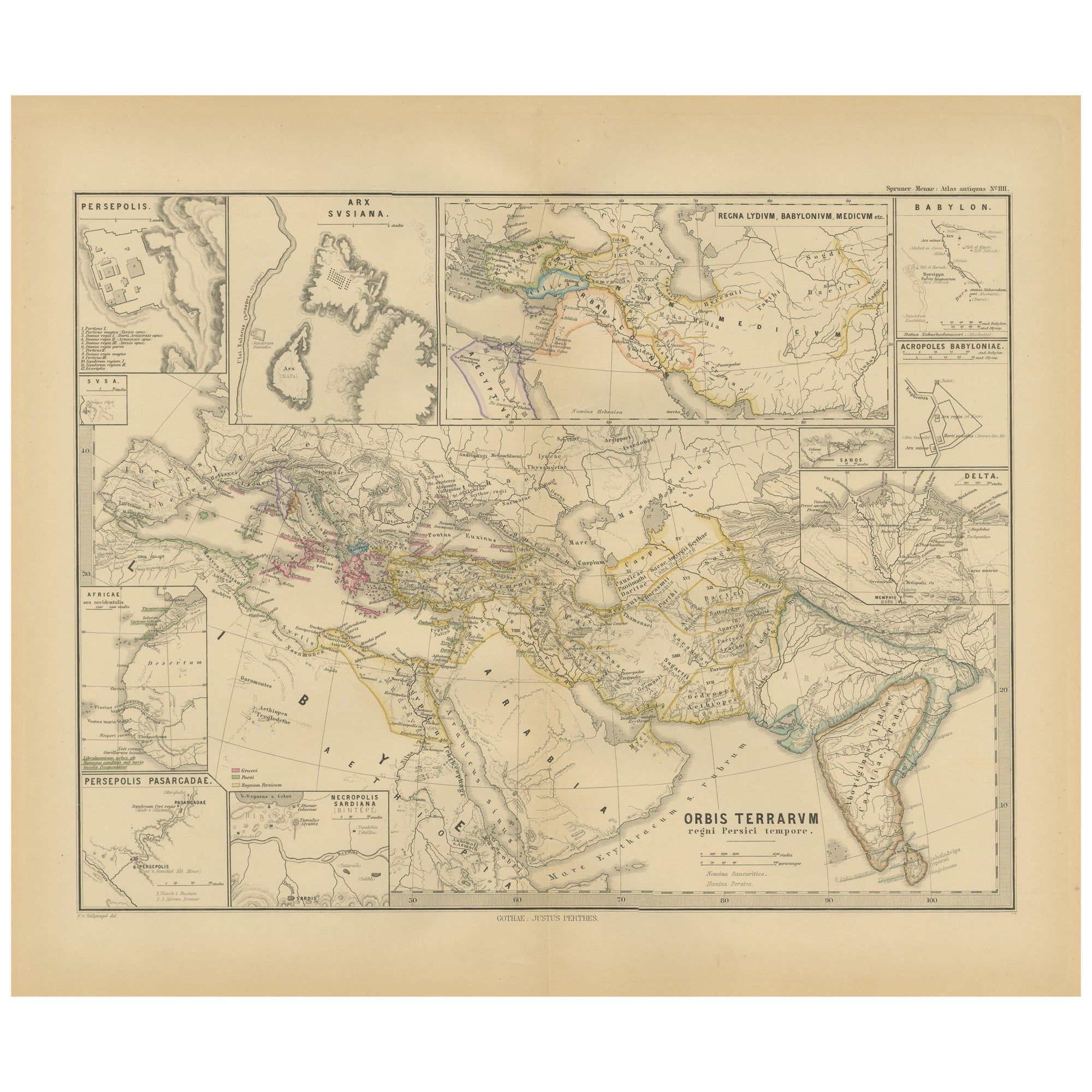
- Empires of Antiquity: The Persian Realm and Beyond Engraved, Published in 1880Located in Langweer, NLThe map is titled "ORBIS TERRARUM regni Persici tempore," which translates from Latin to "The World at the Time of the Persian Empire." This map is particularly interesting for sever...Category
Antique 1880s Maps
MaterialsPaper
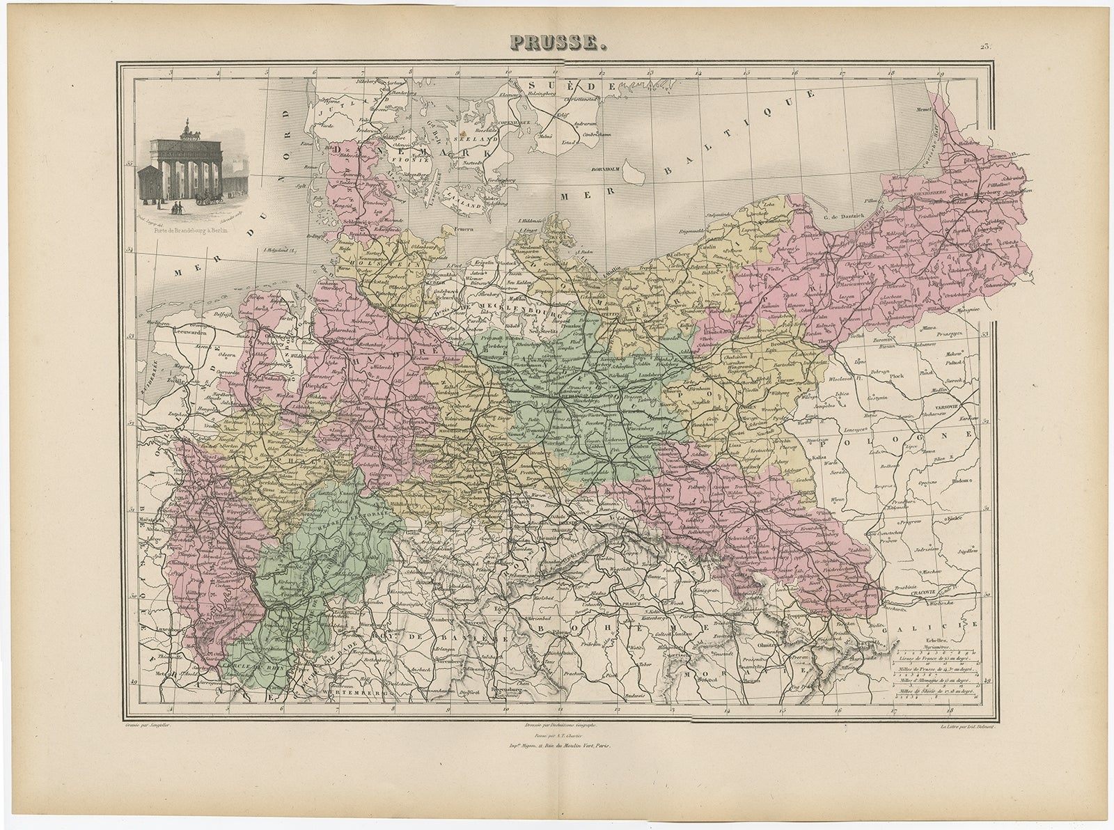
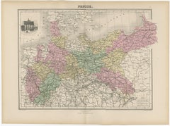
- Antique Map of the Kingdom of Prussia, 1880Located in Langweer, NLAntique map titled 'Prusse'. Old map of the Kingdom of Prussia, with a decorative vignette of the gate of Brandenburg, Berlin. This map originates from 'Géographie Universelle Atlas-...Category
Antique 19th Century Maps
MaterialsPaper
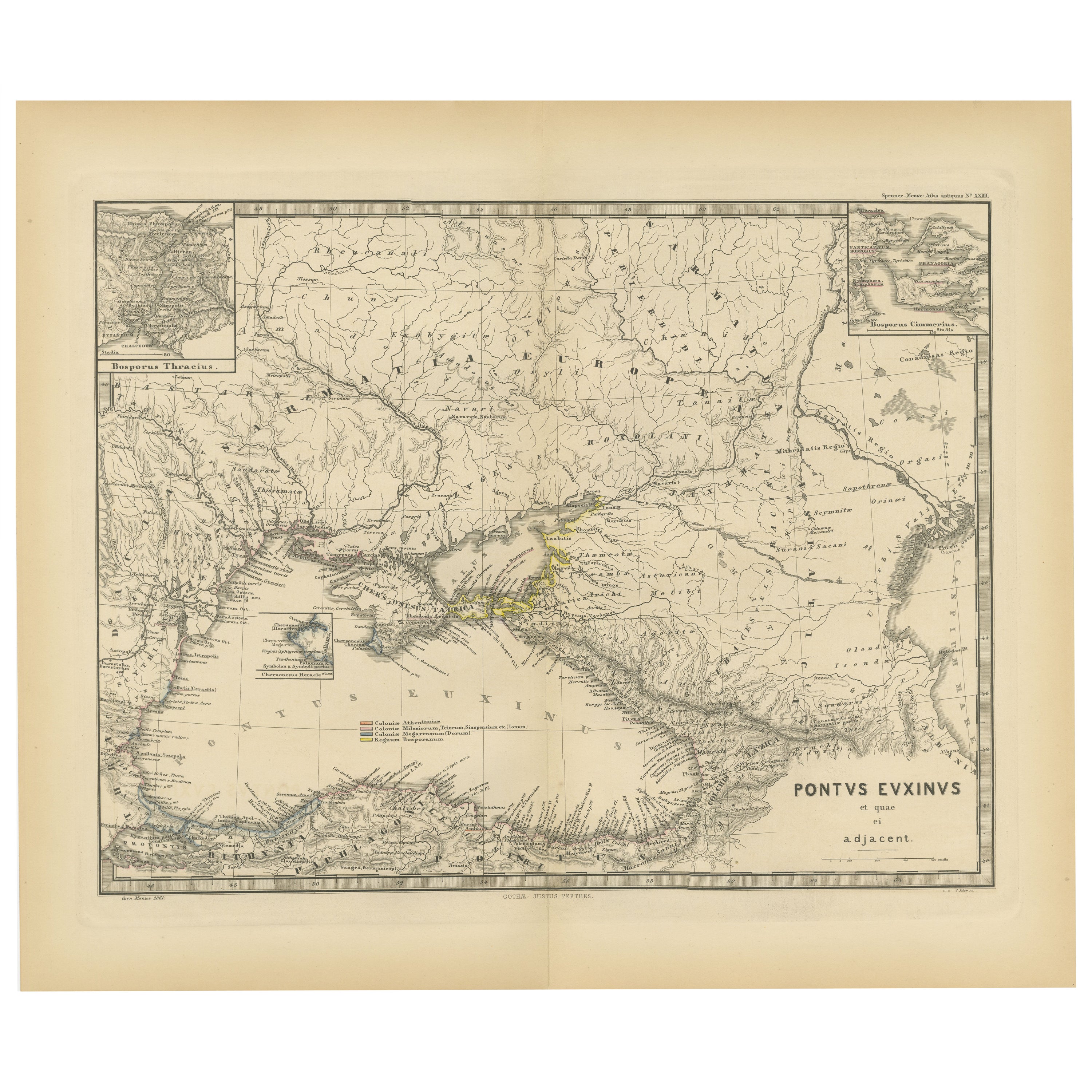
- Black Sea in Antiquity: Pontus Euxinus Map, Published in 1880Located in Langweer, NLThis map, titled "PONTUS EUXINUS," depicts the Black Sea region, historically known as the Pontus Euxinus. The Black Sea was central to ancient trade routes and cultural exchange, bo...Category
Antique 1880s Maps
MaterialsPaper
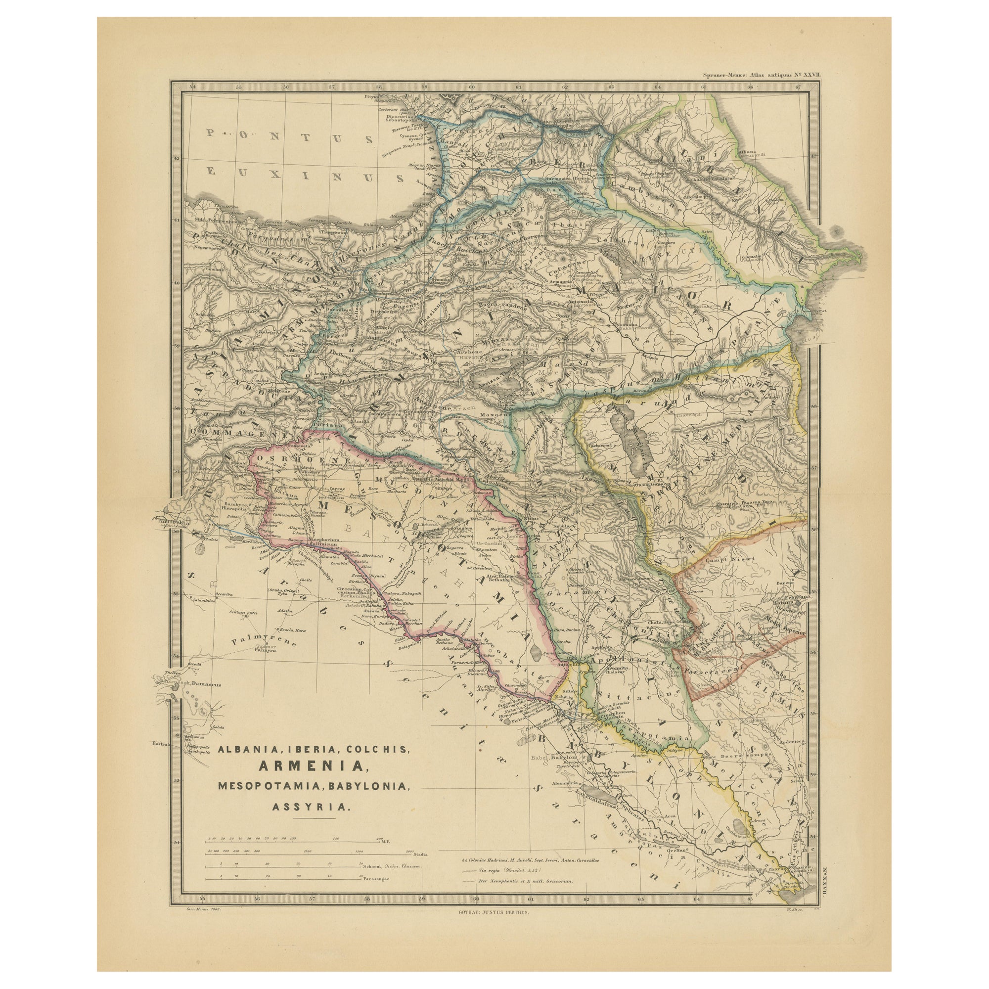
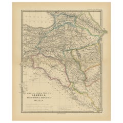
- Ancient Crossroads: Albania to Assyria in Antiquity, Published in 1880Located in Langweer, NLThe map titled "ALBANIA, IBERIA, COLCHIS, ARMENIA, MESOPOTAMIA, BABYLONIA, ASSYRIA" portrays the ancient regions that would encompass parts of modern-day Eastern Turkey, Armenia, Aze...Category
Antique 1880s Maps
MaterialsPaper
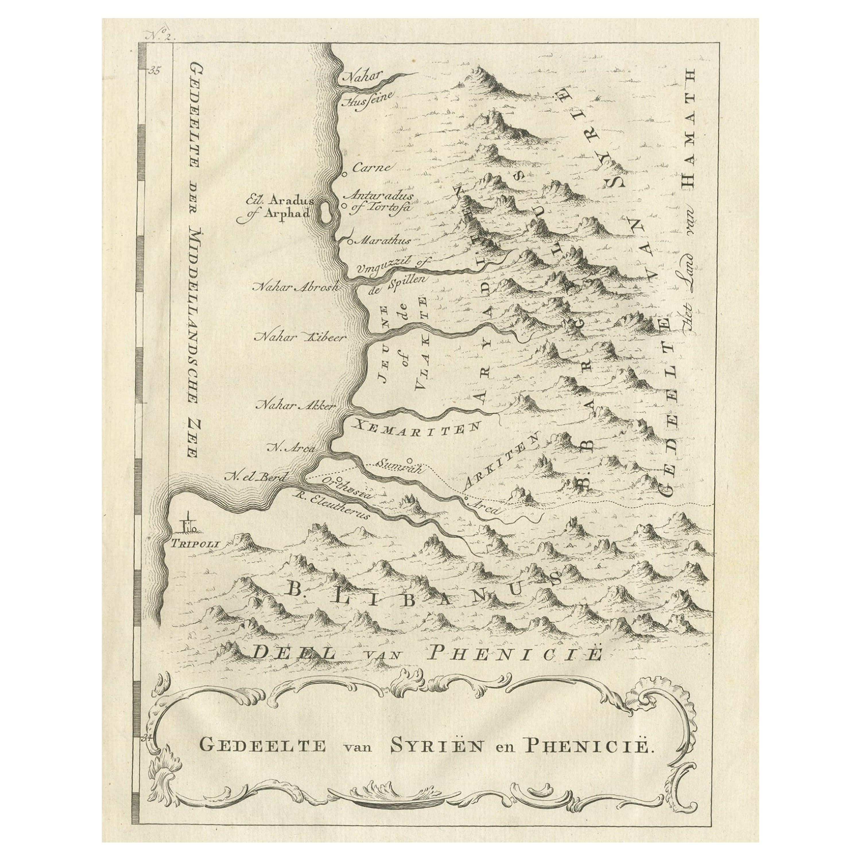
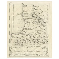
- Old Dutch Map of Part of Syria and Phoenicia, 1773Located in Langweer, NLAntique print titled 'Gedeelte van Syriën en Phenicië'. Old map of part of Syria and Phoenicia. Originates from the first Dutch editon of an interesting travel account of Norther...Category
Antique 1770s Maps
MaterialsPaper
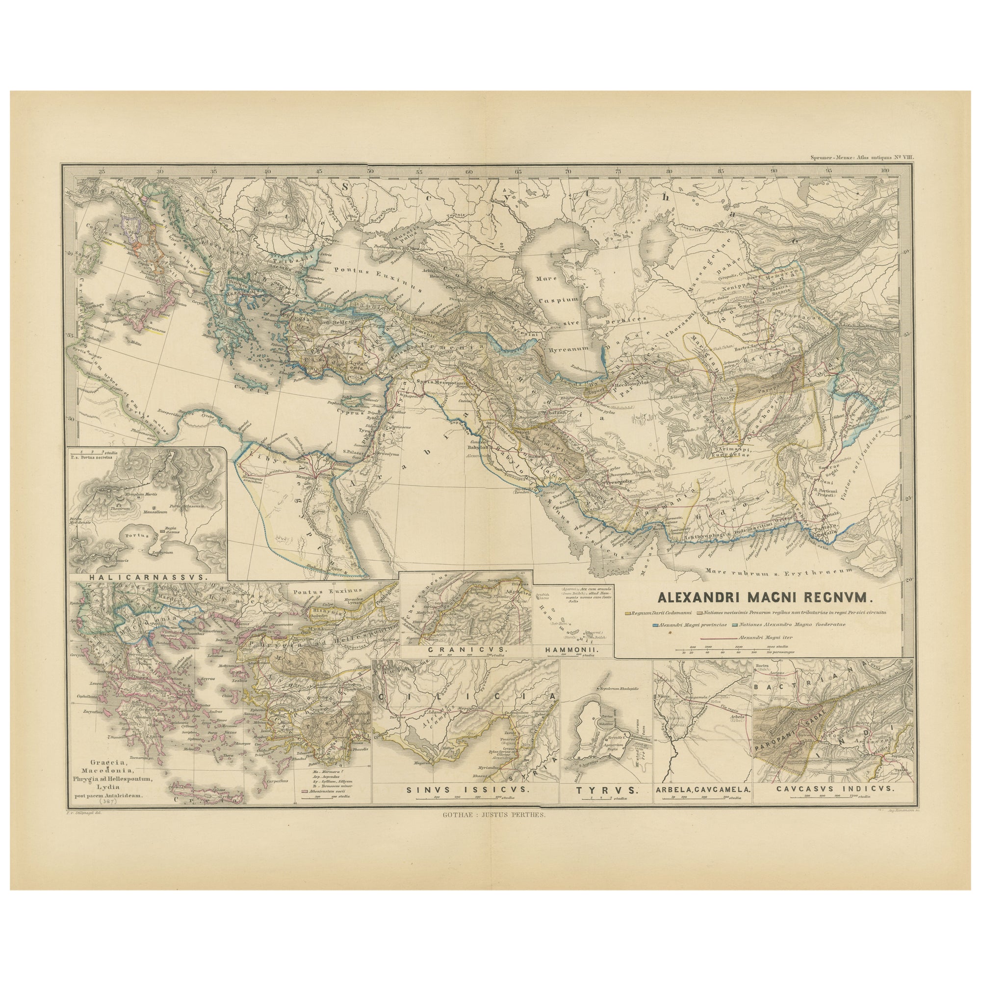
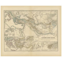
- Antique Map of The Kingdom of Alexander the Great, Published in 1880Located in Langweer, NLThe map is titled "ALEXANDRI MAGNI REGNUM," which translates to "The Kingdom of Alexander the Great." It depicts the vast territories conquered by Alexander the Great during his reig...Category
Antique 1880s Maps
MaterialsPaper

You May Also Like
- Map of the Kingdom of Sardinia and Part of the Kingdom of Genoa, RomeBy Giovanni Maria CassiniLocated in Hamilton, Ontario18th century map by Italian engraver Giovanni Maria Cassini (Italy 1745-1824). Map of Part of the Kingdom of Sardinia and Part of the Kingdom of Genoa: Rome. This is a hand colored a...Category
Antique 18th Century Italian Maps
MaterialsPaper
- Pair of Sotheby's Catalogues on Antiquities and Islamic ArtLocated in valatie, NYSotheby's New York: Antiquities and Islamic Art, 1990. Egyptian, Greek, Etruscan, Roman and Western Asiatic Antiquities and Islamic Works of Art. 230 lots. Sotheby's London: Antiquit...Category
Late 20th Century Books
MaterialsPaper
- 2 Volumes. N.P. Willis & J. S. Coyne, The Scenery and Antiquities of IrelandLocated in New York, NY2 Volumes. N.P. Willis & J. Stirling Coyne, The Scenery and Antiquities of Ireland. Bound in full green morocco, gilt-tooled detailing, and raised band spines. All edges gilt with gi...Category
Antique Late 19th Century English Books
MaterialsLeather
- Antique Royal Standard of the United Kingdom in Giltwood Frame and Under GlassLocated in Morristown, NJAn antique Royal Standard of the United Kingdom, possibly by Benjamin Edgington, London. The fabric is in a giltwood frame under glass. Each of the four quadrants on the flag represe...Category
Antique 1830s English British Colonial Historical Memorabilia
MaterialsFabric, Glass, Wood
- Gilpin, Wm: Observations... on Great Britain, and High-Lands of Scotland, 2 volsLocated in Middletown, NYThis is Gilpin's third in his series of works tracing picturesque beauty in British natural landscapes. In it he portrays the landscapes of Scottish Highlands, and describes them lyrically in his text. Prefacing the list of Prints at the end of the second volume, the author says "With regards to the prints, which adorn these volumes, I can only say..... that few of them pretend to be 'exact portraits.' They in general 'only characterize the countries,' through which the reader is carried." The illustrations, based on Gilpin's sketches, were etched by his nephew William Sawrey Gilpin using the newly invented aquatint process. This volume also includes a technical discourse about drawing and the mixing of colors, including a chart (vol. 1, p. 131-134) William Gilpin (1724 – 1804) was an English artist, Church of England cleric, schoolmaster and author. He is best known as a travel writer and as one of those who originated the idea of the picturesque. Gilpin's tour journals circulated in manuscript to friends such as the poet William Mason and a wider circle including Thomas Gray...Category
Antique Late 18th Century English Books
MaterialsLeather, Paper
- Sotheby's: The Breitbart Collection of Antiquities & Ancient Glass, 6/1990Located in valatie, NYSotheby's: The Breitbart Collection of Antiquities & Ancient Glass, 6/1990. 145 lots, Ancient Glass; Egyptian, Western Asiatic, and classical antiquities...Category
1990s American Books
MaterialsPaper