Items Similar to Empires of Antiquity: The Persian Realm and Beyond Engraved, Published in 1880
Want more images or videos?
Request additional images or videos from the seller
1 of 6
Empires of Antiquity: The Persian Realm and Beyond Engraved, Published in 1880
About the Item
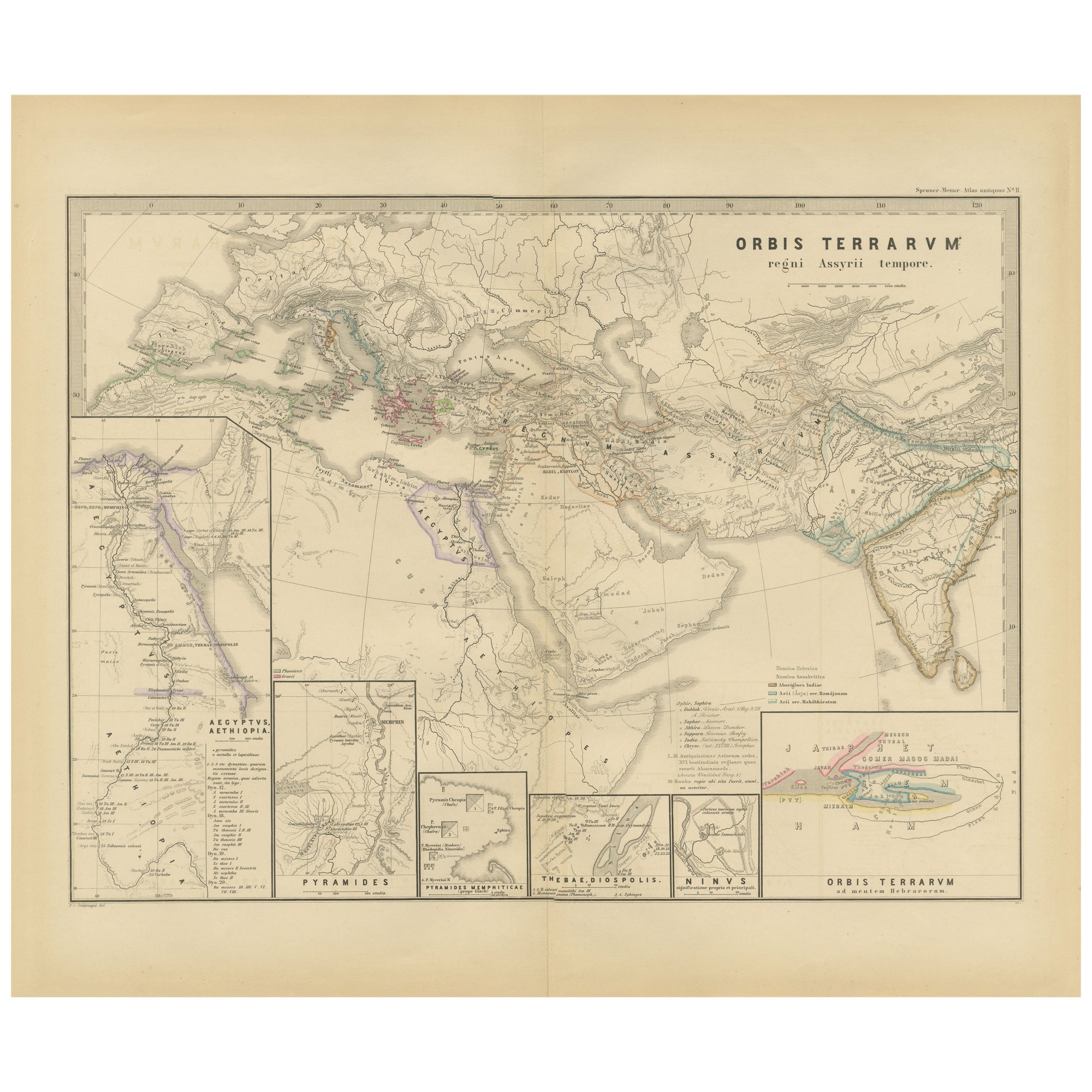
The map is titled "ORBIS TERRARUM regni Persici tempore," which translates from Latin to "The World at the Time of the Persian Empire." This map is particularly interesting for several reasons:
1. **Coverage of the Persian Empire**: It captures the vast reach of the Persian Empire at its height, including not only Persia itself but also the territories it controlled, which stretched from the Indus River in the east to parts of Greece and Egypt in the west.
2. **Historical Period**: The map likely covers the Achaemenid period, which is from around 550 BC to 330 BC when the Persian Empire was the most dominant force in the known world until its conquest by Alexander the Great.
3. **Inset Maps**: The detailed inset maps, such as "PERSEPOLIS PASARGADAE," the ruins of Persepolis, and "ACROPOLIS BABYLONIAE," the Acropolis of Babylon, provide focused historical insights into significant ancient cities.
4. **Geographical Features**: It shows important geographical features like the Tigris and Euphrates rivers, the Zagros Mountains, and the Persian Gulf, which were critical for the development of the region.
5. **Ancient Cities**: The map marks the locations of key cities such as Babylon, Susa, and Persepolis, which were important administrative and cultural centers of the empire.
6. **Cultural and Political Boundaries**: It reflects the political landscape of the time, providing a visual representation of the various satrapies (provinces) and the empire's scope.
7. **Trade Routes**: It may depict ancient trade routes that were vital for commerce and the spread of culture across the empire's vast territories.
8. **Latin Labels**: The use of Latin for naming geographical features and regions provides a scholarly perspective typical of historical maps from the 19th century.
This map is from the "Spruner-Menke Atlas Antiquus," created by Karl Spruner von Merz and edited by Theodorus Menke. The atlas is known for its detailed and historically accurate maps of ancient civilizations and was published in the late 19th century.
During the time the map is covering, the Persian Empire under the Achaemenid dynasty was the largest empire the world had seen. It was known for its administrative sophistication, a system of satrapies with loyal governors, and the Royal Road, which facilitated communication and trade. The empire also constructed monumental architectural projects, such as the palaces at Persepolis, and it allowed a degree of cultural and religious autonomy within its vast territories. The Persian Empire's influence on politics, culture, and economics was profound and lasted well beyond its conquest by Alexander the Great.
The map comes from the "Spruner-Menke Atlas Antiquus," crafted by Karl Spruner von Merz, known as Karl Spruner, and edited by Theodorus Menke. This atlas was a significant work of historical geography from the 19th century, valued for its detailed and accurate historical mappings. The map encapsulates the historical knowledge of the time regarding the Persian Empire and the surrounding regions.
- Dimensions:Height: 15.56 in (39.5 cm)Width: 18.51 in (47 cm)Depth: 0 in (0.02 mm)
- Materials and Techniques:
- Period:
- Date of Manufacture:1880
- Condition:Good, given age. General age-related toning, especially around the edges. vertical folding line as issued. Please study scan carefully.
- Seller Location:Langweer, NL
- Reference Number:
About the Seller
5.0
Platinum Seller
These expertly vetted sellers are 1stDibs' most experienced sellers and are rated highest by our customers.
Established in 2009
1stDibs seller since 2017
1,916 sales on 1stDibs
Typical response time: <1 hour
- ShippingRetrieving quote...Ships From: Langweer, Netherlands
- Return PolicyA return for this item may be initiated within 14 days of delivery.
More From This SellerView All
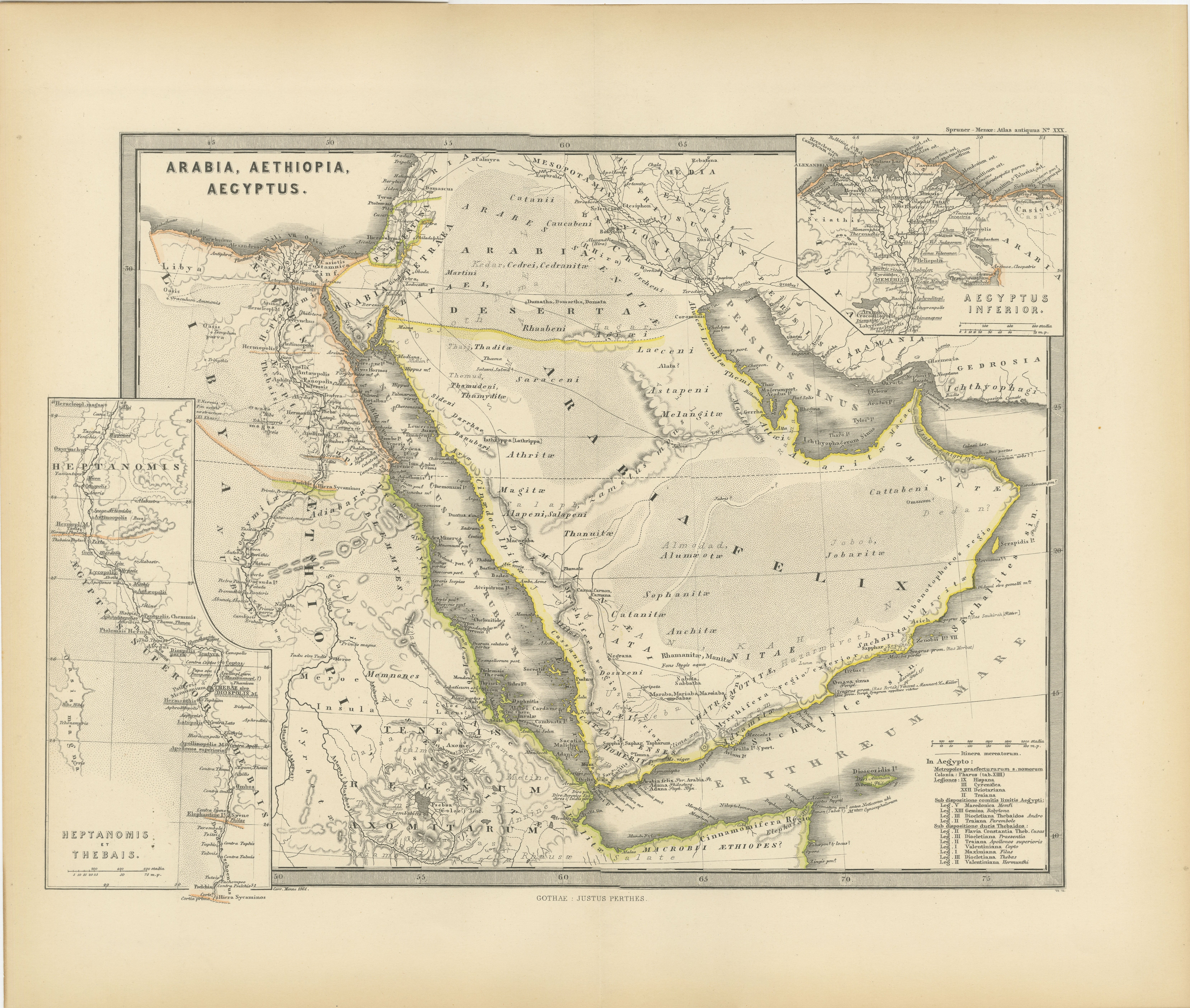
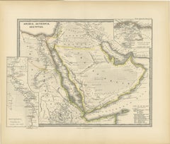
- Ancient Realms of Northeast Africa: Arabia, Ethiopia, and Egypt, Published 1880Located in Langweer, NLThis map, titled "ARABIA, AETHIOPIA, AEGYPTUS," illustrates the regions of ancient Arabia, Ethiopia, and Egypt. Features that make this map interesting include: 1. **Geographical ...Category
Antique 1880s Maps
MaterialsPaper
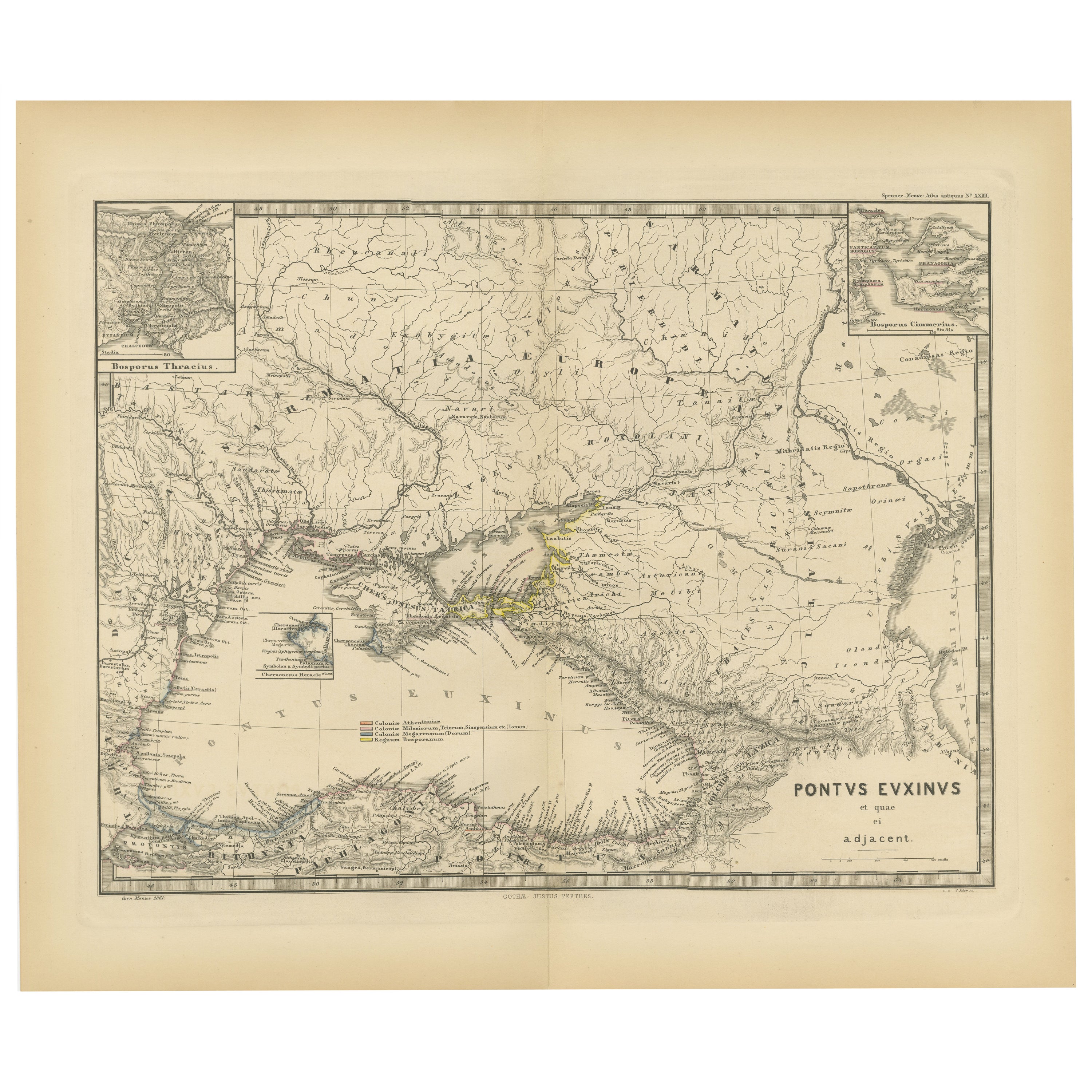
- Black Sea in Antiquity: Pontus Euxinus Map, Published in 1880Located in Langweer, NLThis map, titled "PONTUS EUXINUS," depicts the Black Sea region, historically known as the Pontus Euxinus. The Black Sea was central to ancient trade routes and cultural exchange, bo...Category
Antique 1880s Maps
MaterialsPaper
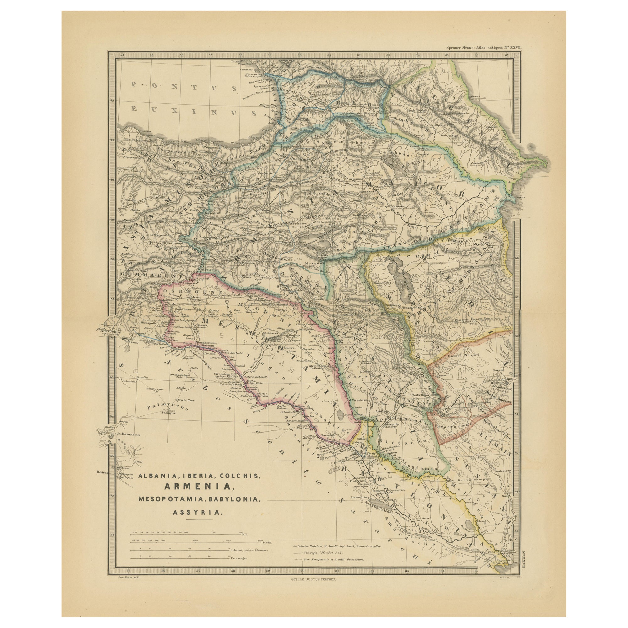
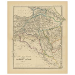
- Ancient Crossroads: Albania to Assyria in Antiquity, Published in 1880Located in Langweer, NLThe map titled "ALBANIA, IBERIA, COLCHIS, ARMENIA, MESOPOTAMIA, BABYLONIA, ASSYRIA" portrays the ancient regions that would encompass parts of modern-day Eastern Turkey, Armenia, Aze...Category
Antique 1880s Maps
MaterialsPaper
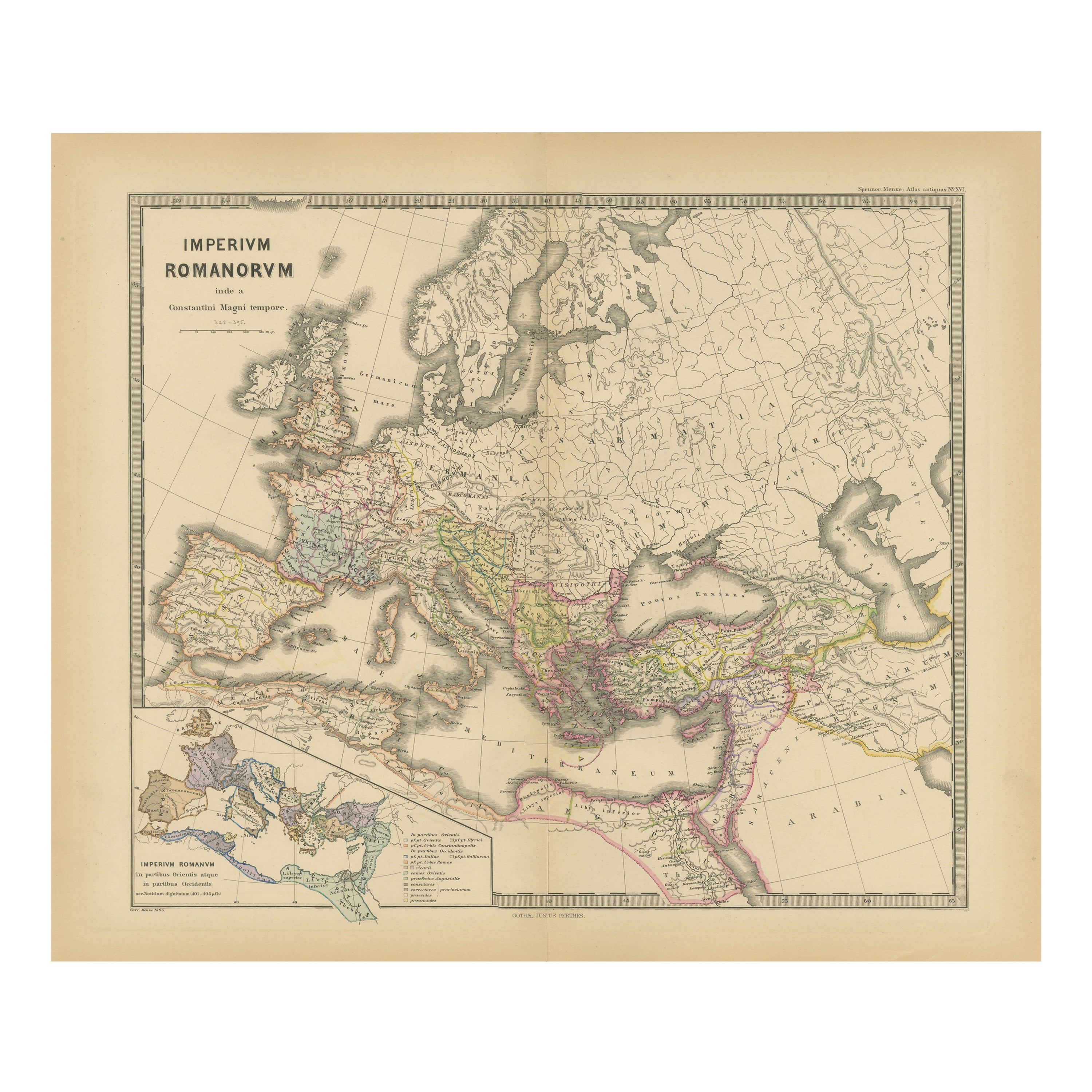
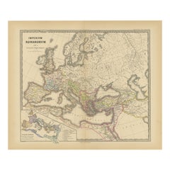
- The Roman Empire from the Time of Constantine the Great, Published in 1880Located in Langweer, NLAntique map titled: "IMPERIUM ROMANORUM inde a Constantini Magni tempore," which translates to "The Roman Empire from the time of Constantine the Great." This map is designed to re...Category
Antique 1880s Maps
MaterialsPaper
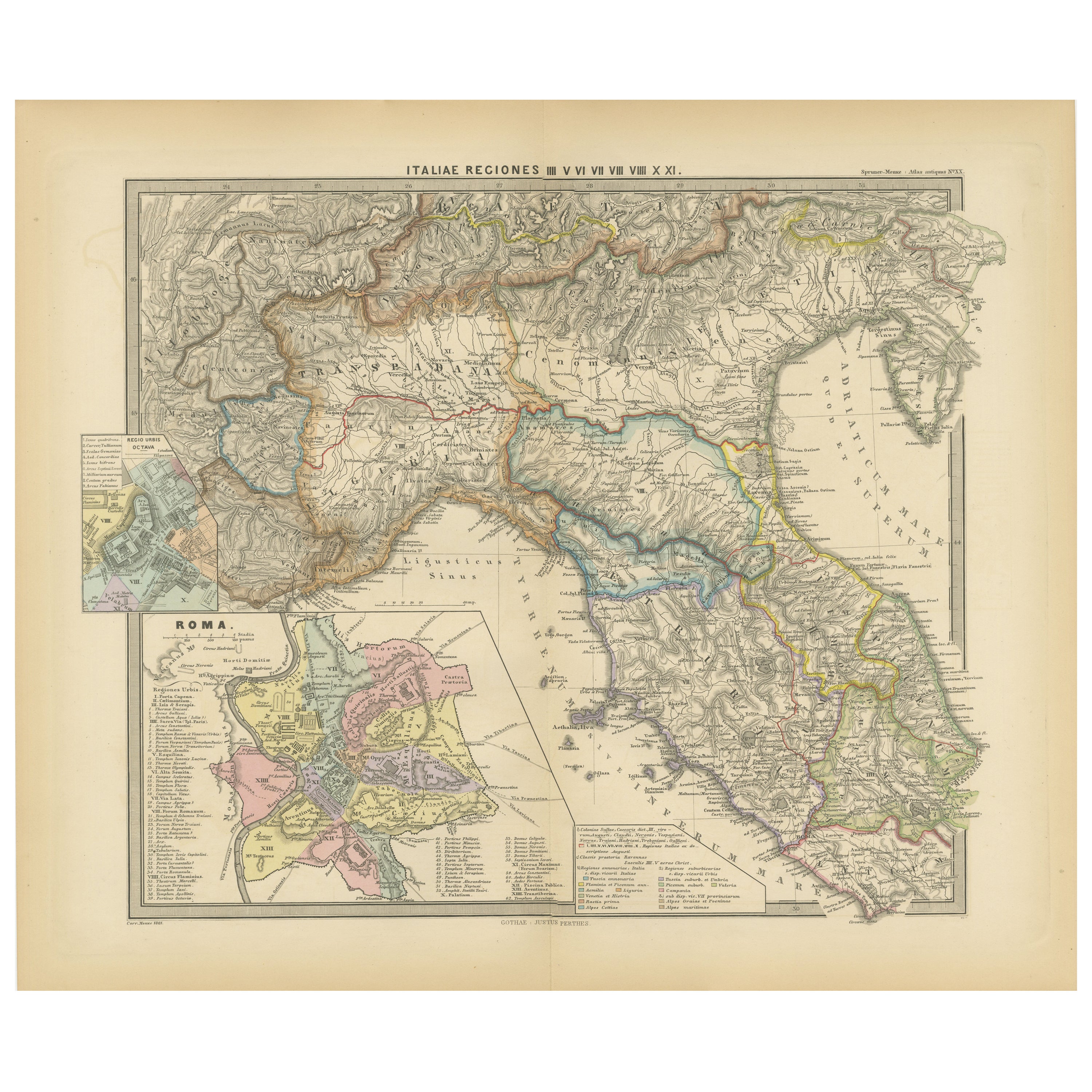
- Ancient Italy: Regions and Rome in the Roman Empire, Published in 1880Located in Langweer, NLThis print is an original detailed map titled "ITALIAE REGIONES I VII VIII IX XI," representing the regions of ancient Italy. Key Features of the Print: 1. **Regional Demarcations...Category
Antique 1880s Maps
MaterialsPaper
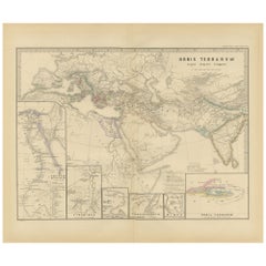
- The World in the Assyrian Empire's Era: A Historical Map, Published in 1880Located in Langweer, NLThis map from the "Spruner-Menke Atlas Antiquus" is titled "ORBIS TERRARVM regni Assyrii tempore," which translates to "The World at the Time of the Assyrian Kingdom." It depicts the...Category
Antique 1880s Maps
MaterialsPaper


You May Also Like
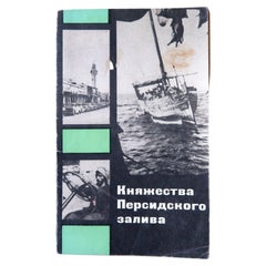
- Vintage Exploration: Realms of the Persian Gulf, 1970, USSR, 1J141Located in Bordeaux, FREmbark on a journey of exploration with this vintage book titled "Княжества Персидского залива" (Realms of the Persian Gulf). Originating from Moscow in the USSR and dating back to 1...Category
Vintage 1970s Books
MaterialsPaper
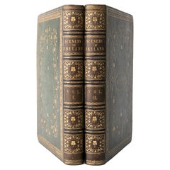
- 2 Volumes. N.P. Willis & J. S. Coyne, The Scenery and Antiquities of IrelandLocated in New York, NY2 Volumes. N.P. Willis & J. Stirling Coyne, The Scenery and Antiquities of Ireland. Bound in full green morocco, gilt-tooled detailing, and raised band spines. All edges gilt with gi...Category
Antique Late 19th Century English Books
MaterialsLeather
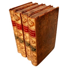
- The Works of Francis Rabelais in 4 Leatherbound Volumes Published In London 1784Located in San Francisco, CAThe works of Francis Rabelais, translated from the French in 4 full original calf bindings with gilt tooled spines published in London by T. Evans in the Strand in 1784. Rabelais was...Category
Antique Mid-18th Century English Georgian Books
MaterialsLeather, Paper
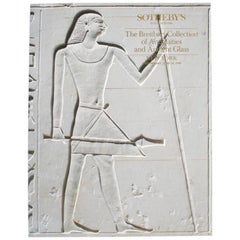
- Sotheby's: The Breitbart Collection of Antiquities & Ancient Glass, 6/1990Located in valatie, NYSotheby's: The Breitbart Collection of Antiquities & Ancient Glass, 6/1990. 145 lots, Ancient Glass; Egyptian, Western Asiatic, and classical antiquities...Category
1990s American Books
MaterialsPaper
- The Works of Edmund Burke in Eight Leatherbound Volumes Published 1808Located in San Francisco, CAThe Works of the Right Honorable Edmund Burke in 8 volumes published for F.C. and J. Rivington, St. Paul's Yard, England by Luke Hanfard and Sons, near Lincoln's-Inn Fields. This att...Category
Antique Early 19th Century English Books
MaterialsLeather, Paper
- The Works of Turgenev in 15 Leatherbound Volumes Published London: 1916Located in San Francisco, CAThe Works of Ivan Turgenev (1818-1883) in 15 volumes, the large type fine paper edition, bound in 3/4 leather, published by William Heinemann, London 1916. Includes the author's most...Category
Early 20th Century English Books
MaterialsLeather, Paper