Items Similar to Ancient Realms of Northeast Africa: Arabia, Ethiopia, and Egypt, Published 1880
Want more images or videos?
Request additional images or videos from the seller
1 of 7
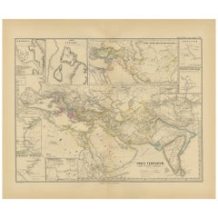
Ancient Realms of Northeast Africa: Arabia, Ethiopia, and Egypt, Published 1880
About the Item
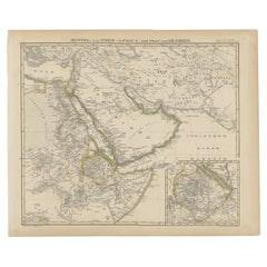
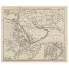
This map, titled "ARABIA, AETHIOPIA, AEGYPTUS," illustrates the regions of ancient Arabia, Ethiopia, and Egypt.
Features that make this map interesting include:
1. **Geographical Span**: It covers a significant portion of the northeast African continent and parts of the Arabian Peninsula, areas rich in history and culture.
2. **Historical Detail**: The map displays detailed information from the ancient world, including the Nile River, the Red Sea, and possibly caravan routes across the desert.
3. **Inset Maps**: The inclusion of inset maps provides detailed views of particular areas, such as "AEGYPTUS INFERIOR" and "HEPTANOMIS, THEBAIS," which show lower Egypt and the Theban region respectively, offering more granular detail about these historically significant locations.
4. **Ancient Cities and Sites**: Locations of ancient cities, temples, and trade centers are likely marked, revealing the advanced civilizations that thrived in these regions.
5. **Topographical Features**: The map shows the varied landscapes, from the mountain ranges in Arabia and Ethiopia to the vast deserts and the fertile Nile valley in Egypt.
6. **Latin Labels**: The use of Latin for place names and descriptions enhances the map's historical authenticity.
7. **Cultural and Political Boundaries**: The boundaries of the regions reflect the political and cultural divisions of the time, providing insight into the ancient kingdoms and empires of Northeast Africa and the Near East.
The period represented by the map is likely during the classical antiquity, specifically during the times when these regions were well-known to the Roman Empire. For Egypt, this would be the period following its conquest by Alexander the Great, its subsequent rule by the Ptolemaic dynasty, and ultimately as a province of Rome after 30 BC. For Arabia and Ethiopia, the period could be reflective of their interactions with the Roman and Hellenistic worlds, which were especially pronounced from the first centuries BC to AD. This map would be particularly interesting to those studying the ancient civilizations of the Nile Valley, the Red Sea trade, and the interactions between Rome and the kingdoms of the Near East and Northeast Africa.
The map is from the "Spruner-Menke Atlas Antiquus," which is a historical atlas created by Karl Spruner von Merz, and later edited by Theodorus Menke. The atlas is known for its detailed maps of historical geographic regions, rendered with great precision and accompanied by scholarly research. These maps were particularly designed for educational use, providing a visual aid for the study of historical and ancient geography. The "Spruner-Menke Atlas Antiquus" is considered a significant work in the field of historical cartography and was published in the late 19th century.
- Dimensions:Height: 15.56 in (39.5 cm)Width: 18.51 in (47 cm)Depth: 0 in (0.02 mm)
- Materials and Techniques:
- Period:
- Date of Manufacture:1880
- Condition:Good, given age. General age-related toning, especially around the edges. Vertical folding line as issued. Please study scan carefully.
- Seller Location:Langweer, NL
- Reference Number:
About the Seller
5.0
Platinum Seller
These expertly vetted sellers are 1stDibs' most experienced sellers and are rated highest by our customers.
Established in 2009
1stDibs seller since 2017
1,916 sales on 1stDibs
Typical response time: <1 hour
- ShippingRetrieving quote...Ships From: Langweer, Netherlands
- Return PolicyA return for this item may be initiated within 14 days of delivery.
More From This SellerView All
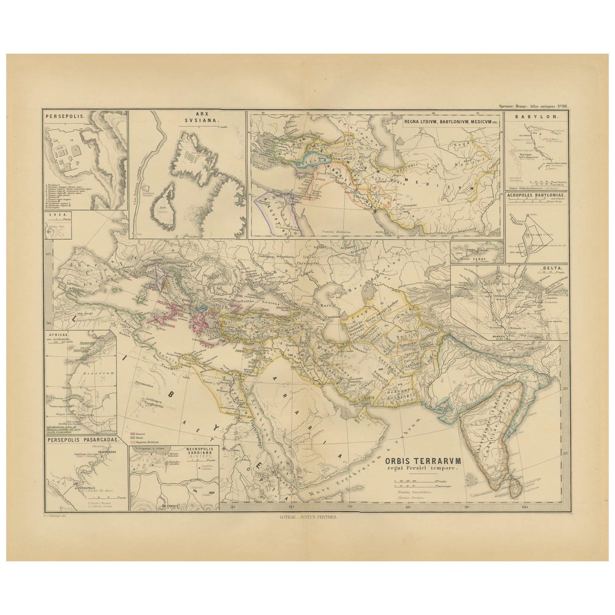
- Empires of Antiquity: The Persian Realm and Beyond Engraved, Published in 1880Located in Langweer, NLThe map is titled "ORBIS TERRARUM regni Persici tempore," which translates from Latin to "The World at the Time of the Persian Empire." This map is particularly interesting for sever...Category
Antique 1880s Maps
MaterialsPaper
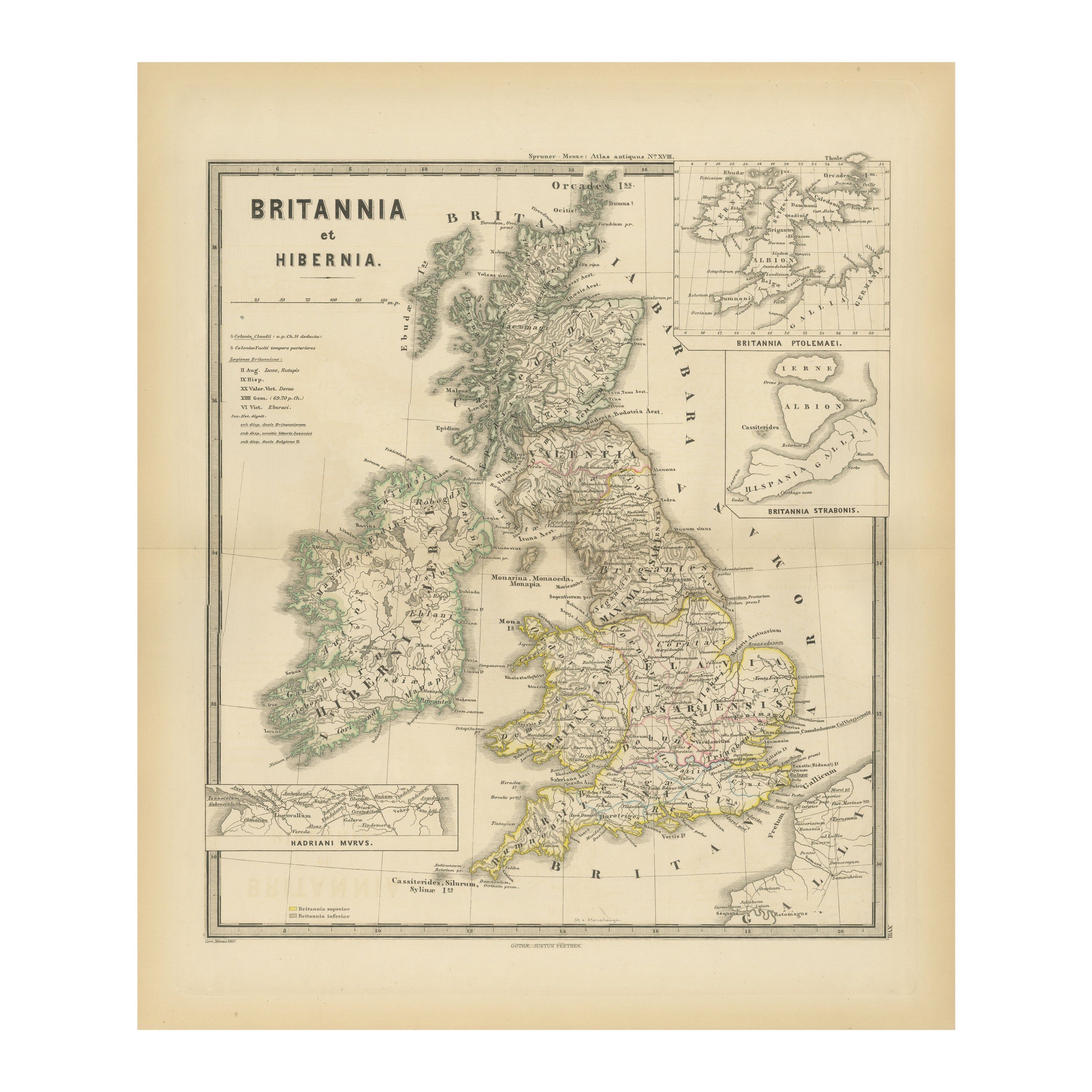
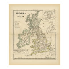
- Ancient Cartography of Britannia and Hibernia, Published in 1880Located in Langweer, NLThis map depicts the geographical area of Great Britain and Ireland, labeled "BRITANNIA et HIBERNIA." It is a historical map, as indicated by the Latin titles and the classical names of regions and tribes. In the main section of the map, Great Britain is depicted in fine detail, with topographical features such as mountains and rivers. The map is color-coded, to differentiate political or tribal boundaries. Various Roman place names are indicated, such as "Londinium" for London. To the left of Great Britain is Ireland, referred to as "Hibernia," similarly detailed with its own topographical features and ancient...Category
Antique 1880s Maps
MaterialsPaper
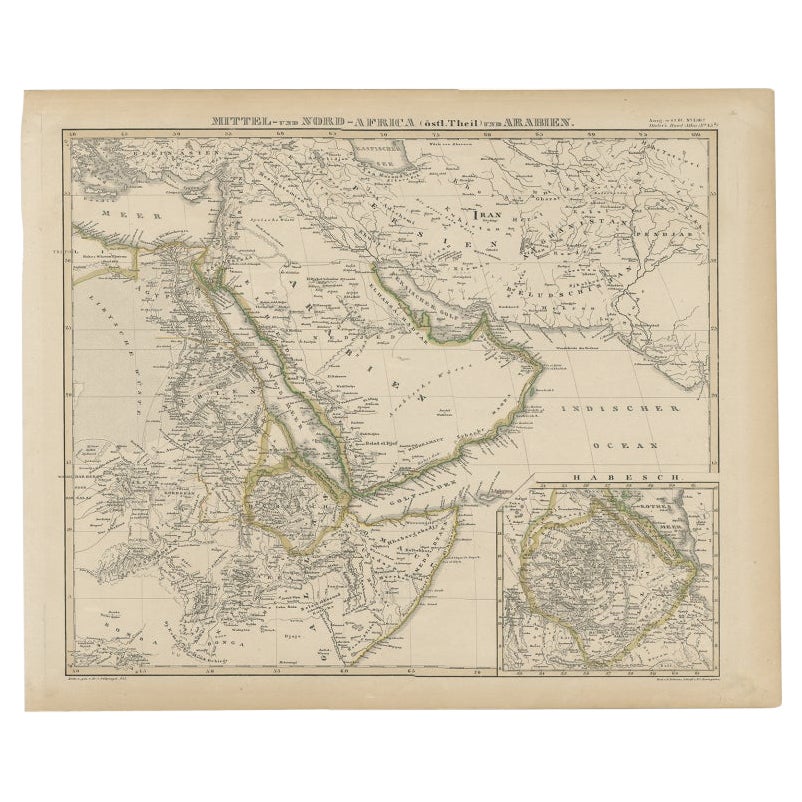
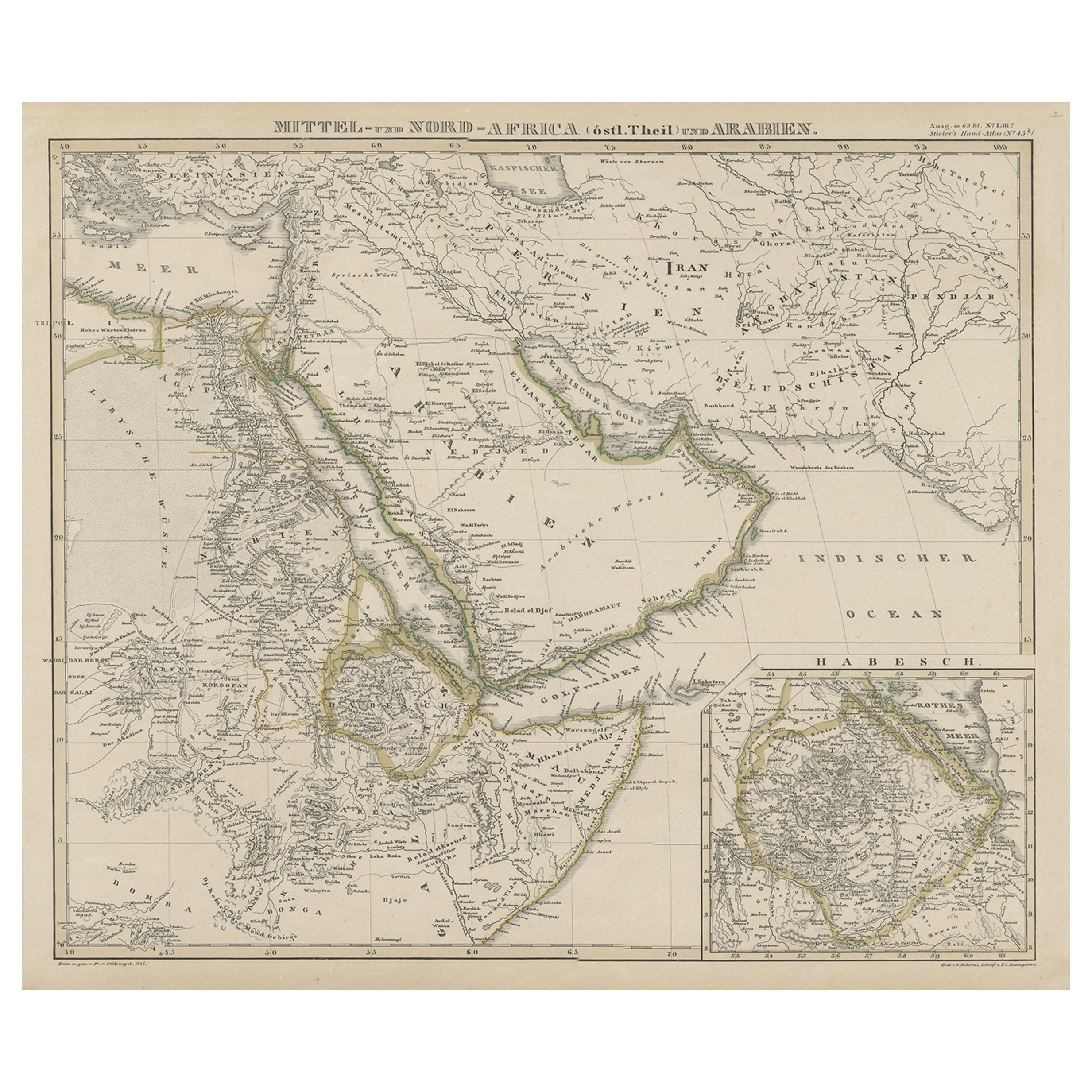
- Antique Map of Africa and Arabia with Inset Map of Ethiopia and Eritrea, 1845Located in Langweer, NLAntique map titled 'Mittel- und Nord-Africa (östl. Theil) und Arabien'. This map depicts North and Central Africa and Arabia with an inset map of Habesch (Ethiopia and Eritrea). Ar...Category
Antique 19th Century Maps
MaterialsPaper
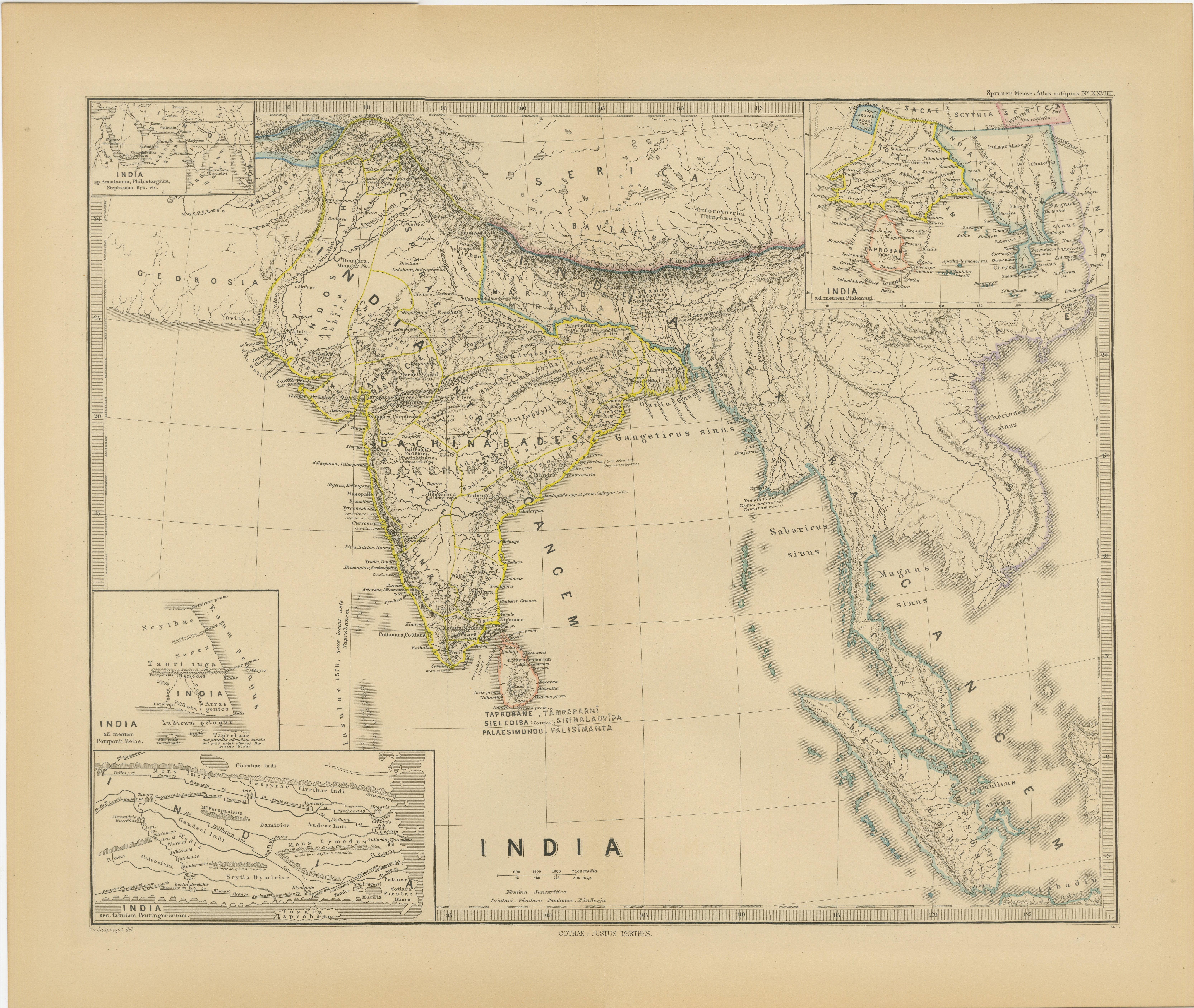
- Ancient Cartography of the Indian Subcontinent, Published in 1880Located in Langweer, NLThis map is titled "INDIA," and it provides a detailed view of the Indian subcontinent with various inset maps that offer additional historical and geographical context. The main ma...Category
Antique 1880s Maps
MaterialsPaper
- North & Central Africa & Arabia, Inset Map of Habesch 'Ethiopia & Eritrea', 1845Located in Langweer, NLAntique map titled 'Mittel- und Nord-Africa (östl. Theil) und Arabien'. This map depicts North and Central Africa and Arabia with an inset map of Habesch (Ethiopia and Eritrea). ...Category
Antique 1840s Maps
MaterialsPaper
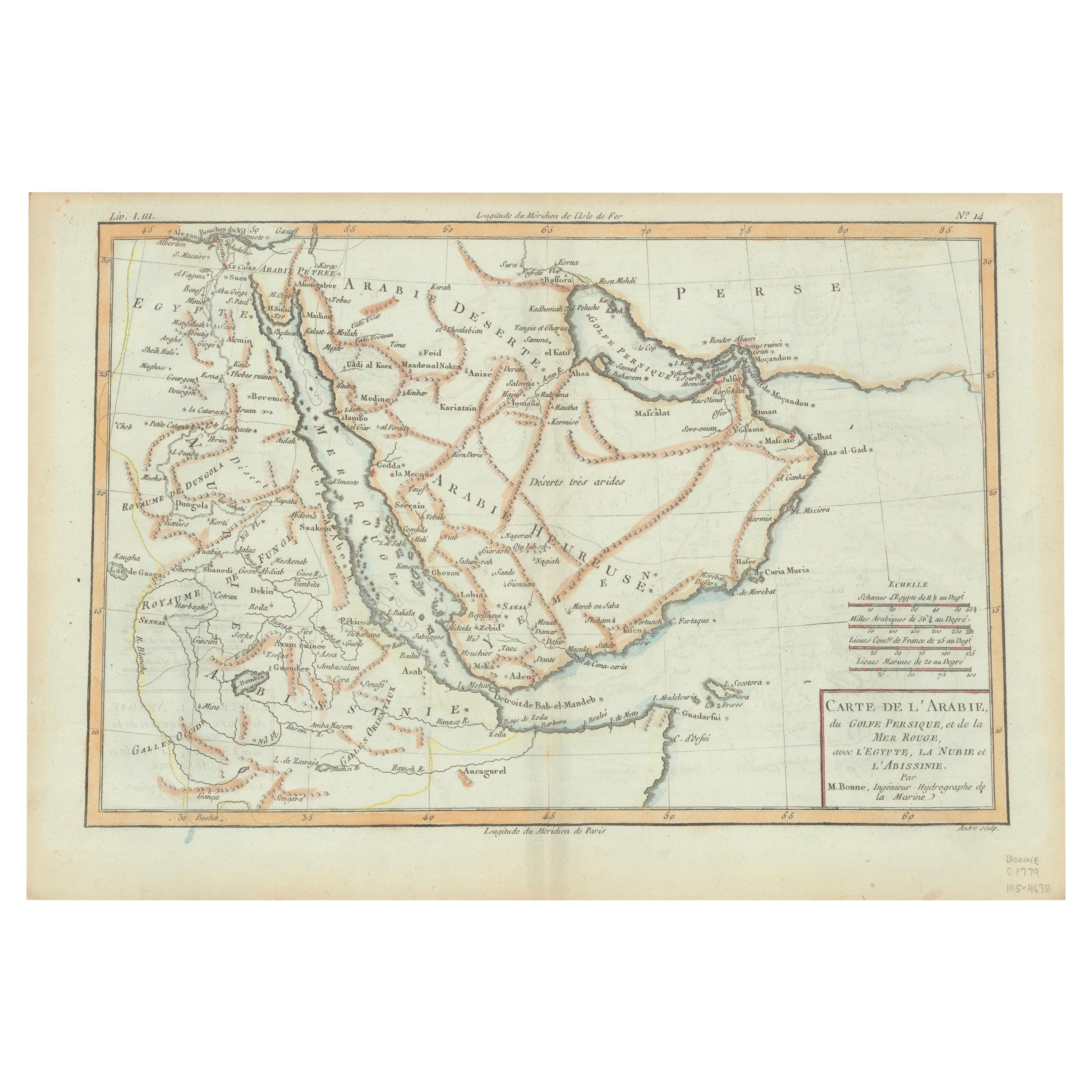
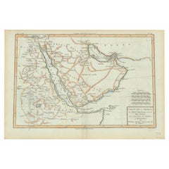
- Old Map of the Arabian Peninsula with Parts of Egypt, Sudan, Eritrea & EthiopiaLocated in Langweer, NL"Carte de l'Arabie, du Golfe Persique, et de la Mer Rouge, avec l'Egypte, la Nubie et l'Abissinie", Bonne, Rigobert Subject: Arabia Period: 1780 (circa) Publication: Atlas de Toutes...Category
Antique 1780s Maps
MaterialsPaper

You May Also Like
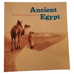
- The American Discovery of Ancient Egypt 1995Located in North Hollywood, CAThe American Discovery of Ancient Egypt 1995. Essays, edited by Nancy Thomas. A survey of the achievements of American Egyptology featuring such enterpris...Category
Late 20th Century Egyptian Moorish Books
MaterialsPaper
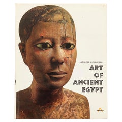
- Art of Ancient Egypt by Kazimierz MichalowskiLocated in Bradenton, FLArt of Ancient Egypt by Kazimierz Michalowski. Hardcover book with dustjacket. Published by Harry N. Abrams Inc., of New York. Printed in France, bound in the Netherlands. 904 illust...Category
Late 20th Century French Egyptian Books
MaterialsPaper
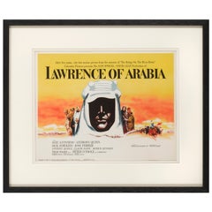
- Lawrence of ArabiaBy Saverio PavoneLocated in London, GBOriginal American Title lobby card for the films US release in 1962. This epic British film is based on the life of T. E. Lawrence. It was directed by David Lean and produced by Sam ...Category
Vintage 1960s American Posters
MaterialsPaper
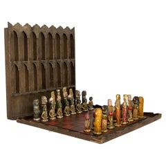
- French Chess Theme of Ancient Egypt Plaster & Wood Restored, circa 1920Located in Labrit, LandesFrench chess game in the thematic of Ancient Egypt. The chess pieces are in painted and waxed plaster, the board is in wood and the is also a display shel...Category
Vintage 1920s French Egyptian Revival Games
MaterialsPlaster, Wood
- London 1744 Published Watercolour Antique Map of East Africa by Eman BowenLocated in GBWe are delighted to offer for sale this New and Accurate Map of Nubia & Abissinia, together with all the Kingdoms Tributary Thereto, and bordering upon them published in 1744 by Emanuel Bowen This is a decorative antique engraved map of East Africa...Category
Antique 1740s English George III Maps
MaterialsPaper
- Africa, Tribal Art of Forest and SavannaLocated in London, GBAfrica, Tribal Art of Forest and Savanna, 1st edition, Published by Thames & Hudson, 1980. Over 200 treasures of African art drawn from rarely seen private collections and beautiful...Category
Vintage 1980s American Modern Books
MaterialsPaper