Items Similar to Antique Map of Africa and Arabia with Inset Map of Ethiopia and Eritrea, 1845


Want more images or videos?
Request additional images or videos from the seller
1 of 5
Antique Map of Africa and Arabia with Inset Map of Ethiopia and Eritrea, 1845
About the Item
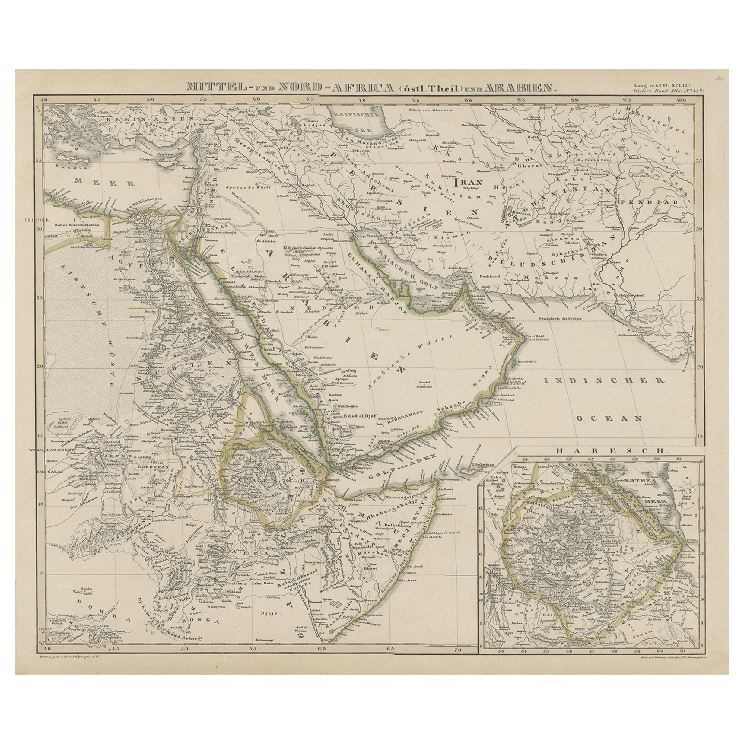
Antique map titled 'Mittel- und Nord-Africa (östl. Theil) und Arabien'. This map depicts North and Central Africa and Arabia with an inset map of Habesch (Ethiopia and Eritrea).
Artists and Engravers: Engraved by Fr. v. Stülpnagel. Published by A. Stieler in 'Stieler's Hand-Atlas'.
Condition: Very good, general age-related toning. Please study image carefully.
Date: 1845
Overall size: 44 x 36 cm.
Image size: 38.5 x 33 cm.
We sell original antique maps to collectors, historians, educators and interior decorators all over the world. Our collection includes a wide range of authentic antique maps from the 16th to the 20th centuries. Buying and collecting antique maps is a tradition that goes back hundreds of years. Antique maps have proved a richly rewarding investment over the past decade, thanks to a growing appreciation of their unique historical appeal. Today the decorative qualities of antique maps are widely recognized by interior designers who appreciate their beauty and design flexibility. Depending on the individual map, presentation, and context, a rare or antique map can be modern, traditional, abstract, figurative, serious or whimsical. We offer a wide range of authentic antique maps for any budget.
- Dimensions:Height: 14.18 in (36 cm)Width: 17.33 in (44 cm)Depth: 0 in (0.01 mm)
- Materials and Techniques:
- Period:
- Date of Manufacture:1845
- Condition:Condition: Very good, general age-related toning. Please study image carefully.
- Seller Location:Langweer, NL
- Reference Number:
About the Seller
5.0
Platinum Seller
These expertly vetted sellers are 1stDibs' most experienced sellers and are rated highest by our customers.
Established in 2009
1stDibs seller since 2017
1,948 sales on 1stDibs
Typical response time: <1 hour
- ShippingRetrieving quote...Ships From: Langweer, Netherlands
- Return PolicyA return for this item may be initiated within 14 days of delivery.
More From This SellerView All
- North & Central Africa & Arabia, Inset Map of Habesch 'Ethiopia & Eritrea', 1845Located in Langweer, NLAntique map titled 'Mittel- und Nord-Africa (östl. Theil) und Arabien'. This map depicts North and Central Africa and Arabia with an inset map of Habesch (Ethiopia and Eritrea). ...Category
Antique 1840s Maps
MaterialsPaper
- Antique Map of South Africa by Wyld '1845'Located in Langweer, NLAntique map titled 'South Africa'. Original antique map of South Africa. This decorative original old map originates from 'An Atlas of th...Category
Antique Mid-19th Century Maps
MaterialsPaper
- Antique Map of Afghanistan and Surroundings, '1845'Located in Langweer, NLAntique map titled 'Map of Persia and Caubul'. Original antique map of Afghanistan and surroundings. This map originates from 'An Atlas of the World, Comprehending Separate Maps of...Category
Antique Mid-19th Century Maps
MaterialsPaper
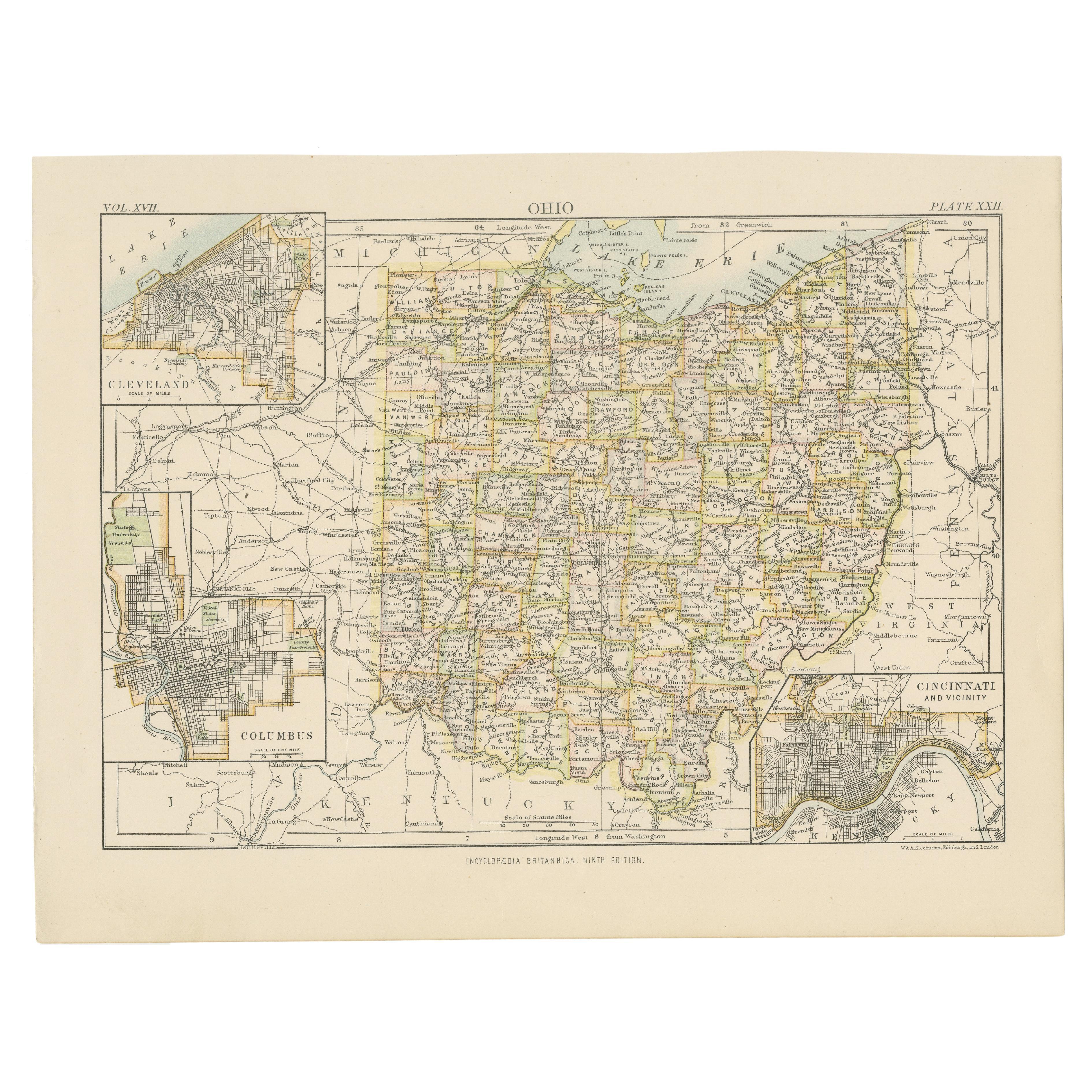
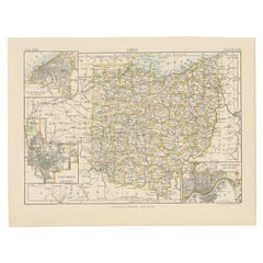
- Antique Map of Ohio, with Inset Maps of Cleveland, Columbus and CincinnatiLocated in Langweer, NLAntique map titled 'Ohio'. Original antique map of Ohio, United States. With inset maps of Cleveland, Columbus and Cincinnati. This print originates from 'Encyclopaedia Britannica', ...Category
Antique Late 19th Century Maps
MaterialsPaper
- Antique Map of Wisconsin with Inset Geological Map of WisconsinLocated in Langweer, NLAntique map titled 'Wisconsin'. Original antique map of Wisconsin, United States. With inset geological map of Wisconsin. This print originates from '...Category
Antique Late 19th Century Maps
MaterialsPaper
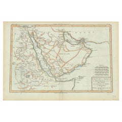
- Old Map of the Arabian Peninsula with Parts of Egypt, Sudan, Eritrea & EthiopiaLocated in Langweer, NL"Carte de l'Arabie, du Golfe Persique, et de la Mer Rouge, avec l'Egypte, la Nubie et l'Abissinie", Bonne, Rigobert Subject: Arabia Period: 1780 (circa) Publication: Atlas de Toutes...Category
Antique 1780s Maps
MaterialsPaper


You May Also Like
- Original Antique Map of South Africa, Arrowsmith, 1820Located in St Annes, LancashireGreat map of South Africa. Drawn under the direction of Arrowsmith. Copper-plate engraving. Published by Longman, Hurst, Rees, Orme and Br...Category
Antique 1820s English Maps
MaterialsPaper
- Antique Map of Principality of MonacoBy Antonio Vallardi EditoreLocated in Alessandria, PiemonteST/619 - "Old Geographical Atlas of Italy - Topographic map of ex-Principality of Monaco" - ediz Vallardi - Milano - A somewhat special edition ---Category
Antique Late 19th Century Italian Other Prints
MaterialsPaper
- Original Antique Map of Spain and Portugal, circa 1790Located in St Annes, LancashireSuper map of Spain and Portugal Copper plate engraving by A. Bell Published, circa 1790. Unframed.Category
Antique 1790s English Other Maps
MaterialsPaper
- Original Antique Map of Ireland- Tipperary and Waterford. C.1840Located in St Annes, LancashireGreat map of Tipperary and Waterford Steel engraving Drawn under the direction of A.Adlard Published by How and Parsons, C.1840 Unframed.Category
Antique 1840s English Maps
MaterialsPaper
- Original Antique Map of Italy. C.1780Located in St Annes, LancashireGreat map of Italy Copper-plate engraving Published C.1780 Unframed.Category
Antique Early 1800s English Georgian Maps
MaterialsPaper

- Original Antique Map of Asia. C.1780Located in St Annes, LancashireGreat map of Asia Copper-plate engraving Published C.1780 Two small worm holes to right side of map Unframed.Category
Antique Early 1800s English Georgian Maps
MaterialsPaper


Recently Viewed
View AllMore Ways To Browse
20th Century Africa Collectibles
Arabian Antique
Antique Fr
19th Century Africa Collectibles
Africa Map Antique
Antique Africa Maps
Antique African Maps
Antique Africa Map
Antique African Map
Africa Antique Map
Antique Maps Africa
Antique Map Africa
Antique Map Of Africa
Antique Maps Of Africa
Ethiopian Design
North Africa Map
V And A African
19th Century Map Of Africa