Items Similar to Antique Map of the African Continent with Inset of the Nile River Delta, c.1870


Want more images or videos?
Request additional images or videos from the seller
1 of 5
Antique Map of the African Continent with Inset of the Nile River Delta, c.1870
About the Item
Antique map titled 'Africa'. Old map of the African continent. This map originates from 'H. Kiepert's Kleiner Atlas der Neueren Geographie für Schule und Haus'.
Artists and Engravers: Kiepert, Heinrich (1818-1899), was a German geographer, and the son of a wealthy businessman.
- Dimensions:Height: 13.78 in (35 cm)Width: 17.56 in (44.6 cm)Depth: 0 in (0.01 mm)
- Materials and Techniques:
- Period:
- Date of Manufacture:circa 1870
- Condition:Condition: Good, general age-related toning. Split on folding line, please study image carefully.
- Seller Location:Langweer, NL
- Reference Number:
About the Seller
5.0
Platinum Seller
These expertly vetted sellers are 1stDibs' most experienced sellers and are rated highest by our customers.
Established in 2009
1stDibs seller since 2017
1,933 sales on 1stDibs
Typical response time: <1 hour
- ShippingRetrieving quote...Ships From: Langweer, Netherlands
- Return PolicyA return for this item may be initiated within 14 days of delivery.
More From This SellerView All
- Antique Map of Egypt and the Nile RiverLocated in Langweer, NLAntique map titled 'Egypten nach dem Zustand der alten Zeit vorgestellt'. This uncommon and richly detailed map of Egypt features hundreds of place names along the Nile. The Sinai Pe...Category
Antique Mid-18th Century Maps
MaterialsPaper
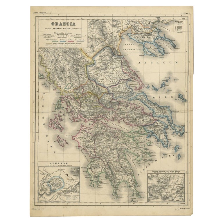
- Antique Map of Greece with Two Small Inset Maps of Athens, c.1870Located in Langweer, NLAntique map titled 'Graecia'. Old map of Greece with two small inset maps of Athens. This map originates from 'Atlas Antiquus, twaalf kaarten behoorende bij de Oude Geschiedenis'. Ar...Category
Antique 19th Century Maps
MaterialsPaper
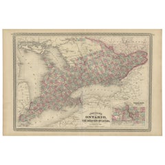
- Antique Map of Ontario with an Inset Map of the Niagara River by Johnson, 1872Located in Langweer, NLAntique map titled 'Johnson's Ontario, of the dominion of Canada (..)'. Original map of Ontario, Canada, with an inset map of the Niagara River and vicinity. This map originates from...Category
Antique Late 19th Century Maps
MaterialsPaper
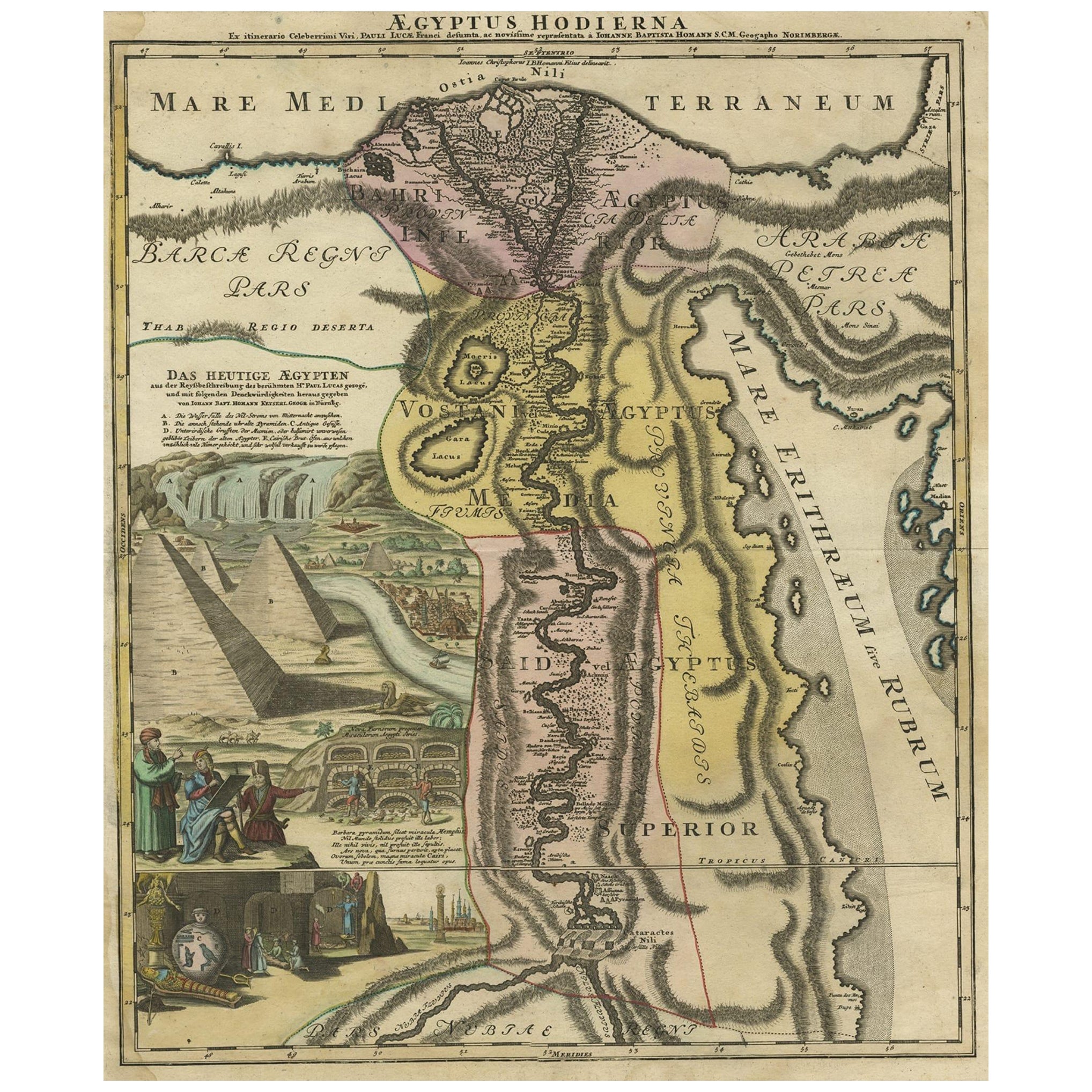
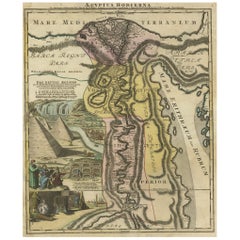
- Antique Map of Egypt and the Nile River with Sphinx, Pyramids, Etc, c.1720Located in Langweer, NLAntique map titled 'Aegyptus Hodierna Ex itinerario Celeberrimi (..)'. Original antique map of Egypt, focused on the Nile River Valley from the Mediterr...Category
Antique 18th Century Maps
MaterialsPaper
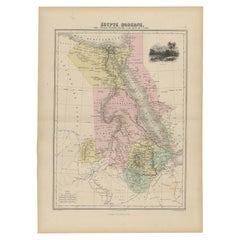
- Antique Map of Africa by A & C, Black, 1870Located in Langweer, NLAntique map titled 'Africa'. Original antique map of Africa. This map originates from ‘Black's General Atlas of The World’. Published by A & C. Black, 1870.Category
Antique Late 19th Century Maps
MaterialsPaper
- Antique Map of The Nile, Egypt, Nubia and Abyssinia and Inset of Jerusalem, 1880Located in Langweer, NLAntique map titled 'Égypte Moderne'. Old map of Egypt, Nubia and Abyssinia (Ethiopia), Kordofan and Darfour (parts of Sudan), as well as part of Arabia. With decorative vignette of J...Category
Antique 19th Century Maps
MaterialsPaper


You May Also Like
- Original Antique Map of South Africa, Arrowsmith, 1820Located in St Annes, LancashireGreat map of South Africa. Drawn under the direction of Arrowsmith. Copper-plate engraving. Published by Longman, Hurst, Rees, Orme and Br...Category
Antique 1820s English Maps
MaterialsPaper
- Africa: the Fashion ContinentBy Rizzoli International PublicationsLocated in New York, NYGain new perspective on the vibrant and innovative world of contemporary African fashion design, bursting with fresh creativity and free from reductive stereotypes. From the runway in Lagos and music festivals in Casablanca or Nairobi, to the “image makers” of Marrakech and the influencers of Dakar or Accra, a new generation of African fashion designers, photographers, bloggers, and hair and makeup artists are redefining the aesthetic contours of the continent. Audacious, humorous, disruptive, and innovative are the bywords of these young creatives who, while drawing upon and revalorizing their heritage, offer an ultra-contemporary perspective on fashion today. A creative revolution is spreading in an extension of continental revindication through cultural reappropriation and the invention of a visual language. Appliqué figures straight from Ghanaian Asafo flags seem to chant modern slogans as they march across silk dresses, traditional textile prints give power back to women, and Xhosa beaded embroidery serves as an inspiration for modern knitwear. Body-artists transform themselves into platforms for activism, and photographers—using clothing...Category
21st Century and Contemporary Books
MaterialsPaper
- Map of the Republic of GenoaLocated in New York, NYFramed antique hand-coloured map of the Republic of Genoa including the duchies of Mantua, Modena, and Parma. Europe, late 18th century. Dimension: 25...Category
Antique Late 18th Century European Maps
- Antique Map of Principality of MonacoBy Antonio Vallardi EditoreLocated in Alessandria, PiemonteST/619 - "Old Geographical Atlas of Italy - Topographic map of ex-Principality of Monaco" - ediz Vallardi - Milano - A somewhat special edition ---Category
Antique Late 19th Century Italian Other Prints
MaterialsPaper
- Original Antique Map of The World by Thomas Clerk, 1817Located in St Annes, LancashireGreat map of The Eastern and Western Hemispheres On 2 sheets Copper-plate engraving Drawn and engraved by Thomas Clerk, Edinburgh. Published by Mackenzie And Dent, 1817 ...Category
Antique 1810s English Maps
MaterialsPaper
- Antique 18th Century Map of the Province of Pensilvania 'Pennsylvania State'Located in Philadelphia, PAA fine antique of the colony of Pennsylvania. Noted at the top of the sheet as a 'Map of the province of Pensilvania'. This undated and anonymous map is thought to be from the Gentleman's Magazine, London, circa 1775, although the general appearance could date it to the 1760's. The southern boundary reflects the Mason-Dixon survey (1768), the western boundary is placed just west of Pittsburgh, and the northern boundary is not marked. The map has a number of reference points that likely refer to companion text and appear to be connected to boundaries. The western and southern boundaries are marked Q, R, S, for example. A diagonal line runs from the Susquehanna R to the Lake Erie P. A broken line marked by many letters A, B, N, O, etc., appears in the east. There are no latitude or longitude markings, blank verso. Framed in a shaped contemporary gilt wooden frame and matted under a cream colored matte. Bearing an old Graham Arader Gallery...Category
Antique 18th Century British American Colonial Maps
MaterialsPaper


Recently Viewed
View AllMore Ways To Browse
19th Century Africa Collectibles
19th Century Map Of Africa
Nile River
The Nile River
Antique Africa Maps And Atlases Africa Maps
Antique House Windows
Texas Antique Furniture
Antique Texas Furniture
Cross Decor
Antique Large Maps
Britain Map
American West Antiques
Antique Furniture Long Island
Antique Map London
Antique London Maps
Antique London Map
London Antique Maps
London Antique Map