Antique Africa Maps And Atlases Africa Maps

3
to
33
142
35
100
69
54
42
31
28
23
18
12
12
10
7
7
6
5
5
3
2
2
2
2
2
2
2
2
2
1
1
1
1
1
1
1
1
1
1
1
3
3
3
3
2
Sort By
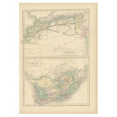
Antique Map of North Africa and South Africa by Black, 1854
Located in Langweer, NL
Morocco, Algeria and South Africa. This map orginates from 'General Atlas Of The World: Containing Upwards
Category

19th Century Antique Africa Maps And Atlases Africa Maps

Materials

Paper

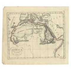
Antique Map of Northern Africa from a Rare Dutch Atlas, 1825
Located in Langweer, NL
Antique map titled 'Africa'. Old map of the African continent originating from 'Atlas der Oude
Category

19th Century Antique Africa Maps And Atlases Africa Maps

Materials

Paper

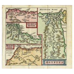
Antique Map of North Africa showing Egypt, Mauritania and Africa Minor, 1672
Located in Langweer, NL
, showing Egypt, Mauritania and Africa Minor. This map originates from the pocket atlas 'Introductionis in
Category

17th Century Antique Africa Maps And Atlases Africa Maps

Materials

Paper

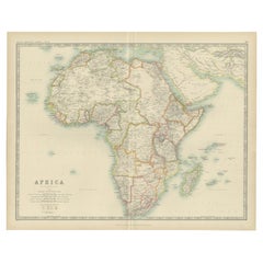
Antique Map of Africa by Johnston (1909)
Located in Langweer, NL
Antique map titled 'Africa'. Original antique map of Africa. This map originates from the ‘Royal
Category

Early 20th Century Antique Africa Maps And Atlases Africa Maps

Materials

Paper

Antique Map of Africa by Johnston (1909)
H 19.49 in W 24.41 in D 0.02 in
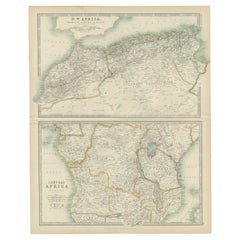
Antique Map of N.W. Africa & Central Africa by Johnston (1909)
Located in Langweer, NL
Africa. This map originates from the ‘Royal Atlas of Modern Geography’. Published by W. & A.K. Johnston
Category

Early 20th Century Antique Africa Maps And Atlases Africa Maps

Materials

Paper

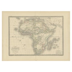
Antique Map of Africa by Lapie, 1842
Located in Langweer, NL
Antique map titled 'Carte d'Afrique'. Map of Africa. This map originates from 'Atlas universel de
Category

Mid-19th Century Antique Africa Maps And Atlases Africa Maps

Materials

Paper

Antique Map of Africa by Lapie, 1842
H 19.89 in W 26.78 in D 0.02 in
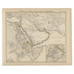
Antique Map of Africa and Arabia with Inset Map of Ethiopia and Eritrea, 1845
Located in Langweer, NL
Antique map titled 'Mittel- und Nord-Africa (östl. Theil) und Arabien'. This map depicts North and
Category

19th Century Antique Africa Maps And Atlases Africa Maps

Materials

Paper

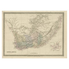
Antique Map of South Africa by Wyld '1845'
Located in Langweer, NL
Antique map titled 'South Africa'. Original antique map of South Africa. This decorative original
Category

Mid-19th Century Antique Africa Maps And Atlases Africa Maps

Materials

Paper

Antique Map of South Africa by Wyld '1845'
H 10.24 in W 14.18 in D 0.02 in
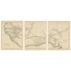
Antique Map of West Africa by Lowry, 1852
Located in Langweer, NL
Antique map titled 'West Africa'. Three individual sheets of West Africa. This map originates from
Category

Mid-19th Century Antique Africa Maps And Atlases Africa Maps

Materials

Paper

Antique Map of West Africa by Lowry, 1852
H 12.21 in W 9.65 in D 0.02 in
Antique Map of South Africa by Lowry, 1852
Located in Langweer, NL
Antique map titled 'South Africa'. Two individual sheets of South Africa. This map originates from
Category

Mid-19th Century Antique Africa Maps And Atlases Africa Maps

Materials

Paper

Antique Map of South Africa by Lowry, 1852
H 12.21 in W 9.65 in D 0.02 in
Antique Map of North Africa by Lowry '1852'
Located in Langweer, NL
Antique map titled 'North Africa Marocco Algiers & Tunis'. Two individual sheets of North Africa
Category

Mid-19th Century Antique Africa Maps And Atlases Africa Maps

Materials

Paper

Antique Map of North Africa by Lowry '1852'
H 12.21 in W 9.65 in D 0.02 in
Antique Map of Southern Africa by Levasseur, 1875
Located in Langweer, NL
Antique map titled 'Afrique Méridionale'. Large map of Southern Africa. This map originates from
Category

Late 19th Century Antique Africa Maps And Atlases Africa Maps

Materials

Paper

Antique Map of Northern Africa by Levasseur, '1875'
Located in Langweer, NL
Antique map titled 'Carte de l'Afrique Septentrionale'. Large map of Northern Africa. This map
Category

Late 19th Century Antique Africa Maps And Atlases Africa Maps

Materials

Paper

Antique Map of Western Africa by Levasseur '1875'
Located in Langweer, NL
Antique map titled 'Carte de la Senegambie Soudan et Guinée'. Large map of Western Africa. This map
Category

Late 19th Century Antique Africa Maps And Atlases Africa Maps

Materials

Paper

Antique Map of Africa by Levasseur 'c.1840'
Located in Langweer, NL
Antique map titled 'Afrique'. Original antique map of Africa. Decorative map of the continent
Category

Mid-19th Century Antique Africa Maps And Atlases Africa Maps

Materials

Paper

Antique Map of Africa by Levasseur 'c.1840'
H 22.84 in W 30.52 in D 1.19 in
Antique Map of Africa with Original Hand Coloring
Located in Langweer, NL
Antique map titled 'Kaart van Afrika door den Heer d'Anville'. Detailed original old map of Africa
Category

Mid-18th Century Antique Africa Maps And Atlases Africa Maps

Materials

Paper

Antique Decorative Coloured Map of South Africa and Madagascar, 1882
Located in Langweer, NL
The map of South Africa is from the Blackie & Son Atlas, published in 1882. This historical map is
Category

1880s Antique Africa Maps And Atlases Africa Maps

Materials

Paper

Antique Map of North and South Africa by Johnston, 1882
Located in Langweer, NL
Two antique maps on one sheet titled 'N.W. Africa, Marocco, Algeria & Tunis' and 'Southern Africa
Category

19th Century Antique Africa Maps And Atlases Africa Maps

Materials

Paper

French Antique Map of Northern Africa and Libya, c.1840
Located in Langweer, NL
Antique map titled 'Marok, Alger et Tunis - Etat de Tripoli'. Map of Northern Africa and Libya
Category

19th Century Antique Africa Maps And Atlases Africa Maps

Materials

Paper

Antique Map of Africa by A & C, Black, 1870
Located in Langweer, NL
Antique map titled 'Africa'. Original antique map of Africa. This map originates from ‘Black's
Category

Late 19th Century Antique Africa Maps And Atlases Africa Maps

Materials

Paper

Antique Map of Africa by A & C, Black, 1870
H 23.63 in W 17.52 in D 0.02 in
Antique Lithography Map, West Africa, English, Framed, Cartography, Victorian
Located in Hele, Devon, GB
This is an antique lithography map of Western Africa. An English, framed atlas engraving of
Category

Mid-19th Century British Early Victorian Antique Africa Maps And Atlases Africa Maps

Materials

Wood

Western Africa Antique Map by W. G. Blackie, 1859
Located in Langweer, NL
The antique map titled 'Western Africa' presents an original depiction of the region. Originating
Category

Mid-19th Century Antique Africa Maps And Atlases Africa Maps

Materials

Paper

Antique Map of the Coast of Guinea, Africa, 1820
Located in Langweer, NL
Antique map Africa titled 'Carte de la Haute et de la Basse Guinée'. Map of the Coast of Guinea
Category

19th Century Antique Africa Maps And Atlases Africa Maps

Materials

Paper

Antique Map of the Coast of Guinea, Africa, 1820
Free Shipping
H 10.44 in W 16.54 in D 0 in
Antique Map of Africa with European Language Borders, 1852
Located in Langweer, NL
Antique map titled 'Afrika'. Map of Africa. This map originates from 'School-Atlas van alle deelen
Category

19th Century Antique Africa Maps And Atlases Africa Maps

Materials

Paper

Antique Map of North Africa by Ortelius, c.1600
Located in Langweer, NL
Antique map titled 'Barbariae et Biledulgerid nova descriptio'. Old map of coastal North Africa
Category

17th Century Antique Africa Maps And Atlases Africa Maps

Materials

Paper

Antique Map of North Africa by Ortelius, c.1580
Located in Langweer, NL
Africa. The map covers the regions of Barbaria and Biledulgerid, essentially the territories north and
Category

16th Century Antique Africa Maps And Atlases Africa Maps

Materials

Paper

Antique Map of West Africa by R. Bonne, 1780
Located in Langweer, NL
, Sierra Leona, Canary Islands and Africa. Drawn by R. Bonne for G. Raynal’s Atlas de Toutes les Parties
Category

Late 18th Century Antique Africa Maps And Atlases Africa Maps

Materials

Paper

Antique Map of West Africa by R. Bonne, 1780
H 15.04 in W 10.24 in D 0.02 in
Antique Map of Western and Eastern Barbary in Africa, c.1744
Located in Langweer, NL
of the Eastern Parts of Barbary'. Decorative maps of North Africa and the Southern Mediterranean
Category

18th Century Antique Africa Maps And Atlases Africa Maps

Materials

Paper

Antique Map of Tunis and Tripoli in Northern Africa, circa 1880
By J. Migeon
Located in Langweer, NL
Empire of Morocco. This map originates from 'Géographie Universelle Atlas-Migeon' by J. Migeon. Artists
Category

19th Century Antique Africa Maps And Atlases Africa Maps

Materials

Paper

Original Antique Coloured Map of Western Africa, Published in 1882
Located in Langweer, NL
This is a map of Western Africa from the 1882 Blackie & Son atlas. The map details the West African
Category

1880s Antique Africa Maps And Atlases Africa Maps

Materials

Paper

Antique Map of Africa by Claude Buy de Mornas '1761'
Located in Langweer, NL
Antique map titled 'Afrique'. Original antique map of Africa flanked with descriptions containing
Category

Mid-18th Century Antique Africa Maps And Atlases Africa Maps

Materials

Paper

Antique Map of the Coast of Guinea, Africa, c.1780
Located in Langweer, NL
Antique map Africa titled 'Carte de la Haute et de la Basse Guinée'. Map of the Coast of Guinea
Category

18th Century Antique Africa Maps And Atlases Africa Maps

Materials

Paper

Antique Map of Spain, Mauritia and Africa by H. Kiepert, circa 1870
By Heinrich Kiepert
Located in Langweer, NL
Antique map titled 'Hispania, Mauretania et Africa'. This map originates from 'Atlas Antiquus
Category

Late 19th Century Antique Africa Maps And Atlases Africa Maps

Materials

Paper

Original Copperplate Engraved Detailed Map of South Africa, ca.1680
Located in Langweer, NL
South Africa. Engraved by Antoine d'Winter for a Dutch edition of Sanson's pocket atlas. Artists and
Category

1680s Antique Africa Maps And Atlases Africa Maps

Materials

Paper

Remarkable Antique Map of Central Africa by Scherer, c.1703
Located in Langweer, NL
Untitled map of Central Africa depicting Tarodant, Lempta, Guber, Borno, Chaxumo, Tombut, Melegvete
Category

18th Century Antique Africa Maps And Atlases Africa Maps

Materials

Paper

"Africa Vetus": a 17th Century Hand-Colored Map by Sanson
By Nicolas Sanson
Located in Alamo, CA
This original hand-colored copperplate engraved map of Africa entitled "Africa Vetus, Nicolai
Category

Late 17th Century French Antique Africa Maps And Atlases Africa Maps

Materials

Paper

Antique Map of North and West Africa by J.B. Elwe, 1792
Located in Langweer, NL
Beautiful richly engraved map of North and West Africa, based upon the earlier maps of De L'Isle
Category

Late 19th Century Antique Africa Maps And Atlases Africa Maps

Materials

Paper

Antique Map of Spain and Part of Africa by Kiepert, C.1870
Located in Langweer, NL
Africa. This map originates from 'Atlas Antiquus, twaalf kaarten behoorende bij de Oude Geschiedenis
Category

19th Century Antique Africa Maps And Atlases Africa Maps

Materials

Paper

Intriguing Antique Map of Europe, Asia and Africa by Scherer, c.1703
Located in Langweer, NL
Two maps on a single sheet showing Europe, Asia and Africa, each depicting nearly the same area. On
Category

18th Century Antique Africa Maps And Atlases Africa Maps

Materials

Paper

Africa: A Large 17th Century Hand-Colored Map by Sanson and Jaillot
By Nicolas Sanson
Located in Alamo, CA
This large original hand-colored copperplate engraved map of Africa entitled "L'Afrique divisee
Category

1690s French Antique Africa Maps And Atlases Africa Maps

Materials

Paper

North & Central Africa & Arabia, Inset Map of Habesch 'Ethiopia & Eritrea', 1845
Located in Langweer, NL
Antique map titled 'Mittel- und Nord-Africa (östl. Theil) und Arabien'. This map depicts North
Category

1840s Antique Africa Maps And Atlases Africa Maps

Materials

Paper

Antique Old Map of Africa with Insets of Mauritius, Reunion and Natal, 1882
Located in Langweer, NL
The uploaded image is a historical map of Africa from the 1882 atlas by Blackie & Son. The map
Category

1880s Antique Africa Maps And Atlases Africa Maps

Materials

Paper

Antique Map of Africa with Decorative Vignette of Saint Helena, 1880
Located in Langweer, NL
Antique map titled 'Afrique'. Old map of Africa, covering the African continent. With decorative
Category

19th Century Antique Africa Maps And Atlases Africa Maps

Materials

Paper

Antique Map of North-Western and South Africa by A.K. Johnston, 1865
Located in Langweer, NL
Two maps on one sheet titled 'North-Western Africa' and 'Southern Africa'. Depicting Morocco
Category

Mid-19th Century Antique Africa Maps And Atlases Africa Maps

Materials

Paper

Antique Map of the Coast of Northwest Africa by Dien, 1820
Located in Langweer, NL
Antique map Africa titled 'Partie Occidentale de l'Ancien Continent, depuis Lisbonne jusquá la
Category

19th Century Antique Africa Maps And Atlases Africa Maps

Materials

Paper

Antique Map of Guinea in West Africa by Blaeu, c.1638
Located in Langweer, NL
Antique map titled 'Guinea'. Decorative map of West Africa, including numerous animals in the
Category

17th Century Antique Africa Maps And Atlases Africa Maps

Materials

Paper

17th Century Hand-Colored Map of West Africa by Mercator/Hondius
Located in Alamo, CA
Hondius, published in their 'Atlas Minor' in Amsterdam in 1635. It is focused on the modern day African
Category

Mid-17th Century Dutch Antique Africa Maps And Atlases Africa Maps

Materials

Paper

Very Attractive Map of North and South America and Western Part of Africa, 1744
Located in Langweer, NL
western part of Africa and south west Europe. With full contemporary hand colouring. This map originates
Category

18th Century Antique Africa Maps And Atlases Africa Maps

Materials

Paper

Antique Map of 'African' Islands in the Mediterranean Sea and The Atlantic, 1747
Located in Langweer, NL
Antique map titled 'Particular draughts of some of the chief African Islands in the Mediterranean
Category

18th Century Antique Africa Maps And Atlases Africa Maps

Materials

Paper

Antique Map of Gabon, Angola and the Congo Region in Africa c.1680
Located in Langweer, NL
Antique map titled 'Royaume de Congo'. Map of Gabon, the Congo and Angola from Cape Lopez and Sao
Category

17th Century Antique Africa Maps And Atlases Africa Maps

Materials

Paper

Puzzle Atlas with Maps, Italy, circa 1900
Located in Milan, IT
80 little wooden cubes covered with printed paper that depending on which side they form the maps
Category

Early 20th Century Italian Antique Africa Maps And Atlases Africa Maps

Materials

Wood, Paper

Puzzle Atlas with Maps, Italy, circa 1900
H 1.25 in W 10 in D 12.75 in
Rare Antique Map of Part of Europe and Africa by Scherer, C.1703
Located in Langweer, NL
Antique map with two figures. The upper figures showing part of Europe and Africa. Below a chart
Category

18th Century Antique Africa Maps And Atlases Africa Maps

Materials

Paper

Old Map of North Africa Depicting Libya, Morocco, Algeria, Tunis Etc, 1922
Located in Langweer, NL
Antique map of Africa titled 'Northern Africa'. Old map of North Africa depicting Libya
Category

1920s Antique Africa Maps And Atlases Africa Maps

Materials

Paper

Very Decorative Rare Antique Map of the Northern Part of Africa, 1702
Located in Langweer, NL
Africa by Heinrich Scherer. The map is full of the spurious geography of the period with inaccurately
Category

Early 1700s Antique Africa Maps And Atlases Africa Maps

Materials

Paper

"Nova Barbariae Descriptio", a 17th Century Hand-Colored Map of North Africa
By Johannes Janssonius
Located in Alamo, CA
This original attractive 17th century hand-colored map of North Africa entitled "Nova Barbariae
Category

Mid-17th Century Dutch Antique Africa Maps And Atlases Africa Maps

Materials

Paper

Intriguing Antique Map of Europe, the Middle East and Africa by Scherer, c.1703
Located in Langweer, NL
Antique map depicting part of Africa, Europe and the Middle East. Also showing various cities in
Category

18th Century Antique Africa Maps And Atlases Africa Maps

Materials

Paper

Antique Map of Northern Africa "Barbary Coast" by R. Bonne, circa 1780
Located in Langweer, NL
A fine example of Rigobert Bonne and Guilleme Raynal’s 1780 map of northwestern Africa or the
Category

Late 18th Century Antique Africa Maps And Atlases Africa Maps

Materials

Paper

"Africae Accurata", a Hand-Colored 17th Century Map of Africa by Visscher
By Nicolaes Visscher II
Located in Alamo, CA
An 18th century hand-colored map of Africa entitled "Africae Accurata Tabula ex officina" by
Category

Late 17th Century Dutch Antique Africa Maps And Atlases Africa Maps

Materials

Paper

London 1744 Published Watercolour Antique Map of East Africa by Eman Bowen
Located in GB
This is a decorative antique engraved map of East Africa, colored by kingdoms and provinces. The map
Category

1740s English George III Antique Africa Maps And Atlases Africa Maps

Materials

Paper

Antique Map of the Cape Verde Islands and Part of Senegal, West Africa, 1690
Located in Langweer, NL
inset of the island Goree. This map originates from Coronelli's rare atlas 'Atlante Veneto'. Artists and
Category

17th Century Antique Africa Maps And Atlases Africa Maps

Materials

Paper

  • 1
Get Updated with New Arrivals
Save "Antique Africa Maps And Atlases Africa Maps", and we’ll notify you when there are new listings in this category.

Antique Africa Maps And Atlases Africa Maps For Sale on 1stDibs

Find a variety of antique africa maps and atlases africa maps available on 1stDibs. The range of distinct antique africa maps and atlases africa maps — often made from paper, wood and oak — can elevate any home. Antique africa maps and atlases africa maps have long been popular, with older editions for sale from the 18th Century and newer versions made as recently as the 20th Century. Antique africa maps and atlases africa maps bearing Baroque or Georgian hallmarks are very popular at 1stDibs. Victor Levasseur, Nicolas Sanson and Nicolaes Visscher II each produced beautiful antique africa maps and atlases africa maps that are worth considering.

How Much are Antique Africa Maps And Atlases Africa Maps?

Prices for antique africa maps and atlases africa maps start at $85 and top out at $65,000 with the average selling for $541.

Read More

Pamela Shamshiri Shares the Secrets behind Her First-Ever Book and Its Effortlessly Cool Interiors

The sought-after designer worked with the team at Hoffman Creative to produce a monograph that beautifully showcases some of Studio Shamshiri's most inspiring projects.

Moroccan Artworks and Objects Take Center Stage in an Extraordinary Villa in Tangier

Italian writer and collector Umberto Pasti opens the doors to his remarkable cave of wonders in North Africa.

Montecito Has Drawn Royalty and Celebrities, and These Homes Are Proof of Its Allure

Hollywood A-listers, ex-pat aristocrats and art collectors and style setters of all stripes appreciate the allure of the coastal California hamlet — much on our minds after recent winter floods.

Whaam! Blam! Pow! — a New Book on Pop Art Packs a Punch

Publishing house Assouline and writer Julie Belcove have teamed up to trace the history of the genre, from Roy Lichtenstein, Andy Warhol and Yayoi Kusama to Mickalene Thomas and Jeff Koons.

The Sparkling Legacy of Tiffany & Co. Explained, One Jewel at a Time

A gorgeous new book celebrates — and memorializes — the iconic jeweler’s rich heritage.

What Makes a Gem-Encrusted Chess Set Worth $4 Million?

The world’s most opulent chess set, weighing in at 513 carats, is literally fit for a king and queen.

Tauba Auerbach’s Geometric Pop-Up Book Is Mighty Rare, Thanks to a Hurricane

This sculptural art book has an epic backstory of its own.

Step inside the Storied Mansions of Palm Beach’s Most Effervescent Architect

From Spanish-style courtyards to fanciful fountains, these acclaimed structures abound in surprising and elegant details.