Items Similar to Antique Map of North Africa showing Egypt, Mauritania and Africa Minor, 1672

Want more images or videos?
Request additional images or videos from the seller
1 of 7
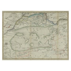
Antique Map of North Africa showing Egypt, Mauritania and Africa Minor, 1672
About the Item
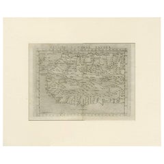
Antique map titled 'Africa Minor, Mauritania , Aegyptus.' Charming miniature map of North Africa, showing Egypt, Mauritania and Africa Minor. This map originates from the pocket atlas 'Introductionis in Universam Geographiam tam Veterem quam novam .. Acessit P. Bertii (Bertius) Brevarium Orbis Terrarum', by Ph. Cluverius (Cluver) and P. Bertius. Artists and Engravers: Petrus Bertius (also Peter Bertius; (Dutch) Pieter de Bert) (14 November 1565 ? 13 October 1629) was a Flemish theologian, historian, geographer and cartographer. Philipp Cluver (1580 - 1622), early modern German geographer and historian.
Artist: Petrus Bertius (also Peter Bertius; (Dutch) Pieter de Bert) (14 November 1565 ? 13 October 1629) was a Flemish theologian, historian, geographer and cartographer. Philipp Cluver (1580 - 1622), early modern German geographer and historian.
Condition: Good, given age. Original folds as issued. General age-related toning and/or occasional minor defects from handling. Please study image carefully.
Date: 1672
Overall size: 14.3 x 13 cm.
Image size: 12.3 x 11.8 cm.
- Dimensions:Height: 5.63 in (14.3 cm)Width: 5.12 in (13 cm)Depth: 0 in (0.01 mm)
- Materials and Techniques:
- Period:
- Date of Manufacture:1672
- Condition:Condition: Good, given age. Original folds as issued. General age-related toning and/or occasional minor defects from handling. Please study image carefully.
- Seller Location:Langweer, NL
- Reference Number:
About the Seller
5.0
Platinum Seller
These expertly vetted sellers are 1stDibs' most experienced sellers and are rated highest by our customers.
Established in 2009
1stDibs seller since 2017
1,919 sales on 1stDibs
Typical response time: <1 hour
- ShippingRetrieving quote...Ships From: Langweer, Netherlands
- Return PolicyA return for this item may be initiated within 14 days of delivery.
More From This SellerView All
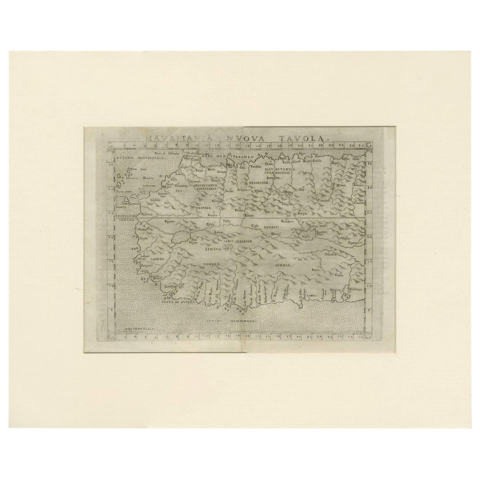
- Antique Map of Mauritania 'Africa' by G. Ruscelli, 1574Located in Langweer, NLA very rare mid-16th century black and white map of North and West Africa called Mauritania by the Italian cartographic editor Girolamo Ruscelli. T...Category
Antique 16th Century Maps
MaterialsPaper
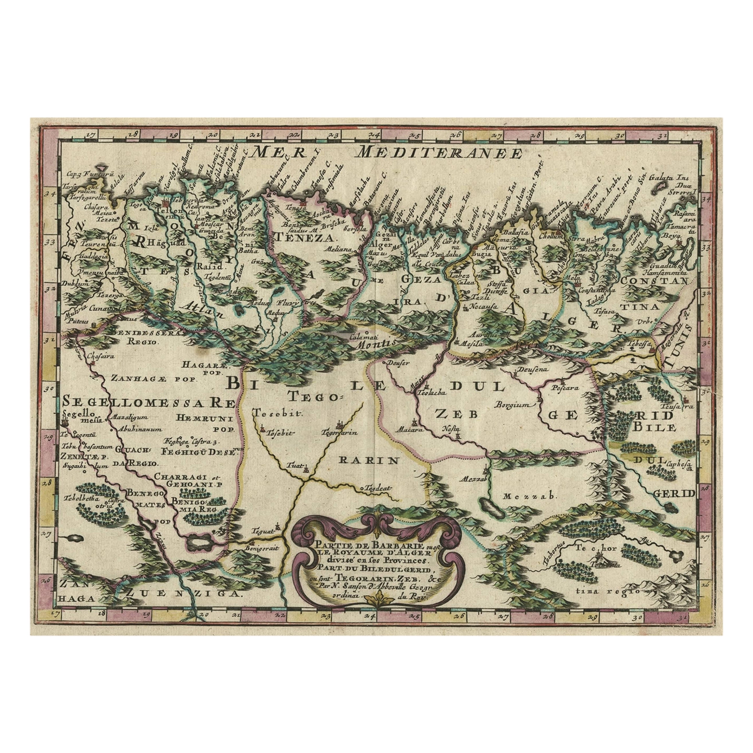
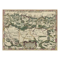
- Copper-Engraved Map Showing the Algerian Coast of North Africa, Published 1683Located in Langweer, NLAntique map titled 'Partie de Barbarie, ou est le Royaume d'Alger (..)'. Copper-engraved map showing the Algerian coast of North Africa. Published 1683. Artists and Engravers:...Category
Antique 1680s Maps
MaterialsPaper
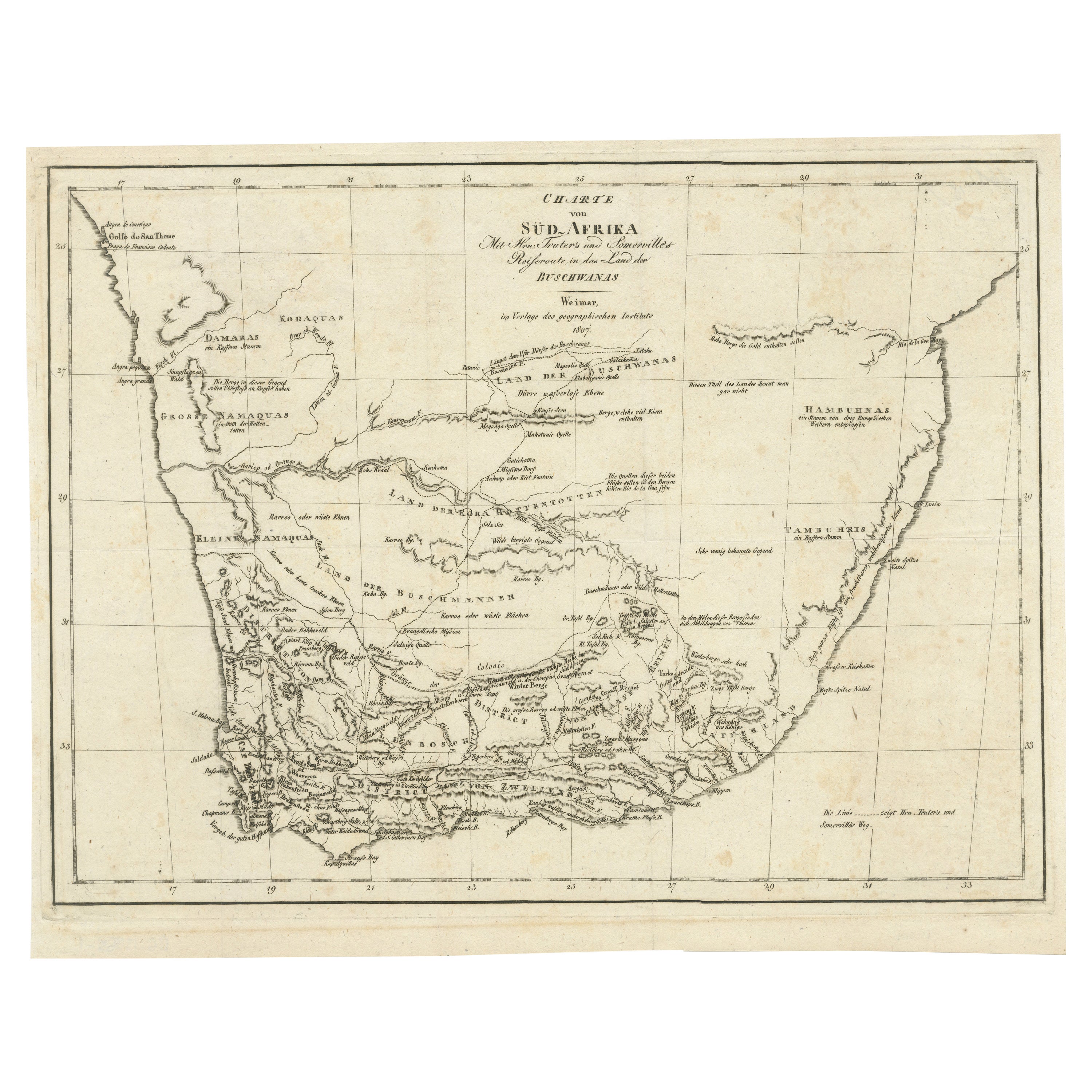
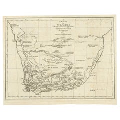
- Antique Map of South Africa showing the Travels of Truter and SomervilleLocated in Langweer, NLAntique map titled 'Charte von Süd-Afrika'. Original antique map of South Africa showing the travels of Truter and Somerville. Published ci...Category
Antique Early 19th Century Maps
MaterialsPaper
- Antique Map of North Africa by Lowry '1852'Located in Langweer, NLAntique map titled 'North Africa Marocco Algiers & Tunis'. Two individual sheets of North Africa. This map originates from 'Lowry's Table Atlas constructed and engraved from the most...Category
Antique Mid-19th Century Maps
MaterialsPaper
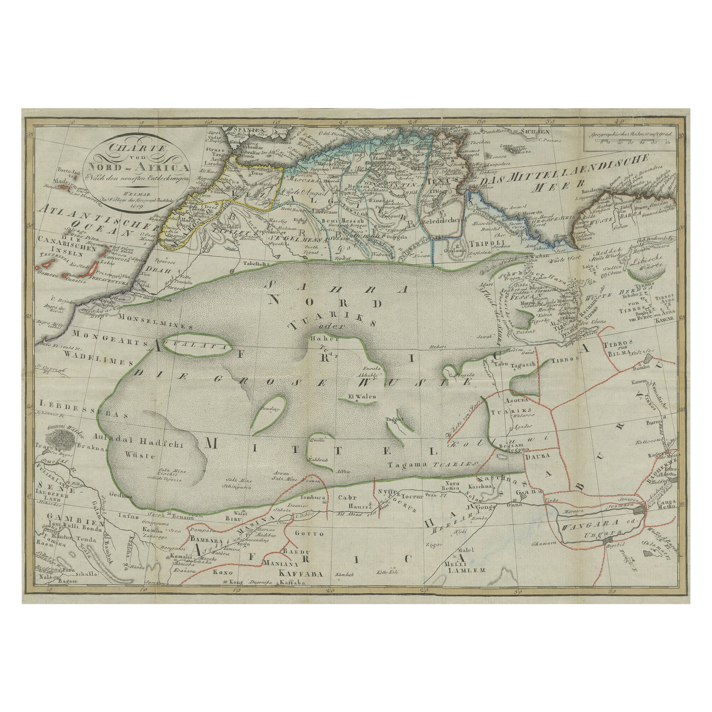
- Antique Map of North Africa including the Sahara DesertLocated in Langweer, NLAntique map titled 'Charte von Nord-Africa'. Scarce map of North Africa. Includes a fantastic depiction of the Sahara Desert. Published in Weimar, 1809.Category
Antique Early 19th Century Maps
MaterialsPaper
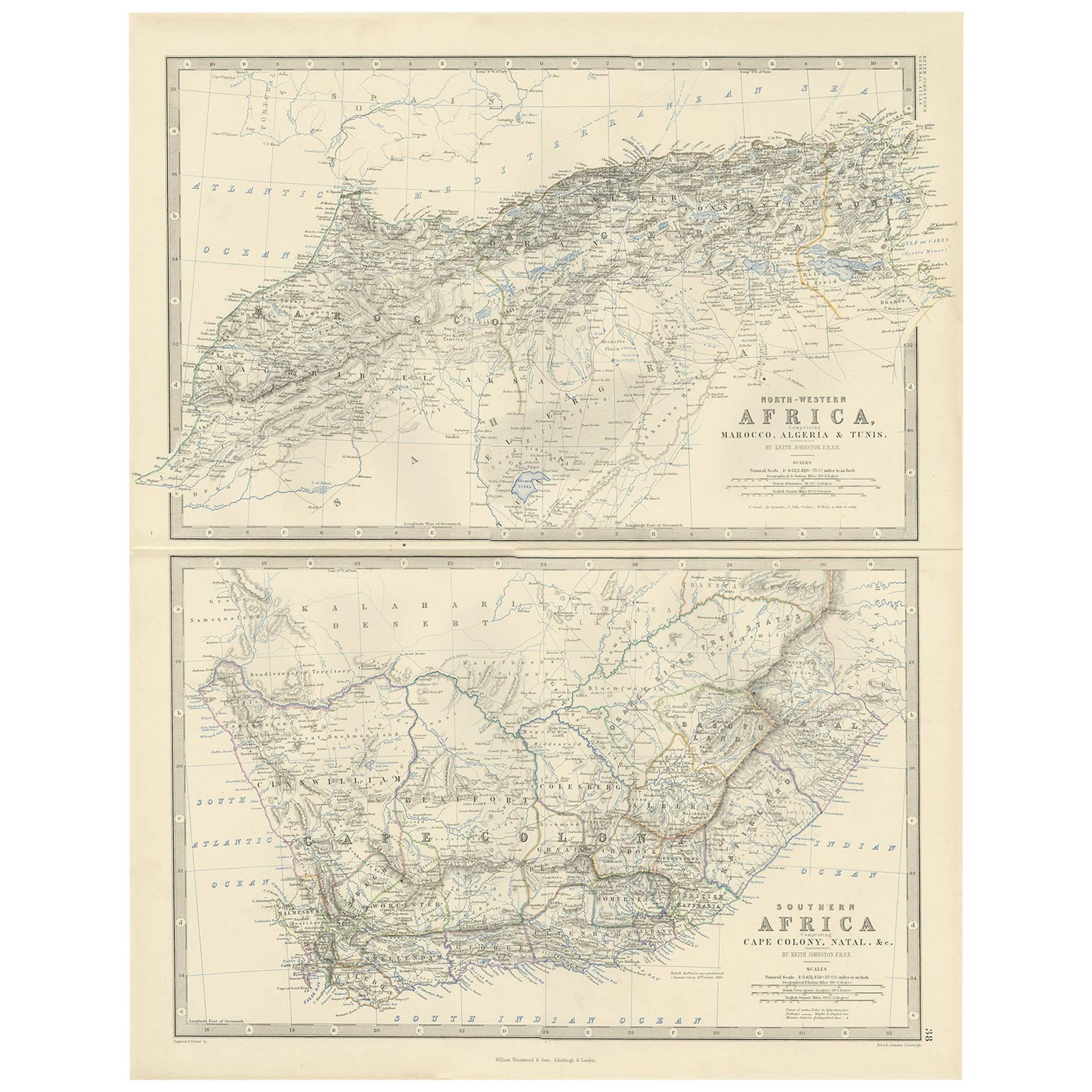
- Antique Map of North-Western and South Africa by A.K. Johnston, 1865Located in Langweer, NLTwo maps on one sheet titled 'North-Western Africa' and 'Southern Africa'. Depicting Morocco, Algeria, Tunis, Cape Colony, Natal and more. This map originates from the ‘Royal Atlas o...Category
Antique Mid-19th Century Maps
MaterialsPaper


You May Also Like
- Large Antique 1859 Map of North AmericaLocated in Sag Harbor, NYThis Map was made by Augustus Mitchell in 1859 It is in amazing condition for being 163 years old. This price is for the rolled up easy to ship version of this piece. I will be Frami...Category
Antique Mid-19th Century American Maps
MaterialsCanvas, Paper

- "Nova Barbariae Descriptio", a 17th Century Hand-Colored Map of North AfricaBy Johannes JanssoniusLocated in Alamo, CAThis original attractive 17th century hand-colored map of North Africa entitled "Nova Barbariae Descriptio" by Johannes Janssonius was published in Paris in 1635. It includes the Med...Category
Antique Mid-17th Century Dutch Maps
MaterialsPaper
- Original Antique English County Map, North Yorkshire, J & C Walker, 1851Located in St Annes, LancashireGreat map of North Yorkshire Original colour By J & C Walker Published by Longman, Rees, Orme, Brown & Co. 1851 Unframed.Category
Antique 1850s English Other Maps
MaterialsPaper
- Hand-Colored 18th Century Homann Map of the Black Sea, Turkey and Asia MinorBy Johann Baptist HomannLocated in Alamo, CAAn attractive original early 18th century hand-colored map of the Black Sea and Turkey entitled "Carte de L'Asie Minevre ou de la Natolie et du Pont Evxin Tiree des Voyages et des Ob...Category
Antique Early 18th Century German Maps
MaterialsPaper
- New Map of North America from the Latest Discoveries, 1763Located in Philadelphia, PAA fine antique 18th century map of the North American seaboard. Entitled "A New Map of North America from the Latest Discoveries 1763". By the Cartographer/Engraver - John Spil...Category
Antique Mid-18th Century English Georgian Maps
MaterialsPaper
- Antique Map of Principality of MonacoBy Antonio Vallardi EditoreLocated in Alessandria, PiemonteST/619 - "Old Geographical Atlas of Italy - Topographic map of ex-Principality of Monaco" - ediz Vallardi - Milano - A somewhat special edition ---Category
Antique Late 19th Century Italian Other Prints
MaterialsPaper


